
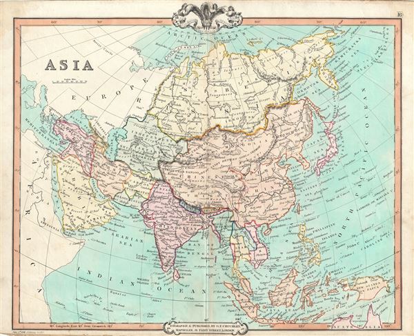
Asia.
sold
- Digital Map Information
- Suitable for large format printing
- DPI: 300
- File Size: 8.91 MB
- File Type: ZIP / TIFF
- ICC color profile embedded
- Delivered instantly via download link
This is a fine example of George Frederick Cruchley's 1850 map of Asia. The map covers the entire continent from the Red Sea to the Kamchatka Sea and from the Arctic to the Gulf of Carpentaria. Shows the Chinese Empire including Tibet, Korea and Mongolia. ... (more details)
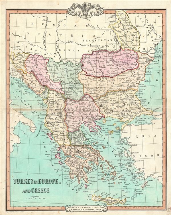
Turkey in Europe and Greece.
sold
- Digital Map Information
- Suitable for large format printing
- DPI: 300
- File Size: 9.06 MB
- File Type: ZIP / TIFF
- ICC color profile embedded
- Delivered instantly via download link
A beautiful 1850 map of Greece, the Balkans and the European part of Turkey by George Frederick Cruchley. It covers from Moldavia to Candia and from the Gulf of Venice or the Adriatic Sea to the Sea of Marmara. The modern day states of Greece, Albania, ... (more details)
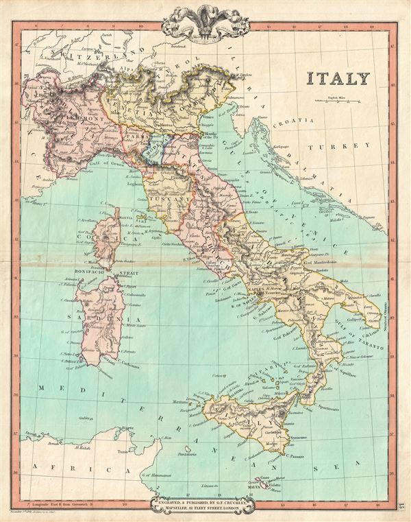
Italy.
sold
- Digital Map Information
- Suitable for large format printing
- DPI: 300
- File Size: 7.48 MB
- File Type: ZIP / TIFF
- ICC color profile embedded
- Delivered instantly via download link
This is an attractive 1850 map of Italy by George Frederick Cruchley. It covers the pre-Garibaldi Italy split into numerous small duchies and states from Venetian Lombardy south to Sicily and Malta. Also includes the islands of Sardinia and Corsica. ... (more details)

Norway, Sweden and Denmark.
sold
- Digital Map Information
- Suitable for large format printing
- DPI: 300
- File Size: 8.91 MB
- File Type: ZIP / TIFF
- ICC color profile embedded
- Delivered instantly via download link
This is a fine example of G. F. Cruchley's 1850 map of Scandinavia, including Norway, Sweden and Denmark. It covers from the Arctic south to Holstein and east as far as the Gulf of Finland. As this map was being drawn Scandinavia was in the midst of ... (more details)

Scotland.
sold
- Digital Map Information
- Suitable for large format printing
- DPI: 300
- File Size: 7.86 MB
- File Type: ZIP / TIFF
- ICC color profile embedded
- Delivered instantly via download link
An attractive map of Scotland by George Frederick Cruchley dated to 1850. It covers Scotland from the Orkney Islands to Wigton in the south, including the Hebrides or Western Isles. The Shetland and Orkney Islands are detailed in an inset in the ... (more details)
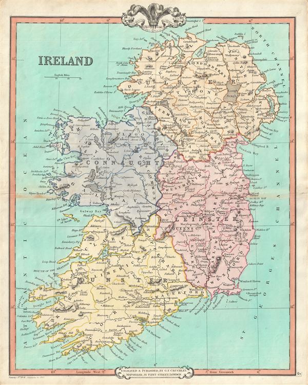
Ireland.
sold
- Digital Map Information
- Suitable for large format printing
- DPI: 300
- File Size: 9.04 MB
- File Type: ZIP / TIFF
- ICC color profile embedded
- Delivered instantly via download link
A lovely 1850 map of Ireland by George Frederick Cruchley. The map covers the the entirity of Irealand and is divided four provinces: Ulster, Connaught, Leinster and Munster. Tuscan Rock, near the southeast coast of Ireland, known to have ... (more details)
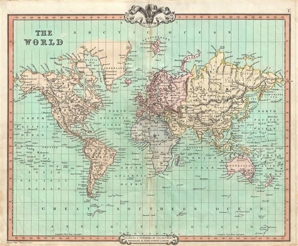
The World.
sold
- Digital Map Information
- Suitable for large format printing
- DPI: 300
- File Size: 8.49 MB
- File Type: ZIP / TIFF
- ICC color profile embedded
- Delivered instantly via download link
This is a fine example of G.F. Cruchley's 1850 map of the World. An interesting map issued just as most of the Earth's non-polar shores had been explored. Cruchley depicts the world showing the six known continents as well as traces of ... (more details)

The SOLAR SYSTEM, with the Orbits of 5 remarkable COMETS.
sold
- Digital Map Information
- Suitable for large format printing
- DPI: 300
- File Size: 5.77 MB
- File Type: ZIP / TIFF
- ICC color profile embedded
- Delivered instantly via download link
An unusual solar system and comet map issued by Emanuel Bowen in 1747. The map shows the solar system with each planet given a circular orbit. The real highlight of the map is Bowen's identification of, in his words, '5 remarkable ... (more details)

Golfe Persique dresse en 1758 et publie en 76, par le Sr. d'Anville, Prem. Geogr. du Roi.
sold
- Digital Map Information
- Suitable for large format printing
- DPI: 300
- File Size: 6.43 MB
- File Type: ZIP / TIFF
- ICC color profile embedded
- Delivered instantly via download link
A scarce 1776 map of the Persian Gulf by Jean Baptiste Bourguignon d'Anville. Essentially a nautical chart, this map covers from Basrah to the Straits of Hormuz. D'Anville prepared this map in 1758 to illustrate a lecture ... (more details)
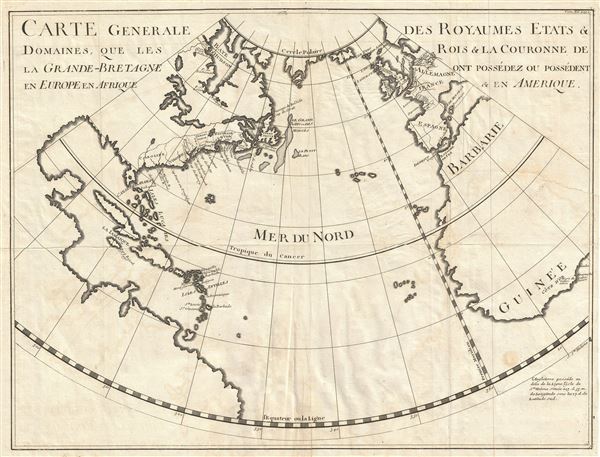
Carte Generale des Royaumes, Etats and Domaines, Que les Rois and La Couronne de La Grande Bretagne ont Possedez ou Possedent en Europe en Afrique and En Amerique.
sold
- Digital Map Information
- Suitable for large format printing
- Full resolution TIFF file
- ICC color profile embedded
- Delivered instantly via download link
An unusual c. 1724 map showing English dominions in the New World, Europe, and Africa. This map was published for Paul Rapin de Thoyras's L'Histoire d'Angleterre . Covering from the Polar Circle to the Equator and from the ... (more details)

Birds Eye View of Boston Harbor Along the South Shore to Provincetown.
sold
- Digital Map Information
- Suitable for large format printing
- File Size: 15.5 MB
- File Type: ZIP / TIFF
- ICC color profile embedded
- Delivered instantly via download link
This is a remarkable 1920 chromolithograph map and view of the Boston Harbor from Boston to Provincetown. It covers all of Cape Cod Bay, Quincy Bay and Dorchester bay with the communities of Boston, east Boston, south ... (more details)

The 'Standard Guide' Ready Reference Map of Washington, to accompany the 'Washington Standard Guide'.
sold
- Digital Map Information
- Suitable for large format printing
- File Size: 18.05 MB
- File Type: ZIP / TIFF
- ICC color profile embedded
- Delivered instantly via download link
This is an appealing 1912 map or plan of Washington D.C. by the Foster and Reynolds Company of Washington. It covers Washington D.C. from the Arlington National Cemetery eastward as far as 28th Street and the ... (more details)

Secolo Mexicano.
sold
- Digital Map Information
- Suitable for large format printing
- DPI: 300
- File Size: 4.45 MB
- File Type: ZIP / TIFF
- ICC color profile embedded
- Delivered instantly via download link
This unusual 1721 chart, drawn by Giovanni Francesco Gemelli Careri, depicts the Aztec calendar wheel, or the Veytia Calendar Wheel. This wheel represents a 52 year cycle and an 18 month annual cycle with ... (more details)

Hydrographicamelo Mexicano rappresentato nelle sue Lacune.
sold
- Digital Map Information
- Suitable for large format printing
- DPI: 300
- File Size: 2.78 MB
- File Type: ZIP / TIFF
- ICC color profile embedded
- Delivered instantly via download link
This unusual 1721 map, drawn by Giovanni Francesco Gemelli Careri, depicts Mexico City as it appeared in the late 17th century. Oriented to the east and centered on the insular Mexico City, Gemelli's map ... (more details)

[North America].
sold
- Digital Map Information
- Suitable for large format printing
- File Size: 9.32 MB
- File Type: ZIP / TIFF
- ICC color profile embedded
- Delivered instantly via download link
This is an unusual 1888 braille map of North America by Martin Kunz. The map covers the entire continent of North America from the Arctic Circle to Panama. This map, in braille, features boundaries, ... (more details)

Preliminary Chart of Calibogue Sound and Skull Creek forming inside passage from Tybee Roads to Port Royal Sound South Carolina.
sold
- Digital Map Information
- Suitable for large format printing
- File Size: 16.08 MB
- File Type: ZIP / TIFF
- ICC color profile embedded
- Delivered instantly via download link
This is an appealing 1862 U. S. Coast Survey nautical chart or maritime map of the Calibogue Sound and Skull Creek, South Carolina. Essentially divided into two sections on the same sheet, the ... (more details)

Sketch A Showing the progress of the Survey in Section No. 1 from 1844 to 1862.
sold
- Digital Map Information
- Suitable for large format printing
- File Size: 19.35 MB
- File Type: ZIP / TIFF
- ICC color profile embedded
- Delivered instantly via download link
This is an attractive example of the 1862 U. S. Coast Survey map or triangulation chart of the New England coastline. It covers the coast line from Greenwich Bay (Rhode Island) eastward past ... (more details)

Inside Passage between Bath and Booth Bay.
sold
- Digital Map Information
- Suitable for large format printing
- File Size: 15.89 MB
- File Type: ZIP / TIFF
- ICC color profile embedded
- Delivered instantly via download link
This is an uncommon 1867 U. S. Coast Survey nautical chart or maritime map of the inner passages between Bath and Boothbay, Maine. Centered on Westport Island, the map covers from Bath to ... (more details)
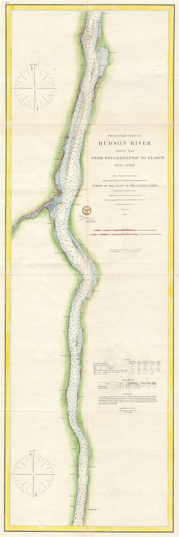
Preliminary Chart of Hudson River Sheet No. 3 from Poughkeepsie to Glasco New York.
sold
- Digital Map Information
- Suitable for large format printing
- File Size: 12.27 MB
- File Type: ZIP / TIFF
- ICC color profile embedded
- Delivered instantly via download link
A beautiful 1862 U. S. Coast Survey nautical chart or maritime map of the Hudson River, New York. The map covers the course of the Hudson River from Glasco to Poughkeepsie. It includes ... (more details)

Suisun Bay California.
sold
- Digital Map Information
- Suitable for large format printing
- File Size: 18.22 MB
- File Type: ZIP / TIFF
- ICC color profile embedded
- Delivered instantly via download link
This is an attractive example of the 1867 U. S. Coast Survey nautical chart or maritime map of Suisun Bay, northern California. The map covers from Benicia and the Karquines Strait in ... (more details)