
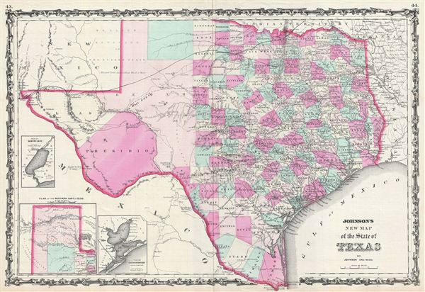
Johnson's New Map of the State of Texas.
sold
- Digital Map Information
- Suitable for large format printing
- File Size: 15.6 MB
- File Type: ZIP / TIFF
- ICC color profile embedded
- Delivered instantly via download link
This is an exceptional example of A. J. Johnson's highly desirable 1863 map of Texas. Created during the American Civil War, this extraordinary folio map details the state of Texas in full. Identifies the elevated Table Lands, El Llando Estadado (the Staked ... (more details)
The map that precipitated the slaughter of Col. Custer at Little Big Horn.
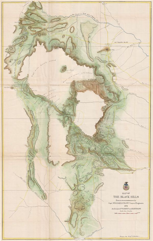
Map of the Black Hills From a reconnaissance by Capt. William Ludlow Corps of Engineers, 1874 And maps of Warren and Raynolds.
sold
- Digital Map Information
- Suitable for large format printing
- File Size: 28.49 MB
- File Type: ZIP / TIFF
- ICC color profile embedded
- Delivered instantly via download link
George Armstrong Custer and William Ludlow's seminal 1874 map of the Black Hills, Dakota Territory, covering from the Missouri to the Powder River and from the 47th to the 43rd parallel. In 1874 one thousand cavalrymen under the command of Lt. Col. George ... (more details)
The map that precipitated the slaughter of Col. Custer at Little Big Horn. 'A most interesting map' - Wheat
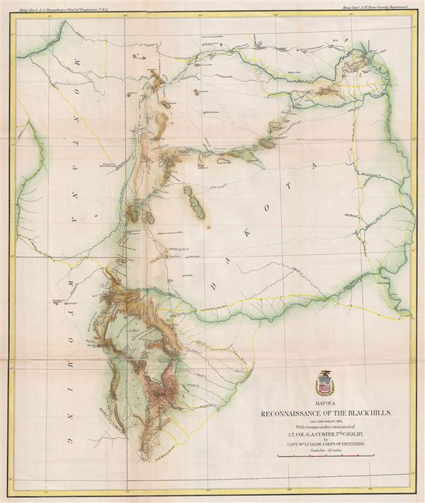
Map of a Reconnaissance of the Black Hills, July and August, 1874, with troops under the command of Lt. Col. G. A. Custer, 7th Cavalry.
sold
- Digital Map Information
- Suitable for large format printing
- File Size: 13.36 MB
- File Type: ZIP / TIFF
- ICC color profile embedded
- Delivered instantly via download link
George Armstrong Custer and William Ludlow's seminal 1874 map of the Black Hills, Dakota Territory, covering from the Missouri to the Powder River and from the 47th to the 43rd parallel. In 1874 one thousand cavalrymen under the command of Lt. Col. George ... (more details)
The map that precipitated the slaughter of Col. Custer at Little Big Horn.
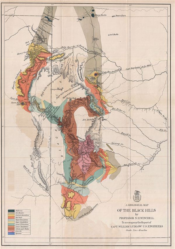
A Geological Map of the Black Hills.
sold
- Digital Map Information
- Suitable for large format printing
- File Size: 13.62 MB
- File Type: ZIP / TIFF
- ICC color profile embedded
- Delivered instantly via download link
This is a rare example of the 1875 geological map of the Black Hills, South Dakota prepared for the official report on the Custer expedition of 1874. Centered on Harney's Peak, the highest point in the Black Hills, the map covers from Slave Butte to the ... (more details)
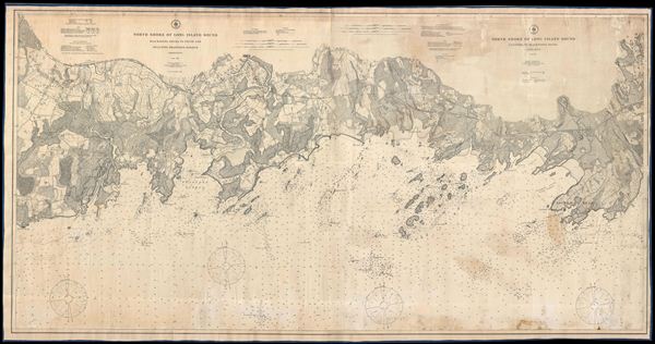
North Shore of Long Island Sond Guilford to Blackstone Rocks Connecticut.
sold
- Digital Map Information
- Suitable for large format printing
- File Size: 83.04 MB
- File Type: ZIP / TIFF
- ICC color profile embedded
- Delivered instantly via download link
This is an impressive large format rolling 1907 nautical chart or maritime map of the northern shore of the Long Island Sound or the Connecticut Coast. Issued by the U. S. Coast and Geodetic Survey, this map covers from east Haven, Connecticut to Sachem ... (more details)
One of the few maps to show Nikla Tesla's Tower.
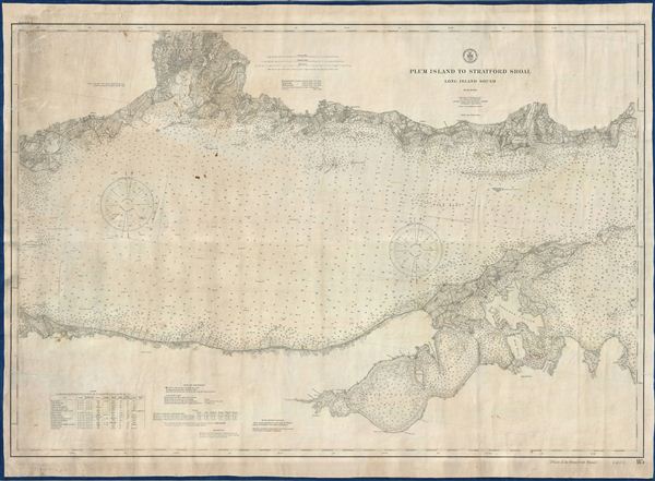
Plum Island To Stratford Shoal Long Island Sound.
sold
- Digital Map Information
- Suitable for large format printing
- File Size: 45.94 MB
- File Type: ZIP / TIFF
- ICC color profile embedded
- Delivered instantly via download link
This is an impressive large format rolling 1907 nautical chart or maritime map of the Long Island Sound, Long Island's North Fork, and Connecticut Coast in the vicinity of New Haven. Issued by the U. S. Coast and Geodetic Survey, this map covers from ... (more details)

Sketch G Showing the Progress of the Survey in part of Section VII from 1849 to 1855.
sold
- Digital Map Information
- Suitable for large format printing
- File Size: 2.28 MB
- File Type: ZIP / TIFF
- ICC color profile embedded
- Delivered instantly via download link
This is a very attractive example of the 1855 U.S. Coast Survey nautical progress chart or map of the Northeastern Gulf Coast of Florida. Centered on St. Andrew's Sound, this map extends from Perdido Bay eastwards past Pensacola Bay and Santa Rosa ... (more details)
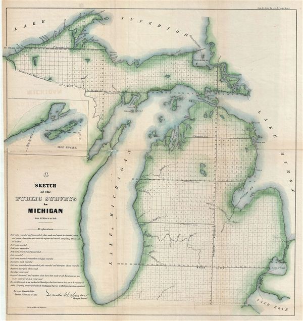
G Sketch of the Public Surveys in Michigan.
sold
- Digital Map Information
- Suitable for large format printing
- File Size: 15.89 MB
- File Type: ZIP / TIFF
- ICC color profile embedded
- Delivered instantly via download link
This is an attractive example of the 1855 public survey map of Michigan. It covers the entire state of Michigan from Lake Superior to Lake erie, including the entirety of Lake Michigan. An inset map near the left margin details Isle Royale. The ... (more details)
One of the few early maps of Connecticut actually published in Connecticut (New Haven).

Connecticut from the best Authorities.
sold
- Digital Map Information
- Suitable for large format printing
- DPI: 300
- File Size: 7.48 MB
- File Type: ZIP / TIFF
- ICC color profile embedded
- Delivered instantly via download link
A rare map of ... (more details)
The earliest obtainable plan or map of New York City.
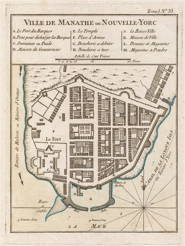
Ville De Manathe ou Nouvelle-Yorc.
sold
- Digital Map Information
- Suitable for large format printing
- DPI: 300
- File Size: 2.44 MB
- File Type: ZIP / TIFF
- ICC color profile embedded
- Delivered instantly via download link
A beautiful ... (more details)
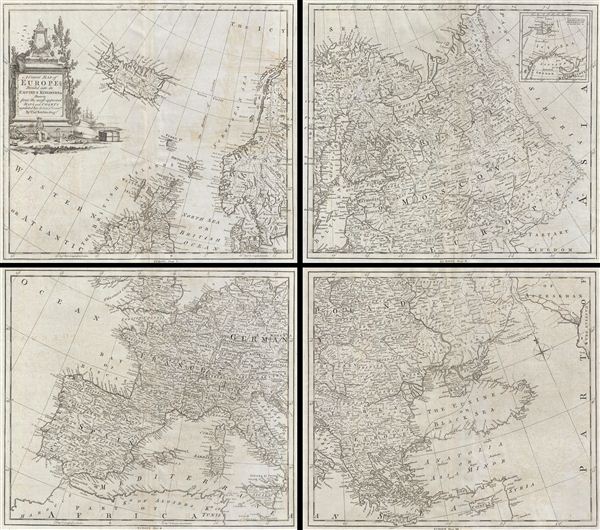
A Correct Map of Europe Divided into its Empires Kingdoms & c.
sold
- Digital Map Information
- Suitable for large format printing
- DPI: 300
- File Size: 38.71 MB
- File Type: ZIP / TIFF
- ICC color profile embedded
- Delivered instantly via download link
A curious ... (more details)
Illustrates the 'The Romantic Rhine' incuding the Rhine Gorge.

Panorama of the Rhein from Mentz to Cologne. / Panorama du Rhin depuis Mayence jusqua Cologne.
sold
- Digital Map Information
- Suitable for large format printing
- DPI: 300
- File Size: 32.05 MB
- File Type: ZIP / TIFF
- ICC color profile embedded
- Delivered instantly via download link
This is a ... (more details)
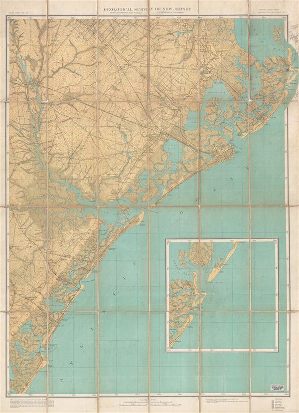
Topographical Map of the 'Egg harbor and Vicinity' New Jersey No 16.
sold
- Digital Map Information
- Suitable for large format printing
- File Size: 11.62 MB
- File Type: ZIP / TIFF
- ICC color profile embedded
- Delivered instantly via download link
This is a ... (more details)
Unusual puzzle atlas.
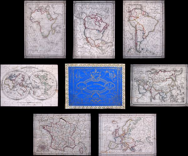
Unusual puzzle atlas.

Important and monumental 20 panel map of Paris.
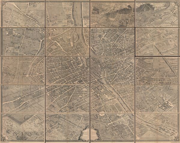
Plan de Paris.
sold
- Digital Map Information
- Suitable for large format printing
- File Size: 30.4 MB
- File Type: ZIP / TIFF
- ICC color profile embedded
- Delivered instantly via download link
This is the c. 1900 Taride edition of Louis Bretez and Michel-Etienne Turgot's monumental 1739 map of Paris. Turgot's map of Paris is possibly the most ambitious urban mapping ever undertaken. This map shows the whole of 18th century Paris and offers a wonderful perspective on the city before Baron Georges Eugène Haussmann's 19th-century redesign. Turgot, who held the mayor-like office of Prevôt des Marchands de Paris , commissioned Louis Bretez and Claude Lucas to produce this map in 1734. Oriented to the east on an axonometric projection, this map is best understood as an aerial view where in every building, window, tree, shadow, and park are shown. It took the team nearly five years of exhaustive sketching and surveying to assemble this masterpiece. In order to produce the thousands of sketches and surveys required to complete this map, Bretez was issued a permit to enter every building in Paris. (more details)

Washington.
sold
- Digital Map Information
- Suitable for large format printing
- DPI: 300
- File Size: 2.49 MB
- File Type: ZIP / TIFF
- ICC color profile embedded
- Delivered instantly via download link
This ... (more details)

Petersburg.
sold
- Digital Map Information
- Suitable for large format printing
- DPI: 300
- File Size: 2.54 MB
- File Type: ZIP / TIFF
- ICC color profile embedded
- Delivered instantly via download link
This ... (more details)

The Four Courts, Dublin.
sold
- Digital Map Information
- Suitable for large format printing
- DPI: 300
- File Size: 2.62 MB
- File Type: ZIP / TIFF
- ICC color profile embedded
- Delivered instantly via download link
This ... (more details)

Amsterdam Towards the Zuyder Zee.
sold
- Digital Map Information
- Suitable for large format printing
- DPI: 300
- File Size: 3.29 MB
- File Type: ZIP / TIFF
- ICC color profile embedded
- Delivered instantly via download link
This ... (more details)