
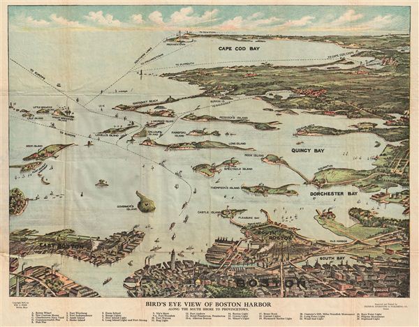
Bird's Eye View of Boston Harbor along the South Shore to Provincetown.
sold
- Digital Map Information
- Suitable for large format printing
- DPI: 300
- File Size: 13.6 MB
- File Type: ZIP / TIFF
- ICC color profile embedded
- Delivered instantly via download link
A remarkable 1917 color lithograph map and view of Boston Harbor from Boston to Provincetown. Includes all of Cape Cod Bay, Quincy Bay and Dorchester Bay with the communities of Boston, east Boston, South Boston, Dorchester, Quincy, Hough's Neck, Mingham, ... (more details)
Prepared for the 10th Olympic Games in Los Angeles.

The Tenth Olympic Games Los Angeles California July 30 - Aug 14 '32.
sold
- Digital Map Information
- Suitable for large format printing
- File Size: 19.01 MB
- File Type: ZIP / TIFF
- ICC color profile embedded
- Delivered instantly via download link
An uncommon printed map of Los Angeles prepared by Mary Hall Atwood for the 1932 Tenth Olympic Games. The map covers the greater Los Angeles area from Ventura to the Pacific and From Point Vincente and Long Point to Azusa. Various points of import to ... (more details)

Carta Esferica de los reconocimientos hechos en 1792 en la Costa N.O. de America para examinar la Entrada de Juan de Fuca, y la internacion de sus Canales navegables levantada de ordern del Rey Neustro Senor abordo de la Goletas Sutil y Mexicana.
sold
- Digital Map Information
- Suitable for large format printing
- File Size: 7.59 MB
- File Type: ZIP / TIFF
- ICC color profile embedded
- Delivered instantly via download link
This is an uncommon 1871 reissue of a 1795 map of Vancouver Island, Washington, and British Columbia by the Spanish navigators Dionisio Alcala-Galiano and Cayetano Valdes. Alcala-Galiano and Valdes led the last important Spanish exploratory voyage to ... (more details)
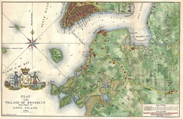
Plan of the Village of Brooklyn and part of Long Island 1766.
sold
- Digital Map Information
- Suitable for large format printing
- File Size: 7.07 MB
- File Type: ZIP / TIFF
- ICC color profile embedded
- Delivered instantly via download link
An unusual and appealing 1864 map of Brooklyn, New York, as it appeared in 1766, towards the end of the colonial period. Covers parts of modern day Brooklyn from Red Hook to Bedford and from Williamsburg to Flatbush. The region is shown divided up ... (more details)

A Chart Shewing part of the Coast of N.W. America, with the tracks of His Majesty's Sloop Discovery and Armed Tender Chatham;; Commanded by George Vancouver Esq. and prepared under his immediate inspection by Lieut. Joseph Baker in which the Continental Shore has been traced and determined from Lat: 46.30 N. and Long236.12 E. to Lat: 52.15 N. and Long . 232.40 E. at the different periods shown by the Tracks.
sold
- Digital Map Information
- Suitable for large format printing
- File Size: 15.36 MB
- File Type: ZIP / TIFF
- ICC color profile embedded
- Delivered instantly via download link
This is a hand colored 1871 reissue of what is considered to be the great navigator George Vancouver's most important and influential map detailing the northwest coast of America. Originally issued in 1798, Vancouver's map covers from Cape Lookout ... (more details)

Chorographica Tabula Lacus Lemanni Locorumque Circumiacentium Auctore Iac. G. Genevensi
sold
- Digital Map Information
- Suitable for large format printing
- DPI: 300
- File Size: 12.49 MB
- File Type: ZIP / TIFF
- ICC color profile embedded
- Delivered instantly via download link
An uncommon and beautiful map of Lake Geneva engraved by Jodocus Hondius for inclusion in his 1606 edition of the Mercator Atlas. It is one of the best-detailed maps of the region based on firsthand report, derived from the manuscript map of native Jacques Goulart. (more details)
Details the Battle of White Plains.
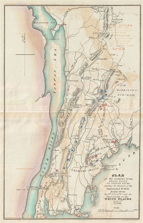
Plan of the Country from Frogs Point to Croton River Shewing the Positions of the American & British Armies from the 12th of Oct. 1776 until the Engagement on the White Plains on the 28th.
sold
- Digital Map Information
- Suitable for large format printing
- DPI: 300
- File Size: 2.06 MB
- File Type: ZIP / TIFF
- ICC color profile embedded
- Delivered instantly via download link
This is a rare map of Westchester County, New York, the Bronx, and upper Manhattan during the American Revolutionary War issued for John Marshall's 1832 edition of the Life of Washington . The map covers the strategically important region north ... (more details)
Illustrates the British takeover of New York City following Battles of Long Island and Harlem Heights.
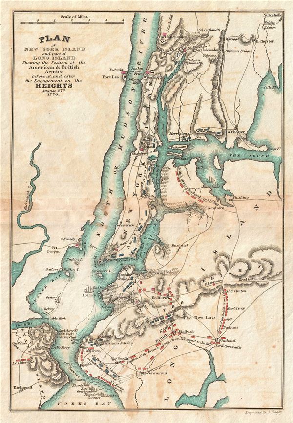
Plan of New York Island and part of Long Island Shewing the Position of the American & British Armies before, at, and after the Engagement on the Heights August 27th 1776.
sold
- Digital Map Information
- Suitable for large format printing
- Full resolution TIFF file
- ICC color profile embedded
- Delivered instantly via download link
This is a rare map of New York City during the American Revolutionary War issued for John Marshall's 1832 edition of the Life of Washington . The map covers the strategically important Manhattan Island and vicinity, including Staten Island, ... (more details)
The Siege of Boston and the Battle of Bunker Hill.

Boston with its Environs.
sold
- Digital Map Information
- Suitable for large format printing
- Full resolution TIFF file
- ICC color profile embedded
- Delivered instantly via download link
This is a rare plan or map of Boston, Massachusetts during the American Revolutionary War issued for John Marshall's 1832 edition of the Life of Washington . The map covers the strategically important city and harbor of Boston, including ... (more details)
Map of Washington's crossing of the Delaware and the Battle of Trenton.

Plan of the Northern part of New Jersey Shewing the Positions of the American & British Armies after crossing the North River in 1776.
sold
- Digital Map Information
- Suitable for large format printing
- Full resolution TIFF file
- ICC color profile embedded
- Delivered instantly via download link
This is a rare map of New York City, Staten Island, and Northern New Jersey during the American Revolutionary War issued for John Marshall's 1832 edition of the Life of Washington . The map covers the strategically important west bank of ... (more details)
The vital Hudson River Corridor during the American Revolutionary War.
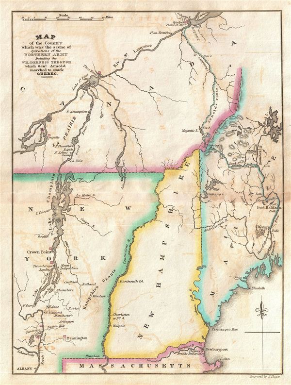
Map of the Country which was the scene of the Northern Army Including the Wilderness through which Gen. Arnold marched to attack Quebec.
sold
- Digital Map Information
- Suitable for large format printing
- Full resolution TIFF file
- ICC color profile embedded
- Delivered instantly via download link
This is a rare map of New York, Vermont, New Hampshire, Maine and Quebec during the American Revolutionary War issued for John Marshall's 1832 edition of the Life of Washington . The map covers the strategically vital Hudson Valley – ... (more details)
Details the Revolutionary War Battle of Rhode Island.

Map of part of Rhode Island Shewing the Positions of the American & British Armies at the Seige of Newport and the subsequent Action on the 29th of August 1778.
sold
- Digital Map Information
- Suitable for large format printing
- Full resolution TIFF file
- ICC color profile embedded
- Delivered instantly via download link
This is a rare map of Narragansett Bay, Rhode Island during the American Revolutionary War issued for John Marshall's 1832 edition of the Life of Washington . The map covers the strategically important Narragansett Bay from Newport to ... (more details)
The southern theater of the American Revolutionary War.
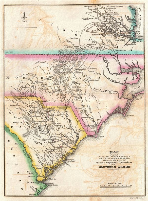
Map of part of Virginia North Carolina South Carolina & Georgia which were the scenes of the most important Operations of the Southern Armies.
sold
- Digital Map Information
- Suitable for large format printing
- Full resolution TIFF file
- ICC color profile embedded
- Delivered instantly via download link
This is a rare map North Carolina, South Carolina, and Virginia during the Revolutionary War issued for John Marshall's 1832 edition of the Life of Washington . The map covers from the Chesapeake Bay and Richmond, Virginia southwards ... (more details)
The Siege of Yorktown - the decisive battle of the American Revolutionary War.

Plan of the Investment and Attack of York in Virginia.
sold
- Digital Map Information
- Suitable for large format printing
- Full resolution TIFF file
- ICC color profile embedded
- Delivered instantly via download link
This is a rare plan or map of Yorktown, Virginia, during the American Revolutionary War issued for John Marshall's 1832 edition of the Life of Washington . The map covers the city of Yorktown (York) and the surrounding countryside. ... (more details)
Illustrates the costly British capture of Philadelphia.
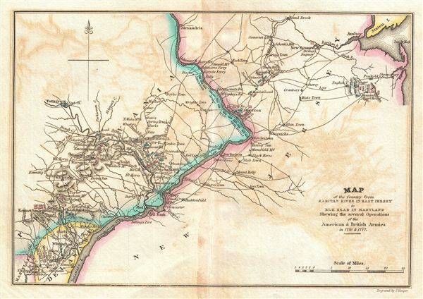
Map of the Country from Raritan River in East Jersey to Elk Head in Maryland Shewing the several Operations of the American and British Arimies in 1776 & 1777.
sold
- Digital Map Information
- Suitable for large format printing
- Full resolution TIFF file
- ICC color profile embedded
- Delivered instantly via download link
This is a rare map of central New Jersey and eastern Pennsylvania during the American Revolutionary War issued for John Marshall's 1832 edition of the Life of Washington . The map covers the lands on both sides of the Delaware River ... (more details)
One of the most important battles in the Revolutionary War.
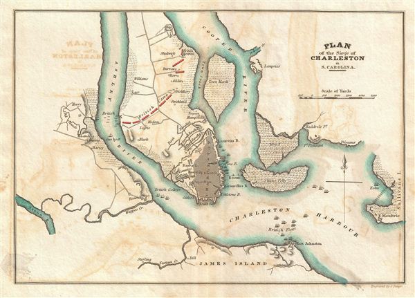
Plan of the Siege of Charleston in S. Carolina.
sold
- Digital Map Information
- Suitable for large format printing
- Full resolution TIFF file
- ICC color profile embedded
- Delivered instantly via download link
This is a rare plan of the Revolutionary War Siege of Charleston, South Carolina, issued for John Marshall's 1832 edition of the Life of Washington . The map covers Charleston Harbor and parts of the Cooper and Ashley Rivers from ... (more details)
The hope and dreams of the Russian conquests in north Asia.
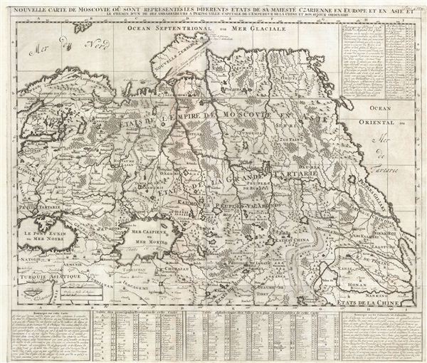
Nouvelle Carte De Moscovie Ou Sont Representes Les Differents Etats De Sa Mateste Czarienne En Europe Et En Asie Et Le Chemin D'un De Ses Ambassadeurs A Peking Ville Capitale De L'Empereur De La Chine Et Son Sejour Ordinaire.
sold
- Digital Map Information
- Suitable for large format printing
- DPI: 300
- File Size: 18.72 MB
- File Type: ZIP / TIFF
- ICC color profile embedded
- Delivered instantly via download link
A beautifully engraved uncolored c. 1720 map of Russian in Asia, Siberia, Tartary and parts of China by Henri Abraham Chatelain. Chatelain's map of imperial Russia covers from the Black Sea (Pont euxin) to Korea (Corea) and the ... (more details)

Carte de L'Asie Mineure Ancienne.
sold
- Digital Map Information
- Suitable for large format printing
- DPI: 300
- File Size: 13.56 MB
- File Type: ZIP / TIFF
- ICC color profile embedded
- Delivered instantly via download link
A fine first edition example of M. Lapie's 1830 map of Asia Minor in Antiquity. This map covers from the Aegean Sea to Mesopotamia and from the Black Sea (Pontus euxinus) to Cyprus and Lebanon. Lapie shows the ancient ... (more details)

Carte de L'Oceanie contenant L'Australie, La Polynesie et Les Iles Asiatiques.
sold
- Digital Map Information
- Suitable for large format printing
- DPI: 300
- File Size: 10.22 MB
- File Type: ZIP / TIFF
- ICC color profile embedded
- Delivered instantly via download link
A fine first edition example of M. Lapie's 1830 map of Australia, New Zealand, Polynesia, and the east India Islands. This map covers from Southeast Asia eastward as far as the remote Polynesian islands of elisabeth and ... (more details)

Carte de la Turquie d'Europe et de la Grece Moderne.
sold
- Digital Map Information
- Suitable for large format printing
- DPI: 300
- File Size: 13.38 MB
- File Type: ZIP / TIFF
- ICC color profile embedded
- Delivered instantly via download link
A fine first edition example of M. Lapie's 1829 map of Greece, the Balkans, and the eruopean Part of Turkey. The map covers Turkey and Greece from the Adriatic Sea and the Ionian Sea to the Black Sea. It shows Hungary, ... (more details)