

Kyoto.
sold
- Digital Map Information
- Suitable for large format printing
- File Size: 23.11 MB
- File Type: ZIP / TIFF
- ICC color profile embedded
- Delivered instantly via download link
A fine Japanese Tokugawa or edo era woodblock map of Kyoto, Japan. Covers all of Kyoto as well as some of the surrounding hills. Printed in the traditional Japanese style popular during the edo Period, with topography shown in profile, no firm directional ... (more details)
Includes the Eiffel Tower in profile.
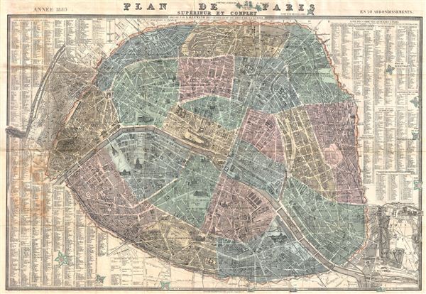
Plan de Paris Superieur et Complet en 20 Arrondissements.
sold
- Digital Map Information
- Suitable for large format printing
- File Size: 39.88 MB
- File Type: ZIP / TIFF
- ICC color profile embedded
- Delivered instantly via download link
A fine tourist 1889 pocket map of Paris drawn by Armand Joseph Lallemand issued by the Depot de Guerre and Chez Bernardin-Bechet. Centered on the Seine, Lallemand's map covers central Paris as contained by the Thiers Wall, plus some of the surrounding ... (more details)
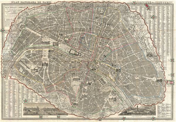
Plan Panorama de Paris Fortifie avec Illustre.tion.
sold
- Digital Map Information
- Suitable for large format printing
- File Size: 42.11 MB
- File Type: ZIP / TIFF
- ICC color profile embedded
- Delivered instantly via download link
A fine tourist 1857 pocket map of Paris drawn by Armand Joseph Lallemand issued by the Depot de Guerre. Centered on the Seine, Lallemand's map covers central Paris as contained by the Thiers Wall. The city is shown at the very beginning of the ... (more details)
A stunning overview of Africa on the cusp of European exploration into the interior.
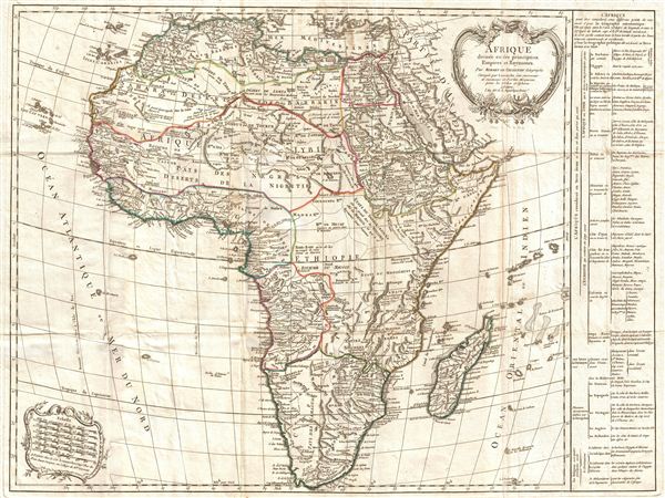
Afrique divisee en ses principaux Empires et Royaumes.
sold
- Digital Map Information
- Suitable for large format printing
- DPI: 300
- File Size: 15.76 MB
- File Type: ZIP / TIFF
- ICC color profile embedded
- Delivered instantly via download link
An important an unusual c. 1870 folding pocket map of Africa by Robert de Vaugondy. Vaugondy frist issued this map in 1749 and it went through at least seven states with editions appearing as late as 1810. Issued on the cusp of europe's great ... (more details)
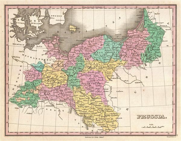
Prussia.
sold
- Digital Map Information
- Suitable for large format printing
- Full resolution TIFF file
- ICC color profile embedded
- Delivered instantly via download link
A beautiful example of Finley's 1827 map of Prussia. Details the Kingdom of Prussia, the most powerful state of the Germanic Confederation, as it was under King Friedrich Wilhelm III. In Finley's classic minimalist style, this map identifies ... (more details)
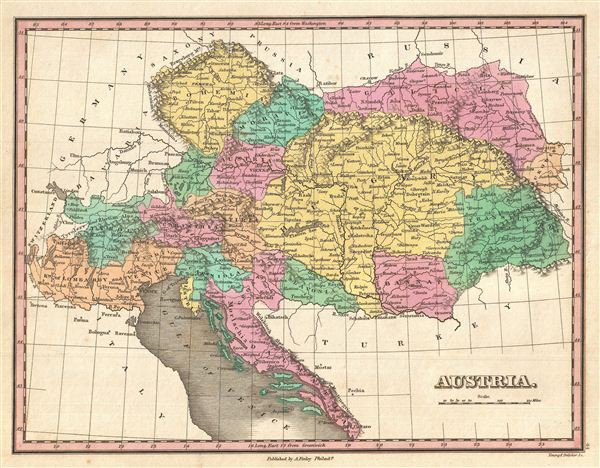
Austria.
$150.00
Acquire
- Digital Map Information
- Suitable for large format printing
- DPI: 300
- File Size: 3.69 MB
- File Type: ZIP / TIFF
- ICC color profile embedded
- Delivered instantly via download link
A beautiful example of Finley's 1827 map of Austria. Covers the territory of the Austro-Hungarian Empire, inclusive of all of Austria, the Italian provinces of Lombardy, Tyrol, Venice, Dalmatia, Hungary, Croatia, the Bohemia, and ... (more details)

Europe.
sold
- Digital Map Information
- Suitable for large format printing
- DPI: 300
- File Size: 3.62 MB
- File Type: ZIP / TIFF
- ICC color profile embedded
- Delivered instantly via download link
A beautiful example of Finley's 1827 map of Europe. Covers the continent in its entirety from the Atlantic to the Caspian Sea and from the Arctic Ocean to the Mediterranean. Notes the legendary and semi-mythical whirlpool known ... (more details)
The first published coastal views of parts of Australia and New Zealand.

Vues de quelques Parties de la Cote Sud ouest de la Nouvelle Hollande et des Iles Oparo et Snares.
sold
- Digital Map Information
- Suitable for large format printing
- DPI: 300
- File Size: 5.45 MB
- File Type: ZIP / TIFF
- ICC color profile embedded
- Delivered instantly via download link
A fine example of George Vancouver's 1799 view sheet depicting various coastal profile views of Australia and New Zealand. This sheet features six beautifully rendered views detailing, from top: Chatham Island, Western ... (more details)
Some of the earliest nautical views of the Pacific Northwest ever published.

Vues de Diverses Parties de la Cote Nord-Ouest d'Amerique.
sold
- Digital Map Information
- Suitable for large format printing
- DPI: 300
- File Size: 7.29 MB
- File Type: ZIP / TIFF
- ICC color profile embedded
- Delivered instantly via download link
A fine example of George Vancouver's 1799 view sheet depicting various coastal profile views of the Pacific Northwest. This sheet features seven beautifully rendered views detailing, from top: Cape Mendocino, ... (more details)
Some of the earliest nautical views of the Pacific Northwest ever published.

Vues de Diverses Parties de la Cote Nord-Ouest d'Amerique.
sold
- Digital Map Information
- Suitable for large format printing
- DPI: 300
- File Size: 8.26 MB
- File Type: ZIP / TIFF
- ICC color profile embedded
- Delivered instantly via download link
A fine example of George Vancouver's 1799 view sheet depicting various coastal profile views of the Pacific Northwest. This sheet features six beautifully rendered views detailing, from top: the Scott Islands ... (more details)
Some of the earliest nautical views Alaska, Mexico and South America ever published.

Vues de Quelques Caps et Iles de la Cote du Nord Ouest et des Cotes Du Sud-Ouest et due Sud de L'Amerique.
sold
- Digital Map Information
- Suitable for large format printing
- DPI: 300
- File Size: 7.03 MB
- File Type: ZIP / TIFF
- ICC color profile embedded
- Delivered instantly via download link
A fine example of George Vancouver's 1799 view sheet depicting various capes explored by Vancouver and his officers during this historic exploration of the western coast of America. This sheet features nine ... (more details)
Some of the earliest nautical views San Francisco, San Diego, and Santa Barbara.

Vues de Diverses Parties de la Cote Nord-Ouest d'Amerique.
sold
- Digital Map Information
- Suitable for large format printing
- DPI: 300
- File Size: 7.69 MB
- File Type: ZIP / TIFF
- ICC color profile embedded
- Delivered instantly via download link
A fine example of George Vancouver's 1799 view sheet for the western coast of North America in and around modern day California. This sheet features seven beautifully rendered views detailing, from top: ... (more details)
Reveals Vancouver's explorations on the Columbia River.
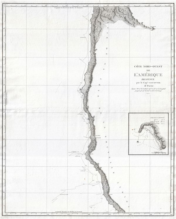
Cote Nord-Ouest de L'Amerique Reconnue par le Cape. Vancouver. 2e Partie.
sold
- Digital Map Information
- Suitable for large format printing
- DPI: 300
- File Size: 12.04 MB
- File Type: ZIP / TIFF
- ICC color profile embedded
- Delivered instantly via download link
A fine example of George Vancouver's 1799 mapping of the northern California and Oregon. This map covers from Cape Lookout and the Columbia River southward past Cape Gregory, Cape Orford, Port St. George, ... (more details)
The map that disproved the Northwest Passage.

Cote Nord-Ouest de L'Amerique Reconnue par le Cape. Vancouver. VIIe Partie.
sold
- Digital Map Information
- Suitable for large format printing
- DPI: 300
- File Size: 17.73 MB
- File Type: ZIP / TIFF
- ICC color profile embedded
- Delivered instantly via download link
One of the great navigator George Vancouver's most important and influential maps, this is Vancouver's 1799 mapping of Kodiak Island and Cook Inlet, Alaska. Centered on the entrance to Cook Inlet, this map ... (more details)
The first English mappings of San Diego and San Francisco Bays.

Cote Nord-Ouest de L'Amerique Reconnue par le Cape. Vancouver. 1e Partie.
sold
- Digital Map Information
- Suitable for large format printing
- DPI: 300
- File Size: 13.42 MB
- File Type: ZIP / TIFF
- ICC color profile embedded
- Delivered instantly via download link
One of the great navigator George Vancouver's most important and influential maps, this is Vancouver's 1799 mapping of the California coastline roughly from San Francisco Bay in the north to Santo ... (more details)
A cornerstone map of Australian discovery and colonization.
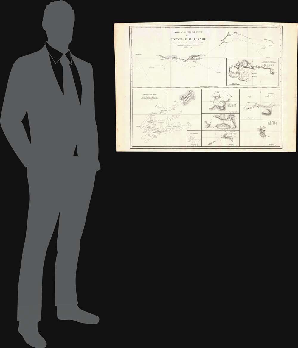
Partie de la Cote Sud-Ouest de la Nouvelle Hollande avec les Routes de la Corvette la Decouverte et sa conserve le Chatham commandes par Georges Vancouver en l'Annee 1791.
sold
- Digital Map Information
- Suitable for large format printing
- DPI: 300
- File Size: 13.52 MB
- File Type: ZIP / TIFF
- ICC color profile embedded
- Delivered instantly via download link
One of the great navigator George Vancouver's most important and influential maps, this is Vancouver's 1799 mapping of southwestern Australia and New Zealand. Though less well known than his ... (more details)
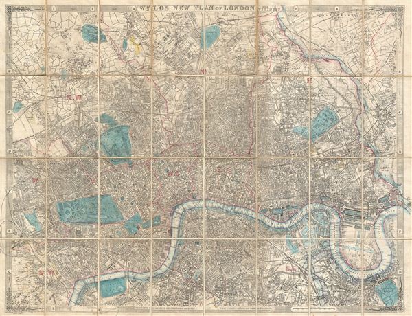
Wyld's New Plan of London and its Vicinity.
sold
- Digital Map Information
- Suitable for large format printing
- File Size: 32.6 MB
- File Type: ZIP / TIFF
- ICC color profile embedded
- Delivered instantly via download link
A large and appealing pocket map of London, england issued by James Wyld in 1889. Centered on the Thames, this map covers central London from Highgate to the Victoria Docks and from Brixton ... (more details)
A colorful beautifully engraved map of London.
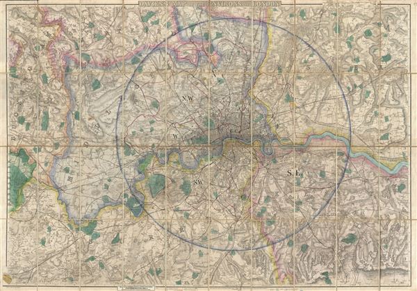
Davies's New Map of the Environs of London.
sold
- Digital Map Information
- Suitable for large format printing
- File Size: 57.5 MB
- File Type: ZIP / TIFF
- ICC color profile embedded
- Delivered instantly via download link
A beautifully engraved, impressively detailed, and colorful 1875 map of London by Benjamin Rees Davies. Centered on the Thames River valley, this map covers from Northaw to Grays Thurrock, ... (more details)
An unusual early case map of London.
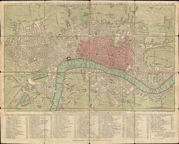
The London Directory or a New & Improved Plan of London, Westminster & Southwark; with the adjacent Country, the New Buildings, the New Roads and the late alterations by Opening of New Streets, & Widening of others 1790.
sold
- Digital Map Information
- Suitable for large format printing
- DPI: 300
- File Size: 15.2 MB
- File Type: ZIP / TIFF
- ICC color profile embedded
- Delivered instantly via download link
A highly appealing 1790 map of London by Robert Sayer. Centered on the Thames River, this map details central London from Islington to Shadwell and from Newington Butts to Tyburn. Only ... (more details)
One of the first maps to depict the London Underground.
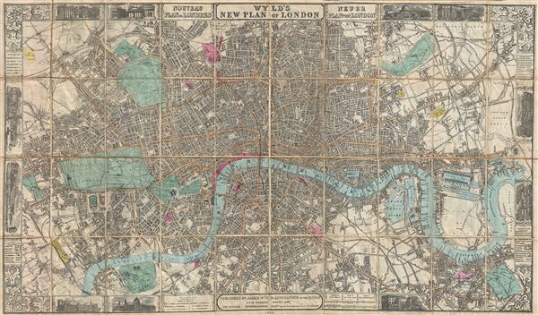
Wyld's New Plan of London.
sold
- Digital Map Information
- Suitable for large format printing
- Full resolution TIFF file
- ICC color profile embedded
- Delivered instantly via download link
A large and appealing pocket map of London, england issued by James Wyld in 1863. Centered on the Thames, this map covers central London from Paddington Cemetery in the northwest to ... (more details)