

Map of Massachusetts and Rhode Island
sold
- Digital Map Information
- Suitable for large format printing
- DPI: 300
- File Size: 3.29 MB
- File Type: ZIP / TIFF
- ICC color profile embedded
- Delivered instantly via download link
This hand colored map is a copper plate engraving, dating to 1850 by the legendary American Mapmaker S.A. Mitchell, the elder. It represents Massachusetts and Rhode Island. Contains a beautiful inset map of downtown Boston. This map also contains notes on ... (more details)

Indo-Chine
sold
- Digital Map Information
- Suitable for large format printing
- Full resolution TIFF file
- ICC color profile embedded
- Delivered instantly via download link
This is a c. 1825 map of Indo-Chine by drawn by French cartographer Aristide Michel Perrot and engraved by P. Tardieu. Covers the area from China in the north to Sumatra in the south, and from the Gulf of Bengal in the west to Canton in the east. ... (more details)

Map of New Jersey
sold
- Digital Map Information
- Suitable for large format printing
- DPI: 300
- File Size: 3.65 MB
- File Type: ZIP / TIFF
- ICC color profile embedded
- Delivered instantly via download link
This hand colored map is a copper plate engraving, dating to 1850 by the legendary American Mapmaker S.A. Mitchell, the elder. It represents New Jersey. This historically important map is extremely rare as it existed only in the 1850 edition of the ... (more details)
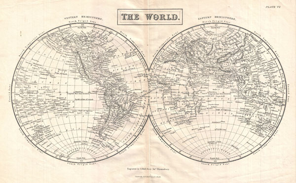
The World
sold
- Digital Map Information
- Suitable for large format printing
- Full resolution TIFF file
- ICC color profile embedded
- Delivered instantly via download link
A highly detailed mis-19th century map of the World in Hemispheres Divided into the Western Hemisphere and Eastern Hemisphere, this map shows and labels islands, continents, major cities, oceans, capes, gulfs and mountains. Also shows ... (more details)

Russia in Asia
sold
- Digital Map Information
- Suitable for large format printing
- Full resolution TIFF file
- ICC color profile embedded
- Delivered instantly via download link
This is a fine 1826 map of Russia in Asia, drawn by J. Assheton and engraved by J. Shury. This beautifully drawn black and white map covers the entire area of Russia and the adjacent parts of the Chinese Empire. Makes note of numerous ... (more details)

Mountains & Rivers
sold
- Digital Map Information
- Suitable for large format printing
- File Size: 17.58 MB
- File Type: ZIP / TIFF
- ICC color profile embedded
- Delivered instantly via download link
One of the finest Mountains and River's Chart published in the mid 19th century. This is the 1862 edition of Johnson and Ward chart or map of the relative distances of the world's great rivers and the relative heights of the world's ... (more details)
Cruchley's last New Plan of London.
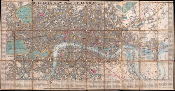
Cruchley's New Plan of London Shewing all the New and Intended Improvements to the Present Time.
sold
- Digital Map Information
- Suitable for large format printing
- DPI: 300
- File Size: 25.43 MB
- File Type: ZIP / TIFF
- ICC color profile embedded
- Delivered instantly via download link
This is a very uncommon and obscure example of Cruchley's New Plan of London . Cruchley's famous plan of London was first issued in 1827 and was updated yearly until this issue, in 1849. The original New Plan of London was much ... (more details)

Carte des Environs de La Ville de Mexico pour l’Histoire gen. des Voyages. 1754.
sold
- Digital Map Information
- Suitable for large format printing
- Full resolution TIFF file
- ICC color profile embedded
- Delivered instantly via download link
This beautiful little map of Mexico City was produced by the French Cartographer Jacques-Nicolas Bellin in 1754. Depicts the now non-extant lake upon which Mexico City was built. Extends as far north as Pachuca and as far south ... (more details)
One of the most influential maps of the Great Lakes to appear in the 18th century.
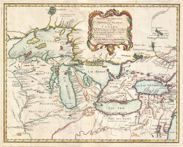
Partie Occidentale de la Nouvelle France ou du Canada.
sold
- Digital Map Information
- Suitable for large format printing
- DPI: 300
- File Size: 13.4 MB
- File Type: ZIP / TIFF
- ICC color profile embedded
- Delivered instantly via download link
A rare and extremely influential 1755 map of the Great Lakes drawn by Jacques Nicholas Bellin. This map, which appeared in the 1755 issue of the Homann Heirs Atlas Major , covers all five of the Great Lakes as well as the ... (more details)
A monumental three part nautical chart or map of the Chesapeake Bay.

Chesapeake Bay Sheet No. 1 From the Head of the Bay to the Mounth of the Magothy River. - Chesapeake Bay From the Head of the Bay to the Mouth of the Potomac River. Sheet No. 2 From the Mouth of the Magothy River to the Mouth of the Hudson River. - Preliminary Chart of Chesapeake Bay Sheet No. 3 From the Mouth of the Hudson River to the Mouth of the Potomac River.
sold
- Digital Map Information
- Suitable for large format printing
- File Size: 4.35 MB
- File Type: ZIP / TIFF
- ICC color profile embedded
- Delivered instantly via download link
This is a monumental and rarely available three part 1857 nautical chart or maritime map of the Chesapeake Bay. Prepared for the 1857 edition of the U.S. Coast Survey's Superintendent's Report this giant map covers from ... (more details)

A New Map of Mississippi with its Roads & Distances.
sold
- Digital Map Information
- Suitable for large format printing
- Full resolution TIFF file
- ICC color profile embedded
- Delivered instantly via download link
This scarce hand colored map is a lithographic engraving of Mississippi dating to 1846 by the legendary American Mapmaker S.A. Mitchell, the elder. This is a rare transitional map produced by the mysterious engraver H. ... (more details)
One of the most influential maps in the history of North America.
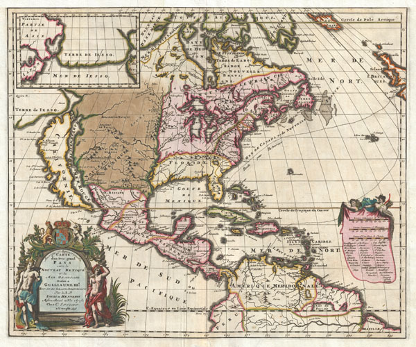
Amerique Septentrionalis Carte d'un tres grand Pays entre le Nouveau Mexique et la Mer Glaciace Dediee a Guilliaume IIIe. Roy de La Grand Bretagne Par le R. P. Louis de Hennepin Mission: Recol: et Not: Apost: Chez c. Specht a Utreght 1698.
sold
- Digital Map Information
- Suitable for large format printing
- DPI: 300
- File Size: 13.5 MB
- File Type: ZIP / TIFF
- ICC color profile embedded
- Delivered instantly via download link
A map that fundamentally impacted the cartographic history of America, this is the 1698 Friar Hennepin map of North America. Covering all of North America from the Equator to the Arctic, this map is remarkable on a ... (more details)

Spain and Portugal.
sold
- Digital Map Information
- Suitable for large format printing
- Full resolution TIFF file
- ICC color profile embedded
- Delivered instantly via download link
This fascinating hand colored 1815 map by Edinburgh cartographer John Thomson depicts southern Spain and Portugal or the Iberian Peninsula. Color coded according to region. This is the finest 19th century ... (more details)
Extremely colorful pictorial map of the Hawaiian Islands.
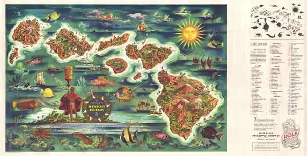
The Dole Map of the Hawaiian Islands.
sold
- Digital Map Information
- Suitable for large format printing
- File Size: 29.76 MB
- File Type: ZIP / TIFF
- ICC color profile embedded
- Delivered instantly via download link
A large decorative pictorial 1950 map of the Hawaii by the artist Joseph Feher. This broadside map covers the eight major Hawaiian Islands in full color with a host of decorative elements including ... (more details)

Map of Arkansas
sold
- Digital Map Information
- Suitable for large format printing
- Full resolution TIFF file
- ICC color profile embedded
- Delivered instantly via download link
This hand colored map is a copper plate engraving, dating to 1849 by the legendary American Mapmaker S.A. Mitchell, the elder. It represents Arkansas. This historically important map is extremely ... (more details)
Possibly the first published map of the Prospect Park Parade Ground.

Plan for the Parade Ground Proposed to be Laid out for Kings County L. I.
sold
- Digital Map Information
- Suitable for large format printing
- File Size: 2.08 MB
- File Type: ZIP / TIFF
- ICC color profile embedded
- Delivered instantly via download link
An extremely scarce example of Vaux and Olmsted's map of the King County Parade Ground (today known as the Prospect Park Parade Ground, or the Prospect Park Base Ball Grounds). The Parade Ground ... (more details)
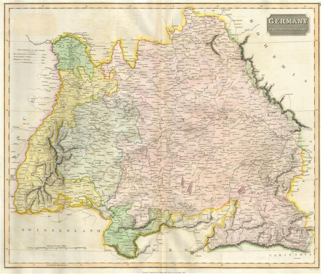
Bavaria, Germany
sold
- Digital Map Information
- Suitable for large format printing
- Full resolution TIFF file
- ICC color profile embedded
- Delivered instantly via download link
This hand colored map is a steel plate engraving, dating to 1814 by the important English mapmaker John Thomson. It depicts the Bavaria and Southern Germany in stupendous detail. Thomson maps ... (more details)
Map of Brooklyn's Eastern Parkway - the world's first Parkway.

City of Brooklyn. Plan of a Portion of Park Way as Proposed to be Laid out From the Eastern Part of the City to The Plaza.
sold
- Digital Map Information
- Suitable for large format printing
- File Size: 1.77 MB
- File Type: ZIP / TIFF
- ICC color profile embedded
- Delivered instantly via download link
A rare 1868 example Vaux & Olmsted's preliminary plan for Eastern Parkway, Brooklyn. This may well be the first published plan of Eastern Parkway, which began construction about 2 years after ... (more details)
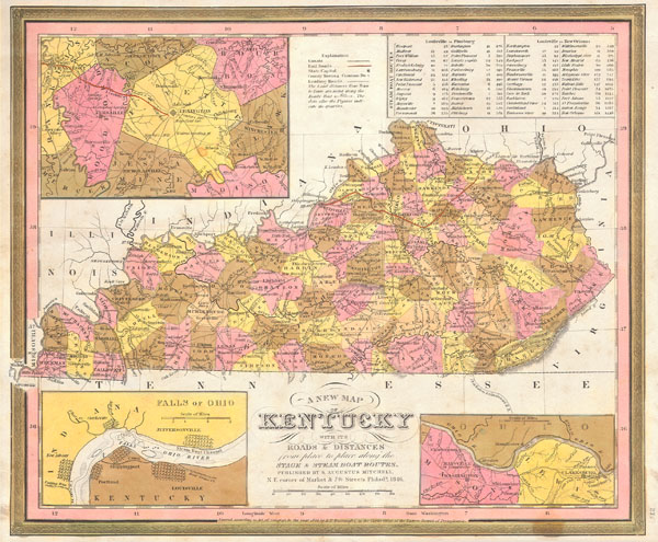
A New Map of Kentucky with its Roads & Distances from place to place along the Stage & Steam Boat Routes.
sold
- Digital Map Information
- Suitable for large format printing
- Full resolution TIFF file
- ICC color profile embedded
- Delivered instantly via download link
This scarce hand colored map is a lithographic engraving of Kentucky dating to 1846 by the legendary American Mapmaker S.A. Mitchell, the elder. There are inset maps of the vicinity of ... (more details)
Vaux and Olmstead's 1867 redesign of Fort Green Park, Brooklyn

Design for the Laying Out of the Grounds known as Fort Green or Washington Park, in the City of Brooklyn.
sold
- Digital Map Information
- Suitable for large format printing
- File Size: 2.86 MB
- File Type: ZIP / TIFF
- ICC color profile embedded
- Delivered instantly via download link
A rare 1867 example Vaux and Olmsted's map of Washington Park or, as it is now known, Fort Greene Park, Brooklyn. Oriented to the east, the map depicts the park as a whole and includes pathways, lakes, buildings, individual trees, rocks, and elevation measurements. The streets and avenues surrounding the park are also noted. The layout of Fort Greene Park shown here reflects Vaux and Olmsted's 1867 redesign. (more details)