
A previously unknown manuscript map of Tokugawa era trade routes between Japan, Taiwan, and China.
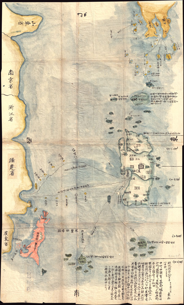
Satsuma Daimyo
sold
- Digital Map Information
- Suitable for large format printing
- DPI: 300
- File Size: 20.78 MB
- File Type: ZIP / TIFF
- ICC color profile embedded
- Delivered instantly via download link
This extraordinary discovery is a previously unknown 1781 (Temmei 1 ) manuscript map of Taiwan and the Satsuma Daimyo. This rare map covers from the southern shores of Kyushu south along the Ryukyu Islands (including Okinawa) to Taiwan and the coastline of ... (more details)
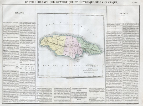
Carte Geographique, Statistique et Historique de la Jamaique.
sold
- Digital Map Information
- Suitable for large format printing
- DPI: 300
- File Size: 6.71 MB
- File Type: ZIP / TIFF
- ICC color profile embedded
- Delivered instantly via download link
This is a stunning 1825 map of Jamaica, in the West Indies. Features a detailed map of the island itself as well as a wealth of historical and statistical data in text boxes surrounding the map. This was originally published in the 1825 French Edition of ... (more details)

Plan of Baltimore.
sold
- Digital Map Information
- Suitable for large format printing
- File Size: 4.73 MB
- File Type: ZIP / TIFF
- ICC color profile embedded
- Delivered instantly via download link
A beautiful example of S. A. Mitchell Jr.'s 1867 map of Baltimore, Maryland. Covers Baltimore from the Northwest Brach of the Patapsco River and Locust Point northwards as far as Green Mountain Cemetary and Oliver Street. Hand colored in pink, green, ... (more details)

Mansfeldia in West Germany
sold
- Digital Map Information
- Suitable for large format printing
- Full resolution TIFF file
- ICC color profile embedded
- Delivered instantly via download link
This magnificent 1647 map by Johannes Blaeu represents Mansfeldia, an area in Eastern Germany near Belgium and Luxembourg. Cartouche in the top right depicts the Mansfeld coat of ... (more details)

Plan of Philadelphia.
sold
- Digital Map Information
- Suitable for large format printing
- File Size: 6.48 MB
- File Type: ZIP / TIFF
- ICC color profile embedded
- Delivered instantly via download link
A beautiful example of S. A. Mitchell Jr.'s 1867 map of Philadelphia, Pennsylvania. Covers Philadelphia, focusing on the downtown area between the Schuylkill and Delaware ... (more details)
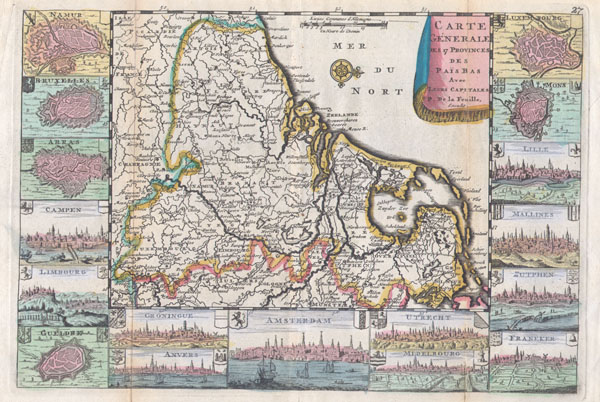
Carte Generale des 17 Provinces des Pais Bas Ave Leurs Capitales.
sold
- Digital Map Information
- Suitable for large format printing
- Full resolution TIFF file
- ICC color profile embedded
- Delivered instantly via download link
A very scarce, c. 1710, map of Belgium, the Netherlands and Luxembourg by Daniellede la Feuille. The main map is surrounded by seventeen plans and views of major cities ... (more details)

Nikko.
sold
- Digital Map Information
- Suitable for large format printing
- File Size: 13.12 MB
- File Type: ZIP / TIFF
- ICC color profile embedded
- Delivered instantly via download link
This is an extremely attractive 1925 (Taisho 14) Japanese view map of Nikko, Japan. Nikko is a U.N. World Heritage Site and considered to be one of the most beautiful ... (more details)
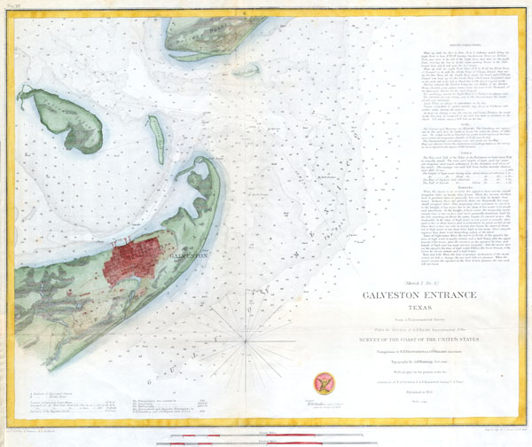
(Sketch 1 No. 3) Galveston Entrance Texas.
sold
- Digital Map Information
- Suitable for large format printing
- DPI: 300
- File Size: 5.61 MB
- File Type: ZIP / TIFF
- ICC color profile embedded
- Delivered instantly via download link
A rare hand colored 1853 costal chart of Galveston harbor, Texas and the finest chart in this series. Includes detailed sailing instructions, depth soundings, and ... (more details)
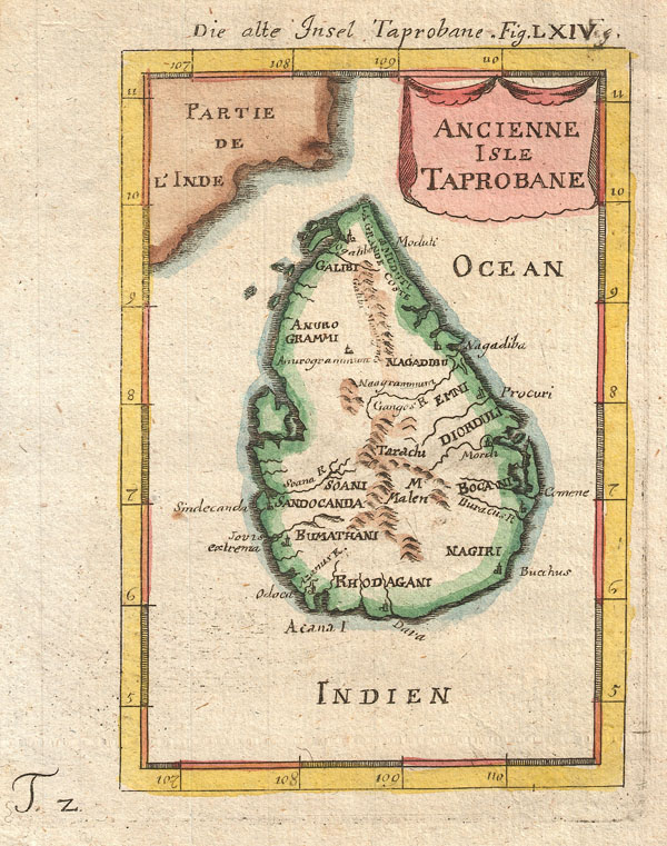
Ancienne Isle Taprobane. Die alte Insel Tabrobane.
sold
- Digital Map Information
- Suitable for large format printing
- Full resolution TIFF file
- ICC color profile embedded
- Delivered instantly via download link
A beautiful miniature 1683 map of Ceylon, Sri Lanka, or Taprobane by Alain Mallet. This stunning little map covers the island of Ceylon as well as parts of ... (more details)

Connecticut
sold
- Digital Map Information
- Suitable for large format printing
- Full resolution TIFF file
- ICC color profile embedded
- Delivered instantly via download link
This hand colored map is a copper plate engraving, dating to 1850 by the legendary American Mapmaker S.A. Mitchell, the elder. It represents Connecticut. ... (more details)
Important biblical map of Lebanon by the founder of 'Palestinology'.
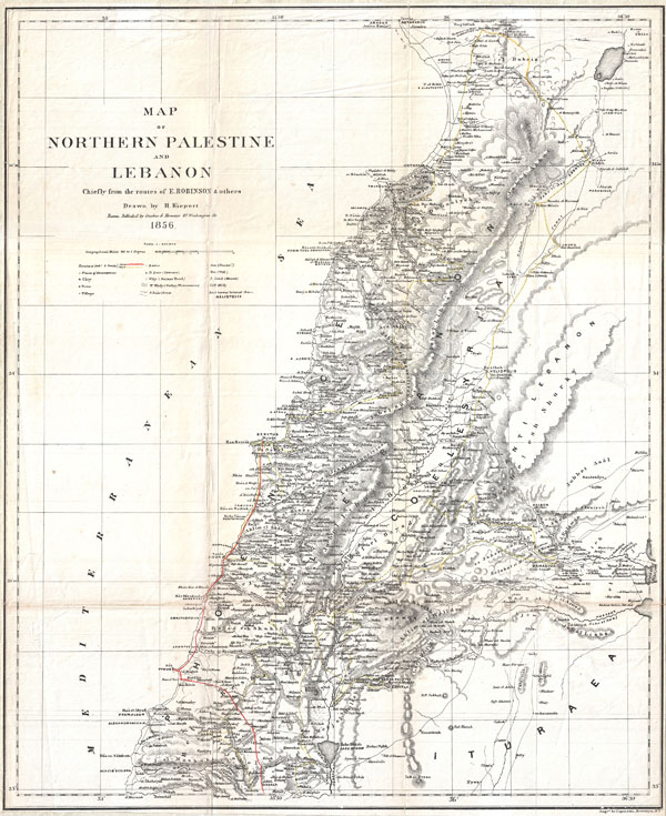
Map of Northern Palestine and Lebanon Chiefly from the Routes of E. Robinson & others.
sold
- Digital Map Information
- Suitable for large format printing
- File Size: 9.11 MB
- File Type: ZIP / TIFF
- ICC color profile embedded
- Delivered instantly via download link
An uncommon map of Lebanon by the classical scholar and cartographer H. Kiepert. Covers all of modern day Lebanon as well as parts of adjacent Israel, ... (more details)

Tokyo.
sold
- Digital Map Information
- Suitable for large format printing
- File Size: 3.78 MB
- File Type: ZIP / TIFF
- ICC color profile embedded
- Delivered instantly via download link
This extraordinary item is a hand colored Meiji Period woodcut map of Edo or Tokyo, Japan. Detailed to street and block level. Beautiful vivid colors. ... (more details)
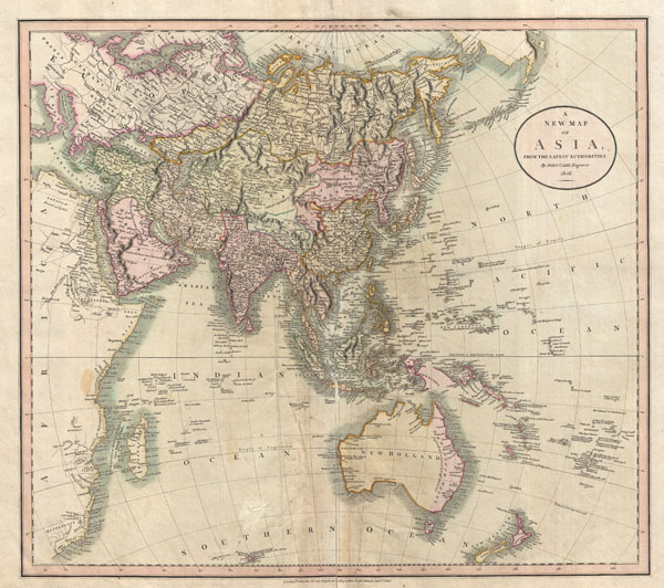
A New Map of Asia, From the Latest Authorities.
sold
- Digital Map Information
- Suitable for large format printing
- DPI: 300
- File Size: 14.75 MB
- File Type: ZIP / TIFF
- ICC color profile embedded
- Delivered instantly via download link
This is John Cary's stunning 1806 map of Asia, Australia, and Polynesia. Covers from the Mediterranean to the Aleutian Islands and from the Arctic to ... (more details)
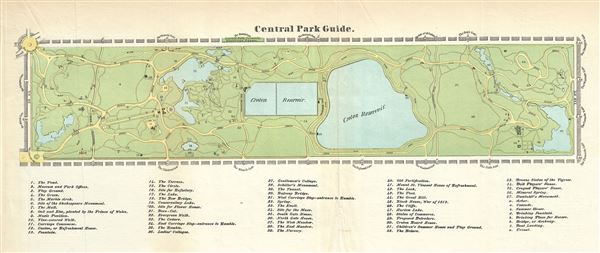
Central Park Guide.
sold
- Digital Map Information
- Suitable for large format printing
- File Size: 1.62 MB
- File Type: ZIP / TIFF
- ICC color profile embedded
- Delivered instantly via download link
A rare hand-colored map of New York City's Central Park prepared and printed for inclusion in the 1869 edition of Valentine's Manual of the ... (more details)

Plan of the City of Philadelphia and Camden.
sold
- Digital Map Information
- Suitable for large format printing
- File Size: 13.13 MB
- File Type: ZIP / TIFF
- ICC color profile embedded
- Delivered instantly via download link
A beautiful example of S. A. Mitchell Jr.'s 1876 folio map of Philadelphia, Pennsylvania. Covers downtown Philadelphia and adjacent ... (more details)
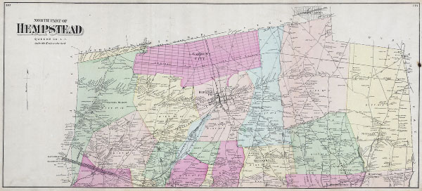
North Part of Hempstead Queens Co. L. I.
sold
- Digital Map Information
- Suitable for large format printing
- File Size: 1.72 MB
- File Type: ZIP / TIFF
- ICC color profile embedded
- Delivered instantly via download link
This scarce and large hand colored map depicts the town of Hempstead, Long Island, New York. Map depicts the populous cities and ... (more details)
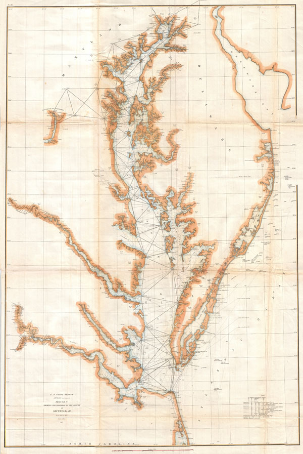
Sketch C Showing the Progress of the Survey in Section No. III from 1843 to 1857.
sold
- Digital Map Information
- Suitable for large format printing
- File Size: 3.83 MB
- File Type: ZIP / TIFF
- ICC color profile embedded
- Delivered instantly via download link
An exceptional example of the 1857 U.S. Coast Survey's progress chart of the Chesapeake Bay. Covers from the mouth of the ... (more details)

Map of the City & County of New-York 1858.
sold
- Digital Map Information
- Suitable for large format printing
- File Size: 18.43 MB
- File Type: ZIP / TIFF
- ICC color profile embedded
- Delivered instantly via download link
An uncommon 1858 map of New York City by D. T. Valentine. This map is divided into two sections. The primary map, ... (more details)
Map that brought the French into the American Revolutionary War.
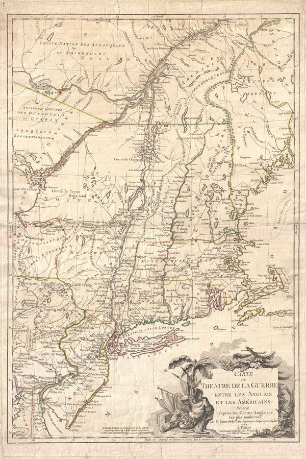
Carte du Theatre de la Guerre entre les Anglais et Les Americains.
sold
- Digital Map Information
- Suitable for large format printing
- DPI: 300
- File Size: 28.67 MB
- File Type: ZIP / TIFF
- ICC color profile embedded
- Delivered instantly via download link
First edition example of an extremely significant map of New York and New England. Issued by Brion de la Tour in ... (more details)

Milanese States
sold
- Digital Map Information
- Suitable for large format printing
- Full resolution TIFF file
- ICC color profile embedded
- Delivered instantly via download link
This fascinating hand colored 1815 map by Edinburgh cartographer John Thomson depicts the Milanese States of ... (more details)