
Chinese Maps (sold)
The Blue Map of China - one of the most important and beautiful maps ever made.
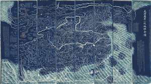
DaQing Wannian Yitong Tianxia Quantu / 大清万年一统天下全图 / All-Under-Heaven Complete Map of the Everlasting Unified Qing Empire
sold
- Digital Map Information
- Suitable for large format printing
- Full resolution TIFF file
- ICC color profile embedded
- Delivered instantly via download link
The legendary Blue Map of China under the Great Qing, one of the rarest, largest, and most aesthetically magnificent Chinese maps ever made. Published in 1811 (Jiaqing 16) in the Qing Dynasty, this Chinese map by Huang Qianren (黃千人, 1694–1771) is of utmost significance. Although ostensibly a map of China, the coverage of this map in fact extends to all lands touched by the influence Qing Empire, including England, Holland, Southeast Asia, Arabia, and Africa. As such it can be considered a political manifesto lionizing the unity and majesty of Qing China as well as a functional administrative document. (more details)
A cartographic expression of the Qing tribute system, this is the earliest known printed example of the 'Tianxia Quantu' map of Qing China.
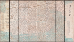
DaQing Wannian Yitong Tianxia Quantu / 大清万年一统天下全图 / All-Under-Heaven Complete Map of the Everlasting Unified Qing Empire
sold
- Digital Map Information
- Suitable for large format printing
- File Size: 89.96 MB
- File Type: ZIP / TIFF
- ICC color profile embedded
- Delivered instantly via download link
A seminal 1806 (Jiaqing 11) Qing Dynasty Chinese map of utmost importance and rarity, this is the earliest known printing of Huang Qianren's (黃千人, 1694–1771) grand and spacious map of the Great Qing Empire of China. Huang Qianren first drew this map ... (more details)
Ceremonial and Administrative Embodiment of the Qing.
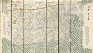
DaQing Wannian Yitong Tianxia Quantu / 大清万年一统天下全图 / All-Under-Heaven Complete Map of the Everlasting Unified Qing Empire
sold
- Digital Map Information
- Suitable for large format printing
- Full resolution TIFF file
- ICC color profile embedded
- Delivered instantly via download link
A seminal 1821 (Daoguang 1) Qing Dynasty Chinese map of utmost importance and rarity, this is Huang Qianren's (黃千人, 1694–1771) grand and spacious map of the Great Qing Empire of China. Although ostensibly a map of China, the coverage of this map in fact extends to all lands touched by the influence Qing Empire, including England, Holland, Southeast Asia, and Africa. As such it can be considered a political manifesto lionizing the unity and majesty of Qing China as well as a functional administrative document. This edition of the map, 1821, was issued to memorialize the reign of the Jiaqing Emperor and celebrate the coming Daoguang reign. (more details)
The last great cartographic masterpiece of Ming China.
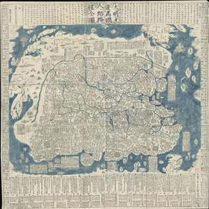
Complete Map of the Nine Border Towns of the Great Ming and of the Human Presence and Travel Routes of the Ten Thousand Countries. / 大明九邊萬國人跡路程全圖 / Dàmíng jiǔ biān wànguó rén jì lùchéng quán tú.
sold
- Digital Map Information
- Suitable for large format printing
- Full resolution TIFF file
- ICC color profile embedded
- Delivered instantly via download link
A rare and extraordinary 1663 (Kangxi 2) xylographic map of Ming China, and indeed the entire world, by Wáng Jūnfǔ (王君甫) issued during the reign of the Kangxi Emperor (1661 – 1722). This massively proportioned map focuses on China, which, bounded on ... (more details)
The last great cartographic masterpiece of Ming China.
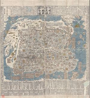
Complete Map of the Nine Border Towns of the Great Ming and of the Human Presence and Travel Routes of the Ten Thousand Countries. / 大明九邊萬國人跡路程全圖 / Dàmíng jiǔ biān wànguó rén jì lùchéng quán tú.
sold
- Digital Map Information
- Suitable for large format printing
- DPI: 300
- File Size: 70.8 MB
- File Type: ZIP / TIFF
- ICC color profile embedded
- Delivered instantly via download link
A rare and extraordinary 1663 (Kangxi 2) xylographic map of Ming China, and indeed the entire world, by Wáng Jūnfǔ (王君甫) issued during the reign of the Kangxi Emperor (1661 – 1722). This massively proportioned map focuses on China, which, bounded on ... (more details)
Ming cartographic heritage.

大明一統二京十三省図 / Great Ming Unification Two Capitals and Thirteen Provinces Map / Da Ming Yi Yong Er Jing Shi San Shen Tu
sold
- Digital Map Information
- Suitable for large format printing
- Full resolution TIFF file
- ICC color profile embedded
- Delivered instantly via download link
This previously unknown 1769 Chinese-language manuscript map of Ming China and Korea is among the most important East Asian cartographic discoveries to emerge in recent years. Monumental in scale and exceptionally detailed, it preserves official Ming Dynasty geographic knowledge long thought lost, likely produced in Tokugawa Japan by descendants of Chinese scholars who fled the fall of the Ming Dynasty in 1644. Rich with elegant calligraphy, extensive topographical and political detail, and numerous textual annotations, the map offers an unparalleled window into the geography, historical memory, and intellectual traditions of the Ming loyalist diaspora. As a unique manuscript with no known counterpart, it represents a once-in-a-lifetime opportunity to acquire an extraordinary artifact of Chinese cartography, Sino-Japanese cultural exchange, and the enduring legacy of the Great Ming. (more details)
The Ming and the Myriad Countries.
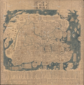
大明九邊萬國人跡路程全圖 / [Complete Map of the Nine Border Crossings of the Great Ming and of the Routes and Settlements of the Myriad Countries].
sold
- Digital Map Information
- Suitable for large format printing
- Full resolution TIFF file
- ICC color profile embedded
- Delivered instantly via download link
An extraordinary 1663 xylographic map of Ming China, and indeed the world by Wang Junfu (王君甫), issued in the second year of the reign of the Kangxi Emperor (r. 1661 – 1722) of the Qing Dynasty. Among other features, it is notable for being dated after the Qing had already displaced the Ming and established a new dynasty, suggesting that it was surreptitiously published and circulated among Ming Loyalists. (more details)
Earliest view of Tsingtao or Qingdao - drawn shortly after the German takeover.
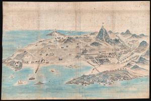
[Tsingtao]
sold
- Digital Map Information
- Suitable for large format printing
- File Size: 78.87 MB
- File Type: ZIP / TIFF
- ICC color profile embedded
- Delivered instantly via download link
This is an outstanding c. 1899 Chinese manuscript view of the city of Qingdao (Tsingtao), China, as it appeared early in the German colonial period. It is hand-painted by an unknown Chinese artist on silk and represents the earliest known image of Qingdao. (more details)
Center of Qing Power on Taiwan.
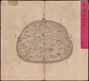
台灣府城全圖 / [Complete Map of the Walled City of Taiwan-fu].
sold
- Digital Map Information
- Suitable for large format printing
- Full resolution TIFF file
- ICC color profile embedded
- Delivered instantly via download link
A remarkable find, this unrecorded c. 1830 manuscript map presents a detailed catalog of Tainan, Taiwan, when the city served as the Qing administrative capital of the island, known as Taiwan-fu. (more details)
Landmark Administrative Map of the Late Qing.
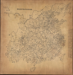
皇朝直省府廳州縣全圖 / [Complete Map of the Dynasty's Provinces, Prefectures, Subprefectures, Departments, and Counties].
sold
- Digital Map Information
- Suitable for large format printing
- Full resolution TIFF file
- ICC color profile embedded
- Delivered instantly via download link
A massive 1864 administrative map of Qing China, published by the Hubei Official Bookshop. When published, it represented the best and most comprehensive administrative map of China. It continued to serve as the basis for large-format administrative maps until the end of the dynasty in 1912 and into the Republican period (1912 - 1949). (more details)
Enigmatic early map of China from the late 18th or early 19th centuries.
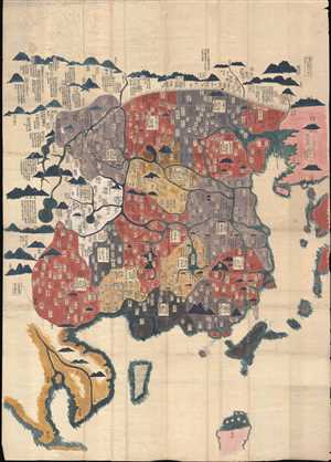
[China]
sold
- Digital Map Information
- Suitable for large format printing
- Full resolution TIFF file
- ICC color profile embedded
- Delivered instantly via download link
A very unusual an enigmatic early Chinese language grand format manuscript map of China on mulberry paper with old color. This map most likely dates from the late 18th or early 19th century and may be an Edo Era Japanese copy of an unknown Chinese source map. ... (more details)
One of the earliest examples of western style Chinese commercial cartography.
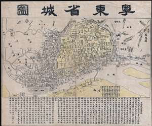
粵東省城圖 / East Guangdong Province City Map. / Yue Dong Sheng Cheng Tu.
sold
- Digital Map Information
- Suitable for large format printing
- Full resolution TIFF file
- ICC color profile embedded
- Delivered instantly via download link
This is a rare Qing Dynasty era Guangxu 26 or 1900 Chinese map of Guangzhou or Canton printed in Guangzhou by the Yangcheng Bookstore (澄天阁点石 / 澄天閣點石書局). It is one of the earliest known examples of Chinese commercial cartography. The map is oriented to the north, looking at the city of Guangzhou from the south side of the Pearl River. The city walls and low mountains are apparent in the distance. Dotted lines on the Pearl Liver indicate river crossings and routes to Haudi (花地). At the base of the map, extensive textual annotation in Chinese describes the development of the city. (more details)
One of only two known examples outside of China, this rare map illustrates the foreign occupation of Beijing following the Boxer Rebellion.
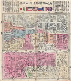
Jīng Chéng Gè Guó Zàn Fēn Jiè Zhǐ Quán Tú / Full Map of Various Foreign Countries' Temporarily Divided Territory Boundaries within the City of Beijing / 京城各國暂分界址全图
sold
- Digital Map Information
- Suitable for large format printing
- File Size: 25.74 MB
- File Type: ZIP / TIFF
- ICC color profile embedded
- Delivered instantly via download link
A map of considerable importance and rarity, this is a 1900 Chinese issue woodcut map illustrating the yearlong occupation of Beijing (Peking) following the suppression of the Boxer Rebellion / Uprising. The title, roughly translated is, 'Full Map of Various ... (more details)
Extraordinary manuscript satirical map of Europe during World War II with Chinese Text.
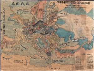
Mapa Humoristico Da Europa - Guerra - 1939 / 歐戰现像
sold
- Digital Map Information
- Suitable for large format printing
- File Size: 8.5 MB
- File Type: ZIP / TIFF
- ICC color profile embedded
- Delivered instantly via download link
An exceptional zoomorphic satirical map of Europe in 1939, here in manuscript form with all text translated into Chinese. This map is based upon a map drawn by the artist António Soares and published by Livraria Franco just weeks after the October 1939 ... (more details)
Rare mid-19th century Qing Map of Beijing printed in China for Chinese government use. Basis for many subsequent maps issued after the Boxer Rebellion.

Jīngchéng nèiwài shǒu shàn quán tú / Premier Full Map of the Capital City's Interior and Exterior / 京城內外首善全圖
sold
- Digital Map Information
- Suitable for large format printing
- DPI: 300
- File Size: 13.93 MB
- File Type: ZIP / TIFF
- ICC color profile embedded
- Delivered instantly via download link
An exceptional c. 1850 Chinese issue Qing Dynasty map of Beijing or Peking, China. This map details the Qing Dynasty walled city of Beijing and was used for administrative purposes. Important buildings, as well as with city and Forbidden City walls, ... (more details)
Very rare map of Qing China issued under the Empress Dowager Cixi.
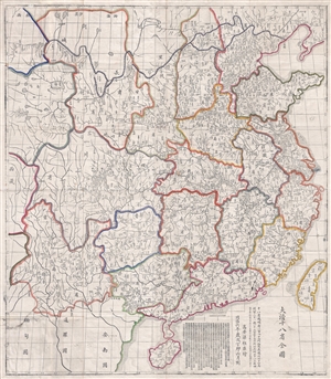
Full Map of the Eighteen Provinces of the Great Qing. / 大清十八省全圖 / Dà qīng shíbā shěng quán tú.
sold
- Digital Map Information
- Suitable for large format printing
- Full resolution TIFF file
- ICC color profile embedded
- Delivered instantly via download link
A rare and enormous 1867 or Tongzhi 6 Chinese map of Qing China. The map covers all of China including Hainan and Taiwan. It is divided into 18 provinces and the great wall is clearly delineated along the top of the map. The map is crisscrossed by a ... (more details)
Rare mid-19th Qing Map of Beijing printed in China for Chinese government use. Basis for many subsequent maps issued after the Boxer Rebellion.
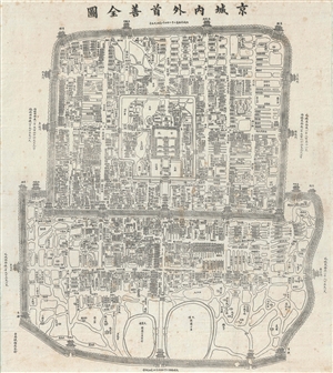
Jīngchéng nèiwài shǒu shàn quán tú / Premier Full Map of the Capital City's Interior and Exterior / 京城內外首善全圖
sold
- Digital Map Information
- Suitable for large format printing
- Full resolution TIFF file
- ICC color profile embedded
- Delivered instantly via download link
An exceptional c. 1867 Chinese issue Qing Dynasty Map of Beijing or Peking, China. This map details the Qing Dynasty walled city of Beijing. Important buildings, as well as with City and Forbidden City walls, are drawn in profile – a very ... (more details)
Rare Chinese Government collection of 45 highly detailed topographical maps of Beijing or Peking, China.

This is an extraordinarily rare set of 45 post-Liberation topographical maps Beijing or Peking, China. They were issued in 1954 by the People's Republic of China and are de-accessioned library pieces. Each map focuses on a different portion ... (more details)
Fine example of Chinese Qing regional cartography.
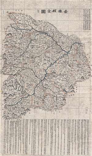
長樂縣全圖 / Complete Map of Changle County.
sold
- Digital Map Information
- Suitable for large format printing
- DPI: 300
- File Size: 48.61 MB
- File Type: ZIP / TIFF
- ICC color profile embedded
- Delivered instantly via download link
A finely executed c. 1800 late Qing Dynasty Chinese manuscript map of Wuhua County in eastern Guangdong Province, China. The map, which uses the Qing name of the region, Changle County, was composed by an anonymous Chinese cartographer, ... (more details)
A rare example of an imperial-era Chinese administrative map.
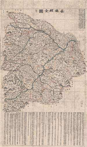
長樂縣全圖 / Complete Map of Changle County.
sold
- Digital Map Information
- Suitable for large format printing
- DPI: 600
- File Size: 134.75 MB
- File Type: ZIP / TIFF
- ICC color profile embedded
- Delivered instantly via download link
A large and finely executed c. 1800 late Qing Chinese manuscript map of Changle County (長樂縣), now Wuhua County, in eastern Guangdong Province. A rare example of a Qing-era administrative map, it displays a great deal of information about the county while also hinting at the limits of Qing authority. (more details)
An important Qing map of China that intentionally omits Ming allied Formosa.
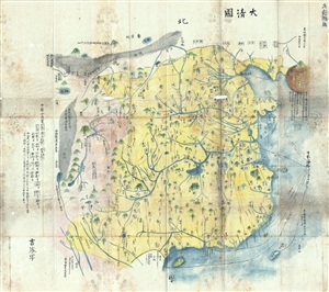
大清国 / Dà Qīng Guó / Great Qing Empire
sold
- Digital Map Information
- Suitable for large format printing
- DPI: 300
- File Size: 16.8 MB
- File Type: ZIP / TIFF
- ICC color profile embedded
- Delivered instantly via download link
A very unusual Chinese language manuscript map of China under the early Qing (Ching / 清朝). The map covers from all of china from the Great Wall to the China Sea and the borders with Vietnam. This depiction most likely is intended ... (more details)
First official Bi-Lingual Map of Singapore issued after Malaysian Independence.
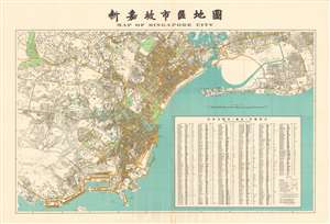
Map of Singapore City. / 新嘉坡市區地圖
sold
- Digital Map Information
- Suitable for large format printing
- File Size: 99.11 MB
- File Type: ZIP / TIFF
- ICC color profile embedded
- Delivered instantly via download link
This is an extremely rare large format 1958 first edition map of Singapore in Chinese and English. Being published just one year after the 1957 Treaty of London recognized the independence of the Federation of Malaysia – which then included Singapore - and in the year that Singapore formally attained internal self-governance. The political transition led to a wave of new bi-lingual publications as English was no longer the only official language. Maps in multiple languages became a necessity both for functional and administrative use. (more details)
First official Bi-Lingual Map of Singapore issued after Malaysian Independence.
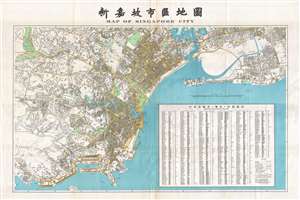
Map of Singapore City. / 新嘉坡市區地圖
sold
- Digital Map Information
- Suitable for large format printing
- File Size: 39.44 MB
- File Type: ZIP / TIFF
- ICC color profile embedded
- Delivered instantly via download link
This is an extremely rare large format 1958 first edition map of Singapore in Chinese and English. Being published just one year after the 1957 Treaty of London recognized the independence of the Federation of Malaysia – which then included Singapore - and in the year that Singapore formally attained internal self-governance. The political transition led to a wave of new bi-lingual publications as English was no longer the only official language. Maps in multiple languages became a necessity both for functional and administrative use. (more details)
The Sacred Mountain Emei Shan.
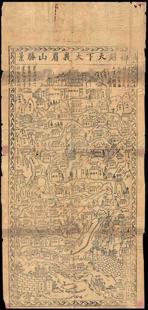
[Emeishan] / 峨眉山.
sold
- Digital Map Information
- Suitable for large format printing
- DPI: 300
- File Size: 31.79 MB
- File Type: ZIP / TIFF
- ICC color profile embedded
- Delivered instantly via download link
An extraordinary find. This is a fragile early 17th or 18th century early Qing Dynasty Chinese xylograph (woodblock) map of Mount Emei or Mount Emeishan. Emishan is one of Four Sacred Buddhist Mountains in China. It is located at ... (more details)
One of the first official Chinese city plans to use western survey and printing techniques.
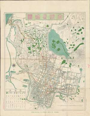
金陵省城圖 / 金陵省城图 / Jinling Provincial City Map.
sold
- Digital Map Information
- Suitable for large format printing
- File Size: 25.08 MB
- File Type: ZIP / TIFF
- ICC color profile embedded
- Delivered instantly via download link
A rare 1907 (Guangxu 33) map of Nanjing (Nanking), China during the late Qing period, issued by the Nanyang Land Survey Department (南洋陸地測量司). This chromolithograph is one of the first Chinese produced and issued official city maps to incorporate western-style surveying methodologies and printing technology. Coverage extends from the Yangtze River (upper left) and the Jiajiang River to Purple Mountain (Zijin Shan; 紫金山) and the Ming Xiaoling Mausoleum (明孝陵). (more details)
Rare map of Fuzhou illustrating postal districts.
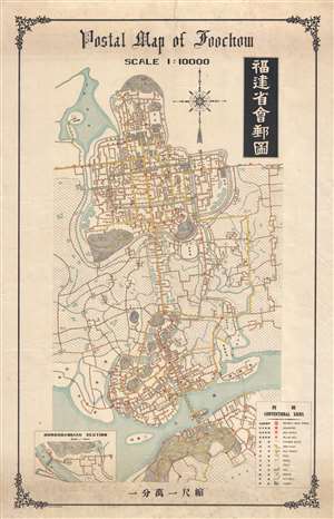
Postal map of Foochow. / 福建省會郵圖
sold
- Digital Map Information
- Suitable for large format printing
- File Size: 16.48 MB
- File Type: ZIP / TIFF
- ICC color profile embedded
- Delivered instantly via download link
This is a scarce c. 1915 Chinese issue postal map of Fuzhou (Foochow), China. The map was issued by the Foochow Printing Bureau of the Treasury Department. While the map does include a fair amount of English, including the title ... (more details)
Issued as Tibet was being invaded by the PRC.
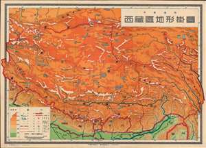
西藏區地形掛圖 / Topographic Wall Map of Tibet.
sold
- Digital Map Information
- Suitable for large format printing
- File Size: 106.69 MB
- File Type: ZIP / TIFF
- ICC color profile embedded
- Delivered instantly via download link
This is a scarce 1950 Chinese wall map of Tibet issued by the Communist Party to propagandize the October 1950 invasion of Tibet by the People's Liberation Army. The large-scale map covers all of Tibet showing terrain, cities, and major transportation networks. It was ostensibly drawn for use in classrooms, but the map is part of a broad effort to generate support for Chinese sovereignty over Tibet as well as to legitimize their claims. (more details)
Chinese slavery in Cuba.
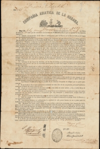
Compania Asiatica de la Habana.
sold
- Digital Map Information
- Suitable for large format printing
- Full resolution TIFF file
- ICC color profile embedded
- Delivered instantly via download link
Highlighting a little-known episode in history, this is a rare 1858 broadside contract between the Compañia Asiatica de la Habana, and a Chinese laborer arranging for his importation to Cuba to work as an indentured servant on a sugar plantation. This document provides an incomparable record of the Chinese experience in Cuba. An illustration at top center shows a ship and a Chinese laborer working next to a Cuban farmer. (more details)
World War II predicted in detail!
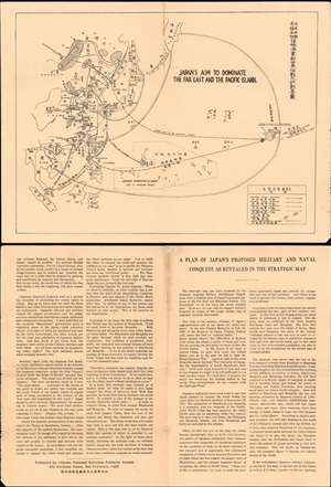
Japan's Aim to Dominate the Far East and the Pacific Islands. / A Plan of Japan's Proposed Military and Naval Conquest As Revealed in the Strategic Map.
sold
- Digital Map Information
- Suitable for large format printing
- File Size: 24.31 MB
- File Type: ZIP / TIFF
- ICC color profile embedded
- Delivered instantly via download link
An intriguing c. 1933 anti-Japanese propaganda map pamphlet published in San Francisco prior to the outbreak of World War II. The map, and the text on the verso, claim to reveal Japan's imperialist plans for domination of the Asia-Pacific region, including the seizure of Hawaii, eight years before the attack on Pearl Harbor. The map is strikingly prescient, outlining Japanese plans in detail, including the upcoming bombing of Pearl Harbor, the attack on the Philippines, and the seizure of Singapore. (more details)
Translating calendars and thought systems between the West and China.
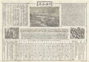
中西合厯 / Combined Chinese and Western Calendar.
sold
- Digital Map Information
- Suitable for large format printing
- File Size: 15.75 MB
- File Type: ZIP / TIFF
- ICC color profile embedded
- Delivered instantly via download link
A rare 1889 (Guangxu 15) missionary broadside printed by the Combined Learning Publishing House (同文書局), the first Chinese owned lithographic press in Shanghai. The broadside attempts to link the wonders of western technology, such as trains and suspension bridges, with Christianity. (more details)
Rare pre-War map of Shanghai by a Chinese owned and operated publishing house.

Latest Map of Shanghai, Pocket Edition. / 袖珍最新上海地圖總圖例
sold
- Digital Map Information
- Suitable for large format printing
- File Size: 43.99 MB
- File Type: ZIP / TIFF
- ICC color profile embedded
- Delivered instantly via download link
A rare map of Shanghai, China, published in 1932 by the Shanghai branch of the Chung Hwa Book Company (中華書局有限公司). The map covers all of the concession areas, including the extra-settlement roads extending far to the west. This is one of the few pre-War maps of Shanghai published by a Chinese firm, as most maps at the time were issued by either British or Japanese interests. Interestingly, as a Chinese map, there is also a large inset in the Shanghai Old City, also called the Chinese City, the roughly circular formerly walled area located just south of the French Concession (purple). The map is scarce, probably owing to it being published in 1932, during or shortly after the January 28 Incident, the beginning of the end of concession era Shanghai. (more details)
Geological diversity of China.
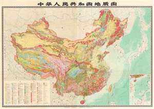
A very large-format 1976 map of the People's Republic of China, including claimed territory in the South China Sea, Taiwan, and along the border with India, produced by the Chinese Academy of Geological Sciences. It was published in the waning days of the Cultural Revolution and can be seen as representative of a wider revival of the sciences in the mid-1970s following the ideological attacks of the late-1960s and early 1970s. (more details)