
UKIYO-E
Making Light of Perry's Gunboat Diplomacy.
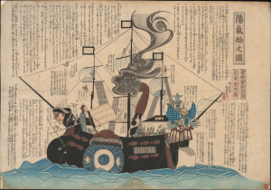
陽氣舩之圖 / [View of the Merry Ship].
$6,500.00
Acquire
- Digital Map Information
- Suitable for large format printing
- Full resolution TIFF file
- ICC color profile embedded
- Delivered instantly via download link
This is a rare c. 1854 kawaraban satirical woodblock print, produced by the pseudonymous Kanoka Mamaro (寒翁窠馬麿), depicting one of Commodore Matthew Perry's 'black ships.' It demonstrates that, even amid a strict regime of censorship, Japanese publishers sought to profit by informing and entertaining the public, including with irreverent takes on the historically significant events underway. (more details)
Japan's first train.
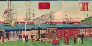
橫濱往返鐵道蒸氣車海上之圖 / [View of Steam Engine on the Seaside Yokohama Line].
$4,500.00
Acquire
- Digital Map Information
- Suitable for large format printing
- Full resolution TIFF file
- ICC color profile embedded
- Delivered instantly via download link
A fascinating 1874 ukiyo-e triptych by Utagawa Hiroshige III celebrating Japan's first passenger railway and the astonishing modernization of Yokohama under the Meiji. Opened between Yokohama and Tokyo in 1872, the steam railway became one of the most potent symbols of a country transforming itself at extraordinary speed, linking Japan's leading international treaty port with the imperial capital. Published two years after the railway's inauguration, the triptych captures not simply a train, but a defining moment in the Meiji Restoration, when foreign technology was being rapidly absorbed and transformed into the infrastructure of modern Japan. (more details)
Tokyo's Foreign Quarter in the Early Meiji Period.
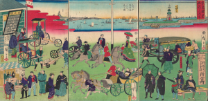
東京繁榮流行の往来 / [The Comings and Goings of Prosperity and Fashions in Tokyo].
$4,500.00
Acquire
- Digital Map Information
- Suitable for large format printing
- Full resolution TIFF file
- ICC color profile embedded
- Delivered instantly via download link
This is an 1870 ukiyo-e depiction of the Tsukiji neighborhood of Tokyo, drawn by Utagawa Hiroshige III and published by Masadaya Heikichi. It displays the neighborhood just months after it was designated as the foreign residence quarter of Tokyo following the Meiji Restoration, emphasizing the rapid importation of foreign technologies, fashion, and manners. (more details)
Yokohama emerging as an international port.
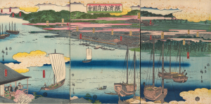
橫濱海岸圖會 / [View of the Coast at Yokohama.]
$4,000.00
Acquire
- Digital Map Information
- Suitable for large format printing
- Full resolution TIFF file
- ICC color profile embedded
- Delivered instantly via download link
An early 1860 ukiyo-e triptych by Utagawa Hiroshige II, capturing Yokohama, Japan, as it emerged as an international treaty port. Published just months after Yokohama opened to foreign trade in 1859, this panoramic view presents a city poised between the insular world of Tokugawa Japan and the profound transformations that would soon accompany sustained contact with the West. Among the earliest printed views of Yokohama, it offers a Japanese vision of the nascent port: cherry blossoms, temples, teahouses, theaters, and the notorious Miyozaki pleasure quarter occupy a landscape only beginning to accommodate global commerce. Most evocative is a woman seated in a waterfront teahouse, telescope in hand, gazing across the harbor - an image that seems to encapsulate Japan itself, watching with fascination as an unfamiliar world approaches. (more details)
The Rapid Expansion of Yokohama.
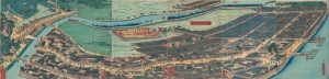
再改橫濱風景 / [Up-to-date View of Yokohama].
$4,000.00
Acquire
- Digital Map Information
- Suitable for large format printing
- Full resolution TIFF file
- ICC color profile embedded
- Delivered instantly via download link
This is a stunning 1861 panoramic set of six ukiyo-e (nishiki-e) Utagawa Sadahide woodblock prints depicting the port of Yokohama. The port opened to foreign trade in 1859, just two years earlier, becoming Japan's primary point of contact with the West. Sadahide was the most prolific among a school of woodblock artists chronicling these momentous changes. (more details)
Early Japanese connections with San Francisco.

亜墨利迦州迦爾波爾尼亜港出帆之圖 / [View of Ships Departing from the Port of California, America].
$4,000.00
Acquire
- Digital Map Information
- Suitable for large format printing
- Full resolution TIFF file
- ICC color profile embedded
- Delivered instantly via download link
A magnificent Ukiyo-e woodblock triptych in the distinctive Yokohama-e style, produced in 1862 by the genre's most prolific master, Utagawa Sadahide. It portrays a group of American ships leaving the 'port of California,' almost certainly San Francisco, presumably bound for Japan. This work is especially notable as it depicts a purely foreign scene, rather than the more common illustrations of foreigners in Yokohama or elsewhere in Japan. (more details)
Passion for foreign technology.
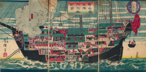
獨逸國軍艦内郭機械圖 / [Drawing of the Internal Workings of a German Navy Ship].
$3,500.00
Acquire
- Digital Map Information
- Suitable for large format printing
- Full resolution TIFF file
- ICC color profile embedded
- Delivered instantly via download link
A scarce c. 1874 ukiyo-e (more specifically, nishiki-e) triptych depicting lively scenes aboard a German naval ship, prepared by the artist Unsen. It is an example of Japan's flourishing interest in foreign technology and practices in the early Meiji period and specifically represents the special connection between the Prussian-led German Empire and the Empire of Japan. (more details)
First Bird's-Eye View of Japan.
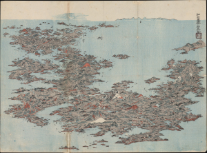
[日本名所之繪 / Picture of the Famous Places of Japan]
$3,500.00
Acquire
- Digital Map Information
- Suitable for large format printing
- File Size: 22.57 MB
- File Type: ZIP / TIFF
- ICC color profile embedded
- Delivered instantly via download link
This is an important c. 1805 Ukiyo-e bird's-eye view of Japan prepared by Kitao Masayoshi. It is the first artistic bird's-eye view of the Japanese archipelago, and influenced the work of Katsushika Hokusai and later Japanese bird's-eye-view artists. (more details)
Building and Rebuilding Yokohama.
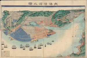
大港橫濱之圖 / [View of the Great Port of Yokohama].
$3,500.00
Acquire
- Digital Map Information
- Suitable for large format printing
- File Size: 53.59 MB
- File Type: ZIP / TIFF
- ICC color profile embedded
- Delivered instantly via download link
A scarce large-format c. 1868 view of Yokohama, prepared by Sadahide, master of the Yokohama-e genre of ukiyo-e woodblocks. It presents the extent of the port and hinterland a decade after it was opened to foreign trade, already expanding far beyond the small fishing village that had hitherto existed there. (more details)
American - Chinese - Japanese exchange in Yokohama.
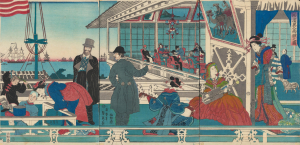
橫濱異人商館之圖 / [View of Foreign Merchant House in Yokohama].
$3,000.00
Acquire
- Digital Map Information
- Suitable for large format printing
- Full resolution TIFF file
- ICC color profile embedded
- Delivered instantly via download link
An absorbing 1861 depiction of Japanese-foreign interactions in Yokohama, this ukiyo-e triptych was prepared by Sadahide, the great chronicler of the treaty port in its early years, and published by Sanoya Kihei. It is notable, among other features, for revealing the three-way exchange between Westerners, Chinese, and Japanese in Yokohama. (more details)
An Early View of Yokohama's Red-Light District.
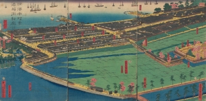
橫濱本町景港崎街新廓 / [View of Yokohama Honmachi and the New Miyozaki Quarter].
$3,000.00
Acquire
- Digital Map Information
- Suitable for large format printing
- Full resolution TIFF file
- ICC color profile embedded
- Delivered instantly via download link
This is a c. 1860 ukiyo-e triptych of Yokohama highlighting, among other elements, the Miyozaki Pleasure Quarter, prepared by Sadahide and published by Yamaguchiya Tōbei. The city, hitherto a small fishing village, rapidly developed after being opened to foreign traders and residents in 1859, building new districts, including Miyozaki, in a handful of months. (more details)
Origins of Modern Japan's Banking System.
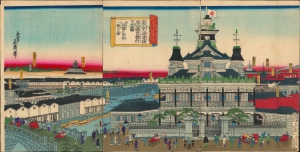
東京海運橋第一國立銀行の全圖并近圓の市中一覽の圖/ [Complete View of the First National Bank at the Tokyo Kaiun Bridge, with a View of the Nearby Cityscape].
$3,000.00
Acquire
- Digital Map Information
- Suitable for large format printing
- Full resolution TIFF file
- ICC color profile embedded
- Delivered instantly via download link
This stunning 1876 Ukiyo-e triptych, depicting the Dai-Ichi Bank Building in Tokyo, was drawn by the artist Yoshitora and published by Takekawa Seikichi. Both the bank and its building, along with several other financial institutions in the same area, were key signifiers of Japan's modernization in the early Meiji period. (more details)
Japan's First Railway in the year it was built.
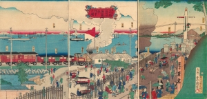
東京高縄品川口蒸氣車往來之圖 / [View of the Coming and Going of the Steam Train at Tokyo Takanawa - Shinagawa].
$3,000.00
Acquire
- Digital Map Information
- Suitable for large format printing
- Full resolution TIFF file
- ICC color profile embedded
- Delivered instantly via download link
An important ukiyo-e triptych drawn by Kunisada II and engraved by Kokaiya Katsugorō in 1872. It depicts Japan's first modern railway, which opened the same year, on its route between Tokyo and Yokohama. (more details)
Keeping Time in Yokohama.
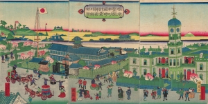
橫濱繁榮本町通時計臺神奈川縣全圖 / [Complete View of the Clock Tower in Yokohama's Flourishing Neighborhood of Honcho, Kanagawa Prefecture].
$2,500.00
Acquire
- Digital Map Information
- Suitable for large format printing
- Full resolution TIFF file
- ICC color profile embedded
- Delivered instantly via download link
A scarce and brightly-colored ukiyo-e 1874 woodblock triptych by Utagawa Kunitsuru depicting Yokohama's town hall (横浜町会所), constructed in 1874 (Meiji 7), one of many new marvels depicted in Yokohama-e prints of the era. Bridging past and present, Kunitsuru employed established nishiki-e conventions but added relatively new, vibrant pink, yellow, and purple aniline inks, most imported from Europe, that eventually became distinctive of Meiji-era woodblock prints. (more details)
One of the Most Influential Japanese Maps of the 19th Century. / Japanese recognition of the Sea of Korea.
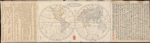
新製輿地全圖 / [Newly-Made Complete Map of the World].
$2,500.00
Acquire
- Digital Map Information
- Suitable for large format printing
- File Size: 30.62 MB
- File Type: ZIP / TIFF
- ICC color profile embedded
- Delivered instantly via download link
This is a fascinating 1844 Mitsukuri Shōgo double-hemisphere world map with descriptive text. Based on a somewhat earlier French map, it is important in the migration of Western geographic knowledge to Japan, even in the years before Japan was 'forced open' by American warships, hastening the end of its period of isolation. It is also unusual as one of the very few Japanese maps to recognize the 'Sea of Korea' toponym. (more details)
Renovating Nihonbashi.
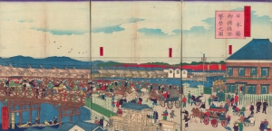
東京第一名所 日本橋御摸檨替繁榮之圖 / [Famous Places of Tokyo No. 1 View of the Prospering Nihonbashi Replacement Bridge].
$2,000.00
Acquire
- Digital Map Information
- Suitable for large format printing
- Full resolution TIFF file
- ICC color profile embedded
- Delivered instantly via download link
An engaging 1873 Ukiyo-e triptych produced by Kuniteru II depicting the new Nihonbashi Bridge in Central Tokyo. The most culturally significant bridge in Japan, the historical terminus of the Tōkaidō highway, the Edo-era arched bridge had been replaced by a Western-style flat bridge the year before this print's publication, both a practically and symbolically important change. (more details)
Restoration and Renovation.
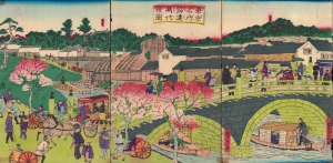
東京名所筋違萬代橋圖 / [View of Tokyo Famous Site Yorozuyo Bridge].
$1,800.00
Acquire
- Digital Map Information
- Suitable for large format printing
- Full resolution TIFF file
- ICC color profile embedded
- Delivered instantly via download link
A lovely 1873 Ukiyo-e triptych by Hiroshige III depicting the Yorozuyo Bridge (more commonly known as the Mansei Bridge) and environs in Tokyo. The stone bridge, completed the same year, symbolized Japan's modernization and the changes brought about by the Meiji Restoration. (more details)
Rare Ukiyo-e: Building a Bridge to Modernity.
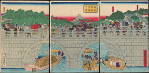
筋違新眼鏡橋弌覧 / [The New Megane Bridge at a Glance].
$1,600.00
Acquire
- Digital Map Information
- Suitable for large format printing
- File Size: 28.92 MB
- File Type: ZIP / TIFF
- ICC color profile embedded
- Delivered instantly via download link
This is Utagawa Yoshitora's c. 1873 Ukiyo-e woodblock triptych of the New Megane Bridge near Tokyo. The view presents Japanese society at the start of the Meiji era, rooted in the traditions of the Edo period but rapidly adopting new influences from abroad. (more details)
Early Expansion of Treaty Port Yokohama.
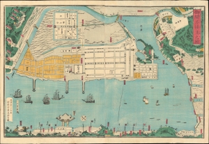
御開港橫濱之圖 / [Map of the Open Port of Yokohama].
$1,400.00
Acquire
- Digital Map Information
- Suitable for large format printing
- Full resolution TIFF file
- ICC color profile embedded
- Delivered instantly via download link
A colorful c. 1862 ukiyo-e map of Yokohama, Japan, by Ichikawa Yoshikazu. It presents the city several years after its opening as a treaty port in 1859, when it was rapidly developing into Japan's main point of trade and cultural interaction with Western powers. (more details)
One of Japan's Earliest Modern Warships.
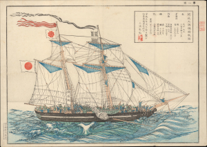
開成丸調練歸帆圖 / [View of Kaisei Maru Sailing Training and Return].
$1,200.00
Acquire
- Digital Map Information
- Suitable for large format printing
- File Size: 12.41 MB
- File Type: ZIP / TIFF
- ICC color profile embedded
- Delivered instantly via download link
This is a scarce 1858 ukiyo-e view of the Kaisei Maru, prepared by Miura Kenya, the vessel's chief carpenter. Although it was in service for only a short time and was quickly eclipsed by more modern vessels, the ship is significant as one of Japan's first domestically produced modern warships. (more details)
Transformation of Tokugawa Edo into a Imperial Tokyo.
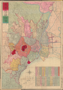
改正 東亰區分明細圖 / [Revised Detailed Map of Tokyo Divided into Wards].
$1,000.00
Acquire
- Digital Map Information
- Suitable for large format printing
- Full resolution TIFF file
- ICC color profile embedded
- Delivered instantly via download link
A striking 1880 Meiji-era city plan of Tokyo, Japan, by Naoha Shūhei, capturing the imperial capital as it transformed from Tokugawa Edo into a modern metropolis. Published shortly after the creation of Tokyo's 15 urban wards, the map combines traditional Japanese cartographic aesthetics with Western conventions, vividly documenting both the city's new administrative geography and its rapidly changing infrastructure. (more details)
Meeting of Ancient and Modern in Meiji-Era Tokyo.
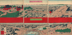
淺艸觀世音境内細圖 兩國橋及淺草橋眞圖 / [Detailed View of the Grounds of Asakusa Kannon Temple / Accurate View of Ryōgoku Bridge and Asakusa Bridge].
$1,000.00
Acquire
- Digital Map Information
- Suitable for large format printing
- Full resolution TIFF file
- ICC color profile embedded
- Delivered instantly via download link
This is an 1887 bifurcated ukiyo-e triptych view of the Sensō-ji in Asakusa and the Ryōgoku neighborhood of Tokyo by Inoue Yasuji. Juxtaposing Tokyo's oldest temple alongside novelties like factories and mass transit, the view captures the spirit of the early Meiji era, when Tokyo was transformed into a modern city. (more details)
Japan's First Railway Line.
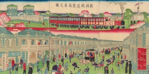
新橋鐵道蒸汽車之圖 / 東京銀座煉瓦石繁榮之圖 [View of the Prosperity of Brick and Stone Buildings in Tokyo's Ginza District / View of a Steam Train on the Shimbashi Railway].
$1,000.00
Acquire
- Digital Map Information
- Suitable for large format printing
- Full resolution TIFF file
- ICC color profile embedded
- Delivered instantly via download link
A curious 1873 ukiyo-e triptych produced by Kunisada III depicting the Tokyo-Yokohama steam train and Shimbashi Station, Japan's first modern railway and Tokyo's first train station, respectively. The view also presents the neighborhood of Ginza, rebuilt following a fire the previous year, as a showpiece of modernization by the Meiji government. (more details)
Strategic Straits to Japan's Inland Sea.
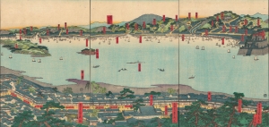
[Untitled] / ['View of Famous Places in the Western Inland Sea' (西国内海名所一覧)].
sold
- Digital Map Information
- Suitable for large format printing
- Full resolution TIFF file
- ICC color profile embedded
- Delivered instantly via download link
A scarce 1859 ukiyo-e triptych of the Kanmon Straits (also known as the Straits of Shimonoseki) where the islands of Honshu and Kyushu meet, produced by Sadahide, one of the most popular ukiyo-e artists of his time. (more details)
A Beautifully Executed Late Edo Ukiyo-e Buddhist Work.
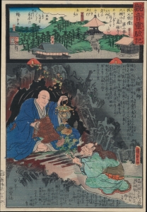
觀音靈驗記 / [Miracles of Kannon].
$750.00
Acquire
- Digital Map Information
- Suitable for large format printing
- Full resolution TIFF file
- ICC color profile embedded
- Delivered instantly via download link
A bright, colorful c. 1859 ukiyo-e woodblock, produced by Kunisada II and Hiroshige II, for the series of Buddhist prints The Miracles of Kannon. (more details)
Readjusting for the Meiji Era.
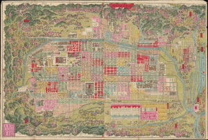
改正再刻亰都區組分細圖 / [Revised and Reengraved Detailed Map of Kyoto Divided into Wards].
$700.00
Acquire
- Digital Map Information
- Suitable for large format printing
- Full resolution TIFF file
- ICC color profile embedded
- Delivered instantly via download link
This is an 1883 city plan or map of Kyoto, Japan, prepared by Hashimoto Chōgetsu. It was published after Kyoto lost its status as Japan's imperial capital, but just as its partial revival as an industrial and transportation hub was beginning. (more details)
Resting Place of Ancient Emperors.
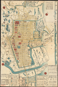
嘉永改正堺大繪圖 (文久三癸亥改正) / [Large Map of Sakai, Revised in the Kaei Era (Re-revised in in the Third Year of the Bunkyū Era)].
$500.00
Acquire
- Digital Map Information
- Suitable for large format printing
- File Size: 29.75 MB
- File Type: ZIP / TIFF
- ICC color profile embedded
- Delivered instantly via download link
This is an 1863 ukiyo-e woodblock plan or city map of Sakai, Osaka, Japan (now part of Osaka) by Hosokawa Yasuyoshi. (more details)