Most recently added antique and rare maps as of 7/1/2025.
$300.00
$950.00
$600.00
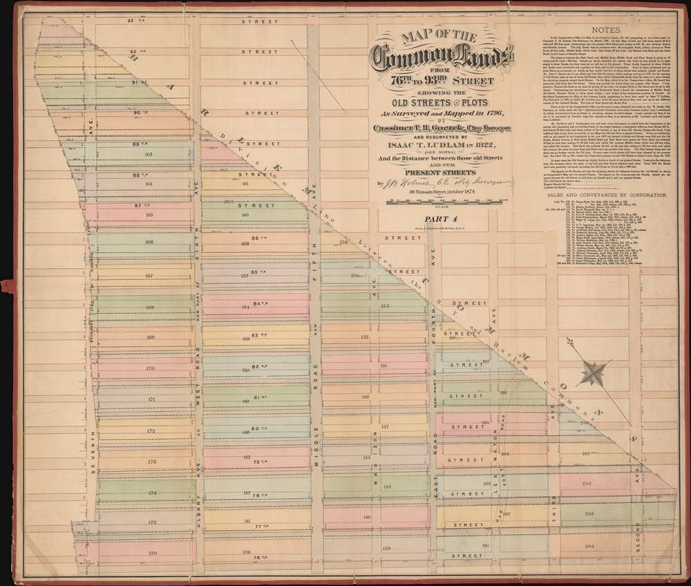
$65,000.00
$425.00
$750.00
$500.00
$350.00
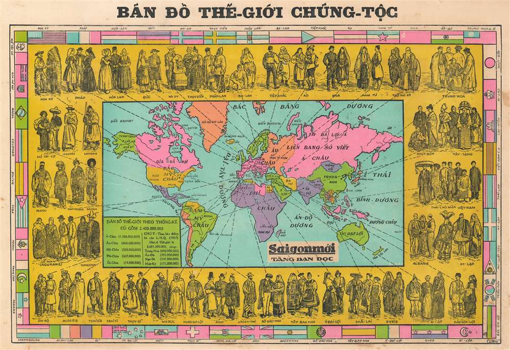
$4,000.00
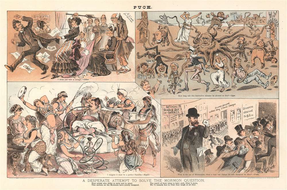
$5,000.00
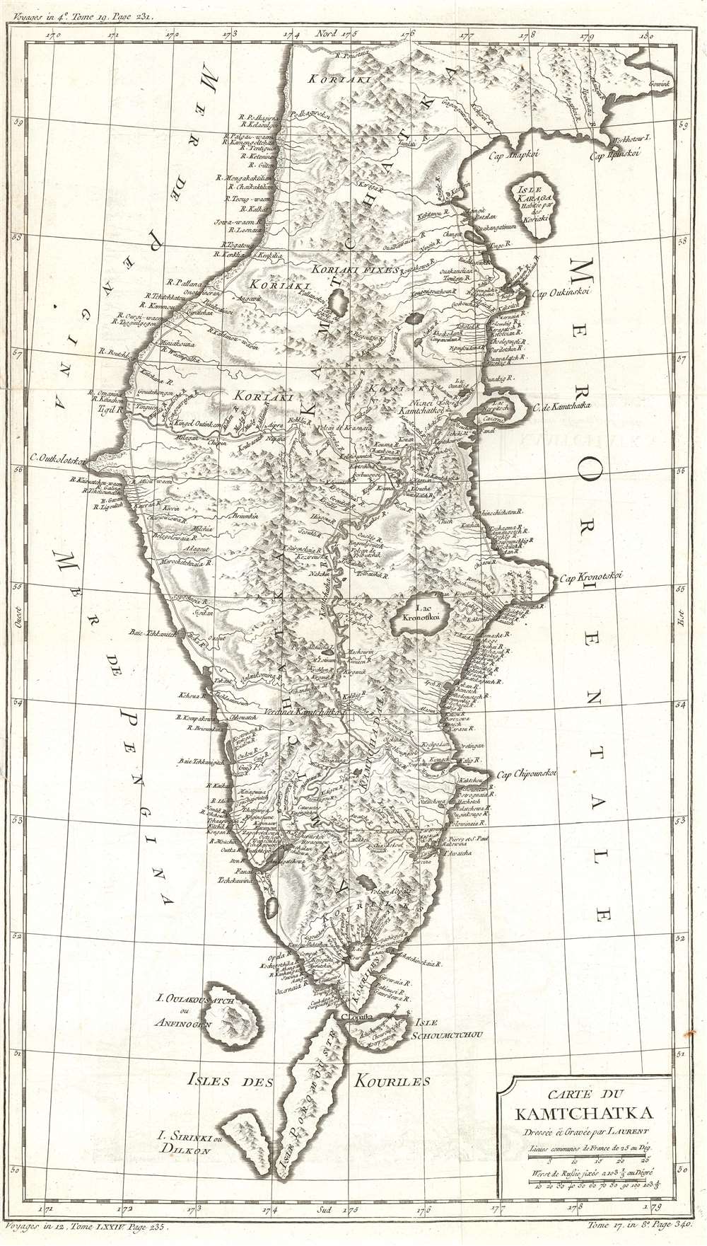
$4,500.00
$650.00
$500.00
$250.00
$5,000.00
$200.00
$150.00
$750.00