
NEW ACQUISITIONS
Home to one of the southernmost breeding colonies of Magellanic penguins.
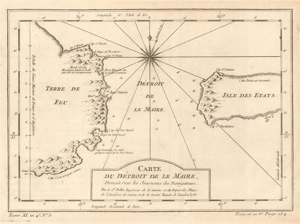
Carte du Détroit de Le Maire, Dressée sur les Journaux des Navigateurs.
$125.00
Acquire
- Digital Map Information
- Suitable for large format printing
- DPI: 600
- File Size: 4.86 MB
- File Type: ZIP / TIFF
- ICC color profile embedded
- Delivered instantly via download link
This is a 1753 Jacques-Nicolas Bellin map of the Le Maire Strait in Argentina. Situated between the Isla de los Estados (Staten Island in English, and not the one that is a borough in New York City) and Tierra del Fuego, the strait was first discovered by European explorers Jacob Le Maire and Willem Schouten in 1616 while they were attempting to find a navigable route between the Atlantic and Pacific Oceans. Their discovery of the strait only shortly preceded their discovery of Cape Horn. The strait is named after Le Maire, and, due to the bad weather and strong currents that the region is famous for, vessels tend to favor going around the east side of Isla de los Estados instead of through the Le Maire Strait. On an ecological note, the Isla de los Estados is home to one of the southernmost breeding colony of Magellanic penguins in the Atlantic. (more details)
Illustrates proposed districts for the U.S. Supreme Court as proposed by the 1960s era National Whig Party.
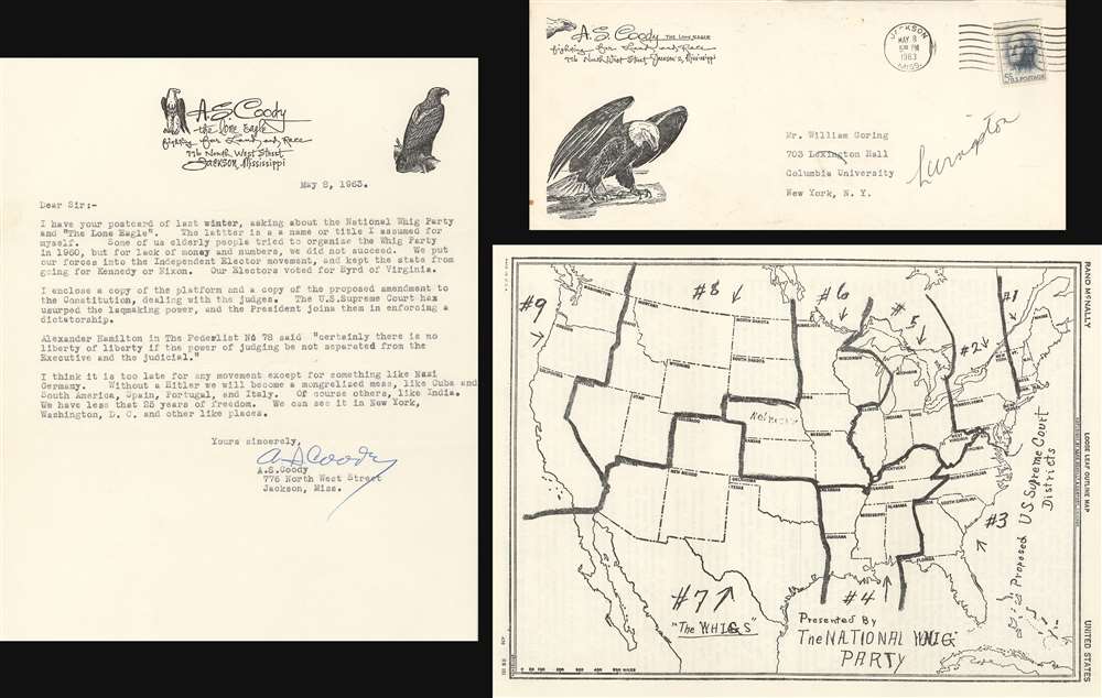
Proposed U.S. Supreme Court Districts. Presented by the National Whig Party.
$550.00
Acquire
- Digital Map Information
- Suitable for large format printing
- File Size: 9.77 MB
- File Type: ZIP / TIFF
- ICC color profile embedded
- Delivered instantly via download link
This is a 1963 map of the United States illustrating the National Whig Party's proposed districts for electing judges to the U.S. Supreme Court. Distributed by A.S. Coody, the map is accompanied by a letter from Coody to a correspondent, the original envelope, and a copy of the platform (pro tem) of the National Whig Party 'The Party of Our Fathers', which refers to itself as 'a grassroots party'. (more details)
Two nautical charts from Cook's first voyage printed on one sheet.
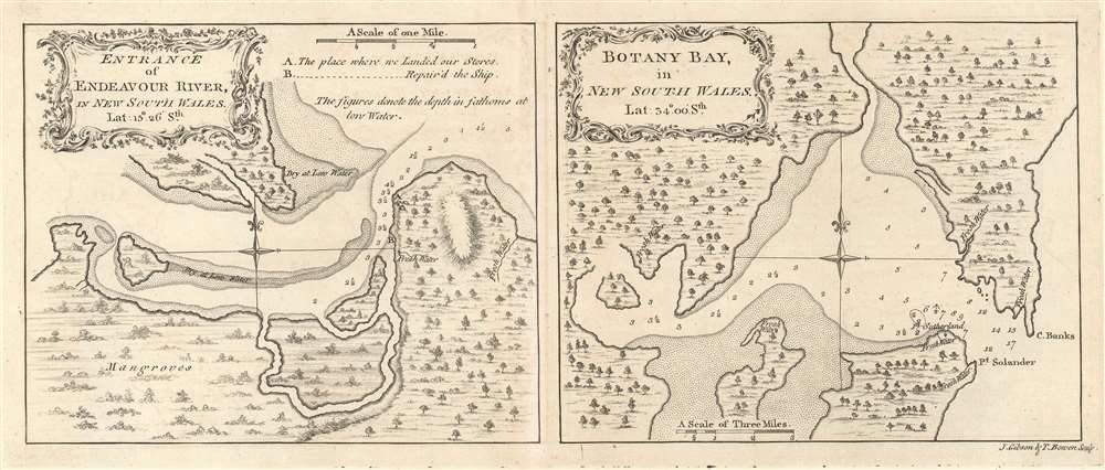
Entrance of Endeavour River, in New South Wales. / Botany Bay, in New South Wales.
$700.00
Acquire
- Digital Map Information
- Suitable for large format printing
- DPI: 600
- File Size: 4.86 MB
- File Type: ZIP / TIFF
- ICC color profile embedded
- Delivered instantly via download link
This is a 1773 Captain James Cook set of two maps of the entrance to the Endeavour River and Botany Bay in Australia, both of which Cook discovered on his first voyage. Each map focuses on its respective region, with the Endeavour River on the left and Botany Bay on the right. (more details)
An early map of the Red River in Vietnam based on Jesuit reports.
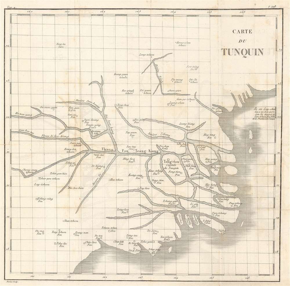
Carte du Tunquin.
$500.00
Acquire
- Digital Map Information
- Suitable for large format printing
- DPI: 600
- File Size: 11.69 MB
- File Type: ZIP / TIFF
- ICC color profile embedded
- Delivered instantly via download link
This is an extremely rare c. 1810 Porlier map of the Red River system in northern Vietnam and the Gulf of Tonkin. The map depicts part of northern Vietnam concentrated around the Red River system (Fleuve Fou Teang Kiang) and Tong-tou (most likely modern-day Hanoi), marked as the capital of Tonkin (Capitale du Tunquin). Numerous other towns and villages are labeled, as are several islands in the Red River delta and along the coastline. Parts of Ha Long Bay are also illustrated. (more details)
Illustrates the economic production of North America and Asia and identifies numerous industries.
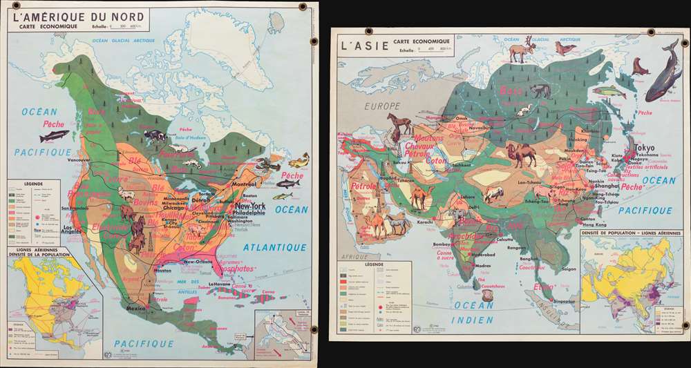
L'Amérique du Nord Carte Economique. / L'Asie Carte Economique.
$300.00
Acquire
- Digital Map Information
- Suitable for large format printing
- File Size: 5.47 MB
- File Type: ZIP / TIFF
- ICC color profile embedded
- Delivered instantly via download link
This is a 1960 Jean Anscombre double-sided pictorial map of the economic production of North America and Asia. The map depicts North America from the Pacific Ocean to the Atlantic Ocean and from the Arctic Ocean to northern South America and Asia from Europe and East Africa to the Pacific Ocean and from the Arctic Ocean to the Indian Ocean and Indonesia. Strikingly colored and illustrated, both maps use pinkish-red text to identify the various products created or raised in regional areas of each continent. Different sizes of font are used, along with varying degrees of a bold typeface, to emphasize the relative importance of certain products.
In North America, wheat (blé), cows, (bovins), and wood (bois) are produced in numerous different parts of the continent, whereas cotton (coton) and phosphates (phosphates) are focused in certain regions. Illustrations of livestock. Including cows, a horse, sheep, a pig, and several species of fish emphasize these industries. City names and highways are also included, as are inset maps illustrating air routes and population density and the Panama Canal Zone are situated along the bottom border.
The Asia map employs the same general concepts and aesthetic, with rice (riz), cotton (coton), tea (thé), sheep (moutons), and oil (pétrole) among the most common products. Illustrations of horses, camels, yak, and salmon highlight the livestock and other animals raised and caught in Asia. Cities throughout the region, including Tokyo, Yokohama, Beigina, Shanghai, Mumbai (Bombay) Karachi, Tehran, and Baghdad are identified. Just as on the North America map, an inset illustrating population density and air routes is situated in the lower right corner. (more details)
In North America, wheat (blé), cows, (bovins), and wood (bois) are produced in numerous different parts of the continent, whereas cotton (coton) and phosphates (phosphates) are focused in certain regions. Illustrations of livestock. Including cows, a horse, sheep, a pig, and several species of fish emphasize these industries. City names and highways are also included, as are inset maps illustrating air routes and population density and the Panama Canal Zone are situated along the bottom border.
The Asia map employs the same general concepts and aesthetic, with rice (riz), cotton (coton), tea (thé), sheep (moutons), and oil (pétrole) among the most common products. Illustrations of horses, camels, yak, and salmon highlight the livestock and other animals raised and caught in Asia. Cities throughout the region, including Tokyo, Yokohama, Beigina, Shanghai, Mumbai (Bombay) Karachi, Tehran, and Baghdad are identified. Just as on the North America map, an inset illustrating population density and air routes is situated in the lower right corner. (more details)
An 18th century French map of Sulawesi, Indonesia.
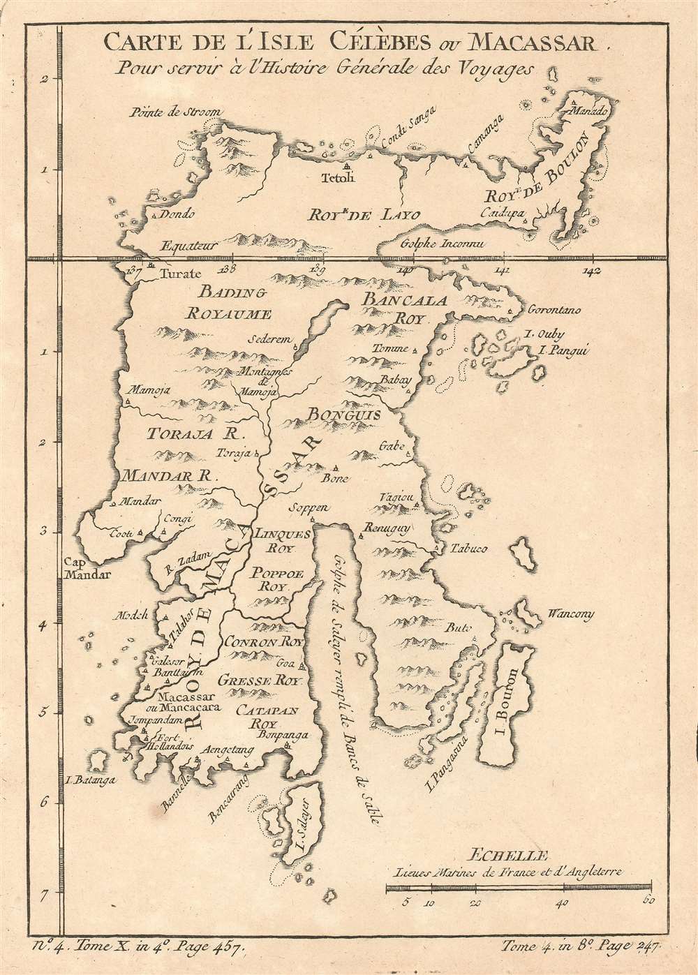
Carte De L'Isle Célèbes ou Macassar : Pour servir à l'Histoire Générale des Voyages.
$175.00
Acquire
- Digital Map Information
- Suitable for large format printing
- DPI: 600
- File Size: 2.78 MB
- File Type: ZIP / TIFF
- ICC color profile embedded
- Delivered instantly via download link
This is a 1757 Jacques-Nicolas Bellin map of Celebes (Sulawesi), Indonesia. The map depicts the entire island and labels villages, rivers, and mountain ranges. The island is divided into several kingdoms (royaumes), each of which is labeled. Gulfs along the coastline are also labeled, as are smaller islands. One safe harbor is also noted next to the Dutch fort (Fort Hollandois) in the southwest part of the island. (more details)
References native tribes while at the same time making it clear how little was known about the interior of the region.
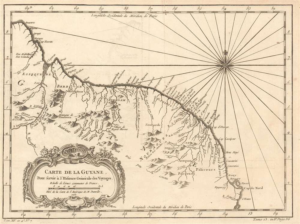
Carte de la Guyane. Pour servir á l'Histoire General des Voyages.
$175.00
Acquire
- Digital Map Information
- Suitable for large format printing
- DPI: 600
- File Size: 6.56 MB
- File Type: ZIP / TIFF
- ICC color profile embedded
- Delivered instantly via download link
This is a 1757 Jacques-Nicolas Bellin map of northeastern South America. The map depicts the region from the Essequibo River in Guyana through Suriname and French Guiana to the Araguari River in Brazil. Myriad locations are labeled along the Atlantic coast, including Paramaribo, Suriname. The vast majority of these locations are rivers, while others are towns along the coast. Some native villages are also identified, but the nations of the native peoples are at least referenced. Notes about the region are also included, stating, for example, that 'the interior of this country is not well known', or that 'the source of this river is unknown'. A note next to the Essequibo River states that 'in this region there are 39 waterfalls'. (more details)
A World War II era tourist map of New York City.
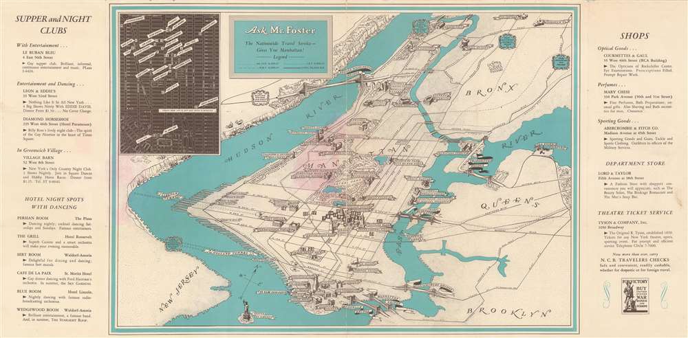
Ask Mr. Foster The Nationwide Travel Service - Gives You Manhattan!
$450.00
Acquire
- Digital Map Information
- Suitable for large format printing
- File Size: 19.07 MB
- File Type: ZIP / TIFF
- ICC color profile embedded
- Delivered instantly via download link
This is a rare c. 1942 Ask Mr. Foster pictorial city map or plan of New York City. The map depicts the region from New Jersey to the Bronx, Brooklyn, and Queens and from Fordham University in the Bronx to the Statue of Liberty and Brooklyn. Numerous Manhattan landmarks are illustrated in profile, including the Empire State Building, the Chrysler Building, the American Museum of Natural History, the Metropolitan Museum of Art, Columbia University, and Yankee Stadium. All six of Manhattan's most well-known bridges are also shown in profile, including the Brooklyn Bridge and the Manhattan Bridge. Both the Midtown Tunnel and the Holland Tunnel are also labeled. An inset map situated in the upper left corner marks twenty-three different restaurants, department stores, and other Manhattan locations, all of which correspond with numbers on the large central map. Clubs, dance halls, shops, and one department store (Lord and Taylor) are listed along the map's left and right sides and each location's address and a short description are also provided. (more details)
Highlights Manhattan's many theatres, including the New Amsterdam and Lyric Theatres.
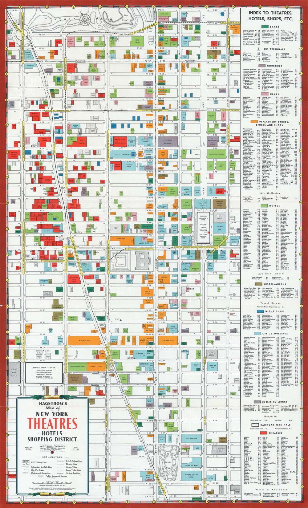
Hagstrom's Map of New York Theatres, Hotels, Shopping District.
$400.00
Acquire
- Digital Map Information
- Suitable for large format printing
- File Size: 27.38 MB
- File Type: ZIP / TIFF
- ICC color profile embedded
- Delivered instantly via download link
This is a c. 1940 Hagstrom map of Midtown Manhattan highlighting the Theatre District and its many theatres. The map depicts the city from Eighth Avenue to Lexington Avenue and from West 61st Street, Central Park, and East 61st Street to 22nd Street. Although numerous buildings are illustrated, not all the city blocks are filled. Banks, churches, clubs, department stores, hotels, nightclubs, office buildings, public buildings, train stations, and theatres are shaded using various colors to allow for easy differentiation and identification. An index, situated along the map's right side, lists the identified locations, offers a color-coding key, and notes each building's coordinates on the map. (more details)
An extremely rare 19th century view of the Government House - the intended residence for the President of the United States before the government decamped to Philadelphia.
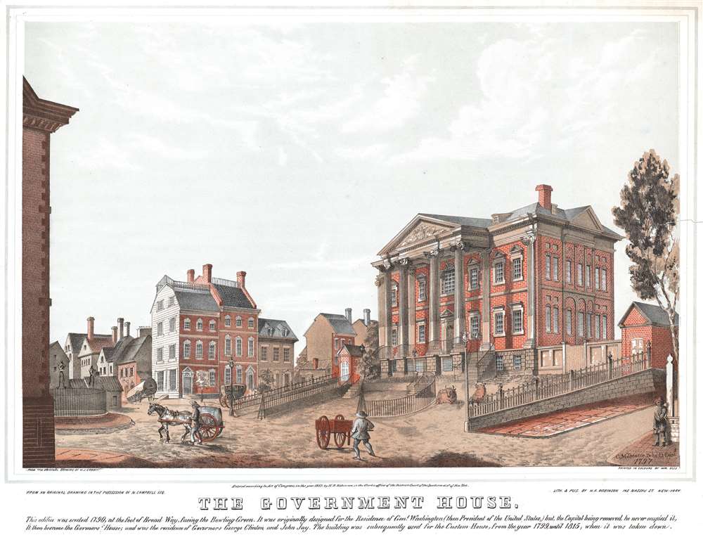
The Government House.
$1,000.00
Acquire
- Digital Map Information
- Suitable for large format printing
- DPI: 600
- File Size: 25.6 MB
- File Type: ZIP / TIFF
- ICC color profile embedded
- Delivered instantly via download link
Nineteenth century New Yorkers were very interested in early New York City history and loved owning pieces that offered a glimpse into that past. This 1847 Henry R. Robinson view of the Government House filled that desire. The Government House, a mansion located at the foot of Broadway south of Bowling Green, where the Alexander Hamilton U.S. Custom House now stands, was originally built to act as the official residence of the President of the United States when New York was still the country's capital. The Government House's construction was authorized by the New York state legislature in 1789 and was completed in 1790. Unfortunately, however, the United States Congress, and with it the President, moved to Philadelphia (and then to Washington, D.C.) before the house was completed. So, instead of functioning as the President's residence, the house acted as the governor's residence. Governor George Clinton moved into the building in 1791 and was followed by John Jay in 1795. Jay was the last governor to live in Government House, as the state government moved to Albany in 1797. By May 1798, the house had been leased to John Avery, who opened the Elysian Boarding and Lodging House. The following year, however, the Government House became the Custom House of New York, and remained in that role until 1815, when the land was sold at auction and the house was demolished. A short summary of the building's history is included as a caption below the view. (more details)
Illustrates famous sites around Manhattan in profile, including the Empire State Building and the Metropolitan Museum of Art.
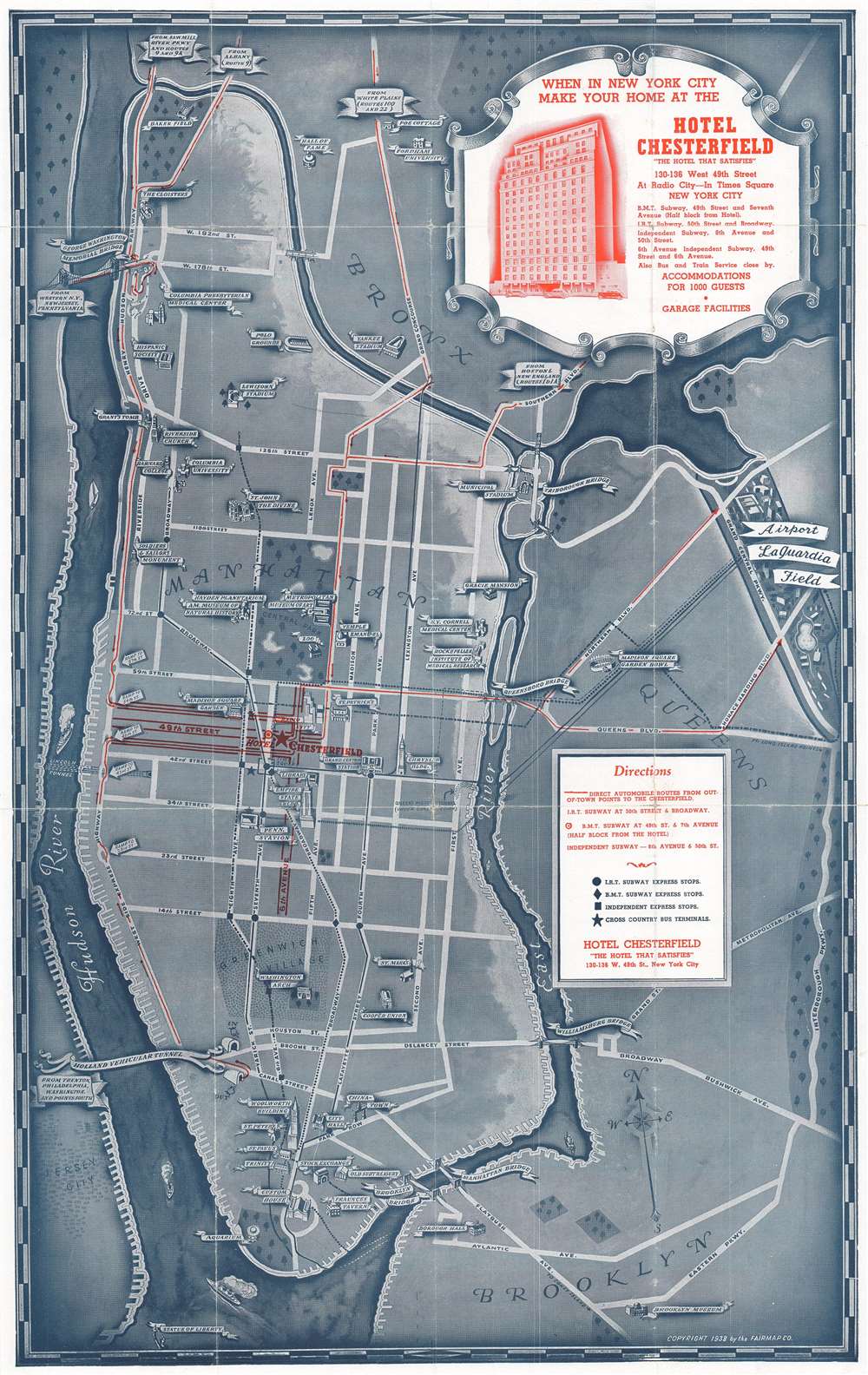
Welcome to the Wonder City of the World / Map of New York City Showing All the Principal Points of Interest to be Seen in This the Wonder City of the World - All Easily Accessible from the Hotel Chesterfield.
$500.00
Acquire
- Digital Map Information
- Suitable for large format printing
- File Size: 44.48 MB
- File Type: ZIP / TIFF
- ICC color profile embedded
- Delivered instantly via download link
This is a 1938 Fairmap Company pictorial map of New York City. The map depicts the city from the Hudson River to the Interborough Parkway between Brooklyn and Queens and from the Bronx to the Statue of Liberty. Created as a promotional advertisement for the Hotel ... (more details)
An early edition of a very rare map of Rome, Italy, highlighting both ancient and contemporary construction.
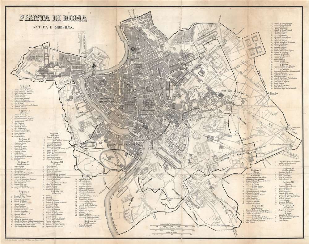
Pianta di Roma Antica e Moderna.
$500.00
Acquire
- Digital Map Information
- Suitable for large format printing
- DPI: 600
- File Size: 22.51 MB
- File Type: ZIP / TIFF
- ICC color profile embedded
- Delivered instantly via download link
This is an 1823 Vandermeren city map or plan of Rome, Italy. The map depicts the city from the Tiber River to the Circus Varianus and from the Piazza del Popolo to the Porta San Sebastiano, a gate along the Appian Way in the Aurelian Walls surrounding the city. Vatican City is also illustrated and is situated on the upper left near the Castel Sant'Angelo. Myriad locations throughout the city are labeled, including the Baths of Caracalla (labeled here as Terme Antoniniane), the Circus Maximus, and the Piazza di Spagna. Over 230 other sites, both ancient and modern, are numerically identified and correspond to fourteen different lists situated around the map itself. As the map is divided into fourteen different regions, these lists range from five sites to over forty. Numerous streets are identified, including the famous Appian Way (Via Appia). (more details)
Highlights events of the previous year, including the first giant panda cub to arrive in the United States.
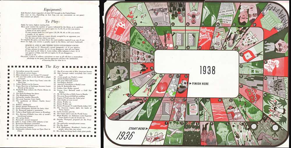
[Play 1937].
$300.00
Acquire
- Digital Map Information
- Suitable for large format printing
- File Size: 34.06 MB
- File Type: ZIP / TIFF
- ICC color profile embedded
- Delivered instantly via download link
This is a 1938 Erik Nitsche game board tracing some of the more newsworthy events (at least in Nitsche's view) that took place the previous year. These events range from the second inauguration of Franklin Roosevelt and the coronation of King George VI to the Giants losing the World Series and nine-year-old Eunice Winstead marrying twenty-two-year-old Charlie Johns. Numerous other events are referenced, such as the opening of the Golden Gate Bridge, the disappearance of Amelia Earhart, and a reference to a record number of deaths in car accidents. The original rule sheet is also present, which also includes a key to the illustrations that make up the fifty-two spaces on the game board. (more details)
Attractive map showing Indian tribes in Mississippi.
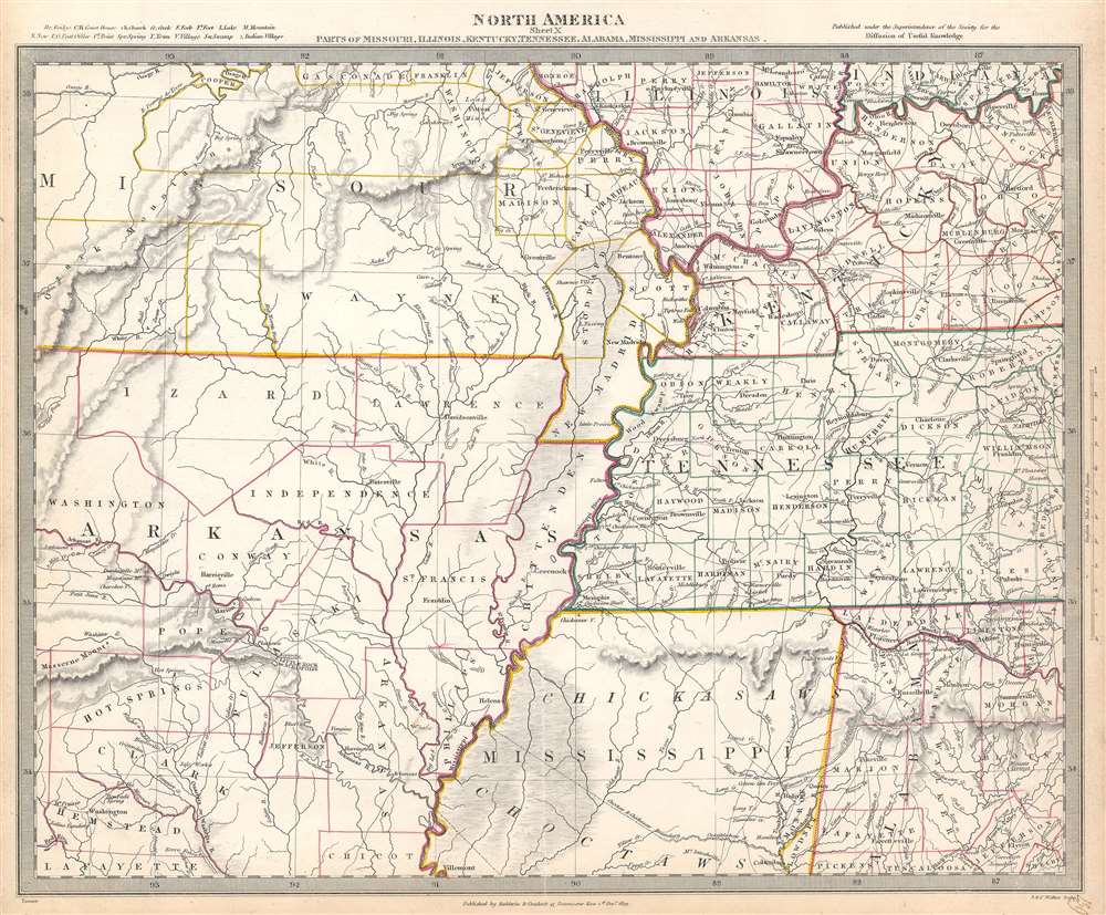
North America Sheet X Parts of Missouri, Illinois, Kentucky, Tennessee, Alabama, Mississippi and Arkansas.
$125.00
Acquire
- Digital Map Information
- Suitable for large format printing
- Full resolution TIFF file
- ICC color profile embedded
- Delivered instantly via download link
This is an 1833 Society for the Diffusion of Useful Knowledge or S.D.U.K. map of Arkansas, Missouri, Mississippi, Kentucky, Tennessee, Alabama and Illinois. The map depicts the region from the Ozark Mountains to Rome, Indiana and Huntsville, Alabama and from Mount Leansboro, Illinois to Columbus, Mississippi. The states are outlined in different colors to allow for easy differentiation, along with individual counties within each state, which are also labeled. Cities, towns, and villages are identified throughout, including Little Rock, Arkansas. Rivers, mountains, Indian villages, and topographical features are also noted throughout, with relief shown by hachure. (more details)
A charming map of Maryland, Delaware, and New Jersey.
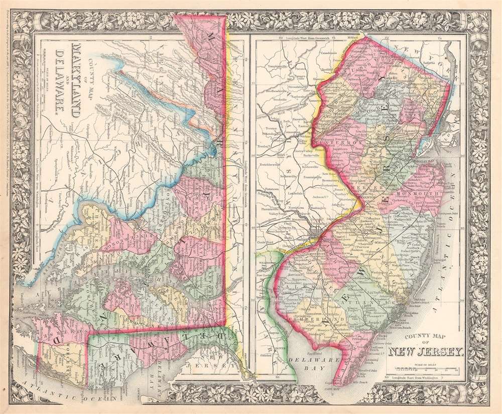
County Map of New Jersey. County Map of Maryland and Delaware.
$100.00
Acquire
- Digital Map Information
- Suitable for large format printing
- File Size: 14.35 MB
- File Type: ZIP / TIFF
- ICC color profile embedded
- Delivered instantly via download link
This is an 1866 S. A. Mitchell Jr. map of New Jersey, Maryland, and Delaware. The map depicts the entirety of New Jersey from Pennsylvania and Delaware to New York and the Atlantic Ocean and from Pennsylvania and New York to Delaware Bay. Maryland and Delaware ... (more details)
Shows urban development in Hong Kong Victoria, Central, and Kowloon. Extensive manuscript updates!
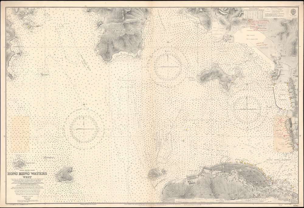
China-South Coast. Hong Kong Waters West.
$3,000.00
Acquire
- Digital Map Information
- Suitable for large format printing
- File Size: 66.09 MB
- File Type: ZIP / TIFF
- ICC color profile embedded
- Delivered instantly via download link
A detailed 1929 British Admiralty nautical chart or maritime map of Hong Kong Harbor and Kowloon. The map covers from eastern Lan Tau Island to Kowloon and from Tsing Yi (青衣, Chung Hue) to Victoria (Hong Kong Central, Sai Wan, Sai Ying Pun, and Sheung Wan. It exhibits copious c. 1930 manuscript updates in the vicinity of Kowloon, including a heavily annotated pastedown. (more details)
From the 1926 rerelease of 1912's Custer's Last Fight commemorating the 50th anniversary of the Battle of Little Bighorn.
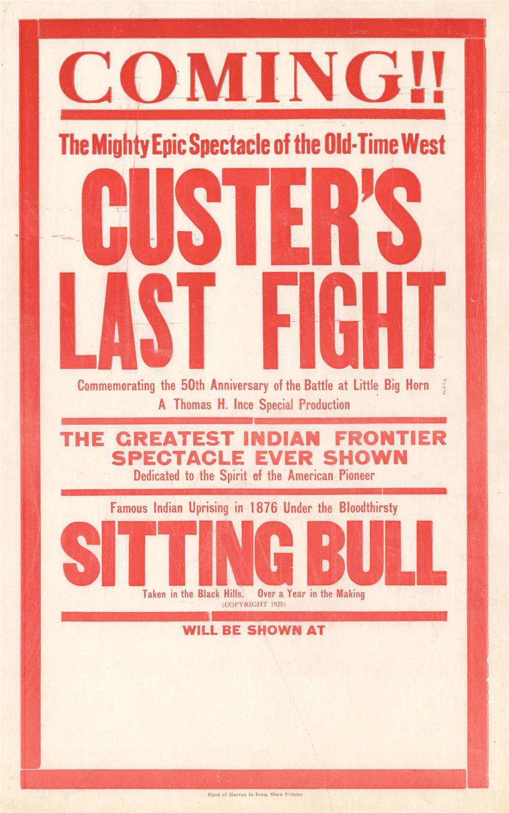
Coming!! The Mighty Epic Spectacle of the Old-Time West Custer's Last Fight Commemorating the 50th Anniversary of the Battle at Little Big Horn A Thomas H. Ince Special Production. The Greatest Indian Frontier Spectacle Ever Shown Dedicated to the Spirit of the American Pioneer. Famous Indian Uprising in 1876 Under the Bloodthirsty Sitting Bull Taken in the Black Hills. Over a Year in the Making.
$350.00
Acquire
- Digital Map Information
- Suitable for large format printing
- File Size: 12.54 MB
- File Type: ZIP / TIFF
- ICC color profile embedded
- Delivered instantly via download link
This is a 1926 window card movie poster celebrating the rerelease of the 1912 Francis Ford silent film Custer's Last Fight . Rereleased to commemorate the 50th anniversary of the Battle of Little Bighorn, the 1926 release included more introductory scenes than ... (more details)
A lovely view of Tampa Bay and vicinity.
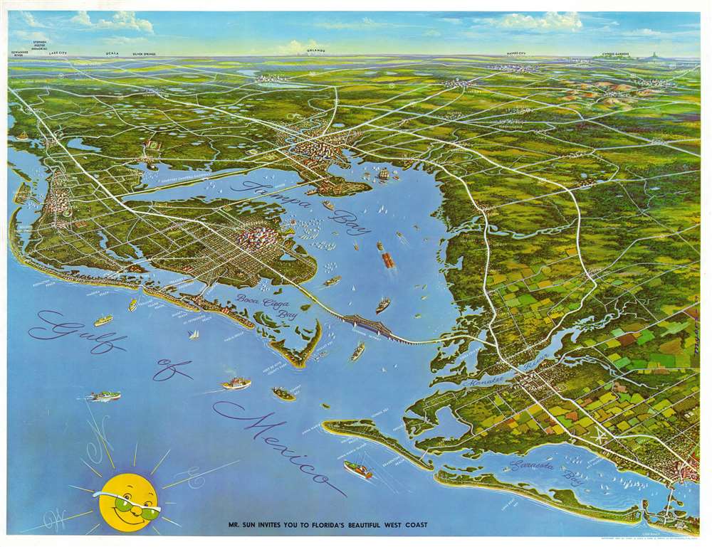
Mr. Sun Invites You to Florida's Beautiful West Coast.
$250.00
Acquire
- Digital Map Information
- Suitable for large format printing
- File Size: 52.02 MB
- File Type: ZIP / TIFF
- ICC color profile embedded
- Delivered instantly via download link
This is a 1954 Charles. A. Lenz and Edward G. Smith pictorial view of Tampa Bay, Florida. The view illustrates the region from Clearwater Beach to Sarasota and from Orlando in the distance to the Gulf of Mexico. Beautifully illustrated, numerous cities and towns are illustrated in profile, including Tampa, St. Petersburg, Bradenton, and Clearwater. The major thoroughfares are depicted and labeled, including the Courtney Campbell Causeway, the Sunshine Skyway, and several state highways. Sailboats, tugs, barges, and large ships ply the waters of Tampa Bay, while fishing trawlers hold station in the Gulf of Mexico. Sarasota Bay is also dotted with sailboats. Beaches all along the Gulf are labeled, as are the causeways leading to the islands. (more details)
A detailed railroad map of the western United States that highlights the route of the Northern Pacific Railroad.
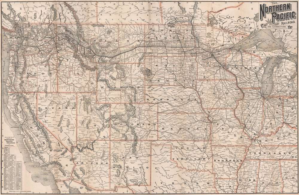
The Northern Pacific Railroad and Connections.
$750.00
Acquire
- Digital Map Information
- Suitable for large format printing
- File Size: 21.02 MB
- File Type: ZIP / TIFF
- ICC color profile embedded
- Delivered instantly via download link
This is an 1891 Rand McNally map of the western United States highlighting the route of the Northern Pacific Railroad. The map depicts the region from the Pacific Ocean to Detroit, Michigan and from Canada to Texas, Louisiana, and northern Mexico. Highly ... (more details)
Gigantic movie poster and map illustrating a Japanese perspecitive on World War II battle for the Pacific.
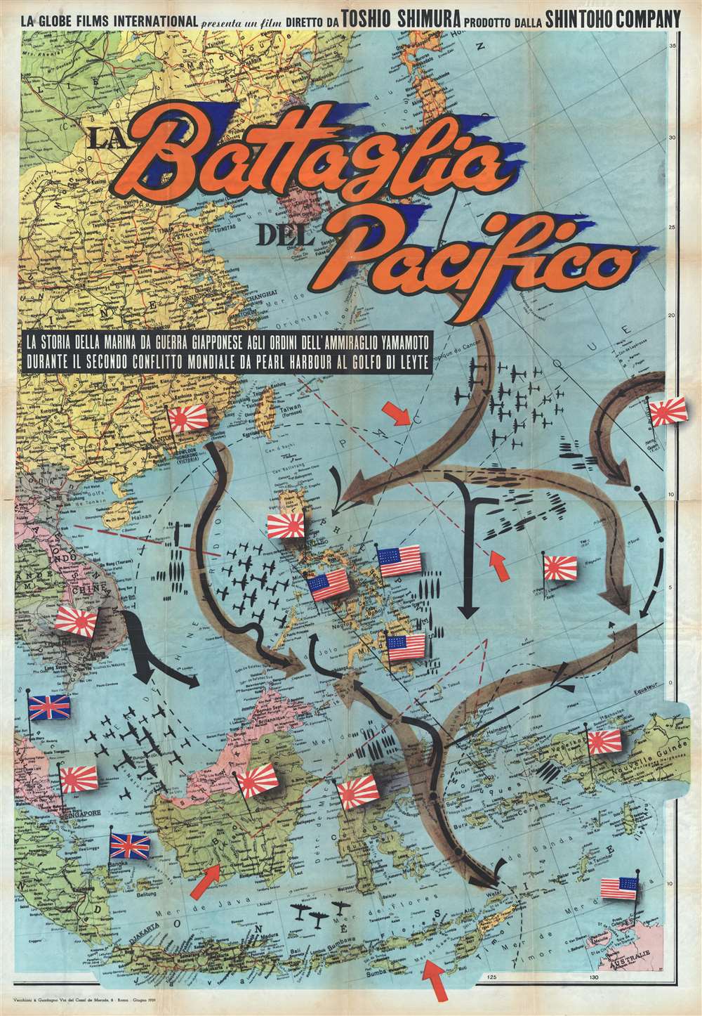
Battaglia del Pacifico.
$6,500.00
Acquire
- Digital Map Information
- Suitable for large format printing
- File Size: 152.77 MB
- File Type: ZIP / TIFF
- ICC color profile embedded
- Delivered instantly via download link
This monumental and rare movie poster and map of East Asia and the Pacific was issued by Vecchioni and Guadango to promote the 1959 Italian release of the post World War II (WW2) 1958 Japanese film Battaglia del Pacifico . The poster takes the form of ... (more details)