
Picquet, Charles (sold)

Charles Picquet (April 15, 1771 – January 15, 1827) was a French cartographer active in Paris during the Napoleonic and post-Napoleonic Eras. Picquet was born in Romagna-sous-Montfaucon, Meuse, France. From about 1798 Picquet supplied maps to the Dépôt de la Guerre. From 1806 he was appointed to Napoleon's Cabinet Topographique. Being politically dexterous, he was able to retain this position after the fall of Napoleon under both Louis XVIII and Charles X. Under Louis XVIII he also obtained the Brevet de Géographe Ordinaire du Cabinet Topographique. He worked with the cartographer Adrien-Hubert Brué (1787 - 1832) on a major atlas project. When Charles Picquet died in 1827, his son, Pierre-Jacques Picquet, continued to publish under his father's imprint name well into the middle part of the 19th century. From roughly 1839, one J. Barthelemier also claimed to be the 'seul acquéreur et successor' of the 'ancienne maison Ch. Picquet' though it is unclear if he succeeded the younger Picquet or challenged his claim to succession. Barthelemier only published maps infrequently until the late 1850s, after which he maintained a more steady output until the early-mid 1870s.
One of the earliest obtainable specific maps of Charleston, South Carolina.
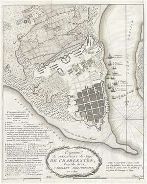
Esquisse des Opérations du Siège de Charleston, Capitale de la Caroline Méridionale, en 1780.
sold
- Digital Map Information
- Suitable for large format printing
- DPI: 300
- File Size: 5.82 MB
- File Type: ZIP / TIFF
- ICC color profile embedded
- Delivered instantly via download link
An excellent highly detailed 1787 American Revolutionary War map of Charleston, South Carolina. Illustrating the 1780 Siege of Charleston, a major American Revolutionary War battle, the map covers the peninsular tip of Charleston and predates many of the landfills ... (more details)
Traces the American Revolutionary War in South Carolina - labels several battles, including Cowpens.

Caroline Meridionale avec les Parties adjacentes : pour servir à l'Intelligence des mouvemens des armées Américaines.
sold
- Digital Map Information
- Suitable for large format printing
- DPI: 300
- File Size: 5.3 MB
- File Type: ZIP / TIFF
- ICC color profile embedded
- Delivered instantly via download link
This is a 1787 Charles Picquet and David Ramsay map of South Carolina. The map depicts the region from Georgia to the Atlantic Ocean and from North Carolina to Savannah and the Atlantic Ocean. A visual summary of the American Revolutionary War in South Carolina, ... (more details)
Detailed study of the final battle of the Revolutionary War - the Battle of Yorktown.
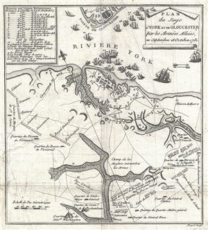
Plan du Siege d'York et de Gloucester par les Armees Alliees en Septembre et Octobre 1781.
sold
- Digital Map Information
- Suitable for large format printing
- DPI: 300
- File Size: 2.55 MB
- File Type: ZIP / TIFF
- ICC color profile embedded
- Delivered instantly via download link
An exceptional 1787 map of the Battle of Yorktown by David Ramsay and Charles Picquet. Ramsay prepared this map for issue in his Histoire de la Revolution d'Amerique , a period account the Siege of Yorktown in which Ramsay participated as a field commander and ... (more details)
A simply stunning large format city map of Paris during the reign of Napoleon I.
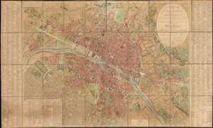
Plan Routier de la Ville de Paris et de ses Faubourgs, où se trouvent indiqués tous les Changements Opérés jusqu'à ce Jour avec les Projets d'Embellissement arrêtés par le Gouvernement.
sold
- Digital Map Information
- Suitable for large format printing
- DPI: 600
- File Size: 128.45 MB
- File Type: ZIP / TIFF
- ICC color profile embedded
- Delivered instantly via download link
This stunning large-format folding 1808 Charles Picquet case map of Paris presents the city during the heady years of the Napoleonic era. Depicting the city from the newly-constructed Pont d'Jena (now the Pont d'Iéna) and the Champs de Mars to the Place du Trône and from Montmartre (then a small hamlet outside Paris) to the Porte d'Italie, the splendor and luxury of Napoleon's imperial capital are on full display. (more details)
A call for brotherhood against the hated English.
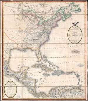
A Map of the United States and Canada, New-Scotland, New-Brunswick and New-Foundland. / Carte des Etats-Unis, avec le Canada, La Nouvelle Ecosse, Le Nouveau Brunswick et Terre-Neuve. / A Map of the West-Indies and of the Mexican-Gulph. / Carte des Indies Occidental et du Golfe du Méxique.
sold
- Digital Map Information
- Suitable for large format printing
- Full resolution TIFF file
- ICC color profile embedded
- Delivered instantly via download link
A lavish, large-scale French map of the United States and West Indies issued in September of 1812 - shortly after the outbreak of the War of 1812 (1812 - 1815). This is one of the few major French cartographic productions not focused on Europe to appear during the Napoleonic Wars (1803 - 1815) and needs to be addressed in this context to be fully understood. With titles both in English and French, it calls for brotherhood and alliance against the hated English. (more details)
One of the earliest comparative mountains and rivers charts and the first to include waterfalls.
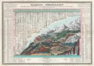
Tableau Comparatif des Principales Montanges, des Principaux Fleuves et Cataractes de la Terre. D'après les observations des plus Savants Voyageurs.
sold
- Digital Map Information
- Suitable for large format printing
- DPI: 300
- File Size: 19.2 MB
- File Type: ZIP / TIFF
- ICC color profile embedded
- Delivered instantly via download link
This is François Bulla's rare 1826 comparative mountains and rivers chart, one of the first charts to integrate mountains and rivers on a single chart, and the first to add waterfalls. For a long time, this map was considered by scholars to be the earliest ... (more details)
One of the most beautiful old color large format 19th century maps of Paris.
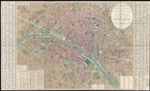
Plan Routier de la Ville de Paris, divise en XII Arrondissements ou Mairies et en Quarante Huit Quartiers, avec tous le Changements et Projets ordonnes par le Gouvernement.
sold
- Digital Map Information
- Suitable for large format printing
- DPI: 300
- File Size: 86.66 MB
- File Type: ZIP / TIFF
- ICC color profile embedded
- Delivered instantly via download link
This is a stunning large format map of Paris issued in 1839 by Pierre-Jacques Picquet. Centered on the Seine River, the map covers from the Champ de Mars eastward to Place du Trone. This map was first issued for administrative use during the Napoleonic era ... (more details)
Beautifully crafted map cabinet for the gentleman's library.
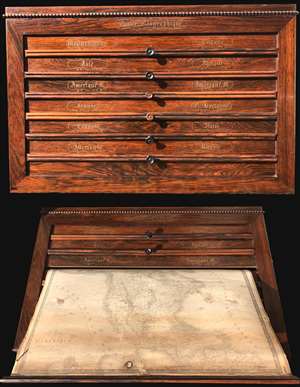
The Caiser Géographique or 'Geographical Locker' was issued by Charles Picquet and A. Brue. This wall mountable atlas is constructed of solid rosewood with masterful brass inlay. The box contains six spring loaded pulls, each attached to two maps, for a ... (more details)
Map exhiiting French interest in a California colony and the Republic of Texas.
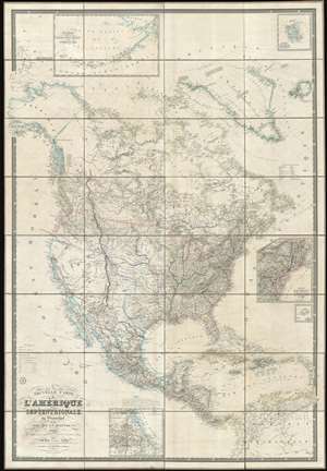
Nouvelle Carte de l'Amérique Septentrionale, du Groenland et des îles qui en dépendent.
sold
- Digital Map Information
- Suitable for large format printing
- DPI: 600
- File Size: 1001.97 MB
- File Type: ZIP / TIFF
- ICC color profile embedded
- Delivered instantly via download link
This is a spectacular and enormous 1843 French wall map of North America, including the Republic of Texas, dissected and on linen, issued by Adrien-Hubert Brué and Charles Picquet. The map represents an ephemeral historical period when France, coming out of the First French Intervention in Mexico, was seriously considering a colonizing play for California. With increased hegemony over Mexico, a mutually beneficial alliance with the Republic of Texas, and a potential colony in California, France was well positioned to push for dominance over all of western North America - inspiring considerable French enthusiasm and great interest in North America among the French populace. This map is perhaps the signal largest and most impressive cartographic statement of King Louis Phliippe ambitions of a new French empire in North America. While it may simply be chance, it is striking the light blue used to represent French properties is also used for Mexico, California, and Russian Alaska. (more details)
One of the only foreign language maps to identify and name the republic of Texas, not only on the map proper, but also in the title.
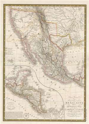
Carte générale des États-Unis Mexicains, de la République du Texas et des etats de l'Amérique Centrale.
sold
- Digital Map Information
- Suitable for large format printing
- DPI: 300
- File Size: 8.98 MB
- File Type: ZIP / TIFF
- ICC color profile embedded
- Delivered instantly via download link
An unusual find, this 1845 French map by Adrien Hubert Brué is one of the only foreign language maps to identify and name the republic of Texas, not only on the map proper, but also in the title. The map is centered the Republic of Texas, which is ... (more details)
Keeping the Ship Afloat
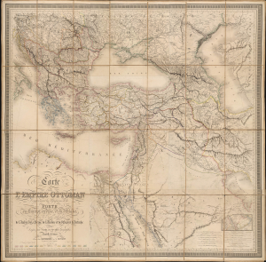
Carte de l'Empire Ottoman Comprenant les Possessions de la Porte en Europe, en Asie et en Afrique; avec les parties limitrophes de l'Arabie, de la Perse, de la Russie et de l'Empire d'Autriche.
sold
- Digital Map Information
- Suitable for large format printing
- Full resolution TIFF file
- ICC color profile embedded
- Delivered instantly via download link
This is an impressive, large-format 1864 folding map of the Ottoman Empire and environs, prepared by Louis Vivien de Saint-Martin and Joseph-Marin-Adolphe Noël des Vergers and published by J. Barthelemier. It presents the Empire in the aftermath of the Crimean War (1853 - 1856), when the Empire attempted to modernize and recover from the loss of territory earlier in the century. (more details)