
Survey of India (sold)
Survey of India (1767 - Present) is India's central engineering agency in charge of mapping and surveying the country. It was founded in 1767 by Major James Rennell, who took the post of first Surveyor General, with the mission to map and consolidate the territories of the British East India Company. The Survey undertook the Great Trigonometrical Survey between 1802 and 1852 in an attempt to accurately measure the Indian Subcontinent - considered one of the greatest feats of mapping of all time. It also sponsored clandestine surveys, at times disguised as Buddhist pilgrims, to infiltrate and map Tibet, then a closed country. With India's independence in 1947, the Survey was folded into the new Indian government, which it remains part of to this day.
The greatest map of Burma - ever.
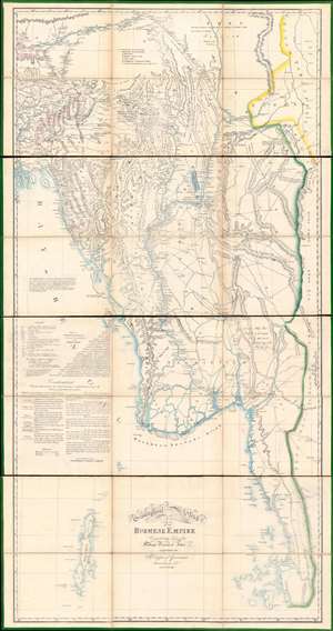
A Geographical Sketch of the Burmese Empire.
sold
- Digital Map Information
- Suitable for large format printing
- Full resolution TIFF file
- ICC color profile embedded
- Delivered instantly via download link
An extraordinary 1825 large-scale map of the Empire of Burma, modern-day Myanmar, issued by the Surveyor-General (QMG) and the private Asiatic Lithographic Press in Calcutta/Kolkata at the height of the First Anglo-Burmese War (1824 - 1826). Issued in four dissected and linen-backed sheets (18.75 x 39.25 in), the map is impressive, measuring nearly 76 inches high and 40 inches wide. Coverage extends from the Brahmaputra River in northern Assam to Domel Island (Letsok-aw Island) and the Mergui Archipelago. Despite its impressive size and apparent density, a close examination actually reveals how little Europeans then knew of the Burmese interior. (more details)
An epic cartographic achievement.
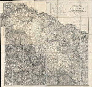
Map of Kashmir with part of Adjacent Mountains surveyed on the basis of the Great Trigonometrical survey of India, under the instructions of Lieutt. Colonel A. S. Waugh, Engineers, F.R.S. F. R.G.S. Survey General of India, by Captain T. G. Montgomerie, Engineers. F.R.G.S. 1st. Assistants under his orders, during 1855, 56 and 57.
sold
- Digital Map Information
- Suitable for large format printing
- File Size: 264.53 MB
- File Type: ZIP / TIFF
- ICC color profile embedded
- Delivered instantly via download link
This is the first edition of Thomas G. Montgomerie's 1859 large-scale map of Kashmir and Jammu - considered the greatest achievement of one of the most epic concerted cartographic efforts in history, the Great Trigonometrical Survey of India. (more details)
Afghanistan in the middle of the Second Anglo/Afghan War, following the Treaty of Gandamak
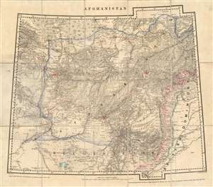
Afghanistan.
sold
- Digital Map Information
- Suitable for large format printing
- File Size: 47.54 MB
- File Type: ZIP / TIFF
- ICC color profile embedded
- Delivered instantly via download link
This is an extremely rare 1879 Survey of India map of Afghanistan, published immediately following the Treaty of Gandamak, which was presumed to be the end of the Second Anglo-Afghan War (in reality, it was a breathing space between the two phases of the conflict, which would span from 1878 to 1880. It was produced in July 1879 under the supervision of James Thomas Walker, who had become Surveyor General in 1878. The map is cartographically derived from Walker's fourth edition of the four-sheet Turkestan and the Countries between the British and Russian Dominions, but it is neither a copy of one of that map's sheets, nor a reduction of that map. Produced by the same team of mapmakers as that seminal map, this present piece focused directly on the territories affected by the recent treaty between Britain and the Emirate of Afghanistan. It was printed at the same scale as its source - thirty two miles to the inch - which implies the need for the swift and timely publication of the map outweighed any considerations of the enlargement of the map. (An 1883 map of the area produced by the same team would be printed at the scale of twenty four miles to the inch.) (more details)
Published during the Burmese Resistance of 1885 - 1895.
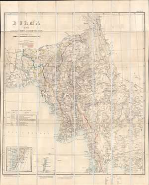
Burma and Adjacent Countries.
sold
- Digital Map Information
- Suitable for large format printing
- Full resolution TIFF file
- ICC color profile embedded
- Delivered instantly via download link
This is an 1892 Survey of India map of Burma (Myanmar), published 6 years after Lower Burma became a province of British India. Constant resistance to British rule, and insurgency activity kept this region persistently in the British press, likely the raison d'être for this large and impressive map. Coverage extends from Calcutta to Cambodia and Thailand (Siam), districts and states throughout are illustrated and labeled, along with cities, towns, and villages. The region's many rivers, including the Ganges and Irrawaddy, appear in detail. Black lines trace the Burma State Railway from Rangoon to Mandalay and points north, and the Eastern Bengal State Railway north from Calcutta. Ruby mines, one of the major resources in Upper Burma, are labeled. An inset in the lower-left details extreme southern Burma, identified here as the Tenasserim. A table in the lower left names British imposed districts and states in both Upper and Lower Burma. (more details)
The largest and best map of Persia.
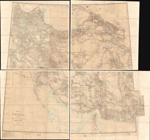
Map of Persia (in Six Sheets) Compiled in the Simla Drawing Office Survey of India.
sold
- Digital Map Information
- Suitable for large format printing
- File Size: 54.87 MB
- File Type: ZIP / TIFF
- ICC color profile embedded
- Delivered instantly via download link
This massive, six-sheet map of Persia produced in 1897 by the British Survey of India (updated to 1902) was the most detailed map of what is now Iran, Iraq, and parts of Azerbaijan and Turkmenistan that had been executed to date: we are aware of no comparable map prior. Its exhaustive detail would continue to command respect well into the 20th century: the German military faithfully copied this map in 1918, as they did with other British maps of important theaters in the Great War. (more details)
Ephemeral Muslim-majority state.
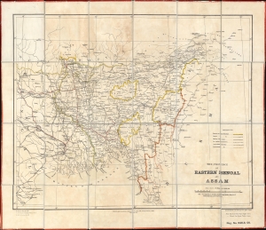
The Province of Eastern Bengal and Assam.
sold
- Digital Map Information
- Suitable for large format printing
- Full resolution TIFF file
- ICC color profile embedded
- Delivered instantly via download link
This is a rare 1906 Survey of India map of 'East Bengal and Assam', an ephemeral Muslim-majority province created by the 1905 Partition of Bengal. The 1905 Partition of Bengal ignited both Indian-Hindu and -Muslim nationalism, influencing the 1947 Partition of India and the creation of East Pakistan and, eventually, Bangladesh. (more details)
Rare administrative map of Calcutta / Kolkata by the Survey of India.
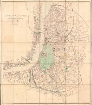
City of Calcutta.
sold
- Digital Map Information
- Suitable for large format printing
- File Size: 108.4 MB
- File Type: ZIP / TIFF
- ICC color profile embedded
- Delivered instantly via download link
A rare, spectacular, and meticulously surveyed large format 1912 city plan or map of Calcutta, or Kolkata, West Bengal, India. Issued in the year after the capital of British India, facing local religious and political unrest, relocated to New Delhi. Centered on Fort William, this massive map extends north as far as Chitpore, south to Parganas, and from the Botanical Gardens and Civil Engineering College in the west, east as far as Kohdaganj, Pagladanga, and Tangra. The Hooghly River features prominently at center with docks and piers noted throughout. The map offers extraordinary detail throughout, with every street, statue, monuments, theater, market, offices, church, hotel, hospital, press, and much more note. (more details)
The Indian Army's Showcase Campaign in the Great War.
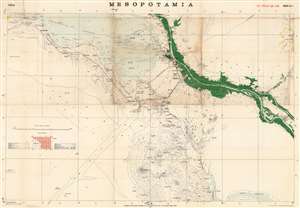
Mesopotamia Sheet No. 4.
sold
- Digital Map Information
- Suitable for large format printing
- File Size: 37.8 MB
- File Type: ZIP / TIFF
- ICC color profile embedded
- Delivered instantly via download link
This is a rare 1917 Survey of India map focusing on the key strategic regions of Basra-Zubair in south-eastern Iraq and the adjacent Khorramshahr area of Persia, one of the first maps to show Abadan - the first oil boomtown of the Middle East. It was also a showcase theater for the employment of units of the Indian Army, whose officers were given charge of the campaign at the beginning of the war. (more details)
India on the eve of the Great Depression.
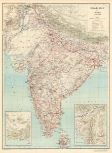
Road Map of India (Excluding Burma).
sold
- Digital Map Information
- Suitable for large format printing
- Full resolution TIFF file
- ICC color profile embedded
- Delivered instantly via download link
This is a 1929 Survey of India road map of India published under Brigadier Robert Henry Thomas. (more details)
The Royal Indian Navy Mutiny.
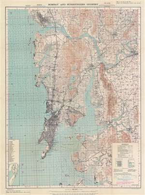
Bombay and Surrounding Country.
sold
- Digital Map Information
- Suitable for large format printing
- File Size: 85.55 MB
- File Type: ZIP / TIFF
- ICC color profile embedded
- Delivered instantly via download link
This is a rare 1946 first edition map of Bombay / Mumbai issued by the Survey of India just days before the Royal Indian Navy Mutiny (February 18 - 15, 1946). The map features manuscript annotations near Butcher Island (Dia Deva) in Bombay Harbor - a major focus of the mutiny as the Bombay Presidency’s entire ammunition hold, including telephone and wireless equipment, was stored there. The map is large and meticulously detailed, noting individual buildings, streets, railroads, topography, depth soundings, and more - without a doubt, the finest map of Bombay then obtainable. (more details)