
Bartholomew Family (sold)
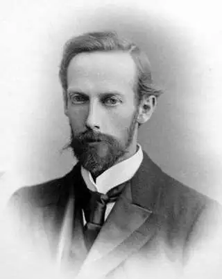
The Bartholomew Family (fl. c. 1810 - 1920) is clan of map publishers active in London through the 19th century. They represent one of the great names in British cartography. The cartographic story of the Bartholomew family begins with George Bartholomew (January, 8 1784 - October 23, 1871, active from 1797), an engraver in the employ of the Daniel Lizars firm of Edinburgh. George was the first of six generations in the Bartholomew map-making dynasty. It was his son, John Bartholomew Sr. (1805 - April 9, 1861) who ultimately founded John Bartholomew and Sons in 1828. The John Bartholomew firm produced thousands of maps and rose to become one of the largest and most prolific cartography firms in Scotland. John Sr. was succeeded by his son, also John Bartholomew Jr. (1831-93). John George Bartholomew (1860-1920), son of John Bartholomew (1831-93) took control of the firm at its height. John George was a charter member of the Royal Scottish Geographical Society and supported the creation of a National Institute of Geography - a good idea that never took off. John George is also reliably attributed to be the first to bring the term "Antarctica" into popular usage as a denominator for the Southern Continent. In recognition of his work, John George was awarded a warrant from the king and often used the title "Cartographer to the King" on his imprint. Among his friends and admirers he was referred to as the "Prince of Cartography". John (Ian) Bartholomew (1890 - 1962) continued the family business and oversaw publication of the Times Survey Atlas of the World in 1922 and the Mid Century Edition of the Time Atlas of the World from 1955 - 1960. John Christoper Bartholomew (1923 - 2008) continued the family business into a fifth generation and was fascinated by the natural sciences. He spearheaded the publication of many of the most detailed and popular maps of the last century. His brother Robert, a trained printer, became production director. Another brother, Peter, an accountant, started as a managing director and eventually became executive chairman. The John Bartholomew firm has been part of the HarperCollins family of publishers since 1989. The vast archive of maps and atlases produced by the Bartholomew family has since been transferred to the National Library of Scotland where it is currently in the cataloguing process.
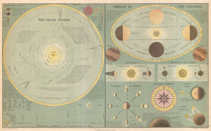
The Solar System. / Theory of the Seasons.
sold
- Digital Map Information
- Suitable for large format printing
- File Size: 4.85 MB
- File Type: ZIP / TIFF
- ICC color profile embedded
- Delivered instantly via download link
This is Adam and Charles Black's 1873 chart of the Solar System and the Theory of the Seasons. The Black brothers introduced this map in the 1850s and it went through a series of revisions and editions well into the 1880s. This example, from 1873, is one of the ... (more details)
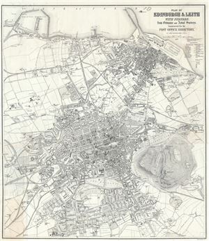
Plan of Edinburgh and Leith with Suburbs, from Ordnance and Actual Surveys, Constructed for the Post Office Directory,
sold
- Digital Map Information
- Suitable for large format printing
- Full resolution TIFF file
- ICC color profile embedded
- Delivered instantly via download link
This is a beautiful 1877 map or plan of the city of Edinburgh and Leith, Scotland, by John Bartholomew. The map covers the city of Edinburgh, known as the 'Athens of the North' in exceptional detail from the Royal Edinburgh Lunatic Asylum (what is today the ... (more details)
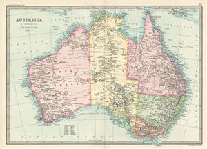
Australia.
sold
- Digital Map Information
- Suitable for large format printing
- File Size: 7.01 MB
- File Type: ZIP / TIFF
- ICC color profile embedded
- Delivered instantly via download link
This is a fine example of Bartholomew's 1890 map of Australia. It covers the entire continent from the Torres Strait south as far as the Bass Strait. Australia, divided into its five provinces of Western Australia, South Australia, Queensland, New South ... (more details)
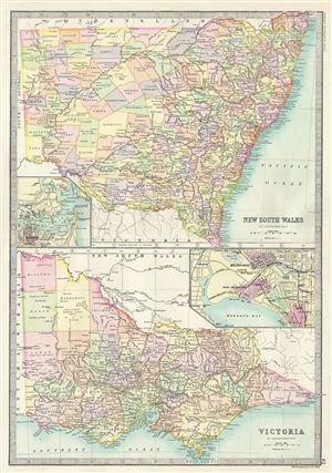
New South Wales. Victoria.
sold
- Digital Map Information
- Suitable for large format printing
- File Size: 8.74 MB
- File Type: ZIP / TIFF
- ICC color profile embedded
- Delivered instantly via download link
This is a fine example of Bartholomew's 1890 map of New South Wales and Victoria in Australia. The map is divided into two parts, with the upper map featuring the Australian state of New South Wales and the map on the bottom features the state of ... (more details)
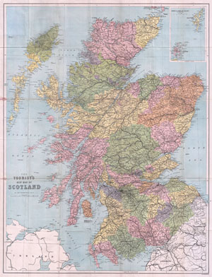
The Tourist's New Map of Scotland
sold
- Digital Map Information
- Suitable for large format printing
- File Size: 26.54 MB
- File Type: ZIP / TIFF
- ICC color profile embedded
- Delivered instantly via download link
This is a beautiful 1892 pocket map of Scotland by the famous cartographer John Bartholomew. Bartholomew established one of the most admired cartographic institutions in the world. His demand for the highest standards can be seen in this map of ... (more details)
Murray provides scientific proof of the long believed in southern continent - Antarctica!
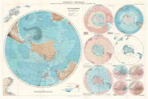
Antarctic Research. Series of Maps Illustrating Dr. John Murray's Address, 1893.
sold
- Digital Map Information
- Suitable for large format printing
- File Size: 30.55 MB
- File Type: ZIP / TIFF
- ICC color profile embedded
- Delivered instantly via download link
This is an 1894 John George Bartholomew map of Antarctica created to accompany Dr. John Murray's address to the Royal Geographical Society (RGS) in 1893. Consisting of one large map of the south polar regions and several smaller ones on one sheet, each map center's on Murray's proposed outline of Antarctica as he believed it existed following his experience as part of the Challenger Expedition. Over the course of his presentation to the RGS, Murray stated that, because of the presence of certain rocks dredged from the ocean floor in the south polar region, he was capable of scientifically confirming the long-hypothesized existence of an Antarctic continent. He even went so far as to state that he believed the continent to be larger than Australia! Each of the maps present on this sheet bears an illustration of Murray's proposed outline of Antarctica. A large portion of the data presented in these maps came directly from the archives of the Challenger Expedition, making a large portion of it new information to the public. (more details)
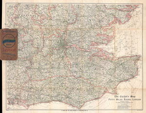
The Cyclist's Map of Fifty Miles Round London showing in color all rideable roads and dangerous hills.
sold
- Digital Map Information
- Suitable for large format printing
- File Size: 28.98 MB
- File Type: ZIP / TIFF
- ICC color profile embedded
- Delivered instantly via download link
This is J. Bartholomew's c. 1895 cyclist's may of 50 miles around London. Covers the greater London area from Ricester in the northwest eastwards and southwards as far as the coast. Includes the counties of Buckingham, Hertford, Essex, ... (more details)
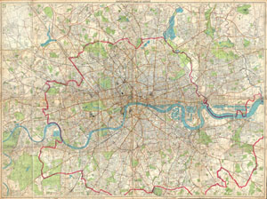
London Fire Brigade Instructional Map. / Bartholomew's Plan of London.
sold
- Digital Map Information
- Suitable for large format printing
- File Size: 116.3 MB
- File Type: ZIP / TIFF
- ICC color profile embedded
- Delivered instantly via download link
An enormously proportioned and extremely unusual map of London, England prepared by John Bartholomew. Covers the entire city of London from Kenton in the northwest, to Richmond Park in the southwest, to Hospital Hill in the northeast and ... (more details)
Provides biblical and modern place names.
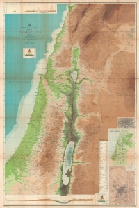
Topographical and Physical Map of Palestine.
sold
- Digital Map Information
- Suitable for large format printing
- Full resolution TIFF file
- ICC color profile embedded
- Delivered instantly via download link
This is John Bartholomew and George Adam Smith 1901 wall map of Palestine featuring both biblical and contemporary content. (more details)
London from above.
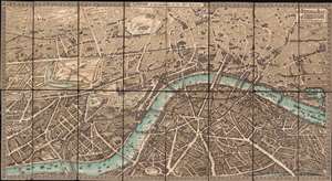
The Pictorial Plan of London.
sold
- Digital Map Information
- Suitable for large format printing
- Full resolution TIFF file
- ICC color profile embedded
- Delivered instantly via download link
A striking chromolithograph Edwardian Era pictorial plan of London issued in 1901 by Charles Baker and Co. Ltd. Centered on Charing Cross, the map covers from Albert Bridge and Kensington Palace to the London Docks and Southwark Park. It extends south to the Grand Surrey Canal and north to include all of Regents Park and Kings Cross Station. The cartographer combines pictorial elements with axonometrical style mapping in which important buildings are represent from equidistant elevated perspective - similar to the great 1738 Bretez/Turgot Plan of Paris, if not on so grand a scale. (more details)
Meticulous manuscript Map of New Zealand.
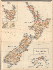
New Zealand.
sold
- Digital Map Information
- Suitable for large format printing
- File Size: 6.87 MB
- File Type: ZIP / TIFF
- ICC color profile embedded
- Delivered instantly via download link
A meticulous manuscript map of New Zealand drawn in 1909 by William Richard Colling Hockin. It was composed soon after New Zealand gained Dominion status within the British Empire, formalizing its independence, and this may have been the occasion that brought New Zealand to the attention of Hockin, then studying in Cornwall to be an electrical engineer. Since we see no other cartographic output from this artist, we must assume this work to be a unique project of leisure and enjoyment; a thoughtful young man's rumination on one of the Empire's newest and most exotic dominions. (more details)
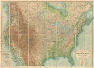
Orographical Reduced Survey Map of the United States and Part of Canada.
sold
- Digital Map Information
- Suitable for large format printing
- File Size: 59.03 MB
- File Type: ZIP / TIFF
- ICC color profile embedded
- Delivered instantly via download link
This is an uncommon example of the 1915 pocket map of the United States and Part of Canada issued by J. G. Bartholomew. This topographical map covers all of the United States, along with parts of Canada and Mexico. The map is highly ... (more details)
Colonial Africa following the Great War.
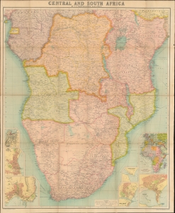
Central and Southern Africa by J. G. Bartholomew, LL. D., F.R.G.S.
sold
- Digital Map Information
- Suitable for large format printing
- File Size: 79.12 MB
- File Type: ZIP / TIFF
- ICC color profile embedded
- Delivered instantly via download link
This large, bright, folding 1921 J. G. Bartholomew map of Central and Southern Africa. (more details)
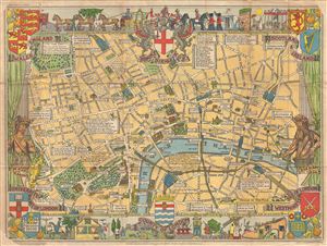
County of London.
sold
- Digital Map Information
- Suitable for large format printing
- File Size: 24.88 MB
- File Type: ZIP / TIFF
- ICC color profile embedded
- Delivered instantly via download link
A colorful and attractive c. 1955 pictorial map of London printed by John Bartholomew & Sons. The comp covers central London from Hyde Park to Aldgate and from Green Park to Waterloo Station. The map was issued to raise funds for ... (more details)
Charming pictorial map of London intended for use by children.
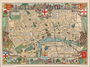
Children's Map of London.
sold
- Digital Map Information
- Suitable for large format printing
- Full resolution TIFF file
- ICC color profile embedded
- Delivered instantly via download link
A colorful and attractive c. 1955 pictorial map of London printed by John Bartholomew & Sons. The map covers central London from Hyde Park to Aldgate and from Green Park to Waterloo Station. Issued to raise funds for the Hospital ... (more details)
Whimsical pictorial map of London.
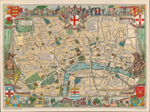
A colorful and attractive c. 1955 pictorial map of London printed by John Bartholomew & Sons. The comp covers central London from Hyde Park to Aldgate and from Green Park to Waterloo Station. The map was issued to raise funds ... (more details)
London legends and folklore.
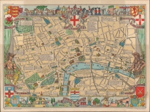
A colorful c. 1955 pictorial map of London by Leslie G. Bullock. The map covers central London from Hyde Park to Aldgate and from Green Park to Waterloo Station. The map was issued to raise funds for the Hospital for Sick Children, Great Ormond Street London. It identifies most major roads with important buildings rendered pictorially. The whole is filled with charming quotations from various authors ranging from Rudyard Kipling, Alfred Noyes, Benjamin Franklin, and others. Surrounded by decorative work intended to represent London life and folklore. (more details)
Impressive pictorial map illustrating the history of England and Wales.
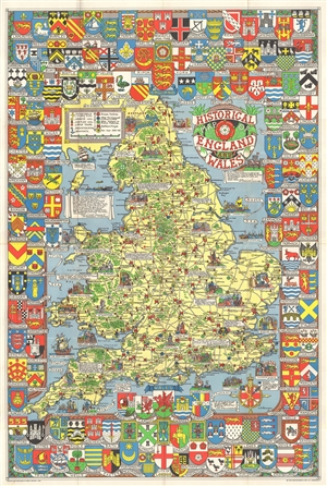
Historical Map of England and Wales.
sold
- Digital Map Information
- Suitable for large format printing
- File Size: 34.7 MB
- File Type: ZIP / TIFF
- ICC color profile embedded
- Delivered instantly via download link
A wonderful large 1963 format pictorial map illustrating the history of England and Wales drawn by Leslie Bullock. The map coves all of England and Scotland with historical locations and events illustrated pictorially in the ... (more details)
A delightful and colorful historical pictorial map of Ireland.
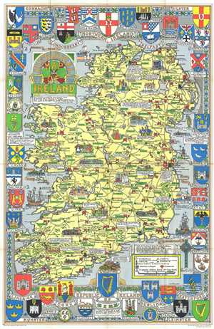
Historical Map of Ireland.
sold
- Digital Map Information
- Suitable for large format printing
- File Size: 28.5 MB
- File Type: ZIP / TIFF
- ICC color profile embedded
- Delivered instantly via download link
This is a delightful 1969 L.G. Bullock pictorial historical map of Ireland. Bullock's map shows the entire Emerald Isle as well as a small amount of the sea. The map is very elaborate and includes several intriguing aspects. (more details)
A delightful and colorful historical pictorial map of Ireland.
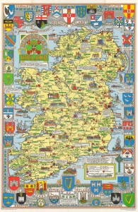
This is a delightful 1969 L.G. Bullock pictorial historical map of Ireland. (more details)
Scottish history.
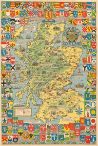
This is a c. 1962 Leslie Bullock pictorial historical map of Scotland. Bullock highlights events in Scottish history and marks castles, cathedrals, and other historic sites. (more details)
Scottish history.
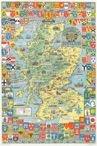
This is a c. 1962 Leslie Bullock pictorial historical map of Scotland. Bullock highlights events in Scottish history and marks castles, cathedrals, and other historic sites. (more details)
Incorporates beautiful illustrations a plants from all over the world.
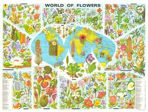
This is a 1972 John Bartholomew and Barbara Everard pictorial map of the world and its flowers. A topographic world map on Goode's projection occupies the center. While few place names are provided, major bodies of water, landmasses, and islands are named. 161 beautiful illustrations of flora surround the central map. The plants are broken up into eleven geographic groups, which are, proceeding clockwise from the upper left: North America, Arctic, Europe, Mediterranean, Tropical and Central Africa, South Africa, Himalaya and China, Antarctic, Southeast Asia, Australasia, and Central and South America. Each plant is numerically identified and corresponds with indexes situated in the lower left and right corners. (more details)
Incorporates beautiful illustrations a plants from all over the world.
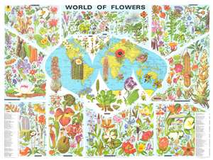
This is a 1972 John Bartholomew and Barbara Everard pictorial map of the world and its flowers. A topographic world map on Goode's projection occupies the center. While few place names are provided, major bodies of water, landmasses, and islands are named. 161 beautiful illustrations of flora surround the central map. The plants are broken up into eleven geographic groups, which are, proceeding clockwise from the upper left: North America, Arctic, Europe, Mediterranean, Tropical and Central Africa, South Africa, Himalaya and China, Antarctic, Southeast Asia, Australasia, and Central and South America. Each plant is numerically identified and corresponds with indexes situated in the lower left and right corners. (more details)
Charming pictorial map of London intended for use by children.
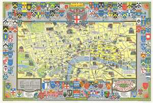
A colorful and attractive c. 1978 pictorial map of London printed by John Bartholomew & Sons. The historical map covers central London from Hyde Park to the London Docks and from Westminster to the Inner Circle in the ... (more details)