
De l’Isle, Guillaume (sold)
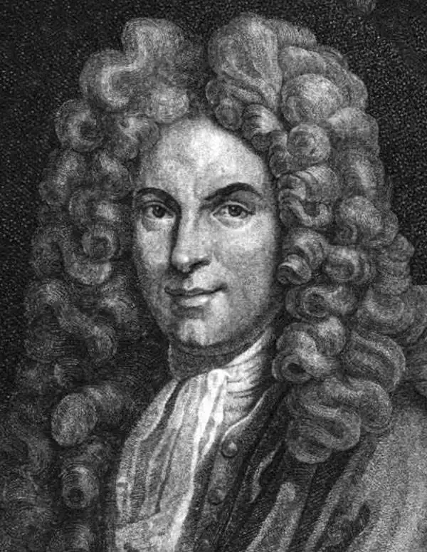
Guillaume De l’Isle (1675 - 1726) was a French cartographer, and arguably the finest mapmaker at the beginning of the eighteenth century. He was the son of Claude De L'Isle (1644 -1720), a Paris-based historian and geographer under Nicholas Sanson, then the leading light of French cartography. He was the chief proponent of the school of 'positive geography' and the primary figure defining the heights of the Golden Age of French Cartography. Guillaume's skill as a cartographer was so prodigious that he drew his first map at just nine years of age. He was tutored by J. D. Cassini in astronomy, science, mathematics and cartography. By applying these diverse disciplines to the vast stores of information provided by 18th century navigators, Guillaume created the technique that came to be known as 'scientific cartography', essentially an extension of Sanson's 'positive geography'. This revolutionary approach transformed the field of cartography and created a more accurate picture of the world. Among Guillaume's many firsts are the first naming of Texas, the first correct map of the Mississippi, the final rejection of the insular California fallacy, and the first identification of the correct longitudes of America. Stylistically De L'Isle also initiated important changes to the medium, eschewing the flamboyant Dutch style of the previous century in favor of a highly detailed yet still decorative approach that yielded map both beautiful and informative. Guillaume was elected to the French Academie Royale des Sciences at 27. Later, in 1718, he was also appointed 'Premier Geographe du Roi', an office created especially for him. De L'Isle personally financed the publication of most of his maps, hoping to make heavy royalties on their sales. Unfortunately he met an untimely death in 1728, leaving considerable debt and an impoverished child and widow. De L'Isle's publishing firm was taken over by his assistant, Phillipe Buache, who would also become his son in law.
First Plate - most desirable Homann Map of America.
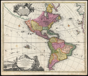
Totius Americae Septentrionalis et Meridionalis.
sold
- Digital Map Information
- Suitable for large format printing
- DPI: 600
- File Size: 54.51 MB
- File Type: ZIP / TIFF
- ICC color profile embedded
- Delivered instantly via download link
This is the scarce first plate of Johann Baptist Homann's 1707 map of America, in a beautiful original color example. It has been long misunderstood and miscataloged. The present example is the first plate, engraved by the elder Homann before 1707. Most examples of the map of this title appearing on the market are a different plate, engraved by Homann's son after 1724 (identified by the Imperial privilege). Thus, the present example is the most desirable Homann map of America. (more details)
Stunningly beautiful old color.
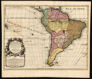
L' Amerique Meridionale, Dressée sur les Observations de Mrs. de l'Academie Royale des Sciences, et quelques autres, et sur les Memoires les plus recens Par G. De l'Isle Geographe. a Amsterdam chez Pierre Schenk sur le vygendam, a l' Atlas de Sanson. Avec Privilege 1708.
sold
- Digital Map Information
- Suitable for large format printing
- File Size: 21.18 MB
- File Type: ZIP / TIFF
- ICC color profile embedded
- Delivered instantly via download link
This is a magnificent example of Peter Schenk's 1708 edition of De L'Isle's 1700 map of South America, with striking rich original color. The map embraces South America from Barbados southwards to just beyond Tierra del Fuego. Although derivative of De L'Isle, the map is richly decorative with a wealth of intriguing cartographic anomalies and tidbits. (more details)
De l'Isle's State-of-the-art cartography, ludicrously misattributed.
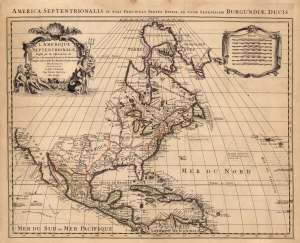
America Septentrionalis in suas Praecipuas Partes Divisa, Ad Usum Serenissimi Burgundiae Ducis/ L'Amerique Septentrionale Dressee sur les Observations de Mrs. de l'Academie Royale des Sciences et quelques autres, et sur les Memoires les plus recens Par N. Sanson.
sold
- Digital Map Information
- Suitable for large format printing
- Full resolution TIFF file
- ICC color profile embedded
- Delivered instantly via download link
This is Peter Mortier's 1708 edition of De L'Isle's foundational 1700 mapping of North America. De l'Isle's map was the first to begin correcting the California-as-an-island myth, however tentatively. The map embraces North America from Baffin's Bay southwards as far as the Spanish Main, westwards to Cape Mendocino, and eastwards to include the Azores and the Sargasso Sea. Cartographically this map is faithful to the De L'Isle, differing mainly in the positioning of the title cartouche and the mileage scales. (more details)
Among the first maps to detail French West Africa.
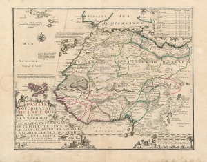
Partie Occidentale De L'Afrique ou se Trouve La Barbarie: Divisée en Royaumes de Maroc, de Fez, d'Alger de Tripoli, et de Tunis, et le Sara ou le Desert de Barbarie la Nigritie ou le Pais Des Negres et la Guinée Les Isles du Cap Verd, Les Isles Canaries et les Acores. Ses Dernieres sont Estimées de l'Amerique.
sold
- Digital Map Information
- Suitable for large format printing
- Full resolution TIFF file
- ICC color profile embedded
- Delivered instantly via download link
This beautifully engraved and rare map is Nicolas De Fer's c. 1709 map of the western part of Africa, with a specific and early focus on the region of Senegal. Senegal was the focus France's main effort at colonization in Africa. Despite those efforts having begun in the mid-seventeenth century, they were astonishingly not captured in cartographic form before 1707. No continental map of Africa prior to that point is so revealing of France's interests in Africa: her efforts to enter the international slave trade, and as well to identify and corner the world's supply of gum arabic. (more details)
State of the Art of Mapping Peter's Russia.
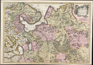
Nouvelle Carte Geographique du Grand Royaume de Moscovie Representant la Partie Septentrionale etc. Par Nicolas Visscher a Amsteldam avec Privilege des Etats Generaux.
sold
- Digital Map Information
- Suitable for large format printing
- Full resolution TIFF file
- ICC color profile embedded
- Delivered instantly via download link
This is a striking old color example of Elizabeth Verseyl Visscher's scarce c. 1709 map of Russia. Though bearing the imprint of Nicholas Visscher II (1649 - 1702), it was updated and issued by his widow, Verseyl Visscher, who managed the firm until her 1726 death. Under her guidance and in collaboration with Peter the Great's geographers, this, the most up-to-date map of the Russian Empire, was added to the Visscher oeuvre. (more details)
Early Woman Map Publisher.
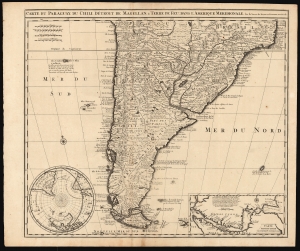
Carte du Paraguay, du Chili, Détroit de Magellan, et Terre de Feu dans l'Amerique Meridionale.
sold
- Digital Map Information
- Suitable for large format printing
- DPI: 600
- File Size: 64.4 MB
- File Type: ZIP / TIFF
- ICC color profile embedded
- Delivered instantly via download link
This is Elizabeth Verseyl Visscher's scarce, c. 1710 map of southern South America, based on the 1703 map by Guillaume De l'Isle. It is notable in particular for being the first published map to include a new, 1702 charting of the Strait of Magellan, which had been suppressed by the Chancellor of France, the Comte de Pontchartrain. (more details)
When the best authorities, aren't.
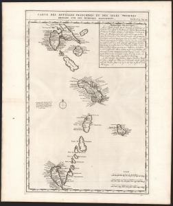
Carte des Antilles Françoises et des Isles Voisines Dressée sur des Memoires Manuscrits.
sold
- Digital Map Information
- Suitable for large format printing
- DPI: 600
- File Size: 31.15 MB
- File Type: ZIP / TIFF
- ICC color profile embedded
- Delivered instantly via download link
This is a superb example of Henri Chatelain's 1719 map of French Antilles, from Guadeloupe to Granada (the southernmost of the Leeward Islands) and the all the Windward Islands. (more details)
Presenting the East to an English Audience.
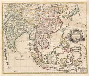
A New Map of India and China from the Latest Observations by I. Senex.
sold
- Digital Map Information
- Suitable for large format printing
- DPI: 600
- File Size: 65.27 MB
- File Type: ZIP / TIFF
- ICC color profile embedded
- Delivered instantly via download link
This is a scarce and elegant 1721 English map of Southeast Asia, the Far East, and the East Indies, drawn and engraved by John Senex. The map is dedicated to the British East Indian Company (EIC) and embraces its primary theaters of operation. At the time the EIC was the wealthiest company in the world and a dominant force in all British affairs, this making this map a subject of great interest to the British public. (more details)
'A towering landmark along the path of Western cartographic development' - Wheat
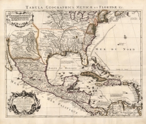
Carte du Mexique et de la Floride des Terres Angloises et des Isles Antilles... / Tabula Geographica Mexicae et Floridae etc.
sold
- Digital Map Information
- Suitable for large format printing
- Full resolution TIFF file
- ICC color profile embedded
- Delivered instantly via download link
This is the 1722 Covens and Mortier issue of Guillaume de L'Isle's groundbreaking map of North America, focusing on Mexico, the Mississippi watershed, and the West Indies. De L'Isle first published this map in 1703, at which point it was the most sophisticated map of the region obtainable: the first map to accurately denote the course of the Mississippi River, the first to accurately place the Great Lakes, and the first appearance on a map of updates from La Salle, Bienville, and D'Iberville. (more details)
'A towering landmark along the path of Western cartographic development' - Wheat
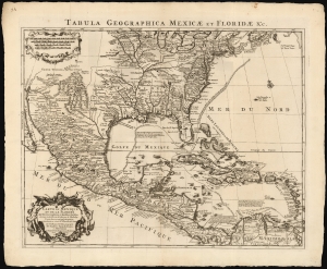
Carte du Mexique et de la Floride des Terres Angloises et des Isles Antilles... / Tabula Geographica Mexicae et Floridae etc.
sold
- Digital Map Information
- Suitable for large format printing
- DPI: 600
- File Size: 60.78 MB
- File Type: ZIP / TIFF
- ICC color profile embedded
- Delivered instantly via download link
This is the 1722 Covens and Mortier issue of Guillaume de L'Isle's groundbreaking map of North America, focusing on Mexico, the Mississippi watershed, and the West Indies. De L'Isle first published this map in 1703, at which point it was the most sophisticated map of the region obtainable: the first map to accurately denote the course of the Mississippi River, the first to accurately place the Great Lakes, and the first appearance on a map of updates from La Salle, Bienville, and D'Iberville. (more details)
The beginning of the Greek struggle for independence.
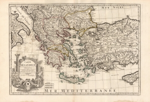
Carte De La Grece...
sold
- Digital Map Information
- Suitable for large format printing
- DPI: 600
- File Size: 86.2 MB
- File Type: ZIP / TIFF
- ICC color profile embedded
- Delivered instantly via download link
This is the 1745 Buache edition of Guillaume De l'Isle's 1707 map of Greece and the western part of Turkey. It presents the region at the beginning of a period of Greek revolts against Ottoman rule. (more details)
Thorough, early defense of the Sea of the West and the Northwest Passage.
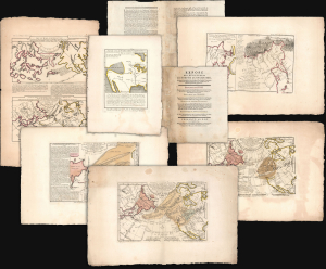
Exposé des Découvertes au Nord de la Grande Mer...
sold
- Digital Map Information
- Suitable for large format printing
- Full resolution TIFF file
- ICC color profile embedded
- Delivered instantly via download link
This is an extremely rare example of Philippe Buache's 1753 Exposé des Découvertes au Nord de la Grande Mer, the essential maps published to support the astonishing geographical theories of Philippe Buache and Joseph Nicolas De l'Isle, presented in August 1752 to the Paris Academie des Sciences. It was then the most complete cartographical defense of Nicolas De l'Isle's 'exposé' of Russian cartographic advances, along with Buache's synthesis of several mappings of the Pacific Northwest, revealing compelling (if ultimately false) evidence of a viable Northwest Passage. These maps were later included in the 1753-1755 Considérations Géographiques, 'the magnum opus of the Delisle-Buache theory of the layout of lands in the North Pacific space,' (Lada-Mocarski, 1969) appearing there in their second states. These six sheets are all first state examples, indicating that the Exposé enjoyed an earlier publication, spurred perhaps by the novelty of Buache and De l'Isle's arguments and the urgency with which the two geographers wished to assuage and rebut critics of their presentation to the Academie. (more details)