
Gerritsz, Hessel (sold)

Hessel Gerritsz (1581 – September 4, 1632) was a Dutch engraver, cartographer, and publisher active in Amsterdam during the late 16th and early 17th centuries, among the most preeminent Dutch geographers of the 17th century. He was born in Assum, a town in northern Holland in 1581. As a young man he relocated to Alkmaar to accept an apprenticeship with Willem Jansz Blaeu (1571-1638). He followed Blaeu to Amsterdam shortly afterwards. By 1610 he has his own press, but remained close to Blaeu, who published many of his maps. In October of 1617 he was appointed the first official cartographer of the Vereenigde Oost-Indische Compagnie (Dutch East Indian Company) or VOC. This strategic position offered him unprecedented access to the most advanced and far-reaching cartographic data of the Dutch Golden Age. Unlike many cartographers of his period, Gerritsz was more than a simple scholar and showed a true fascination with the world and eagerness to learn more of the world he was mapping in a practical manner. In 1628 he joined a voyage to the New World which resulted in the production of his seminal maps, published by Joannes de Laet in his 1630 Beschrijvinghe van West-Indien; these would be aggressively copied by both the Blaeu and Hondius houses, and long represented the standard followed in the mapping of the new world. Among his other prominent works are a world map of 1612, a 1613 map of Russia by the brilliant Russian prince Fyodor II Borisovich Godunov (1589 – 1605), a 1618 map of the pacific that includes the first mapping of Australia, and an influential 1630 map of Florida. Gerritsz died in 1632. His position with the VOC, along with many of his printing plates, were taken over by Willem Janszoon Blaeu.
Henry Hudson's Final Voyage.
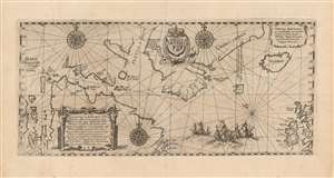
Tabula nautica, qua repraesentātur orae maritimae meatus, ac freta, noviter a H. Hudsono Anglo ad Caurum supra Novam Franciam indagata anno 1612.
sold
- Digital Map Information
- Suitable for large format printing
- Full resolution TIFF file
- ICC color profile embedded
- Delivered instantly via download link
This is Johann Theodore De Bry's 1613 edition of Hessel Gerritz' chart of the North Atlantic and the Canadian Maritimes, based on the reports of Henry Hudson's fourth, final voyage. Predated only by Gerritsz' much rarer 1612 issue, this is the first map of Hudson Bay and the surrounding region, and remained the best chart of the northern regions of Canada for decades. The chart reaches from the British Isles to the western shore of James Bay, extending from 50° - 70° N. (more details)
First authenticated European Contact with Australia; best Philippine Mapping to date.
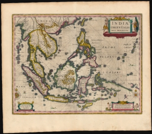
Indiae Orientalis Nova Descriptio.
sold
- Digital Map Information
- Suitable for large format printing
- Full resolution TIFF file
- ICC color profile embedded
- Delivered instantly via download link
This is a gorgeous, original color example of Jan Jansson's 1630 map of the East Indies - the first printed map to present Willem Janszoon's European 1606 contact with Australia. It also represents a milestone in the mapping of the Philippines, containing a markedly more precise depiction of the archipelago than any prior printed map. (more details)
Foundational map of the southernmost extent of the Americas.
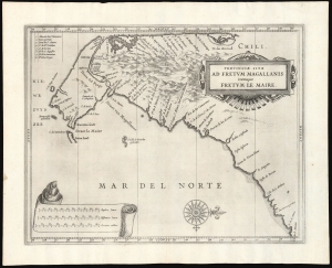
Provinciae Sitae Ad Fretum Magallanis itemque Fretum Le Maire.
sold
- Digital Map Information
- Suitable for large format printing
- DPI: 600
- File Size: 24.84 MB
- File Type: ZIP / TIFF
- ICC color profile embedded
- Delivered instantly via download link
This is Johannes de Laet's 1630 map of southern South America, from the southern bank of the Rio de la Plata in the north to Tierra del Fuego in the south. It was the work of the official chartmaker of the Dutch West India Company, Hessel Gerritsz; his was the best charting of the region available. It first appeared in De Laet's 1626 Beschrijvinghe van West-Indien with a Dutch title, Provincien van de Straet van Magallanes, ende vande Straet Le Maire. (The title and the labels for the three scales were altered on the copperplate for the 1633 Latin-text edition.) (more details)
State of the art of the mapping of Peru.
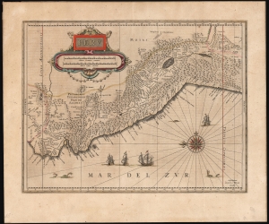
Peru.
sold
- Digital Map Information
- Suitable for large format printing
- Full resolution TIFF file
- ICC color profile embedded
- Delivered instantly via download link
This is Willem Blaeu's beautiful 1630 map of Peru. It is among the first maps included in Blaeu's Appendix, being one of the plates Blaeu purchased from Jodocus Hondius in 1629. (more details)
Early Appendix Issue.
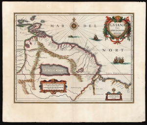
Guiana sive Amazonum Regio.
sold
- Digital Map Information
- Suitable for large format printing
- Full resolution TIFF file
- ICC color profile embedded
- Delivered instantly via download link
This is an early, 1631 example of Willem Blaeu's map of Guiana, displaying the northeastern parts of South America, Lake Parima (Parime Lacus), and the route to El Dorado. Blaeu acquired the plate from his competitor Jodocus Hondius, but the map's geographical information is the work of neither of them. It was initially drawn by Dutch cartographer Hessel Gerritz, who produced the map on the strength of his 1628/29 voyage to Brazil and the Caribbean. This would be among the maps Gerritz contributed to Joannes de Laet’s Beschrijvinghe van West-Indiën first published in 1625. The map covers from Isla Margarita and the Orinoco Delta eastward as far as Tampico and southwards as far as the Amazon River. (more details)
Scarce map of Russia reflecting the work of the short lived but promising Tzar and boy genius, Fyodor II Borisovich Godunov.
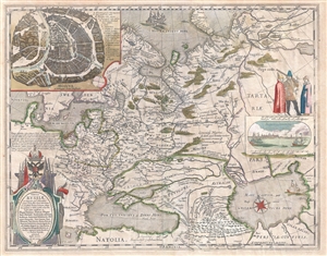
Tabula Russiae ex autographo, quod delineandum curavit Foedor filius Tzaris Boris desumta ... Magno domino, Tzari et magno duci Michäeli Foedrowits omnium Russorum, autocratori ... dedicata ab Hesselo Gerardo.
sold
- Digital Map Information
- Suitable for large format printing
- DPI: 300
- File Size: 14.17 MB
- File Type: ZIP / TIFF
- ICC color profile embedded
- Delivered instantly via download link
A very attractive 1632 old color example of Hessel Gerritsz's important map of Russia. Centered on Moscow, the map covers from the North Sea to the Caspian Sea and from Nova Zembla to Trabzon (Black Sea south coast). There is a large and impressive inset map of ... (more details)
Previously suppressed new cartography for Australia and the Philippines.
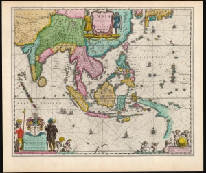
India quae Orientalis dicitur, et Insulae Adiacentes.
sold
- Digital Map Information
- Suitable for large format printing
- Full resolution TIFF file
- ICC color profile embedded
- Delivered instantly via download link
This is a sumptuous example of Willem Blaeu's 1635/1642 map of India, Southeast Asia, China, the Philippines, and Japan - including new information on the Philippines and Austraila. It is also among the earliest maps to depict the Philippine archipelago with any degree of precision. The map's cartographic content was engraved (probably in 1630 but as late as 1632) by Hessel Gerritsz, Blaeu's predecessor as official chartmaker for the Dutch East India Company, thus many of its features were previously suppressed, seeing public print first in this Blaeu edition. (more details)
First Dutch Atlas Map of North America.
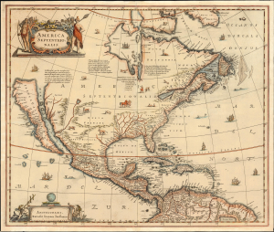
America Septentrionalis.
sold
- Digital Map Information
- Suitable for large format printing
- File Size: 25.59 MB
- File Type: ZIP / TIFF
- ICC color profile embedded
- Delivered instantly via download link
This is Jan Jansson's 1636 map of North America, the first Dutch folio map to focus on North America, featuring abundant cartographic firsts. It is the first general Dutch map of North America to depict a Great Lake connected to the St. Lawrence, and the first obtainable Dutch atlas map of North America to embrace the theory of Insular California. Map historian Carl Wheat considered the many accurate depictions of America's fauna on the map to 'represent its most authentic information, so far as what is now the western United States is concerned'. (more details)
One of the Earliest Colonial Maps of the North American East Coast.
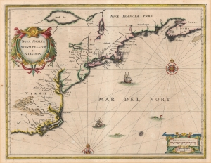
Nova Anglia Novum Belgium et Virginia.
sold
- Digital Map Information
- Suitable for large format printing
- Full resolution TIFF file
- ICC color profile embedded
- Delivered instantly via download link
A beautiful, original color example of Jan Jansson's 1636 map of the North American coastline from Cape Lookout (here identified as C. of Feare) to Nova Scotia. It offers some of the earliest depictions of the Chesapeake Bay, Delaware Bay, Manhattan Island, New Amsterdam, Long Island, and the Great Lakes. It is also among the first maps to accurately portray the position of Bermuda vis-a-vis the American coastline. (more details)
One of the Earliest Colonial Maps of the North American East Coast.
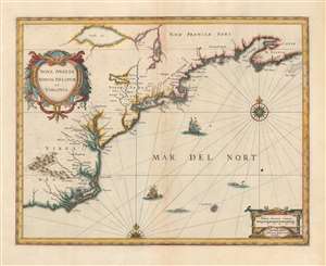
Nova Anglia Novum Belgium et Virginia.
sold
- Digital Map Information
- Suitable for large format printing
- Full resolution TIFF file
- ICC color profile embedded
- Delivered instantly via download link
A beautiful first state example of Jan Jansson's 1636 map of the North American coastline from Cape Lookout (here identified as C. of Feare) to Nova Scotia. The map includes parts of modern-day North Carolina, Virginia, Maryland, Delaware, New York, New Jersey, Massachusetts, Connecticut, Rhode Island, Vermont, New Hampshire, Maine, and Nova Scotia. Most particularly, it offers some of the earliest depictions of the Chesapeake Bay, Delaware Bay, Manhattan Island, New Amsterdam, Long Island, and the Great Lakes. It is also among the first maps to accurately portray the position of Bermuda vis-a-vis the American coastline. (more details)
Superb example of a classic map.
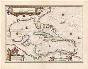
Insulae Americanae in Oceano Septentrionali cum Terris adiacentibus.
sold
- Digital Map Information
- Suitable for large format printing
- Full resolution TIFF file
- ICC color profile embedded
- Delivered instantly via download link
This is a beautiful 1638 example of Willem Blaeu's 1634 map of the Caribbean Islands and the adjacent coastlines of North and South America. Both geographically and aesthetically this map set the standard for the mapping of this region: more than a dozen maps of the region produced later in the 17th century would copy this map, some to the extent of reproducing the title. Blaeu based this work both on his own West Indische Paskaert and Hessel Gerritsz' unacquirably rare and unassailably authoritative De Eylanden Ende Vastelanden Van Westindien op de Noordzee of 1631. The map thus reflects those geographers' commanding knowledge of the Caribbean and the Gulf Coast. (more details)
Classic Dutch Map of the Caribbean.
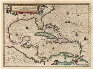
Insulae Americanae in Oceano Septentrionali cum Terris adiacentibus.
sold
- Digital Map Information
- Suitable for large format printing
- Full resolution TIFF file
- ICC color profile embedded
- Delivered instantly via download link
This is a beautiful 1638 example of Jan Jansson's 1636 map of the Caribbean Islands and the adjacent coastlines of North and South America. This is among the most beautiful maps of the region produced in the first half of the 17th century. Moreover, the present example is in superb condition with gorgeous, bright original color. (more details)
Superb example of a classic map.
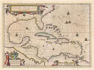
Insulae Americanae in Oceano Septentrionali cum Terris adiacentibus.
sold
- Digital Map Information
- Suitable for large format printing
- DPI: 600
- File Size: 49.15 MB
- File Type: ZIP / TIFF
- ICC color profile embedded
- Delivered instantly via download link
This is a beautiful 1640 example of Willem Blaeu's 1634 map of the Caribbean Islands and the adjacent coastlines of North and South America. Both geographically and aesthetically this map set the standard for the mapping of this region: more than a dozen maps of the region produced later in the 17th century would copy this map, some to the extent of reproducing the title. Blaeu based this work both on his own West Indische Paskaert and Hessel Gerritsz' unacquirably rare and unassailably authoritative De Eylanden Ende Vastelanden Van Westindien op de Noordzee of 1631. The map thus reflects those geographers' commanding knowledge of the Caribbean and the Gulf Coast. (more details)
First Latin edition of a classic map.
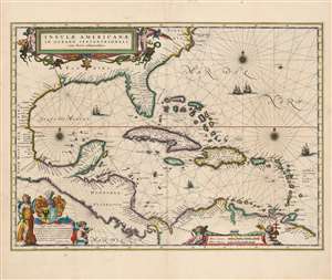
Insulae Americanae in Oceano Septentrionali cum Terris adiacentibus.
sold
- Digital Map Information
- Suitable for large format printing
- Full resolution TIFF file
- ICC color profile embedded
- Delivered instantly via download link
This is a beautiful 1635 example of Willem Blaeu's 1634 map of the Caribbean Islands and the adjacent coastlines of North and South America: this was the first Latin edition of the map to appear in the Blaeu atlas. Both geographically and aesthetically, this map set the standard for the mapping of this region: more than a dozen maps of the region produced later in the 17th century would copy this map, some to the extent of reproducing the title. Blaeu based this work both on his own West Indische Paskaert and Hessel Gerritsz' unacquirably rare and unassailably authoritative De Eylanden Ende Vastelanden Van Westindien op de Noordzee of 1631. The map thus reflects those geographers' commanding knowledge of the Caribbean and the Gulf Coast. (more details)
The most beautiful example of Blaeu's city map of Moscow.
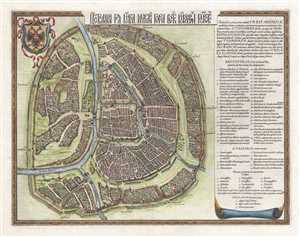
Царствающои град Москва началнои город всех московских государствах. / Carstvajuščoi grad Moskva načalo I gorod všeh Moskovech I carstvach. Urbis Moskvae.
sold
- Digital Map Information
- Suitable for large format printing
- DPI: 300
- File Size: 10.89 MB
- File Type: ZIP / TIFF
- ICC color profile embedded
- Delivered instantly via download link
This is a 1642 Hessel Gerritsz city map or plan of Moscow, Russia. With the Kremlin at its center, the map depicts the city from the city from the Moscow River to Zemlyanoy Gorod, which is surrounded by ramparts and a moat. This historical district in Moscow ... (more details)
A beautiful example of a plan of Moscow's 'fortress'.
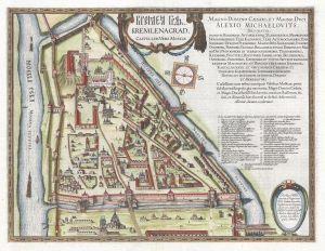
КРЕМЛЁН ГРАД. / Kremlenagrad, Castellum Urbis Moskvæ.
sold
- Digital Map Information
- Suitable for large format printing
- DPI: 300
- File Size: 11.39 MB
- File Type: ZIP / TIFF
- ICC color profile embedded
- Delivered instantly via download link
This is a 1642 Hessel Gerritsz map of the Kremlin, Moscow, Russia. (more details)
One of the most beautifully engraved maps of the West Indies.
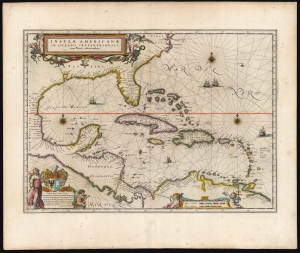
Insulae Americanae in Oceano Septentrionali cum Terris adiacentibus.
sold
- Digital Map Information
- Suitable for large format printing
- Full resolution TIFF file
- ICC color profile embedded
- Delivered instantly via download link
This is a superb 1643 example of Willem Blaeu's 1634 map of the Caribbean Islands in gorgeous original color. Both geographically and aesthetically, this map set the standard for the mapping of this region: more than a dozen maps produced later in the 17th century derived form this map, some to the extent of reproducing the title. Blaeu based this work both on his own West Indische Paskaert and Hessel Gerritsz' unacquirably rare and unassailably authoritative 1631 De Eylanden Ende Vastelanden Van Westindien op de Noordzee. The map thus reflects those geographers' commanding knowledge of the Caribbean and the Gulf Coast. (more details)
First Dutch Atlas Map of North America.
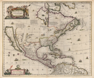
America Septentrionalis.
sold
- Digital Map Information
- Suitable for large format printing
- Full resolution TIFF file
- ICC color profile embedded
- Delivered instantly via download link
This is a beautiful old-color example of Jan Jansson's 1636 map of North America. It is the first folio map to focus on North America specifically after De Jode's 1593 map, and as such features several cartographic primacies. It is the first general Dutch map of North America to depict a Great Lake connected to the St. Lawrence, and the first obtainable Dutch atlas map of North America to embrace the theory of Insular California. Map historian Carl Wheat considered the many accurate depictions of America's fauna on the map to 'represent its most authentic information, so far as what is now western United States is concerned'. (more details)
A scarce and elegant map showing the route to the Spice Islands and an early glimpse of Australia.
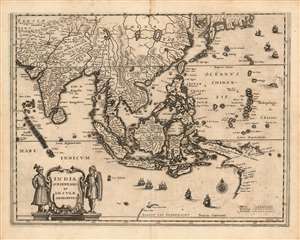
India Orientalis et Insulae Adiecentes.
sold
- Digital Map Information
- Suitable for large format printing
- DPI: 600
- File Size: 11.33 MB
- File Type: ZIP / TIFF
- ICC color profile embedded
- Delivered instantly via download link
This is a scarce 1638 Matthais Merian map of India, Southeast Asia, China, and Japan, including some of the earliest mapped portions of Australia. The map is beautifully engraved, decorated with nine sailing ships, a sea monster, and an elegant compass rose; the title cartouche is flanked by soldiers in Mogul garb. The mapping of India appears to be largely consistent with that of Linschoten. The Philippines are shown in sharp detail, albeit exaggerated in size. New Guinea is shown according to Le Maire's charting. (more details)
Enriched Dutch Map of Magellanica.
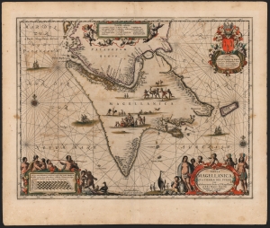
Tabula Magellanica qua Tierrae del Fuego et I. Le Maire detectis Novissima et accuratissima descriptio exhibetur.
sold
- Digital Map Information
- Suitable for large format printing
- DPI: 600
- File Size: 56.62 MB
- File Type: ZIP / TIFF
- ICC color profile embedded
- Delivered instantly via download link
This is an example of the most beautifully engraved 17th century map of Tierra del Fuego, engraved by Jan Jansson for inclusion in his atlases in 1646. It is the third map in the Hondius-Janssonius atlases to focus on this region, and was added to bring Jansson's mapping of the southernmost part of America up to date. The present depiction is the result of over a century of exploration, revealing the discoveries of Magellan, Le Maire and Schouten, and finally the voyage made by Jacques l'Hermite with the so-called Nassau Fleet between 1623 and 1624. (more details)
First Printed Dutch Chart of the Pacific.
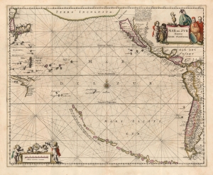
Mar del Zur Hispanis Mare Pacificum.
sold
- Digital Map Information
- Suitable for large format printing
- Full resolution TIFF file
- ICC color profile embedded
- Delivered instantly via download link
This is a superb example of Jan Jansson's 1650 map of the Pacific Ocean. It appeared in the 5th volume of Jansson's Atlas Novus, which focused on the world's oceans and can be construed as the first sea atlas intended for a general audience. It is the first chart of the Pacific to appear in a Dutch atlas and the first printed chart of the Pacific to depict California as an island. Striking, speculative cartography appears throughout, including an insular California and an insular Korea. It also includes a mysterious but expansive South Sea archipelago associated with the elusive Spanish explorer Hernán Gallego. (more details)
The hunt for El Dorado.
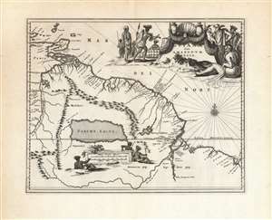
Guiana sive Amazonum Regio.
sold
- Digital Map Information
- Suitable for large format printing
- DPI: 600
- File Size: 35.21 MB
- File Type: ZIP / TIFF
- ICC color profile embedded
- Delivered instantly via download link
This beautiful engraving is a 1673 Arnold Montanus map of the northwestern parts of South America, including Lake Parima (Parime Lacus), revealing the hoped-for route to El Dorado. Coverage embraces from Isla Margarita and the Orinoco Delta eastward as far as Tampico and southwards as far as the Amazon River. Geographically, the map is a faithful copy of a map of the same title engraved by Jodocus Hondius Jr. in 1629, and published by the Blaeu and Hondius firms throughout the 17th century. This whole lineage of maps derives from Hessel Gerritz' seminal Guaiana ofte de Provincien tusschen Rio de las Amazonas ende Rio de Yuiapari ofte Orinoque, a map based equally on Gerritz' own travels to the West Indies and the firm belief of travelers and geographers alike in the existence of El Dorado. This example appeared in Montanus' 1673 Unbekannte Neue Welt, having been engraved by Montanus for John Ogilby's America in 1671 (there is no alteration to the plate between these two issues, and no clear distinction to be made between them). (more details)
Most Visually Engaging Seventeenth Century Map of Russia.
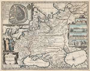
A Map of Russia.
sold
- Digital Map Information
- Suitable for large format printing
- DPI: 600
- File Size: 65.3 MB
- File Type: ZIP / TIFF
- ICC color profile embedded
- Delivered instantly via download link
This is John Speed's scarce 1676 map of Russia, one of the first English maps of Russia and certainly the most decorative. The map is scarce, having appeared only in the latter, Basset and Chiswell edition of the Speed atlas. Centered on Moscow, the map covers from the North Sea to the Caspian Sea and from Nova Zembla to Trabzon (Black Sea south coast). There is a large and impressive inset map of Moscow: this is centered on the Kremlin, Belygorod, and the Kityagorod. Five inset views depict the Emperor's Court in the Kremlin, the vital port of Archangel, the Russian fort at Narva (in modern Estonia and a crucial stronghold on Russia’s western border), bathhouses and a mill. Above the cartouche are figures dressed in 'The Habit of Russians,' one of whom carries the Russian coat of arms. (more details)
Featuring a mighty sea battle!
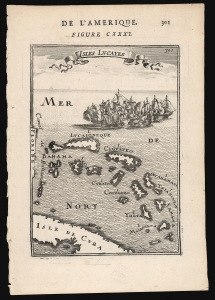
Isles Lucayes.
sold
- Digital Map Information
- Suitable for large format printing
- DPI: 600
- File Size: 6.07 MB
- File Type: ZIP / TIFF
- ICC color profile embedded
- Delivered instantly via download link
This is a 1683 Alain Manesson Mallet map of the Bahamas: one of the earliest maps to focus on the archipelago. The map pictures the islands separated from Florida by the 'Canal de Bahama', and with part of the island of Cuba marking the map's southern extreme. The islands are presented and named after the c.1631 chart of the Dutch Hessel Gerritsz, whose depiction of the Caribbean provided the main model for the region followed by virtually every cartographer of the 17th century.
The engraving is attractively done: the plate is topped with a flowing title banner, and is decorated with a mighty sea battle: after all, the Canal de Bahama was the safe passage out of the Gulf of Mexico used by the Spanish treasure fleets, and the Bahamas provided Dutch, English and French pirates ample safe harbor in which to lie in wait for the fat Spanish galleons. (more details)
The engraving is attractively done: the plate is topped with a flowing title banner, and is decorated with a mighty sea battle: after all, the Canal de Bahama was the safe passage out of the Gulf of Mexico used by the Spanish treasure fleets, and the Bahamas provided Dutch, English and French pirates ample safe harbor in which to lie in wait for the fat Spanish galleons. (more details)