
Topographical Engineers, Army Corps of (sold)

Army Corps of Topographical Engineers (fl.1838 - 1863) refers to the an elite branch of the U.S. Army created on July 4, 1838 to perform civil mapping and survey work throughout the United States. The origins of the Corps of Topographical Engineers can be traced back to the American Revolutionary War, where General George Washington recognized the need for accurate surveys pursuant to military action. Shortly following the war, in 1779, a civilian engineering corps was created by act of Congress. Identified in 1802 by Thomas Jefferson, the "Corps of Engineers," which was based at West Point, the group participated in the War of 1812 and in later in the fortification of New Orleans. It was not until 1838, however, that a separate group of "Topographical Engineers" was formally recognized. This elite group, consisting only of officers, most of whom were trained in surveying and engineering by the esteemed Andrew Ellicott at West Point, never numbered more than 36 individuals - the best and brightest. This small but determined group played a central role in the mapping and exploration of the American West. Few branches of the military can boast such a distinguished alumni. Their names resonate throughout the map of the west and include John Charles Fremont, Zebulon Pike, George Meade, Kemble Warren, William Amiel Weeks, A. B. Gray, Randolph B. Marcy, James H. Simpson, Howard Stansbury, John W. Gunnison, William Ludlow, and Robert S. Williamson. The onset of the American Civil War brought an abrupt end to the surveying activity of the Topographical Engineers. Many of the most prominent engineers went on to distinguished military careers on both sides of the War Between the States. The Army Corps of Topographical Engineers itself was folded into the Corps of Engineers on March 31, 1863. Though the Army Corps of Engineers continues to do military and civil survey work to this day, the elite club of adventures that formed the Topographical Engineers were no more.
Used by Henry David Thoreau when writing 'Cape Cod.'
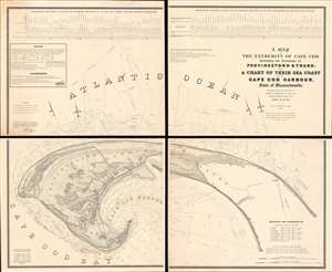
A Map of the Extremity of Cape Cod Including the Townships of Provincetown and Truro: A Chart of Their Sea Coast and of Cape Cod Harbour, State of Massachusetts.
sold
- Digital Map Information
- Suitable for large format printing
- Full resolution TIFF file
- ICC color profile embedded
- Delivered instantly via download link
An exceptional discovery, this is James Duncan Graham's wall map of Provincetown at the tip of Cape Cod. At the time of issue, and for a long time afterwards, this was the definitive map of the Provincetown area and the surrounding waters, said to have been used by, among many others, Henry David Thoreau when writing Cape Cod. The map was produced to
aid in the projection of the works for the military defenses of the important harbor formed by the peculiar spiral termination of [Cape Cod], and also to aid our ships of war and other vessels in entering it with safety after making this prominent headland. (Congressional Report, 25th Congress, Second Session, p. 3).(more details)
The first scientific mapping of the entire region based on actual observation. - Martin and Martin
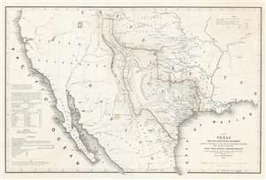
Map of Texas and the Countries Adjacent: Compiled in the Bureau of the Corps of Topographical Engineers; From The Best Authorities, for the State Department, Under the Direction of Colonel J. J. Abert, Chief of the Corps; by W. H. Emory, 1St. Lieut. T.E.
sold
- Digital Map Information
- Suitable for large format printing
- DPI: 600
- File Size: 28.42 MB
- File Type: ZIP / TIFF
- ICC color profile embedded
- Delivered instantly via download link
A seminal production, this 1844 large-format edition map of the Republic of Texas by the U.S. Topographical Engineer, W. H. Emory, is the most important pre-war map of Texas. Centered on the vast claims of the Republic of Texas, Emory's map offers expansive coverages extending from the Pacific to west Florida and from South Pass (modern day Wyoming) to Tampico, Mexico. This map is significant on a number of levels. First, it is the first scientifically surveyed map of the Texas region. Second, it serves as the official U.S. acknowledgement of the full territorial claims of the Republic of Texas. Third, it is a vital reconnaissance of the Texas region in anticipation of the breakout of the Mexican-American War (1846 - 1848). Fourth, it establishes the Texas claims that would be fought over during the Mexican-American War. Fifth and finally, it lays down the Texas borders that would later be copied by Disturnell in his 'Treaty Map' of 1847, formalizing the U.S-Mexican border. (more details)
The first scientific mapping of the entire region
based on actual observation. - Martin and Martin
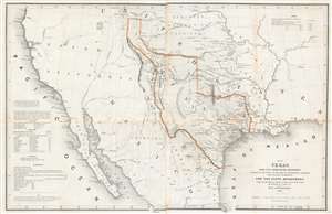
Map of Texas and the Countries Adjacent: Compiled in the Bureau of the Corps of Topographical Engineers; From The Best Authorities, for the State Department, Under the Direction of Colonel J. J. Albert, Chief of the Corps; by W. H. Emory, 1St. Lieut. T.E.
sold
- Digital Map Information
- Suitable for large format printing
- DPI: 600
- File Size: 29.71 MB
- File Type: ZIP / TIFF
- ICC color profile embedded
- Delivered instantly via download link
A seminal production, this 1844 large-format edition map of the Republic of Texas by the U.S. Topographical Engineer, W. H. Emory, is the most important pre-war map of Texas. Centered on the vast claims of the Republic of Texas, Emory's map offers expansive coverage extending from the Pacific to west Florida and from South Pass (modern day Wyoming) to Tampico, Mexico. This map is significant on a number of levels. First, it is the first scientifically surveyed map of the Texas region. Second, it serves as the official U.S. acknowledgement of the full territorial claims of the Republic of Texas. Third, it is a vital reconnaissance of the Texas region in anticipation of the breakout of the Mexican-American War (1846 - 1848). Fourth, it establishes the Texas claims that would be fought over during the Mexican-American War. Fifth and finally, it lays down the Texas borders that would later be copied by Disturnell in his 'Treaty Map' of 1847, formalizing the U.S-Mexican border. (more details)
The most important map of Florida, issued 1 year after statehood at the end of the Second Seminole War.
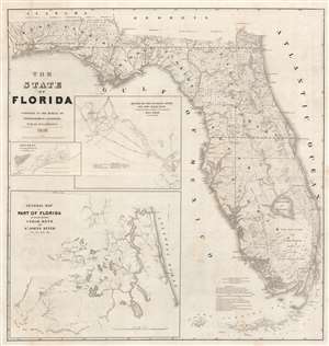
The State of Florida.
sold
- Digital Map Information
- Suitable for large format printing
- Full resolution TIFF file
- ICC color profile embedded
- Delivered instantly via download link
The first official map of the State of Florida, this spectacular production was issued in 1846, on year after statehood and at the end of the Second Seminole War, by the Army Bureau of Topographical Engineers. The map was drawn by Joseph Goldsborough Bruff, an adventurer, playboy, and civilian contractor working with the Topographical Engineers. It illustrates the state of the Florida survey as of 1846, as well as major events, routes, and settlements associated with the First and Second Seminole Wars. Moreover, the map includes holdover grants from the Spanish era, including Arredondo's Grant and Forbes' Purchase. With unsurpassed detail and scale, this map became the foundational map for most subsequent maps of Florida through the end of the 19th century. (more details)
The most important map of Florida, issued 1 year after statehood at the end of the Second Seminole War.
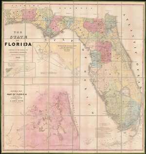
The State of Florida.
sold
- Digital Map Information
- Suitable for large format printing
- DPI: 600
- File Size: 81.56 MB
- File Type: ZIP / TIFF
- ICC color profile embedded
- Delivered instantly via download link
The first official map of the State of Florida, this spectacular production was issued in 1846, on year after statehood and at the end of the Second Seminole War, by the Army Bureau of Topographical Engineers. Here the map is presented in deluxe full color format, dissected and mounted on linen. The map was drawn by Joseph Goldsborough Bruff, an adventurer, playboy, and civilian contractor working with the Topographical Engineers. It illustrates the state of the Florida survey as of 1846, as well as major events, routes, and settlements associated with the First and Second Seminole Wars. Moreover, the map includes holdover grants from the Spanish era, including Arredondo's Grant and Forbes' Purchase. With unsurpassed detail and scale, this map became the foundational map for most subsequent maps of Florida through the end of the 19th century. (more details)
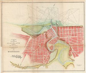
Survey of the Harbor of Cleveland Ohio.
sold
- Digital Map Information
- Suitable for large format printing
- File Size: 10.1 MB
- File Type: ZIP / TIFF
- ICC color profile embedded
- Delivered instantly via download link
This is an uncommon example of the Howard Stansbury's 1853 topographical survey map of the Cleveland Harbor, Ohio. The map covers the city of Cleveland from Monroe Street (Monroe Ave) to Front Street (Front Ave) and shows soundings in feet. The Army Corps of ... (more details)
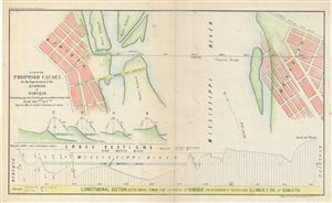
Plan of the Proposed Causey. For the Improvement of the Harbor of Dubuque.
sold
- Digital Map Information
- Suitable for large format printing
- File Size: 3.53 MB
- File Type: ZIP / TIFF
- ICC color profile embedded
- Delivered instantly via download link
This is an uncommon example of the 1855 Corps of Topographical engineers map illustrating the proposed causey (route) at Dubuque Harbor, Iowa. The map covers from Dubuque to Dunleith across the Mississippi River and features a longitudinal section extending ... (more details)
One of the most interesting maps to show expeditions into our chosen area...' - Wheat
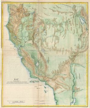
Map Showing the different routes travelled over by the Detachments of the overland Command in the Spring of 1855 from Salt Lake City, Utah to the Bay of San Francisco.
sold
- Digital Map Information
- Suitable for large format printing
- File Size: 14.24 MB
- File Type: ZIP / TIFF
- ICC color profile embedded
- Delivered instantly via download link
This is a beautiful example of the 1855 War Department map of Salt Lake City, Utah to San Francisco Bay, California. The map covers the Great Basin to illustrate the routes traveled by Colonel e. J. Steptoe, Captain Rufus Ingalls and Lieutenant Sylvester ... (more details)
Rare Civil War map of the Battle of Vicksburgh from Spangenberg manuscript.
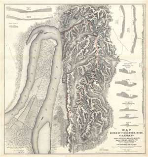
Map of the Siege of Vicksburg, Miss. By the U.S. Forces Under the Command of Genl. U.S. Grant, U.S. Vls. Maj. F.E. Prime, Chief Engr. Surveyed and constructed under the direction of Capt. C.B. Comstock, U.S. Engr.s and Lt. Col. Js. H. Wilson . . . Drawn by Chs. Spangenberg.
sold
- Digital Map Information
- Suitable for large format printing
- File Size: 36.14 MB
- File Type: ZIP / TIFF
- ICC color profile embedded
- Delivered instantly via download link
This is a rare c. 1863 separate issue Charles Spangenberg Civil War map of the Siege of Vicksburg (May 18, 1863 - July 4, 1863). This map, considered one of the most attractive Civil War maps, is based upon a manuscript map drawn by military engineer ... (more details)
Rare Civil War map of the Battle of Vicksburgh from Spangenberg manuscript.
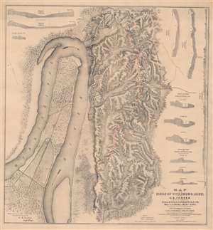
Map of the Siege of Vicksburg, Miss. By the U.S. Forces Under the Command of Genl. U.S. Grant, U.S. Vls. Maj. F.E. Prime, Chief Engr. Surveyed and constructed under the direction of Capt. C.B. Comstock, U.S. Engr.s and Lt. Col. Js. H. Wilson . . . Drawn by Chs. Spangenberg.
sold
- Digital Map Information
- Suitable for large format printing
- File Size: 67.43 MB
- File Type: ZIP / TIFF
- ICC color profile embedded
- Delivered instantly via download link
This is a rare c. 1863 separate issue Charles Spangenberg Civil War map of the Siege of Vicksburg (May 18, 1863 - July 4, 1863). This map, considered one of the most attractive Civil War maps, is based upon a manuscript map drawn by military engineer Charles Spangenberg shortly after the siege. It covers Vicksburg and the surrounding hills as well as the full bend of the Mississippi River. To the right of the map there are various cross sections illustrating the Confederate and Union fortifications. (more details)
Cavalry field map for the Atlanta Campaign of the American Civil War.
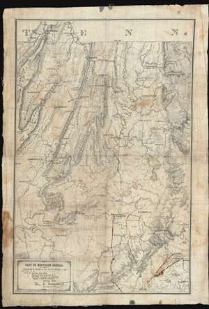
Map of Northern Georgia.
sold
- Digital Map Information
- Suitable for large format printing
- File Size: 32.27 MB
- File Type: ZIP / TIFF
- ICC color profile embedded
- Delivered instantly via download link
'Printed in the Field, Chattanooga, Tenn.', this map of northwestern Georgia is a remarkable artifact of the American Civil War (1861 - 1864) issued by William E. Merrill and William C. Margendant days before the launching of the Atlanta Campaign (May 7, 1863 - Sep 2, 1864). Printed on muslin specifically for Union Calvary officers, this map covers the northeastern part of Georgia, from Chattanooga and the Tennessee border south as far as Dallas and east to include Kennesaw. There can be little doubt that this map saw action in the field, with period manuscript annotations marking routes after May 17th, when Sherman split Union forces south of Adairsville into three separate armies headed by Maj. Generals John Schofield, George H. Thomas, and James B. McPherson. (more details)
The map that precipitated the slaughter of Col. Custer at Little Big Horn.
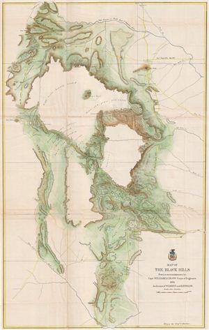
Map of the Black Hills From a reconnaissance by Capt. William Ludlow Corps of Engineers, 1874 And maps of Warren and Raynolds.
sold
- Digital Map Information
- Suitable for large format printing
- File Size: 28.49 MB
- File Type: ZIP / TIFF
- ICC color profile embedded
- Delivered instantly via download link
George Armstrong Custer and William Ludlow's seminal 1874 map of the Black Hills, Dakota Territory, covering from the Missouri to the Powder River and from the 47th to the 43rd parallel. In 1874 one thousand cavalrymen under the command of Lt. Col. ... (more details)
The map that precipitated the slaughter of Col. Custer at Little Big Horn. 'A most interesting map' - Wheat
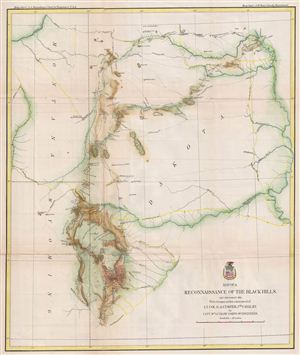
Map of a Reconnaissance of the Black Hills, July and August, 1874, with troops under the command of Lt. Col. G. A. Custer, 7th Cavalry.
sold
- Digital Map Information
- Suitable for large format printing
- File Size: 13.36 MB
- File Type: ZIP / TIFF
- ICC color profile embedded
- Delivered instantly via download link
George Armstrong Custer and William Ludlow's seminal 1874 map of the Black Hills, Dakota Territory, covering from the Missouri to the Powder River and from the 47th to the 43rd parallel. In 1874 one thousand cavalrymen under the command of Lt. Col. ... (more details)
The map that precipitated the slaughter of Col. Custer at Little Big Horn.
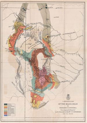
A Geological Map of the Black Hills.
sold
- Digital Map Information
- Suitable for large format printing
- File Size: 13.62 MB
- File Type: ZIP / TIFF
- ICC color profile embedded
- Delivered instantly via download link
This is a rare example of the 1875 geological map of the Black Hills, South Dakota prepared for the official report on the Custer expedition of 1874. Centered on Harney's Peak, the highest point in the Black Hills, the map covers from Slave Butte ... (more details)
Map of Ludlow and Custer's reconnaissance of South Dakota's Black Hills in search of Gold.

Map of a Reconnaissance of the Black Hills, July and August, 1874, With troops under command of Lt. Col. G. A. Custer, 7th Cavalry, by Capt. Wm Ludlow Corps of Engineers.
sold
- Digital Map Information
- Suitable for large format printing
- File Size: 10.41 MB
- File Type: ZIP / TIFF
- ICC color profile embedded
- Delivered instantly via download link
George Armstrong Custer and William Ludlow's seminal 1874 map of the Black Hills, Dakota Territory, covering from the Missouri to the Powder River and from the 47th to the 43rd parallel. In 1874 one thousand cavalrymen under the command of Lt. ... (more details)
Evolution of the National Mall.
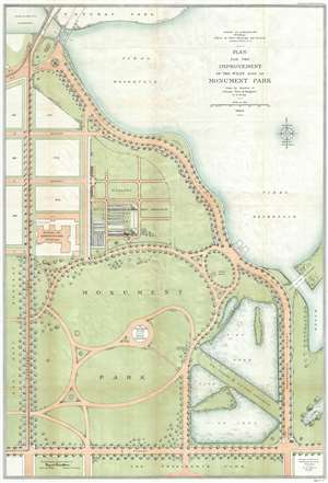
Plan for the Improvement of the West Side of Monument Park.
sold
- Digital Map Information
- Suitable for large format printing
- File Size: 17.94 MB
- File Type: ZIP / TIFF
- ICC color profile embedded
- Delivered instantly via download link
This is a 1902-04 U.S. Army Corps of Engineers map of Monument Park, the National Mall, Washington D.C. This map was issued to address draining issues of drainage - note the large fishponds in the lower right. Centered on the Washington Monument and oriented to the south, with north at the bottom, the map depicts from the President's Park at the bottom to the tidal reservoir, the Maryland Avenue Bridge and Potomac Park at the top, and from Fourteenth Street to Seventeenth Street and the tidal basin on the right. Above Memorial Park and the Washington Monument, B, C, and D Streets are depicted as well as several city blocks. The Bureau of Engraving and Printing is identified, as well as the Nursery of the Office of Public Buildings and Grounds. To the right of Monument Park, two fishponds are illustrated, which, per the map, were part of the U.S. Fish Commission. To the left of Monument Park, across Fourteenth Street, lies the grounds of the Agriculture Department. (more details)
West Point Military Academy and more.
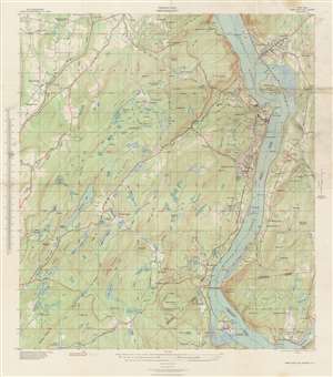
Terrain Map. New York West Point and Vicinity.
sold
- Digital Map Information
- Suitable for large format printing
- File Size: 49.08 MB
- File Type: ZIP / TIFF
- ICC color profile embedded
- Delivered instantly via download link
This is a 1939 U.S. Army Corps of Engineers’ terrain or topographical map of West Point and vicinity, New York. The map depicts the area from Storm King Mountain in Cornwall, along the Hudson River, south as far as Iona Island near Stony Point, and from Houghton Farm east to Forsonville. Details pertaining to the region's terrain, including important roads, camps, military reservations, hills, lakes, and a host of additional features, appear throughout. (more details)