
1818 Pinkerton Map of the East Indies and Southeast Asia (Singapore, Borneo, Java, Sumatra, Thailand
One of the most beautiful maps of the East Indies to appear in the 19th century.
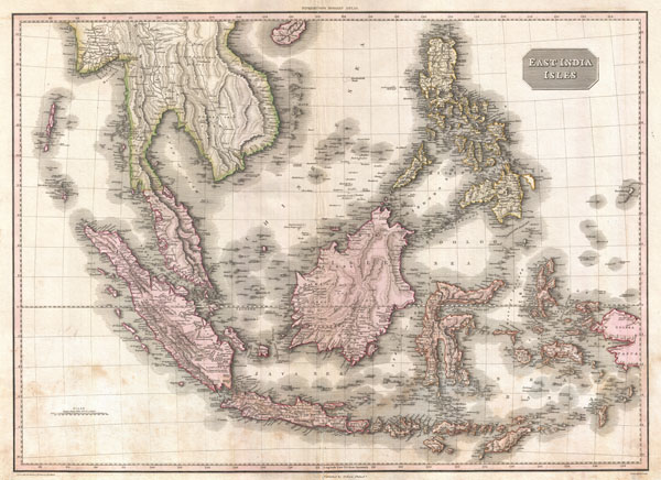
East India Isles.
sold
- Digital Map Information
- Suitable for large format printing
- DPI: 300
- File Size: 23.62 MB
- File Type: ZIP / TIFF
- ICC color profile embedded
- Delivered instantly via download link
Truly a masterwork of copperplate engraving, this is Pinkerton's extraordinary 1818 map of the East Indies. Covers from Burma south to Java and from the Andaman Islands eastward as far as the Philippines and New Guinea. Includes the entire Malay Peninsula, much ... (more details)

Johnson's Kentucky and Tennessee.
sold
- Digital Map Information
- Suitable for large format printing
- File Size: 18.93 MB
- File Type: ZIP / TIFF
- ICC color profile embedded
- Delivered instantly via download link
A beautiful example of A. J. Johnson's 1866 map of Kentucky and Tennessee. Represents Johnson's third iteration of this map, which he updated in 1865 to reflect changes to these secessionist states following the American Civil War. Map shows both states in full ... (more details)
One of the first complete U.S. Coast Survey mappings of the Chesapeake and Delaware Bays.

(C No. 3) Preliminary Chart of Delaware and Chesapeake Bays and the Sea Coast from Cape Henlopen to Cape Charles.
sold
- Digital Map Information
- Suitable for large format printing
- File Size: 17.11 MB
- File Type: ZIP / TIFF
- ICC color profile embedded
- Delivered instantly via download link
This is one of the earliest iterations of the U.S. Coast Survey's project to fully map and chart the waters of the Chesapeake Bay and Delaware Bay. This chart is based on survey work initiated in 1855 and has been updated to 1893. Covers from Charleston south ... (more details)
Stunning and important early map of Florida and the West Indies.

Insulae Americanae, Nempe: Cuba, Hispaniola, Jamaica, Pto Rico, Lucania, Antillae vulgo Caribae, Barlo -Et Sotto - Vento. Etc.
sold
- Digital Map Information
- Suitable for large format printing
- Full resolution TIFF file
- ICC color profile embedded
- Delivered instantly via download link
An absolutely stunning example of Cornelius Danckerts' important 1696 map of Florida, the West Indies, Central America, the Caribbean, and the Spanish Main. Cartographically influenced by Blaeu's 1636 map of the same region, this map covers from Mexico to the ... (more details)

Pennsylvania.
sold
- Digital Map Information
- Suitable for large format printing
- File Size: 8.72 MB
- File Type: ZIP / TIFF
- ICC color profile embedded
- Delivered instantly via download link
A beautiful 1857 example of Colton's map of Pennsylvania. Covers the entire state as well adjacent parts of New York, Maryland, and New Jersey. Like most of Colton's state maps, this map is largely derived from an earlier wall map of North America produced ... (more details)
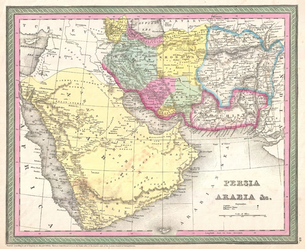
Persia, Arabia & C.
sold
- Digital Map Information
- Suitable for large format printing
- DPI: 300
- File Size: 6.65 MB
- File Type: ZIP / TIFF
- ICC color profile embedded
- Delivered instantly via download link
A fine example of S. A. Mitchell Sr.'s important c. 1850 map of Arabia, Persia, and Afghanistan. Covers the region from the Mediterranean and Red Sea eastward as far as India, including all of modern day Saudi Arabia, Israel, Jordan, Syria, Iran, Iraq, ... (more details)

Johnson's Central America.
sold
- Digital Map Information
- Suitable for large format printing
- File Size: 8.77 MB
- File Type: ZIP / TIFF
- ICC color profile embedded
- Delivered instantly via download link
A beautiful 1866 example of Johnson's map of the Central America and Jamaica. Covers from the Yucatan southeast as far as Panama and north as far as Jamaica. Like most of Johnson's North America maps, this map is largely derived from an earlier wall ... (more details)

Johnson's Florida.
sold
- Digital Map Information
- Suitable for large format printing
- File Size: 7.23 MB
- File Type: ZIP / TIFF
- ICC color profile embedded
- Delivered instantly via download link
A beautiful example of A. J. Johnson's 1866 map of Florida. This rare map offers a fascinating snapshot of this secessionist state shortly following the close of the American Civil War. Map shows the state in full with color coding according to county. ... (more details)
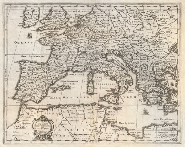
Lumen Historiarum per Occidentem.
sold
- Digital Map Information
- Suitable for large format printing
- DPI: 300
- File Size: 13.42 MB
- File Type: ZIP / TIFF
- ICC color profile embedded
- Delivered instantly via download link
An exceptional c. 1652 map of Europe by Jan Jansson. Centered on Italy, this map covers from Spain to Greece and from England to northern Africa. Designed by Frans van Haren (Haraeus), a Dutch theologian and globe maker active from about 1615 to ... (more details)
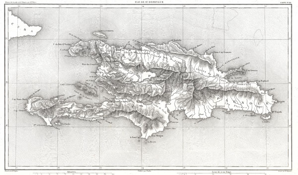
Ile de St. Domingue.
sold
- Digital Map Information
- Suitable for large format printing
- File Size: 5.24 MB
- File Type: ZIP / TIFF
- ICC color profile embedded
- Delivered instantly via download link
A beautifully engraved map of the West Indies island of Hispaniola or Santo Domingo by the French cartographer August Henri Dufour. Covers the entire island in striking topographical detail. Identifies towns, cities, rivers, lakes, mountains, ... (more details)
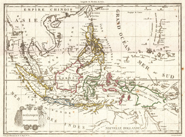
Oceanique Occidentale.
sold
- Digital Map Information
- Suitable for large format printing
- DPI: 300
- File Size: 3.65 MB
- File Type: ZIP / TIFF
- ICC color profile embedded
- Delivered instantly via download link
A highly desirable c. 1810 mapping of Southeast Asia and the East Indies by the French cartographer Ambrose Tardieu. Covers from Burma to Australia and from Sumatra to New Guinea. Includes Siam (Thailand), Cambodia (Cambodge), Vietnam ... (more details)
Ephemeral mapping of North America immediately followng the Louisiana Purchase.
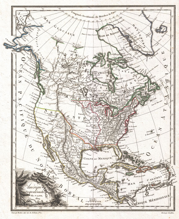
Amerique Septentrionale.
sold
- Digital Map Information
- Suitable for large format printing
- DPI: 300
- File Size: 4.37 MB
- File Type: ZIP / TIFF
- ICC color profile embedded
- Delivered instantly via download link
A highly uncommon and desirable 1810 map of North America by the French cartographer Ambrose Tardieu. Depicts all of North America including Canada, Mexico the United States at a formative but ephemeral period shortly following the ... (more details)
Unusual mediaeval mapping of creation.

Sisteme de la Creation du Monde Suivant Moise. 2e. Planche
sold
- Digital Map Information
- Suitable for large format printing
- DPI: 300
- File Size: 3.47 MB
- File Type: ZIP / TIFF
- ICC color profile embedded
- Delivered instantly via download link
A curious c. 1728 mapping of the ancient world and the cosmos rendered from an arcane Biblical perspective. Though composed well after the discovery of the New World and the circumnavigations of Magellan and Drake, this two part ... (more details)
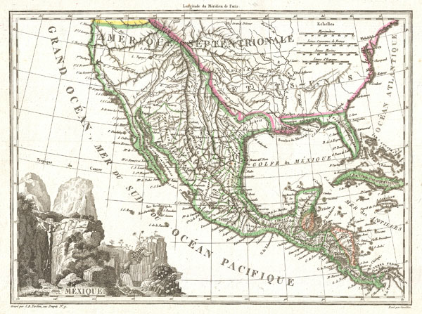
Mexique.
sold
- Digital Map Information
- Suitable for large format printing
- Full resolution TIFF file
- ICC color profile embedded
- Delivered instantly via download link
This is an unusual 1810 map of Mexico and the United States by the French cartographer J. B. Tardieu. Depicts all of Mexico and much of the United States shortly following the acquisition of Louisiana but prior to the ... (more details)

Mountains and Rivers
sold
- Digital Map Information
- Suitable for large format printing
- File Size: 16.27 MB
- File Type: ZIP / TIFF
- ICC color profile embedded
- Delivered instantly via download link
Most likely the finest American Mountains and Rivers chart or map of the mid-19th century. This is the 1855 Colton prototype for the popular 1860-1863 Johnson's Mountains and Rivers chart. Depicts the relative distances ... (more details)
Extremely scarce large scale map of Hispaniola.
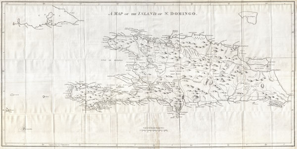
A Map of the Island of St. Domingo.
sold
- Digital Map Information
- Suitable for large format printing
- DPI: 300
- File Size: 15.35 MB
- File Type: ZIP / TIFF
- ICC color profile embedded
- Delivered instantly via download link
A dramatic and important map of the island of St. Domingo (Santo Domingo) or Hispaniola prepared by Bryan Edwards and published by John Stockdale in 1800. Covers the island in full offering significant detail ... (more details)
A rare 19th Century Nautical Chart of the Chesapeake Bay.
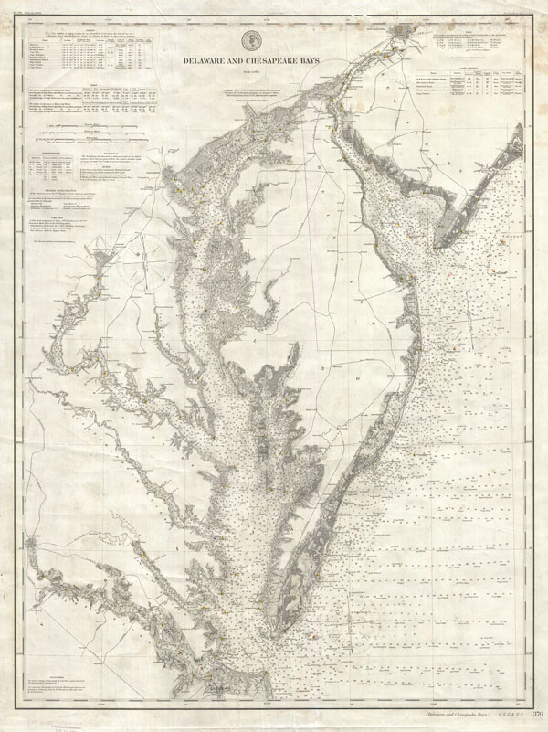
Delaware and Chesapeake Bays.
sold
- Digital Map Information
- Suitable for large format printing
- File Size: 35.6 MB
- File Type: ZIP / TIFF
- ICC color profile embedded
- Delivered instantly via download link
This is a rare example of the 1893 U.S. Coast Survey Map or Nautical Chart of the Chesapeake Bay and Delaware Bay. This chart is based on survey work initiated in 1855 and has been updated to 1893. Covers ... (more details)

Germaniae Veteris Nova Descriptio.
sold
- Digital Map Information
- Suitable for large format printing
- DPI: 300
- File Size: 13.72 MB
- File Type: ZIP / TIFF
- ICC color profile embedded
- Delivered instantly via download link
This is a remarkable example of Jan Jansson's 1657 mapping of Germany in antiquity. Depicts a richly forested region covering from Gaul to Dacia and from the Baltic Sea to the Adriatic Sea. ... (more details)
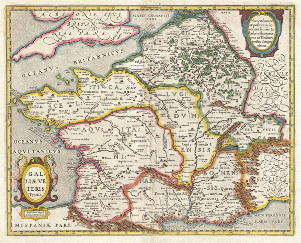
Galliae Veteris Typus.
sold
- Digital Map Information
- Suitable for large format printing
- DPI: 300
- File Size: 14.05 MB
- File Type: ZIP / TIFF
- ICC color profile embedded
- Delivered instantly via download link
This is a remarkable example of Jan Jansson's 1657 mapping of France or Gaul in antiquity. Cartographically this map exhibits heavy influence from a very similar map of the same name ... (more details)
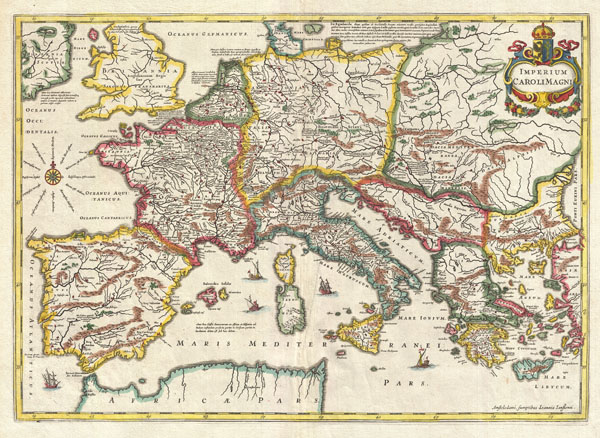
Imperium Caroli Magni.
sold
- Digital Map Information
- Suitable for large format printing
- DPI: 300
- File Size: 15.13 MB
- File Type: ZIP / TIFF
- ICC color profile embedded
- Delivered instantly via download link
This is a remarkable example of Jan Jansson's 1657 mapping of the Empire of Charlemagne. Covers from Spain to the Black Sea and from Denmark and Ireland to North Africa. Filled with ... (more details)