
Evolution of Missouri's borders.
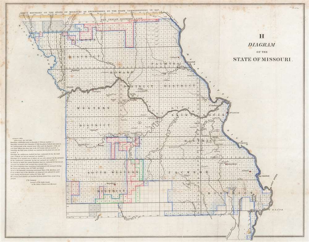
H Diagram of the State of Missouri.
sold
- Digital Map Information
- Suitable for large format printing
- Full resolution TIFF file
- ICC color profile embedded
- Delivered instantly via download link
This is an 1845 Frederick R. Conway Land Office survey map of Missouri. The state has been platted into townships, with letters 's', 'z', 'o', and 'x' indicating the status of each township's survey. Districts within the state are labeled, and cities and towns are identified, including St. Louis, Palmyra, and Hannibal. The evolution of Missouri's borders is traced as well, with lines marking the 'Old Indian Boundary Line', the 'north boundary of the State if Missouri as established by the state commissioners in 1837', and the 'old west boundary of the State of Missouri.' (more details)
Britain and Russia squabbling over imperial control in Central Asia.
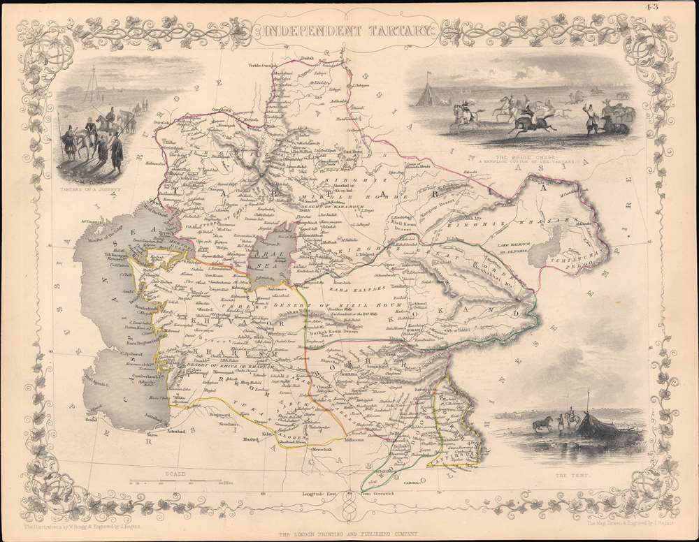
Independent Tartary.
sold
- Digital Map Information
- Suitable for large format printing
- Full resolution TIFF file
- ICC color profile embedded
- Delivered instantly via download link
This is a highly decorative 1851 map of Central Asia drawn by John Rapkin and published by John Tallis, with hand-drawn colored borders between polities (the Emirate of Bukhara, the Khanate of Khiva, the Khanate of Kokand, and 'Tartaria,' roughly equivalent to today's Kazakhstan, Kunduz, and Badakhshan). (more details)
The second 'official' published map of Miami.
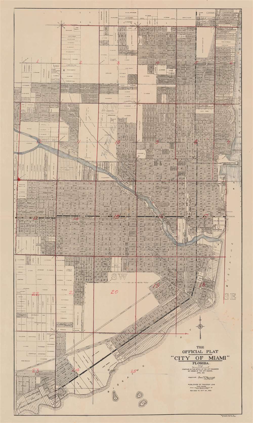
The Official Plat 'City of Miami' Florida.
sold
- Digital Map Information
- Suitable for large format printing
- File Size: 33.53 MB
- File Type: ZIP / TIFF
- ICC color profile embedded
- Delivered instantly via download link
This is the 1920 second edition of the first official plat map of Miami, published at the height of its development during the Third Florida Land Boom. The map lays out the streets and development of Miami from roughly Northeast 39th Street to Kloeber Bay Fronts and illustrates streets, parks, private property holdings, hotels, utilities and more. It exhibits additional manuscript work dividing the city into 25 zones, as well as identifying Highland Park and the home of someone named 'Mary Louise' on SW Fourth St. (more details)
Bucolic Panorama of Paris and her Countryside.

Prosp. der Statt Parys wie solche an ietzo an zusehen.
sold
- Digital Map Information
- Suitable for large format printing
- Full resolution TIFF file
- ICC color profile embedded
- Delivered instantly via download link
This is a 1655 Caspar Merian view of Paris, France - a superbly executed view showing that in artistry Caspar was indeed his father's son. The view is oriented to the west-south-west, from a perspective both further from the city and more to the east than the elder Merian's 1638 view. Rather than border the view with stylized or fanciful floral decoration, Caspar Merian has - following the lead of his father - chosen to frame the panorama in realistic semi-wild trees and bracken of the hillside from which the view was drawn, which has the effect of emphasizing that it was drawn from life. (more details)
An Old-Colored Example of the Earliest Acquirable Printed Map of the African Continent.

Totius Africae tabula et descriptio universalis etiam ultra Ptolemaei limites extensa.
sold
- Digital Map Information
- Suitable for large format printing
- Full resolution TIFF file
- ICC color profile embedded
- Delivered instantly via download link
This is a 1550 Latin Cosmographia edition of Sebastian Münster's 1540 map of Africa, the earliest map of the continent available to the collector. For more than thirty years during the age of discovery, this map would be the predominant representation of Africa for the European reader. The purpose of the map was to reveal, to a lay readership, the still-momentous discoveries that the waters around Africa represented a navigable route to the Indian Ocean, a reality not known to classical geographers. The Latin title of the map emphasizes this:
The map and description of the whole of Africa extended even beyond the limits of Ptolemy.Within its generally-recognizable depiction of the shape of the continent, Münster's work presents an amalgam of sources. Most of the general detail of North Africa is derived from Ptolemaic geography, as is the depiction of the Nile with its sources in the lakes of the Mountains of the Moon (Ptolemy's assumptions about the sources of that river would remain unchallenged on maps of Africa until the end of the 17th century.) Many place names in North Africa were likely drawn from Leo Africanus' 1526 Descrittione dell 'Africa, though many - for example, Garamantes - are drawn from classical historians such as Herodotus. Münster draws on Portuguese sources for west Africa. (Cadamosto's 15th century journeys there would reveal the Cape Verde Islands, which appear here.) Numerous kingdoms are noted throughout the continent and are marked by a crown and scepter. Some of these include the Arab kingdoms of Melinde and Quiola, Meroë, where the Nubian kings are said to be buried, and Hamarichthe capital of the kingdom of the mythical Christian king Prester John. In an elegant frame, Münster includes a descriptive text describing the route taken by the Portuguese around the African coast to arrive at Calicut, modern Kozhikode on the western coast of India:
From Portugal to the Eastern Empire of Calicut, we arrive by this sea route. On the western side of Mauritania and Getulia, we arrive at Cape Verde, formerly called Experias, where the Hesperides Islands are seen. After having passed Ethiopia we find the southern cape, which is the Cape of Good Hope, which reaches nine degrees below the Tropic. Soon the region bends to to Cape Prassum, which Ptolemy placed at his southernmost limits and called an unknown land. Thence the road is open to the Troglodites, where the gold mines of Zaphala were known even to the ancients. From thence, having crossed the kingdom of Melinde, we pass through the Barbarian Gulf, into the Indian Ocean, and at length to the city of Calicut.(The text is typeset, and changes typographically from edition to edition - but in all editions it appears to adhere to this same topic.) (more details)
Colonial rivalries in early America - fine original color.
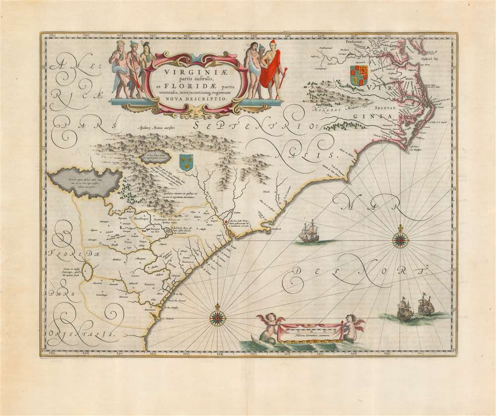
Virginiae Partis australis, et Floridae partis orientalis, interjacentiumque regionum Nova Descriptio.
sold
- Digital Map Information
- Suitable for large format printing
- Full resolution TIFF file
- ICC color profile embedded
- Delivered instantly via download link
This is Willem Blaeu's beautiful map of Virginia and Florida, engraved in 1638 and appearing here in a superb example of the 1662 Atlas Maior edition, printed for Joan Blaeu's mammoth masterpiece atlas. This classic Dutch map, which encompassed the Carolinas and what would become Georgia and part of Florida, has been called 'the most correct map of this area yet to appear.' (Cumming) (more details)
Manuscript map drawn by a Confederate soldier of a battle during the first year of the American Civil War.
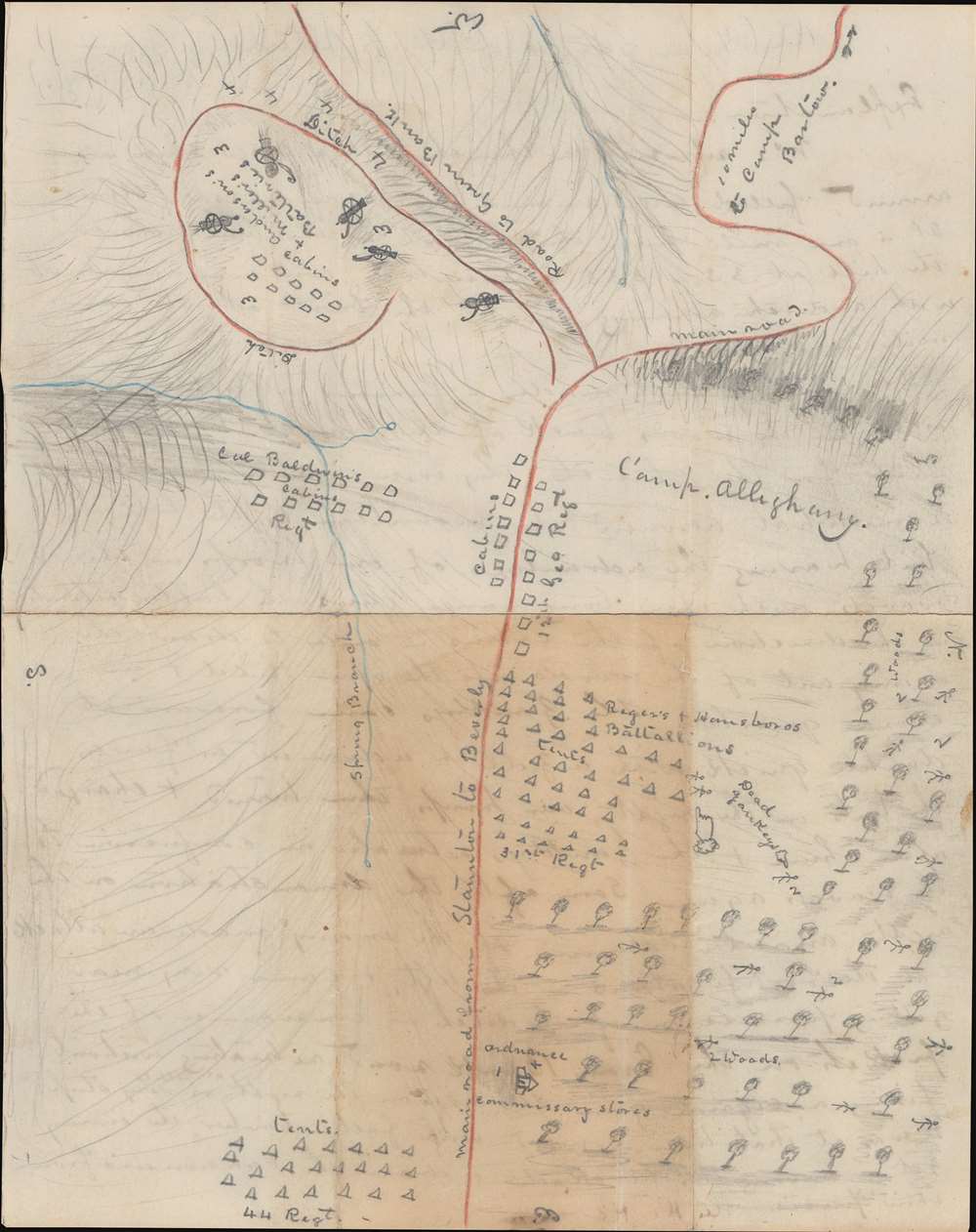
A Hand sketch of Camp Allegheny from memory.
sold
- Digital Map Information
- Suitable for large format printing
- Full resolution TIFF file
- ICC color profile embedded
- Delivered instantly via download link
This is a one-of-a-kind Confederate-drawn manuscript map of the Battle of Camp Allegheny, Pocahontas County, West Virginia, fought on December 13, 1861, early in the American Civil War (1861 - 1865). The map's creator, likely the Confederate officer Thomas Ranson, labels the encampment of the 44th Regiment, the 31st (Virginia) Regiment, and cabins occupied by the 12th Georgia Regiment, and Col. Baldwin's Regiment (the 52nd Virginia Regiment - the likely map creator's unit). Artillery batteries commanded by Anderson and Miller are illustrated on top of the knob in the upper right. A church where Confederate ordnance and commissary supplies were stored is illustrated in a copse of trees near the bottom. The initial Union attack came from these trees and the map's creator marks 'dead Yankeys' throughout the woods. The Staunton Pike, which the Confederates were protecting, runs vertically through the map from east to west (with west at top). (more details)
Disputed islands - resolved?

亞細亞小東洋圖 / [Map of Asia and Little Eastern Ocean].
sold
- Digital Map Information
- Suitable for large format printing
- File Size: 14.8 MB
- File Type: ZIP / TIFF
- ICC color profile embedded
- Delivered instantly via download link
This is a rare and historically significant 1857 map of East Asia (Japan, Korea, China, Annam, etc.) by the 18th century Japanese cartographer, geographer, and Sinologist Nagakubo Sekisui (長久保玄珠). At the time of publication in Japan, this map was regarded as especially accurate and a gold standard of Japanese cartography for nearly a century after its initial publication. It is also important because it includes several currently disputed islets, including: Dokdo/Takeshima (竹シマ), the Kuril Islands (唐度), and the Diaoyu/Senkaku Islands (高華). (more details)
A foundational map.

Ptolemaisch general Tafel/ begreissend die halbe kugel der Welt.
sold
- Digital Map Information
- Suitable for large format printing
- Full resolution TIFF file
- ICC color profile embedded
- Delivered instantly via download link
An attractive 1572 example of Sebastian Münster's map of the world, according to Claudius Ptolemy. The map thus details the Oikumene, the inhabited world as it was known to the Roman Empire of the second century, well before the Age of Discovery. It covers only the 'Old World' from the Atlantic (Pillars of Hercules) to Indochina, and from the Arctic to the Equator. The map is surrounded by aeoli and clouds. (more details)
The beginning of the Japanese empire.

實測詳密 台灣島大地圖 附-澎湖島 琉球島 / [Map of Taiwan Island Measured in Detail, with the Penghu and Ryukyu Islands].
sold
- Digital Map Information
- Suitable for large format printing
- File Size: 34.75 MB
- File Type: ZIP / TIFF
- ICC color profile embedded
- Delivered instantly via download link
This is a very rare 1895 Ōtsuka Usaburō map of Taiwan, the Penghu Islands (also known as the Pescadores), and the Ryukyu Islands. It was made in the midst of Japan's conquest of Taiwan and includes a range of information that would be useful from an administrative perspective. (more details)
Published during the Burmese Resistance of 1885 - 1895.
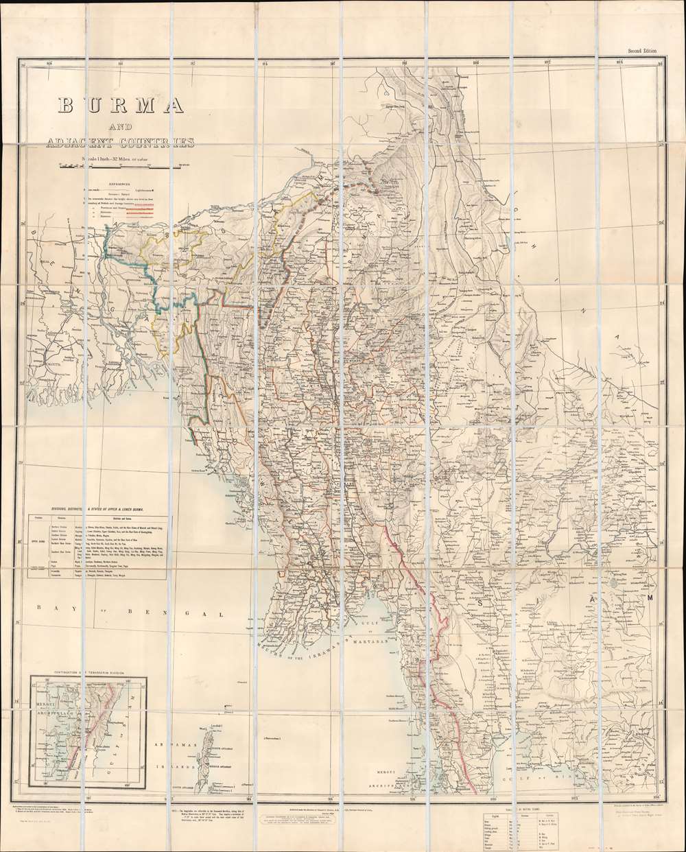
Burma and Adjacent Countries.
sold
- Digital Map Information
- Suitable for large format printing
- Full resolution TIFF file
- ICC color profile embedded
- Delivered instantly via download link
This is an 1892 Survey of India map of Burma (Myanmar), published 6 years after Lower Burma became a province of British India. Constant resistance to British rule, and insurgency activity kept this region persistently in the British press, likely the raison d'être for this large and impressive map. Coverage extends from Calcutta to Cambodia and Thailand (Siam), districts and states throughout are illustrated and labeled, along with cities, towns, and villages. The region's many rivers, including the Ganges and Irrawaddy, appear in detail. Black lines trace the Burma State Railway from Rangoon to Mandalay and points north, and the Eastern Bengal State Railway north from Calcutta. Ruby mines, one of the major resources in Upper Burma, are labeled. An inset in the lower-left details extreme southern Burma, identified here as the Tenasserim. A table in the lower left names British imposed districts and states in both Upper and Lower Burma. (more details)
Monuments and historical wonders.
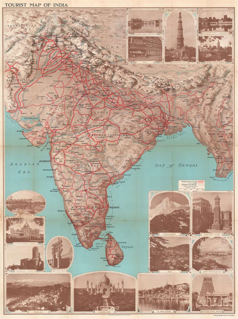
Tourist Map of India.
$800.00
Acquire
- Digital Map Information
- Suitable for large format printing
- Full resolution TIFF file
- ICC color profile embedded
- Delivered instantly via download link
This is a lovely c. 1930 map of India by George Philip and Sons Ltd. The map extends from Kashmir south to Ceylon or Sri Lanka and includes modern-day India, Pakistan, Nepal, Bhutan, and Burma (Myanmar). Cities, towns, and villages are labeled throughout, with large block lettering marking the region's most important cities. Bold red lines highlight the railway network and differentiates between broad vs. narrow gauge. (more details)
One of Münster's Scarcest Maps: The Holy Land and Fertile Crescent
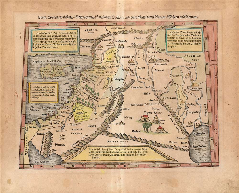
Cyria/ Cypern/ Palestina//Mesopotamia/Chaldea/und zwei Arabia/mit Bergen/Wåssern und Stetten.
sold
- Digital Map Information
- Suitable for large format printing
- Full resolution TIFF file
- ICC color profile embedded
- Delivered instantly via download link
This is Sebastian Münster's 1540 map of the Holy Land, Cyprus and the Fertile Crescent, from the 1578 German edition of Munster's Cosmographia Universalis. One of Münster's scarcest maps, it is one of his Ptolemaic works - derived from the Alexandrian geographer's second century geographic information, as passed along (probably) via Waldseemüller's 1513 Quarta Asiae Tabula. Being a smaller woodcut, Münster's work necessarily simplifies the 1513 map, but what it lacks in size the present work makes up for in its informative qualities: four typeset text boxes describe the contents of the map in detail (here in German: the text was re-set for the various editions.) (more details)
The last and most controversial nuclear weapon tests in the continental United States.

1957 Operation Plumbbob Certificate of Participation.
sold
This unusual bit of Americana is a 'Certificate of Participation' in Operation Plumbbob, the largest and most controversial atomic weapon test program in the continental United States. The present certificate was issued to Melvin G. Moura and is signed by Alvin C. Graves (Scientific Advisor), Gerald W. Johnson (Test Director), Hershel E. 'Ted' Parsons (Deputy for Military Operations), James E. Reeves (Nevada Site Manager), and W. W. Allen (Support Director). (more details)
The last independent sugar producer in the United States.

The Story of Cane Sugar.
sold
- Digital Map Information
- Suitable for large format printing
- Full resolution TIFF file
- ICC color profile embedded
- Delivered instantly via download link
This is a c. 1930 Pennsylvania Sugar Refining Company pictorial map of Caribbean sugar production. Insets of Cuba and Puerto Rico illustrate two major sugar growing. An illustration of the Pennsylvania Sugar Refining Company's refinery marks Philadelphia, and trains, cars, buses, and airplanes are illustrated speeding the finished sugar to markets nationwide. A charming view of the refinery occupies the space just below the map. A short explanation details the process of growing sugar cane, harvesting, and processing it for shipment to the refinery, and then making the sugar. (more details)
A city in ruin...

關東大震災圖 / [Map of the Great Kanto Earthquake Disaster].
sold
- Digital Map Information
- Suitable for large format printing
- Full resolution TIFF file
- ICC color profile embedded
- Delivered instantly via download link
This is a rare and affecting 1923 Kuroda Yoshio (黑田欽夫) map showing the areas of Tokyo and Yokohama destroyed by the Great Kanto Earthquake (September 1, 1923) - just 2 weeks after the events depicted! It is a powerful testament to the devastation, which leveled or burned much of Tokyo and virtually all of Yokohama. (more details)
Waterways in Jiangsu Province, China.

舊黃河 秦淮河 長江 運河 / [Former Yellow River, Qinhuai River, Yangzi River, Grand Canal].
sold
- Digital Map Information
- Suitable for large format printing
- File Size: 9.65 MB
- File Type: ZIP / TIFF
- ICC color profile embedded
- Delivered instantly via download link
This is an extremely rare map from c. 1860 of coastal Jiangsu Province, China that includes a number of cities (county seats), but primarily focuses on waterways, namely the former course of the Yellow River, the Qinhuai River, the Yangzi River, and the Grand Canal. The map also gives a brief history of changes in the course of these waterways over time. (more details)
A city destroyed during the Taiping Rebellion.

六安州城圖 / [Map of the Walled City of Lu'an].
sold
- Digital Map Information
- Suitable for large format printing
- File Size: 6.48 MB
- File Type: ZIP / TIFF
- ICC color profile embedded
- Delivered instantly via download link
This is a very rare c. 1872 map of the walled city and environs of Lu'an, seat of Lu'an Prefecture in Anhui Province, China (the city's name includes an unusual pronunciation of 六 as 'lu'). It is a wonderfully clear representation of a typical Chinese city in the late imperial era. (more details)
China's southwestern frontier.

岳州府慈利縣圖 / [Map of Cili County, Yuzhou Prefecture].
sold
- Digital Map Information
- Suitable for large format printing
- File Size: 7.34 MB
- File Type: ZIP / TIFF
- ICC color profile embedded
- Delivered instantly via download link
This is a unique c. 1869 manuscript map of Cili County, Yuezhou Prefecture in Hunan Province, China. This map gives limited information about Cili itself (inside the walled county seat), noting that it has a Confucian academy and a temple to the city god, and primarily shows the orientation of the county seat to nearby mountains and jurisdictions (Changde, Shimen, etc.). Although not noted, the large river that cuts across the map is the Li River (or Lishui River 澧水), while the smaller river branching to the north is likely the Lou River (漊水). (more details)
Reporting on the Jesuit Missions in South America.
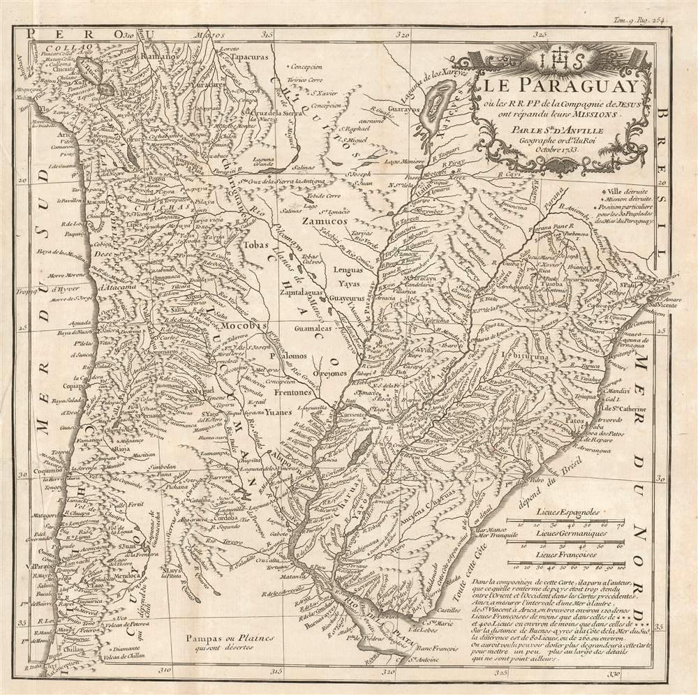
Le Paraguay, où les R.R.P.P. de la Compagnie de Jesus ont répandu leurs missions.
$500.00
Acquire
- Digital Map Information
- Suitable for large format printing
- Full resolution TIFF file
- ICC color profile embedded
- Delivered instantly via download link
This is J. B. B. d'Anville's attractive, detailed map of Paraguay, Uruguay, part of Chile, and northern Argentina based on the reports of Jesuit missionaries, and intended for inclusion in a collection of those reports. It updates D'Avila's 1726 map of the Jesuit Provinces, covering the area now comprising parts of Chile, Paraguay, Bolivia, Peru, Brazil, Uruguay, and Argentina. The rivers of the region are shown in detail and mountains are indicated pictorially. Towns and villages are marked. A key indicates the presence of destroyed missions and villages, and the locations of tribes contacted by the Jesuits. The map's elegant cartouche is surmounted by the Jesuit arms. It should be noted that in the period between the execution of the map in 1733 and the printing of this 1781 edition, the Jesuits had been expelled from South America: from Portuguese territories in 1759 and the Spanish territories in 1767. (more details)