
Highlights several important locations during the first year of the Russo-Turkish War of 1787 - 1792.
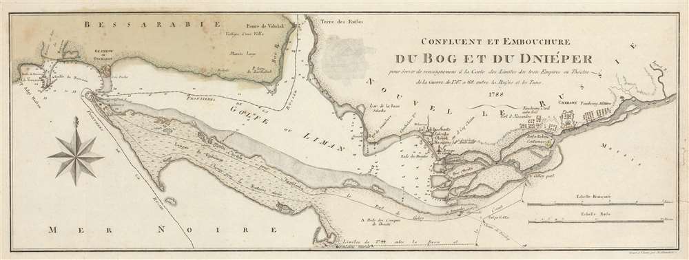
Confluent et Embouchure du Bog et du Dniéper pour Servir de renseignemens à la Carte de Limites de trois Empire ou Théatre de la Guerre de 1787 et 88 entre la Russie et les Turcs.
sold
- Digital Map Information
- Suitable for large format printing
- DPI: 600
- File Size: 15.06 MB
- File Type: ZIP / TIFF
- ICC color profile embedded
- Delivered instantly via download link
This is a 1788 Francois Joseph Maire map of southern Ukraine and Crimea during the first year of the Russo-Turkish War of 1787 - 1792. Depicting the region east of Odessa, the map stretches from the Gulf of Berezan to the Inhulets (Inguol) River and from Bessarabia to the Black Sea. The mouth of the Dnieper River is illustrated just to the right of center, and Russian military encampments are illustrated just up the river around Kherson (Cherson). Numerous depth soundings are noted near the river's mouth and up its course to Kherson. Depth soundings are also present in Dniprovs'ka Gulf (Golfe ou Liman). Two roads are illustrated on the Kinburn (Kinbourne) Peninsula that connect the Kinburn Fortress to a port on the Dnieper. The modern-day cities of Kherson (Cherson) and Ochakiv (Okzakow ou Otchakof) are labeled. (more details)
Printed one month before the start of World War II, the Sunday News asks the question, 'War or Peace?'

For War or Peace?
sold
- Digital Map Information
- Suitable for large format printing
- File Size: 32.72 MB
- File Type: ZIP / TIFF
- ICC color profile embedded
- Delivered instantly via download link
Published on Sunday, July 30, 1939, one month before Nazi Germany invades Poland and starts World War II, this Edwin Sundberg pictorial map of Europe compares the relative strength of European militaries while posing the question, 'For War or Peace'? Depicting Europe from Ireland and Spain to Russia and from Scandinavia to North Africa, Sundberg deftly uses color to illustrate the ever-building tensions between the 'Rome - Berlin Axis' and the 'London - Paris Alliance'. A ribbon of Nazi and Italian flags connects Berlin and Rome, while both Germany and Italy are shaded orange. A very similar ribbon of British and French flags connects London and Paris, with France and Great Britain colored green. French and Italian colonies are green and orange, respectively. Light shades of green and orange denote which countries are leaning toward the Alliance or the Axis, while nations colored gray are believed to be either neutral or undecided. Solid black lines along international borders denote fortifications. (more details)
A comical pictorial tourist map of New York City highlighting all of the city's iconic landmarks - and it's now closed automats!
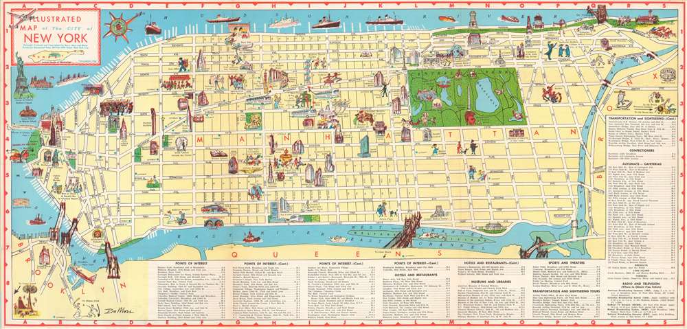
Illustrated Map of the City of New York.
sold
- Digital Map Information
- Suitable for large format printing
- File Size: 28.76 MB
- File Type: ZIP / TIFF
- ICC color profile embedded
- Delivered instantly via download link
Providing a charming and entertaining visual summary of Manhattan's numerous museums, sites, and hotels, this 1956 Ira Ross pictorial map of Manhattan in New York City creates a perfect introduction to the 'Big Apple' for visiting tourists. The map depicts the borough in detail from Battery Park to the Met Cloisters and the Bronx and from the Hudson River to Brooklyn and Queens. Manhattan's famous street grid, with its parallel streets and avenues, is clearly labeled and easily navigated.
The city's most recognizable destinations, including the Metropolitan Museum of Art, the American Museum of Natural History, the Whitney Museum of Modern Art, and the Museum of Modern Art are all marked by vignettes highlighting their most well-known attributes: ancient sculpture, a Tyrannosaurus Rex, and modernist paintings. Other landmarks, such as the Chrysler Building, the Empire State Building, the Flatiron Building, the United Nations Headquarters, and the Washington Arch are illustrated in profile. Numerous hotels are highlighted, as are New York City mainstays like Macy's at Herald Square, Madison Square Garden, and even Yankee Stadium.
Other sites are more comically represented, such as a reading lion for the New York Public Library, a patient chasing a nurse at Bellevue Hospital, or caricatures of opera singers for the Metropolitan Opera House. A now lost part of New York City's, and America's popular culture, the automat, a fast food restaurant where foods and drinks were served out of vending machines is present throughout, with numerous automats marked by blue stars. The city's bridges, including the iconic Brooklyn Bridge, are sketched in profile as well. The city's numerous parks, such as Riverside Park, Fort Tryon Park, and, of course Central Park, stand out as green oases in a desert of yellow. The Statue of Liberty and Ellis Island are included along the left border in New York Harbor. (more details)
The city's most recognizable destinations, including the Metropolitan Museum of Art, the American Museum of Natural History, the Whitney Museum of Modern Art, and the Museum of Modern Art are all marked by vignettes highlighting their most well-known attributes: ancient sculpture, a Tyrannosaurus Rex, and modernist paintings. Other landmarks, such as the Chrysler Building, the Empire State Building, the Flatiron Building, the United Nations Headquarters, and the Washington Arch are illustrated in profile. Numerous hotels are highlighted, as are New York City mainstays like Macy's at Herald Square, Madison Square Garden, and even Yankee Stadium.
Other sites are more comically represented, such as a reading lion for the New York Public Library, a patient chasing a nurse at Bellevue Hospital, or caricatures of opera singers for the Metropolitan Opera House. A now lost part of New York City's, and America's popular culture, the automat, a fast food restaurant where foods and drinks were served out of vending machines is present throughout, with numerous automats marked by blue stars. The city's bridges, including the iconic Brooklyn Bridge, are sketched in profile as well. The city's numerous parks, such as Riverside Park, Fort Tryon Park, and, of course Central Park, stand out as green oases in a desert of yellow. The Statue of Liberty and Ellis Island are included along the left border in New York Harbor. (more details)
A wonderfully detailed map of Saint Paul, Minnesota.
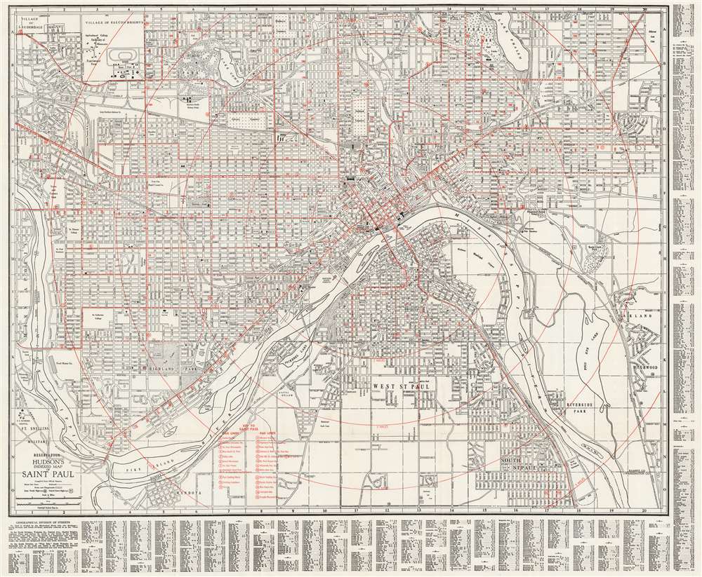
Hudson's Indexed Map of Saint Paul.
sold
- Digital Map Information
- Suitable for large format printing
- File Size: 66.55 MB
- File Type: ZIP / TIFF
- ICC color profile embedded
- Delivered instantly via download link
This is a c. 1929 Hudson Map Company city map or plan of Saint Paul, Minnesota. With the Mississippi River winding its way through the center of the city, the map depicts from the Village of Lauderdale, the Village of Falcon Heights, and Lake Phalen to Mendota and South Saint Paul and from Minneapolis to Oakland and Highland. Streets and avenues are labeled throughout. Country clubs, parks, and golf courses are illustrated, including Riverside Park along the Mississippi. Numerous railroads, such as the Great Northern and the Chicago, Milwaukee, St. Paul, and Pacific are traced through the city. The State Capitol Building, City Hall, Union Station, the State Fairgrounds, the University of Minnesota, the St. Joseph Orphanage, and the Northern Pacific Railway Shops are identified, as is the U.S. Veterans Hospital and the Fort Snelling Military Reservation. (more details)
A French edition of Joshua Fisher's chart of Delaware Bay, considered to be one of the most important maps of the vicinity of Philadelphia ever produced.
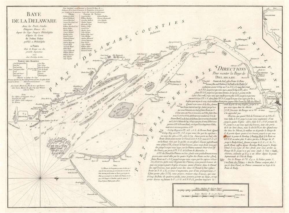
Baye de la Delaware Avec les Ports, Sondes, Dangers, Bancs, etc. depuis les Caps Jusqu'a Philadelphie d'Après la Carte de Joshua Fisher publiée a Philadelphie.
sold
- Digital Map Information
- Suitable for large format printing
- DPI: 600
- File Size: 28.52 MB
- File Type: ZIP / TIFF
- ICC color profile embedded
- Delivered instantly via download link
This 1777 George-Louis Le Rouge nautical chart or maritime map of Delaware Bay is a French edition of a near unobtainable chart by the self-taught Philadelphia cartographer Joshua Fisher. The chart depicts the region from just south of Cape Henlopen (labeled here as Cape James) to Philadelphia and from Delaware to Cape May and the Atlantic Ocean. Channels, shoals, ledges, flats, and other navigational hazards are illustrated, as are several different channels, all of which are labeled. Depth soundings are included along each of these channels as well. Coastal landmarks are identified, including both Cape Henlopen and Cape May with their latitudes noted. An inset of the waterway above Philadelphia is situated in the upper right corner. Detailed navigational instructions for the bay are included in the bottom right quadrant. (more details)
A charming set of twelve pictorial postcards recording a voyage to from Euorope to Singapore, Hong Kong, Shanghai, and Yokohama.

[Hamburg to Yokohama.]
sold
- Digital Map Information
- Suitable for large format printing
- File Size: 16.65 MB
- File Type: ZIP / TIFF
- ICC color profile embedded
- Delivered instantly via download link
This is a charming 1903 set of hand-colored pictorial map postcards with extensive manuscript content recording a voyage from Hamburg, Germany to Yokohama, Japan, including visits to Singapore, Hong Kong, Shanghai, Suez, and more. Divided into twelve different postcards, the cards depict the route from Hamburg through the English Channel and the Strait of Gibraltar, across the Mediterranean to the Suez Canal, then through the Red Sea to the Indian Ocean and Sri Lanka, Singapore, Hong Kong, Fuzhou, Shanghai, Nagasaki, and finally Yokohama. Beautiful views adorn each of the twelve cards, including illustrations of the Needles on the Isle of Wight, Gibraltar, the lighthouse at Genoa, the city of Aden in Yemen, the Suez Canal, Hong Kong, Colombo, and Nagasaki. (more details)
An extremely rare 19th century pictorial representation of the peoples of the world.

The Microcosm or World in Miniature.
sold
- Digital Map Information
- Suitable for large format printing
- DPI: 600
- File Size: 25.56 MB
- File Type: ZIP / TIFF
- ICC color profile embedded
- Delivered instantly via download link
This is an Anglo-centric 1849 Edward King circular pictorial ethnographic map of the world - here in its only known example. With Queen Victoria and Prince Albert at center, the peoples of world surround them, forming a globe. Individuals from a multitude of cultures are illustrated dancing, praying, hunting, ranching, fighting, and otherwise engaging with life. It should be pointed out that cultural and racial stereotypes are propagated throughout, but identification of individual ethnic and cultural groups is difficult as none of the illustrations are labeled. On the left side one finds what may be an Indian maharaja riding on the back of an elephant not far from a snake charmer and people smoking a hookah. An Asian temple appears near the elephant, in front of which sits an emperor being hailed by one of his subjects. Further along are British soldiers. At the top of the page one of course finds the Arctic, populated by reindeer and people riding in sledges. The majority of the rest of the globe is filled with people wearing traditional dress and homes. (more details)
A popular and colorful infographic chart tracing evolution on Earth.

The Histomap of Evolution Earth, Life and Mankind for Ten Thousand Million Years.
sold
- Digital Map Information
- Suitable for large format printing
- File Size: 96.35 MB
- File Type: ZIP / TIFF
- ICC color profile embedded
- Delivered instantly via download link
A real oddity, this is a colorful 1942 John B. Sparks infographic chart or 'histomap' of evolution. Tracing 'ten thousand million years' of history, the chart begins 'ten thousand million' years ago and follows the development of life on Earth. The large central portion, with its curvy lines, employs seven different colors and starts with the emergence of protozoa and other unicellular organisms and ends with a popular pseudoscience of the 1930s and 1940s: conflating nationality with race. The chart includes Germans, French, British, Slavs, Russians, Americans, Chinese, and Japanese. The different eras and periods in Earth's history, the Paleozoic, Mesozoic, and Cenozoic Eras, are included along both the right and left. The shorter periods, such as the Triassic, Jurassic, and Cretaceous, are identified with short summaries of what occurred during each. The right side traces the emergence of life and how it developed during each period, while on the right geological, cultural, and historical events are noted. (more details)
Highlights the progress of the Allied push against Japan in the Pacific all the while getting closer to Japan itself.
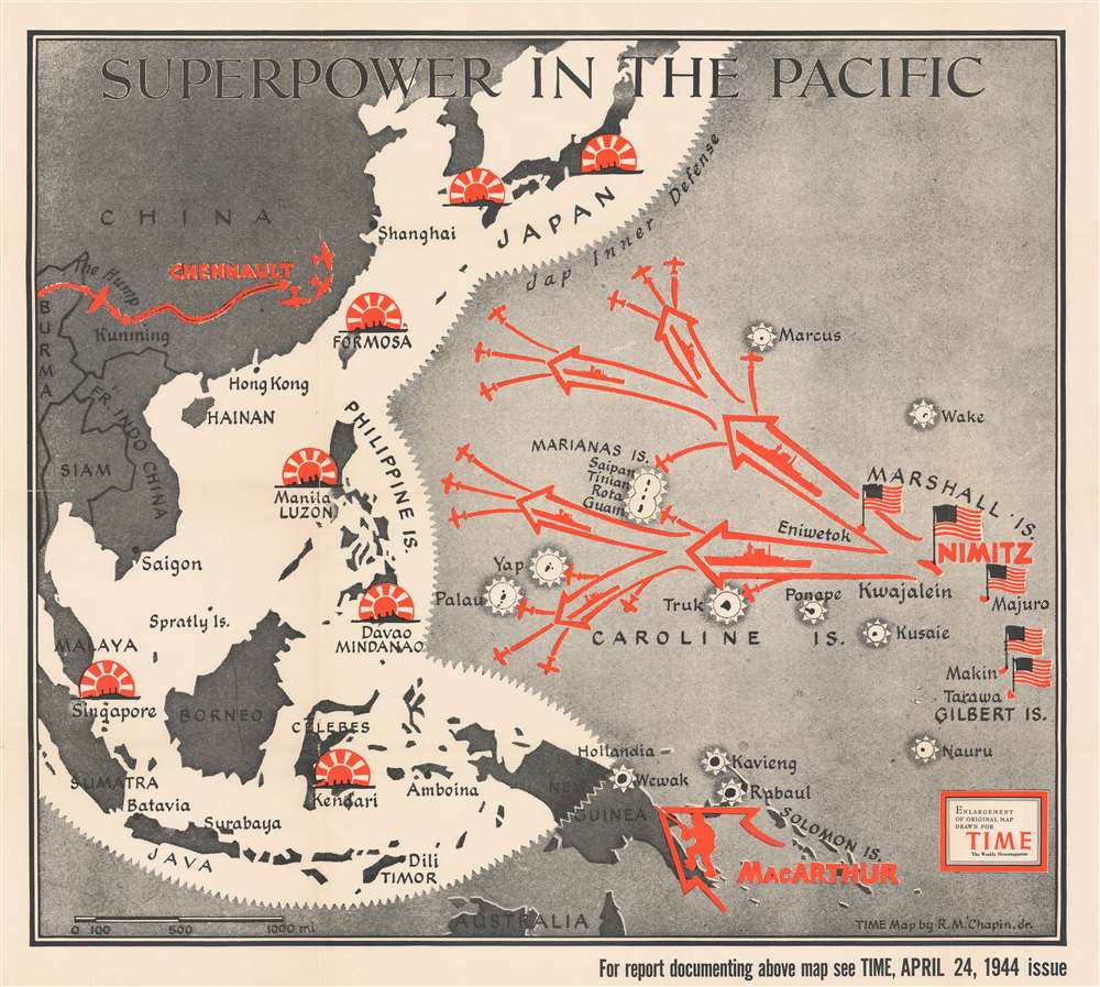
Superpower in the Pacific.
sold
- Digital Map Information
- Suitable for large format printing
- File Size: 90.24 MB
- File Type: ZIP / TIFF
- ICC color profile embedded
- Delivered instantly via download link
This is a 1944 Robert M. Chapin Jr. map of the then-current situation in the Pacific Theater during World War II. The map depicts the region from Burma and China to the Gilbert Islands and from Japan to northern Australia. (more details)
A Vietnamese city plan of Saigon published during the Vietnam War.

Bản Đồ Đô Thành Saigon. [Map of the City of Saigon].
sold
- Digital Map Information
- Suitable for large format printing
- File Size: 36.19 MB
- File Type: ZIP / TIFF
- ICC color profile embedded
- Delivered instantly via download link
This is a 1966 Pham Thang city map or plan of Saigon, South Vietnam. The map depicts the city from the border between Saigon and An Lac to Gia Định Province and from Bình Hòa to Bình Hưng. Streets throughout the city are labeled in Vietnamese, along with parks and rivers, including the Saigon. The city's eight quận, or counties, are numerically identified and shaded different colors to allow for easy differentiation. Villages around the city are identified. An index of streets and other locations across the city is situated along the bottom border and provides the grid location where each place is located. (more details)
Highlights Manhattan's many theatres, including the New Amsterdam and Lyric Theatres, as well as the newly-constructed United Nations Headquarters.
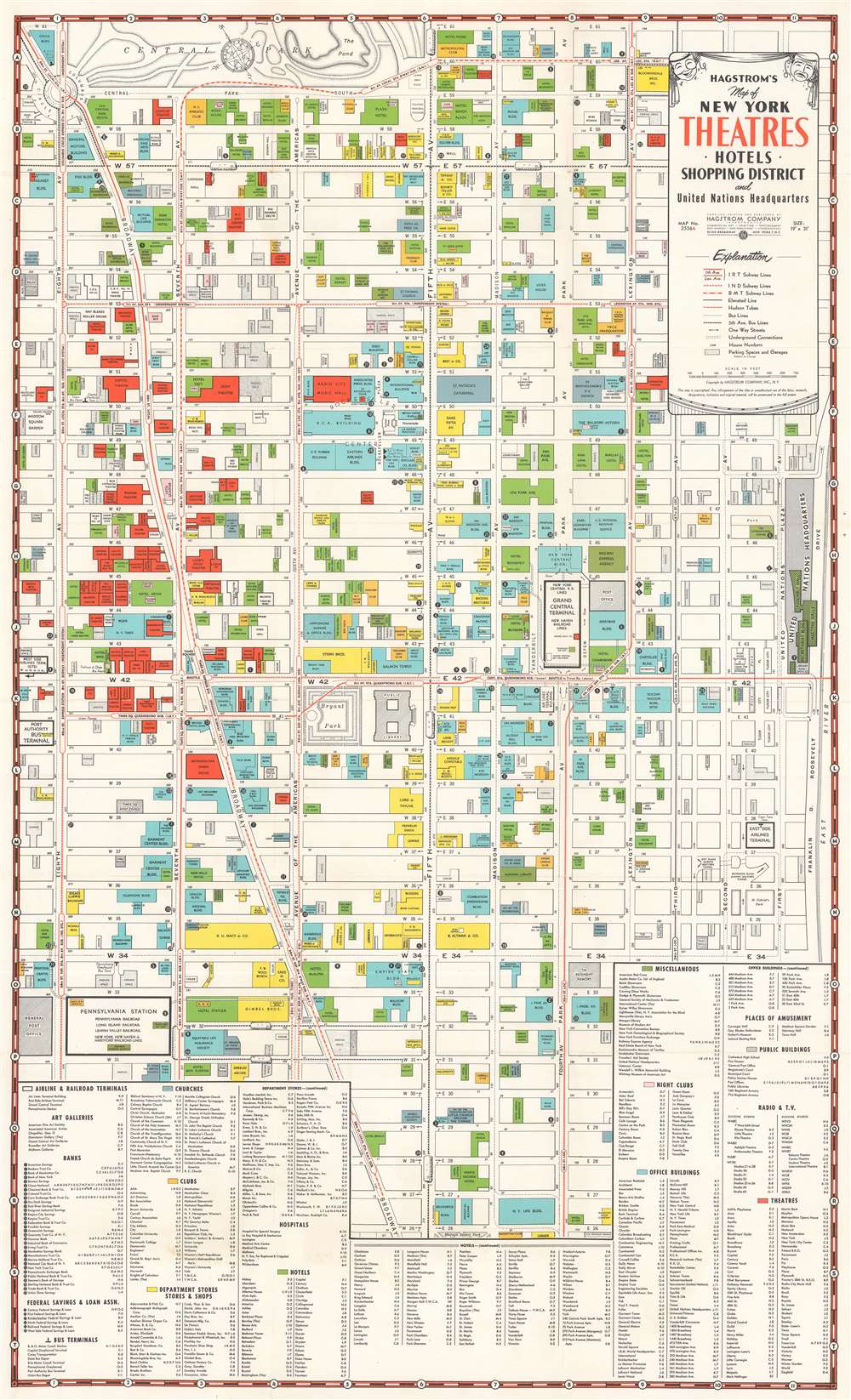
Hagstrom's Map of New York Theatres, Hotels, Shopping District and United Nations Headquarters.
sold
- Digital Map Information
- Suitable for large format printing
- File Size: 32.76 MB
- File Type: ZIP / TIFF
- ICC color profile embedded
- Delivered instantly via download link
This is a c. 1950 Hagstrom map of Midtown Manhattan highlighting the Theatre District and its many theatres. The map depicts the city from Eighth Avenue to the East River and from West 61st Street, Central Park, and East 61st Street to 26th Street. Although myriad buildings are illustrated, not all the city blocks are filled. Banks, churches, clubs, department stores, hotels, nightclubs, office buildings, public buildings, train stations, and theatres are shaded using various colors to allow for easy differentiation and identification.
The focus, of course, is on the areas many theatres, which are shaded red. Numerous theatres still in operation today are labeled here, including the New Amsterdam, Lyric, Majestic, Broadhurst, Booth, Golden, Barrymore, and the Music Box. Numerous others illustrated here have since been closed or repurposed. The newly-constructed United Nations Headquarters, located along the East River between East 42nd Street and East 48th Street, is illustrated and the Secretariat Building, the Meeting Halls, and the Assembly Hall are all labeled. Other New York City landmarks that fall within the map's borders include the Empire State Building, the central branch of the New York Public Library, the Museum of Modern Art (MoMA), Bryant Park, Grand Central Station, and Herald Square. Both Macy's and Bloomingdale's are labeled, as are the Waldorf Astoria Hotel and the Plaza Hotel. An index, situated along the bottom of the map, lists the identified locations, provides the color with which they are shaded, and each building's location on the map's grid. Streets and avenues are also labeled and subway lines are illustrated and identified as well. (more details)
The focus, of course, is on the areas many theatres, which are shaded red. Numerous theatres still in operation today are labeled here, including the New Amsterdam, Lyric, Majestic, Broadhurst, Booth, Golden, Barrymore, and the Music Box. Numerous others illustrated here have since been closed or repurposed. The newly-constructed United Nations Headquarters, located along the East River between East 42nd Street and East 48th Street, is illustrated and the Secretariat Building, the Meeting Halls, and the Assembly Hall are all labeled. Other New York City landmarks that fall within the map's borders include the Empire State Building, the central branch of the New York Public Library, the Museum of Modern Art (MoMA), Bryant Park, Grand Central Station, and Herald Square. Both Macy's and Bloomingdale's are labeled, as are the Waldorf Astoria Hotel and the Plaza Hotel. An index, situated along the bottom of the map, lists the identified locations, provides the color with which they are shaded, and each building's location on the map's grid. Streets and avenues are also labeled and subway lines are illustrated and identified as well. (more details)
A beautifully detailed map of Turkey, Greece, and the Balkans.
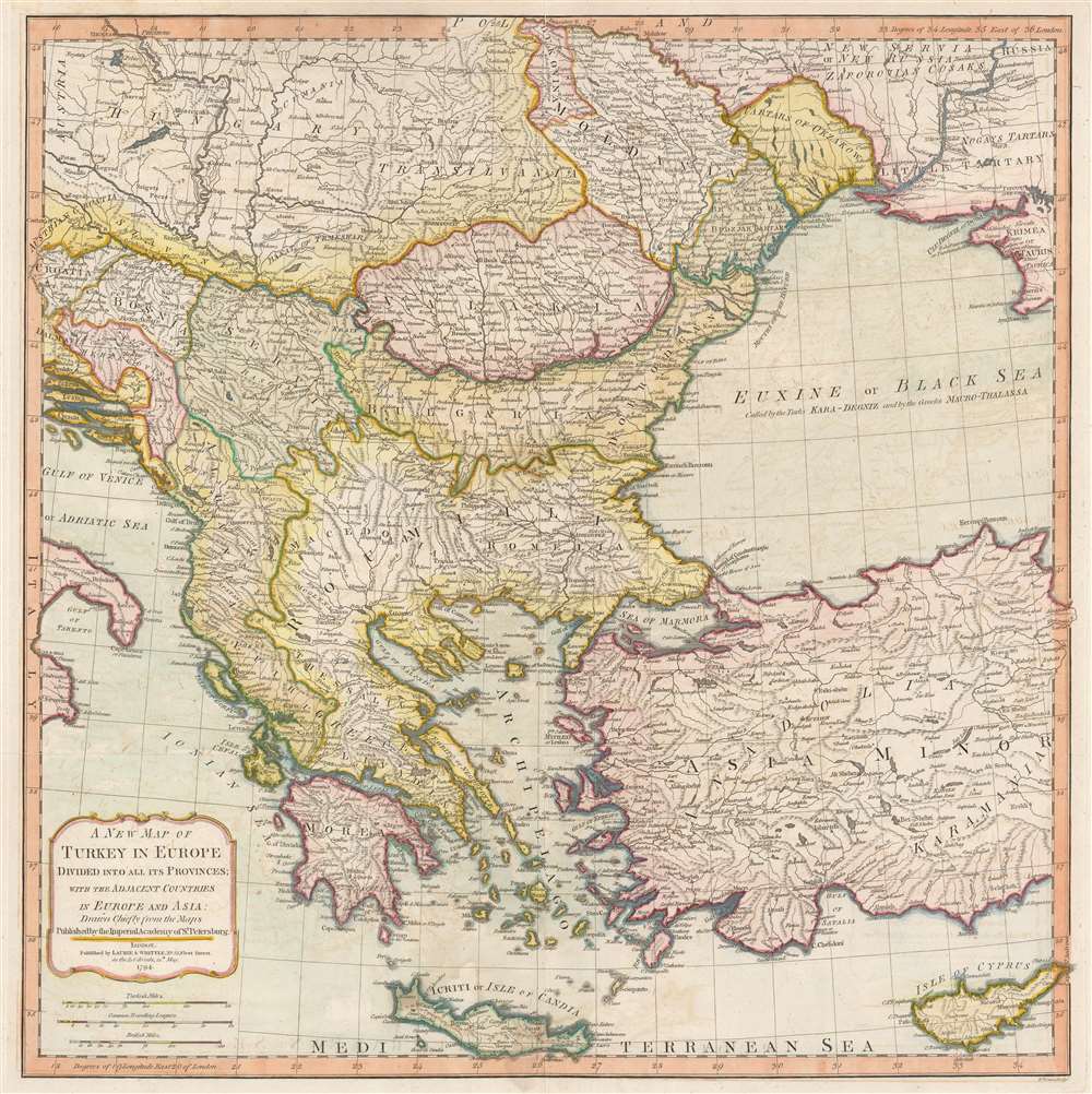
A New Map of Turkey in Europe Divided into all its Provinces' with the Adjacent Countries in Europe and Asia: Drawn Chiefly from the Maps Published by the Imperial Academy of St. Petersburg.
sold
- Digital Map Information
- Suitable for large format printing
- Full resolution TIFF file
- ICC color profile embedded
- Delivered instantly via download link
An extraordinary large format 1794 map of Greece, Turkey in Europe, the Balkans and adjacent regions by Laurie and Whittle. The map depicts the region from the Gulf of Taranto, Italy, to the Crimea, and from Transylvania and Moldova to Crete and Cyprus. The modern-day nations of Greece, Turkey, Cyprus, Bosnia, Croatia, Albania, Serbia, Macedonia, Bulgaria, Hungary, Rumania, Bulgaria, and Moldova, as well as parts of Italy, Austria and the Ukraine are illustrated. Extraordinary detail is evident throughout, noting cities, roads, geographical features, and sub-states. (more details)
Labels numerous cities, including Constantinople, Baghdad, and Alexandria.

A New Map of Turkey in Asia.
sold
- Digital Map Information
- Suitable for large format printing
- File Size: 19.11 MB
- File Type: ZIP / TIFF
- ICC color profile embedded
- Delivered instantly via download link
This is a 1794 Laurie and Whittle map of Turkey. The map depicts the region form the Aegean Sea to Iraq and from the Black Sea to the Nile Delta in Egypt and the Persian Gulf. Highly detailed, myriad cities, towns, and villages are labeled throughout, including Constantinople (Istanbul), Jerusalem, Baghdad, Basra, and Alexandria. Roads wind their way across the landscape, including the Route of the Caravan through the Desert. Rivers, such as the Tigris and Eurphrates, Lakes, including Lake Urmia in Iran, mountain ranges are also illustrated. The Sea of Marmara and the Dardanelles are both labeled. Cyprus is detailed in the Mediterranean, with cities and towns labeled across the island. (more details)
Features illustrations of Madison Square Garden and the American Museum of Natural History.

Eighth Avenue District 'From the Battery to The Bronx'.
sold
- Digital Map Information
- Suitable for large format printing
- File Size: 19.37 MB
- File Type: ZIP / TIFF
- ICC color profile embedded
- Delivered instantly via download link
This is a 1929 Eighth Avenue District Association pictorial map of Eighth Avenue in New York City. The map depicts on the island of Manhattan from the Battery to the Jacqueline Kennedy Onassis Reservoir and from New Jersey to Brooklyn and Queens. Created to promote businesses along Eighth Avenue, hotels, theatres, shops, banks, and other entities are labeled. The furniture and millinery district, the printing district, the retail district, and the automobile sales district are highlighted, as are Madison Square Garden, Columbus Circle, and the Museum of Natural History along Central Park West. The Holland Tunnel Plaza is even considered to be part of the Eighth Avenue district.
Very little is illustrated if it isn't part of Eighth Avenue, but some New York City landmarks are noted. Times Square is labeled, as is the New York Public Library Stephen A. Schwarzman Building, Grand Central Station, and the Metropolitan Museum of Art. The Brooklyn Bridge, Manhattan Bridge, Williamsburg Bridge, and Queensborough Bridge span the East River, while subway lines to Eighth Avenue are emphasized by dark dashed black lines. Numerous piers along the Hudson River are labeled, including the White Star Line, the United American, and the freight and merchandise terminals. (more details)
Very little is illustrated if it isn't part of Eighth Avenue, but some New York City landmarks are noted. Times Square is labeled, as is the New York Public Library Stephen A. Schwarzman Building, Grand Central Station, and the Metropolitan Museum of Art. The Brooklyn Bridge, Manhattan Bridge, Williamsburg Bridge, and Queensborough Bridge span the East River, while subway lines to Eighth Avenue are emphasized by dark dashed black lines. Numerous piers along the Hudson River are labeled, including the White Star Line, the United American, and the freight and merchandise terminals. (more details)
Ilustrates the 'war situation' in East Asia just before the outbreak of WWII.
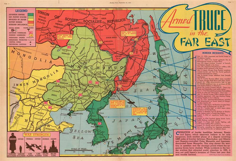
Armed Truce in the Far East.
sold
- Digital Map Information
- Suitable for large format printing
- File Size: 29.72 MB
- File Type: ZIP / TIFF
- ICC color profile embedded
- Delivered instantly via download link
This is a 1938 Edwin L. Sundberg pictorial map of East Asia. Tracing 'border incidents' between the Russians and the Japanese from 1935 until 1938, the map depicts the region from Ulaanbaatar to the Pacific Ocean and from the Soviet Union to Kyushu. (more details)
A city plan of Madrid featuring advertisements for well-known Spanish sherry and brandy.
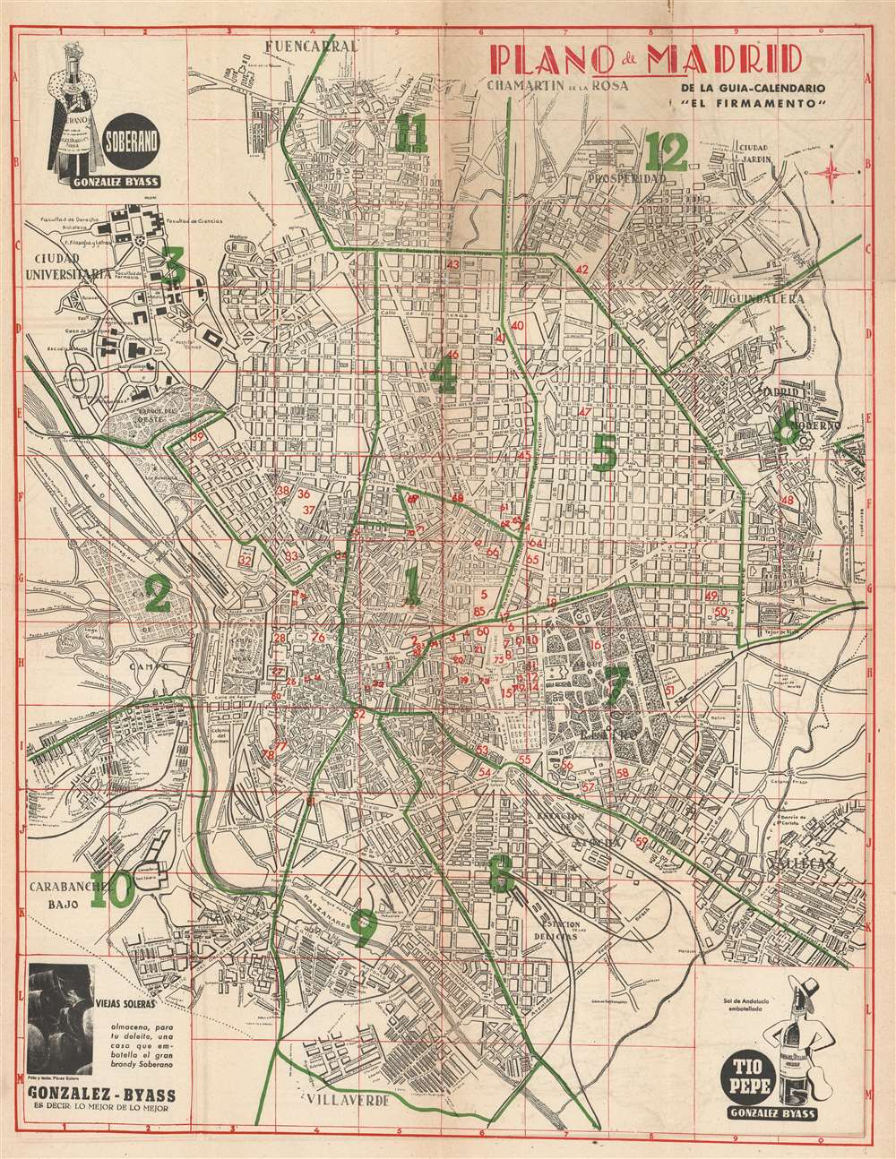
Plano de Madrid.
sold
- Digital Map Information
- Suitable for large format printing
- File Size: 36.28 MB
- File Type: ZIP / TIFF
- ICC color profile embedded
- Delivered instantly via download link
This is a c. 1950 El Firmamento city map or plan of Madrid, Spain. The map depicts the city from the Casa de Campo and the Ciudad Universitaria to Vallecas and from Fuencarral to Villaverde. Different districts are labeled throughout the city, as are streets, plazas, and parks. The city parks are illustrated in detail, including the paths within the Parque del Oeste and the Parque del Retiro. Eighty-five public buildings and monuments are numerically identified and correspond with an index printed on the verso. Advertisements for the González Bayass sherry winery are printed in three of the map's four corners. A general advertisement for the winery is situated in the lower left corner, while the upper left corner advertises Soberano, the winery's most celebrated brandy, named in recognition of the winery's friendship with the King of Spain. An advertisement for Tio Pepe, a Fino stye sherry, is in the lower right corner. (more details)
Rare early map of Florida based upon Spanish navigation.
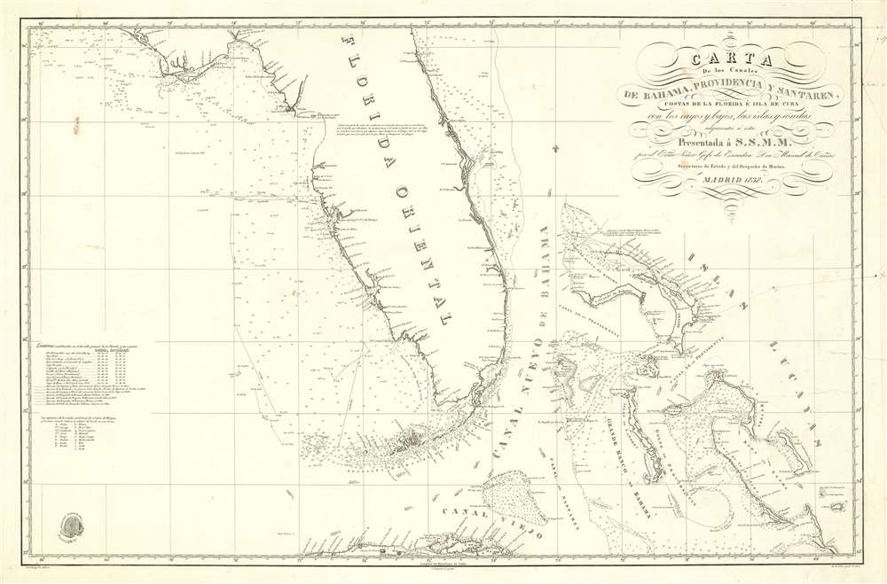
Carta de los Canales de Bahama, Providencia y Santaren, Costas de la Florida e Isla de Cuba con los cayos y bajos, las islas y sondas adyacentes a esta
sold
- Digital Map Information
- Suitable for large format printing
- DPI: 600
- File Size: 36.24 MB
- File Type: ZIP / TIFF
- ICC color profile embedded
- Delivered instantly via download link
A stunningly engraved 1838 Spanish nautical chart of Florida and the Bahamas (Lucayas) used by the Dirección Hidrografía. Coverage extends from roughly from St. Augustine to Cuba, and from the Bay of St. Andres (Saint Andrew Bay) to Rum Cay and I. Conception. There is very little inland detail, but the Florida Keys, Tampa bay, and the Vicinity of Miami are well maps - with notes as to where fresh water can be found. The routes of several seven voyages are noted here, and were influential in preparing the map, most undertaken between 1794 and 1820. The general shape of Florida of Florida is consistent with maps of the period, including an exaggerated hook south of Cape Romano, and an unexplored region in the vicinity of the Crystal River south of the Cedar Keys. (more details)
Charming pictorial map highlighting the unique character of the Delmarva Peninsula (Chesapeake Bay).
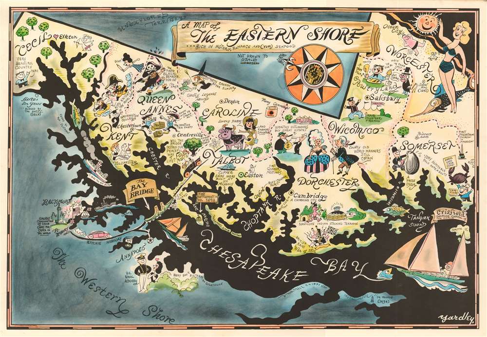
A Map of the Eastern Shore … Rich in History, Romance and (yum) Seafood.
sold
- Digital Map Information
- Suitable for large format printing
- File Size: 34.55 MB
- File Type: ZIP / TIFF
- ICC color profile embedded
- Delivered instantly via download link
This is Richard Q. Yardley's charming map of the eastern shore of the Chesapeake Bay. Comprising most of the Maryland portion of the Delmarva Peninsula, the map is oriented to the east and covers, roughly, Cecil, Kent, Queen Anne's, Caroline, Talbot, Dorchester, Wiscomsco, Worcester, and Somerset counties. Areas to the east and west, including Delaware ('Unexplored Territories') and the Western Shore of the Chesapeake Bay (with the exception of Baltimore and Annapolis) are shaded dark blue. Colorful vignette illustrations with humorous annotations fill the focus area, some lionizing local characters, lifestyle, history, and folklore; others gently poking fun at 'mainlanders.'
As reporter B. Drumond Ayres wrote in the September 12, 1982 New York Times,
As reporter B. Drumond Ayres wrote in the September 12, 1982 New York Times,
The Eastern Shore is a land for all seasons. But none quite compares with early fall, that wonderfully ambivalent time of fullness and decline, when the sea trout are still biting, doves are beginning to fly, a few fat tomatoes still cling to the vine, and the night air, although still alive with the chirp of crickets, provides excuse enough for the season's first wood fire. And this is the bargain season, the two-for-one time.He goes on to describe the independent personality of the region, suggesting it is more akin to an island than a peninsula. (more details)
…
The lay of the land, the language of the people, their food, their homes, their pursuits -these things tend to have a certain distinctiveness not found on the more homogenized mainland lying to the west across the broad marshes and waters of the Chesapeake.
Vaux and Olmstead's 1867 redesign of Fort Green Park, Brooklyn

Design for the Laying Out of the Grounds known as Fort Green or Washington Park, in the City of Brooklyn.
sold
- Digital Map Information
- Suitable for large format printing
- File Size: 8.68 MB
- File Type: ZIP / TIFF
- ICC color profile embedded
- Delivered instantly via download link
A rare 1867 example Vaux and Olmsted's map of Washington Park or, as it is now known, Fort Greene Park, Brooklyn. Oriented to the east, the map depicts the park as a whole and includes pathways, lakes, buildings, individual trees, rocks, and elevation measurements. The streets and avenues surrounding the park are also noted. The layout of Fort Greene Park shown here reflects Vaux and Olmsted's 1867 redesign. (more details)
Dutch Golden Age map of the British Isles.
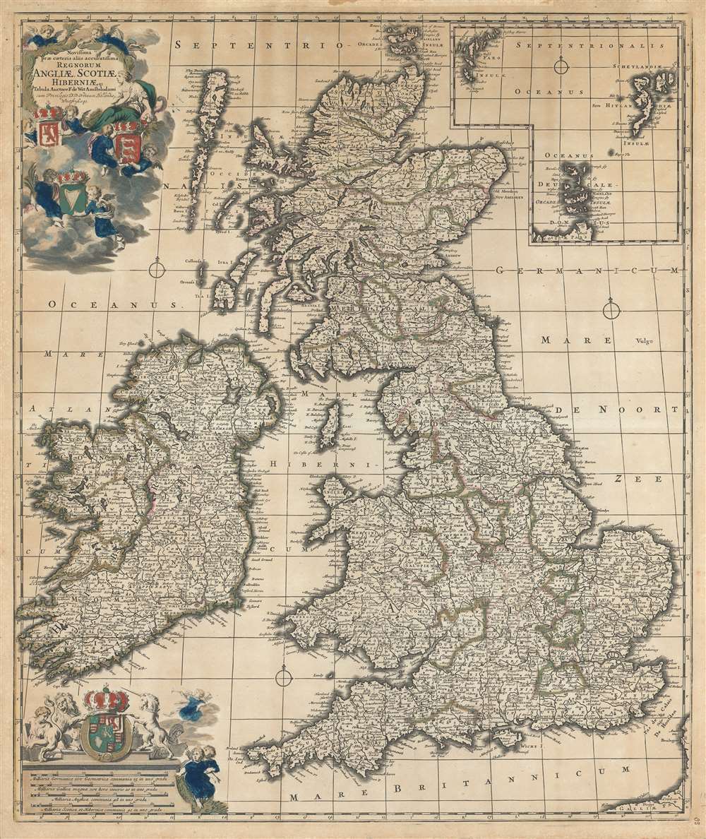
Novissima prae caeteris aliis accuratissima regnorum Angliae, Scotiae, Hiberniae.
sold
- Digital Map Information
- Suitable for large format printing
- DPI: 600
- File Size: 44.67 MB
- File Type: ZIP / TIFF
- ICC color profile embedded
- Delivered instantly via download link
An impressive c. 1690 Dutch Golden Age map of the British Isles by Frederick de Wit. The map including England, Scotland, Wales, and Ireland, as well as an inset of the Faro, Shetland and Orkney Islands. The title cartouche, appearing in the upper left, is surrounded by clouds in which putti display the coats of arms of England, Scotland and Ireland. The scale of miles, appearing in the lower left, is further embellished with the royal joint-sovereignty coat of arms of William and Mary (1689-94). (more details)