
Pictorial map of the Penobscot Bay region of Maine.
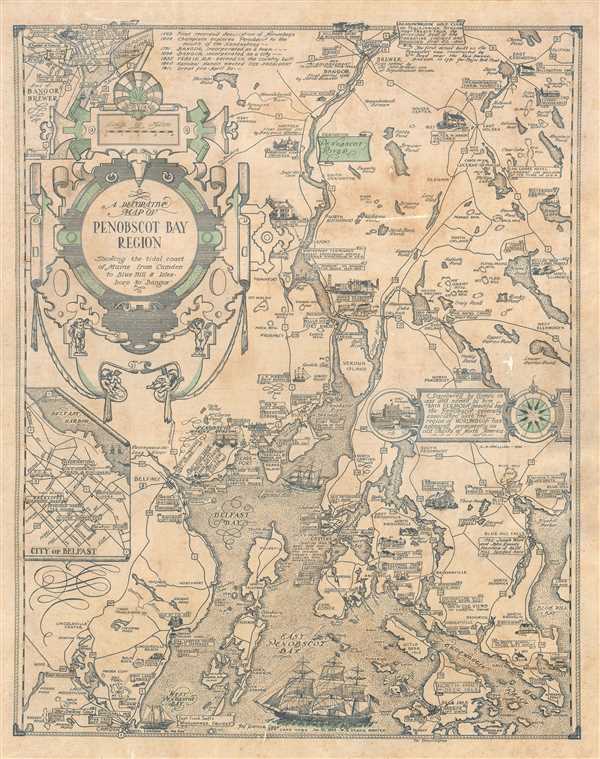
A Decorative Map of Penobscot Bay Region Showing the tidal coast of Maine from Camden to Blue Hill and Isles boro to Bangor.
sold
This is a 1940 Luther Savage Phillips pictorial map of Penobscot Bay, Maine. The map depicts the region from Hobbs Pond and Camp Merestead to Blue Hill Bay and from Bangor to Deer Isle. Sites throughout the region are illustrated in profile with their names inscribed on banners, including the Penobscot Marine Museum, the St. Regis Paper Company, Sunset Ridge Farm, Camp Roosevelt, and the Walter M. Hardy Orchard. Other regional sites are also identified, as are important highways, rivers, and islands. An inset to the right of center illustrates Fort Pownal and is situated next to a textbox that provides a short history of Penobscot Bay which reads, ‘Discovered by Gomes in 1525 and named by him ‘Baya Fermosa’ (beautiful bay), the Penobscot - generally associated with the region of Norumbega - has appeared prominently on old charts of North America.’ A short chronological history of the region is included as well, along the top border, near an inset map of 'Part of Bangor and Brewer', while a second insert, in the lower left quadrant, details the city of Belfast. Three sailing ships are depicted in Penobscot Bay, along with a lone sea monster. (more details)
Nautical chart for one of the most isolated archipelagic island chains in the world.
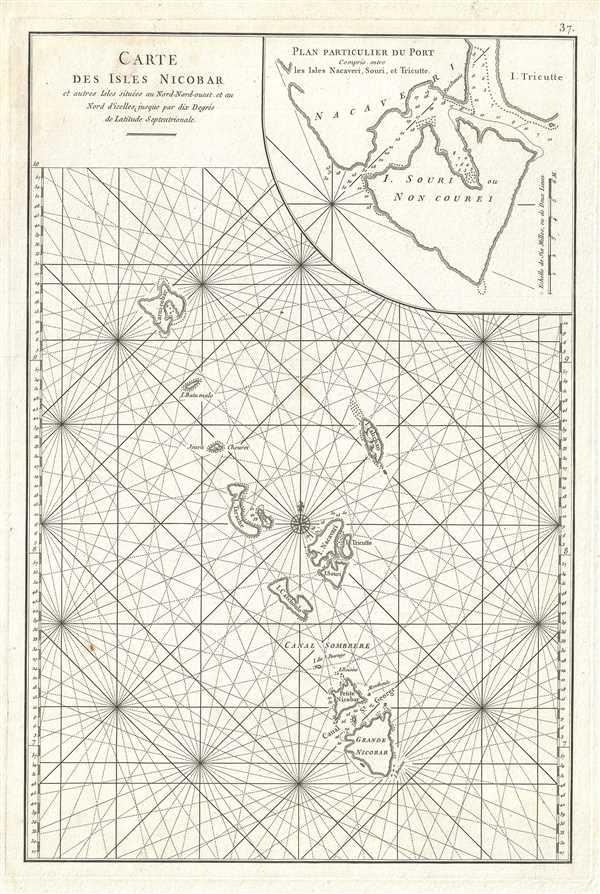
Carte des Isles Nicobar.
sold
- Digital Map Information
- Suitable for large format printing
- DPI: 300
- File Size: 6.77 MB
- File Type: ZIP / TIFF
- ICC color profile embedded
- Delivered instantly via download link
This is a beautiful 1775 maritime map or nautical chart of the Nicobar Islands of India. The map covers from the Car Nicobar Island south to the Great Nicobar Island and includes Little Nicobar, Katchal, Nancowry, Trinket Island, Camorta, Tillangchong, Bompoka, ... (more details)
Whimsical 19th century map of Great Britain and Ireland.
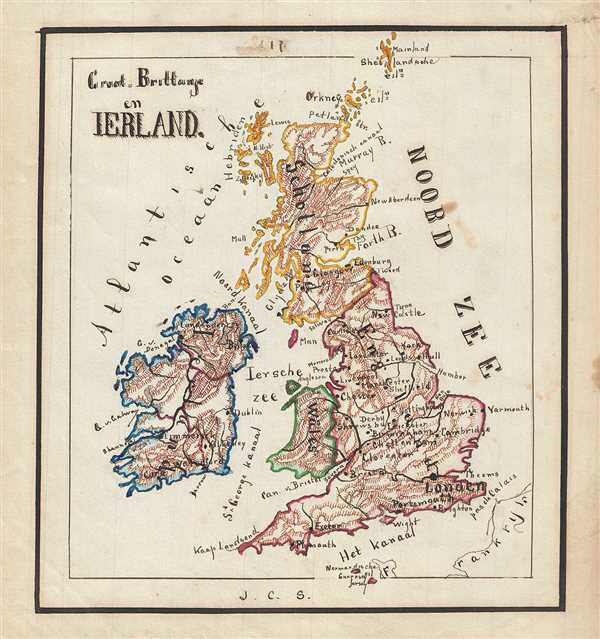
Groot-Brittahje en Ireland.
sold
- Digital Map Information
- Suitable for large format printing
- File Size: 2.17 MB
- File Type: ZIP / TIFF
- ICC color profile embedded
- Delivered instantly via download link
This is an attractive and whimsical 1871 manuscript map of the British Isles by J. C. Sikkel. Entirely hand-drawn, it covers Ireland, England, Wales, and Scotland including the Shetland Islands. Beautifully shows topography and notes several important cities, ... (more details)
Striking hand-drawn whimsical map of South America.

Zuid - Amerika.
sold
- Digital Map Information
- Suitable for large format printing
- File Size: 1.92 MB
- File Type: ZIP / TIFF
- ICC color profile embedded
- Delivered instantly via download link
This is an attractive 1871 manuscript map of South America by J. C. Sikkel. The map covers the entire continent, cut out and pasted on a larger sheet, and is hand-drawn with outstanding detail. The geography follows the conventions of the period with ... (more details)
19th century whimsical manuscript map of Africa.
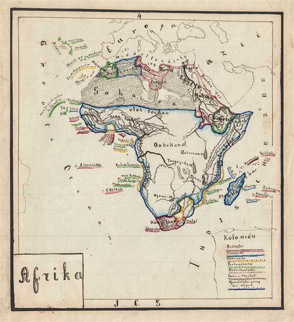
Afrika.
sold
- Digital Map Information
- Suitable for large format printing
- File Size: 2.53 MB
- File Type: ZIP / TIFF
- ICC color profile embedded
- Delivered instantly via download link
This is a beautiful 1871 manuscript map of Africa by J. C. Sikkel. The entire continent of Africa is hand drawn and includes Madagascar. The geography follows the conventions of the period with color coding representing the various possessions. The ... (more details)
Manuscript map of Asia showing various possessions.
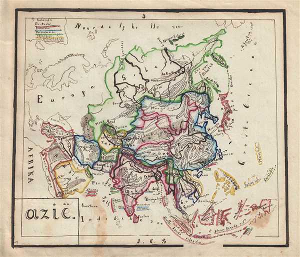
Azie.
sold
- Digital Map Information
- Suitable for large format printing
- File Size: 2.67 MB
- File Type: ZIP / TIFF
- ICC color profile embedded
- Delivered instantly via download link
This is an unusual and beautiful manuscript map of the Asia dating to 1871 drawn by J.C. Sikkel. The entire continent from Siberia to New guinea and is hand-drawn in outstanding detail. The geography follows the conventions of the period with ... (more details)
Extremely rare Japanese perspective satirical 'Octopus Map' of Asia.

A Humorous Diplomatic Atlas of Europe and Asia. / 滑稽欧亜外交地図 / Kokkei Ō-A Gaikō Chizu.
sold
- Digital Map Information
- Suitable for large format printing
- File Size: 13.69 MB
- File Type: ZIP / TIFF
- ICC color profile embedded
- Delivered instantly via download link
A wonderful example of the rare 1904 Kisaburō Ohara / Shingo Nakamura satirical 'Octopus Map' of Europe. Composed at the outbreak of the Russo-Japanese War (1904 - 1905), Ohara here follows the conventions established by J. J. van Brederode ( Humoristische-Oorlogskaart, 1870) and Fred Rose (Serio-Comic War Map, 1877). These two maps established the convention of satirizing Russian expansionism as a menacing Kraken-like 'Black Octopus.' Whereas Brederode and Rose confine their images to Russia, Ohara has here expanded the idea to encompass all of Eurasia. Russia's eight grasping tentacles extend across Europe and Asia; on many countries they already have a firm grip. Finland, Poland, Crimea, and the Balkan nations are represented as skulls, while tentacles grasp Turkey around the foot and waist, Persia about the neck, and Tibet by the arm. The Trans-Siberian Railway and the South Manchuria Railway, represented by the rightmost tentacle, had by this time extended Russian influence into Manchuria as far as the valuable ice-free Russian stronghold of Port Arthur. As this map was issued in March of 1904, the struggle between Russian and Japan over control of Port Arthur was ongoing. Port Arthur was surrendered to the Japanese, who defeated the Russian Fleet in December of 1905, several months after this map was printed. Ohara sums up the situation in his English language descriptions of the map, printed in the upper left,
Black Octopus is a name newly given to Russia by a certain prominent Englishman. For the black octopus is so avaricious, that he stretches out his eight arms in all directions, and seizes up every thing that comes within his reach. But as it sometimes happens he gets wounded seriously even by a small fish, owing to his too much covetousness. Indeed, a Japanese proverb says: 'Great avarice is like unselfishness.' We Japanese need not to say much on the cause of the present war. Suffice it to say that the further existence of the Black Octopus will depend entirely upon how he comes out of this war. The Japanese fleet has already practically annihilated Russia's naval powers in the Orient. The Japanese army is about to win a signal victory over Russia in Corea and Manchuria. And when ... St. Petersburg? Wait and see! The ugly Black Octopus! Hurrah! Hurrah! for Japan.Certainly the map had a strong message, but who saw it? (more details)
The last great cartographic masterpiece of Ming China.

Complete Map of the Nine Border Towns of the Great Ming and of the Human Presence and Travel Routes of the Ten Thousand Countries. / 大明九邊萬國人跡路程全圖 / Dàmíng jiǔ biān wànguó rén jì lùchéng quán tú.
sold
- Digital Map Information
- Suitable for large format printing
- Full resolution TIFF file
- ICC color profile embedded
- Delivered instantly via download link
A rare and extraordinary 1663 (Kangxi 2) xylographic map of Ming China, and indeed the entire world, by Wáng Jūnfǔ (王君甫) issued during the reign of the Kangxi Emperor (1661 – 1722). This massively proportioned map focuses on China, ... (more details)
A previously unknown early manuscript map of the early vicinity of Saigon or Ho Chi Minh City, Vietnam.

[Saigon and Cholon]
sold
- Digital Map Information
- Suitable for large format printing
- File Size: 40.34 MB
- File Type: ZIP / TIFF
- ICC color profile embedded
- Delivered instantly via download link
The finest and most detailed manuscript map yet discovered illustrating Saigon or Ho Chi Minh City, Vietnam. The map is centered on the center of Saigon City, west of the Song Sai Gon River between the Nhiêu Lộc River and the Bến Nghé ... (more details)
One of the most beautiful early 20th century maps of San Francisco.
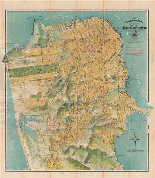
The 'Chevalier' Commercial Pictorial and Tourist Map of San Francisco.
sold
- Digital Map Information
- Suitable for large format printing
- File Size: 21.85 MB
- File Type: ZIP / TIFF
- ICC color profile embedded
- Delivered instantly via download link
One of the most beautiful early 20th century maps of San Francisco. This remarkable 1915 chromolithographic topographical and pictorial map of San Francisco, California was issued by August Chevalier. Named 'The Chevalier' after its author, ... (more details)
Only known example of this map overprinted to illustrate the Cook-Peary North Pole discovery debate of 1909.
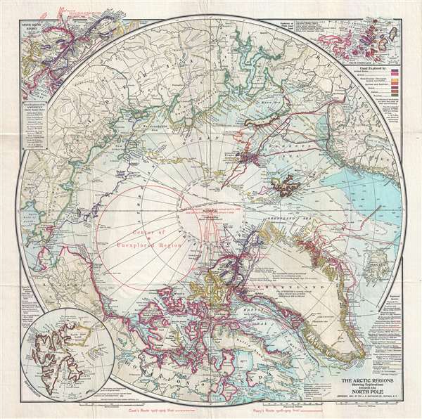
The Arctic Regions Showing Exploration towards the North Pole.
sold
- Digital Map Information
- Suitable for large format printing
- Full resolution TIFF file
- ICC color profile embedded
- Delivered instantly via download link
An extremely rare 1909 separately issued map of the Arctic showing exploratory routes towards the North Pole as of 1909. The map covers the Arctic regions as far south as Iceland and the Bearing Straits. The map is based upon a 1907 map ... (more details)
One of only two mansucript maps of Bombay we have seen.
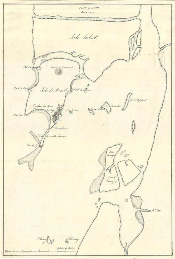
Plan du Port de Bombay.
sold
- Digital Map Information
- Suitable for large format printing
- DPI: 300
- File Size: 2.89 MB
- File Type: ZIP / TIFF
- ICC color profile embedded
- Delivered instantly via download link
A remarkable and unique c. 1830 manuscript plan or map of Bombay (Mumbai), India. The map covers Bombay from roughly modern day Andheri East to modern day Zirad. Cartographically, it is based on the c. 1775 work of Jean-Baptiste After ... (more details)
Blair's remarkable 19th century Temperance Movement map of New York City.

Map of New York City to Accompany 'The Temperance Movement or the Conflict between Man and Alcohol.'
sold
- Digital Map Information
- Suitable for large format printing
- File Size: 6.22 MB
- File Type: ZIP / TIFF
- ICC color profile embedded
- Delivered instantly via download link
A fascinating 1887 persuasive map of New York City in which the locations of some 9000 licensed bars and saloons are identified in red. The map covers Manhattan south of 115th street as well as adjacent parts of Jersey City, Hoboken, ... (more details)
Scarce nautical chart that details the voyages of Scottish slaver Archibald Dalzel.
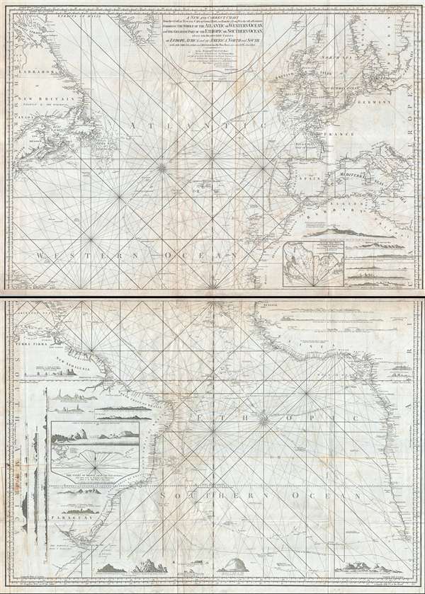
A New and Correct Chart From the 63.° of Lat: N. to the Cape of Good Hope, and from the 71.° Long: W. to the 38° E. of London. Exhibiting the Whole of the Atlantic or Western Ocean, and the Greatest Part of the Ethiopic or Southern Ocean; wherein the Respective Coasts of Europe, Africa, and of America North and South, with all the Islands and Dangers in the Two Seas are carefully described.
sold
- Digital Map Information
- Suitable for large format printing
- DPI: 300
- File Size: 75.84 MB
- File Type: ZIP / TIFF
- ICC color profile embedded
- Delivered instantly via download link
A massive two part 1802 Laurie and Whittle maritime map or nautical chart of the Atlantic Ocean. The map is presented in two large panels which can be joined or displayed separately. The upper panel details the Atlantic from ... (more details)
Revolutionary War Era Map of Cape Cod and Boston Harbor with dramatic cartouche.
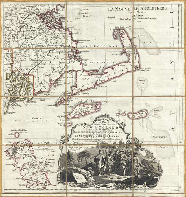
A Map of the most Inhabited part of New England containing the Provinces of Massachusets Bay and New Hampshire, with the Colonies of Connecticut and Rhode Island, divided into Counties and Townships: The whole composed form Actual Surveys and its Situation adjusted by Astronomical Observations.
sold
- Digital Map Information
- Suitable for large format printing
- Full resolution TIFF file
- ICC color profile embedded
- Delivered instantly via download link
A dramatic 1777 Braddock Mead and Le Rouge map of Cape Cod, Nantucket, Martha's Vineyard and Boston Bay. The map covers from Boston to Martha's Vineyard and from Narragansett Bay to Crab Bank and the Nantucket Shoals. This ... (more details)
Wonderful decorative propaganda map advocating for the United States as a global power following the acquisition of Upper California and Texas as the end of the Mexican American War.
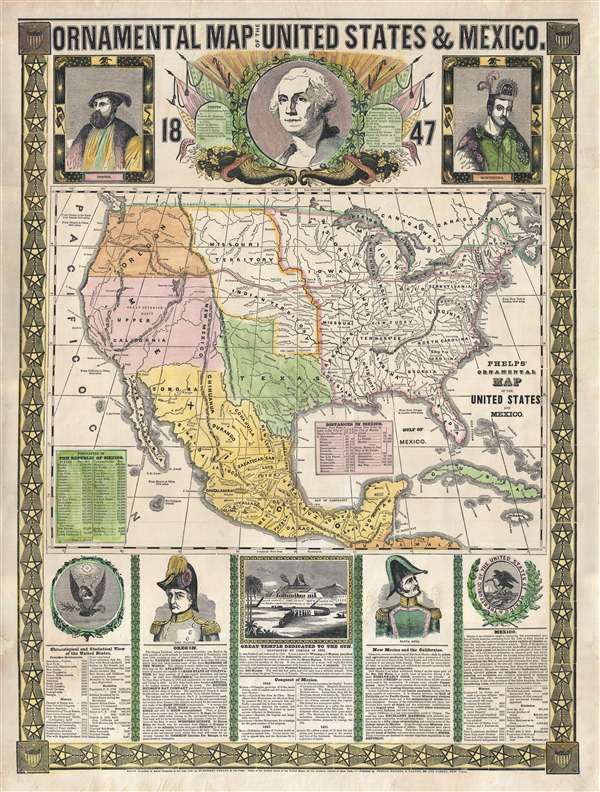
Ornamental Map of The United States and Mexico, 1847.
sold
- Digital Map Information
- Suitable for large format printing
- DPI: 300
- File Size: 18.49 MB
- File Type: ZIP / TIFF
- ICC color profile embedded
- Delivered instantly via download link
A remarkably graphic propaganda map of the United States in 1847 by Humphrey Phelps. Boldly expressing U.S. dominance of the continent, this map loudly proclaims Manifest Destiny. The United States is here transformed by ... (more details)
The finest large scale atlas map of North and South Carolina to appear in the 19th century.

Map of North and South Carolina by H. S. Tanner.
sold
- Digital Map Information
- Suitable for large format printing
- DPI: 300
- File Size: 17.88 MB
- File Type: ZIP / TIFF
- ICC color profile embedded
- Delivered instantly via download link
A rare and important map of North Carolina and South Carolina by H. S. Tanner. This elephant folio map covers all of Georgia and Alabama as well as, in less detail, adjacent parts of Georgia, Tennessee, and Virginia. The ... (more details)
Beautiful early plan of the city with illustration of the Quebec Exchange.
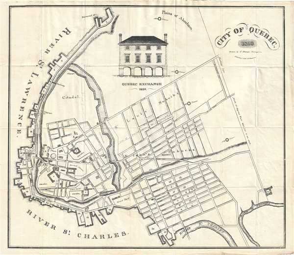
City of Quebec.
sold
- Digital Map Information
- Suitable for large format printing
- DPI: 300
- File Size: 8.3 MB
- File Type: ZIP / TIFF
- ICC color profile embedded
- Delivered instantly via download link
This is a beautiful and extremely rare 1829 map of the city of Quebec, Canada by J. Hamel. Oriented with north at the bottom, the map covers fortified center of Quebec City at the conjunction of the St. Laurence River and ... (more details)
Includes images of famous monuments and tourist attractions.
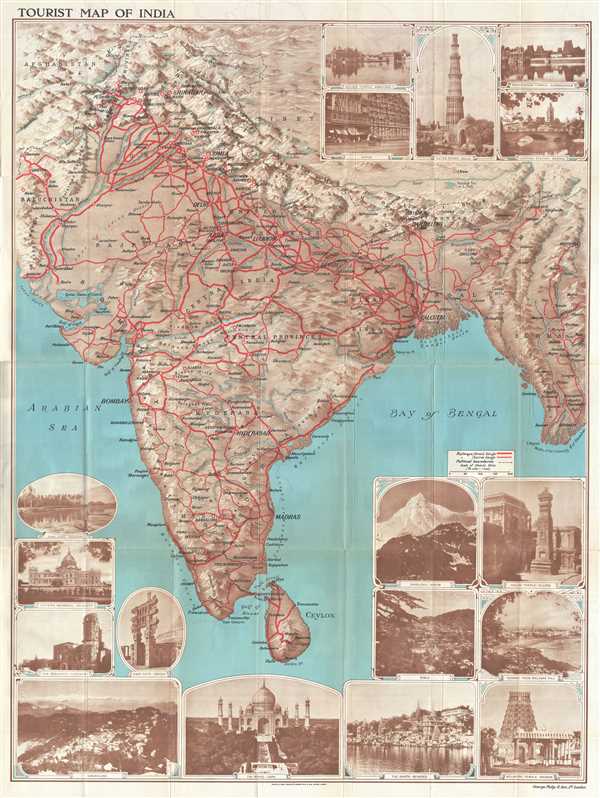
Tourist Map of India
sold
- Digital Map Information
- Suitable for large format printing
- File Size: 50.34 MB
- File Type: ZIP / TIFF
- ICC color profile embedded
- Delivered instantly via download link
This is a lovely c.1930 map of India by George Philip and Sons Ltd. The map extends from Kashmir south to include Ceylon or Sri Lanka and includes modern day India, Pakistan, Nepal, Bhutan, and Burma or Myanmar. Cities, towns, and villages are labeled throughout, with large block lettering marking the region's most important cities. Bold red lines highlight the region's railway network and even differentiates between broad gauge and narrow gauge tracks. (more details)
Beautiful pictorial map or guide to Switzerland's cuisine.
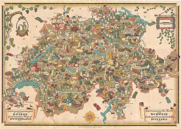
Carte Gastronomique de la Suisse. Gastronomic map of Switzerland. Gastronomische Karte der Schweiz. Carta gastronomica della Svizzera.
sold
- Digital Map Information
- Suitable for large format printing
- File Size: 19.39 MB
- File Type: ZIP / TIFF
- ICC color profile embedded
- Delivered instantly via download link
This is a fascinating 1939 pictorial map of Switzerland depicting the cuisine of Switzerland. The map covers the entire country in striking detail. Notes cantons, rivers, lakes, and roads. The entire map is covered in ... (more details)