
Occupied Germany after World War II.

Atlanta Karte der Besatzungs-Zonen mit Neuen Postleitgebieten. КАРТА ОККУПАЦИОННЫХ ЗОН. Map of the Occupation Areas. Carte des Zones d'Occupation.
sold
- Digital Map Information
- Suitable for large format printing
- File Size: 19.87 MB
- File Type: ZIP / TIFF
- ICC color profile embedded
- Delivered instantly via download link
This is the c. 1946 Atlanta Service map of Germany delineating the Allied Occupation Zones after the defeat of Nazi Germany. Text appears in four different languages: English, Russian, French, and German. The Oder-Neisse Line, the basis for the border between Germany and Poland, is in bold. The four Occupation Zones, administered by the United States, Great Britain, France, and the Soviet Union, are divided and shaded accordingly. Former Eastern Germany is highlighted to indicate that it was now part of a reconstituted Poland, and possibly its allegiance to the Soviet Union. Berlin is specifically highlighted, because, as it was the capital of defeated Nazi Germany, it was decided that all four Allies would occupy and administer a sector of the city. An inset in the lower-left depicts a divided Berlin, illustrating neighborhoods within each zone. (more details)
Rome's many ancient sites.

Plan of Rome 1887.
sold
- Digital Map Information
- Suitable for large format printing
- File Size: 43.03 MB
- File Type: ZIP / TIFF
- ICC color profile embedded
- Delivered instantly via download link
This is a striking 1887 tourism and transportation map of Rome, Italy, highlighting the city's historic monuments. (more details)
Malaspina hydrography and Ildefonso de Aragón geography.

Reduzierte Karte von den Philippinen und den Sulu Inseln.
sold
- Digital Map Information
- Suitable for large format printing
- File Size: 1049.97 MB
- File Type: ZIP / TIFF
- ICC color profile embedded
- Delivered instantly via download link
This is a striking 1832 Heinrich Berghaus map of the Philippines. It was issued for Berghaus' looseleaf Atlas von Asien, the best-informed general cartographic work on Asia to appear in the mid-19th century. It is the first large-scale map to comprehensively incorporate both the Malaspina hydrography and Ildefonso de Aragón seminal geographical surveys. (more details)
Ancient Meets Modern.
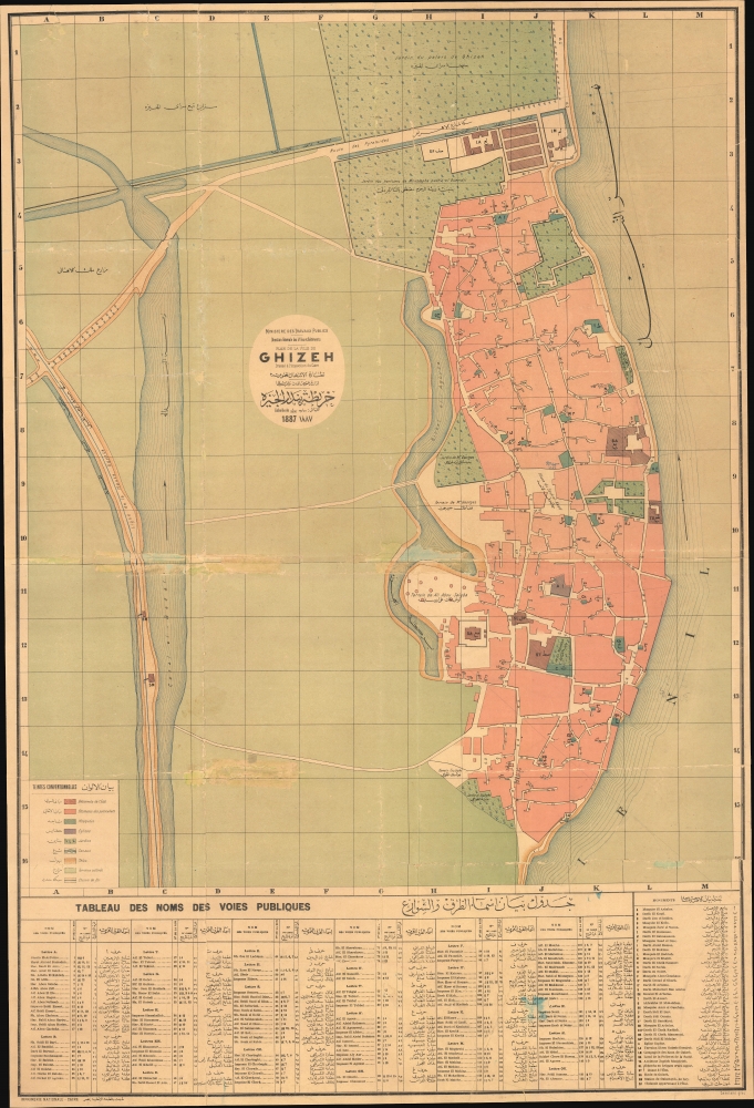
Plan de la ville de Ghizeh / خريطة مدينة الجيزة.
sold
- Digital Map Information
- Suitable for large format printing
- File Size: 55.09 MB
- File Type: ZIP / TIFF
- ICC color profile embedded
- Delivered instantly via download link
A scarce large-format bilingual (French - Arabic) city map of plan of Giza, Egypt, prepared by the Egyptian Supervision (Ministry) of Public Works and printed in 1887 by the National Printing Press of Egypt. It was produced as Giza was becoming an increasingly popular destination for European Egyptologists, a process facilitated by the completion of the railway seen here. (more details)
Fortifying the Frontier.
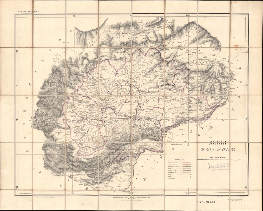
District Peshawar.
$2,000.00
Acquire
- Digital Map Information
- Suitable for large format printing
- File Size: 41.59 MB
- File Type: ZIP / TIFF
- ICC color profile embedded
- Delivered instantly via download link
A scarce folding map of Peshawar and environs, originally published in 1884 by the Survey of India and here updated to 1906. It presents the region as it was solidified as the frontline of the British Raj and a buffer zone between India and Afghanistan. (more details)
A Scarce Map from the Opening Days of World War I.

Karikatur des Europäischen Kriegsschauplatzes.
sold
- Digital Map Information
- Suitable for large format printing
- File Size: 10.86 MB
- File Type: ZIP / TIFF
- ICC color profile embedded
- Delivered instantly via download link
A scarce 1914 serio-comic chromolithographic map from the early days of the First World War, printed by Fritz Elsner. Providing a German perspective on the conflict, it harshly denounces the country's enemies, including France, Britain, and Russia. (more details)
First European Atlas Map of the Beijing Region.
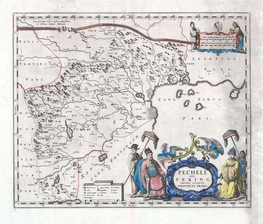
Pecheli, sive Peking, Imperii Sinarum Provincia Prima.
sold
- Digital Map Information
- Suitable for large format printing
- DPI: 600
- File Size: 46.6 MB
- File Type: ZIP / TIFF
- ICC color profile embedded
- Delivered instantly via download link
This is Martino Martini's 1655 map of Beijing / Peking vicinity, China, printed by Joan Blaeu for the Novus Atlas Sinensis, considered the first European atlas of China. The work was based on Chinese sources edited by Martini, who spent years in China, and thus was 'far in advance of any previous European work. For the period, it was remarkably accurate' (Tooley). (more details)
One of the first maps to show the Pacific Northwest.
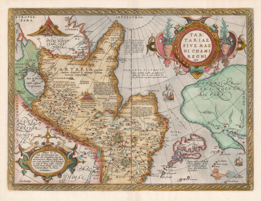
Tartariae Sive Magni Chami Regni typus.
$1,800.00
Acquire
- Digital Map Information
- Suitable for large format printing
- DPI: 600
- File Size: 46.45 MB
- File Type: ZIP / TIFF
- ICC color profile embedded
- Delivered instantly via download link
An example of Ortelius' seminal 1579 map of Tartary, one of the first maps to focus on the North Pacific. While the map is intended to detail Asia under the Great Khan, it is perhaps more notable for what it presents of America. The map includes what is now the west coast of the United States, northwestern Canada, and Alaska, lands then almost entirely unknown. It is the earliest obtainable map to name California. It also displays a strait separating Asia and America - the Strait of Anian - appearing long before Vitus Bering's exploration proved the existence of such. (more details)
French interest in the California Gold Rush.

Carte de la Nouvle. Californie.
sold
- Digital Map Information
- Suitable for large format printing
- File Size: 13.34 MB
- File Type: ZIP / TIFF
- ICC color profile embedded
- Delivered instantly via download link
This is a scarce and overlooked 1850 map of Upper California issued by Hypolite Ferry at the height of the California Gold Rush. It is the first French-language map of the gold region issued to capitate on widespread French interest and investment in joint-stock mining companies. (more details)
Ancient and modern Mapping of Crete.
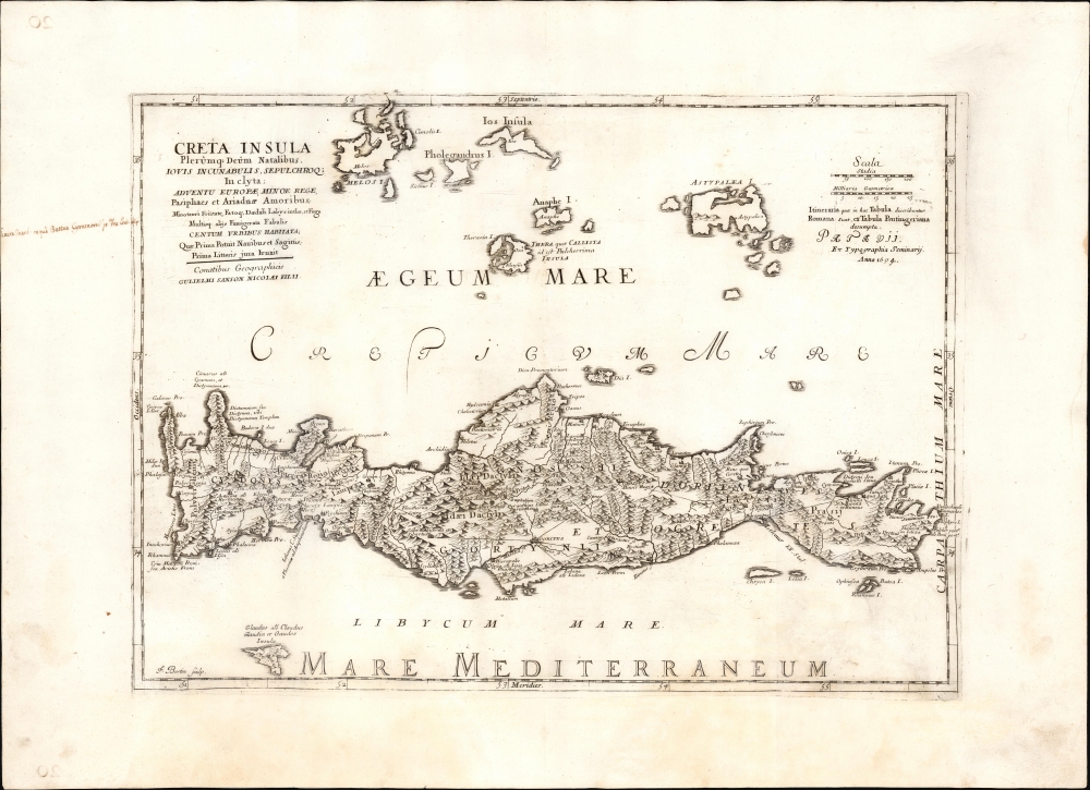
Creta Insula Plerûmq...
sold
- Digital Map Information
- Suitable for large format printing
- File Size: 18.67 MB
- File Type: ZIP / TIFF
- ICC color profile embedded
- Delivered instantly via download link
This is an elegant 1694 map, after Sanson, of the Greek island of Crete, combining modern topography with Roman-era toponymy. (more details)
One of the Earliest Printed Maps of Ceylon / Sri Lanka.

[Tabula XII. Asiae.]
$750.00
Acquire
- Digital Map Information
- Suitable for large format printing
- Full resolution TIFF file
- ICC color profile embedded
- Delivered instantly via download link
This is Laurent Fries' 1525 edition of Martin Waldseemüller's Ptolemaic map of Sri Lanka. This island - here named Taprobana - represented, for Ptolemy, the limit of European geographic knowledge in the east. The smallest area to have appeared in Ptolemaic canon, later geographers wrestled with the identity of the island depicted. Many correctly identified the island as Sri Lanka, though Munster, Mercator, and others speculated that the better candidate was Sumatra. (more details)
Scarce, Prague-engraved map of Crete.
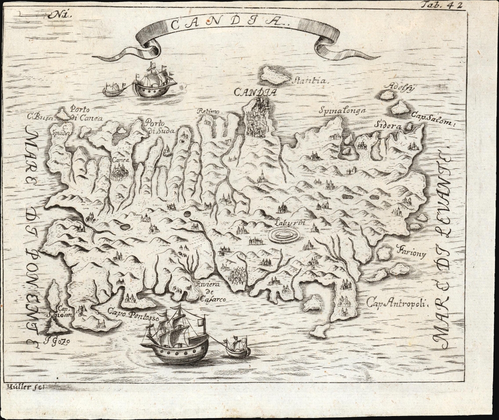
Candia.
sold
- Digital Map Information
- Suitable for large format printing
- File Size: 2.8 MB
- File Type: ZIP / TIFF
- ICC color profile embedded
- Delivered instantly via download link
This is a 1732 map of Crete, appearing in the printed pilgrimage of the Bohemian monk and traveler Angelikus Maria Müller. This north-oriented map illustrates the island's topography pictorially and dramatically. The map is strikingly engraved and embellished with fine ships. (more details)
Siwa, Bahariya, Farafra, Dakhla-Kharga Circuit.
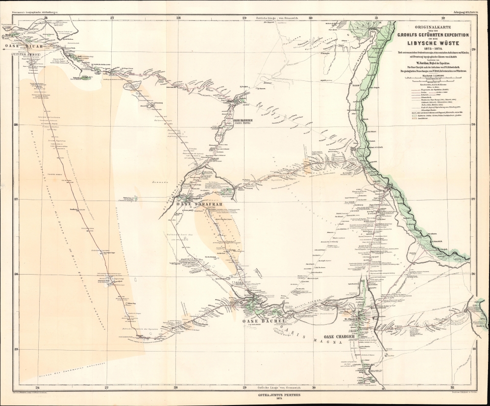
Originalkarte der von G. Rohlfs geführten Expedition in die Libysche Wüste, 1873 - 1874.
$500.00
Acquire
- Digital Map Information
- Suitable for large format printing
- File Size: 12.48 MB
- File Type: ZIP / TIFF
- ICC color profile embedded
- Delivered instantly via download link
A fascinating map of the deserts of western Egypt and eastern Libya, tracing the routes of the 1873 - 1874 Rohlfs Expedition, drawn by the expedition's surveyor Wilhelm Jordan. It is one of the few, and perhaps the first, early maps to detail the desert oases of western Egpyt. Today, the Siwa, Bahariya, Farafra, Dakhla-Kharga Route is a possible if rugged circuit for the adventurous traveler. (more details)
Earliest Acquirable Derivative of the First Map of France made in France.
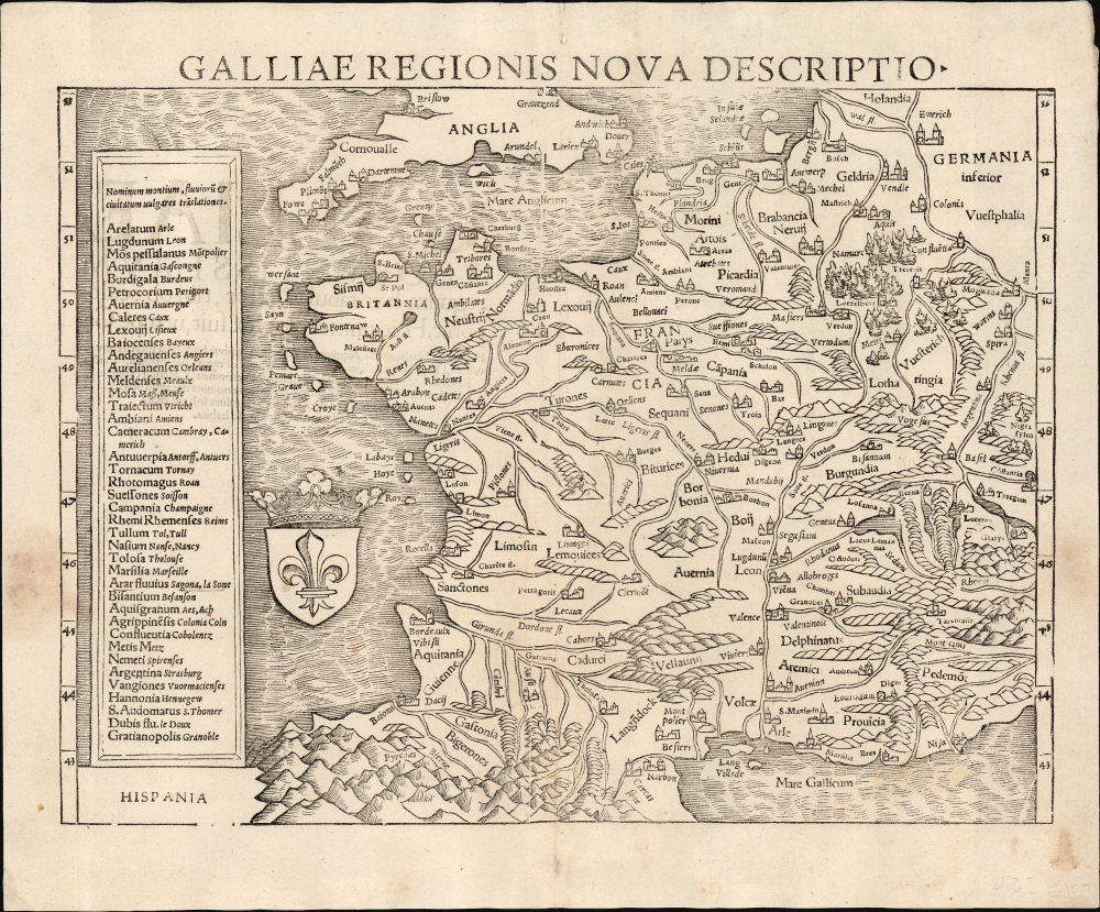
Galliae Regionis Nova Descriptio.
sold
- Digital Map Information
- Suitable for large format printing
- Full resolution TIFF file
- ICC color profile embedded
- Delivered instantly via download link
This elegant 1550 woodcut map by Sebastian Münster is one of the earliest acquirable true modern maps of France, being based on the unacquirable 1525 Oronce Finé Nova Totius Galliae descriptio, the first map of France produced in France based on contemporaneous observations. Münster's work is the earliest acquirable derivative of that groundbreaking map. (more details)
Rebuilding after the Revolution.

Western division of Paris. / Eastern division of Paris.
sold
- Digital Map Information
- Suitable for large format printing
- Full resolution TIFF file
- ICC color profile embedded
- Delivered instantly via download link
A 1834 two-sheet map or plan of the city of Paris, France, by the Society for the Diffusion of Useful Knowledge (S.D.U.K.). (more details)
City of Brotherly Love.
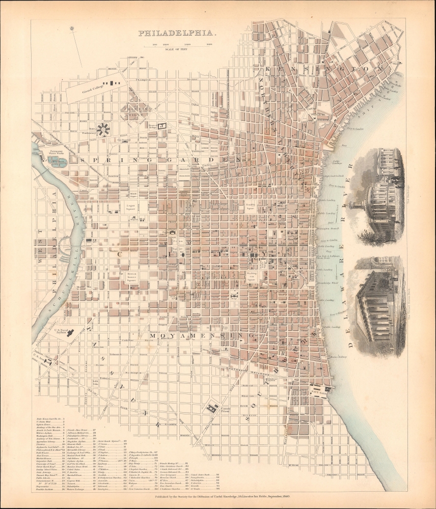
Philadelphia.
sold
- Digital Map Information
- Suitable for large format printing
- File Size: 10.52 MB
- File Type: ZIP / TIFF
- ICC color profile embedded
- Delivered instantly via download link
An 1840 map or plan of the city of Philadelphia by the Society for the Diffusion of Useful Knowledge (S.D.U.K.). (more details)
Serio comic map of Europe just after the outbreak of World War II.

L'Europe en Sept. 1939.
sold
- Digital Map Information
- Suitable for large format printing
- File Size: 57.07 MB
- File Type: ZIP / TIFF
- ICC color profile embedded
- Delivered instantly via download link
This is a striking 1939 André Vlaanderen serio-comic map of 'Europe in September 1939' just after the outbreak of World War II. Vlaanderen adopts the serio-comic map genre to convey the violence, chaos, and fear that enveloped Europe. He pays tribute to Fred Rose, the popularizer of the serio-comic map, by drawing Norway and Sweden (Nos. 13 and 14) as dogs, following Rose's 1899 Angling in Troubled Waters. Instead of providing our own explication of this map, we offer Vlaanderen's words instead. (more details)
First depiction of South America south of the Rio de la Plata based on Exploration
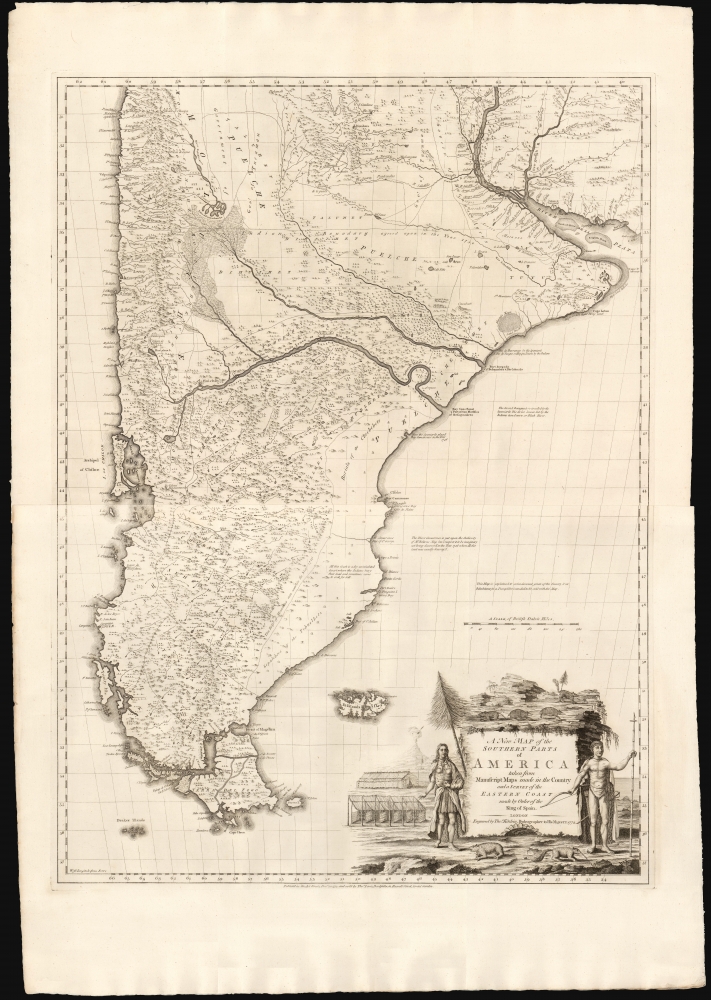
A New Map of the Southern Parts of America.
sold
- Digital Map Information
- Suitable for large format printing
- File Size: 55.22 MB
- File Type: ZIP / TIFF
- ICC color profile embedded
- Delivered instantly via download link
This is a beautiful example of Thomas Kitchin and English Jesuit Missionary Thomas Falkner's huge 1772 map of South America below the Rio de la Plata. The map is the fruit of some forty years of exploration, providing the first glimpse of the interior regions of Patagonia based on firsthand experience. (more details)
Extremely Rare Inspirationist Broadside.

Eben Ezer Sam. 7. 12.
sold
- Digital Map Information
- Suitable for large format printing
- File Size: 13.3 MB
- File Type: ZIP / TIFF
- ICC color profile embedded
- Delivered instantly via download link
This is a one-of-a-kind lithograph broadside by Joseph Prestele (1796 - 1867) encompassing the migration from Hesse, Germany to western New York of the pietist sect known as the Community of True Inspiration. It is a composite image narrating the journey from Germany to America of Prestele and his coreligionists. It illustrates the estates in Hesse, where the sect took root; the ship that brought Prestele and his family to America in 1843; the views of Staten Island visible from the ship; and panoramas of the three villages of Eben-Ezer where Prestele and the Inspirationists settled in the 1840s and 50s. (more details)
Lost Continent of Atlantis: Found?
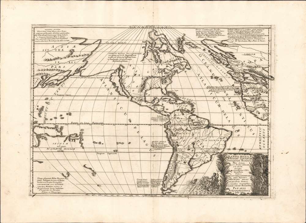
Atlantis Insula a Nicolao Sanson antiquitati restituta nunc demum majori forma delineata et in decem regna iuxta decem Neptuni filios distributa Praeterea insualae. nostraeqr contenentis regiones quibus imperavere Atlantici reges aut quas armis tentavere ex conatibus geographicus.
sold
- Digital Map Information
- Suitable for large format printing
- Full resolution TIFF file
- ICC color profile embedded
- Delivered instantly via download link
This is a beautiful example of Nicolas and Guillaume Sanson's map of America as the lost continent of Atlantis. The present examples is a scarce 1694 Italian edition, finely engraved and printed with strong inks on beautiful Italian paper - à la Coronelli. It is visually and physically superior to Sanson's own earlier editions. (more details)