
Detailed ground plan of the St. Louis World's Fair.

St. Louis World's Fair Louisiana Purchase Exposition May to December 1904.
sold
- Digital Map Information
- Suitable for large format printing
- File Size: 5.96 MB
- File Type: ZIP / TIFF
- ICC color profile embedded
- Delivered instantly via download link
This is an appealing 1903 ground plan or map of the Louisiana Purchase exposition of the St. Louis World’s Fair held in St. Louis, Missouri. The map, oriented with north at the bottom, covers the exposition grounds from Forest Park to Pennsylvania Avenue, naming ... (more details)
A finely engraved map of the West Indies.

A New Map of the West India Isles, from the Latest Authorities.
sold
- Digital Map Information
- Suitable for large format printing
- DPI: 300
- File Size: 15.07 MB
- File Type: ZIP / TIFF
- ICC color profile embedded
- Delivered instantly via download link
A beautiful example of John Cary’s important 1803 map of Florida, Central America and the West Indies. Cary's map covers from Texas (called Cenis) eastward to the Carolinas and the Bahamas, and then southward past Florida and the West Indies to include all of ... (more details)
Rare and dramatic Bird's-Eye View of Helena, Montana.

Perspective map of the city of Helena, Mont. Capital of State, county seat of Lewis & Clarke Co.
sold
- Digital Map Information
- Suitable for large format printing
- Full resolution TIFF file
- ICC color profile embedded
- Delivered instantly via download link
A dramatic bird's-eye view of Helena, Montana, issued by the Henry Wellge and the American Publishing Company in 1890. This impressive view is a fine example of Wellge's work, which is known for monumental size and emphasis of the horizontal dimension. The ... (more details)
Rare highly decorative map of the Strait of Magellan showing Spilbergen's route.
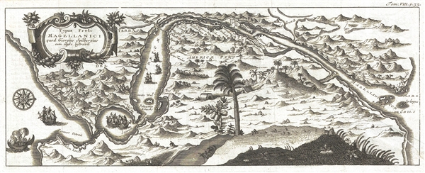
Typus Freti Magellanici quod Giorguis Spilbergius cum classe lustgravit.
sold
- Digital Map Information
- Suitable for large format printing
- DPI: 300
- File Size: 3.23 MB
- File Type: ZIP / TIFF
- ICC color profile embedded
- Delivered instantly via download link
A very rare and highly decorative map of the Strait of Magellan published by René-Auguste-Constantin de Renneville to illustrate the Joris van Spilbergen's 1615 navigation through the strait. The map is oriented to the southwest, with northeast at the ... (more details)
Bellin's beautiful map of the Straits of Magellan.
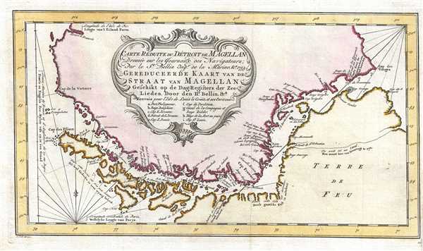
Carte Reduite du Detroit de Magellan Dressee sur les Journaux des Navigateurs.
sold
- Digital Map Information
- Suitable for large format printing
- DPI: 300
- File Size: 3.43 MB
- File Type: ZIP / TIFF
- ICC color profile embedded
- Delivered instantly via download link
This is a beautiful 1753 Bellin map of the Straits of Magellan, South America. It covers the important strait located at the southern tip of the South American mainland, just north of Tierra del Fuego. Extends from Cap des Vierges to Cap de la Victoire. ... (more details)
Beautiful map of Arabia based on earlier map by Vaugondy.
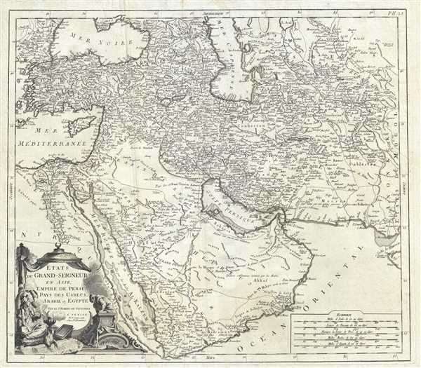
Etats du Grand-Seigneur en Asie, Empire de Perse, Pays des Usbecs, Arabie et Egypte.
sold
- Digital Map Information
- Suitable for large format printing
- DPI: 300
- File Size: 19.06 MB
- File Type: ZIP / TIFF
- ICC color profile embedded
- Delivered instantly via download link
This is Paolo Santini’s spectacular 1778 map of the Persia, Arabia and Turkey or the Ottoman Empire. Covers the Empire at its height, with territory spanning from the Black Sea to the southernmost extension of Arabia and west, inclusive of Persia, as ... (more details)
Beautiful city plan of Paris, France.
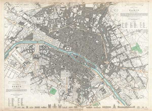
Western division of Paris. Eastern division of Paris.
sold
- Digital Map Information
- Suitable for large format printing
- DPI: 300
- File Size: 14.13 MB
- File Type: ZIP / TIFF
- ICC color profile embedded
- Delivered instantly via download link
This is a beautiful 1834 map or plan of the city of Paris, France by the Society for the Diffusion of Useful Knowledge. Centered on the Seine River, the map covers the embastilled center of Paris in beautiful detail. Streets, parks, bridges, monuments, ... (more details)
Beautiful map of North America depicting the Northwest Passage.
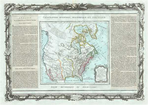
Nouveau Mexique, Louisiane, Canada, et les Etats Unis.
sold
- Digital Map Information
- Suitable for large format printing
- DPI: 300
- File Size: 14.64 MB
- File Type: ZIP / TIFF
- ICC color profile embedded
- Delivered instantly via download link
A rare and highly unusual 1786 map of North America by Desnos and Brion de la Tour. It depicts North America according to the French conception with a northwest passage extending west from Hudson Bay towards Lake Winipigue, then along the mythical 'R. ... (more details)
City Plan of Boston with beautifully illustrated views.
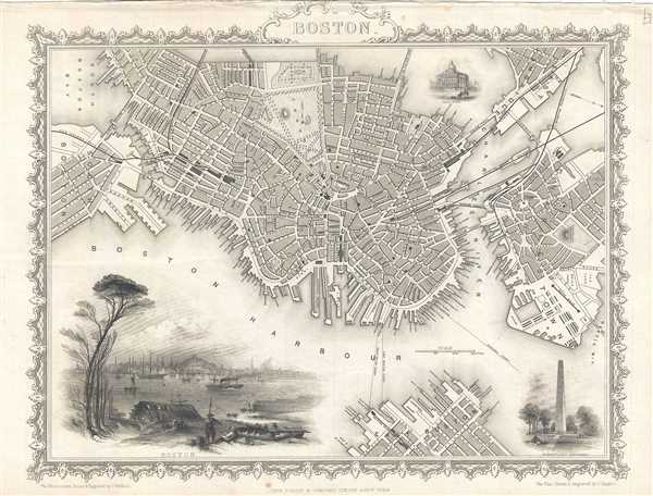
Boston.
sold
- Digital Map Information
- Suitable for large format printing
- DPI: 300
- File Size: 5.4 MB
- File Type: ZIP / TIFF
- ICC color profile embedded
- Delivered instantly via download link
A beautiful example of John Tallis’ and John Rapkin's 1851 decorative map of Boston, Massachusetts. The map covers downtown Boston prior to the Back Bay landfill projects, extending from Dover Street to the Charles River. Parts of adjacent South ... (more details)
Beautiful maritime map of the eastern coast of India.
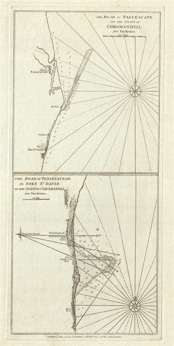
The Road of Palleacate, off the Coast of Coromandell. The Road of Tengepatnam or Fort St. David on the Coast of Coromandel.
$200.00
Acquire
- Digital Map Information
- Suitable for large format printing
- DPI: 300
- File Size: 6.97 MB
- File Type: ZIP / TIFF
- ICC color profile embedded
- Delivered instantly via download link
This is a fine example of Laurie and Whittle's 1794 nautical chart or maritime map of Palleacate (Pulicat) and Tengepatnam or Fort St. David on the Coromandel Coast in the state of Tamil Nadu, India. Essentially two maps on one sheet, the upper map ... (more details)
Early map of the world depicting the Sea of the West.

Mappe-Monde dressee pour l'Etude de la Geographie, relativement aux Auteurs les plus Modernes.
sold
- Digital Map Information
- Suitable for large format printing
- DPI: 300
- File Size: 13.42 MB
- File Type: ZIP / TIFF
- ICC color profile embedded
- Delivered instantly via download link
This is a beautiful example of Desnos and Brion de la Tour’s 1786 map of the world on a hemisphere projection. North America, particularly the Northwestern quadrants, are exceptionally interesting and speculative. A magnificent inland sea, called ... (more details)
Exceptional map of the western hemisphere depicting the two competing theories in the mapping of the Pacific Northwest.
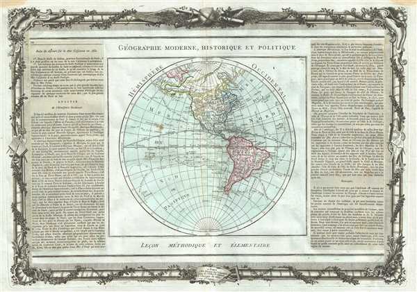
Hemisphere Occidental.
sold
- Digital Map Information
- Suitable for large format printing
- DPI: 300
- File Size: 13.89 MB
- File Type: ZIP / TIFF
- ICC color profile embedded
- Delivered instantly via download link
This is a exceptional map of the Western Hemisphere by de la Tour and Desnos dating to 1786. Covers the entire hemisphere in beautiful detail covering North America and South America. The routes of many explorers and important recent discoveries ... (more details)
Beautiful map of the eastern hemisphere with Australia joined with New Guinea.
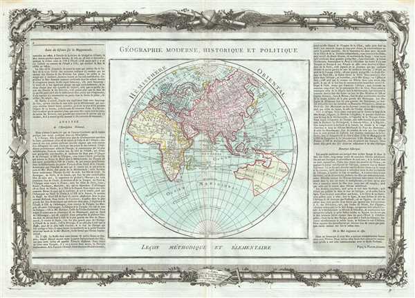
Hemisphere Oriental.
$600.00
Acquire
- Digital Map Information
- Suitable for large format printing
- DPI: 300
- File Size: 14.36 MB
- File Type: ZIP / TIFF
- ICC color profile embedded
- Delivered instantly via download link
This is an impressive map of the Eastern Hemisphere by Desnos and Brion de la Tour dating to 1786. Depicts the Eastern Hemisphere in beautiful detail covering Asia, Europe, Africa and Australia. Though rife with speculation, the map attempts to ... (more details)
18th century map of the Piedmont wine region of Italy.

Partie De L'Italie, Comprenant Les Etats Du Roy De Sardaigne, De Milan, Parme, Et Genes.
sold
- Digital Map Information
- Suitable for large format printing
- DPI: 300
- File Size: 13.91 MB
- File Type: ZIP / TIFF
- ICC color profile embedded
- Delivered instantly via download link
This is a beautiful example of Desnos and Brion de la Tour’s 1786 map of the northern Italy. It covers from Lake Geneva south as far as Massa and depicts the regions of Piedmont, Milan, Genoa, Parma and Savoy. Several important towns are ... (more details)
The vital Hudson River Corridor during the American Revolutionary War.

Map of the Country which was the scene of the Northern Army Including the Wilderness through which Gen. Arnold marched to attack Quebec.
sold
- Digital Map Information
- Suitable for large format printing
- Full resolution TIFF file
- ICC color profile embedded
- Delivered instantly via download link
This is a rare map of New York, Vermont, New Hampshire, Maine and Quebec during the American Revolutionary War issued for John Marshall's 1832 edition of the Life of Washington . The map covers the strategically vital Hudson Valley – ... (more details)
Large attractive city plan of Manhattan and Bronx, New York City.
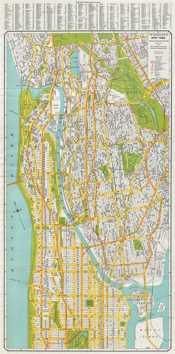
The Complete Map of New York Manhattan and Southwestern Bronx.
sold
- Digital Map Information
- Suitable for large format printing
- File Size: 22.32 MB
- File Type: ZIP / TIFF
- ICC color profile embedded
- Delivered instantly via download link
This is an excellent map of New York City by Alexander Gross dating to c.1940. The map covers the northern portions of the borough of Manhattan from 102nd Street to Inwood. The southwest portion of Bronx is also covered southward from ... (more details)
Beautiful separate issue nautical chart of Cape Ann, Massachusetts.

Rockport Harbor Massachusetts.
sold
- Digital Map Information
- Suitable for large format printing
- File Size: 7.25 MB
- File Type: ZIP / TIFF
- ICC color profile embedded
- Delivered instantly via download link
This is a beautiful example of the U.S. Coast Survey's 1859 nautical chart or maritime map of Cape Ann or Rockport Harbor, Massachusetts. It extends from Halibut Point south to Cape Hedge and includes Milk Island, Thatcher’s Island ... (more details)
Scarce separate issue nautical chart of Plymouth Harbor, Massachusetts.

Plymouth Harbor Massachusetts.
sold
- Digital Map Information
- Suitable for large format printing
- File Size: 13.99 MB
- File Type: ZIP / TIFF
- ICC color profile embedded
- Delivered instantly via download link
This is a beautiful example of the U.S. Coast Survey's 1857 nautical chart or maritime map of Plymouth Harbor, Massachusetts. It covers the important harbor located just south of Boston near Cape Cod and includes Saquish Head, ... (more details)
Scarce city plan of Cambridge, Massachusetts.
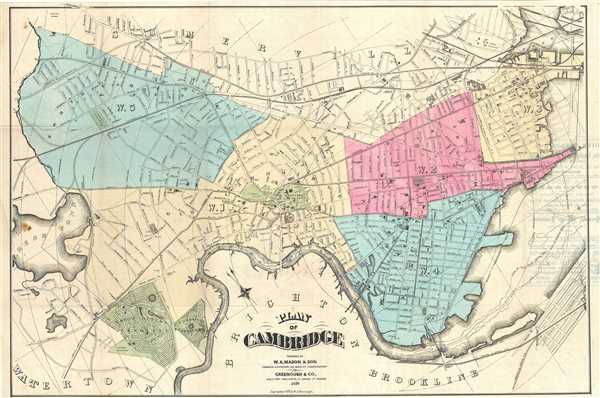
Plan of Cambridge.
sold
- Digital Map Information
- Suitable for large format printing
- File Size: 13.96 MB
- File Type: ZIP / TIFF
- ICC color profile embedded
- Delivered instantly via download link
This is a scarce and beautiful 1878 map of the city of Cambridge Massachusetts by W. A. Mason and Sons. Centered on Harvard College, cover Cambridge north of the Charles River extending from Fresh Pond to what is today Gilmore ... (more details)
Large maritime map of Boston Bay and Harbor.

Boston Harbor Massachusetts.
sold
- Digital Map Information
- Suitable for large format printing
- File Size: 38.38 MB
- File Type: ZIP / TIFF
- ICC color profile embedded
- Delivered instantly via download link
A stunning 1872 example of the U.S. Coast Survey’s nautical chart or maritime map of Boston Bay, Boston Harbor, and environs. The map covers the Massachusetts coastline from Cape Ann southward past Gloucester, Marblehead, ... (more details)