
17th century map of Morocco on the Barbary Coast of Africa.
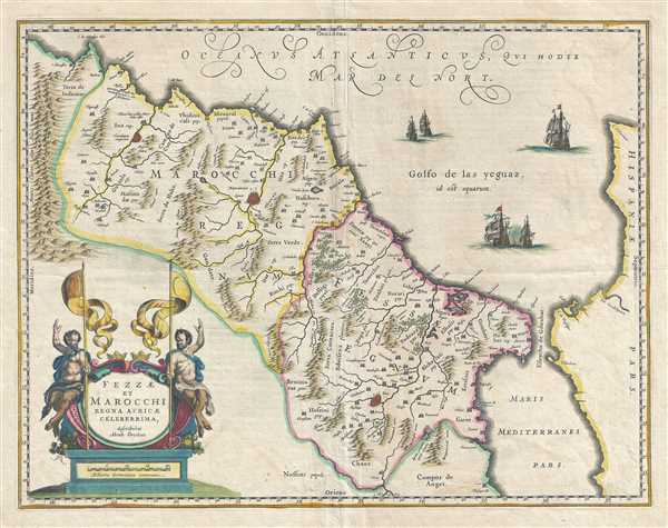
Fezzae et Marocchi Regna Africae Celeberrima.
sold
- Digital Map Information
- Suitable for large format printing
- DPI: 300
- File Size: 12.14 MB
- File Type: ZIP / TIFF
- ICC color profile embedded
- Delivered instantly via download link
This is a beautiful 1675 map of Morocco on the Barbary Coast of northern Africa by Johannes Blaeu. Oriented with north on the right, the map covers Morocco and the Kingdom of Fez from the Atlas Mountains north to the coast of Spain. The Strait of Gibraltar is also ... (more details)
A remarkable heavily annotatioed wall format map of the world showing Texas as a Republic.

A New Chart of the World On Mercator's Projection With The Tracks Of The Most Celebrated and Recent Navigators.
sold
- Digital Map Information
- Suitable for large format printing
- Full resolution TIFF file
- ICC color profile embedded
- Delivered instantly via download link
This is an impressive 1844 large format map of the world by Henry Teesdale. The map covers the entire world on a Mercator projection with copious notes and annotations throughout. The map is thorough, but predictably presented a highly Anglo-centric perspective ... (more details)
This separately issued nautical chart is the culmination of nearly 20 years of Coast Survey work in the Vicinity of Martha's Vineyard and Buzzard Bay.

No. 13 From Muskeget Channel to Buzzard's Bay and Entrance to Vineyard Sound Mass.
sold
- Digital Map Information
- Suitable for large format printing
- File Size: 29.4 MB
- File Type: ZIP / TIFF
- ICC color profile embedded
- Delivered instantly via download link
An impressive separately issue 1860 nautical chart of Martha's Vineyard and Buzzards Bay. This chart represents the U.S. Coast Survey's most advanced work in the vicinity of Martha's Vineyard. The map covers from New Bedford to Muskeget Island and from Wareham ... (more details)
Uncommon Civil War era map depicting slaveholding and non-slaveholding states.
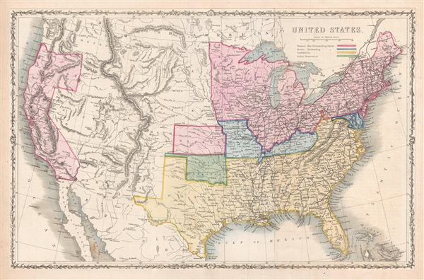
United States.
sold
- Digital Map Information
- Suitable for large format printing
- Full resolution TIFF file
- ICC color profile embedded
- Delivered instantly via download link
This is an uncommon 1862 map of the United States by Taliaferro Preston Shaffner. Issued just as the American Civil War was beginning, the map depicts the federal non-slaveholding states, the states bordering slaveholding states, the confederate slaveholding ... (more details)
Beautifully detailed map of Scandinavia.

Scandinavia, or Sweden, Denmark and Norway.
sold
- Digital Map Information
- Suitable for large format printing
- DPI: 300
- File Size: 14.11 MB
- File Type: ZIP / TIFF
- ICC color profile embedded
- Delivered instantly via download link
This fascinating hand colored 1814 map depicts Sweden, Denmark, and Norway. Modern day Finland, though included, was then part of the Kingdom of Sweden. Relief is shown by hachure with towns, cities, and major topographical features identified. The legendary ... (more details)
Large map of the Russian Empire spanning Asia and Europe.
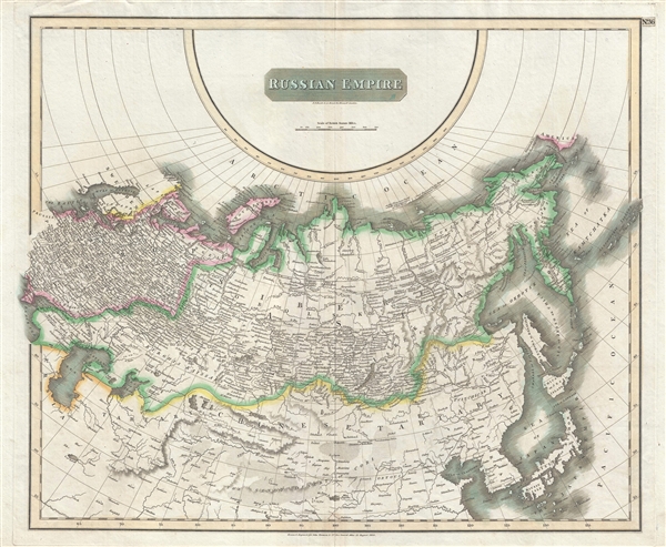
Russian Empire.
sold
- Digital Map Information
- Suitable for large format printing
- DPI: 300
- File Size: 15.94 MB
- File Type: ZIP / TIFF
- ICC color profile embedded
- Delivered instantly via download link
This large 1814 atlas map depicts the Russian Empire in its entirety, both in Europe and in Asia as well as adjacent parts of Tartary, Chinese Tartary, Japan, Korea, and the Gobi. In 1815 Tsarist Russia emerged from the Napoleonic Wars economically insolvent ... (more details)
Early 19th century map depicting Asia under the Mongol Empire.
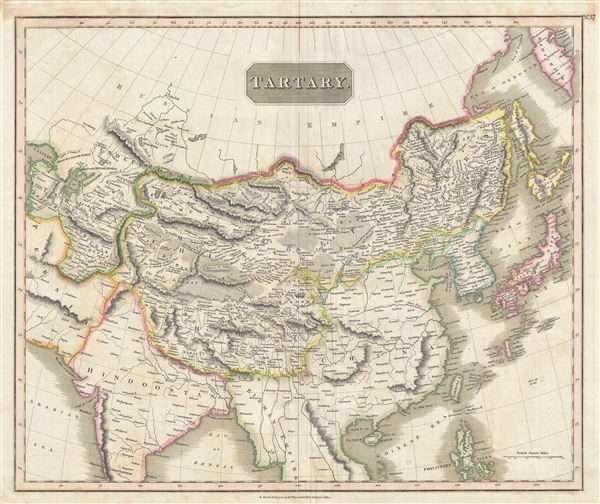
Tartary.
sold
- Digital Map Information
- Suitable for large format printing
- DPI: 300
- File Size: 16.9 MB
- File Type: ZIP / TIFF
- ICC color profile embedded
- Delivered instantly via download link
This fascinating hand colored 1814 map of central and East Asia, covering southern Tartary, Tibet (Tibet), Mongolia, and generally the whole of Central Asia. The area is named after the 'Tartars,' the Turkic and Mongol peoples of the Mongol Empire. The ... (more details)
City plan of Dallas, Texas celebrating the centenery of Texas's independence from Mexico.

Commercial & Street Map of Dallas, Texas.
sold
- Digital Map Information
- Suitable for large format printing
- File Size: 15.48 MB
- File Type: ZIP / TIFF
- ICC color profile embedded
- Delivered instantly via download link
This is a beautiful 1936 map or plan of the city of Dallas, Texas issued by Stacy Map Publishers. Issued to celebrate the centenary of the Republic of Texas, it covers from Love Field south to the Cedar Crest Country Club and from Bachmans Dam east to ... (more details)
Mitchell's plan of the city of Chicago, Illinois.

Chicago.
sold
- Digital Map Information
- Suitable for large format printing
- File Size: 5.31 MB
- File Type: ZIP / TIFF
- ICC color profile embedded
- Delivered instantly via download link
This hand colored map or plan of the city of Chicago dates to 1874 and was issued by the important American map publisher Samuel Augustus Mitchell, the younger. It covers from thirty first street northward to Fullerton Avenue. The map covers the ... (more details)
Beautiful map of the Washington D.C.
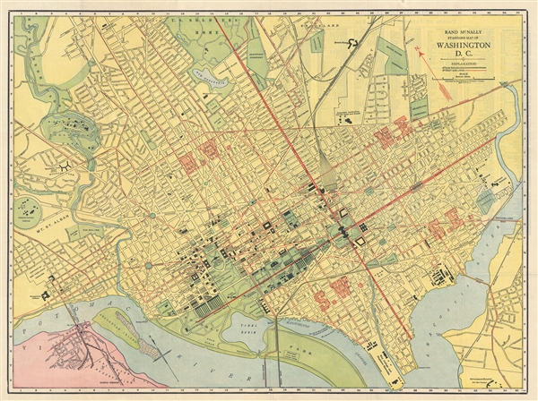
Rand McNally Standard Map of Washington D.C.
sold
- Digital Map Information
- Suitable for large format printing
- File Size: 13.48 MB
- File Type: ZIP / TIFF
- ICC color profile embedded
- Delivered instantly via download link
This is a beautiful 1925 map or plan of Washington D.C. by Rand McNally and Company. It covers Washington D.C. from the Potomac River to the Anacostia River and north to the Soldiers Home Ground. The map is exceptionally detailed, noting important ... (more details)
Stunning art deco map of Paris.
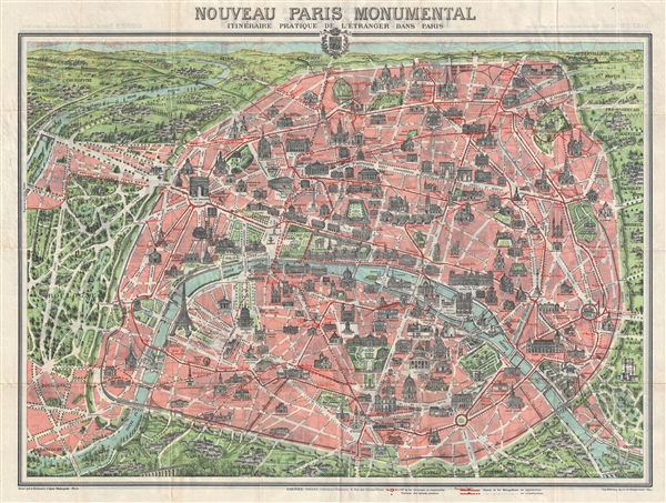
Nouveau Paris Monumental Inineraire Pratique de L'Etranger Dans Paris.
sold
- Digital Map Information
- Suitable for large format printing
- File Size: 20 MB
- File Type: ZIP / TIFF
- ICC color profile embedded
- Delivered instantly via download link
An iconic c.1909 tourist pocket map of Paris, France. Presented as a same field birds-eye view, this map centers on the Seine River, and covers the embastilled heart of modern Paris. Although ostensibly designed as a subway map, this map offers ... (more details)
Detailed map of the city of Los Angeles.

Map of Los Angeles California.
sold
- Digital Map Information
- Suitable for large format printing
- File Size: 37.85 MB
- File Type: ZIP / TIFF
- ICC color profile embedded
- Delivered instantly via download link
This is a large 1941 pocket map of Los Angeles, California by E. F. Hill, issued by C.S. Hammond and Company. It extends from Griffith Park south to Inglewood and South Gate. The map is incredibly detailed and notes individual streets, ... (more details)
Beautiful map of the Santa Clara County of California - home to Silicon Valley.
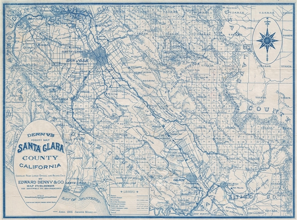
Denny's Pocket Map Santa Clara County California.
sold
- Digital Map Information
- Suitable for large format printing
- Full resolution TIFF file
- ICC color profile embedded
- Delivered instantly via download link
This is a lovely 1913 pocket map published by Edward Denny and Company featuring the Santa Clara County in California. The map covers from the San Francisco Bay and Coyote Creek south to the Bay of Monterey and east as far as ... (more details)
Beautiful bird's eye-view of Boston harbor.

Boston Harbor.
sold
- Digital Map Information
- Suitable for large format printing
- File Size: 6.99 MB
- File Type: ZIP / TIFF
- ICC color profile embedded
- Delivered instantly via download link
This is an uncommon 1925 example of a George H. Walker's aquatint view of Boston Harbor. Centered on South Boston, the view covers Boston Harbor from East Boston and Nahant eastward as far as Squantum and Slate Island. The ... (more details)
Beautifully engraved early 19th century English map of Africa.

Africa.
sold
- Digital Map Information
- Suitable for large format printing
- DPI: 300
- File Size: 11.05 MB
- File Type: ZIP / TIFF
- ICC color profile embedded
- Delivered instantly via download link
This is John Thomson's fascinating 1814 map of Africa in its first edition. This remarkable map is as engrossing as much for what it doesn't show as for what it does. The great blank interior, here labeled, 'unknown ... (more details)
The last great cartographic masterpiece of Ming China.
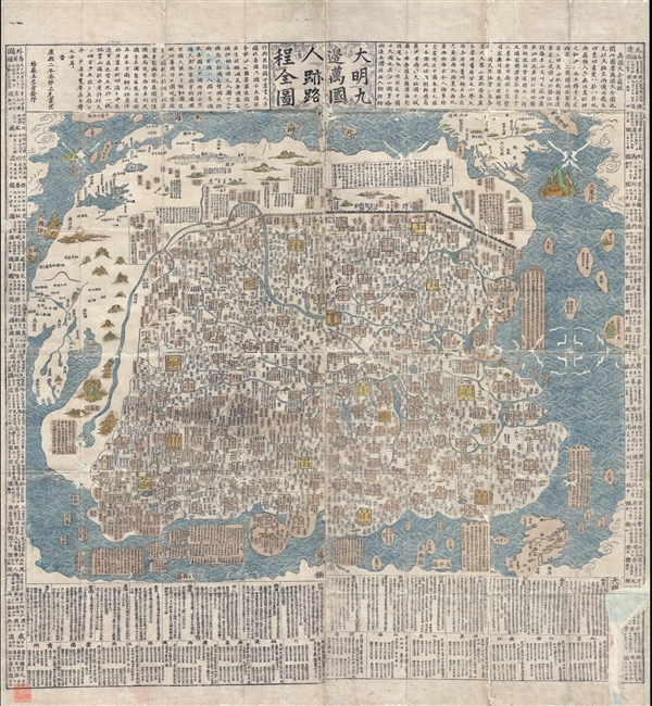
Complete Map of the Nine Border Towns of the Great Ming and of the Human Presence and Travel Routes of the Ten Thousand Countries. / 大明九邊萬國人跡路程全圖 / Dàmíng jiǔ biān wànguó rén jì lùchéng quán tú.
sold
- Digital Map Information
- Suitable for large format printing
- DPI: 300
- File Size: 70.8 MB
- File Type: ZIP / TIFF
- ICC color profile embedded
- Delivered instantly via download link
A rare and extraordinary 1663 (Kangxi 2) xylographic map of Ming China, and indeed the entire world, by Wáng Jūnfǔ (王君甫) issued during the reign of the Kangxi Emperor (1661 – 1722). This massively ... (more details)
Very rare map of Qing China issued under the Empress Dowager Cixi.

Full Map of the Eighteen Provinces of the Great Qing. / 大清十八省全圖 / Dà qīng shíbā shěng quán tú.
sold
- Digital Map Information
- Suitable for large format printing
- Full resolution TIFF file
- ICC color profile embedded
- Delivered instantly via download link
A rare and enormous 1867 or Tongzhi 6 Chinese map of Qing China. The map covers all of China including Hainan and Taiwan. It is divided into 18 provinces and the great wall is clearly delineated along the ... (more details)
Remarkable 19th century Japanese map of Bangkok, Thailand.

盤谷府之圖 / Bangkok House.
sold
- Digital Map Information
- Suitable for large format printing
- File Size: 9.73 MB
- File Type: ZIP / TIFF
- ICC color profile embedded
- Delivered instantly via download link
A scarce Meiji 8, 1875 Japanese issue plan or map of Bangkok, Thailand. Centered on the Chao Phraya River, the map covers the 'S' shaped bend in the river where the original royal fortifications of Bangkok, ... (more details)
Rare 19th Century Japanese Map of Luzon, the Philippines.

[Untitled, Philippines] 第二圖 / Map Two.
sold
- Digital Map Information
- Suitable for large format printing
- File Size: 6.32 MB
- File Type: ZIP / TIFF
- ICC color profile embedded
- Delivered instantly via download link
A scarce Meiji 8, 1875 Japanese issue plan or map of Luzon in the Philippines. Centered on Manila Bay, the map covers all of Luzon north of Legazpi, Marinduque, and northern Mindoro. The map is primarily a ... (more details)
One of the better English language maps of Beijing, published in Beijing, during World War II.

Peking.
sold
- Digital Map Information
- Suitable for large format printing
- File Size: 13.17 MB
- File Type: ZIP / TIFF
- ICC color profile embedded
- Delivered instantly via download link
An unusual 1939 map of Beijing or Peking, China, published by the Poplar Island Press, in Beijing. This map covers the old walled city of Beijing in considerable detail with many of the Chinese street ... (more details)