
One of the earliest American issued maps of the Southeastern States.
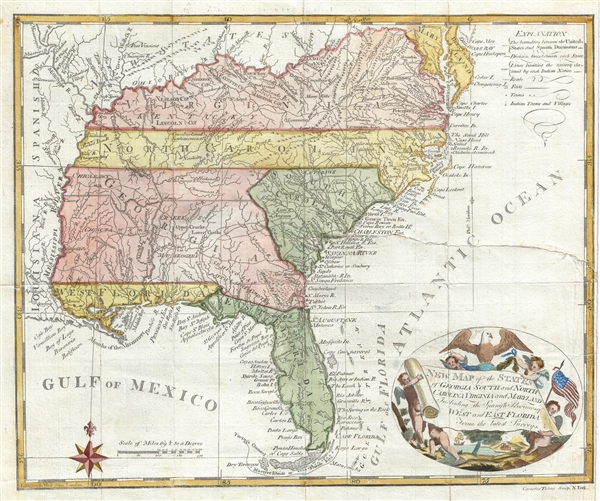
New Map of the States of Georgia South ad North Carolina Virginia and Maryland Including the Spanish Provinces of West and East Florida from the latest Surveys.
sold
- Digital Map Information
- Suitable for large format printing
- Full resolution TIFF file
- ICC color profile embedded
- Delivered instantly via download link
An intriguing and extremely scarce 1793 map of the southeastern portions of the United States, including Florida, by Cornelius Tiebout. The map covers from the Chesapeake Bay to the Florida Keys ad from the Mississippi River to the Atlantic seaboard. For an ... (more details)
The largest and most detailed map of New Jersey to appear in the 19th century - a seminal production.

Topographical map of the State of New Jersey together with the vicinities of New York and Philadelphia, and with most of the state of Delaware from the State Geological Survey and the U.S. Coast Survey, and from surveys by G. Morgan Hopkins, civil engineer.
sold
Magnificently detailed, visually stunning, and monumentally proportioned, this is William Kitchell's seminal 1860 wall map of New Jersey. This is the largest map of New Jersey printedi n the 19th century. Mounted on linen with rollers, this map covers the ... (more details)
Charismatic and highly decorative map of Hispaniola or Santo Domingo.
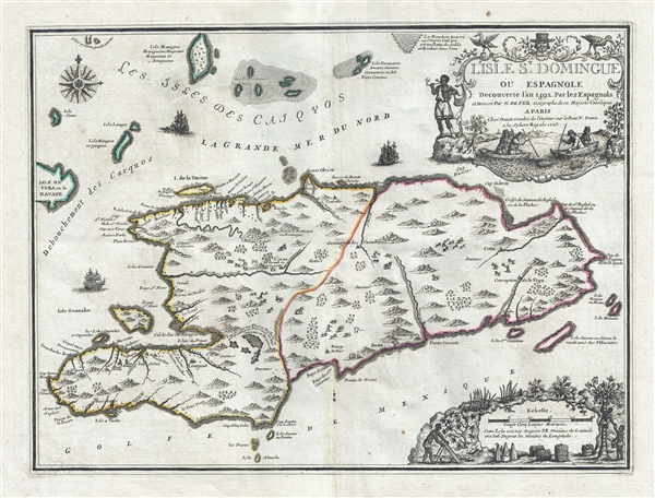
L'Isle St. Domingue ou Espagnole Decouverte l'an 1492 par les Espagnols.
sold
- Digital Map Information
- Suitable for large format printing
- DPI: 300
- File Size: 6.22 MB
- File Type: ZIP / TIFF
- ICC color profile embedded
- Delivered instantly via download link
A stunning large format example of Nicolas De Fer and Guillaume Danet's map of the island of Santo Domingo or Hispaniola. The map coves the island in full as well as parts of adjacent Cuba and Turks and Caicos. The island is shown with colored boundaries derived from the 1697 Treaty of Ryswick dividing the island into the western French portion (modern Haiti) and the larger eastern lands of Spain (Dominican Republic). Topography is drawn in profile according to De Fer's idiosyncratic style. (more details)
Wonderful map of northern India intended to illustrate the trade potential of the region.
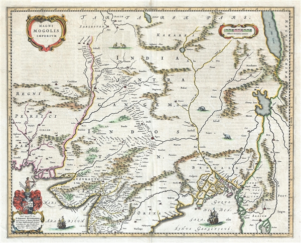
Magni Mogolis Imperium.
sold
- Digital Map Information
- Suitable for large format printing
- DPI: 300
- File Size: 13.18 MB
- File Type: ZIP / TIFF
- ICC color profile embedded
- Delivered instantly via download link
A marvelous 1640 map by Joan and Cornelius Blaeu representing the kingdom of the Great Mogul in northern India. Extending from the Indus River Valley to the Irrawaddy River Valley and from Tibet to Bombay, this map covers much of modern day India as well ... (more details)
Wonderful view of the short lived Loew Bridge in lower Manhattan.

The 'Loew Bridge' Broadway and Fulton St.
sold
- Digital Map Information
- Suitable for large format printing
- File Size: 1.35 MB
- File Type: ZIP / TIFF
- ICC color profile embedded
- Delivered instantly via download link
This is a lovely 1868 view of the Loew Bridge over Broadway and Fulton Street in New York City, by Shannon and Rogers. The view features the short-lived cast iron pedestrian bridge across New York City’s busiest street. Pedestrians are seen walking ... (more details)
An uncommon promotional railroad Map of Long Island advertising stunning shoreline and southerly breezes.

Map of Long Island Showing the Long Island Railroad System and Montauk Steamboat Company Lines.
sold
- Digital Map Information
- Suitable for large format printing
- File Size: 5.33 MB
- File Type: ZIP / TIFF
- ICC color profile embedded
- Delivered instantly via download link
This appealing promotional map of Long Island was issued in 1911 by the Long Island Railroad. It depicts Long Island in full, inclusive of Manhattan, Brooklyn, Queens, the Long Island Sound, and the southern shore of Connecticut and northern parts of ... (more details)
Dramatic view of Moscow in the early 18th century.

La Ville de Moscou, Capitale de la Moscovie.
sold
- Digital Map Information
- Suitable for large format printing
- DPI: 300
- File Size: 10.29 MB
- File Type: ZIP / TIFF
- ICC color profile embedded
- Delivered instantly via download link
This is a beautiful 1729 view of Moscow by Pieter Van der Aa. It depicts the capital of the Tsardom of Russia, Moscow, as it appeared in the early 18th century. Features the countryside in the foreground with shepherds and cattle herders along with ... (more details)
Uncommon English language map of Nicaragua showing the Nicaragua Route (Nicaragua Canal).

Part of Central America Showing the Route from the Atlantic by the Rio de San juan the Lakes of Nicaragua and Leon to the Pacific Drawn under the direction of Orlando W. Roberts by John Irving 1825.
sold
- Digital Map Information
- Suitable for large format printing
- DPI: 300
- File Size: 2.64 MB
- File Type: ZIP / TIFF
- ICC color profile embedded
- Delivered instantly via download link
This is a lovely 1827 map of Nicaragua by John Irving. It covers from Leon south to the Gulf of Nicoya and east to the Laguna de Perlas. Includes the Lake of Leon (Lago Xolotian) and Lake of Nicaragua (Lago Nicaragua). Notes considerable ... (more details)
Early map of the British Isles noting Hadrian's Wall.
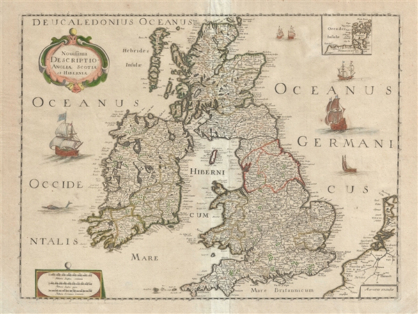
Novissima Descriptio Angliae, Scotiae et Hiberniae.
sold
- Digital Map Information
- Suitable for large format printing
- DPI: 300
- File Size: 13.43 MB
- File Type: ZIP / TIFF
- ICC color profile embedded
- Delivered instantly via download link
This is a beautiful c. 1650 map of the British Isles by Pierre Mariette and Nicolas Sanson. Covers all of England, Scotland, Wales and Ireland. Includes a small inset of the Orkney Islands in the top right quadrant. Beautifully detailed, ... (more details)
Map of Florida shortly after its annexation showing early county structure. Names the 'Cape Florida Settlement' or what would eventually become Miami.

Map of the Territory of Florida.
sold
- Digital Map Information
- Suitable for large format printing
- DPI: 300
- File Size: 5.48 MB
- File Type: ZIP / TIFF
- ICC color profile embedded
- Delivered instantly via download link
This is an unusual 1834 first edition map of Florida issued by David H. Burr. It depicts territorial Florida just a few years after the region was annexed by the United States. Color-coding defines Florida’s early county development ... (more details)
An interesting early American map of the Oregon Territory advocating American territorial claims to British Columbia.
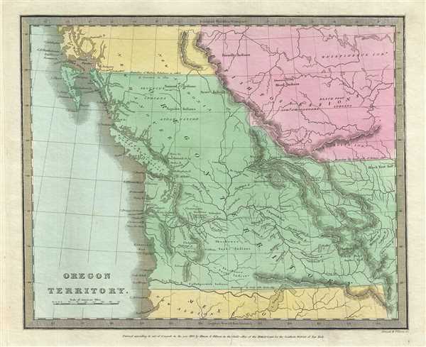
Oregon Territory.
sold
- Digital Map Information
- Suitable for large format printing
- DPI: 300
- File Size: 5.59 MB
- File Type: ZIP / TIFF
- ICC color profile embedded
- Delivered instantly via download link
This is the 1833 first edition map of the Oregon Territory issued by David H. Burr. The map covers from the Los Mongos River and Lake Timpanoges (Great Salt Lake), north as far as Prince of Wales Island, including modern day Oregon, ... (more details)
Important early 19th century map of Illinois.

Illinois.
sold
- Digital Map Information
- Suitable for large format printing
- DPI: 300
- File Size: 5.43 MB
- File Type: ZIP / TIFF
- ICC color profile embedded
- Delivered instantly via download link
This is a good example of David H. Burr’s 1834 first edition map of Illinois. Offers color-coding at a county level and notes rivers, towns, cities, roads and renders elevation by hachure. Burr’s map of Illinois is particularly ... (more details)
Charming view of Sixth Avenue in Midtown Manhattan c. 1868.

View in Sixth Avenue, Between 55th and 57th Sts. Looking West.
sold
- Digital Map Information
- Suitable for large format printing
- File Size: 1.18 MB
- File Type: ZIP / TIFF
- ICC color profile embedded
- Delivered instantly via download link
This is a beautiful 1868 view looking westward from Sixth Avenue between 55th and 57th streets in what is now Midtown Manhattan, New York City. The view gives an interesting snapshot of what this area looked like in the middle of ... (more details)
One of the most beautiful and sumptuously illustrated maps of the 18th century.
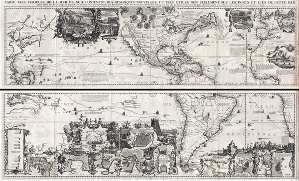
Carte très curieuse de la Mer du Sud, contenant des Remarques Nouvelles et très utiles non seulement sur des Ports et Îles de cette Mer, mais aussy sur les principaux Pays de l'Amerique tant Septentrionale que Méridionale en a été faite.
sold
- Digital Map Information
- Suitable for large format printing
- DPI: 300
- File Size: 76.5 MB
- File Type: ZIP / TIFF
- ICC color profile embedded
- Delivered instantly via download link
One of the most spectacularly decorative maps of the 18th century, this is Henri Chatelain's magnificent 1719 map of the Americas and the Pacific. This sumptuously engraved map is centered on the American continent, but extends ... (more details)
Important satirical map of Europe issued just before the Franco Prussian War.

Nouvelle Carte D'Europe Dressee Pour 1870. / Carte drôlatique d’Europe pour 1870.
sold
- Digital Map Information
- Suitable for large format printing
- File Size: 3.95 MB
- File Type: ZIP / TIFF
- ICC color profile embedded
- Delivered instantly via download link
A rare example of the original French edition of Paul Hadol's satirical map of Europe on the cusp of the Franco-Prussian War. This map, covering all of Europe, is a comic panorama wherein the individual nations take the telling ... (more details)
Coronelli's map of the Mughal Empire under Emperor Aurangzeb Alamgir. Shows the apocryphal Lake Chiamay.
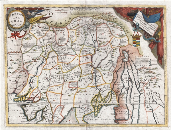
Impero Del Gran Mogol descritto e didicato all' Illustrissimo et Eccellentisimo S. Girolamo Correr, Sauio Grande dal P. Cosmografo Coronelli
sold
- Digital Map Information
- Suitable for large format printing
- DPI: 300
- File Size: 15.16 MB
- File Type: ZIP / TIFF
- ICC color profile embedded
- Delivered instantly via download link
A colorful example of Vincenzo Coronelli's 1691 map of the Mughal Empire under the Emperor Aurangzeb Alamgir (1618 – 1707). The map covers what is today Northern India, as well as parts of Pakistan, Bangladesh, Nepal, Bhutan, ... (more details)
Dramatic and beautiful early map of the world's winds and currents.

Zu Dr. Jileks Oceanografie
sold
- Digital Map Information
- Suitable for large format printing
- File Size: 16.32 MB
- File Type: ZIP / TIFF
- ICC color profile embedded
- Delivered instantly via download link
An unusual find, this is a remarkable c. 1880 chromolithograph map of the world illustrating ocean currents. Centered on the Pacific basin, the map covers the entire world, overlapping somewhat in Africa. While there is very ... (more details)
Iconic early map of New England and New York with 'Visscher View' of New Amsterdam.

Novi Belgii Novaeque Angliae Nec Non Pennsylvaniae et Partis Virginiae Tabula multis in locis emendata.
sold
- Digital Map Information
- Suitable for large format printing
- DPI: 300
- File Size: 14.86 MB
- File Type: ZIP / TIFF
- ICC color profile embedded
- Delivered instantly via download link
A map of extreme importance, this is a fine example of Nicholaas Visscher's 1684 Novi Belgii or map of New York, New England, Pennsylvania, and Virginia. This is the first map in the Jansson-Visscher Series here presented in ... (more details)
Exceedingly rare first edition of De Wit's masterful sea chart of the West Indies during the Golden Age of Caribbean Piracy.
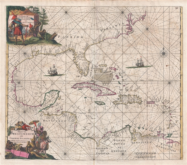
Indiarum Occidentalium Tractus Littorales cum Insulis Caribicis. / Pascaert van Westindien ende Caribise Eylanden.
sold
- Digital Map Information
- Suitable for large format printing
- DPI: 300
- File Size: 15.36 MB
- File Type: ZIP / TIFF
- ICC color profile embedded
- Delivered instantly via download link
A fine and rare old color example of the first edition of Frederick de Wit's 1675 nautical chart or maritime map of the West Indies, Central America, Gulf of Mexico, and Florida. Printed during the Golden Age of Caribbean ... (more details)
The earliest obtainable specific map of the Galapagos Islands.
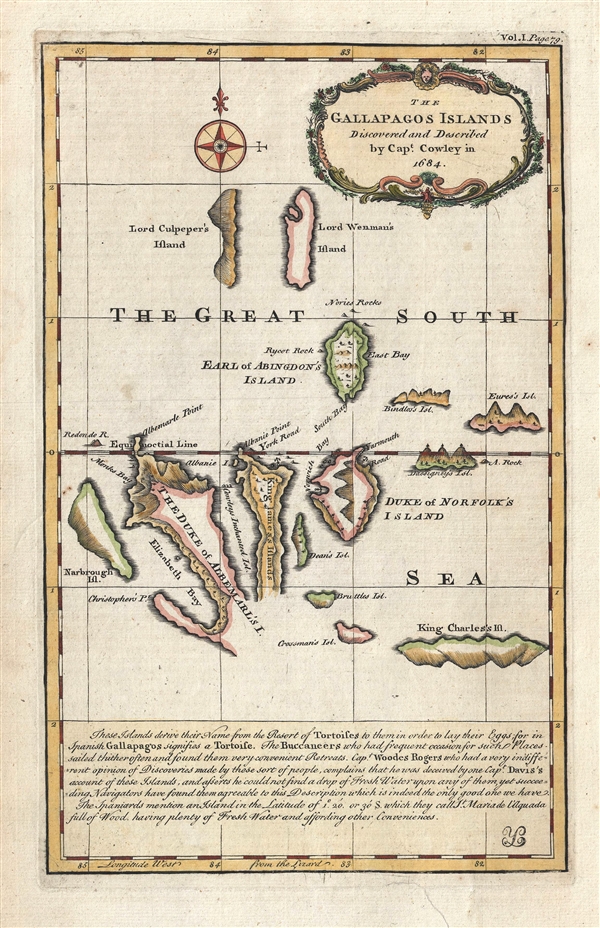
The Gallapagos Islands Discovered and Described by Capt. Cowley in 1684.
sold
- Digital Map Information
- Suitable for large format printing
- DPI: 300
- File Size: 2.82 MB
- File Type: ZIP / TIFF
- ICC color profile embedded
- Delivered instantly via download link
This is one of the earliest obtainable specific maps of the Galapagos Islands. The map tentatively covers the islands and is attributed to Captain William Ambrose Cowley. The map claims that Cowley discovered the ... (more details)