
A particularly beautiful example of this important nautical chart.

Coast Chart No. 20 New York Bay and Harbor New York.
sold
- Digital Map Information
- Suitable for large format printing
- File Size: 29.27 MB
- File Type: ZIP / TIFF
- ICC color profile embedded
- Delivered instantly via download link
This is a rare 1866 U.S. Coast Survey nautical chart or maritime map of New York City, its harbor, and environs. Though variants of this chart appeared earlier, the present example is most likely the first independent issue of this map in its full, completed form. ... (more details)
Seutters depiction of the Duchy of Luxembourg.

Ducatus Luxemburg.
sold
- Digital Map Information
- Suitable for large format printing
- DPI: 300
- File Size: 25.59 MB
- File Type: ZIP / TIFF
- ICC color profile embedded
- Delivered instantly via download link
This is a lovely 1730 map of Luxembourg and surroundings by the important Augsburg map publisher Georg Matthaus Seutter. It extends from Ulmen in Germany west to Rocroi in France and from Amneville, France north as far as Huy in Belgium, covering all of ... (more details)
Map of India under the British East India Company.

Hindostan.
sold
- Digital Map Information
- Suitable for large format printing
- DPI: 300
- File Size: 5.31 MB
- File Type: ZIP / TIFF
- ICC color profile embedded
- Delivered instantly via download link
This is an early first edition map of India or Hindostan by David H. Burr dating to 1835. It covers the subcontinent from Cashmere to Ceylon (Sri Lanka) and from the mouth of the Indus to Birmah (Burma or Myanmar). The modern day countries of India, Sri ... (more details)
Attractive view of New York City's historically significant Printing House Square.

Printing House Square 1868.
sold
- Digital Map Information
- Suitable for large format printing
- File Size: 1.03 MB
- File Type: ZIP / TIFF
- ICC color profile embedded
- Delivered instantly via download link
This is a beautiful 1868 view of the Printing House Square or what is today Park Row near the southern triangle of City Hal Park, New York City by Shannon and Rogers. It depicts what was at the time known as Printing House Square, a concentrated hub of ... (more details)
Beautiful early view of Central Park's iconic Bow Bridge.

Central Park. The Lake and The Bow Bridge.
sold
- Digital Map Information
- Suitable for large format printing
- File Size: 1.09 MB
- File Type: ZIP / TIFF
- ICC color profile embedded
- Delivered instantly via download link
This is a lovely 1868 view of the Bow Bridge and the Lake in Central Park, by Shannon and Rogers. The Bow Bridge, built in 1862 is located roughly at 74th street in the heart of New York City’s Central Park and connects the Ramble and Cherry Hill. ... (more details)
View of Central Park's Lake with the Bow Bridge in the background.

Central Park. The Lake from the East Side.
sold
- Digital Map Information
- Suitable for large format printing
- File Size: 1.08 MB
- File Type: ZIP / TIFF
- ICC color profile embedded
- Delivered instantly via download link
This is a beautiful 1868 view of the Lake in Central Park as seen from the east, by Shannon and Rogers. The view features a boat in the water with the Bow Bridge visible in the distance. The Lake, Central Park’s largest naturalistic water body, ... (more details)
Charming view of Central Park's Lake and Bethesda Fountain.

Central Park. The Lake from the Terrace.
sold
- Digital Map Information
- Suitable for large format printing
- File Size: 1.21 MB
- File Type: ZIP / TIFF
- ICC color profile embedded
- Delivered instantly via download link
This is a charming 1868 view of the Lake in Central Park, by Shannon and Rogers. This view of the Lake is seen from the Bethesda Terrace, located roughly at 72nd street in the heart of New York City’s Central Park. This view beautifully depicts ... (more details)
Bowles map of the western United States.
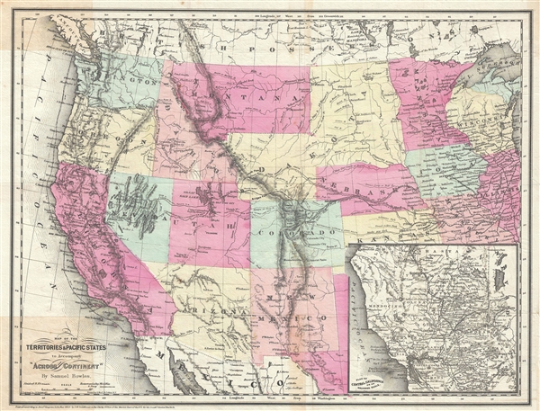
Map of the Territories and Pacific States to Accompany 'Across the Continent'.
sold
- Digital Map Information
- Suitable for large format printing
- File Size: 8.31 MB
- File Type: ZIP / TIFF
- ICC color profile embedded
- Delivered instantly via download link
A highly appealing 1865 map of the western parts of the United States drawn to illustrate Samuel Bowles' Across the Continent . The map covers from the Pacific Ocean to Illinois and the Great Lakes. It is notable for its detailed inclusion of ... (more details)
Southern Rhone wine region.

Gouvernement General de Provence, divise en ses Vigueries, avec les pays circonvoisins, le Comtat Venaissin, la Principaute d'Orange, et les terres adjacentes.
sold
- Digital Map Information
- Suitable for large format printing
- DPI: 300
- File Size: 16.67 MB
- File Type: ZIP / TIFF
- ICC color profile embedded
- Delivered instantly via download link
This is a scarce 1754 map of Provence, France by Robert de Vaugondy. It covers the southern coast of France from Nice to Saint-Gilles. The departments of Var, Gard, Bouches-du-Rhone, Alpes-de-Haute-Provence, Alpes-Maritimes and Vaucluse are ... (more details)
Beautiful map of the Kingdom of Slavonia.
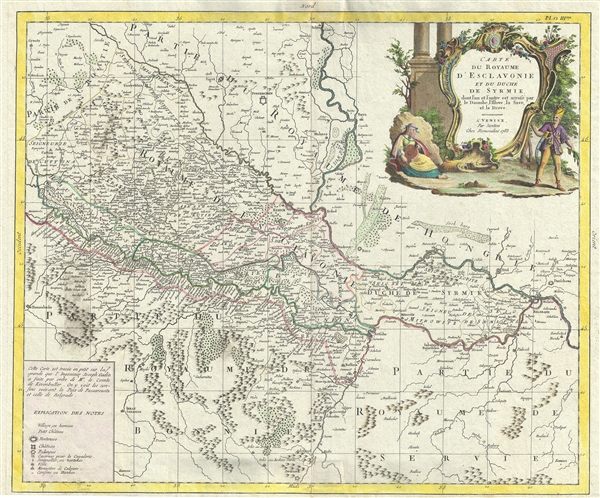
Carte du Royaume D'Esclavonie et du Duche de Syrmie, dont l'un et l'autre est arrose par le Danube, l'Illove, La Save, et la Drave.
sold
- Digital Map Information
- Suitable for large format printing
- DPI: 300
- File Size: 15.83 MB
- File Type: ZIP / TIFF
- ICC color profile embedded
- Delivered instantly via download link
This is a beautiful example of Paolo Santini’s 1783 map of the Kingdoms of Slavonia and Syrmia depicting parts of modern day Croatia, Serbia, Bosnia and Herzegovina as well as parts of Hungary. The map extends south from Tolna in Hungary ... (more details)
Map depicting the places known in the early ages of the world.
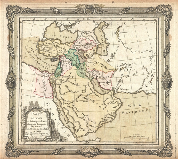
Carte des Pays et Principaux Lieux Connus dans les premiers ages du Monde.
sold
- Digital Map Information
- Suitable for large format printing
- DPI: 300
- File Size: 6.01 MB
- File Type: ZIP / TIFF
- ICC color profile embedded
- Delivered instantly via download link
This is an appealing 1766 map of the Middle East and Arabia by Brion de la Tour and Louis Charles Desnos. It covers the regions between the Caspian Sea and the Gulf of Aden and from Turkey east to the Indus Valley including Turkey, Cyprus, ... (more details)
Beautiful map of Upper Canada.
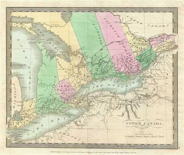
Upper Canada.
sold
- Digital Map Information
- Suitable for large format printing
- DPI: 300
- File Size: 4.78 MB
- File Type: ZIP / TIFF
- ICC color profile embedded
- Delivered instantly via download link
This is an attractive 1835 first edition map of Upper Canada or Ontario by David H. Burr. Centered on Lake Ontario, this map covers from Lake Erie northward to Lake Nippissing. Throughout, various cities, rivers, mountain passes, and an ... (more details)
Early map depicting Lower Canada.

Lower Canada.
sold
- Digital Map Information
- Suitable for large format printing
- DPI: 300
- File Size: 4.92 MB
- File Type: ZIP / TIFF
- ICC color profile embedded
- Delivered instantly via download link
This is a good 1834 first edition example of David F. Burr’s map of Lower Canada. Centered on the St. Lawrence River, it covers part of Quebec or Lower Canada including the District of 3 Rivers (a primarily French administrative ... (more details)
Burr's mapping of Canada's maritime provinces.

Newfoundland Nova Scotia and New Brunswick.
sold
- Digital Map Information
- Suitable for large format printing
- DPI: 300
- File Size: 4.79 MB
- File Type: ZIP / TIFF
- ICC color profile embedded
- Delivered instantly via download link
This is a beautiful 1833 first edition example of David F. Burr’s map of Canada's Maritime Provinces, including New Brunswick, Nova Scotia, Newfoundland, and Prince Edward Island. The map covers all of New Brunswick, Nova ... (more details)
19th century map of European Russia.

Russia in Europe.
sold
- Digital Map Information
- Suitable for large format printing
- DPI: 300
- File Size: 5.32 MB
- File Type: ZIP / TIFF
- ICC color profile embedded
- Delivered instantly via download link
This is a nice 1834 first edition map of European Russia by David H. Burr. It covers the European part of Russia from Poland to the Ural Mountains and from the Arctic Ocean to Circassia. It includes in whole or part of the ... (more details)
One of the earliest, if not the earliest, obtainable specific printed map of Taiwan or Formosa.
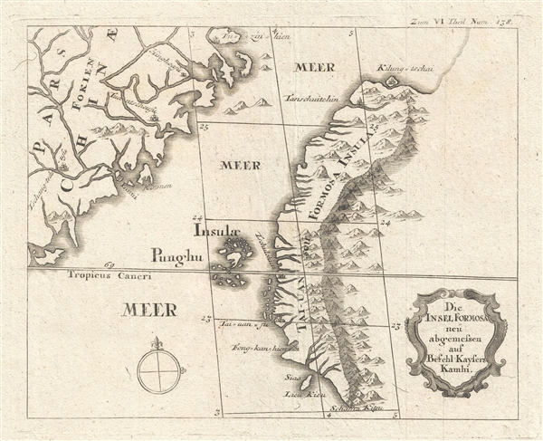
Die Insel Formosa neu abgemessen auf Befehl Kaysers Kamhi. [The Island of Formosa As Newly Surveyed By Order of Emperor Kamhi.]
sold
- Digital Map Information
- Suitable for large format printing
- Full resolution TIFF file
- ICC color profile embedded
- Delivered instantly via download link
This rare find is one of the earliest, if not the earliest, obtainable printed map of Taiwan or Formosa Island. It was issued around 1726 to illustrate Joseph Stöcklein's [Stoecklein] compellation of Jesuit missionary ... (more details)
1779 William Herbert Map of the Pirate Refuge of Ile Sainte-Marie (Libertalia / Nosy Boraha), Madaga
Exceptional English map of the Legendary Pirate republic of Libertalia where Kidd's galley, the Adventure, was recently discovered.
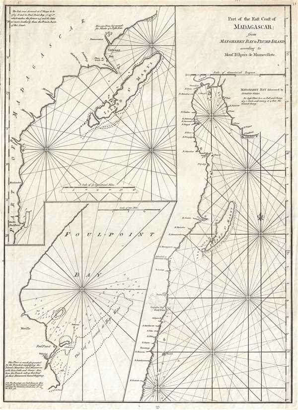
Part of the East Coast of Madagascar from Manghabey Bay to Plumb Island according to Mons. D'Apres de Mannevillette.
sold
- Digital Map Information
- Suitable for large format printing
- Full resolution TIFF file
- ICC color profile embedded
- Delivered instantly via download link
One of the most enjoyable maps we have had the privilege of cataloging, this is William Herbert's map of the island of Île Sainte-Marie, St. Mary's Island, or as it is known today, Nosy Boraha, Madagascar. During the ... (more details)
Remarkable and highly decorative early American wall sized map of the world.
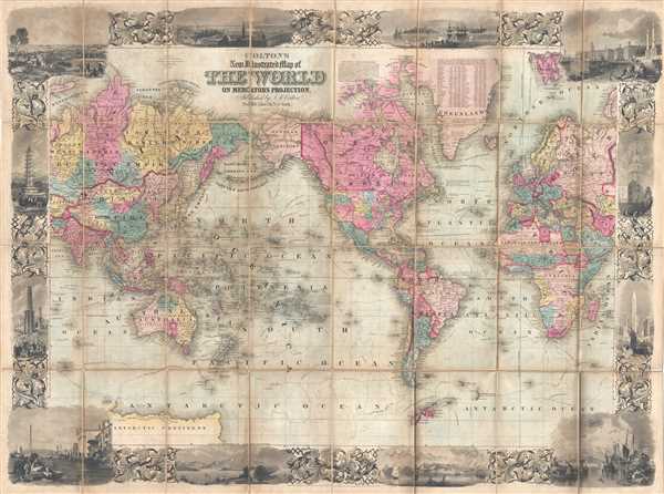
Colton's New Illustrated Map of the World on Mercator's Projection.
sold
- Digital Map Information
- Suitable for large format printing
- DPI: 300
- File Size: 37.61 MB
- File Type: ZIP / TIFF
- ICC color profile embedded
- Delivered instantly via download link
A rare and highly attractive dissected case-map edition of Colton's New Illustrated Map of the World . Centered on America, this grand map presents the entire world on a Mercator Projection. Countries, continents, ... (more details)
One of the finest large format American maps of Ohio obtainable.
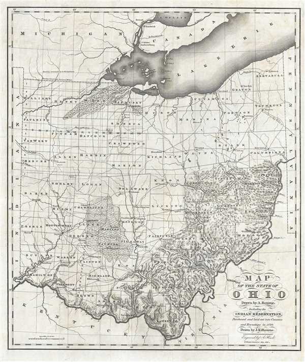
Map of the State of Ohio Drawn by A. Bourne. Including the Indian Reservation, Purchased and laid out Counties and Townships in 1820.
sold
- Digital Map Information
- Suitable for large format printing
- Full resolution TIFF file
- ICC color profile embedded
- Delivered instantly via download link
A rare 1820 American map of Ohio drawn for Caleb Atwater's Description of Antiquities Discovered in the State of Ohio . This map covers all of modern day Ohio as well as some of the surrounding states from Lake ... (more details)
This gigantic wall map is the highest expression of the Coast Survey's work in and around New York City and Harbour.
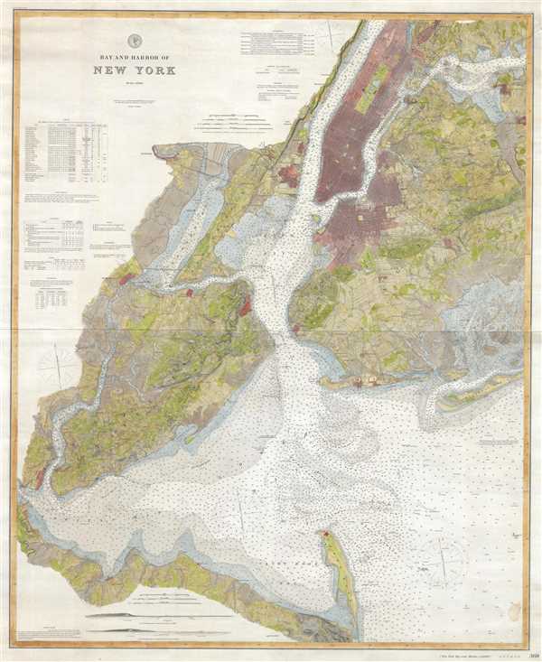
Bay and Harbor of New York.
sold
- Digital Map Information
- Suitable for large format printing
- Full resolution TIFF file
- ICC color profile embedded
- Delivered instantly via download link
This is a rare and dramatic 1889 wall map version of the U.S. Coast Survey nautical chart or maritime map of New York City and Harbor. Like most of its smaller predecessors, this map covers from Sandy Hook to ... (more details)