
The Silk Road between the Caspian Sea and the Hindu Kush.

[Tabula Septima Asiae].
sold
- Digital Map Information
- Suitable for large format printing
- Full resolution TIFF file
- ICC color profile embedded
- Delivered instantly via download link
This is Laurent (Lorenz) Fries' 1522 map of central Asia and the Silk Road, among the earliest acquirable maps of Central Asia east of the Caspian Sea. Although presenting 2nd-century Ptolemaic geography, this map remained relevant as the best map of the region available. Additionally, Fries' iteration of this Ptolemaic map is distinct from any other in its incorporation of contemporary information about the denizens of the region - in this case, drawn from the texts on Waldseemüller's 1516 Carta Marina. (more details)
692nd Tank Destroyers in WWII.

692nd Tank Destroyer Battalion.
sold
- Digital Map Information
- Suitable for large format printing
- Full resolution TIFF file
- ICC color profile embedded
- Delivered instantly via download link
This is a rare c. 1945 World War II unit route map of the 692nd Tank Destroyer Battalion in Europe prepared by 1st Lieutenant Francis L. Yost. This map highlights the battalion's movements across the continent, details its campaigns, and remembers the members of the battalions that were killed in action. (more details)
Rockwell International built all 6 Space Shuttles.
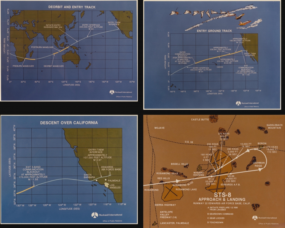
Deorbit and Entry Track. Entry Ground Track. Descent Over California. STS-8 Approach and Landing Runway 22 Edwards Air Force Base, Calif.
sold
This is a set of 4 1983 maps created by Rockwell International illustrating the Space Shuttle Challenger's entry and landing to conclude STS-8. (more details)
Infrastructure and Land Reclamation in Kowloon.

中英文 九龍全圖 附地名索引 / 九龍全圖 / [Street Map of Kowloon with Streets Index / Complete Map of Kowloon].
sold
A brightly colored, large-format 1974 Sun Sun bilingual street plan or map of Kowloon, Hong Kong. It provides a snapshot of the city as it underwent notable changes in the late British colonial period, including the opening of the Cross Harbour Tunnel, an extension of Kai Tak Airport, and land reclamation projects. (more details)
Striking Woodcut map of Greece.

New Griechenlandt mit andern anstossenden Laendern wie es zu unsern zeiten beschriben ist.
sold
- Digital Map Information
- Suitable for large format printing
- Full resolution TIFF file
- ICC color profile embedded
- Delivered instantly via download link
This evocative map of Greece and the Greek Islands was added to Münster's Cosmographia in 1588 as part of Sebastian Petri's extensive update of the work. (more details)
Birth of British Railways.
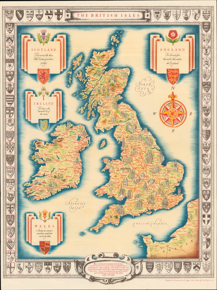
The British Isles.
sold
- Digital Map Information
- Suitable for large format printing
- Full resolution TIFF file
- ICC color profile embedded
- Delivered instantly via download link
A charming c. 1951 pictorial map of the British Isles, drawn by Cecil Meyer for the recently created British Railways, the product of the nationalization of Britain's rail network in 1947 - 1948. (more details)
Around Coral Gables.

Larson's Map of Coral Gables. Compliments of Withers.
sold
- Digital Map Information
- Suitable for large format printing
- Full resolution TIFF file
- ICC color profile embedded
- Delivered instantly via download link
This is a c. 1951 Leon W. Larson city map of Coral Gables, Florida. (more details)
A delightful and colorful historical pictorial map of Ireland.

Historical Map of Ireland.
sold
This is a delightful 1969 L.G. Bullock pictorial historical map of Ireland. (more details)
Spreading the Word about Sinking Axis Ships.

ما ترر حمولة من 1,250,000 طن من سفن المحور في وسط البحر الأبيض المتوسط / [Over 1,250,000 tons of Axis shipping sunk in the central Mediterranean].
sold
- Digital Map Information
- Suitable for large format printing
- File Size: 28.98 MB
- File Type: ZIP / TIFF
- ICC color profile embedded
- Delivered instantly via download link
A vibrant c. 1943 chromolithographed Arabic-language propaganda poster, cheering the Allied war effort and celebrating the sinking of Axis ships in the Mediterranean. (more details)
A crew member's sketch of the voyages of the U.S.S. Salt Lake City throughout WWII.

Cruise of the U.S.S. Salt Lake City.
sold
- Digital Map Information
- Suitable for large format printing
- File Size: 40.59 MB
- File Type: ZIP / TIFF
- ICC color profile embedded
- Delivered instantly via download link
This is a unique 1945 manuscript map of the U.S.S. Salt Lake City's World War II cruises, covering from February 1942 until August 4, 1945. It was hand drawn on cloth by Ralph Bennett, a crewman. (more details)
Revealing a separate Asia and America.
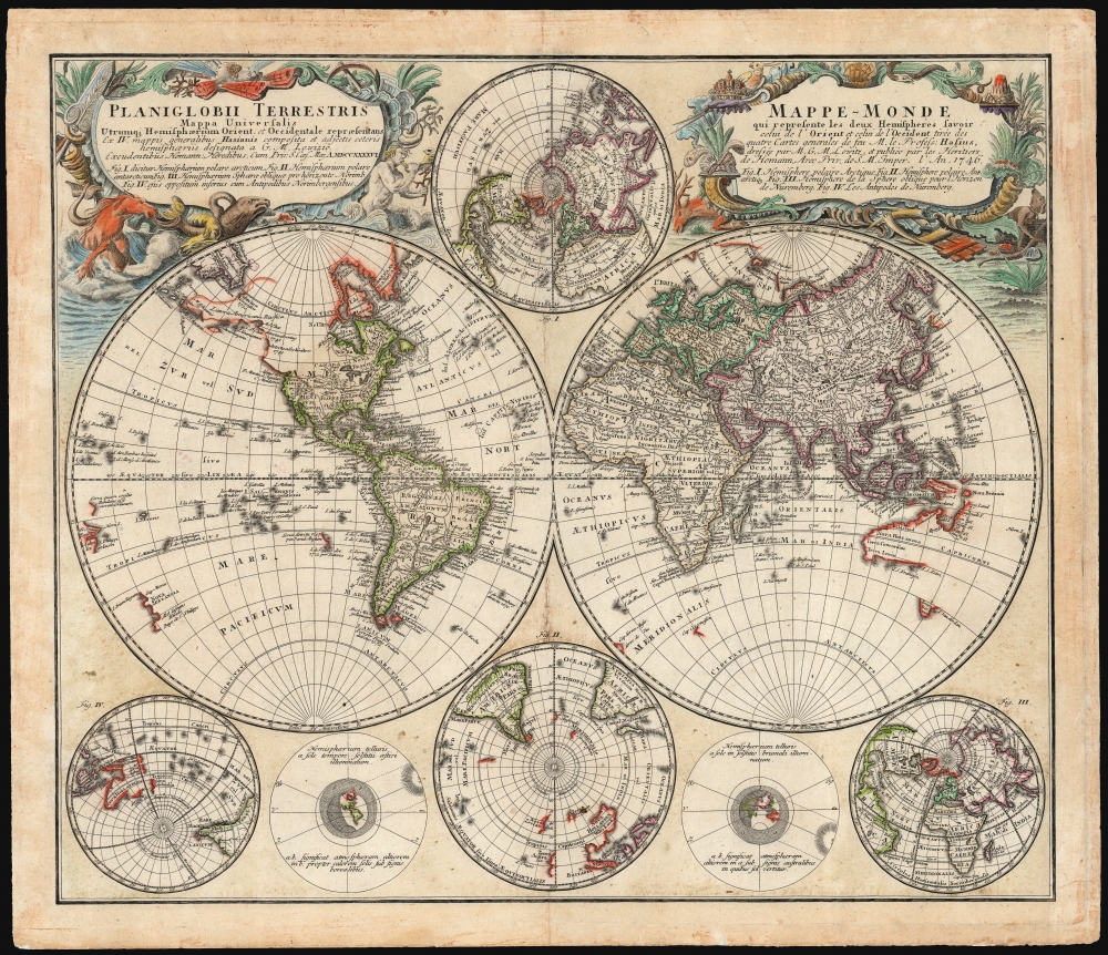
Planiglobii Terrestris/ Mappe-Monde.
$1,500.00
Acquire
- Digital Map Information
- Suitable for large format printing
- File Size: 29.97 MB
- File Type: ZIP / TIFF
- ICC color profile embedded
- Delivered instantly via download link
This is an elegant and detailed 1759 world map by Johann Matthias Hase and Georg Maurice Lowitz, contributors to the firm of Homann Heirs. The map was first issued in 1746, reflecting the best available cartographic detail of the day both from French and Russian sources. The present example was updated c. 1759 to reflect the discoveries of Bering and Chirikov according to the 1754 Müller map, confirming the separation of the continents of Asia and North America. (more details)
The mystery of sunspots.

Schema corporis solaris prout ab astronomis hoc saeculo per machinas helioscopicas observatum est.
sold
- Digital Map Information
- Suitable for large format printing
- Full resolution TIFF file
- ICC color profile embedded
- Delivered instantly via download link
A finely engraved 1685 map of the Sun by Athanasius Kircher and Johann Zahn. The map provides a dramatic image of the Sun based upon the revolutionary 1665 work of the Jesuit polymath Athanasius Kircher (1602 - 1680). (more details)
Massacre at Paso de Quinteros.
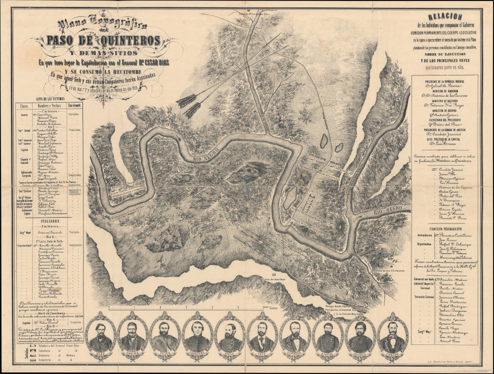
Plano topográfico del Paso de Quinteros y demás sitios en que tuvo lugar la capitulación del Gral. César Díaz y se consumó la hecatombe en que aquel Gefe y sus demás compañeros fueron asesinados en los días 1 y 2 y siguientes del mes de febrero del año 1858.
sold
- Digital Map Information
- Suitable for large format printing
- File Size: 49.73 MB
- File Type: ZIP / TIFF
- ICC color profile embedded
- Delivered instantly via download link
A richly detailed c. 1885 historical map of the Paso de Quinteros along the Rio Negro in Uruguay, produced by the Escuela de Artes y Oficios. It commemorates a massacre that took place there in 1858, following an uprising the previous year, an episode in a decades-long Uruguayan Civil War. (more details)
Among the earliest American maps to illustrate the United States stretching from coast to coast.
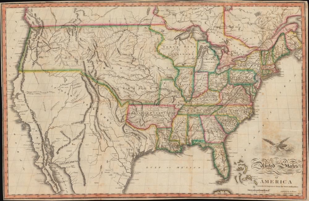
United States of America Corrected and Improved from the Best Authorities.
sold
- Digital Map Information
- Suitable for large format printing
- Full resolution TIFF file
- ICC color profile embedded
- Delivered instantly via download link
An uncommon 1820 map of the United States by Benjamin Warner. Following on John Melish's wall map of 1819, this is one of the earliest maps to depict the United States extending from the Atlantic to the Pacific. As Wheat notes, this map is significant as one of several issued up to about 1823 that galvanized geographic ideas regarding the only tenuously explored lands beyond the Rocky Mountains, including the mythical 'River of the West' or 'Buenaventura' and other speculations. (more details)
Virgo from the most important 17th century celestial atlas.

[Virgo].
sold
- Digital Map Information
- Suitable for large format printing
- File Size: 9.74 MB
- File Type: ZIP / TIFF
- ICC color profile embedded
- Delivered instantly via download link
This is a beautiful example of Johann Bayer's celestial chart of the zodiacal constellation Virgo. It was engraved for Bayer's seminal 1603 celestial atlas, Uranometria: omnium asterismorum content schemata, nova methodo delineata, aereis laminis expressa. As the forerunner of all later celestial atlases, the importance and relevance of this work are emphasized by its continued publication throughout the mid-17th century. (more details)
R and R during World War II.

VI Corps Rest Center Nancy, France. / The VI Corps Rest Center at Nancy France How to Get Around.
sold
- Digital Map Information
- Suitable for large format printing
- Full resolution TIFF file
- ICC color profile embedded
- Delivered instantly via download link
This is a Leo Sarkisian pictorial map of the VI Corps Rest Center in Nancy, France, published in March 1945, two months before the end of World War II in Europe. (more details)
Land of Eternal Spring.
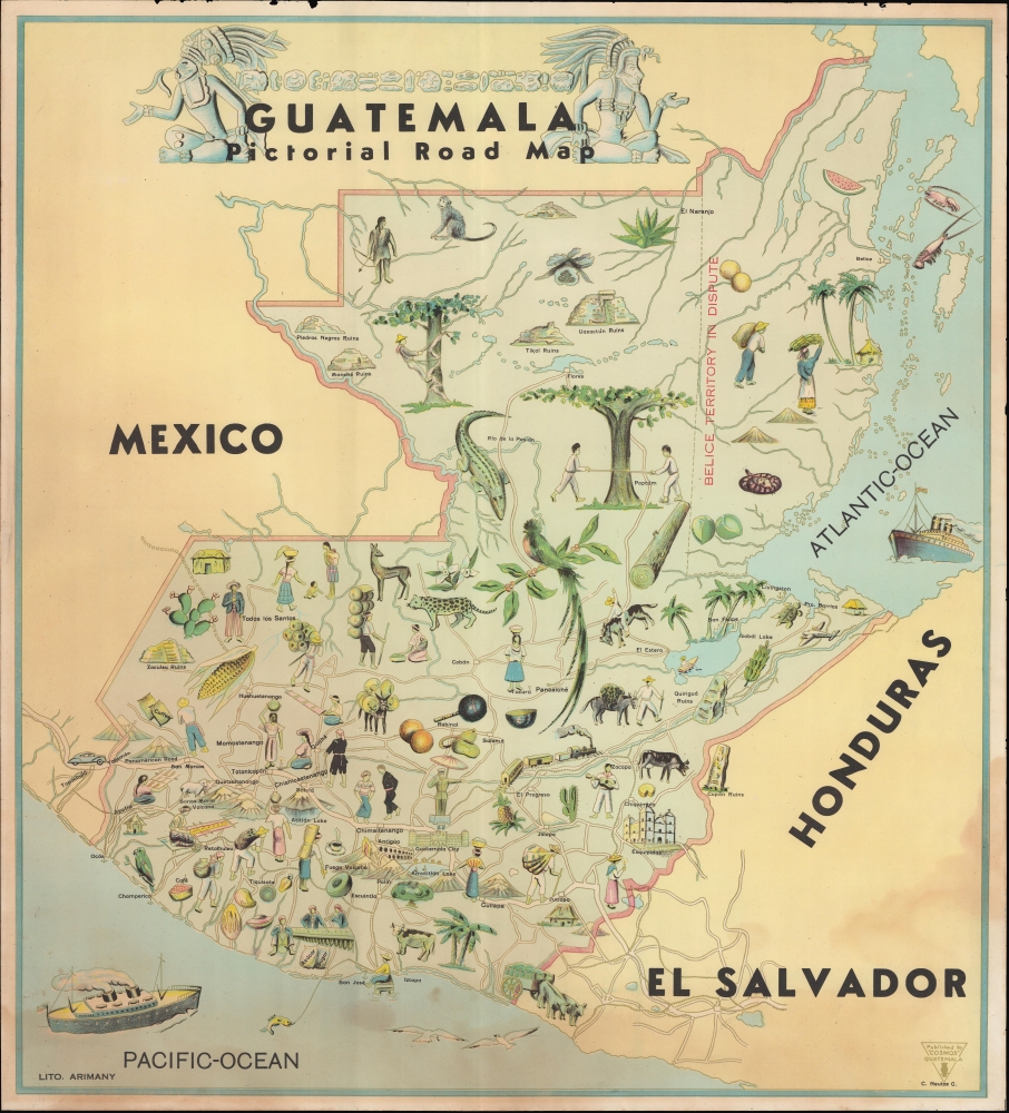
Guatemala Pictorial Road Map.
sold
- Digital Map Information
- Suitable for large format printing
- File Size: 21.72 MB
- File Type: ZIP / TIFF
- ICC color profile embedded
- Delivered instantly via download link
A c. 1945 pictorial map of Guatemala, drawn by C. Neutze and printed by Litografía Arimany. (more details)
Capital of the U.S. Virgin Islands.
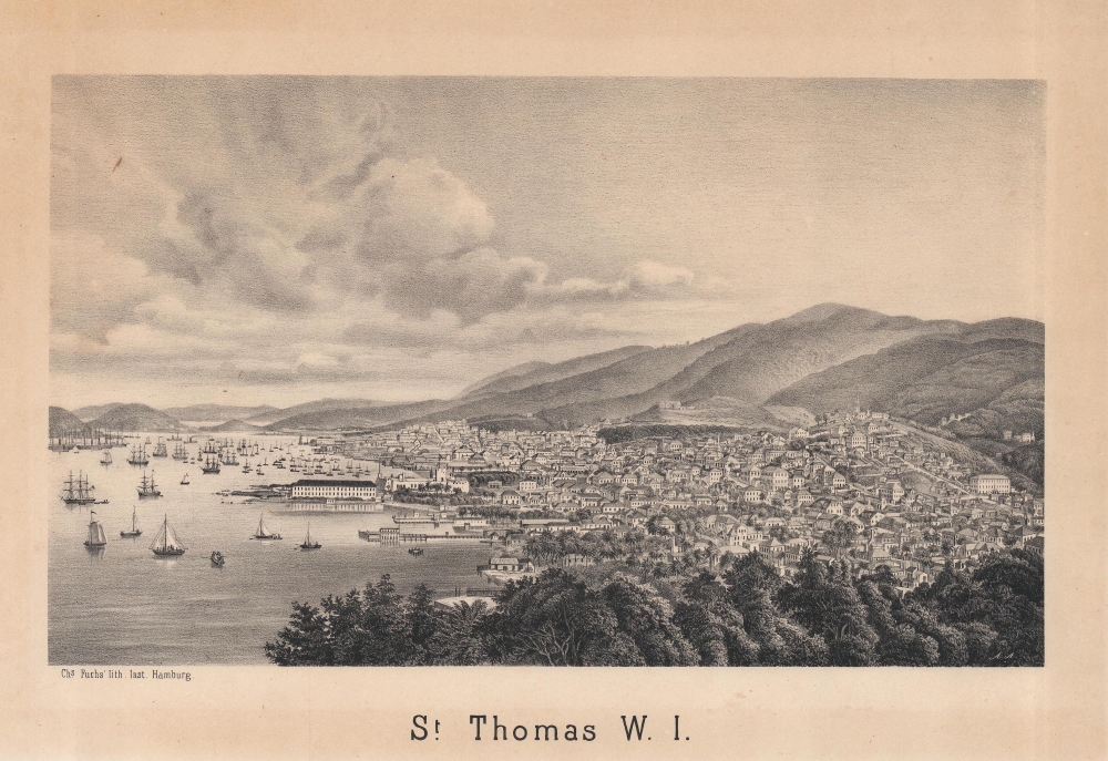
St. Thomas W. I.
sold
- Digital Map Information
- Suitable for large format printing
- File Size: 10.93 MB
- File Type: ZIP / TIFF
- ICC color profile embedded
- Delivered instantly via download link
A scarce, unrecorded c.1875 view of the city of Charlotte Amalie, St. Thomas, U.S. Virgin Islands (then part of the Danish West Indies), printed by Charles Fuchs in Hamburg. (more details)
Florida's towns, rivers, and railroads.

Colton's Florida.
sold
- Digital Map Information
- Suitable for large format printing
- File Size: 28.62 MB
- File Type: ZIP / TIFF
- ICC color profile embedded
- Delivered instantly via download link
This is a c. 1875 G.W. and C.B. Colton map of Florida. Replacing the smaller single-sheet map of Florida appearing in early editions of the Colton atlas, this new map captures Florida's explosive growth in the late 19th century. (more details)
Fortune! At your own risk!

Lost Mines, Buried and Sunken Treasures of California and Nevada. / Lost Treasures and Mines of Nevada and California.
sold
This is a 1962 Occidental Publishing Company map of buried treasure and sunken ships in California and Nevada. Throughout the map, lost mines, buried treasure, and sunken ships abound, capturing the romance of the treasure hunt. (more details)