
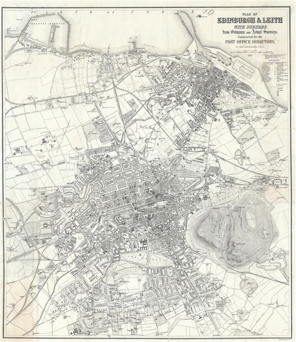
Plan of Edinburgh and Leith with Suburbs, from Ordnance and Actual Surveys, Constructed for the Post Office Directory,
sold
- Digital Map Information
- Suitable for large format printing
- Full resolution TIFF file
- ICC color profile embedded
- Delivered instantly via download link
This is a beautiful 1877 map or plan of the city of Edinburgh and Leith, Scotland, by John Bartholomew. The map covers the city of Edinburgh, known as the 'Athens of the North' in exceptional detail from the Royal Edinburgh Lunatic Asylum (what is today the Royal ... (more details)
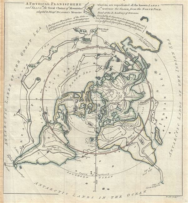
A Physical Planisphere wherein are represented all the known Lands and Seas, w.th the Great Chains of Mountains w.ch traverse the Globe from the North Pole.
sold
- Digital Map Information
- Suitable for large format printing
- Full resolution TIFF file
- ICC color profile embedded
- Delivered instantly via download link
This is a beautiful 1757 Philippe Buache map of the world represented on an unusual polar projection rendered from the North Pole. The map covers from the North Pole Arctic region south beyond Tasmania (Van Diemen's Land) to include parts of New Zealand and even ... (more details)
Maps the source of the Senegal and Gambia Rivers.
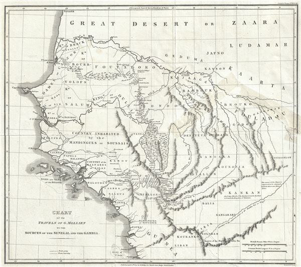
Chart of the Travels of G. Mollien to the Sources of the Senegal and the Gambia.
sold
- Digital Map Information
- Suitable for large format printing
- Full resolution TIFF file
- ICC color profile embedded
- Delivered instantly via download link
This is a fascinating 1820 map of western Africa by Richard Phillips illustrating the travels of Gaspard Theodore Mollien to the sources of the Senegal and Gambia Rivers. It covers modern day Senegal and Gambia along with neighboring Mauritania, Guinea, ... (more details)
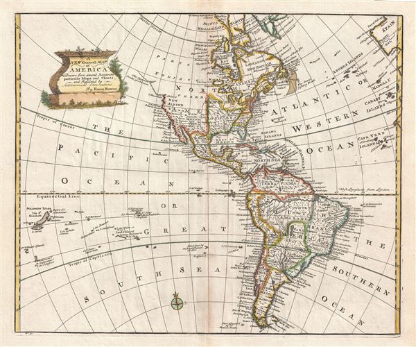
A New General Map of America.
sold
- Digital Map Information
- Suitable for large format printing
- DPI: 300
- File Size: 8.59 MB
- File Type: ZIP / TIFF
- ICC color profile embedded
- Delivered instantly via download link
This is a stunning 1747 decorative map of the Western Hemisphere by the English cartographer Emanuel Bowen. It covers North and South America as well as much of the Pacific and the Atlantic as far as Spain and the Canary Islands. The map details America ... (more details)
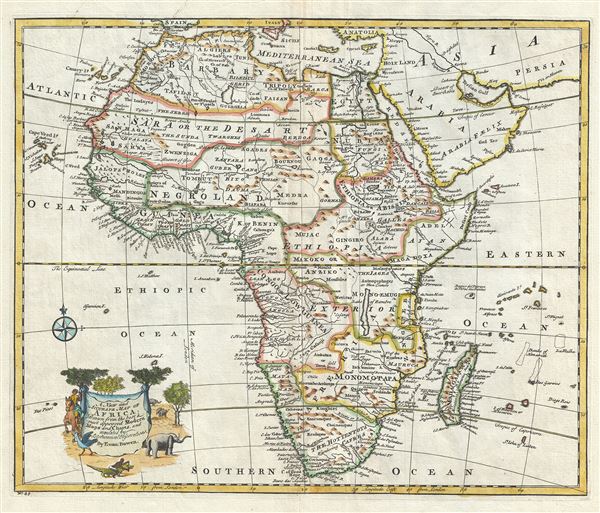
A New and Accurate Map of Africa.
sold
- Digital Map Information
- Suitable for large format printing
- DPI: 300
- File Size: 9.2 MB
- File Type: ZIP / TIFF
- ICC color profile embedded
- Delivered instantly via download link
This is an extremely attractive 1747 decorative map of Africa by the English cartographer Emmanuel Bowen. It depicts the African continent in stunning detail with numerous notations and comments regarding the people, geography, and wildlife of the ... (more details)
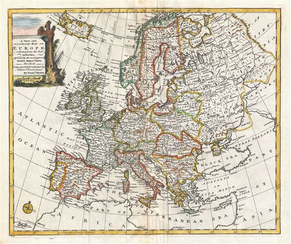
A New and Accurate Map of Europe.
sold
- Digital Map Information
- Suitable for large format printing
- DPI: 300
- File Size: 10.25 MB
- File Type: ZIP / TIFF
- ICC color profile embedded
- Delivered instantly via download link
This is a beautiful 1747 decorative map of Europe by the English cartographer Emmanuel Bowen. The map covers from Iceland to Tartary and south as far as North Africa. It also includes western Russia and the Black Sea. It renders the entire region ... (more details)
Identifies the Sea of Korea.
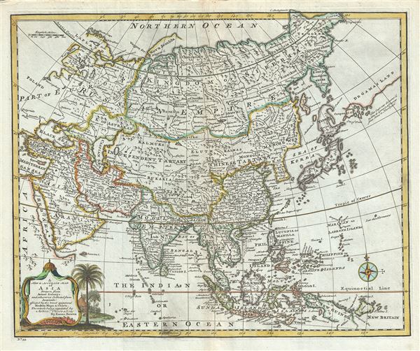
A New and Accurate Map of Asia.
sold
- Digital Map Information
- Suitable for large format printing
- DPI: 300
- File Size: 10.08 MB
- File Type: ZIP / TIFF
- ICC color profile embedded
- Delivered instantly via download link
This is an extremely attractive 1747 decorative map of Asia by the English cartographer Emmanuel Bowen. This map covers the entire continent from Africa and the Mediterranean east to the Bering Sea and south as far as Java and New Guinea. The map ... (more details)
Identifies the Sea of Korea.
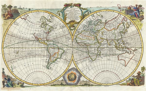
A New and Accurate Map of all the Known World.
sold
- Digital Map Information
- Suitable for large format printing
- DPI: 300
- File Size: 11.31 MB
- File Type: ZIP / TIFF
- ICC color profile embedded
- Delivered instantly via download link
This is an extremely attractive 1747 decorative double hemisphere world map by the English cartographer Emmanuel Bowen. This beautiful map covers the entire world as it was understood in the middle part of the 18th century, before the explorations ... (more details)
Miniature Japanese Map of the world based on Matteo Ricci.
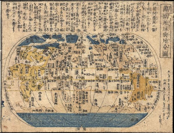
Wanguo Quantu (Complete Map of the Globe and World)
sold
- Digital Map Information
- Suitable for large format printing
- Full resolution TIFF file
- ICC color profile embedded
- Delivered instantly via download link
A miniature 18th century xylograph (woodcut) Japanese map of the world. This small map follows the model of the Chinese issued 1602 Matteo Ricci map - then the most sophisticated European style world map available to Japanese cartographers. The ... (more details)
Uncommon Japanese map of the world.
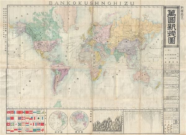
Bankokushnghizu.
sold
- Digital Map Information
- Suitable for large format printing
- File Size: 23.93 MB
- File Type: ZIP / TIFF
- ICC color profile embedded
- Delivered instantly via download link
An uncommon 1881 (Meiji 14) Japanese map of the world by Yamanaka Zensaburo. This map, clearly derived from European sources, illustrates the world on Mercator's projection. The routes of various explorer as well as oceanic trade routes are ... (more details)

January February March. April May June. July August September. October November December.
sold
- Digital Map Information
- Suitable for large format printing
- Full resolution TIFF file
- ICC color profile embedded
- Delivered instantly via download link
This is a beautifully hand colored set of four maps depicting the night sky in the twelve months of the year, by Elijah Burritt. Each sheet features the stars and constellation in the night sky over a quarter. On each of the charts, the ... (more details)
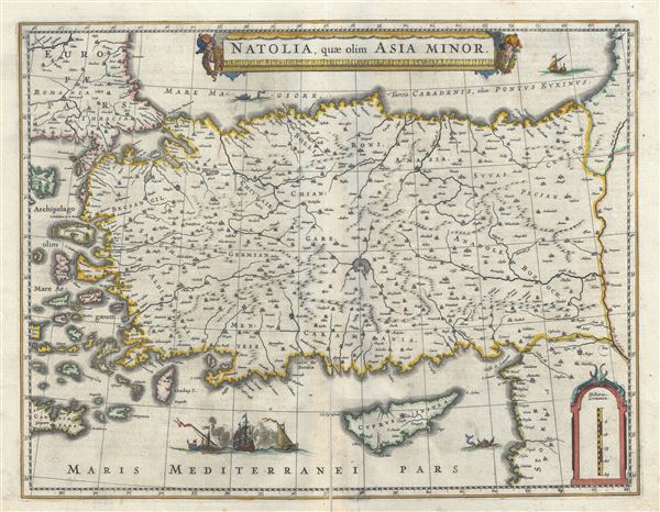
Natolia, quae olim Asia Minor.
sold
- Digital Map Information
- Suitable for large format printing
- Full resolution TIFF file
- ICC color profile embedded
- Delivered instantly via download link
This is an attractive c. 1640 map of Turkey or Asia Minor by Johannes Blaeu. It covers Turkey from the Aegean Sea east as far as the Euphrates River. Cyprus and some of the Aegean Islands are also included. The map is beautifully ... (more details)
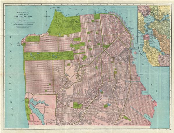
Rand McNally Standard Map of San Francisco.
sold
This is a beautiful map of the city of San Francisco, California, issued by the Rand McNally and Company in c.1930. It covers the entire city from Fort Point and Presidio Park as far south as the Laguna de la Merced. The map is ... (more details)

Index Map. [Map of Long Island Based upon Recent U.S. Coast Surveys, Together with Local Maps on File. Supplemented by Careful Territorial Observations].
sold
- Digital Map Information
- Suitable for large format printing
- Full resolution TIFF file
- ICC color profile embedded
- Delivered instantly via download link
This is an index map in four sections depicting the four part 1896 map series by E. Belcher Hyde, detailing Long Island. A set of four sections, the map covers long Island from Brooklyn to Montauk. Section 1 covers from ... (more details)
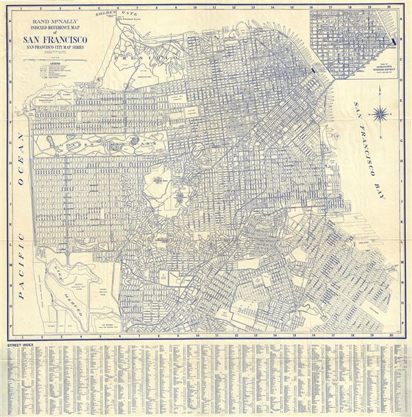
Rand McNally Indexed Reference Map of San Francisco San Francisco City Map Series.
sold
- Digital Map Information
- Suitable for large format printing
- File Size: 18.9 MB
- File Type: ZIP / TIFF
- ICC color profile embedded
- Delivered instantly via download link
This is a fine c.1940 folding map or plan of the city of San Francisco by Rand McNally. It shows all major streets, parks, cemetery, squares and peaks and covers San Francisco from Fort Point (Golden Gate Bridge) in the ... (more details)
18th century manuscript map of Korea!
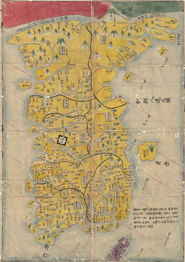
Chosen Hachido no Zu (or) Chosen Koko Zenzu (General Map of Korea)
sold
- Digital Map Information
- Suitable for large format printing
- DPI: 300
- File Size: 2.83 MB
- File Type: ZIP / TIFF
- ICC color profile embedded
- Delivered instantly via download link
A beautiful c. 1786 manuscript map of Korea prepared by Hayashi Shihei. This map was drawn to illustrate Shihei's Sangoku Tsuran Zusetsu (Illustrated General Survey of the Three Countries). It covers all of Korea as ... (more details)
A clash of cultures.

Bankoku Kōkai-zu / 萬国航海圖 / World Navigational Map.
sold
- Digital Map Information
- Suitable for large format printing
- File Size: 9.32 MB
- File Type: ZIP / TIFF
- ICC color profile embedded
- Delivered instantly via download link
A remarkable 1862 Yokohama Published Japanese large format Japanese map of the world by Edward Schnell and Kango Takeda. This map is based upon an English map drown by John Purdy and others in 1845. Kango Takeda ... (more details)
Wonderful pre-Rennell map of India.

Presqu'Isle des Indes Orientales, Comprenant l'Indostan ou Empire du Mogol, Differens Royaumes ou Etats, Les Vastes Possessions des Anglais, et les autres Etablissemens EuropEens, avec les Grandes Routes.
sold
- Digital Map Information
- Suitable for large format printing
- DPI: 300
- File Size: 19.33 MB
- File Type: ZIP / TIFF
- ICC color profile embedded
- Delivered instantly via download link
This is a scarce and beautiful 1786 map of India and Sri Lanka by Robert de Vaugondy. It covers the Indian subcontinent from Independent Tartary south to include Ceylon and the Maldives and from Persia east as far ... (more details)
Munster's second world map.
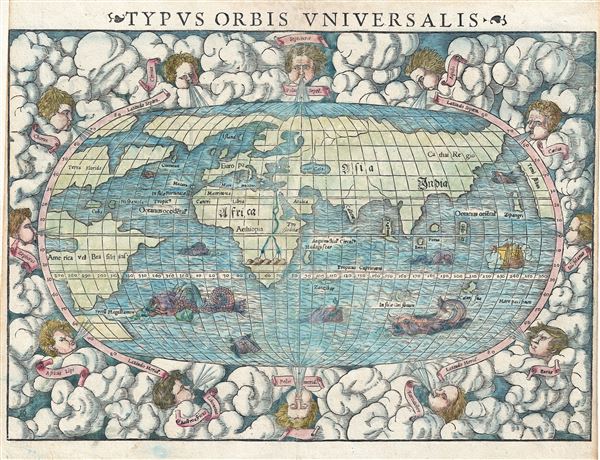
Typus Orbis Universalis.
sold
- Digital Map Information
- Suitable for large format printing
- DPI: 300
- File Size: 8.05 MB
- File Type: ZIP / TIFF
- ICC color profile embedded
- Delivered instantly via download link
One of the most recognizable maps of the 16th century, this is a fine colored example of Sebastian Munster's 1550 map of the world - considered the first map to identify the Pacific Ocean or, as here, 'Mare ... (more details)
Petri's map of America with new toponymy on North America's west coast.
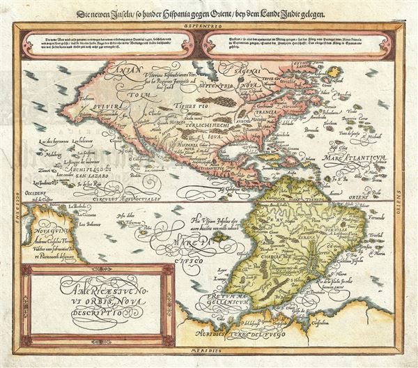
Americae Sive Novi Orbis Nova Descriptio. / Die newen inseln so hinder Hispaniam gegen Orient, bey dem landt Indie gelegen.
sold
- Digital Map Information
- Suitable for large format printing
- DPI: 300
- File Size: 7.25 MB
- File Type: ZIP / TIFF
- ICC color profile embedded
- Delivered instantly via download link
An attractive c. 1588 edition of Sebastian Henric Petri's Americae Sive Novi Orbis published in the 1628 edition of Sebastian Munster's Cosmographia . This map covers all of north and South America from a ... (more details)