
New Mexico's history, culture, and wildlife.

A Poster of New Mexico.
sold
This is the 1984 pictorial map of New Mexico in the iconic information-dense style of Richard Waldmire. (more details)
Eighth Wonder of the World.

Empire State Building Dominates the World's Greatest City.
sold
A wonderful c. 1958 promotional view of Manhattan highlighting the Empire State Building and its observatory, published by the observatory itself. (more details)
Monumental and rare World War II route map.

Operations from Omaha Beach to Elbe River.
sold
- Digital Map Information
- Suitable for large format printing
- Full resolution TIFF file
- ICC color profile embedded
- Delivered instantly via download link
This is a monumental and impressive 1945 John A. LeDonne route map of Europe tracing the movements of the 1115th Engineer Combat Group during World War II. It is the largest and most impressive 'Route Map' to emerge out of World War II (1939 - 1945). (more details)
Before Gettysburg.
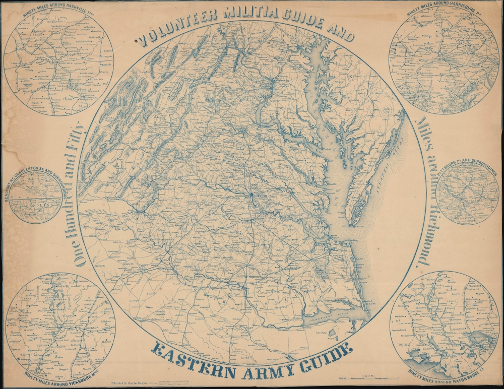
Volunteer Militia Guide and Eastern Army Guide: One Hundred and Fifty Miles around Richmond.
sold
- Digital Map Information
- Suitable for large format printing
- File Size: 38.63 MB
- File Type: ZIP / TIFF
- ICC color profile embedded
- Delivered instantly via download link
An extremely rare c. 1863 Charles Magnus broadside map of the Chesapeake, Virginia, Washington D.C. theater of the American Civil War (1861 - 1865). The map records the early days of the war when the Confederacy was rapidly advancing and before the high-water mark at Gettysburg. (more details)
Meeting point of the Japanese and Western worlds.

橫濱大湊細見之圖 / [Large Detailed Composite View of Yokohama].
sold
- Digital Map Information
- Suitable for large format printing
- Full resolution TIFF file
- ICC color profile embedded
- Delivered instantly via download link
This is a masterful c. 1860 six-panel composite view of Yokohama produced by Sadahide (貞秀), one of the great ukiyo-e artists of the late Edo period and early Meiji. The view depicts Yokohama shortly following its opening to foreign trade, a development that would have dramatic consequences for both Yokohama and Japan. (more details)
Eastern reaches of the Silk Road.
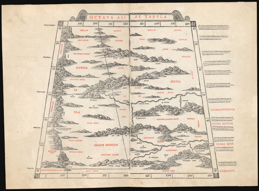
Octava Asia Tabula.
$2,000.00
Acquire
- Digital Map Information
- Suitable for large format printing
- File Size: 18.22 MB
- File Type: ZIP / TIFF
- ICC color profile embedded
- Delivered instantly via download link
This is a rare example of Bernard Sylvanus' 1511 Ptolemaic map of the eastern reaches of the Silk Road. Printed in a single edition, it is one of the most visually distinctive early woodcut maps to detail parts of modern-day Kazakhstan, Kyrgyzstan, and Tajikistan, the northeastern part of Mongolia, and the Xinjiang province of China. For Ancient Romans, this was the most remote part of the known world: Serica, named after the precious silk understood to originate there. (more details)
One of the first maps to offer any detail of the lower Mississippi.
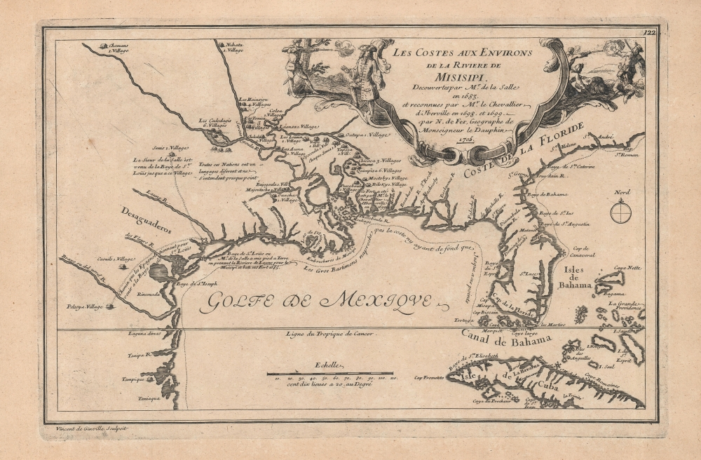
Les Costes aux Environs de la Riviere de Misisipi.
sold
- Digital Map Information
- Suitable for large format printing
- DPI: 600
- File Size: 17.92 MB
- File Type: ZIP / TIFF
- ICC color profile embedded
- Delivered instantly via download link
An uncommon map of often neglected and misunderstood significance, this is Nicolas de Fer's 1705 map of the Gulf Coast, Florida, and Texas, one of the earliest published maps to show any significant detail of the lower Mississippi Valley. It is the first widely disseminated illustration of D'Iberville's cartography along the Mississippi. Also, it dramatically illustrates La Salle's assassination at the hands of his own disgruntled men. (more details)
The Most Decorative 17th Century English Map of Asia
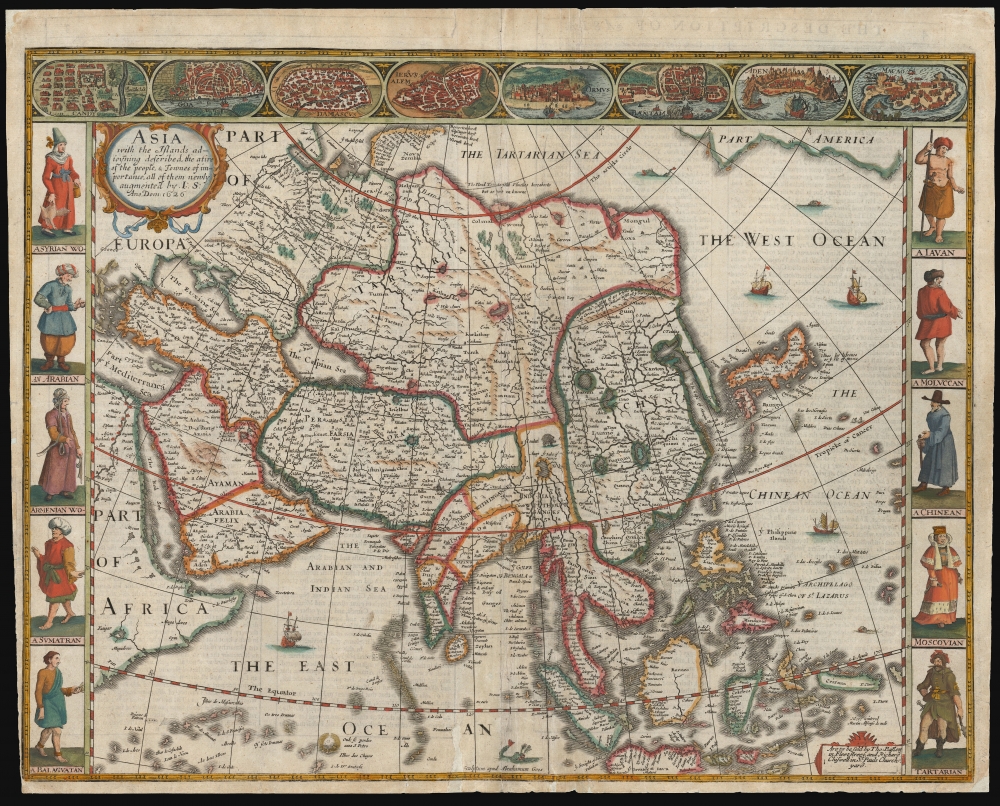
Asia with the Islands adjoyning described...
sold
- Digital Map Information
- Suitable for large format printing
- Full resolution TIFF file
- ICC color profile embedded
- Delivered instantly via download link
This is John Speed's 1626 map of Asia, the first map of the continent printed in English, in its 1676 edition. This beautiful map is one of the most desirable early maps of continent, combining superb engraving, attractive Dutch styling, and entertaining and abundant English text. (more details)
Modernizing Alexandria, to Return it to Its Ancient Glory.
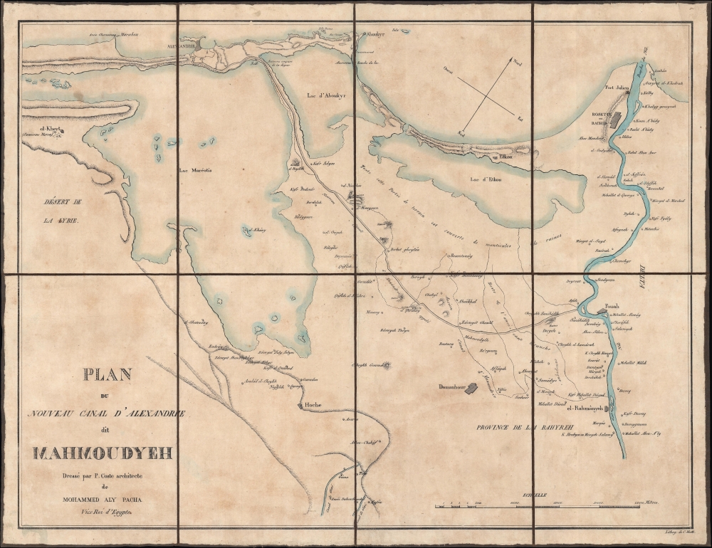
Plan du Nouveau Canal d'Alexandrie dit Mahmoudyeh.
sold
- Digital Map Information
- Suitable for large format printing
- File Size: 14.7 MB
- File Type: ZIP / TIFF
- ICC color profile embedded
- Delivered instantly via download link
A scarce c. 1823 separately-issued folding map of Mahmudiyya Canal near Alexandria, Egypt, by Pascal Coste. The canal was one of several key infrastructure projects launched by Muhammad Ali Pasha. (more details)
Lakota Chief with a most unusual War Bonnet.

[Native American Chief.]
$1,200.00
Acquire
- Digital Map Information
- Suitable for large format printing
- Full resolution TIFF file
- ICC color profile embedded
- Delivered instantly via download link
This is a c. 1889 James E. Meddaugh albumen cabinet card photograph of a Native American Lakota chief. The image is mounted on one of Meddaugh's cabinet cards from his Rushville, Nebraska, studio. The unidentified Native American chief is standing facing the ... (more details)
The 'All Red Line' is Secure...
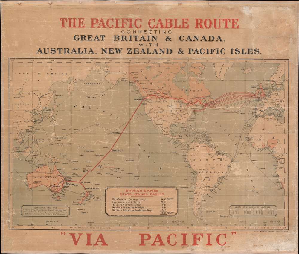
The Pacific Cable Route Connecting Great Britain and Canada with Australia, New Zealand, and Pacific Isles.
sold
- Digital Map Information
- Suitable for large format printing
- File Size: 36.69 MB
- File Type: ZIP / TIFF
- ICC color profile embedded
- Delivered instantly via download link
This is a c. 1911 John Waterlow and Sons map of the world highlighting British government telegraph cables. Known as the 'All Red Line', this vast telegraph network linked the entirety of the British Empire, allowing for near instant global communication with even the most remote outposts of the empire. This map was issued to celebrate the trans-Pacific cable, linking Vancouver, British Columbia, to Southport, Australia. (more details)
A Rare, Early Korean Map of Joseon.

東國八道大總圖 / [General Map of the Eight Provinces of Korea].
sold
- Digital Map Information
- Suitable for large format printing
- File Size: 7.94 MB
- File Type: ZIP / TIFF
- ICC color profile embedded
- Delivered instantly via download link
A rare Korean woodblock map of the Korean Peninsula produced c. 1800, almost certainly as part of a Yeojido atlas. (more details)
The Pleasure of Vipers...
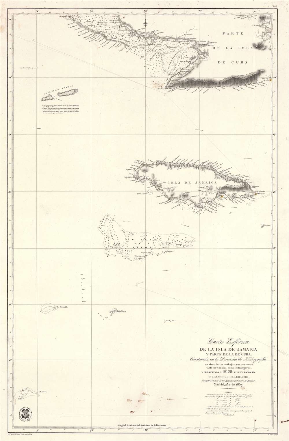
Carta Esférica de la Isla de Jamaica y Parte de la de Cuba.
sold
- Digital Map Information
- Suitable for large format printing
- File Size: 41.35 MB
- File Type: ZIP / TIFF
- ICC color profile embedded
- Delivered instantly via download link
A scarce 1857 Dirección de Hidrografía nautical chart or maritime map of Jamaica, the Little Cayman Islands, and Southern Cuba. Centered on Pendro Bank (Vibora), the map extends as far north as Nipe Bay on Cuba's north coast, and as far west as Little Cayman. The seas to the south are largely empty, but the Serrana Bank atoll in the western Caribbean is noted. (more details)
One of the Earliest Tourist Maps of Lake Champlain.

Map of Lake Champlain.
sold
- Digital Map Information
- Suitable for large format printing
- File Size: 22.63 MB
- File Type: ZIP / TIFF
- ICC color profile embedded
- Delivered instantly via download link
A scarce 1895 Seneca Ray Stoddard map of Lake Champlain issued for the Central Vermont Railroad. It was published at the height of the lake's late 19th-century popularity as a tourist destination. (more details)
Cruising the Americas.

The Americas Served by American Republic Lines ; Grace Line ; Pan American Airways System Pan American-Grace Airways ; United Fruit Company.
sold
- Digital Map Information
- Suitable for large format printing
- File Size: 97.88 MB
- File Type: ZIP / TIFF
- ICC color profile embedded
- Delivered instantly via download link
An attractive 1948 Kenneth Webster Thompson pictorial map of the Americas issued to promote cruise travel. (more details)
First American Woman in Space.

Space Shuttle Mission Chart STS-7.
sold
This is a 1982 Defense Mapping Agency map of STS-7 Space Shuttle orbits superimposed over a Mercator projection map of the world. America's first female astronaut, Sally Ride, was a member of the crew of STS-7. (more details)
Marketing the petrol industry to American youth.

Science in the Search for Oil.
sold
This is a c. 1970 wall chart describing the formation and discovery of oil published by the American Petroleum Institute for classroom use. It accompanies several educational booklets, including 'Facts About Oil', a 'Teacher's Guide', 'Science' and more. The whole provides remarkable insight into how the petroleum industry marketed itself to American youth. (more details)
Earliest Railroad on the North Shore of Massachusetts.
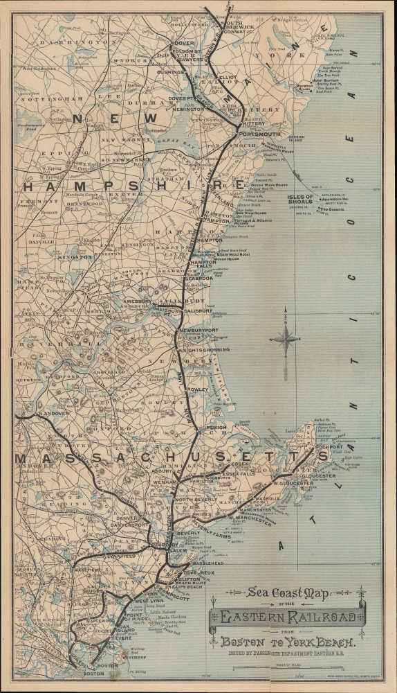
Sea Coast Map of the Eastern Railroad from Boston to York Beach.
sold
- Digital Map Information
- Suitable for large format printing
- File Size: 14.37 MB
- File Type: ZIP / TIFF
- ICC color profile embedded
- Delivered instantly via download link
A scarce c. 1880 map of the Eastern Railroad in the coastal region of Massachusetts, New Hampshire, and Maine, issued by Rand Avery Supply of Boston for the railroad's Passenger Department. (more details)
NASA's launch facilities at Kennedy Space Center.

Facilities at John F. Kennedy Space Center, NASA and Cape Canaveral Air Force Station.
sold
This is a December 1982 map of Kennedy Space Center and Cape Canaveral Air Force Station, Florida, likely published by NASA. Facilities are marked and identified throughout both installations, and detailed inset maps provide even more information. (more details)
Adirondack Express.

Map of the Chateaugay Railroad and Connections.
sold
- Digital Map Information
- Suitable for large format printing
- File Size: 12.25 MB
- File Type: ZIP / TIFF
- ICC color profile embedded
- Delivered instantly via download link
A c. 1891 map of the Adirondacks region and Lake Champlain tracing the lines of the Chateaugay Railroad, printed by the American Bank Note Co. This map was produced when railroads had opened up the Adirondacks for travelers, making it a fashionable destination for tourists from New York City and other cities in New England and the Mid-Atlantic. (more details)