
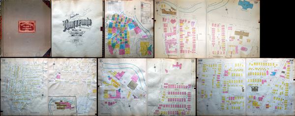
Insurance Maps of Hartford, Connecticut Volume II.
sold
This is a scarce 1922 atlas containing insurance maps of Hartford, Connecticut, published by the Sanborn Map Company in New York. The atlas contains seventy seven hand colored maps covering parts of Hartford. Maps identify streets, individual buildings, rivers, ... (more details)
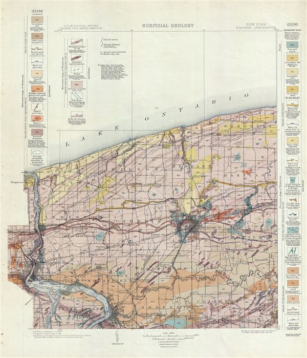
New York. Niagara Quadrangle. Surficial Geology.
sold
- Digital Map Information
- Suitable for large format printing
- File Size: 14.11 MB
- File Type: ZIP / TIFF
- ICC color profile embedded
- Delivered instantly via download link
This is a beautiful 1913 U.S. Geological Survey map showing the surficial geology of the Niagara County, including the Niagara River and the Niagara Falls, New York. The map illustrates the distribution of unconsolidated sediment in the region, covering from ... (more details)
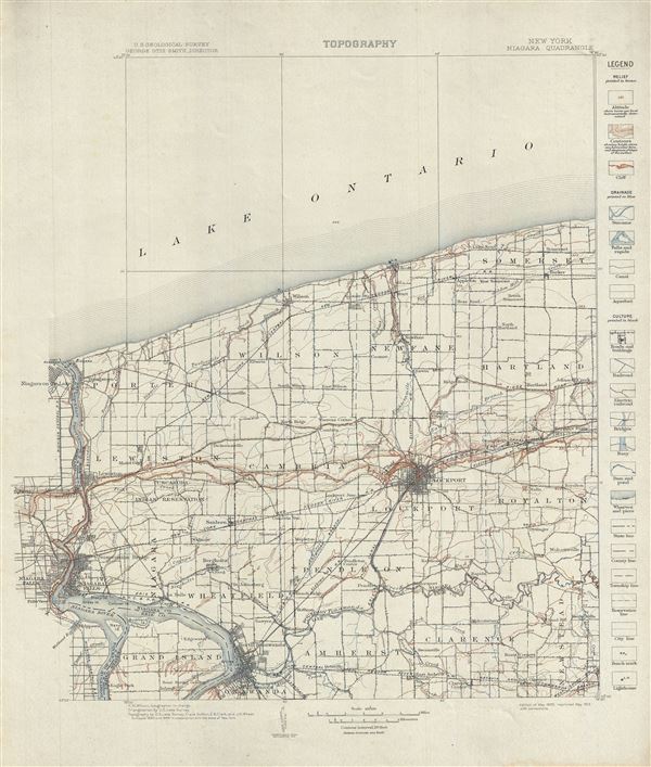
New York. Niagara Quadrangle. Topography.
sold
- Digital Map Information
- Suitable for large format printing
- File Size: 11.92 MB
- File Type: ZIP / TIFF
- ICC color profile embedded
- Delivered instantly via download link
This is a fine 1913 topographic map of the Niagara County including the Niagara River and the Niagara Falls, in New York by the U. S. Geological Survey. The map covers from Lake Ontario to Tonawanda and from Niagara Falls in Ontario, Canada and the Niagara ... (more details)
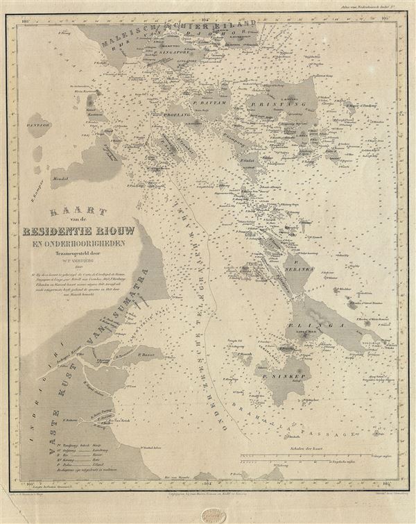
Kaart van de Residentie Riouw en Onderhoorigheden.
sold
- Digital Map Information
- Suitable for large format printing
- File Size: 7.81 MB
- File Type: ZIP / TIFF
- ICC color profile embedded
- Delivered instantly via download link
This is a scarce and beautiful 1860 map of the Riau Island Province in Sumatra, Indonesia. The map covers from southern Malaysia and Johor Bahru to Singkep Island or Pulau Singkep of the Riau Islands. Includes the Riau Archipelago and the Island of ... (more details)
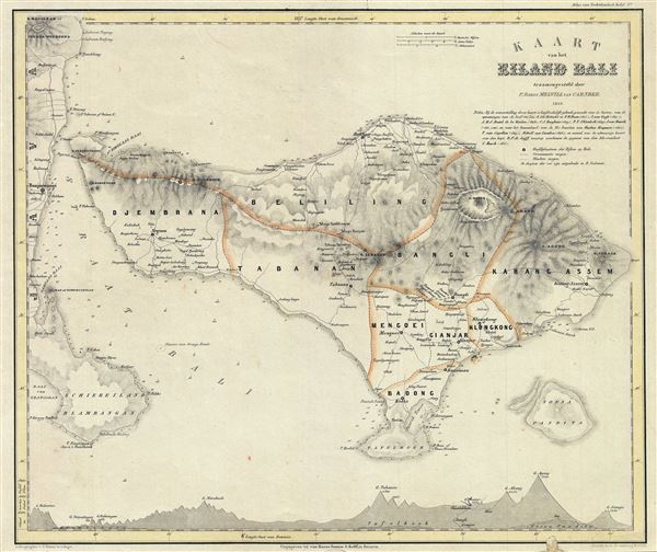
Kaart van het Eiland Bali.
sold
- Digital Map Information
- Suitable for large format printing
- File Size: 8 MB
- File Type: ZIP / TIFF
- ICC color profile embedded
- Delivered instantly via download link
This is a scarce 1856 map of Bali, Indonesia by the Dutch cartographer Pieter Baron Melvill van Carnbee. The map covers the entire island of Bali along with Penida Island and the eastern coast of Java. The map offers considerable detail throughout, ... (more details)
Using Croffutt's guide Verne's Phileas Fogg could have completed his great journey in just 87 days and 13 hours!

Crofutt's New Map of the Trans-Continental, American, and Trans-Continental, European, Route Around the World.
sold
- Digital Map Information
- Suitable for large format printing
- File Size: 31.41 MB
- File Type: ZIP / TIFF
- ICC color profile embedded
- Delivered instantly via download link
This is a fascinating 1871 George A. Crofutt map of the world showing various circumnavigatory routes. The map covers the entire world, excluding the Arctic and Antarctic regions, with the American continent presented at center. The American and ... (more details)
The first map of the world in a standard Atlas - of fundamental importance to the history of cartography.
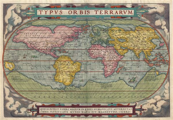
Typus Orbis Terrarum.
sold
- Digital Map Information
- Suitable for large format printing
- DPI: 300
- File Size: 10.46 MB
- File Type: ZIP / TIFF
- ICC color profile embedded
- Delivered instantly via download link
A fine first edition third printing example of Aberham Ortelius' iconic 1570 map of the world. This map is the first map of the world to appear in a standard atlas and is thus of fundamental importance to the history of cartography. Centered ... (more details)

Vue d'une partie de la ville de Lion dessignee dans le maison de Mrs. les Chanoines regulliers de St. Antoine.
sold
- Digital Map Information
- Suitable for large format printing
- DPI: 300
- File Size: 102.04 MB
- File Type: ZIP / TIFF
- ICC color profile embedded
- Delivered instantly via download link
An unusual and monumental view of Lyon France by Francois Cleric and Francois Poilly. This view is a 19th century restrike of a view originally published in Paris c. 1720. The view presents Lyon as view looking west from the eastern bank ... (more details)
Uncommon map presenting Texas at its largest and highlighting the California Gold Region.
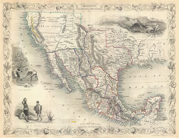
Mexico, California and Texas.
sold
- Digital Map Information
- Suitable for large format printing
- DPI: 300
- File Size: 5.51 MB
- File Type: ZIP / TIFF
- ICC color profile embedded
- Delivered instantly via download link
This is John Tallis's and J.H. Rapkin's highly desirable 1851 Map of Mexico, Texas and Upper California shortly after the Mexican American War and in the early days of the California Gold Rush. Texas is depicted at its fullest extent ... (more details)
Scarce early map of the world.
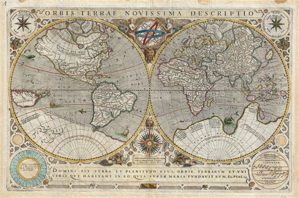
Orbis Terrae Novissima Descriptio.
sold
- Digital Map Information
- Suitable for large format printing
- DPI: 300
- File Size: 13.11 MB
- File Type: ZIP / TIFF
- ICC color profile embedded
- Delivered instantly via download link
A fine 1633 example of Jodocus Hondius and Jean Le Clerc's scarce separately published map of the world. Based on Gerard Mercator's map of 1587, Jodocus Hondius was commissioned by the French publisher Le Clerc to produce this map ... (more details)

Principal Automobile Routes In and Out of Los Angeles.
sold
- Digital Map Information
- Suitable for large format printing
- File Size: 12.25 MB
- File Type: ZIP / TIFF
- ICC color profile embedded
- Delivered instantly via download link
This is a fine 1946 map of the city of Los Angeles, California issued by the Automobile Club of Southern California. The map details the various routes in and out of Los Angeles and covers from Baldwin Hills north as far as Grand ... (more details)
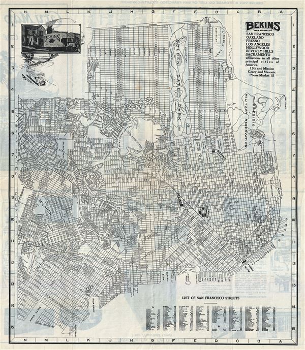
City Map of San Francisco, Calif.
sold
- Digital Map Information
- Suitable for large format printing
- File Size: 11.61 MB
- File Type: ZIP / TIFF
- ICC color profile embedded
- Delivered instantly via download link
This is a fine c. 1930s pocket map of the city of San Francisco by the Bekins Van and Storage Co. The map shows all major streets, piers, parks and cemeteries. It covers San Francisco from the Bay View Park in the south to Fort ... (more details)
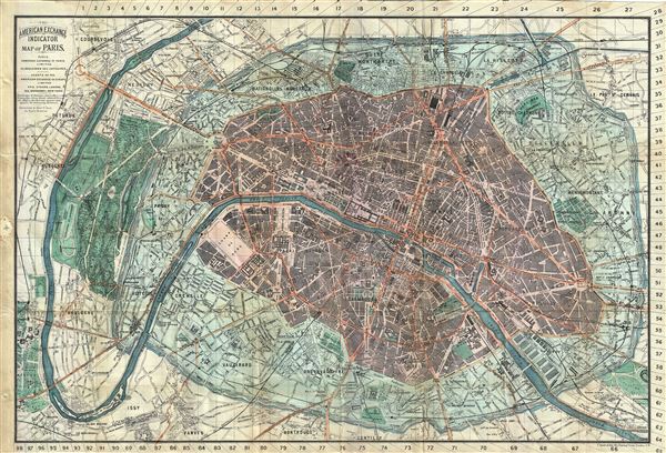
The American Exchange Indicator Map of Paris.
sold
- Digital Map Information
- Suitable for large format printing
- File Size: 29.22 MB
- File Type: ZIP / TIFF
- ICC color profile embedded
- Delivered instantly via download link
This is a beautiful 1883 folding map of Paris, France issued by the American Exchange in Paris, Limited. Centered on the Seine River, it covers embastilled Paris as contained in the Thiers Wall, and its immediate vicinity, ... (more details)

Venezia.
sold
- Digital Map Information
- Suitable for large format printing
- File Size: 10.57 MB
- File Type: ZIP / TIFF
- ICC color profile embedded
- Delivered instantly via download link
This is a beautiful c.1923 map or city plan of Venice, Italy. It covers Venice from Canale Scomenzera to Isola San Pierto and from Isola Della Giudecca to the Isola San Michele in the north. The map details streets, ... (more details)
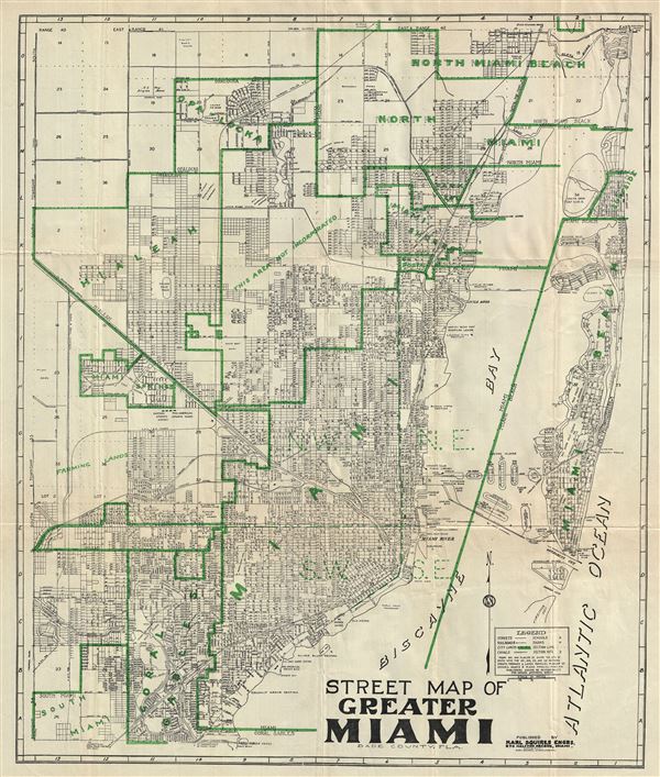
Street Map of Greater Miami Dade County, Fla.
sold
- Digital Map Information
- Suitable for large format printing
- File Size: 19.48 MB
- File Type: ZIP / TIFF
- ICC color profile embedded
- Delivered instantly via download link
This is a beautiful 1945 pocket map of Miami, Florida, published by Karl Squires Engineers and issued by the American News Company. The map covers greater Miami from Coral Gables Canal north as far as the Miami Beach ... (more details)

Supervue of New York City
sold
- Digital Map Information
- Suitable for large format printing
- File Size: 22.35 MB
- File Type: ZIP / TIFF
- ICC color profile embedded
- Delivered instantly via download link
This is a stunning 1937 bird's eye view map or view of New York City, by Samuel Freedman. The view covers all of Manhattan Island and extends from Liberty Island and the northern end of Governor's Island to Harlem ... (more details)
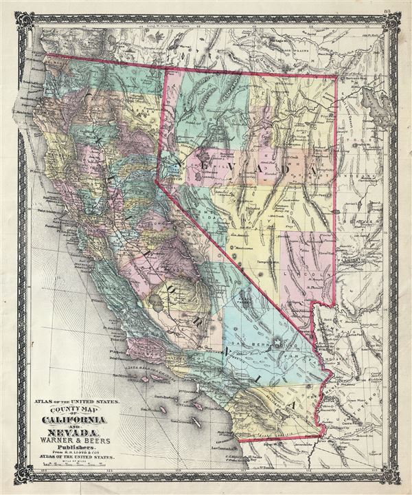
Atlas of the United States. County Map of California and Nevada.
sold
- Digital Map Information
- Suitable for large format printing
- File Size: 10.74 MB
- File Type: ZIP / TIFF
- ICC color profile embedded
- Delivered instantly via download link
This is a beautiful 1875 Warner and Beers' map of California and Nevada. It depicts the states of California and Nevada in extraordinary detail, along with parts of neighboring Utah, Oregon, Idaho and Arizona, ... (more details)

Atlas of the United States. County Map of California and Nevada.
sold
- Digital Map Information
- Suitable for large format printing
- File Size: 10.75 MB
- File Type: ZIP / TIFF
- ICC color profile embedded
- Delivered instantly via download link
This is a beautiful 1874 Warner and Beers' map of California and Nevada. It depicts the states of California and Nevada in extraordinary detail, noting major towns, counties, cities, lakes, rivers, railway ... (more details)
Rare blueback nuatical chart of Taiwan or Formosa.

East India Archipelago [Eastern Passages to China and Japan] [Chart No. 7]
sold
- Digital Map Information
- Suitable for large format printing
- File Size: 64.16 MB
- File Type: ZIP / TIFF
- ICC color profile embedded
- Delivered instantly via download link
This is an extremely rare and highly desirable 1861 Imray blue-back chart depicting Taiwan (Formosa) and northern Luzon. Covers the regions between 16°30' to 25°40' North Latitude and between ... (more details)
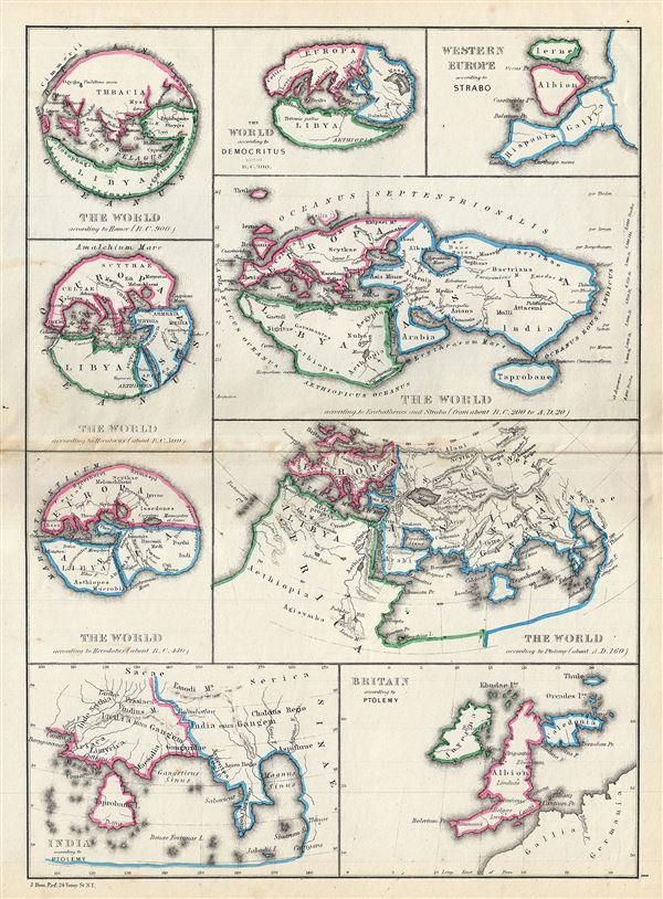
The World According to Homer (B.C. 900). The World According to Hecataeus (about B.C. 500). The World According to Herodotus (about B.C. 440). The World According to Democritus about B.C. 300. The World According to Eratosthenes and Strabo (from about B.C. 200 to A. D. 20). Western Europe According to Strabo. The World According to Ptolemy (about A.D. 160). India According to Ptolemy. Great Britain According to Ptolemy.
sold
- Digital Map Information
- Suitable for large format printing
- File Size: 3.55 MB
- File Type: ZIP / TIFF
- ICC color profile embedded
- Delivered instantly via download link
A fascinating 1867 map by William Hughes featuring the world according to ancient Greek astronomers, poets, historians and geographers. This map includes nine maps on a single sheet, each ... (more details)