
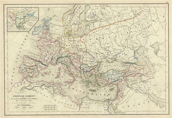
l'Empire Romain et les Barbares du Nord au IVeme. Siecle et avant la Grande Invasion.
sold
- Digital Map Information
- Suitable for large format printing
- DPI: 300
- File Size: 8.28 MB
- File Type: ZIP / TIFF
- ICC color profile embedded
- Delivered instantly via download link
This is a beautiful example of Alexandre Delamarche's 1843 map of europe under the Roman empire and just prior the c. 350 C.e. Barbarian Invasions. It covers all of europe from the Atlantic Ocean to Asia, and from the Arctic to northern Africa. An inset in the ... (more details)

l'Oceanie.
sold
- Digital Map Information
- Suitable for large format printing
- DPI: 300
- File Size: 7.73 MB
- File Type: ZIP / TIFF
- ICC color profile embedded
- Delivered instantly via download link
This is a beautiful example of Alexandre Delamarche's 1850 map of Australia and Polynesia. It covers Australia, New Zealand, Polynesia, Micronesia, Melanesia and Malaysia. The Hawaiian archipelago is identified as the Sandwich Islands. Two inset maps in the ... (more details)

Carte de la Suisse, ou Helvetie.
sold
- Digital Map Information
- Suitable for large format printing
- DPI: 300
- File Size: 8.28 MB
- File Type: ZIP / TIFF
- ICC color profile embedded
- Delivered instantly via download link
This is a beautiful example of Alexandre Delamarche's 1843 map of Switzerland or the Helvetic Republic. The map covers the entirety of Switzerland divided into its constituent Cantons from Vaud to Grisons. As this map was issued, Switzerland was undergoing a ... (more details)
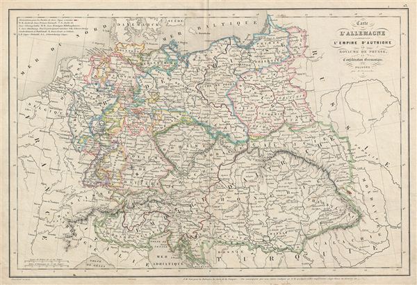
Carte d'Allemange comprenant l'Empire d'Autriche, le Royaume de Prusse, la Confederation Germanique et la Pologne.
sold
- Digital Map Information
- Suitable for large format printing
- Full resolution TIFF file
- ICC color profile embedded
- Delivered instantly via download link
This is a beautiful example of Alexandre Delamarche's 1850 map of Germany and the Austrian empire. It covers the German states from the border with Holland and Belgium eastward as far as Poland and Russia and from Holstein to the Adriatic. Includes the ... (more details)
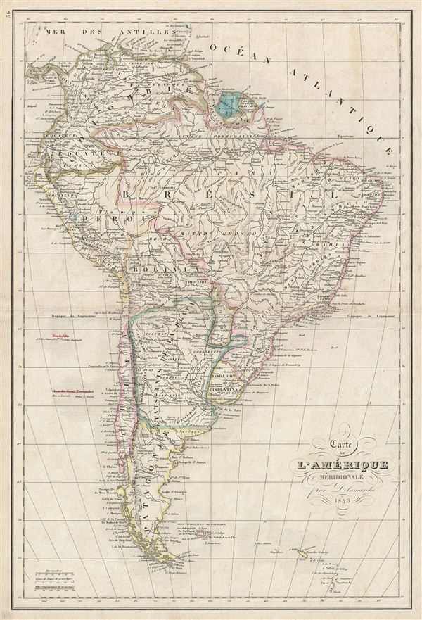
Carte de l'Amerique Meridionale.
sold
- Digital Map Information
- Suitable for large format printing
- DPI: 300
- File Size: 8.58 MB
- File Type: ZIP / TIFF
- ICC color profile embedded
- Delivered instantly via download link
This is a beautiful example of Alexandre Delamarche's 1843 map of South America. It covers the entire continent from the Caribbean to Tierra del Fuego and from the Pacific to the Atlantic, including the Falkland Islands. It includes the modern day ... (more details)
Extraordinary rare map of Manhattan's Midtown East and Murray Hill - possibly the only example in private hands.
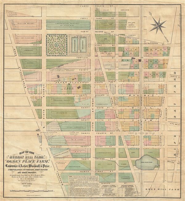
Map of the 'Murray Hill Farm,' 'Ogden Place Farm,' Lawrence & Astor, Wiswall & Price, Corporation, Wm. Wright, John Taylor and other Property.
sold
- Digital Map Information
- Suitable for large format printing
- File Size: 32.17 MB
- File Type: ZIP / TIFF
- ICC color profile embedded
- Delivered instantly via download link
An exceptional and extremely scarce 1867 John Bute Holmes map of New York City's Midtown East and Murray Hill neighborhoods. Holmes' map covers from 30th street to 44th street and from Broadway (Bloomingdale Road) to Lexington Avenue. This ... (more details)
A scarce map of exceptional importance illustrating early Swedish settlements in New Jersey, Pennsylvania, and Delaware.

Delineatio Pennsilvaniae et Caesareae, nov. occident seu West N. Iersey in America
sold
- Digital Map Information
- Suitable for large format printing
- DPI: 300
- File Size: 3.74 MB
- File Type: ZIP / TIFF
- ICC color profile embedded
- Delivered instantly via download link
This is an extremely rare whimsical 1731 map focusing on the remnants of the ephemeral colony of New Sweden by Jonas Silferling and Tobias Biorck. New Sweden, which by 1731 had been assimilated into British New York, occupied parts of ... (more details)
Extraordinary manuscript illustration of 17th century Battle of Camaret.
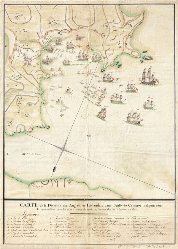
Carte de la Defcente des Anglais et Hollandais dans l'Anse de Camaret, le 18 Juin 1694.
sold
- Digital Map Information
- Suitable for large format printing
- DPI: 300
- File Size: 18.01 MB
- File Type: ZIP / TIFF
- ICC color profile embedded
- Delivered instantly via download link
An extraordinary 1790 manuscript (hand drawn) illustration of the 1694 Battle of Camaret. Truly a masterwork of cartographic manuscript illustration, this map covers parts of Camaret Bay and Vaubon's fortifications at Camaret-sur-Mer, ... (more details)
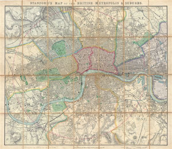
Stanford's Map of the British Metropolis & Suburbs.
sold
- Digital Map Information
- Suitable for large format printing
- File Size: 39.81 MB
- File Type: ZIP / TIFF
- ICC color profile embedded
- Delivered instantly via download link
An extremely attractive 1861 pocket or case map of London, england, by edward Stanford. Centered on the Thames River, Stanford's folding case map covers central London from Holloway to Blackwall and from Dulwich to Brook Green. early ... (more details)
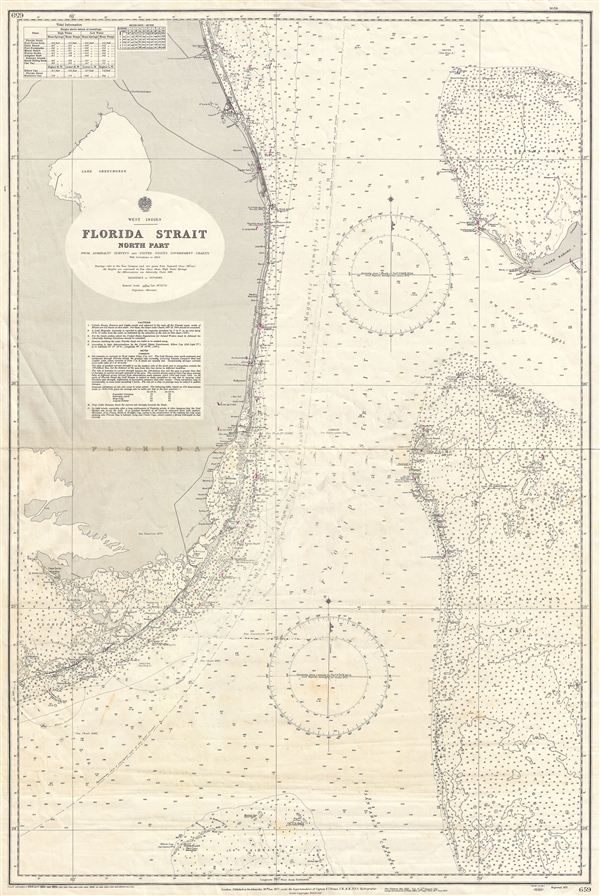
West Indies Florida Strait North Part
sold
- Digital Map Information
- Suitable for large format printing
- File Size: 30.25 MB
- File Type: ZIP / TIFF
- ICC color profile embedded
- Delivered instantly via download link
An uncommon 1954 British Admiralty nautical chart or maritime map of South Florida, the Florida Keys, and the Great Bahama Bank, known collectively as the 'Florida Strait.' The map covers Florida from St. Lucie (Fort Capron) south to ... (more details)
A fine 18th century wall map of North America.
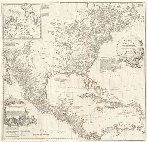
North America.
sold
- Digital Map Information
- Suitable for large format printing
- Full resolution TIFF file
- ICC color profile embedded
- Delivered instantly via download link
This is an exceptionally interesting and beautiful 1752 wall map of North America composed by Malachy Postlethwayte. Postlethwayte, an englishman, prepared this map for issue in conjunction with the second edition (1752) of his ... (more details)
Early French nautical chart of the East Indies, including Singapore, based upon the work of Horsburgh.
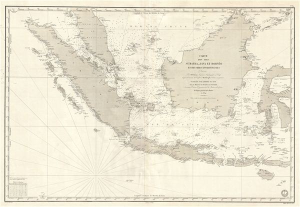
Carte des Iles Sumatra, Java et Borneo et des mers Environnates.
sold
- Digital Map Information
- Suitable for large format printing
- DPI: 300
- File Size: 26.14 MB
- File Type: ZIP / TIFF
- ICC color profile embedded
- Delivered instantly via download link
An uncommon and impressive 1848 French Depot-General de la Marine nautical chart or maritime map of the east Indies. Based upon the earlier work of the British hydrographer James Horsburgh, this map covers Sumatra, Java, and ... (more details)
The quintessential early 19th century English blueback nautical chart.
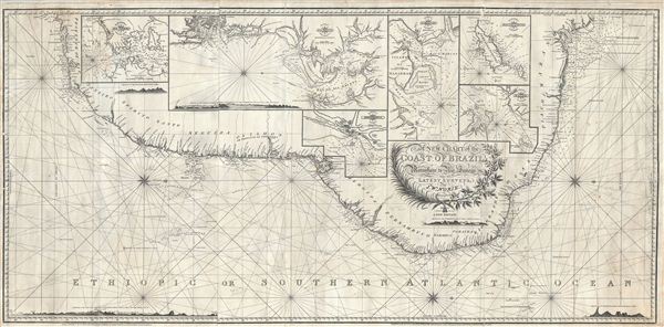
A New Chart of the Coast of Brazil from Maranham to Rio Janeiro.
sold
- Digital Map Information
- Suitable for large format printing
- DPI: 300
- File Size: 45.42 MB
- File Type: ZIP / TIFF
- ICC color profile embedded
- Delivered instantly via download link
An extraordinary 1819 John Norie nautical chart or portolan map of the coast of Brazil. This fantastic map, a quintessential example of early 19th century British chart making, covers the eastern coastline of South America ... (more details)
Scarce early American nautical chart of Florida with an inset of Key West.
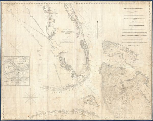
The Bahama Banks and the Gulf of Florida.
sold
- Digital Map Information
- Suitable for large format printing
- DPI: 300
- File Size: 65.76 MB
- File Type: ZIP / TIFF
- ICC color profile embedded
- Delivered instantly via download link
A scarce, detailed, and highly attractive 1848 nautical chart or maritime map of Florida and the Bahamas by e. and G. W. Blunt. The chart covers Florida from 29°37' N, or, roughly speaking, from the latitue of Lake George ... (more details)

Der Sudliche Theil von Frankreich nebst einem Theile von Spanien.
sold
- Digital Map Information
- Suitable for large format printing
- Full resolution TIFF file
- ICC color profile embedded
- Delivered instantly via download link
This is a fascinating example of the 1850 Justus Perthes map of southwestern France. It covers the southern part of France from Clermont to the northern part of Spain and from Basses Pyrenees east as far as Var. Map is ... (more details)

Die Schwiez.
sold
- Digital Map Information
- Suitable for large format printing
- DPI: 300
- File Size: 12.15 MB
- File Type: ZIP / TIFF
- ICC color profile embedded
- Delivered instantly via download link
This is a fascinating example of the 1852 Justus Perthes map of Switzerland. It covers all of Switzerland and parts of neighboring France, Germany, Austria and Italy. Map is highly detailed with both political and ... (more details)
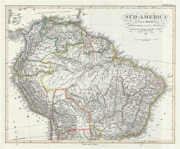
Sud-America in zwei Blatten.
sold
- Digital Map Information
- Suitable for large format printing
- DPI: 300
- File Size: 8.85 MB
- File Type: ZIP / TIFF
- ICC color profile embedded
- Delivered instantly via download link
This is a fascinating example of the 1850 Justus Perthes map of the northern part of South America. It covers the northern part of the continent including Panama, New Granada, Venezuela, ecuador, Peru, Brazil, ... (more details)

Der Nord-Westliche Teil von Frankreich.
sold
- Digital Map Information
- Suitable for large format printing
- DPI: 300
- File Size: 9.01 MB
- File Type: ZIP / TIFF
- ICC color profile embedded
- Delivered instantly via download link
This is a fascinating example of the 1854 Justus Perthes map of northwestern France. It covers from Seine Infer to Charente in the South and west as far as Finisterre, including parts of neighboring england. ... (more details)

Die Preuss: Provinzen Preussen und Posen Mit Uebersicht des Preussischen Staats.
sold
- Digital Map Information
- Suitable for large format printing
- DPI: 300
- File Size: 7.91 MB
- File Type: ZIP / TIFF
- ICC color profile embedded
- Delivered instantly via download link
This is a fascinating example of the 1854 Justus Perthes map of Prussia. It covers from Brandenburg to Grodno, part of modern day Poland and Lithuania. An inset in the lower right quadrant offers an overview ... (more details)
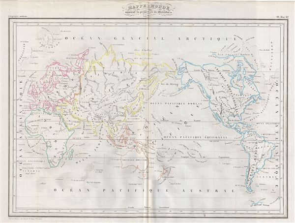
Mappe-monde suivant la projection de Mercator.
sold
- Digital Map Information
- Suitable for large format printing
- DPI: 300
- File Size: 8.55 MB
- File Type: ZIP / TIFF
- ICC color profile embedded
- Delivered instantly via download link
This is a fine example of Conrad Malte-Brun's 1843 map of the World on Mercator's Projection. An interesting map of the world issued just as most of the earth's non-polar shore has been explored. Gone are ... (more details)