
Holmes, John Bute
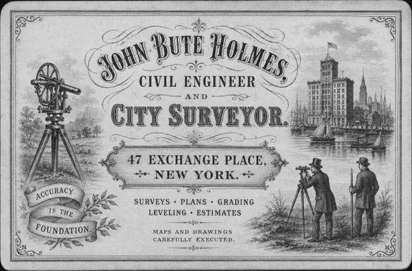
John Bute Holmes (March 31, 1822 - May 21, 1887) was an Irish civil engineer, city surveyor, and mapmaker based in New York City in the middle to latter 19th century. Holmes was described as a 'short, stout man, with curly gray hair, a smooth face, and a short, thick neck.' Some records suggest he was born in the Dutch East Indies. Holmes' father-in-law supplied funds for him to immigrate to America in 1840 and shortly thereafter, in 1844, he established himself in New York City. He briefly returned to Europe before once again settling in New York City in 1848. Apparently, according to several New York Times articles dating to the 1870s, Holmes was a man of dubious personal and moral character. He was involved in several legal disputes most of which were associated with his outrageous - even by modern standards - womanizing. In 1857 he was convicted of forgery of a marriage document and sentenced to 15 years of hard labor at Sing Sing, of which he served 5 before wealthy associates interceded on his behalf for an early release. Holmes seems to have been married to several different women at the same time and to have had an unfortunate attraction to exceptionally young women - one of whom, 16 year old May Chamberlayne claimed to be his wife and sued him for 50,000 USD. On another occasion he was found guilty of killing Brooklyn policeman David Gourly with whose wife he 'had been intimate.' Another woman, Miss Abrams, who he hired as a housekeeper, was repeatedly attacked by Holmes and ultimately driven to madness and was consigned to Bellevue Hospital, where she died. Although he attempted to flee the country rather than face conviction for 4th degree manslaughter, he was ultimately arrested and served one year in prison. During the American Civil War he ran for Alderman of the First Ward, in New York. Despite his legal issues, Holmes was a man of considerable means, with a personal fortune estimated between 100,000 and 500,000 USD - a significant sum in the late 19th century. Much of his wealth is associated with a series of important cadastral maps produced between 1867 and 1875 while he was employed as a surveyor and civil engineer under the corrupt Tweed regime. When Holmes died of an 'apoplectic fit' there was considerable wrangling over his estate among his 7 heirs and 11 children. The cream of his estate where his maps, some of which were valued at more than 30,000 USD in 1887. Holmes lived on a large farm-estate in Fanwood New Jersey.
Best specific map of Gramercy Park and Murray Hill issued the 19th century.
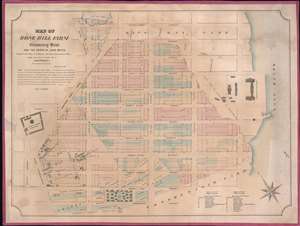
Map of Rose Hill Farm, Gramercy Seat, and the estate of John Watts.
$3,000.00
Acquire
- Digital Map Information
- Suitable for large format printing
- File Size: 29.4 MB
- File Type: ZIP / TIFF
- ICC color profile embedded
- Delivered instantly via download link
This is a John Bute Holmes 1866 cadastral map of parts of the Gramercy, Rose Hill, and Kips Bay neighborhoods in the borough of Manhattan in New York City. (more details)
One of the earliest speciic maps to detail Manhattan Valley and the northern part of the Upper West Side.
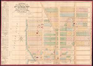
Map of the Strikers Bay Farm Estate of Mrs. Ann Rogers Decd. Part of the estate of John Glendining and part of the Herman Le Roy Farm.
$3,800.00
Acquire
- Digital Map Information
- Suitable for large format printing
- File Size: 27.98 MB
- File Type: ZIP / TIFF
- ICC color profile embedded
- Delivered instantly via download link
One of only 5 known examples of John Bute Holmes's c. 1874 cadastral map of the northern part of the Upper West Side and Manhattan Valley, New York City. The map covers from 96th street to 107th street and from the Hudson River to Central Park (8th Avenue / Central Park West). Today, with its proximity to both Riverside Park and Central Park, this is one of Manhattan's most desirable neighborhoods. (more details)
Soho.
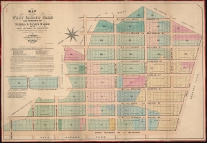
Map of the West Bayard Farm The Property of Nicholas and Stephen Bayard and the John Dyckman Dcd. Property.
$4,500.00
Acquire
- Digital Map Information
- Suitable for large format printing
- File Size: 49.42 MB
- File Type: ZIP / TIFF
- ICC color profile embedded
- Delivered instantly via download link
This is an 1866 John Bute Holmes cadastral maps of the western part of Soho, one of New York City's most interesting and vibrant neighborhoods. These lands were once part of the West Bayard Farm. (more details)
Creation of Chelsea, Manhattan.
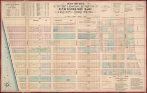
Map of the Franklin and Robinson, Janet De Kay, Henry Eckford, Mary Clarke and Clement C. Moore Estates.
$1,800.00
Acquire
- Digital Map Information
- Suitable for large format printing
- File Size: 36.71 MB
- File Type: ZIP / TIFF
- ICC color profile embedded
- Delivered instantly via download link
A rare separate issue 1869 John Bute Holmes map of the Chelsea neighborhood of Manhattan, New York City. The map captures the break-up of these lands to accommodate the Manhattan grid system. (more details)
A wonderful map of Little Italy, Nolita, and part of Soho that traces the history of these neighborhoods.
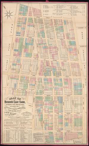
Map of Bayard's East Farm, Accurately Made from Old Maps, (not in Register's Office), From Conveyances on Record from NICHOLAS BAYARD, Sheriff's Sales, Lottery Lots, etc., etc.
$5,000.00
Acquire
- Digital Map Information
- Suitable for large format printing
- File Size: 44.82 MB
- File Type: ZIP / TIFF
- ICC color profile embedded
- Delivered instantly via download link
This is a John Bute Holmes 1869 cadastral map of modern day Little Italy and parts of the iconic neighborhoods of Nolita, Soho, and Chinatown in the borough of Manhattan in New York City - the only specific map of this area to appear in the 19th century. The map depicts the region from Broadway to Bowery and from Prince Street to Pell Street. Highly detailed, Holmes's map provides the viewer with a look at the neighborhood in 1869 and with an idea of how it developed. Streets area labeled, and Holmes provides both the former names of the streets and their current ones. Individual lots are identified by addresses, and those that fell victim to widening streets and a changing urban landscape are ghosted in using dashed lines. (more details)
Evolving relationship between New York City and Harlem.
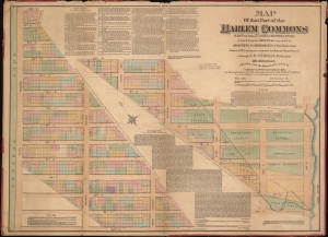
Map of that part of the Harlem Commons east of the 5th Ave. and Central Park copied from the original map made by Joseph F. Bridges, City Surveyor, January 1826, now in possession of a gentleman who purchased it through A.R. Morgan, Esq., from Mr. Bridges : showing also the boundaries given by Charles Clinton, Surveyor, Dec. 1825, and the inaccuracies of both the above-named maps, with other important information.
$3,500.00
Acquire
- Digital Map Information
- Suitable for large format printing
- Full resolution TIFF file
- ICC color profile embedded
- Delivered instantly via download link
This is an 1871 John Bute Holmes cadastral map of the Upper East Side in the borough of Manhattan in New York City. Constructed in an unusual manner, the map depicts the Upper East Side along a diagonal that stretches from Ninety-Sixth Street and Fifth Avenue to Seventy-Fourth Street and Avenue B. New York's now famous grid system acts as the base, along with the lots that were created by the 1811 Commissioner's Plan, which allows the neighborhood's evolution to be illustrated. One such detail is Fourth Avenue. Here, dashed lines mark the present sides of the avenue, several feet into the lots on either side. A large former estate is illustrated between Eightieth Street and Seventy-Eighth Street. (more details)
A map of Hell's Kitchen that traces the development of the neighborhood.
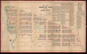
Map of the Hermitage Farm and the Norton Estate.
$4,000.00
Acquire
- Digital Map Information
- Suitable for large format printing
- File Size: 47.75 MB
- File Type: ZIP / TIFF
- ICC color profile embedded
- Delivered instantly via download link
This is an 1872 John Bute Holmes cadastral map of the modern-day neighborhood of Hell's Kitchen in the borough of Manhattan in New York City. The map depicts the neighborhood from the Hudson River to Broadway (labeled as Bloomingdale Road) and from 48th Street to 39th Street. Highly detailed, Holmes's map provides the viewer with a look at the neighborhood as it was in 1872 and also projects an image of how it developed. Streets are labeled, and individual lots are identified by their addresses. Some elements are ghosted in using dashed lines, including Twelfth Avenue and several wharves. (more details)
Chelsea and Hell's Kitchen, including today's Hudson Yards.
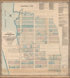
Map of the Glass House Farm Also the Schroepple, Ray, and other estates down to the Franklin and Robinson and the Widow Mary Clarke and Thomas B. Clarke.
$1,800.00
Acquire
- Digital Map Information
- Suitable for large format printing
- File Size: 62.81 MB
- File Type: ZIP / TIFF
- ICC color profile embedded
- Delivered instantly via download link
A rare 1873 John Bute Holmes cadastral map of part of the Manhattan neighborhoods Chelsea and Hell's Kitchen, New York City. It is likely the earliest obtainable specific map of this part of Manhattan. (more details)
Includes part of Bloomingdale Road, today known as Broadway, including Times Square.
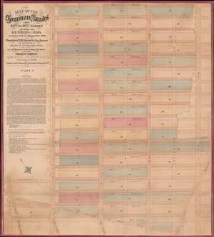
Map of the Common Lands from 42nd to 59th Streets Showing the Old Streets and Plots…
$3,000.00
Acquire
- Digital Map Information
- Suitable for large format printing
- File Size: 29.23 MB
- File Type: ZIP / TIFF
- ICC color profile embedded
- Delivered instantly via download link
This is a John Bute Holmes 1874 cadastral map of Midtown Manhattan. The map depicts the region from Seventh Avenue to Third Avenue and from 59th Street to 42nd Street. A somewhat-confusing jumble of solid and dashed lines appears throughout the neighborhood, allowing the viewer to trace its development, particularly with regard to streets. Entire blocks were shifted between 1796, when Goerck first surveyed this part of Manhattan, and 1874, when Holmes created this work. Street angles changed, as did the width of both the streets and the avenues.
Albany Avenue, Steuben Street Cross Road, and the Eastern Post Road (also known as the Boston Post Road) were erased when the grid system was implemented. Bloomingdale Road, in the lower left corner, is known as Broadway today, thus illustrating the intersection of 42nd Street and Broadway, Times Square. At some point after Goerck's initial survey, both Madison Avenue and Lexington Avenue were cut down the middle of the blocks between Fourth Avenue and Fifth Avenue, and Fourth and Third Avenue, respectively, evident by how Holmes identifies each block by only one number and not two. (more details)
Albany Avenue, Steuben Street Cross Road, and the Eastern Post Road (also known as the Boston Post Road) were erased when the grid system was implemented. Bloomingdale Road, in the lower left corner, is known as Broadway today, thus illustrating the intersection of 42nd Street and Broadway, Times Square. At some point after Goerck's initial survey, both Madison Avenue and Lexington Avenue were cut down the middle of the blocks between Fourth Avenue and Fifth Avenue, and Fourth and Third Avenue, respectively, evident by how Holmes identifies each block by only one number and not two. (more details)
Depicts the original boundaries of the Rutgers Farm, the first settlement on the Lower East Side.
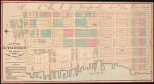
Map Of The Rutger's Farm As it existed in 1784, Accurately Made From Reliable Data
$5,000.00
Acquire
- Digital Map Information
- Suitable for large format printing
- File Size: 43.1 MB
- File Type: ZIP / TIFF
- ICC color profile embedded
- Delivered instantly via download link
This is a John Bute Holmes 1874 cadastral map of the Lower East Side and Two Bridges neighborhoods, which have historically been considered one neighborhood. A traditionally immigrant, working class neighborhood, the map depicts from Oliver Street to Montgomery Street and from Division Street to the East River. (more details)
Depicts the neighborhood as it was in the 1790s: dominated by the Common Lands and long before Central Park was even conceived.
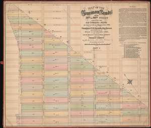
Map of the Common Lands from 76th to 93rd Street Showing the Old Streets and Plots As Surveyed and Mapped in 1796, by Cassimer T.H. Goerck, City Survey and resurveyed by Isaac T. Ludlam in 1822, (See Notes) And the Distance between these old Streets and our Present Streets.
$4,500.00
Acquire
- Digital Map Information
- Suitable for large format printing
- File Size: 36.96 MB
- File Type: ZIP / TIFF
- ICC color profile embedded
- Delivered instantly via download link
This is a John Bute Holmes 1874 cadastral map of the Upper East Side neighborhood of Manhattan - the only specific map of this area to appear in the 19th century. The map depicts the region from Seventh Avenue (or at least where it would be if Central Park hadn't been built) to Second Avenue and from 93rd Street to 76th Street. The bulk of the map is occupied by the northern reaches of the Common Lands, including the boundary between the Common Lands and the village of Harlem. This boundary was a diagonal line approximately from the intersection of today's Second Avenue and 79th Street to what would be the intersection of 92nd Street and Seventh Avenue, if Central Park had not been constructed. Also evident are the early planning stages of what would become Park Avenue - some of New York city's most covented real estate. (more details)
Ephemeral plans for a new Thirteenth Avenue.
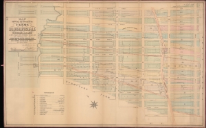
Map showing the perimeters of farms in Bloomingdale and the old roads and lanes as they existed one hundred years ago : belonging to the Cozine, Harson, Hopper, Hegeman, Stake, Stryker, Eden, Tevon, Haynes, Horsmanden, Reis, Kelly, Webber, Cutting, Astor, Emmett and other families.
$5,000.00
Acquire
- Digital Map Information
- Suitable for large format printing
- File Size: 68.07 MB
- File Type: ZIP / TIFF
- ICC color profile embedded
- Delivered instantly via download link
This is a John Bute Holmes 1879 cadastral map of Midtown West, including Times Square and the Theater District. It captures the area during a brief period of widespread development and redistricting. (more details)