

Russie d'Europe.
sold
- Digital Map Information
- Suitable for large format printing
- File Size: 7.83 MB
- File Type: ZIP / TIFF
- ICC color profile embedded
- Delivered instantly via download link
This is a fine example of J. Migeon's 1878 map of european Russia. The map covers from the Arctic Ocean to the Black Sea and from Sweden to Tartary. Parts of Austria, Prussia and european Turkey are also included. Russia at this time was under the suzerainty of ... (more details)
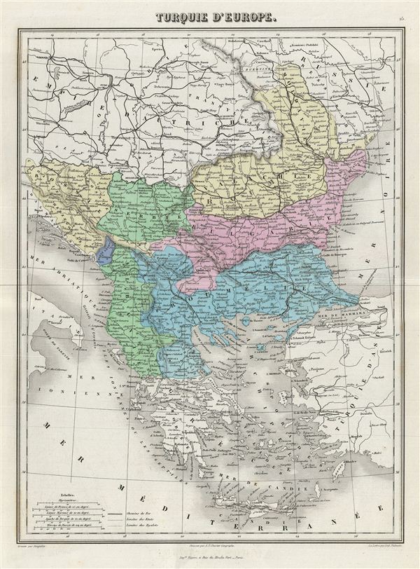
Turquie d'Europe.
sold
- Digital Map Information
- Suitable for large format printing
- File Size: 7.75 MB
- File Type: ZIP / TIFF
- ICC color profile embedded
- Delivered instantly via download link
This is a fine example of Migeon's 1876 map of the european parts of Turkey. The map covers from Moldova to Thessaly and from the Adriatic to the Black Sea. Greece and the island of Candia or Crete is also included. This map, drawn when the Ottoman empire ... (more details)
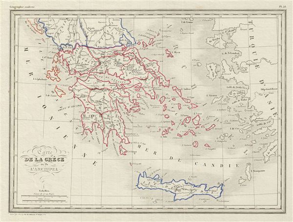
Carte de la Grece et de l'Archipeil.
sold
- Digital Map Information
- Suitable for large format printing
- DPI: 300
- File Size: 4.21 MB
- File Type: ZIP / TIFF
- ICC color profile embedded
- Delivered instantly via download link
This is a fine example of Conrad Malte-Brun's 1842 map of Greece and the Archipelago. It covers Greece from Albania to the Island of Candia or Crete. Boundaries are outlined in color according to regions and territories. Several cities, towns, rivers, ... (more details)

Italie Merdionale.
sold
- Digital Map Information
- Suitable for large format printing
- File Size: 8.32 MB
- File Type: ZIP / TIFF
- ICC color profile embedded
- Delivered instantly via download link
This is a fine example of Migeon's 1876 map of southern Italy. The map covers the Kingdom of Naples (The Kingdom of the Two Sicilies), which extended from the Papal States south to include much of the southern Peninsula as well as Sicily. Divided and ... (more details)
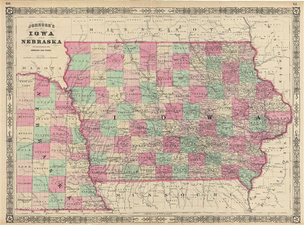
Johnson's Iowa and Nebraska.
sold
- Digital Map Information
- Suitable for large format printing
- File Size: 17.12 MB
- File Type: ZIP / TIFF
- ICC color profile embedded
- Delivered instantly via download link
This is A. J. Johnson's 1865 map of Iowa and Nebraska. The map covers the entire state of Iowa as well as the eastern portions of Nebraska. Offers color coding according to county and notations for railways, roadways, cities, towns, and river ... (more details)
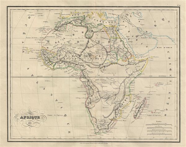
Afrique.
sold
- Digital Map Information
- Suitable for large format printing
- Full resolution TIFF file
- ICC color profile embedded
- Delivered instantly via download link
This is a fascinating example of Conrad Malte-Brun's 1836 map of Africa. The map covers the entire continent from the Mediterranean Sea to Cape Colony and from the Atlantic Ocean to Madagascar and the Seychelles Islands in the Indian Ocean. ... (more details)
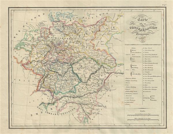
Carte de la Confederation Germanique.
sold
- Digital Map Information
- Suitable for large format printing
- DPI: 300
- File Size: 9.38 MB
- File Type: ZIP / TIFF
- ICC color profile embedded
- Delivered instantly via download link
This is a fine example of Conrad Malte-Brun's 1835 map of the Germanic Confederation. The map covers Germany and the Netherlands from Denmark to Croatia and the Adriatic Sea. A table along the right margin lists the states comprising the ... (more details)
Extraordinary 21 ft panorama of history!
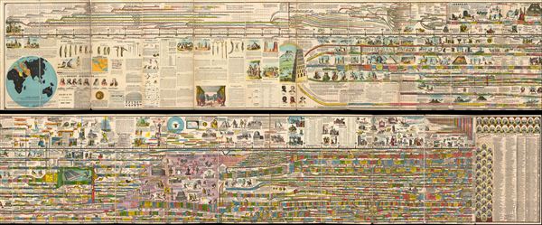
Adams' Illustrated Panorama of History.
sold
- Digital Map Information
- Suitable for large format printing
- File Size: 17.59 MB
- File Type: ZIP / TIFF
- ICC color profile embedded
- Delivered instantly via download link
A truly monumental achievement, this is Adams' Illustrated Panorama of History . Measuring some 27 inches high and 271 inches long, this gigantic panoramic diagram charts the history of the world from a Biblical perspective, starting with ... (more details)
Highest expression of the Coast Survey's work in Narragansett Bay, Rhode Island.
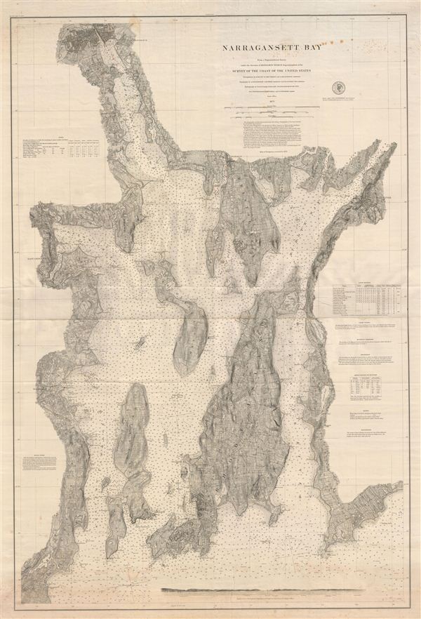
Narragansett Bay.
sold
- Digital Map Information
- Suitable for large format printing
- File Size: 54.69 MB
- File Type: ZIP / TIFF
- ICC color profile embedded
- Delivered instantly via download link
A scarce 1873 nautical chart of Narragansett Bay, Rhode Island, issued by the U.S. Coast Survey. Printed on two sheets which have been joined at the center, this fine working nautical chart covers the entirety of Narragansett Bay from ... (more details)
Earliest serious British attempt to map the area around Shanghai, China. Surveyed by 'Chinese Gordon' during the Taiping Rebellion.

Military Plan of the Country Around Shanghai from Surveys Made in 1862, 63, 64, 65.
sold
- Digital Map Information
- Suitable for large format printing
- File Size: 63.93 MB
- File Type: ZIP / TIFF
- ICC color profile embedded
- Delivered instantly via download link
An extremely scarce 1865 case map illustrating the country around Shanghai, China. This map, by British military officer Charles George Gordon (a.k.a. 'Chinese Gordon'), covers from the mouth of the Yangtze River south to the Tsien ... (more details)
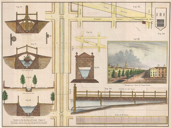
Perspective View of Canal Street. Scales to the Section of Canal.
sold
- Digital Map Information
- Suitable for large format printing
- File Size: 12.05 MB
- File Type: ZIP / TIFF
- ICC color profile embedded
- Delivered instantly via download link
An unusual 1860 map illustrating the evolution of New York City's Canal Street. Canal Street, located in lower Manhattan, takes its name from a canal that was constructed in the early 19th century to drain the Collect Pond into the ... (more details)
Extremely scarce American Revolutionary War trading card.

Ende der Feindseeligkeiten Die Englander raumen den Americanern Neu-Yorck un -- 1783.
sold
- Digital Map Information
- Suitable for large format printing
- DPI: 300
- File Size: 0.56 MB
- File Type: ZIP / TIFF
- ICC color profile embedded
- Delivered instantly via download link
An extremely scarce 1783 Daniel N. Choloweicki trading card of the British evacuation of New York City at the end of the American Revolutionary War. This card size etched view was part of a series issued by Chodowiecki in Berlin in ... (more details)

North Battery, Foot of Hubert St. Looking South, 1820.
sold
- Digital Map Information
- Suitable for large format printing
- File Size: 4.24 MB
- File Type: ZIP / TIFF
- ICC color profile embedded
- Delivered instantly via download link
This is a beautiful 1820 view of North Battery, New York City. The North Battery was built at the foot of Hubert Street in 1808, following the 1807 British attack on the American Frigate Chesapeake . Four other forts including ... (more details)

Skating Pond, Central Park, N.Y. 1861.
sold
- Digital Map Information
- Suitable for large format printing
- File Size: 2.17 MB
- File Type: ZIP / TIFF
- ICC color profile embedded
- Delivered instantly via download link
This is a beautiful 1861 view of the Skating Pond in New York's Central Park. The aquatint view features beautifully dressed Victorians ice-skating with Central Park's Bow Bridge in the background. This view was engraved by ... (more details)
First edition, first state of Lotter's stunning map of northern Poland.
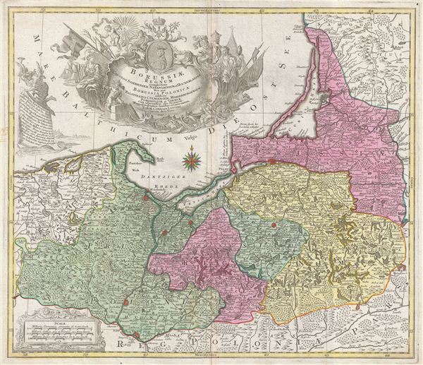
Borussiae Regnum Complectens Circulos Sambiensem, Natangiensem et Hockerlandiae nec non Borussia Polonica Exhibens Palatinatus Culmiensem, Marienburgensem, Pomerelliae et Varmiae.
sold
- Digital Map Information
- Suitable for large format printing
- DPI: 300
- File Size: 20.15 MB
- File Type: ZIP / TIFF
- ICC color profile embedded
- Delivered instantly via download link
A stunning 1759 first edition, first state, map of northern Poland (Borussiae) by the Augsburg cartographer Tobias Conrad Lotter. The map covers from German Pomerania eastward to Lithuania and Belarus and from the Baltic Sea ... (more details)
Scarce nautical chart of the Windward Passage, a popular hunting ground for Caribbean pirates and privateers.
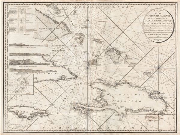
A Chart of the Windward Passage Between the Islands of Jamaica Hispaniola and Cuba with the other Passages to the Northwest of Hispaniola.
sold
- Digital Map Information
- Suitable for large format printing
- DPI: 300
- File Size: 29.95 MB
- File Type: ZIP / TIFF
- ICC color profile embedded
- Delivered instantly via download link
A mesmerizing and extremely scarce 1795 Charles Roberts nautical chart of the Windward Passage, between Cuba and Hispaniola (Santo Domingo), in the Greater Antilles, West Indies. Centered on Great Iguana Island (Le Mornet or ... (more details)

Chart No. 10 Boston Bay and Approaches.
sold
- Digital Map Information
- Suitable for large format printing
- File Size: 34.06 MB
- File Type: ZIP / TIFF
- ICC color profile embedded
- Delivered instantly via download link
A rare 1866 nautical chart or maritime map Boston Bay, Boston Harbor, and environs. It covers the Massachusetts coastline from Cape Ann southward past Gloucester, Marblehead, Lynn, Boston and Cohasset to Green Harbor River. ... (more details)
Scarce French nautical chart of the East Coast from New York to Florida.
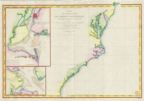
Carte de la Cote Orientale de l'Amerique Septentrionale Partie Comprise Entre New York et la Riviere Saint Jean.
sold
- Digital Map Information
- Suitable for large format printing
- DPI: 300
- File Size: 29.4 MB
- File Type: ZIP / TIFF
- ICC color profile embedded
- Delivered instantly via download link
This is a highly scarce 1834 map of the eastern coast of the United States. The map covers the entire coastline from New York City to the St. John River in Florida, inclusive of the Chesapeake Bay, the Outer Banks, and the ... (more details)
This primary map of Canada emphasized the importance of the river trading routes.' -Kershaw
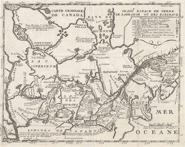
Carte Generale de Canada.
sold
- Digital Map Information
- Suitable for large format printing
- Full resolution TIFF file
- ICC color profile embedded
- Delivered instantly via download link
A fine example of Lahontan's scarce and important 1715 map of the Great Lakes, Canada, and the Upper Mississippi. Lahontan's map covers from the Mississippi River eastward to the mouth of the St. Lawrence and the Atlantic ... (more details)
One of the most interesting maps to show expeditions into our chosen area...' - Wheat
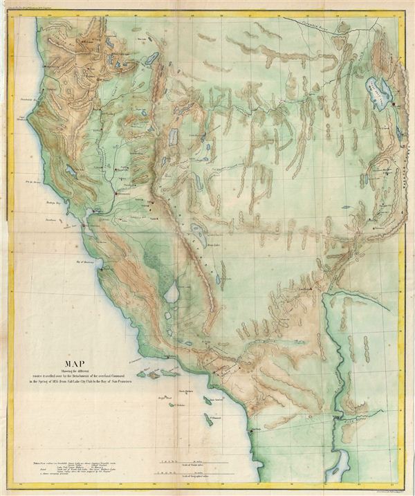
Map Showing the different routes travelled over by the Detachments of the overland Command in the Spring of 1855 from Salt Lake City, Utah to the Bay of San Francisco.
sold
- Digital Map Information
- Suitable for large format printing
- File Size: 14.24 MB
- File Type: ZIP / TIFF
- ICC color profile embedded
- Delivered instantly via download link
This is a beautiful example of the 1855 War Department map of Salt Lake City, Utah to San Francisco Bay, California. The map covers the Great Basin to illustrate the routes traveled by Colonel e. J. Steptoe, Captain Rufus ... (more details)