
Identifies the 'Sea of Korea'.
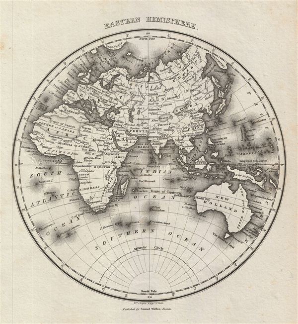
Eastern Hemisphere.
sold
- Digital Map Information
- Suitable for large format printing
- DPI: 300
- File Size: 3.23 MB
- File Type: ZIP / TIFF
- ICC color profile embedded
- Delivered instantly via download link
This is an attractive example of the 1828 Malte-Brun map of the eastern Hemisphere. It covers europe, Asia, Australia, Africa and the east Indies. Although 'New Holland' officially changed its name to Australia in 1824, it is here referred to by its older Dutch ... (more details)

Western Hemisphere.
sold
- Digital Map Information
- Suitable for large format printing
- DPI: 300
- File Size: 3.2 MB
- File Type: ZIP / TIFF
- ICC color profile embedded
- Delivered instantly via download link
This is an attractive example of the 1828 Malte-Brun map of the Western Hemisphere. It covers North America, South America and most of Polynesia, including New Zealand. The Pacific Coast of the United States is here identified as 'New Albion,' a name given to ... (more details)
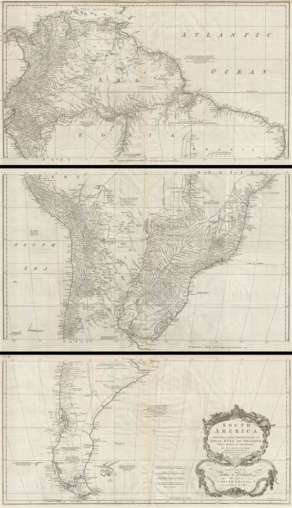
South America. Performed Under the Patronage of Louis Duke of Orleans First Prince of the Blood.
sold
- Digital Map Information
- Suitable for large format printing
- DPI: 300
- File Size: 57.7 MB
- File Type: ZIP / TIFF
- ICC color profile embedded
- Delivered instantly via download link
A curious and uncommon three panel 1755 wall map of South America by the English publisher M. Postlethwayte. A derivative of D'Anville's earlier map, Postlethwayte's map covers the entire continent from the Lesser Antilles and Panama to Cape Horn. Published ... (more details)

Village of Buffalo.
sold
- Digital Map Information
- Suitable for large format printing
- Full resolution TIFF file
- ICC color profile embedded
- Delivered instantly via download link
This is a fascinating example of the 1804 Joseph ellicott map of the village of Buffalo, New York. Covers eastward from Lake erie, focusing on the downtown area of Buffalo. Upper left quadrant contains an inset of the Map of the Village of New Amsterdam - as ... (more details)
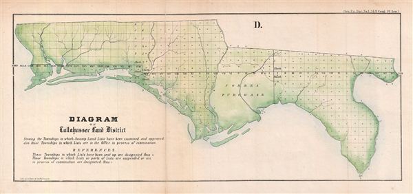
D. Diagram of Tallahassee Land District.
sold
- Digital Map Information
- Suitable for large format printing
- File Size: 3.59 MB
- File Type: ZIP / TIFF
- ICC color profile embedded
- Delivered instantly via download link
An appealing 1855 Florida Land Office survey map of the Florida Panhandle. This map covers the panhandle from the Alabama Border to the Suwannee River. This map was drawn to illustrate the progress of the Florida Land Survey. The state of the Land Survey is ... (more details)
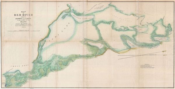
Map of Red River with its Bayous and Lakes in the Vicinity of the Raft.
sold
- Digital Map Information
- Suitable for large format printing
- File Size: 30.68 MB
- File Type: ZIP / TIFF
- ICC color profile embedded
- Delivered instantly via download link
A large 1855 map following the course of the Red River from Shreveport, Louisiana to its confluence with the Red Bayou. This map was drawn by Charles A. Fuller to illustrate his travels on and inspection of the Red River. Using a simple raft, Fuller left ... (more details)

F. Diagram: Explanatory of the surveys proposed to be executed in the order of importance to the interests of the Government, marked 1,2,3.
sold
- Digital Map Information
- Suitable for large format printing
- File Size: 5.84 MB
- File Type: ZIP / TIFF
- ICC color profile embedded
- Delivered instantly via download link
An appealing 1855 Florida Land Office survey map of the South Florida. This map covers peninsular Florida from Tampa Bay south as far as the everglades and the Florida Keys. Numerous cities, depts., lakes, and other geographical features are noted. The ... (more details)

D. Diagram: of Tampa Land District.
sold
- Digital Map Information
- Suitable for large format printing
- File Size: 6.45 MB
- File Type: ZIP / TIFF
- ICC color profile embedded
- Delivered instantly via download link
An appealing 1855 Florida Land Office survey map of the Tampa Land District, South Florida. This map covers peninsular Florida from, roughly, Merritt Island and the modern day Chassahowitzka Wildlife Refuge south as far as the everglades and the Florida ... (more details)
Colonial era nautical chart of New York City and Harbor.
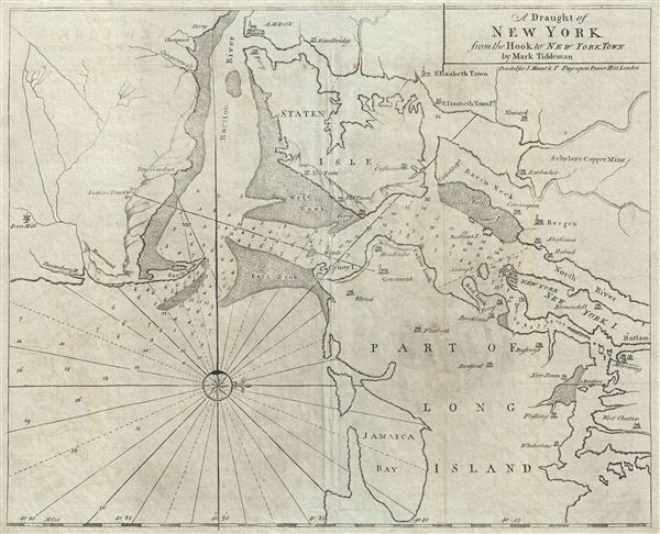
A Draught of New York from the Hook to New York Town.
sold
- Digital Map Information
- Suitable for large format printing
- DPI: 300
- File Size: 17.42 MB
- File Type: ZIP / TIFF
- ICC color profile embedded
- Delivered instantly via download link
A scarce and impressive colonial period c. 1773 Mark Tiddeman nautical chart of New York City and harbor. Oriented to the west and centered on Coney Island (Cunny I.), Tiddeman's chart coves from Staten Island to Jamaica Bay and from Sandy Hook to ... (more details)
Quirky 18th century British four-sheet wall map identifying the Biblical paradise of Ophir.
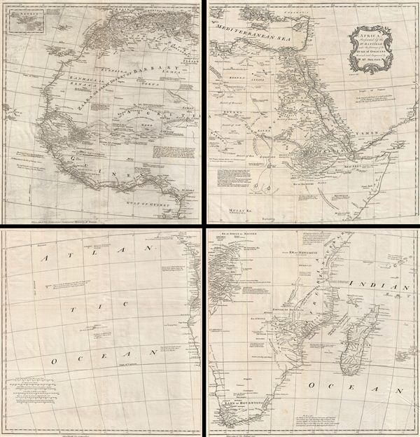
Africa, Performed by the Sr. D'Anville under the Patronage of the Duke of Orleans.
sold
- Digital Map Information
- Suitable for large format printing
- DPI: 300
- File Size: 56.05 MB
- File Type: ZIP / TIFF
- ICC color profile embedded
- Delivered instantly via download link
A curious and uncommon four panel wall map 1755 map of Africa by the english publisher M. Postlethwayte. A derivative of D'Anville's map of 1749, Postlethwayte's map covers the entire continent of Africa from the Mediterranean to the Cape of ... (more details)
Rare map illustrating indigenous footpaths across 19th century Tanzania.

East Africa. Sketch Map of native Routes from Dar Es Salaam towards the head of Lake Nyassa.
sold
- Digital Map Information
- Suitable for large format printing
- File Size: 4.82 MB
- File Type: ZIP / TIFF
- ICC color profile embedded
- Delivered instantly via download link
This uncommon and fascinating 1879 A. K. Johnston map of central Africa illustrated the native African travel routes from Dar es Salaam to the head of Lake Nyasa (Lake Malawi). This map was is based upon the explorations of the missionary ... (more details)
Quirky 18th century British multi-sheet wall map of the Near and Middle East.
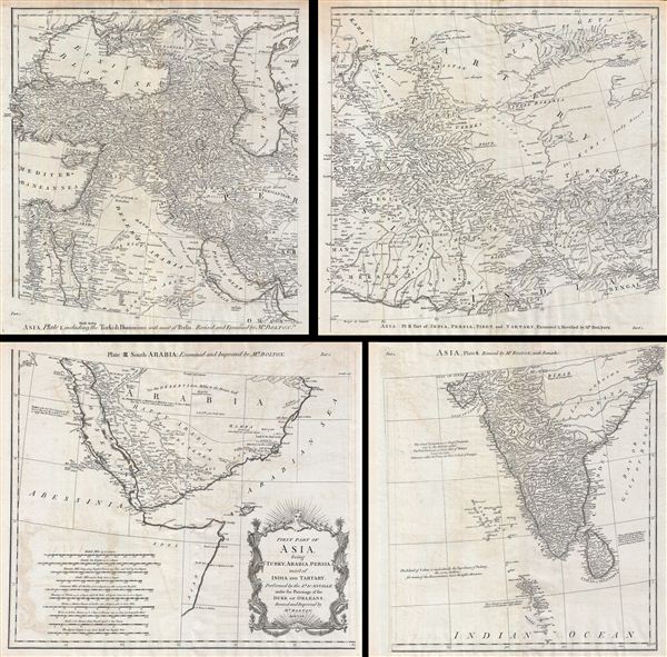
First Part of Asia, being Turkey, Arabia, Persia, most of India and Tartary.
sold
- Digital Map Information
- Suitable for large format printing
- DPI: 300
- File Size: 43.02 MB
- File Type: ZIP / TIFF
- ICC color profile embedded
- Delivered instantly via download link
A curious and uncommon four panel wall map 1786 map of India, Persia, and Arabia by the english publisher M. Postlethwayte. Published in four separate panels, this map can be either joined as a single massive map as assembled, as above, ... (more details)
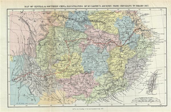
Map of Central & Southern China, Illustrating Mr. McCarth's Journey from Chin-Kiang to Bhamo 1877.
sold
- Digital Map Information
- Suitable for large format printing
- File Size: 6.41 MB
- File Type: ZIP / TIFF
- ICC color profile embedded
- Delivered instantly via download link
This is a fine example of the 1879 Johnston map of central and southern China. Illustrating the journeys of the missionary John McCarthy from Chin-Kiang to Bhamo in 1877, Johnsont's map covers all of China from the borders with Burma ... (more details)
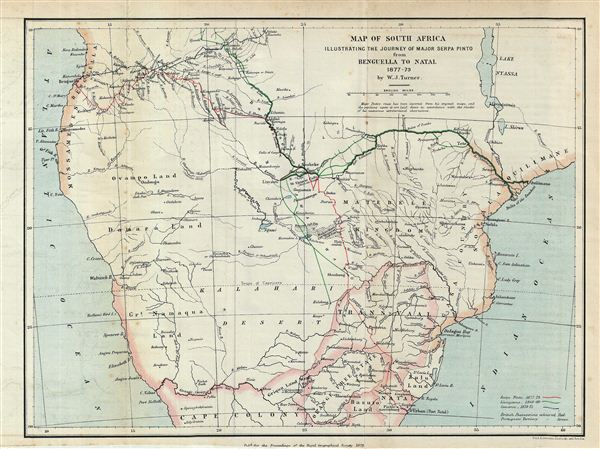
Map of South Africa Illustrating the Journey of Major Serpa Pinto from Benguella to Natal 1877-79.
sold
- Digital Map Information
- Suitable for large format printing
- File Size: 4.79 MB
- File Type: ZIP / TIFF
- ICC color profile embedded
- Delivered instantly via download link
This is an uncommon 1879 map of central Africa by A. K. Johnston. Illustrating the journey of the Portuguese explorer Major Serpa Pinto, this map covers from the Atlantic Ocean to the Indian Ocean and from Njambi to Cape Colony. ... (more details)
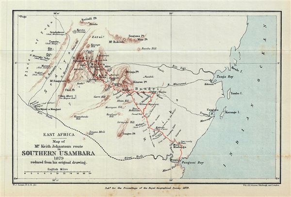
East Africa. Map of Mr. Keith Johnston's route in Southern Usambara 1879 reduced from his original drawing.
sold
- Digital Map Information
- Suitable for large format printing
- File Size: 1.91 MB
- File Type: ZIP / TIFF
- ICC color profile embedded
- Delivered instantly via download link
This is a fascinating example of the 1879 Stanford map of southern Usambara, Tanzania, east Africa. The map follows the route of the missionary Keith Johnston (1844-1879) and details the Usambara Mountains from Fuga to the Indian ... (more details)
Unusual early map from the Livingstone Mission.
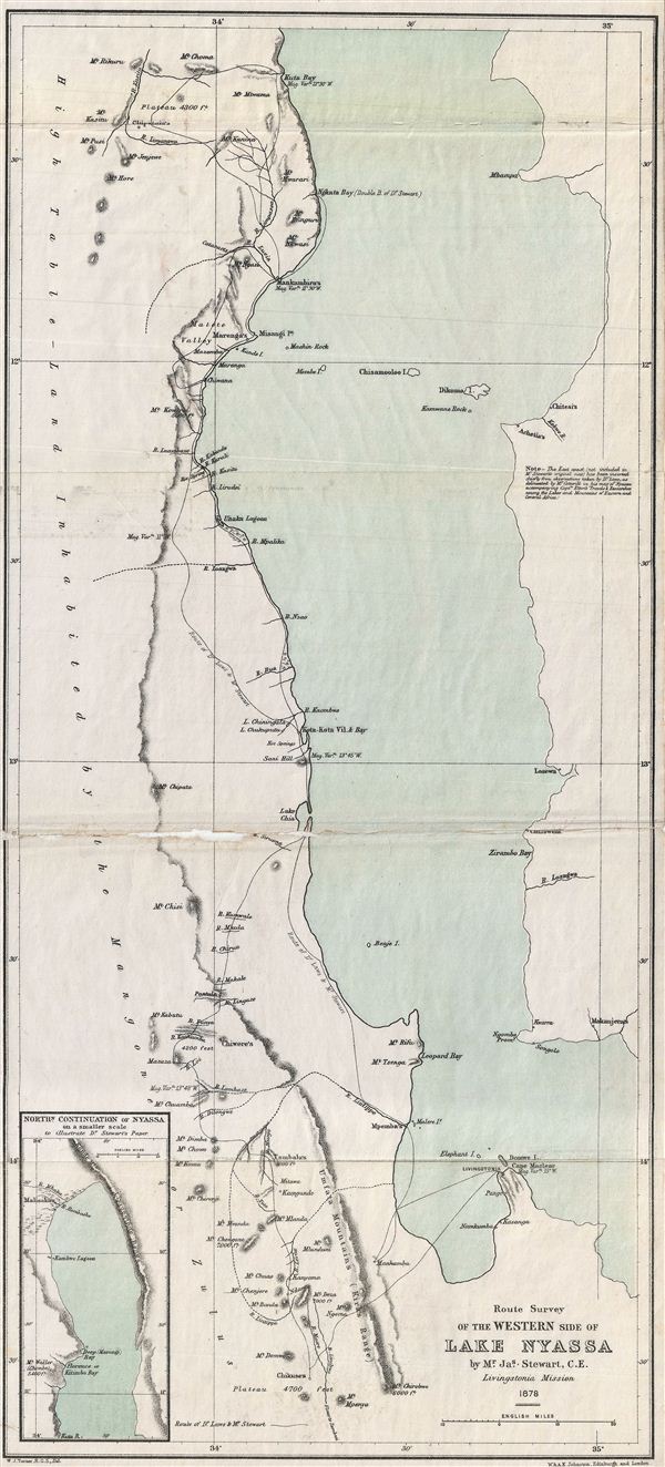
Route Survey of the Western Side of Lake Nyassa.
sold
- Digital Map Information
- Suitable for large format printing
- File Size: 5.32 MB
- File Type: ZIP / TIFF
- ICC color profile embedded
- Delivered instantly via download link
This is an uncommon example of the 1879 Stanford map of Lake Nyassa or Lake Malawi, Africa. This map focuses on the western part of the lake from Kuta Bay to Mt. Mpenya. Contains inset map of the northern part of Nyassa in lower ... (more details)
The first modern world map incorporating a comparative mountains and rivers chart.
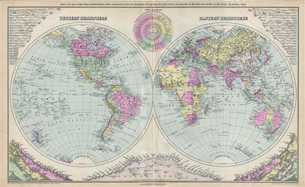
Gray's New Map of the World in Hemispheres, with Comparative Views of the Heights of the Principal Mountains and Lengths of the Principal Rivers on the Globe.
sold
- Digital Map Information
- Suitable for large format printing
- File Size: 16.73 MB
- File Type: ZIP / TIFF
- ICC color profile embedded
- Delivered instantly via download link
This is a beautiful example of Frank A. Gray's 1879 map of the world on a hemispherical projection. This map is significant as, in addition to a world map, it must be considered the first modern comparative mountains and rivers ... (more details)
1862 Lloyd Map of New England (Vermont, New Hampshire, Maine, Massachusetts, Connecticut, Rhode Isla

Township Map of New England.
sold
- Digital Map Information
- Suitable for large format printing
- File Size: 16.74 MB
- File Type: ZIP / TIFF
- ICC color profile embedded
- Delivered instantly via download link
This is a fascinating example of the 1862 H. H. Lloyd map of New england. Lloyds map covers from Maine to Long Island, including the states of Maine, New Hampshire, Vermont, Massachusetts, Rhode Island and Connecticut, as well ... (more details)
Identifies the ephemeral province of 'Stickeen' in the modern day Yukon.
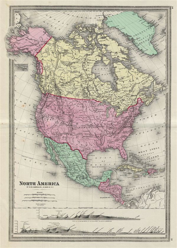
North America.
sold
- Digital Map Information
- Suitable for large format printing
- File Size: 14 MB
- File Type: ZIP / TIFF
- ICC color profile embedded
- Delivered instantly via download link
This is a fascinating example of the 1862 H. H. Lloyd map of North America. Centered on the United States, covers from the Arctic Ocean to Panama, including Greenland and parts of South American and the West Indies. A tiny ... (more details)
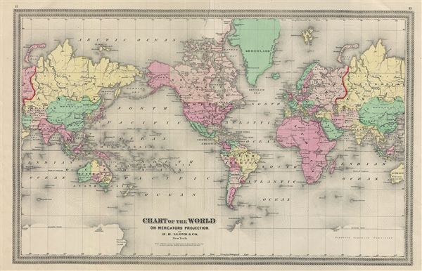
Chart of the World on Mercators Projection.
sold
- Digital Map Information
- Suitable for large format printing
- File Size: 13.88 MB
- File Type: ZIP / TIFF
- ICC color profile embedded
- Delivered instantly via download link
This is a fine example of the 1862 H. H. Lloyd map or chart of the world on Mercator's Projection. The map is centered on the American continent and a portion of Asia is duplicated to show its connection with the United ... (more details)