

Map of the World from the latest Discoveries.
sold
- Digital Map Information
- Suitable for large format printing
- DPI: 300
- File Size: 6.32 MB
- File Type: ZIP / TIFF
- ICC color profile embedded
- Delivered instantly via download link
A finely detailed first edition 1794 map of the world in hemispheres by Robert Wilkinson. Wilkinson's map covers the entire world with color coding by continent. The exploratory routes taken by cook are noted. In Australia, here labeled New Holland, Van Diemen's ... (more details)
A rare mapping of the briefly extant Confederate State of Arizona.

Johnson's California, Territories of New Mexico and Utah.
sold
- Digital Map Information
- Suitable for large format printing
- Full resolution TIFF file
- ICC color profile embedded
- Delivered instantly via download link
One of the scarcest and most historically significant of A. J. Johnson's southwest series. Published in 1863 at the height of the American Civil War, this stunning map depicts the state of California and the territories of Nevada, Utah, Colorado, New Mexico and ... (more details)
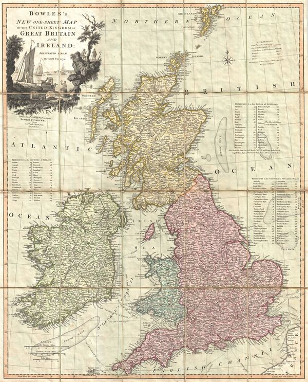
Bowles's New One-Sheet Map of the United Kingdom of Great Britain and Ireland; Delineated from the latest Surveys.
sold
- Digital Map Information
- Suitable for large format printing
- DPI: 300
- File Size: 22.99 MB
- File Type: ZIP / TIFF
- ICC color profile embedded
- Delivered instantly via download link
A surprisingly scarce 1801 case or pocket map of the British Isles, including england, Scotland, and Ireland, by Carrington Bowles and Samuel Carver. Bowles' map covers all of the British Isles from the Shetland Islands south to the Scilly Isles and from ... (more details)
The most important and influential map of Virginia and Carolina to appear in the 17th century.
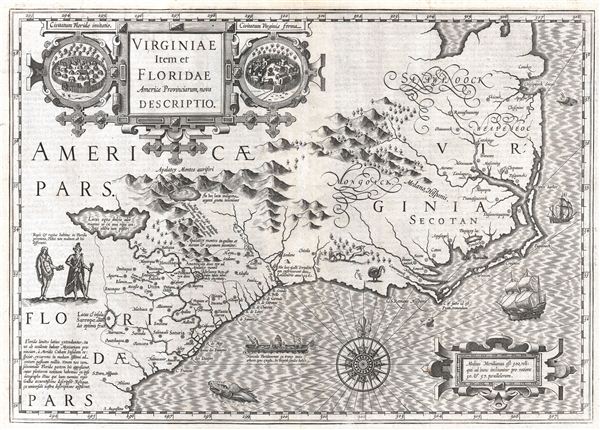
Virginiae Item et Floridae Americae Provinciarum, nova Descriptio.
sold
- Digital Map Information
- Suitable for large format printing
- DPI: 300
- File Size: 12.17 MB
- File Type: ZIP / TIFF
- ICC color profile embedded
- Delivered instantly via download link
Published in 1606 by the Mercator – Hondius firm, this is the most influential map of the southeastern part of North America to emerge in the 17th century and the first map to depict by Virginia and Florida. entitled, 'Virginiae Item et Floridae', ... (more details)
A cartographic landmark in the mapping of Pennsylvania.
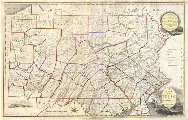
A Map of the State of Pennsylvania by Reading Howell MDCCCXI.
sold
- Digital Map Information
- Suitable for large format printing
- DPI: 300
- File Size: 25.69 MB
- File Type: ZIP / TIFF
- ICC color profile embedded
- Delivered instantly via download link
This map, which was first issued by Reading Howell in 1791, is considered to be one of the most important maps of Pennsylvania ever issued as well as the finest of the 18th century. Howell, a landowner and surveyor of Pennsylvania, was commissioned ... (more details)

A New and Accurate Map of the Russian Empire.
sold
- Digital Map Information
- Suitable for large format printing
- DPI: 300
- File Size: 3.13 MB
- File Type: ZIP / TIFF
- ICC color profile embedded
- Delivered instantly via download link
A finely detailed first edition 1794 map of the Russian empire by Robert Wilkinson. Covers the lands claimed by Tsarist Russia from the Black and Baltic Seas fully across Asia to the Bearing Strait and the Peninsula of Kamchatka, and from the ... (more details)
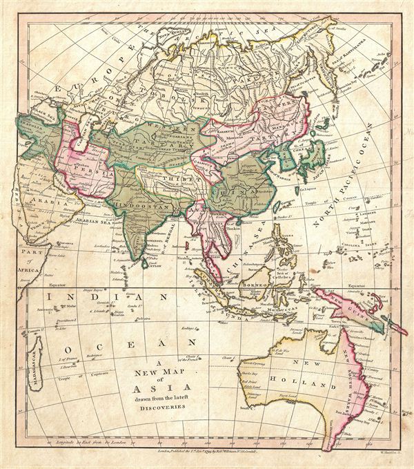
A New Map of Asia drawn from the latest Discoveries.
sold
- Digital Map Information
- Suitable for large format printing
- DPI: 300
- File Size: 3.29 MB
- File Type: ZIP / TIFF
- ICC color profile embedded
- Delivered instantly via download link
A finely detailed first edition 1794 map of Asia and Australia by Robert Wilkinson. Wilkinson's map covers from the Russian Arctic to the Indian Ocean and from Madagascar to New South Wales and New Guinea. Here Asia is divided into various ... (more details)

Turkey in Asia, Drawn from the most respectable Authorities.
sold
- Digital Map Information
- Suitable for large format printing
- DPI: 300
- File Size: 3.4 MB
- File Type: ZIP / TIFF
- ICC color profile embedded
- Delivered instantly via download link
A finely detailed first edition 1794 map of Turkey in Asia by Robert Wilkinson. Though titled Turkey, Wilkinson's map actually covers most of the Asiatic territories governed by the Ottoman empire, inclusive of the modern day Turkey, ... (more details)
Identifies the Sea of Korea.

China, Drawn from the Latest and Best Authorities.
sold
- Digital Map Information
- Suitable for large format printing
- DPI: 300
- File Size: 2.39 MB
- File Type: ZIP / TIFF
- ICC color profile embedded
- Delivered instantly via download link
A finely detailed first edition 1794 map of China and Korea by Robert Wilkinson. Wilkinson's map covers China in full as well as Korea, Formosa (Taiwan), and parts of adjacent Japan, Tibet, Vietnam (Tonkin), and Tartary (Mongolia). ... (more details)

An Accurate Map of the Island and Channels between China and New Holland.
sold
- Digital Map Information
- Suitable for large format printing
- DPI: 300
- File Size: 3.34 MB
- File Type: ZIP / TIFF
- ICC color profile embedded
- Delivered instantly via download link
A finely detailed first edition 1794 map of the east Indies and Southeast Asia by Robert Wilkinson. Wilkinson's map covers the region from Burma to Australia and from Sumatra to New Guinea, inclusive of Borneo, Malay, Singapore, ... (more details)
One of the first maps to detail the 1788 British colonization of New South Wales, Australia.
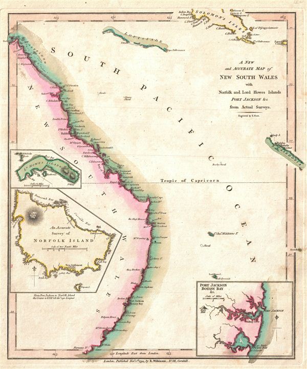
A New and Accurate Map of New South Wales with Norfolk and Lord Howes Islands Port Jackson and C. from Actual Surveys.
sold
- Digital Map Information
- Suitable for large format printing
- DPI: 300
- File Size: 2.68 MB
- File Type: ZIP / TIFF
- ICC color profile embedded
- Delivered instantly via download link
A finely detailed first edition 1794 map of the New South Wales, Australia, by Robert Wilkinson. One of the first maps to detail the British colonization of Australia, Wilkinson's map covers eastern Australia from the endeavors ... (more details)
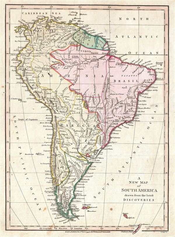
A New Map of South America drawn from the latest Discoveries.
sold
- Digital Map Information
- Suitable for large format printing
- Full resolution TIFF file
- ICC color profile embedded
- Delivered instantly via download link
A finely detailed first edition 1794 map of the South America by Robert Wilkinson. Wilkinson's map covers the entire continent from Panama and the Caribbean to Tierra del Fuego and the Falklands Islands, inclusive of South ... (more details)

An Accurate Map of the West Indies, from the Latest Improvements.
sold
- Digital Map Information
- Suitable for large format printing
- DPI: 300
- File Size: 2.31 MB
- File Type: ZIP / TIFF
- ICC color profile embedded
- Delivered instantly via download link
A finely detailed first edition 1794 map of the West Indies and the Caribbean by Robert Wilkinson. Wilkinson's map covers the West Indies, from the Mexican Coast to the Windward Islands, inclusive of , the Gulf of Mexico, ... (more details)
Shows the speculative 'River of the West'.
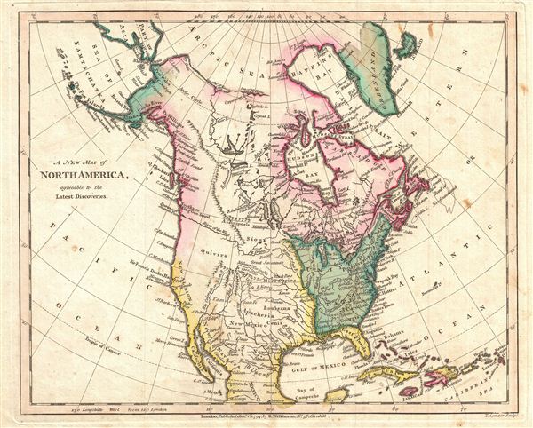
A New Map of North America, agreeable to the Latest Discoveries.
sold
- Digital Map Information
- Suitable for large format printing
- DPI: 300
- File Size: 2.74 MB
- File Type: ZIP / TIFF
- ICC color profile embedded
- Delivered instantly via download link
A finely detailed first edition 1794 map of North America by Robert Wilkinson. Wilkinson's map covers the entire continent of North America from the Arctic Sea to Mexico and from Atlantic to Pacific. This map bears the ... (more details)
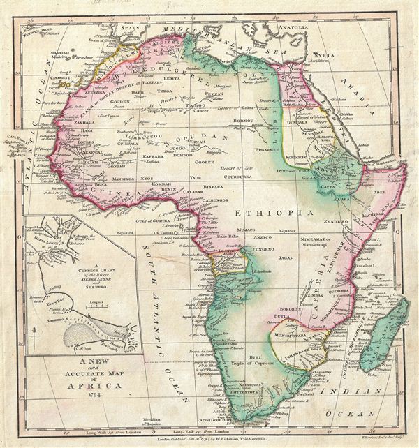
A New and Accurate Map o Africa.
sold
- Digital Map Information
- Suitable for large format printing
- DPI: 300
- File Size: 3.47 MB
- File Type: ZIP / TIFF
- ICC color profile embedded
- Delivered instantly via download link
A finely detailed first edition 1794 map of Africa by Robert Wilkinson. Wilkinson's map covers the entire continent of Africa inclusive of the island of Madagascar and adjacent parts of europe and Arabia. Africa was as ... (more details)
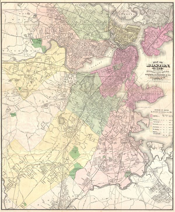
Map of Boston 1875.
sold
- Digital Map Information
- Suitable for large format printing
- File Size: 27.4 MB
- File Type: ZIP / TIFF
- ICC color profile embedded
- Delivered instantly via download link
An uncommon large format map of Boston, Massachusetts issued by Mary Sampson for issue in the 1875 edition of J. B. Beers' Atlas of Middlesex County Mass . Covers all of Boston as well as the adjacent communities of ... (more details)
The rarest iteration of this important map - the Lynchburg Edition.
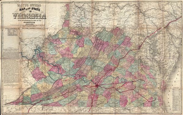
Lloyd's Official Map of the State of Virginia From actual surveys by order of the Executive 1828 and 1859.
sold
- Digital Map Information
- Suitable for large format printing
- File Size: 54.59 MB
- File Type: ZIP / TIFF
- ICC color profile embedded
- Delivered instantly via download link
An extremely scarce map, this is the Lynchburg edition of J. T. Lloyd's important map of Virginia – without a doubt the most influential map of Virginia to be issued during the American Civil War. Lloyd's enormous ... (more details)
Shows the North Carolina land grants that presaged the formation of Tennessee.

A Map of the United States of America, with Part of the Adjoining Provinces from the latest Authorities.
sold
- Digital Map Information
- Suitable for large format printing
- DPI: 300
- File Size: 3.41 MB
- File Type: ZIP / TIFF
- ICC color profile embedded
- Delivered instantly via download link
An unusual and ephemeral 1794 first edition map of the United States by Robert Wilkinson. Wilkinson's map covers the United States from the Mississippi River to the Atlantic seaboard and from the Great Lakes and ... (more details)
Southern Italy before the Napoleonic Wars.

Naples and Sicily, Drawn form the Best Authorities.
$300.00
Acquire
- Digital Map Information
- Suitable for large format printing
- DPI: 300
- File Size: 3.89 MB
- File Type: ZIP / TIFF
- ICC color profile embedded
- Delivered instantly via download link
This is an attractively colored, detailed 1794 map of southern Italy by Robert Wilkinson, presenting the territories of the Kingdom of Naples. (more details)

The Middle Part o Italy, Containing The Estates of the Church, The Dutchy of Tuscany, & C. Drawn from the best Authorities.
sold
- Digital Map Information
- Suitable for large format printing
- DPI: 300
- File Size: 2.6 MB
- File Type: ZIP / TIFF
- ICC color profile embedded
- Delivered instantly via download link
An exquisitely detailed first edition 1794 map of Tuscany and the Papal States by Robert Wilkinson. Wilkinson's map covers from the island of elba to the Gulf of Venice and from Modena to Naples, inclusive of ... (more details)