

[Untitled Rivers and Mountains Comparison Chart]
sold
- Digital Map Information
- Suitable for large format printing
- DPI: 300
- File Size: 4.5 MB
- File Type: ZIP / TIFF
- ICC color profile embedded
- Delivered instantly via download link
A colorful and playful example of the genre of 'maps' that lay rivers side by side, and mountains side by side, for purposes of comparing their sizes. Mountains are grouped by Eastern and Western Hemisphere. Though difficult to date with precision, this chart is ... (more details)

Geological Map of San Francisco Peninsula By Andrew C. Lawson.
sold
- Digital Map Information
- Suitable for large format printing
- File Size: 6.91 MB
- File Type: ZIP / TIFF
- ICC color profile embedded
- Delivered instantly via download link
This beautiful 1895 'Geological Map of the San Francisco Peninsula by Andrew C. Lawson' depicts five classes of rock: Montara granite, Franciscan Series, Pliocene & Pleistocene, Serpentine;and Alluvium and Salt Marsh. Covers the area from Fort Point and Goat ... (more details)

Sketch H Showing the progress of the Survey in Section no. VIII from 1846 - 1859.
sold
- Digital Map Information
- Suitable for large format printing
- File Size: 8.71 MB
- File Type: ZIP / TIFF
- ICC color profile embedded
- Delivered instantly via download link
A very attractive example of the 1859 U.S. Coast Survey nautical chart or map of the Mississippi River Delta and environs. Centered on the fanlike river delta itself, this map extends westward as far as Marsh Island and Vermillion Bay and eastward along the ... (more details)
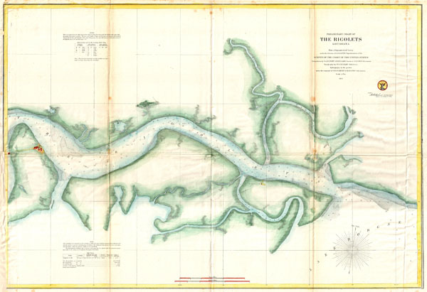
Preliminary Chart of The Rigolets, Louisiana
sold
- Digital Map Information
- Suitable for large format printing
- File Size: 11.38 MB
- File Type: ZIP / TIFF
- ICC color profile embedded
- Delivered instantly via download link
A beautiful hand colored 1859 United States Costal Survey chart or map of Louisiana's Rigolets River. The Rigolets is a river or strait that connects Lake Borgne to Lake Pontchartrain, forming in the process the boundary between New Orleans (Orleans ... (more details)

Sketch C Showing the Progress of the Survey in Section III From 1843 to 1871.
sold
- Digital Map Information
- Suitable for large format printing
- File Size: 17.96 MB
- File Type: ZIP / TIFF
- ICC color profile embedded
- Delivered instantly via download link
An exceptional example of the 1871 United States Costal Survey's progress chart of The Chesapeake Bay and Delaware Bay region. Covers from the mouth of the Susquehanna to Back Bay North Carolina, west as far as Washington D.C. and Richmond, and east ... (more details)

United States of America. The Course of the River St. Lawrence, from Lake Ontario to Manicouagan Point.
sold
- Digital Map Information
- Suitable for large format printing
- DPI: 300
- File Size: 13.5 MB
- File Type: ZIP / TIFF
- ICC color profile embedded
- Delivered instantly via download link
A particularly bright and beautiful example of John Thomson's important 1814 map of the United States and the course of the St. Lawrence River. Essentially two maps in one. The right and map focuses on the United States from the Mississippi ... (more details)
An essential map for any Transmississippi collection.
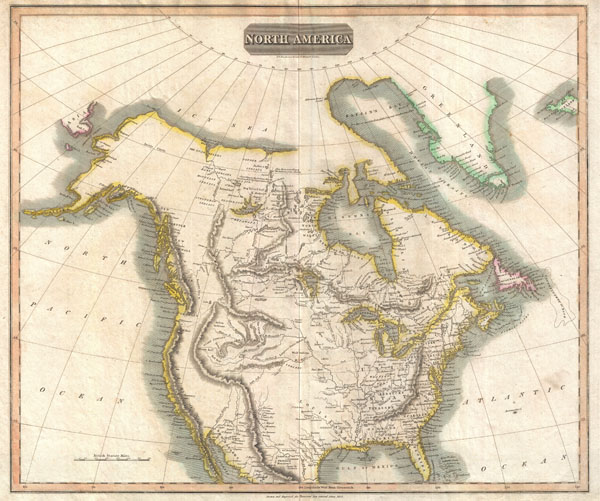
North America.
sold
- Digital Map Information
- Suitable for large format printing
- DPI: 300
- File Size: 16.65 MB
- File Type: ZIP / TIFF
- ICC color profile embedded
- Delivered instantly via download link
This beautiful map is John Thomson's important 1814 interpretation of North America. This map covers from the Arctic Sea south to the southern tip of Florida and the northern parts of Mexico. Cartographically Thomson draws heavily from the ... (more details)
View of San Francisco just after the 1849 California Gold Rush.

San Francisco. 1856.
sold
- Digital Map Information
- Suitable for large format printing
- File Size: 5.3 MB
- File Type: ZIP / TIFF
- ICC color profile embedded
- Delivered instantly via download link
A highly appealing view map of San Francisco dating to 1856. Reveals San Francisco as seen from Nob Hill looking down California Street. Telegraph Hill appears on the left. Shows numerous buildings and ships throughout. The most important ... (more details)
One of the most attractive American atlas maps of Washington D.C. to appear in the mid-19th century.

City of Washington.
sold
- Digital Map Information
- Suitable for large format printing
- Full resolution TIFF file
- ICC color profile embedded
- Delivered instantly via download link
This is beautiful hand colored 1850 map of Washington D.C., Capital of the United States. The map covers all of Washington D.C. as well as parts of adjacent Georgetown. The whole is highly detailed with individual buildings noted and color ... (more details)
One of the most attractive American atlas maps of New York City to appear in the mid-19th century.
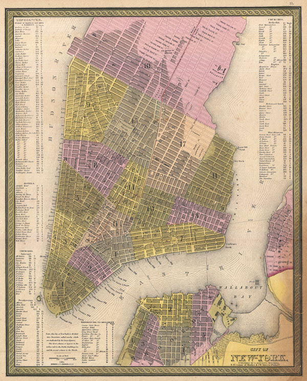
City of New-York.
sold
- Digital Map Information
- Suitable for large format printing
- DPI: 300
- File Size: 10.28 MB
- File Type: ZIP / TIFF
- ICC color profile embedded
- Delivered instantly via download link
This hand colored map of New York City is a lithograph engraving, dating to 1850 by the American mapmaker S.A. Mitchell Sr. The map epicts the island of Manhattan from 37th street (Kips Bay) south to Battery Park and Brooklyn from ... (more details)
The earliest chart to depict the heights of mountains and the lengths of rivers together in one illustration' - Rumsey
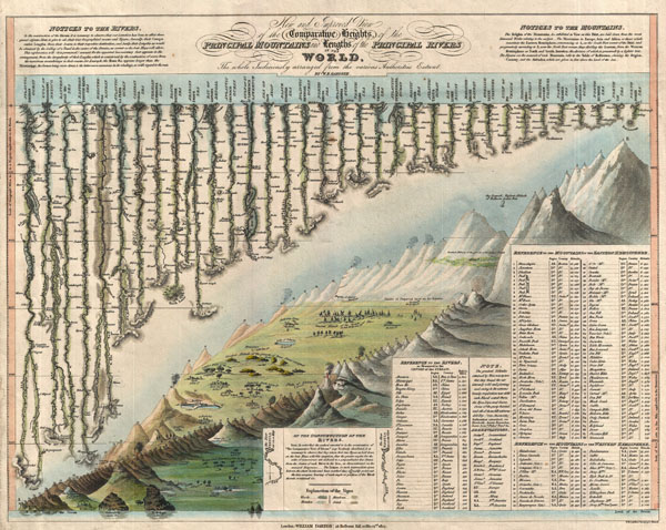
New and Improved View of the Comparative Heights, of the Principal Mountains and Lengths of the Principal Rivers in the World.
sold
- Digital Map Information
- Suitable for large format printing
- DPI: 300
- File Size: 6.4 MB
- File Type: ZIP / TIFF
- ICC color profile embedded
- Delivered instantly via download link
A groundbreaking convention establishing map of extreme scarcity, this is William Darton and W. R. Gardner's 1823 comparative mountains and rivers of the world chart. According to Rumsey this is the first known example of a ... (more details)
One of the most beautiful maps of Italy to emerge in the 19th century.
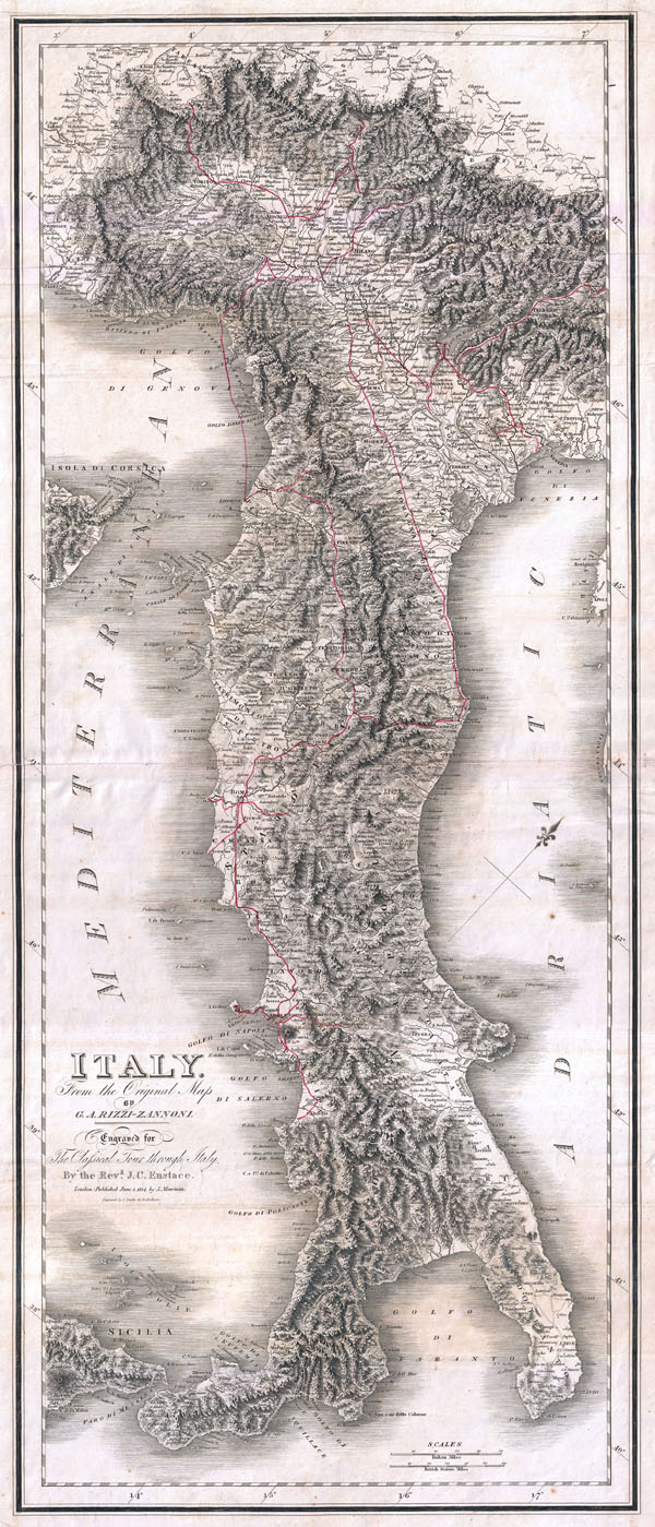
Italy from the Original Map by G. A. Rizzi-Zannoni.
sold
- Digital Map Information
- Suitable for large format printing
- DPI: 300
- File Size: 28.69 MB
- File Type: ZIP / TIFF
- ICC color profile embedded
- Delivered instantly via download link
One of the most attractive maps of Italy to appear in the 19th century, this is the 1814 Mawman and Smith re-engraving of G. A. Rizzi-Zannoni's magnificent 1802 Nuova Carta dell'Italia . Only slightly smaller than ... (more details)
One of the Coast Survey's earliest mappings of the Puget Sound.

Sketch K Showing the Progress of the Survey in Section No. XI (Upper Sheet) from Tillamook Bay to the Boundary.
sold
- Digital Map Information
- Suitable for large format printing
- File Size: 9.23 MB
- File Type: ZIP / TIFF
- ICC color profile embedded
- Delivered instantly via download link
A delicately hand-colored 1859 US Costal Survey map or triangulation chart of Washington State from Tillamook Head to Vancouver Island, including Juan De Fuca Strait, the Puget Sound, Olympia, and Seattle, with ... (more details)
An influential map of North America considered, 'A Foundation Map.' Also, the first printed map to show the Sargasso Sea.
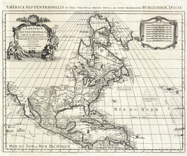
L'Amerique Septentrionale Dressee sur les Observations de Mes. De L'Academie Royale des Sciences… America Septentrionalis in Suas Praecipuas Partes Divisa, ad usum Serenissumu Burgundiae Ducis.
sold
- Digital Map Information
- Suitable for large format printing
- DPI: 300
- File Size: 17.25 MB
- File Type: ZIP / TIFF
- ICC color profile embedded
- Delivered instantly via download link
An extraordinary map, this is Covens and Mortier's 1708 reissue of De L'Isle's landmark 1700 mapping of North America. Covers the continent of North America from the Baffin Bay southwards as far as the Spanish ... (more details)
Early 18th century world map with decorative borders showing an insular California.
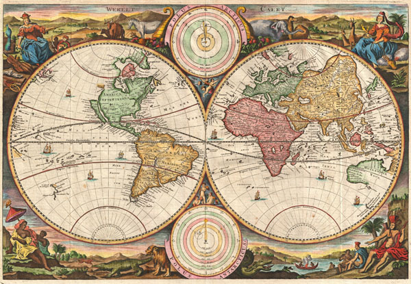
Werelt Caert.
sold
- Digital Map Information
- Suitable for large format printing
- Full resolution TIFF file
- ICC color profile embedded
- Delivered instantly via download link
A fine 1730 world map was drawn by Daniel Stoopendaal for publication in the Keur Bible. Based on Visscher's very similar map of 1663, this map depicts the world on a hemisphere projection surrounded by ... (more details)
The first map to depict Manhattan as an Island and the first cartographic depiction of North American fauna.

Nova Belgica et Anglia Nova.
sold
- Digital Map Information
- Suitable for large format printing
- DPI: 300
- File Size: 10.61 MB
- File Type: ZIP / TIFF
- ICC color profile embedded
- Delivered instantly via download link
A beautiful old color example of one of the most important maps in the history of America, Blaeu's c. 1635 Nova Belgica et Anglia Nova . Oriented to the west, this map covers the American coast from ... (more details)
Extraordinary decorative map of Long Island.
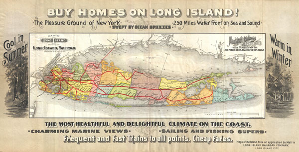
Map of Long Island showing the Long Island Railroad.
sold
- Digital Map Information
- Suitable for large format printing
- File Size: 13.2 MB
- File Type: ZIP / TIFF
- ICC color profile embedded
- Delivered instantly via download link
This highly appealing decorative map of Long Island was issued in 1891 by the Long Island Railroad to promote real estate investment throughout the island. Cartographically the map is based upon ... (more details)
One of the most important maps of America ever produced and certainly one of the greatest influence…' - P. Burden (Mapping of America)
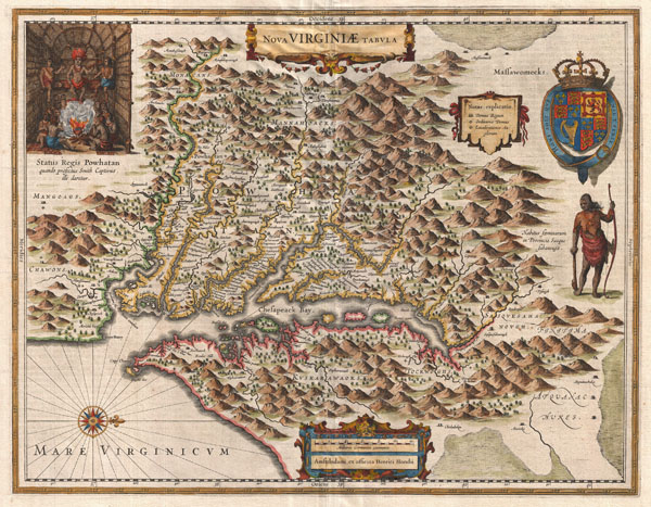
Nova Virginiae Tabula.
sold
- Digital Map Information
- Suitable for large format printing
- DPI: 300
- File Size: 13.15 MB
- File Type: ZIP / TIFF
- ICC color profile embedded
- Delivered instantly via download link
A very fine example of Henricus Hondius' 1630 map of the Virginia colony and the Chesapeake Bay. Oriented to the west, this map covers from Cape Henry to the Susquehanna River and inland as far ... (more details)

Afrika nach den arabishcen Geographen und bis zur Ankunft der Portugiesen VIIItes bis XIVtes Jahrhundert
sold
- Digital Map Information
- Suitable for large format printing
- File Size: 4.35 MB
- File Type: ZIP / TIFF
- ICC color profile embedded
- Delivered instantly via download link
This is Karl von Spruner's 1855 map of Africa from the Arab conquests in the 8th century up to the arrival of the Portuguese in the 14th century. Much of southern Africa shows only rivers and ... (more details)

Africa seit Anfang des XVten Jahrhundert's
sold
- Digital Map Information
- Suitable for large format printing
- File Size: 5.96 MB
- File Type: ZIP / TIFF
- ICC color profile embedded
- Delivered instantly via download link
This is Karl von Spruner's 1855 map of Africa 'since the beginning of the 15th century.' Two insets include, at left, 'The Colonies of the Gold Coast,' and below that, 'Al Magreb' (northwest ... (more details)