

New Brunswick, Nova Scotia, Newfoundland, and Prince Edward Id.
sold
- Digital Map Information
- Suitable for large format printing
- File Size: 7.27 MB
- File Type: ZIP / TIFF
- ICC color profile embedded
- Delivered instantly via download link
This is the uncommon 1857 issue of J. H. Colton's map of Canada's Maritime Provinces, including New Brunswick, Nova Scotia, Newfoundland, and Prince Edward Island. Covers all of New Brunswick, Nova Scotia, Newfoundland and Prince Edward, along with a portion of ... (more details)

Northern Italy.
sold
- Digital Map Information
- Suitable for large format printing
- Full resolution TIFF file
- ICC color profile embedded
- Delivered instantly via download link
This fascinating hand colored 1809 map by Edinburgh cartographer John Pinkerton depicts Northern Italy, including Tuscany (Florence / Firenze ), Venice, Lombardy, Piedmont, and Milan. Early Pinkerton maps such as this one offer extraordinary quality and detail ... (more details)
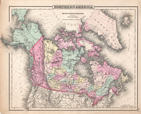
Northern America. British, Russian, and Danish Possessions in North America.
sold
- Digital Map Information
- Suitable for large format printing
- File Size: 7.48 MB
- File Type: ZIP / TIFF
- ICC color profile embedded
- Delivered instantly via download link
This is the uncommon 1857 issue of J. H. Colton's map of Northern America (British, Russian and Danish.) Covers the entire area of what is modern day Canada, as well as what is now Alaska and Greenland. Divided and color coded according to province and ... (more details)
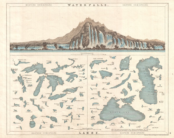
Waterfalls. Lakes.
sold
- Digital Map Information
- Suitable for large format printing
- File Size: 3.4 MB
- File Type: ZIP / TIFF
- ICC color profile embedded
- Delivered instantly via download link
A very interesting and attractive comparative chart of waterfalls and lakes in the eastern and western hemispheres. The top portion of the map is beautifully illustrated with waterfalls of the world, with those in the west on the left and those found in ... (more details)
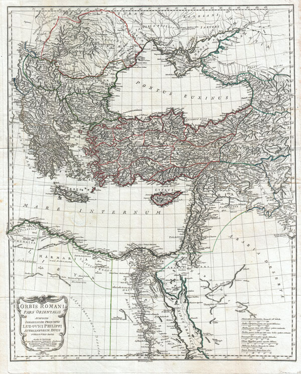
Orbis Romani, pars orientalis. Auspiciis Serenissimi Principis Ludovici Philippi, Aurelianorum Ducis publici juris facta. Auctor d'Anville, Regiae Humaniorium Litterarum Academiae, et Scientiarum Petropolitanae Socius, Celsitudinique Serenissimae a Secretis. MDCCLXXXII.
sold
- Digital Map Information
- Suitable for large format printing
- DPI: 300
- File Size: 30.82 MB
- File Type: ZIP / TIFF
- ICC color profile embedded
- Delivered instantly via download link
This is the stunning eastern sheet from Jean Baptiste Bourguignon D'Anville's two map set depicting the Roman Empire. Depicts the eastern portion of the Mediterranean inclusive of Greece and extends inland as far as modern day Armenia. Contains the ... (more details)

Antilles ou Indes Occidentales par Th. Doutovenay.
sold
- Digital Map Information
- Suitable for large format printing
- DPI: 300
- File Size: 4.66 MB
- File Type: ZIP / TIFF
- ICC color profile embedded
- Delivered instantly via download link
An attractive 1852 map of the West Indies by Th. Duvotenay. Covers from Florida to Venezuela and from Honduras to Barbados. Includes the Bahamas, Cuba, Jamaica, Santo Domingo (Hispaniola), Porto Rico, and the Lesser Antilles or Windward Isles. ... (more details)

Galignani’s Plan of Paris and Environs.
sold
- Digital Map Information
- Suitable for large format printing
- File Size: 9.97 MB
- File Type: ZIP / TIFF
- ICC color profile embedded
- Delivered instantly via download link
A large and attractive map of Paris dating to the 1860s. This fine map of central Paris was the only cartographic endeavor of the Paris-dwelling Italian Anglophile, Antonio Galignani. Galignani would have prepared this map for sale to English ... (more details)

Hindoustan ou Inde en deca du Gange et Inde Transgangetique par V. Levasseur Geographe.
sold
- Digital Map Information
- Suitable for large format printing
- Full resolution TIFF file
- ICC color profile embedded
- Delivered instantly via download link
A beautiful 1852 map of India and Southeast Asia by Victor Levasseur. Features the entire sub-continent as well as all of Southeast Asia. Includes the modern day nations of India, Pakistan, Bangladesh, Nepal, Thailand, Vietnam, Cambodia, Laos, ... (more details)
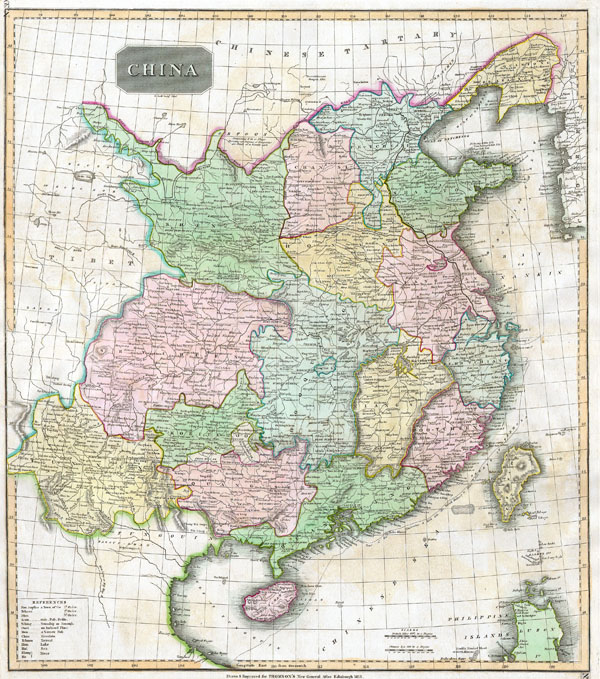
China
sold
- Digital Map Information
- Suitable for large format printing
- Full resolution TIFF file
- ICC color profile embedded
- Delivered instantly via download link
This fascinating hand colored 1814 map by Edinburgh cartographer John Thomson depicts China. Shows the Great Wall of China as the northern boundary. Extends as far west as the Tibetan plateau and as far south as the old Vietnamese/Chinese ... (more details)
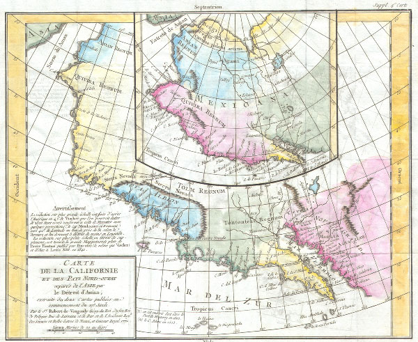
Carte de la Caliofrnie et des pays Nord-ouest separes de l’Asie par Le Detroit d’Anian, extradite de dus Cartes publiees au commencement du 17e Siecle.
sold
- Digital Map Information
- Suitable for large format printing
- Full resolution TIFF file
- ICC color profile embedded
- Delivered instantly via download link
This is the important Denis Diderot / Didier Robert De Vaugondy map of California. Two maps, the larger depicts the Northwestern part of North America from Anian (Alaska) to Cabo San Lucas. The smaller central map is a larger ... (more details)

Region Antarctique.
sold
- Digital Map Information
- Suitable for large format printing
- File Size: 3.86 MB
- File Type: ZIP / TIFF
- ICC color profile embedded
- Delivered instantly via download link
An uncommon color map of the Antarctic region. Published by the Hachette firm, circa 1890. Reflects a relatively primitive state of exploration in the region though a number of exploratory routes mapped out. A key in the upper ... (more details)

Tabula Generalis Iutiae
sold
- Digital Map Information
- Suitable for large format printing
- Full resolution TIFF file
- ICC color profile embedded
- Delivered instantly via download link
This is a historically important and spectacular 1710 Homann map part of Denmark. Formally titled ''Tabula Generalis Iutiae.'' Features a decorative title cartouche including Poseidon and others. Johann Baptist Homann ... (more details)

Kahoolawe.
sold
- Digital Map Information
- Suitable for large format printing
- File Size: 0.68 MB
- File Type: ZIP / TIFF
- ICC color profile embedded
- Delivered instantly via download link
This is an uncommon 1906 map of the island of Kahoolawe was prepared for the Report of the Governor of the Territory of Hawaii to the Secretary of the Interior . Kahoolawe is the smallest of Hawaii's primary volcanic ... (more details)
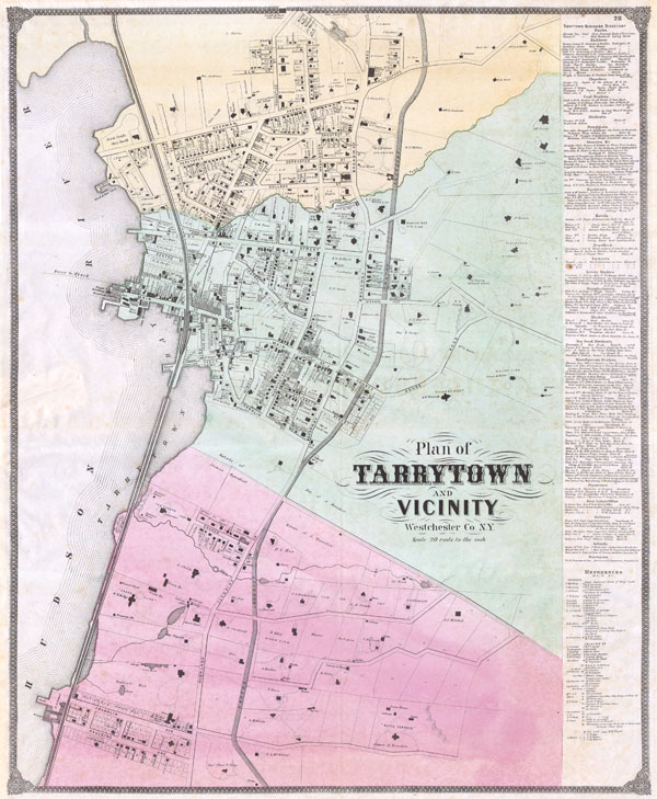
Plan of Tarrytown and Vicinity Westchester Co. N.Y.
sold
- Digital Map Information
- Suitable for large format printing
- File Size: 5.89 MB
- File Type: ZIP / TIFF
- ICC color profile embedded
- Delivered instantly via download link
This is an extraordinary and rare large format F. Beers map of Tarrytown, New York. Map is a hand colored lithographic engraving dating 1868. Tarrytown is a prominent town on the Hudson river and the location of the ... (more details)
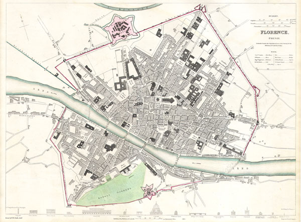
Florence. Firenze.
sold
- Digital Map Information
- Suitable for large format printing
- Full resolution TIFF file
- ICC color profile embedded
- Delivered instantly via download link
This map is a steel plate engraving, dating to 1835 by the Society for the Diffusion of Useful Knowledge, S.D.U.K. It represents the city of Florence or Firenze, Italy. Depicts the old city of Firenze in ... (more details)
One of the earliest published maps of Russia.

Moschovia Nvova Tavola.
sold
- Digital Map Information
- Suitable for large format printing
- DPI: 300
- File Size: 2.77 MB
- File Type: ZIP / TIFF
- ICC color profile embedded
- Delivered instantly via download link
A beautiful example of Girolamo Ruscelli's c. 1574 map of Moscovie. Covers modern day Russia and the Ukraine from the Arctic to the Crimea and as far east as the Caspian Sea. Interest in this area peaked ... (more details)
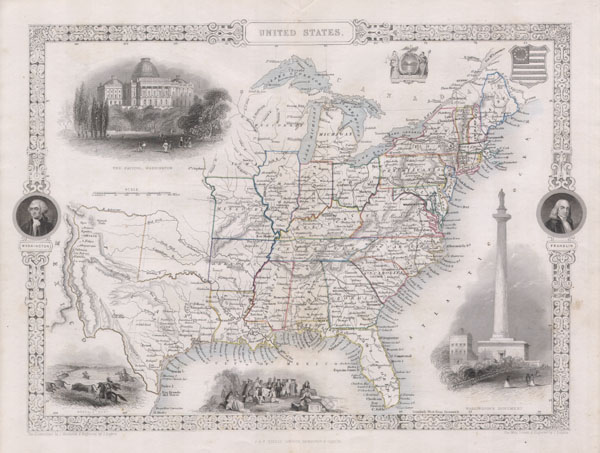
United States.
sold
- Digital Map Information
- Suitable for large format printing
- Full resolution TIFF file
- ICC color profile embedded
- Delivered instantly via download link
This is John Tallis's highly desirable 1850 Map of the United States. This is the earliest variation on this map that includes Texas as a state. Herein Texas is depicted at near its fullest extent ... (more details)
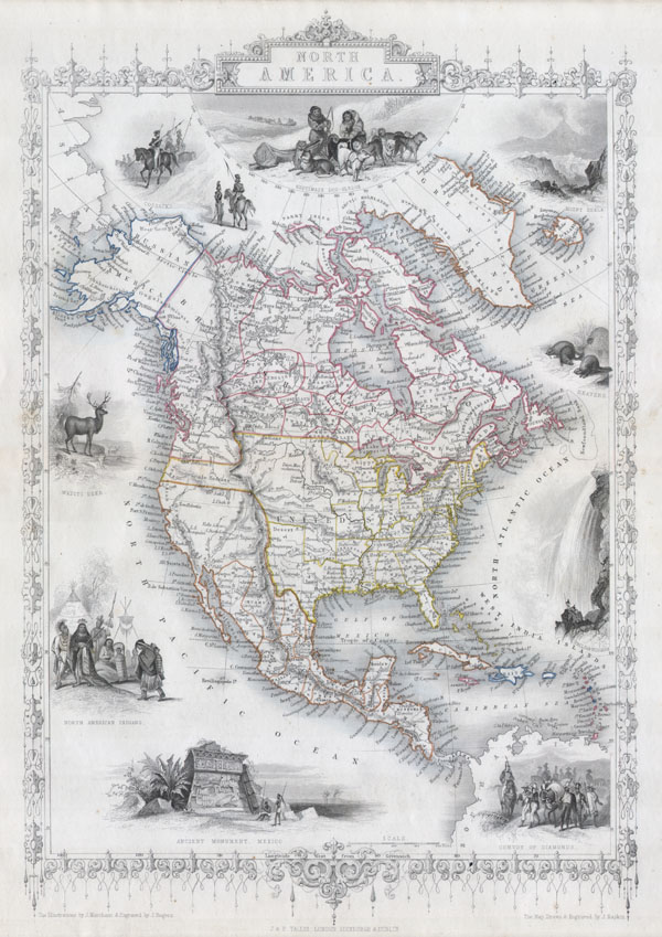
North America.
sold
- Digital Map Information
- Suitable for large format printing
- Full resolution TIFF file
- ICC color profile embedded
- Delivered instantly via download link
This is John Tallis's highly desirable and very rare 1850 Map of the North America. Made shortly following the entry of Texas into the Union, this map depicts an important point in American history. ... (more details)
Monumental world map showing California as an Island.

Mappe-monde Geo-Hydrographique ou Description Generale du Globe Terrestre et Aquatique en Deux-Plans-Hemipsheres ou son Exactement Remarquees en General Toutes les Parties de la Terre et de L'Eau, suivant les Relations les plus Nouvelles, par le S. Sanson Geographe Ordinaire du Roy.
sold
- Digital Map Information
- Suitable for large format printing
- DPI: 300
- File Size: 27.92 MB
- File Type: ZIP / TIFF
- ICC color profile embedded
- Delivered instantly via download link
An extraordinary map of monumental proportions, this Sanson and Jaillot's c.1691 decorative map of the world on a double hemisphere projection. Covers the entire world according to its 17th century ... (more details)

Le Nouveau Mexique, avec la Partie Septentrionale de l'Ancien, ou de la Nouvelle Espagne.
sold
- Digital Map Information
- Suitable for large format printing
- DPI: 300
- File Size: 2.28 MB
- File Type: ZIP / TIFF
- ICC color profile embedded
- Delivered instantly via download link
This is a beautiful c. 1780 Bonne map of northern Mexico and Texas. Covers from the Pacific Ocean through Mexico, Texas and Louisiana to western Florida, extends north as far as the Mission of St. ... (more details)