
Beijing (sold)
The best, largest, and most important map of Beijing made before World War II.
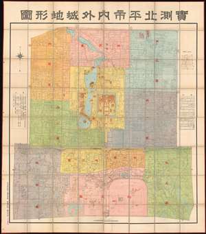
Surveyed Map of Inner City and Outer City, Beijing. /實測北平市内外城地形圖
sold
- Digital Map Information
- Suitable for large format printing
- Full resolution TIFF file
- ICC color profile embedded
- Delivered instantly via download link
The best, largest, and most important map of Beijing made before World War II. This is an astounding wall-sized Republic of China era administrative map of Beijing (Beiping) dating to January 1937 (Mingou 26). This map was issued just months before the Marco Polo Bridge Incident, the Battle of Beiping-Tianjin, the opening of the Second Sino Japanese War, and the subsequent Japanese occupation of Beijing. Measuring 85.5 x 79.5 in (217.17 x 201.93 cm), this enormous work is the largest and most detailed map of Beijing (or Beiping) yet produced. When commissioned by 21st Beijing mayor Yuan Liang (袁良, 1882–1953), more than 10 years had passed since the last major map of Beijing was issued - which was both on a smaller scale and inaccurate. (more details)
The first printing of the most authoritative and influential map of the siege of the British Legation in Peking (Beijing) during the Boxer Rebellion. Printed in Beijing!
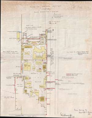
Plan of British Legation Peking shewing defences June to August 1900.
sold
- Digital Map Information
- Suitable for large format printing
- File Size: 6.79 MB
- File Type: ZIP / TIFF
- ICC color profile embedded
- Delivered instantly via download link
An otherwise unobtainable rarity of the utmost historical importance produced in Beijing in the aftermath of the 1900 Boxer Rebellion (Yihetuan Movement, 義和團運動). This is the first, largest, and best official map Beijing's British Legation to illustrate the events of the Boxer Rebellion (1899 - 1901) and the siege of the Legation Quarter.
The map is the product of meticulous on-site surveys and post-siege interviews conducted by British Engineer Henry Edward Colvin Cowie. When the Boxer Rebellion laid siege to the Beijing Legation Quarter, Cowie was drafted from his civilian position with the Indian Public Works Department and sent to Beijing as part of the Bombay Sappers and Miners contingent of the China Relief Expedition. The map was printed on site and bears the Bo. S. and M. (Bombay Sapper's and Miners) imprint, suggesting it was printed with field lithography equipment carried with the Relief Expedition. This is thus the first printing of Cowie's important map and is the source of several subsequent editions which appeared in various influential books and articles on the Boxer Rebellion.
Lithograph signatures of both Lieut. H.E.C. Cowie, and his superior, Lieutenant Colonel George Kenneth Scott-Moncrieff, appear in the lower right. It is also signed in manuscript by Captain Francis Garden Poole (1870 - 1950), an important figure in the defense of the British Legation, this providing the map with an excellent provenance. (more details)
The map is the product of meticulous on-site surveys and post-siege interviews conducted by British Engineer Henry Edward Colvin Cowie. When the Boxer Rebellion laid siege to the Beijing Legation Quarter, Cowie was drafted from his civilian position with the Indian Public Works Department and sent to Beijing as part of the Bombay Sappers and Miners contingent of the China Relief Expedition. The map was printed on site and bears the Bo. S. and M. (Bombay Sapper's and Miners) imprint, suggesting it was printed with field lithography equipment carried with the Relief Expedition. This is thus the first printing of Cowie's important map and is the source of several subsequent editions which appeared in various influential books and articles on the Boxer Rebellion.
Lithograph signatures of both Lieut. H.E.C. Cowie, and his superior, Lieutenant Colonel George Kenneth Scott-Moncrieff, appear in the lower right. It is also signed in manuscript by Captain Francis Garden Poole (1870 - 1950), an important figure in the defense of the British Legation, this providing the map with an excellent provenance. (more details)
The first, best, and earliest map of the Defense of the Legation Quarter during the Boxer Rebellion - original Cyanotype printed in Beijing shortly after the events described.
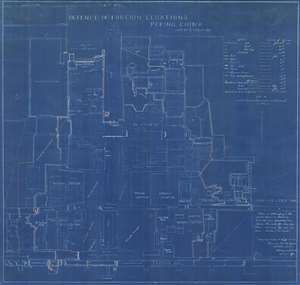
Defence of Foreign Legations, Peking, China, June 20th to Aug. 14th, 1900.
sold
- Digital Map Information
- Suitable for large format printing
- File Size: 26.9 MB
- File Type: ZIP / TIFF
- ICC color profile embedded
- Delivered instantly via download link
A rarity of the utmost historical importance produced in Beijing in the aftermath of the 1900 Boxer Rebellion (Yihetuan Movement, 義和團運動). This is the first, largest, and best official map Beijing's Legation Quarter (Dong Jiaomin Xiang / 東交民巷) to illustrate the events of the Boxer Rebellion (1899 - 1901) and the siege of the Foreign Legations. The map was prepared by the American military engineer Harley Bascom 'Fergie' Ferguson, who was sent to Beijing in 1900 as part of the China Relief Expedition, a multinational emergency force mustered to liberate the besieged legations and suppress the Boxer Rebellion. Produced in cyanotype (blueprint) with Ferguson's own manuscript annotations, this map was issued in miniscule quantities intended only for distribution among military and civilian officials in Beijing – there are only three surviving examples known. Due to the meticulousness and accuracy in illustrating daily progression of the battle, Ferguson's map is today the basis for all subsequent maps of the Legation Quarter's defense. (more details)
One of only two known examples outside of China, this rare map illustrates the foreign occupation of Beijing following the Boxer Rebellion.
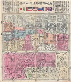
Jīng Chéng Gè Guó Zàn Fēn Jiè Zhǐ Quán Tú / Full Map of Various Foreign Countries' Temporarily Divided Territory Boundaries within the City of Beijing / 京城各國暂分界址全图
sold
- Digital Map Information
- Suitable for large format printing
- File Size: 25.74 MB
- File Type: ZIP / TIFF
- ICC color profile embedded
- Delivered instantly via download link
A map of considerable importance and rarity, this is a 1900 Chinese issue woodcut map illustrating the yearlong occupation of Beijing (Peking) following the suppression of the Boxer Rebellion / Uprising. The title, roughly translated is, 'Full Map of Various ... (more details)
Rare mid-19th century Qing Map of Beijing printed in China for Chinese government use. Basis for many subsequent maps issued after the Boxer Rebellion.

Jīngchéng nèiwài shǒu shàn quán tú / Premier Full Map of the Capital City's Interior and Exterior / 京城內外首善全圖
sold
- Digital Map Information
- Suitable for large format printing
- DPI: 300
- File Size: 13.93 MB
- File Type: ZIP / TIFF
- ICC color profile embedded
- Delivered instantly via download link
An exceptional c. 1850 Chinese issue Qing Dynasty map of Beijing or Peking, China. This map details the Qing Dynasty walled city of Beijing and was used for administrative purposes. Important buildings, as well as with city and Forbidden City walls, are ... (more details)
Rare mid-19th Qing Map of Beijing printed in China for Chinese government use. Basis for many subsequent maps issued after the Boxer Rebellion.
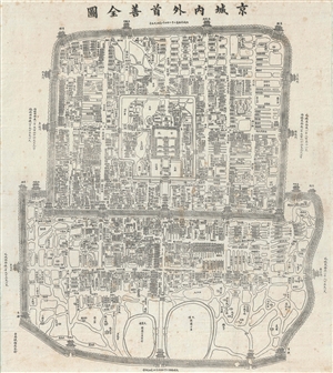
Jīngchéng nèiwài shǒu shàn quán tú / Premier Full Map of the Capital City's Interior and Exterior / 京城內外首善全圖
sold
- Digital Map Information
- Suitable for large format printing
- Full resolution TIFF file
- ICC color profile embedded
- Delivered instantly via download link
An exceptional c. 1867 Chinese issue Qing Dynasty Map of Beijing or Peking, China. This map details the Qing Dynasty walled city of Beijing. Important buildings, as well as with City and Forbidden City walls, are drawn in profile – a very traditional ... (more details)
Rare Chinese Government collection of 45 highly detailed topographical maps of Beijing or Peking, China.

This is an extraordinarily rare set of 45 post-Liberation topographical maps Beijing or Peking, China. They were issued in 1954 by the People's Republic of China and are de-accessioned library pieces. Each map focuses on a different portion of the city ... (more details)
From Empire to Republic.
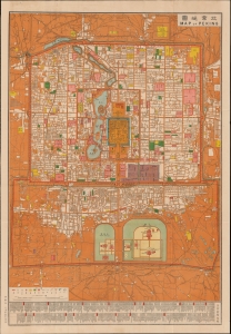
Map of Peking. / 北京地圖
sold
- Digital Map Information
- Suitable for large format printing
- File Size: 102.86 MB
- File Type: ZIP / TIFF
- ICC color profile embedded
- Delivered instantly via download link
This is a rare, important, and beautifully produced multi-color chromolithograph map of Beijing issued by the Chung-Tung Litho Works press in 1914. Issued under the Beiyang Government (1912 - 1928) or First Republic of China, this map is significant in illustrating a transition of power from the old imperial system to a theoretically modern republic. (more details)
Chromolithograph map of Beijing by Chiense Publisher.
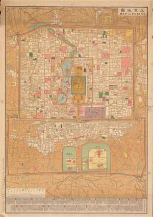
Map of Peking. / 北京地圖
sold
- Digital Map Information
- Suitable for large format printing
- File Size: 208.93 MB
- File Type: ZIP / TIFF
- ICC color profile embedded
- Delivered instantly via download link
This is a rare, important, and beautifully produced multi-color chromolithograph map of Beijing issued by the Chung-Tung Litho Works press in 1914. Issued under the Beiyang Government (1912 - 1928) or First Republic of China, this map is significant in illustrating a transition of power from the old imperial system to a theoretically modern republic. The multi-color chromolithographic process employed here allows for color coding to define individual buildings: government properties (red), schools (green), temples (yellow), embassies and diplomatic sites (purple). Note that the presidential palace itself is now within the Imperial City - a symbol of the Republic's redefinition of Chinese governmental power. Below the map proper is an index identifying government offices in the capitals of the various provinces. The map itself is a western style cartographic projection, likely based upon German and British surveys compiled after the 1900 suppression of the Boxer Rebellion. (more details)
1898 Harry Fenn Original Manuscript View of the Forbidden City, Beijing (Peking) for Harper's Weekly
One of a kind original pen and ink cover art for Harper's Weekly illustrating the Forbidden City.
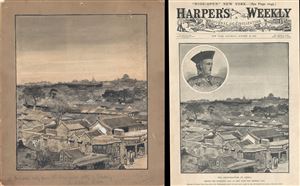
Coal Hill [Beijing Forbidden City View]
sold
- Digital Map Information
- Suitable for large format printing
- File Size: 11.71 MB
- File Type: ZIP / TIFF
- ICC color profile embedded
- Delivered instantly via download link
A remarkable discovery. This 1898 view of Beijing or Peking's Forbidden City is the original pen and ink cover art for the October 22, 1898 edition of Harper's Weekly , which is itself included with this piece. The view was drawn by Harry Fenn from, ... (more details)
Propaganda map supporting the Beiyang government.
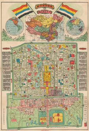
最新北京全圖 / Latest Full Map of Beijing. / 中華民國全圖 / Republic of China Map.
sold
- Digital Map Information
- Suitable for large format printing
- File Size: 37.88 MB
- File Type: ZIP / TIFF
- ICC color profile embedded
- Delivered instantly via download link
A rare 1925 propaganda map of Beijing, China issued by the ROC Mapping Office to commemorate the 15th year of the Beiyang Government / Republic of China. The map is large an impressive. At top, it is surmounted by the Five-Colored Flag of the Republic of China, used from 1911/12 to 1928, when it was replaced the Kuomintang flag. Below the flags there is a large map of China, flanked on either side by maps of the Western and Eastern and eastern hemisphere, underscoring China's culturally central position as the 'Mandarin Zhongguo' or 'Middle Kingdom.' Below is a detailed map of Beijing, with keys to either site highlighting important sites and buildings. (more details)
Rare Japanese woodblock map of Beijing.
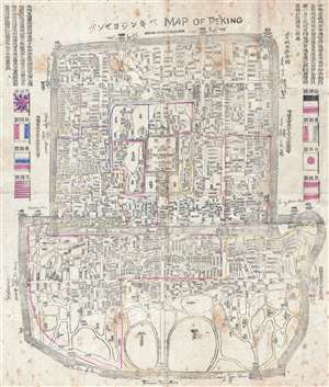
Map of Peking.
sold
- Digital Map Information
- Suitable for large format printing
- Full resolution TIFF file
- ICC color profile embedded
- Delivered instantly via download link
This is an important and rare 1900 Japanese woodblock map of Beijing or Peking. Centered on the Forbidden City, the map depicts the city following the multinational suppression of the Boxer Rebellion (Yihetuan Movement) of 1900. The map was issued ... (more details)
Rare early Qing Dynasty map of Beijing, China.

Qing Dynasty full map of Beijing, with map of Tianjin's Bai He River and Purple Bamboo Forest. / 清國北京城全圖, 附天津白河及紫竹林之圖 / TQīng Guó Bě Jīng Chéng Quán Tú, Fù Tiān Jīn Bái Hé Jí Zǐ Zhú Lín Zhī Tú
sold
- Digital Map Information
- Suitable for large format printing
- Full resolution TIFF file
- ICC color profile embedded
- Delivered instantly via download link
An important early map of Beijing or Peking, China, dating to 1885. This map was issued at the end of the Sino-French War (1884 – 1885). It covers all of Beijing as well as some of the surrounding countryside. Supplementary maps above and to ... (more details)
Rare Japanese woodblock map of Beijing.
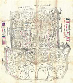
Map of Peking.
sold
- Digital Map Information
- Suitable for large format printing
- Full resolution TIFF file
- ICC color profile embedded
- Delivered instantly via download link
This is an extremely rare c.1900 Japanese woodblock map of Beijing or Peking. Centered on the Forbidden City, the map depicts the city during the Boxer Rebellion (Yihetuan Movement) of 1900. It depicts Beijing during the year when the Boxer ... (more details)
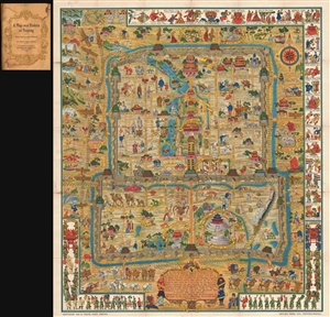
One of the iconic maps of the golden age of Pictorial Maps.
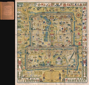
A Map and History of Peiping; formerly known as Peking; capital of provinces, princedoms, and kingdoms since 1121 B.C.; in 1264 A.D. the capital of the Mongol Empire of Kublai Khan; made the capital of the Ming Empire and built as it is today by Yung Lo in 1421; continued as the capital of the Chinese Empire through the Ming and Ching Dynasties; and now a city which will live long in the memory of man as one of the greatest the world has ever known. Completed on this fifth day of February in the year of our Lord Nineteen Hundred and Thirty-six.
sold
- Digital Map Information
- Suitable for large format printing
- File Size: 35.71 MB
- File Type: ZIP / TIFF
- ICC color profile embedded
- Delivered instantly via download link
An example of Frank Dorn's iconic 1936 chromolithograph pictorial map of Beijing or Peking, China. It is considered one of the great maps from the Golden Age of Pictorial Cartography. The map captures Beijing in the days leading up to World War II (1939 - 1945) - though by this time, China was already at odds with Japan, and the Second Sino-Japanese War (1937 - 1945), a precursor to WWII in Asia, was brewing. (more details)
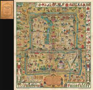
One of the iconic maps of the golden age of Pictorial Maps.
A Map and History of Peiping; formerly known as Peking; capital of provinces, princedoms, and kingdoms since 1121 B.C.; in 1264 A.D. the capital of the Mongol Empire of Kublai Khan; made the capital of the Ming Empire and built as it is today by Yung Lo in 1421; continued as the capital of the Chinese Empire through the Ming and Ching Dynasties; and now a city which will live long in the memory of man as one of the greatest the world has ever known. Completed on this fifth day of February in the year of our Lord Nineteen Hundred and Thirty-six.
sold
- Digital Map Information
- Suitable for large format printing
- File Size: 35.52 MB
- File Type: ZIP / TIFF
- ICC color profile embedded
- Delivered instantly via download link
An example of Frank Dorn's iconic 1936 chromolithograph pictorial map of Beijing or Peking, China. It is considered one of the great maps from the Golden Age of Pictorial Cartography. The map captures Beijing in the days leading up to World War II (1939 - 1945) - though by this time, China was already at odds with Japan, and the Second Sino-Japanese War (1937 - 1945), a precursor to WWII in Asia, was brewing. (more details)
One of the iconic maps of the golden age of Pictorial Maps.
A Map and History of Peiping; formerly known as Peking; capital of provinces, princedoms, and kingdoms since 1121 B.C.; in 1264 A.D. the capital of the Mongol Empire of Kublai Khan; made the capital of the Ming Empire and built as it is today by Yung Lo in 1421; continued as the capital of the Chinese Empire through the Ming and Ching Dynasties; and now a city which will live long in the memory of man as one of the greatest the world has ever known. Completed on this fifth day of February in the year of our Lord Nineteen Hundred and Thirty-six.
sold
- Digital Map Information
- Suitable for large format printing
- File Size: 12.67 MB
- File Type: ZIP / TIFF
- ICC color profile embedded
- Delivered instantly via download link
An example of Frank Dorn's iconic 1936 chromolithograph pictorial map of Beijing or Peking, China. It is considered one of the great maps from the Golden Age of Pictorial Cartography. The map captures Beijing in the days leading up to World War II (1939 - 1945) - though by this time, China was already at odds with Japan, and the Second Sino-Japanese War (1937 - 1945), a precursor to WWII in Asia, was brewing. (more details)
Celebrating the Republic of China.
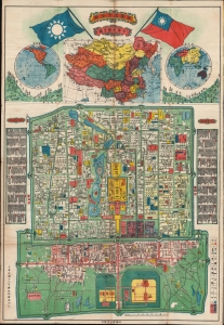
最新北京全圖 / Latest Full Map of Beijing. / 中華民國全圖 / Republic of China Map.
sold
- Digital Map Information
- Suitable for large format printing
- File Size: 44.06 MB
- File Type: ZIP / TIFF
- ICC color profile embedded
- Delivered instantly via download link
A rare 1929 or Minguo 18 chromolithograph propaganda map of Beijing, China, issued by the ROC Mapping Office to commemorate the 18th year of the Beiyang Government / Republic of China. (more details)
Rare map showing lands now incorporated into metropolitan Beijing.
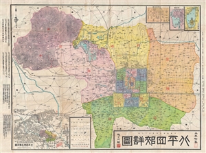
Map of Places of Historical Interest in the Environs of Peiping.
sold
- Digital Map Information
- Suitable for large format printing
- File Size: 32.51 MB
- File Type: ZIP / TIFF
- ICC color profile embedded
- Delivered instantly via download link
A very 1930 rare map of Beijing or Peiping, China. Map covers all of modern Beijing including the suburban vicinity – a very rare aspect. The map was drawn by HuaLong Wang and published by the New Geographical Society just prior to the ... (more details)
Strikingly detailed ROC administrative map of Beijing!
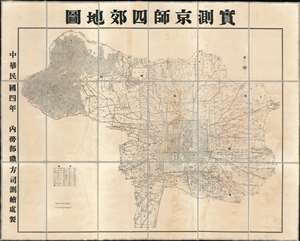
Surveyed Map of Beijing and the Four Suburbs. / 實測京師四郊地圖
sold
- Digital Map Information
- Suitable for large format printing
- DPI: 600
- File Size: 160.6 MB
- File Type: ZIP / TIFF
- ICC color profile embedded
- Delivered instantly via download link
An extraordinarily detailed large format 1915 (Mingou 4) map of Beijing and its 4 suburbs (East, West, North, South) issued by the Republic of China Ministry of Internal Affairs. At the time these regions were being incorporated under the administrative sovereignty of Beijing, but at the same time, operated somewhat independently, with separate regional governance and policing forces. Coverage extends from the old walled city to the surrounding areas, reaching as far northwest as today's Yangtaishan Scenic Area, east to (roughly) Xinggu, and south to Xihongmenzhen, encompassing the 'suburban' surroundings of the Republic's capital. This map was intended for administrative use and offers impressive detail throughout, naming different types of terrain and topographical detail, as well as illustrating transportation networks, administrative infrastructures (schools, electrical lines, etc.), mercantile infrastructure (shops, factories), and policing districts. (more details)
A unique Boxer Rebellion field map of Beijing representing the most detailed map of this region at time.
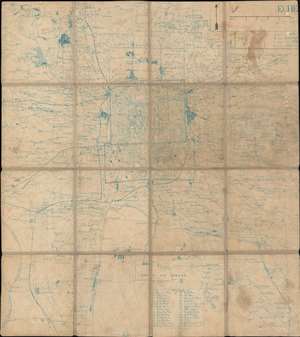
[Peking and Environs]
sold
- Digital Map Information
- Suitable for large format printing
- File Size: 21.53 MB
- File Type: ZIP / TIFF
- ICC color profile embedded
- Delivered instantly via download link
An exceptional c. 1900 Boxer Rebellion period map of Beijing and vicinity, China. Presented as a diazo or whiteprint (reverse cyanotype), with some manuscript, this map while complete onto itself, represents a small part of a now-lost French Service Géographique manuscript map of the environs of Beijing prepared for field use during the Boxer Rebellion (1899 - 1901). Offering greater detail than any known contemporaneous map of the region, the exceptional cartography here was not eclipsed until the 1930s and 40s. (more details)
One of the iconic maps of the golden age of Pictorial Maps.
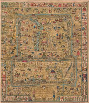
A Map and History of Peiping; formerly known as Peking; capital of provinces, princedoms, and kingdoms since 1121 B.C.; in 1264 A.D. the capital of the Mongol Empire of Kublai Khan; made the capital of the Ming Empire and built as it is today by Yung Lo in 1421; continued as the capital of the Chinese Empire through the Ming and Ching Dynasties; and now a city which will live long in the memory of man as one of the greatest the world has ever known. Completed on this fifth day of February in the year of our Lord Nineteen Hundred and Thirty-six.
sold
- Digital Map Information
- Suitable for large format printing
- File Size: 39.69 MB
- File Type: ZIP / TIFF
- ICC color profile embedded
- Delivered instantly via download link
An attractive broadside example of Frank Dorn's iconic 1936 pictorial map of Beijing or Peking, China. Considered one of the great maps from the Golden Age of Pictorial Cartography, this map covers all of Beijing as contained within the ... (more details)
Qing Beijing!
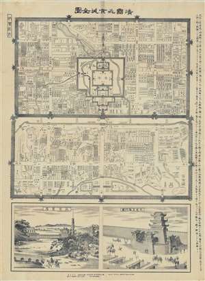
清國北亰全圖 / [Complete Map of Qing Beijing].
sold
- Digital Map Information
- Suitable for large format printing
- Full resolution TIFF file
- ICC color profile embedded
- Delivered instantly via download link
This is a rare 1894 map of Beijing by the Japanese cartographer Kitaro Kumazawa (熊澤喜太郎) that details the streets and hutong of Beijing along with important buildings and sites. The map has two inset drawings of the Forbidden City (故宮, noted here in the Japanese style as 皇居) and the Zhengyang Gate (正陽門), the main southern gate to the inner city just below Tiananmen Square. A description at the right gives a brief history of Beijing and an explanation of the division of the city into inner and outer sections. (more details)
One of the two great Pre-WWII pictorial maps of Beijing.
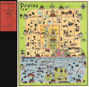
A Pictorial Map of Peiping in full colours.
sold
- Digital Map Information
- Suitable for large format printing
- Full resolution TIFF file
- ICC color profile embedded
- Delivered instantly via download link
This is John Kirk Sewall's rare c. 1928-1933 pictorial map of Beijing or Peking, China. This is one of two great pictorial maps of Beijing issued prior to World War II, the other being by Frank Dorn. The map uses color coding to divide ... (more details)
Exceptionally rare large format map of Beijing or Peking drawn after the Boxer Rebellion.
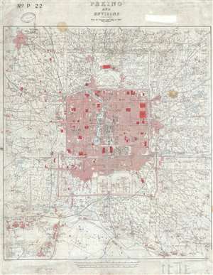
Peking and Environs From the German Staff Map of 1907 with additions.
sold
- Digital Map Information
- Suitable for large format printing
- File Size: 28.4 MB
- File Type: ZIP / TIFF
- ICC color profile embedded
- Delivered instantly via download link
This is an extremely rare 1909 British map of Beijing or Peking China drawn prepared by the British Ordnance Survey Office Southampton for the War Office. Cartographically the map is based upon a 1907 German map published in Berlin ... (more details)
Wonderful, charming idiosyncratic map of Beijing and Tianjin issued in China at the end of the Second Sino-Japanese War.
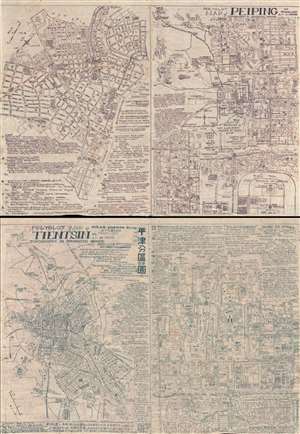
Polyglot Map of Peiping for Travellers or as Memo. / Polyglot Map of Tientsin.
sold
- Digital Map Information
- Suitable for large format printing
- File Size: 21.15 MB
- File Type: ZIP / TIFF
- ICC color profile embedded
- Delivered instantly via download link
A remarkable idiosyncratic multi-lingual discovery, this is a rare 1945 multi-colored broadsheet mimeograph map of Beijing (Peiping) and Tianjin (Tientsin), China. The map comprises of our maps printed back to back on a single ... (more details)
Uncommon early European map of Beijing or Peking China.
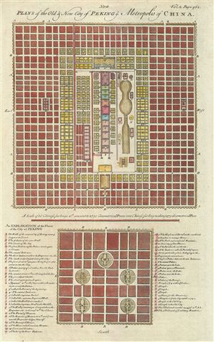
Plans of the Old & New City of Peking Metropolis of China.
sold
- Digital Map Information
- Suitable for large format printing
- DPI: 300
- File Size: 4.69 MB
- File Type: ZIP / TIFF
- ICC color profile embedded
- Delivered instantly via download link
An uncommon and appealing 1744 map of Beijing or Peking, China. The map features two maps of Beijing both drawn to scale. The larger upper map illustrates 'New Peking' c. 1700 while the smaller map shows ancient Beijing. Both ... (more details)
Published shortly after the Battle of Beiping-Tianjin, 1937.
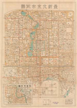
最新北京市街圖 / New Street Map of Beijing.
sold
- Digital Map Information
- Suitable for large format printing
- File Size: 25.35 MB
- File Type: ZIP / TIFF
- ICC color profile embedded
- Delivered instantly via download link
A rare 1937 map of Beijing (北京) issued following the Battle of Beijing (Battle of Beiping-Tianjin) and the Peiking-Tientsin Operation, or as the Japanese know it, the North China Incident. The main map covers Beijing in impressive detail, focusing on the Imperial City, Tartar or Inner City, and the central part of the Outer City, roughly between the Xibianmen and Dongbinamen gates. Throughout, the map names streets, hutongs, tramways, and neighborhoods. A smaller secondary map of Tianjin / Tientsin (天津市) appears in the lower left quadrant. Both cities were associated with the events of the Battle of Beiping-Tianjin. (more details)
Incredibly detailed city map of Beijing during the Interwar Period - identifies over 200 locations!
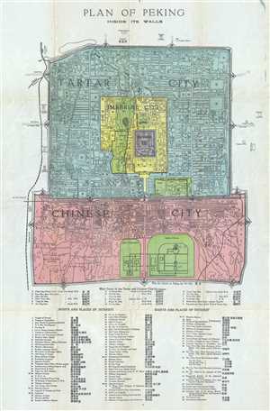
Plan of Peking Inside its Walls.
sold
- Digital Map Information
- Suitable for large format printing
- File Size: 8.7 MB
- File Type: ZIP / TIFF
- ICC color profile embedded
- Delivered instantly via download link
This is a 1924 Fei-Shi city map or plan of Beijing / Peking, China. The map depicts the city in great detail, numerically identifying over 210 locations throughout the city. The Tartar City, Chinese City, Legation Quarter, ... (more details)
One of the better English language maps of Beijing, published in Beijing, during World War II.
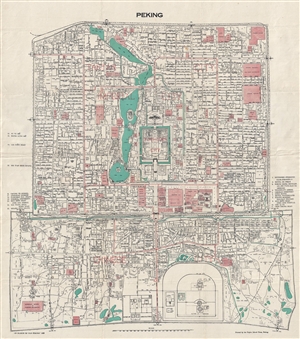
Peking.
sold
- Digital Map Information
- Suitable for large format printing
- File Size: 13.17 MB
- File Type: ZIP / TIFF
- ICC color profile embedded
- Delivered instantly via download link
An unusual 1939 map of Beijing or Peking, China, published by the Poplar Island Press, in Beijing. This map covers the old walled city of Beijing in considerable detail with many of the Chinese street names transliterated ... (more details)
Republican Era Beijing.
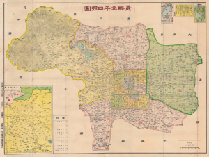
最詳北平四郊圖 / [Most detailed map of the four suburbs of Beiping].
sold
- Digital Map Information
- Suitable for large format printing
- File Size: 59.78 MB
- File Type: ZIP / TIFF
- ICC color profile embedded
- Delivered instantly via download link
This is a very rare Bai Meichu (白眉初) map of Beijing (Beiping) from 1937, on the eve of the Second Sino-Japanese War (1937 - 1945). The map features unique annotations that suggest hands-on administrative use in urban development and city planning during this critical period. (more details)
Rare map of Beijing prepared at the beginning of the Peip'ing (北平) period.
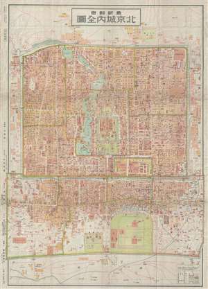
最新詳密 北京城內全圖 / The Latest Beijing City Map.
sold
- Digital Map Information
- Suitable for large format printing
- File Size: 13.51 MB
- File Type: ZIP / TIFF
- ICC color profile embedded
- Delivered instantly via download link
A scarce map of Beijing or Peking, China, issued in October of 1929 or Showa 4. The map details the inner and outer cities as well as the Forbidden City and the Legation Quarter. The map was drawn b the Japanese military ... (more details)