
Chase, Ernest Dudley (sold)
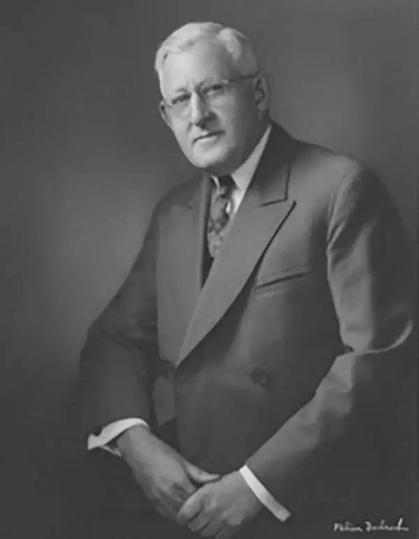
Ernest Dudley Chase (July 26, 1878 - August 25, 1966) was an American illustrator of greeting cards and pictorial maps active in the first half of the 20th century. From his studio in Winchester, Massachusetts, Chase became famous for his elaborately illustrated pictorial maps. He was born in Lowell, Massachusetts, and attended the Lowell Textile School and the Vesper George Art School. He took work with Butterfield Printing Company in 1900. In 1906, he moved to the W. T. Sheehan Printing Firm. He began producing postcards and greeting cards on his own account in 1908. This initial imprint was Des Arts Publishers, but later, he changed it to Ernest Dudley Chase Publishers. Chase is best known today for his distinctive pictorial maps, most of which he published privately, characterized by dense vignette images of important locations. The biographical pamphlet A Meticulous Maker of Maps describes Chase's attention to detail wherein, pursuing a 'passion for perfection' by stippling his images 'dot-by-dot, with tiny pens' under a magnifying glass. His impressive corpus includes nearly 50 maps focusing on various parts of the United States and Europe, as well as other international locations and novelty pieces. Most are thematic, focusing on topics such as wonders of the world, stamps, aviation, and war. Others, such as his map of The United States as viewed by California and Loveland are satirical. All, in their original editions, are coveted by a dedicated following of modern collectors.
A unusual variant state of Ernest Dudley Chase's map of the British Isles. Signed by Chase in the lower left, just under the copyright.
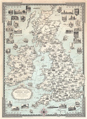
A Pictorial Map of the British Isles By Ernest Dudley Chase.
sold
- Digital Map Information
- Suitable for large format printing
- File Size: 13.26 MB
- File Type: ZIP / TIFF
- ICC color profile embedded
- Delivered instantly via download link
An uncommon signed 1935 pictorial map of the British Isles by Ernest Dudley Chase. The map covers all of England, Scotland, Wales, and Ireland. Chase uses the most important building in each town, usually a church or lordly manor, to symbolize the whole. London ... (more details)
Signed Ernest Dudley Chase's 1938 extraordinarily detailed whimsical pictorial map of Boston and its vicinity.
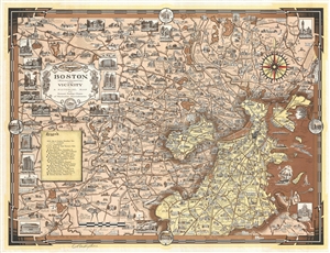
Boston (Massachusetts) and Vicinity. A Pictorial Map.
sold
- Digital Map Information
- Suitable for large format printing
- File Size: 14.38 MB
- File Type: ZIP / TIFF
- ICC color profile embedded
- Delivered instantly via download link
A fine example of Ernest Dudley Chase's 1938 extraordinarily detailed whimsical pictorial map of Boston and its vicinity. The map is roughly centered on Watertown and covers from Wayland to Boston Harbor and from Stoneham to Hyde Park. It features 20 large ... (more details)
Signed. Natural and Manufactured wonders.
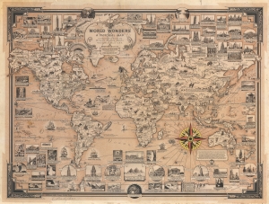
World Wonders. A Pictorial Map.
sold
- Digital Map Information
- Suitable for large format printing
- File Size: 76.71 MB
- File Type: ZIP / TIFF
- ICC color profile embedded
- Delivered instantly via download link
This is a 1939 Ernest Dudley Chase pictorial map of the world celebrating natural and manufactured wonders worldwide. Signed by Chase in pencil below the border in the lower left. Pictorial vignettes highlight structures on every continent, including bridges, skyscrapers, cathedrals, and monuments. Among these are the Empire State Building, the Colosseum, Angkor Wat, the Dome of the Rock, and Petra. Other vignettes capture Earth's natural wonders, including waterfalls, mountains, caves, and canyons. Smaller illustrations populate the continents, many of which illustrate Earth's diverse wildlife. Others emphasize human achievements, technological advances, or landmark moments in exploration. (more details)
Patriotic Pictorial Map of the United States.
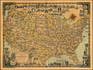
America the Wonderland. A Pictorial Map of the United States. Designed and Drawn by Ernest Dudley Chase of Winchester, Mass.
sold
This is a 1941 Ernest Dudley Chase pictorial map of the continental United States. Pictorial 'icons' fill the country from coast to coast and highlight American industry, culture, natural wonders, and resources. (more details)
Signed Example of Chase's popular World War II World Map.
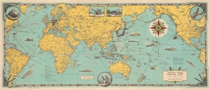
Total War Battle Map.
sold
- Digital Map Information
- Suitable for large format printing
- File Size: 22.69 MB
- File Type: ZIP / TIFF
- ICC color profile embedded
- Delivered instantly via download link
This is a 1942 Ernest Dudley Chase pictorial map of the world during World War II (1939 - 1945). It is one of a series of maps Chase produced to illustrate the war as it developed. (more details)
A fantastic pictorial map of South America highlighting the continent's flora, fauna, and man-made marvels.
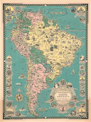
The Good Neighbor Pictorial Map of South America.
sold
- Digital Map Information
- Suitable for large format printing
- File Size: 35.15 MB
- File Type: ZIP / TIFF
- ICC color profile embedded
- Delivered instantly via download link
This is a 1942 Ernest Dudley Chase pictorial map of South America. The map depicts the continent from the Pacific Ocean to the Atlantic Ocean and from Costa Rica to Cape Horn. Incredibly detailed and beautifully illustrated, Chase highlights the wide array of flora and fauna that call South America home alongside its most spectacular natural and man-made sites. Illustrations of South American animals, including the condor, anteater, sloth, macaw, toucan, iguana, and chinchilla, fill the continent. The continent's other natural riches, such as Brazil's diamonds and emeralds, the rubber found in the Amazon, oil, cacao, and tea are also promoted. Cities and towns are labeled throughout, including Sao Paulo, Caracas, Bogota, Quito, La Paz, Lima, Montevideo, Buenos Aires, and Santiago. Each of these cities, along with many others, are also identified by illustrations of famous buildings, or, in the case of Rio de Janeiro, Copacabana Beach. Circular vignettes appear along all four borders and highlight famous buildings from across the continent, the majority of which are churches. Others illustrate world famous sites, such as Machu Picchu, Iguazu Falls, and the Christ the Redeemer statue in Rio de Janeiro. A portrait of Simón Bolívar is included below the title cartouche with a caption celebrating the liberation movement that he instigated from Colombia to Chile. (more details)
Provides a fantastic overview of where the Pacific War was fought.
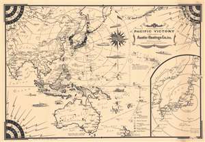
A Pictorial Map Pacific Victory.
sold
- Digital Map Information
- Suitable for large format printing
- File Size: 43.18 MB
- File Type: ZIP / TIFF
- ICC color profile embedded
- Delivered instantly via download link
This is a 1944 Ernest Dudley Chase pictorial map of the Pacific Ocean during World War II. Depicting from central Asia to the west coast of the United States, Chase identifies islands throughout the Pacific, many of which were points of contention during the war. (more details)
Targeting the Home Islands.
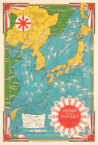
Japan, The Target A Pictorial Jap-Map.
sold
- Digital Map Information
- Suitable for large format printing
- File Size: 18.23 MB
- File Type: ZIP / TIFF
- ICC color profile embedded
- Delivered instantly via download link
This is a rare 1944 Ernest Dudley Chase pictorial map of Japan, Korea, and Taiwan, reflecting the steady advance of Allied forces towards the Home Islands in the final phase of World War II (1939 - 1945) in the Pacific. It is signed by Chase in pencil on the lower margin. (more details)
A Spanish language reduction of Ernest Dudley Chase's map of North America published by a Mexican magazine.
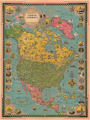
Mapa Pictórico de Norte America.
sold
- Digital Map Information
- Suitable for large format printing
- File Size: 22.32 MB
- File Type: ZIP / TIFF
- ICC color profile embedded
- Delivered instantly via download link
This is a 1945 Spanish translation of an Ernest Dudley Chase pictorial map of North America. Cities throughout the continent, from Anchorage, Alaska, to Panama City, Panama, are labeled in black lettering, with the capitals identified by block letters. Profile views of famous buildings enhance these labels, some of which include the White House, numerous state capital buildings, Guadalajara Cathedral, and the Mexico City Metropolitan Cathedral. Similar views also mark important cultural and natural sites, including Arches National Park, Yellowstone National Park (Old Faithful), Hoover Dam, Mesa Verde National Park, and Chichen Itza. Vignette views of other sites around the region, such as Rockefeller Center, the Capitol Building in Washington, D.C., Niagara Falls, the French Quarter in New Orleans, and the Capitol Building in Havana. (more details)
An extremely rare Spanish language reduction of Ernest Dudley Chase's map of the history of flight published in Mexico.
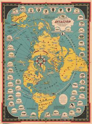
Mapa Historico de la Aviacion o Cronica de la Conquista del Aire por el Hombre.
sold
- Digital Map Information
- Suitable for large format printing
- File Size: 19.2 MB
- File Type: ZIP / TIFF
- ICC color profile embedded
- Delivered instantly via download link
This is a 1945 Spanish translation of an Ernest Dudley Chase pictorial map of the history of aviation that was published in Mexico. A reduced version of Chase's map entitled 'The Story Map of Flying', small vignettes highlighting landmark achievements in aviation encircle a map of the world drawn on a polar projection. Planes, both real and imaginary, are illustrated flying across the world. Some of these include flying boats, early airliners, and bombers flown during World War II, including the Consolidated B-24 Liberator and the Boeing B-17 Flying Fortress. Humanity's earliest attempts at flight are chronicled beginning at the top left and proceeding clockwise, from the unsuccessful attempts to fly with wings strapped to one's arms, to hot air balloons, and then several unsuccessful attempts to create powered flying machines. The Wright Flyer, recognized as the first successful heavier-than-air powered aircraft, is illustrated just below the title, next to Charles Lindbergh's Spirit of St. Louis, in which Lindbergh completed the first successful solo flight across the Atlantic Ocean. Other aviation pioneers referenced here include Glenn Curtis, Richard Byrd, Amelia Earhart, Wiley Post, and Howard Hughes. (more details)
Celebrates Alexander Graham Bell's 100th birthday.
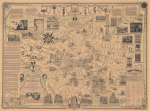
Boston Birthplace of the Telephone. A Pictorial Map of the down town area.
sold
- Digital Map Information
- Suitable for large format printing
- File Size: 84.43 MB
- File Type: ZIP / TIFF
- ICC color profile embedded
- Delivered instantly via download link
This is a 1947 Ernest Dudley Chase pictorial map of Boston, Massachusetts, tracing the history of Alexander Graham Bell's invention of the telephone. (more details)
Charming pictorial map of Cape Cod.
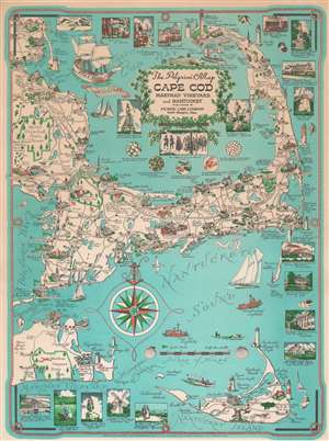
This is a 1956 Clara K. Chase revision of Ernest Dudley Chase's iconic map of Cape Cod, Martha's Vineyard, and Nantucket. The map covers from Marshfield to Nantucket and from Martha's Vineyard to Provincetown, comprehensive of the towns of Duxbury, Kingston, Plymouth, Falmouth, Hyannis, Chatham, Wellfleet, Nantucket, and Edgartown, among others. Historical sites are rendered in profile. Wonderful vignettes surround the map, most of which are annotated with descriptive text, some of which are quite humorous. (more details)
Celebrating Alaska's admission into the Union on January 3, 1959.
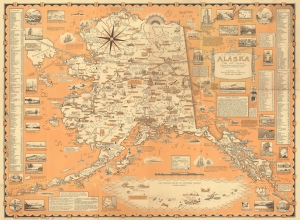
This 1959 Ernest Dudley Chase pictorial map of Alaska celebrates January 3, 1959, when President Dwight D. Eisenhower signed the bill making Alaska the 49th state. (more details)
Scarce late edition of Ernest Dudley Chase's iconic map of Cape Cod showing the Kennedy Compound.
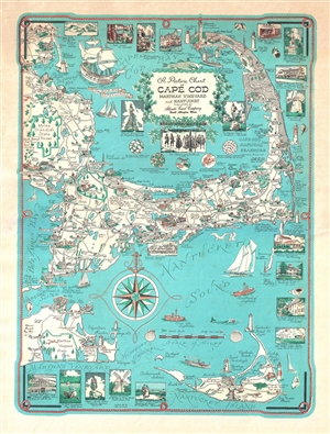
Picture Chart of Cape Cod, Martha's Vineyard and Nantucket.
sold
- Digital Map Information
- Suitable for large format printing
- File Size: 6.49 MB
- File Type: ZIP / TIFF
- ICC color profile embedded
- Delivered instantly via download link
This is a c. 1960 revision of Ernest Dudley Chase's iconic map of Cape Cod, Martha's Vineyard, and Nantucket. The map covers from Marshfield to Nantucket and from Martha's Vineyard to Provincetown. It includes the additional historic towns of Duxbury, Kingston, Plymouth, Falmouth, Hyannis, Chatham, Wellfleet, Nantucket, and Edgartown, among many others. Historical sites are rendered in profile. Surrounding the map there are countless vignettes, most of which are annotated with descriptive text, some quite humorous. President Kennedy's Summer Home is in evidence near Hyannis Port – a revision that appeared c. 1960 after Kennedy was elected. (more details)
One year after statehood - Hawaiian edition.
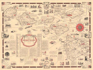
Aloha. A Pictorial Map of the Hawaiian Islands. The United States' Fiftieth State.
sold
This is a scarce 1960 Ernest Dudley Chase and Doris Riemann pictorial map of Hawaii, a visually rich and educational celebration of the archipelago a year after statehood. This is one of the scarcer Chase maps, especially as here, in its Hawaiian edition. (more details)
Come visit Massachusetts after seeing the New York World's Fair!
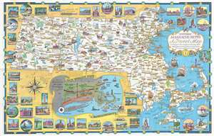
One of Ernest Dudley Chase's less common pictorial maps, this map of Massachusetts was created for the Massachusetts Pavilion at the 1964 New York World's Fair. Charmingly illustrated with eye-catching color, the map highlights the sightseeing opportunities of the Bay State. Historic buildings throughout are illustrated in profile and in the vignettes that frame the map. Historic ships, such as the Mayflower and Old Ironsides, ply the waters off the Massachusetts coast. An inset along the bottom border illustrates routes to tempt travelers into a side trip to Massachusetts after visiting the World's Fair, highlighting Boston, Plymouth, and in particular the New Bedford Whaling Museum, which had lent a 175-foot section of the famous 1,295-foot-long Whaling Panorama to the New England Pavilion restaurant. Numerous vignettes highlight activities available to the visitor, such as fishing, golfing, horseback riding, and boating. Historic sites from around the state, including Springfield Armory, Faneuil Hall in Boston, and the Bunker Hill Monument in Charlestown are noted for the less sporty tourist. (more details)