
Dezauche, Jean-Claude (sold)

Jean-Claude Dezauche (1745 - 1824) was a French map publisher active in Paris during the first half of the 19th century. He established his own engraving firm around 1770 after having engraved music since 1762. Dezauche bought the archives of Phillipe Buache and Guillaume de L'Isle from Jean Nicholas Buache, Buache's heir, in 1780. Dezauche soon obtained a monopoly on selling the charts produced by the Dépôt de la Marine. Jean-Claude Dezuache passed his business to his son, Jean André Dezauche, upon his death, who took over selling the Dépôt de la Marine charts.
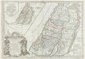
Carte de la terre des Hebreux ou Israelites partagee selon l'ordre de Dieu aux douze tribus descendantes des douze fils de Jacob…
sold
- Digital Map Information
- Suitable for large format printing
- DPI: 300
- File Size: 23.12 MB
- File Type: ZIP / TIFF
- ICC color profile embedded
- Delivered instantly via download link
A fine example of Delamarche's exceptional 1745 map of the Holy Land, Israel, or Palestine. Details the region on both sides of the Jordan River with the Mediterranean shoreline running from Sidon to Raphia. The map depicts the region divided according to the ... (more details)
A monument to speculative cartography showing the Sea of the West and mythical discoveries of De Fonte.
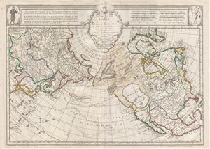
Carte Des Nouvelles Decouvertes au Nord de la Mer de Sud, tant a l'Est de la Syberie et du Kamtchatka, qu'a L'Ouest de la Nouvelle France.
sold
- Digital Map Information
- Suitable for large format printing
- DPI: 300
- File Size: 20.31 MB
- File Type: ZIP / TIFF
- ICC color profile embedded
- Delivered instantly via download link
The 1789 Dezauche edition of Joseph Nicolas De l'Isle's extraordinary 1752 map of North America, Siberia, the Arctic, and the North Pacific. J. N. De L'Isle and Buache drew this map to illustrate their speculations on the feasibly of a Northwest Passage. ... (more details)
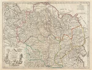
Carte de Tartarie.
sold
- Digital Map Information
- Suitable for large format printing
- DPI: 300
- File Size: 24.1 MB
- File Type: ZIP / TIFF
- ICC color profile embedded
- Delivered instantly via download link
A fascinating 1766 Guillaume Delisle map of Tartary comprising most of Asian Russia, Siberia, Mongolia, Korea, northern China, and Independent Tartary. The map covers the vast expanse of northern Asia from the Black Sea and Gulf of Finland eastward as far ... (more details)
Rare French map detailing the Golden Age of Caribbean Piracy.
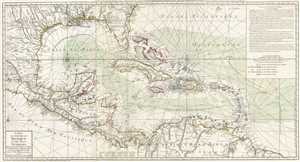
Carte du Golphe du Mexique et des Isles Antilles.
sold
- Digital Map Information
- Suitable for large format printing
- DPI: 300
- File Size: 17.7 MB
- File Type: ZIP / TIFF
- ICC color profile embedded
- Delivered instantly via download link
A fine example of the 1780 Dezauche edition of Buache's important map of the West Indies. Centered on Cuba, this massive map covers Central America, the Gulf of Mexico, the West Indies, and the Caribbean from Mexico and Texas to the Lesser Antilles and from Florida to the Spanish Main. Cartographically, Buache derived this map from Henry Popple's remarkable 1733 map of North America. As a whole it exhibits numerous significant advances over the earlier Buache / De L'Isle model of the region. These include a more sophisticated mapping of peninsular Florida, the Gulf Coast, and the interior of Texas, Florida, and Mexico. The Mission de Los Teijas, one of the first usages of the word 'Texas' on a published map, is noted. Rumb lines are evident throughout, suggesting this map was also based on sea chart sources. (more details)
Rare French map detailing the Golden Age of Caribbean Piracy.
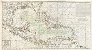
Carte du Golphe du Mexique et des isles Antilles.
sold
- Digital Map Information
- Suitable for large format printing
- DPI: 300
- File Size: 30.45 MB
- File Type: ZIP / TIFF
- ICC color profile embedded
- Delivered instantly via download link
A fine example of the 1780 Dezauche edition of Buache's important map of the West Indies. Centered on Cuba, this massive map covers Central America, the Gulf of Mexico, the West Indies, and the Caribbean from Mexico and Texas to the Lesser Antilles and ... (more details)
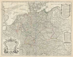
L'Allemagne Dressee sur les observations de Tycho-Brahe, de Kepler, de Snellius, sur celles de Messieurs de l'Academie Royale des Sciences etc.
sold
- Digital Map Information
- Suitable for large format printing
- DPI: 300
- File Size: 21.71 MB
- File Type: ZIP / TIFF
- ICC color profile embedded
- Delivered instantly via download link
An appealing 1780 map of Germany by Delisle. This is a later revision, by Jean-Claude Dezauche, of Guillaume De L'isle's map of 1701. This map, which underwent numerous republications, covers the Germanic territories from the Baltic Sea to the Gulf of ... (more details)
The Swan Song of Speculative Cartography regarding the Pacific Northwest.
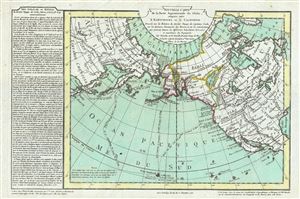
Nouvelle Carte de la Partie Septentrionale du Globe, comprise entre le Kamtchatka et la Californie.
sold
- Digital Map Information
- Suitable for large format printing
- DPI: 300
- File Size: 7.68 MB
- File Type: ZIP / TIFF
- ICC color profile embedded
- Delivered instantly via download link
Truly one of the scarcest and most extraordinary maps we have ever seen, this is Jean-Nicholas Buache de Neuville's 1781 map of the North Pacific, North America, and Siberia. This map is so dense with cartographic curiosity that it is as if Buache de ... (more details)
A remarkable Pre-Cook polar projection showing the Arctic and the Sea of the West.
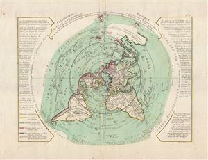
Planisphere Physique.
sold
- Digital Map Information
- Suitable for large format printing
- DPI: 300
- File Size: 12.32 MB
- File Type: ZIP / TIFF
- ICC color profile embedded
- Delivered instantly via download link
An exceptionally bright and beautiful c. 1781 Philippe Buache map of the world presented on an unusual polar projection rendered from the North Pole. The map covers from the North Pole Arctic region south beyond Tasmania (Van Diemen's Land) to ... (more details)
A remarkable Pre-Cook polar projection showing the Arctic and the Sea of the West.
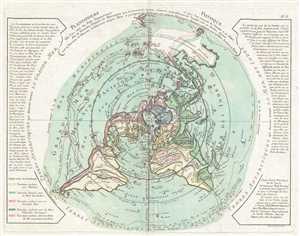
Planisphere Physique.
sold
- Digital Map Information
- Suitable for large format printing
- DPI: 300
- File Size: 7.47 MB
- File Type: ZIP / TIFF
- ICC color profile embedded
- Delivered instantly via download link
An exceptionally bright and beautiful c. 1781 Philippe Buache map of the world presented on an unusual polar projection rendered from the North Pole. The map depicts the world from the North Pole Arctic region south beyond Tasmania (Van ... (more details)
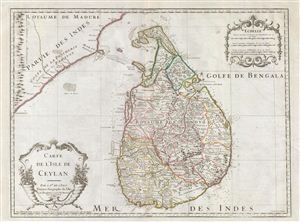
Carte de L'Isle de Ceylan.
sold
- Digital Map Information
- Suitable for large format printing
- Full resolution TIFF file
- ICC color profile embedded
- Delivered instantly via download link
The Dezauche issue of Guillaume de L'Isle's fine map of Ceylon or Sri Lanka. A fine example of De L'Isle's work this map covers the entire island of Ceylon as well as the surrounding seas and parts of adjacent India. As this map was ... (more details)
The first edition of this important map to illustrate all three of Cook's seminal voyages.
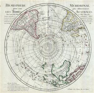
L'Hemisphere Meridional pour voir plus distinctement Les Terres Australes.
sold
- Digital Map Information
- Suitable for large format printing
- DPI: 300
- File Size: 14.89 MB
- File Type: ZIP / TIFF
- ICC color profile embedded
- Delivered instantly via download link
This is a stunning map of the Southern Hemisphere drawn by Guillaume de L'Isle and updated in 1782 by Jean-Claude Dezauche. Extends from the South Pole northwards in all directions as far as the Equator, encompassing in the process ... (more details)
A foundational map and the first to name 'Texas'.

Carte De La Louisiane Et Du Cours Du Mississipi Avec Les Colonies Anglaises.
sold
- Digital Map Information
- Suitable for large format printing
- DPI: 300
- File Size: 22.82 MB
- File Type: ZIP / TIFF
- ICC color profile embedded
- Delivered instantly via download link
A foundational map and one of the most important illustrations of North America ever published, this the 1782 Dezauche edition Guillaume De L'Isle's influential Carte de la Louisiane et du Cours du Mississipi . Originally issued in ... (more details)
Beautifully illustrates the intriguing discoveries of the Baron Lahonton.
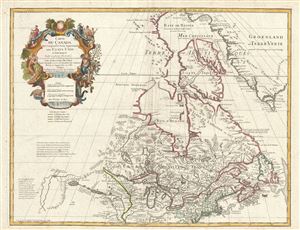
Carte du Canada Qui Comprend la Partie Septentrionale des Etats Unis D'Amerique.
sold
- Digital Map Information
- Suitable for large format printing
- DPI: 300
- File Size: 20 MB
- File Type: ZIP / TIFF
- ICC color profile embedded
- Delivered instantly via download link
This is the 1783 Dezauche issue of Phillipe Buache and Guillaume D L'Isle's important map of northern North America. The map covers the United States north of the Chesapeake and Canada or New France. De L'Isle first issued this ... (more details)
The only edition of this landmark map to include the United States.
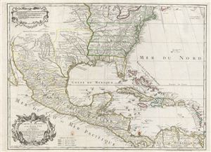
Carte du Mexique et des Etats unis d'Amerique, Partie Meridionale.
sold
- Digital Map Information
- Suitable for large format printing
- DPI: 300
- File Size: 20.63 MB
- File Type: ZIP / TIFF
- ICC color profile embedded
- Delivered instantly via download link
This is the 1783 Dezauche issue of Phillipe Buache and Guillaume D L'Isle's important map of North America and the West Indies. The map covers the United States, Mexico, New Mexico, Central America and the West Indies or ... (more details)
First of this series to recognize the United States.
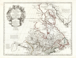
Carte du Canada Qui Comprend la Partie Septentrionale des Etats Unis D'Amerique.
sold
- Digital Map Information
- Suitable for large format printing
- Full resolution TIFF file
- ICC color profile embedded
- Delivered instantly via download link
This is the 1783 Dezauche issue of Guillaume de l'Isle's map of Canada and the Northern United States. Published after the close of the American Revolutionary War (1775 - 1783), this is one of the first French maps to formally recognize the United States. (more details)
One of the last French maps to use the term 'Sea of Korea'.
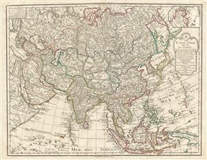
Carte D'Asie dressee pour L'Instruction…
sold
- Digital Map Information
- Suitable for large format printing
- DPI: 300
- File Size: 20.59 MB
- File Type: ZIP / TIFF
- ICC color profile embedded
- Delivered instantly via download link
A rare and attractive 1800 map of Asia by Guillaume Delisle and Philippe Buache. Centered on Independent Tartary, this map covers the entire continent from Africa and the Mediterranean east to the Bering Sea and south as ... (more details)
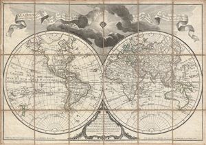
Mappemonde a l'usage de l'Instr.on par Guillaume Delisle et Philippe Buache Premiers Geographes et de l'Academie des Sciences. Revue e Augmentee des Nles. Decouvertes par Dezauche en 1808.
sold
- Digital Map Information
- Suitable for large format printing
- DPI: 300
- File Size: 23.46 MB
- File Type: ZIP / TIFF
- ICC color profile embedded
- Delivered instantly via download link
An uncommon and appealing 1808 pocket map of the world in two hemispheres by Dezauche. This is a later revision, by Dezauche, of Guillaume de Lisle and Phillipe Buache's map of 1785. This popular map, which underwent ... (more details)
A call for brotherhood against the hated English.
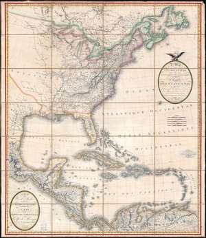
A Map of the United States and Canada, New-Scotland, New-Brunswick and New-Foundland. / Carte des Etats-Unis, avec le Canada, La Nouvelle Ecosse, Le Nouveau Brunswick et Terre-Neuve. / A Map of the West-Indies and of the Mexican-Gulph. / Carte des Indies Occidental et du Golfe du Méxique.
sold
- Digital Map Information
- Suitable for large format printing
- Full resolution TIFF file
- ICC color profile embedded
- Delivered instantly via download link
A lavish, large-scale French map of the United States and West Indies issued in September of 1812 - shortly after the outbreak of the War of 1812 (1812 - 1815). This is one of the few major French cartographic productions not focused on Europe to appear during the Napoleonic Wars (1803 - 1815) and needs to be addressed in this context to be fully understood. With titles both in English and French, it calls for brotherhood and alliance against the hated English. (more details)