
Diderot, Denis (sold)
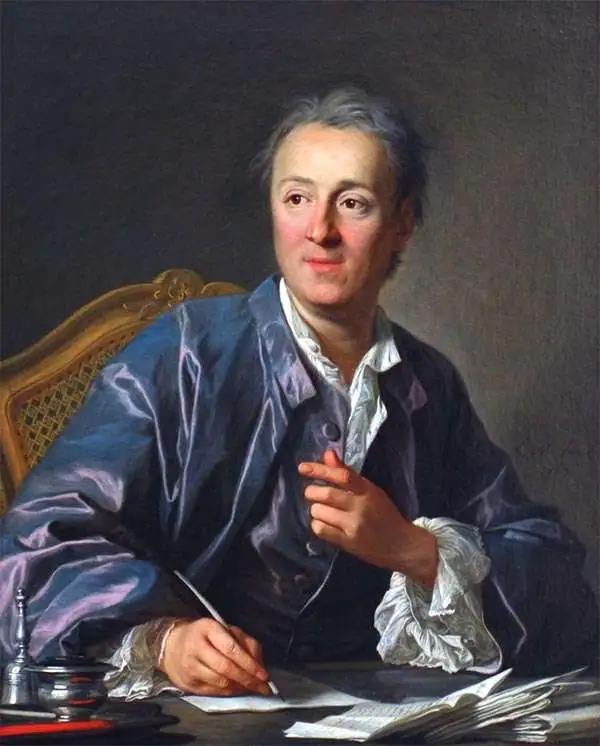
Denis Diderot (October 5, 1713 - July 31, 1784) was a French Enlightenment era philosopher, publisher and writer. Diderot was born in the city of Langres, France and educated at the Lycée Louis le Grand where, in 1732, he earned a master of arts degree in philosophy. Diderot briefly considered careers in the clergy and in law, but in the end chose the more fiscally challenge course of a writer. Though well respected in philosophical circles Diderot was unable to obtain any of the government commissions that commonly supported his set and consequently spent much of his life in deep poverty. He is best known for his role in editing and producing the Encyclopédie . The Encyclopédie was one of the most revolutionary and impressive works of its time. Initially commissioned as a translation of Ephraim Chambers' Cyclopaedia, or Universal Dictionary of Arts and Sciences, Diderot instead turned into a much larger and entirely new work of monumental depth and scope. Diderot's Encyclopédie was intended to lay bare before the common man the intellectual mysteries of science, art and philosophy. This revolutionary mission was strongly opposed by the powers of the time who considered a learned middle class it a threat to their authority. In the course of the Encyclopédie production Diderot was imprisoned twice and the work itself was officially banned. Nonetheless, publication continued in response to a demand exceeding 4000 subscribers. The Encyclopédie was finally published in 1772 in 27 volumes. Following the publication of the Encyclopédie Diderot grew in fame but not in wealth. When the time came to dower his only surviving daughter, Angelique, Diderot could find no recourse save to sell his treasured library. In a move of largess, Catherine the II Russia sent an emissary to purchased the entire library on the condition that Diderot retain it in his possession and act as her "librarian" until she required it. When Diderot died of gastro-intestinal problems 1784, his heirs promptly sent his vast library to Catherine II who had it deposited at the Russian National Library, where it resides to this day.
First cartobibliography of the Northwest Passage.
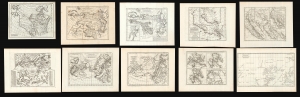
Carte des parties nord et oust de L'Amerique/ Carte des parties Nord et est de L'Asie/Nouvelle représentation Des Côtes Nord et Est de l'Asie/ Carte de la Californie et des Pays Nord-Ouest separés de l'Asie par le détroit d'Anian./ Carte de la Californie Suivant.../ Carte des Nouvelles Decouvertes dressée par Phil. Buache/ Carte Générale des Découvertes de l'Amiral de Fonte…/ Carte Generale des Découvertes de l'Amiral de Fonte ... Jefferys/ Carte qui Représente les différentes connoissances que l'on a eues des Terres Arctiques depuis 1650 jusqu'en 1747 / Partie de la Carte du Capitaine Cluny…
sold
This is Robert de Vaugondy's seminal 1772 map series exploring the mapping of North America, Asia, and specifically the Northwest Passage, summarizing three centuries of cartography. Included as a supplement to Diderot's 1772 Encyclopédie, this was among the first studies in comparative cartography committed to print. The cartographic survey embraced some of the most important topics in 18th-century geography and might justifiably be proposed as the first cartobibliography.
(more details)
(more details)
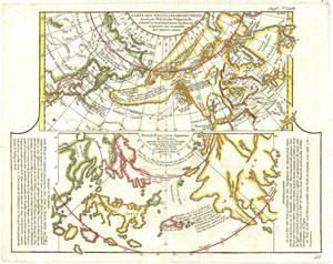
Carte Des Nouvelles Decouvertes dressee par Phil. Bauche Pr. Geograp? Du Roi presentee a l'Adad? Des Sciences le g Aout 1762 et approuvee dans son assemblee du 6 Septembre suivant. / Extrait d'une Carte Japonoise de L'Univers apportee en Europe par Kaempser et deposee dans le cabinet de seu Mr. Han-Sloane president de la Soceity Royale de Londres.
sold
- Digital Map Information
- Suitable for large format printing
- DPI: 300
- File Size: 6.48 MB
- File Type: ZIP / TIFF
- ICC color profile embedded
- Delivered instantly via download link
This is a fascinating combination of two contrasting maps on a single sheet. Both maps cover the northeastern parts of Asia and the northwestern parts of North America. This two map chart was originally drawn by Phillip Buache to expound upon his theories ... (more details)
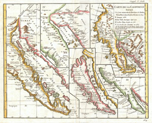
Carte de la Californie suivant / I. La carte manuscrite de l'Amérique de Mathieu Néron Pecci olen dresse à Florence en 1604 / II. Sanson 1656 / III. De L'Isle Amérique Sept. 1700 / IV. le Pere Kino Jesuite en 1705 / V. La Societe des Jésuites en 1767.
sold
- Digital Map Information
- Suitable for large format printing
- DPI: 300
- File Size: 6.85 MB
- File Type: ZIP / TIFF
- ICC color profile embedded
- Delivered instantly via download link
A rare and important map of California in five different states, ranging from roughly 1656 to 1767. Engraved by the important French cartographer Robert De Vaugondy, for the c. 1770 edition of the Denis Diderot (1713-84) Encyclopedie . This map explores the ... (more details)
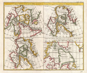
CARTE qui represente les différentes connoissances que l’on a eues des TERRES ARCTIQUES depuis 1650 jusqu’en 1747 ausquelles il faut comparer la Carte suivante Cte 10 Par M de Vaugondy 1773
sold
- Digital Map Information
- Suitable for large format printing
- Full resolution TIFF file
- ICC color profile embedded
- Delivered instantly via download link
This is a fascinating combination of four contrasting maps of the same area a single sheet. All four maps cover the northeastern part of America and Greenland, including the Hudson, Button and Baffin Bay regions, the Davis Straits and the Coast Labrador. ... (more details)
A fascinating 17th century pre-Cook speculation on the configuration of northwestern America.
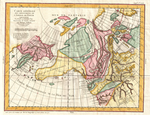
Carte Generale Des Decouvertes de L'Amiral de Fonte representant la grand porbabilite d'un Passage Au Nord Ouest par Thomas Jefferys Geographe du Roi a Londres 1768.
sold
- Digital Map Information
- Suitable for large format printing
- DPI: 300
- File Size: 15.19 MB
- File Type: ZIP / TIFF
- ICC color profile embedded
- Delivered instantly via download link
A truly fascinating 1772 map of the northwestern parts of North America by Robert de Vaugondy and Thomas Jefferys. Essentially depicts the north eastern parts of Asia, speculations on northwestern America, and Admiral De Fonte's mythical conception of a ... (more details)
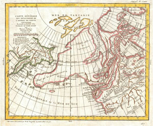
Carte Generale Des Decouvertes de L'Amiral de Fonte representant la grand porbabilite d'un Passage Au Nord Ouest par Thomas Jefferys Geographe du Roi a Londres 1768.
sold
- Digital Map Information
- Suitable for large format printing
- DPI: 300
- File Size: 7.1 MB
- File Type: ZIP / TIFF
- ICC color profile embedded
- Delivered instantly via download link
A truly fascinating 1772 map of the northwestern parts of North America by Robert de Vaugondy. Essentially depicts the north eastern parts of Asia, speculations on northwestern America and Admiral De Fonte's mythical conception of a Northwest Passage. ... (more details)
Cartographic game of telephone.
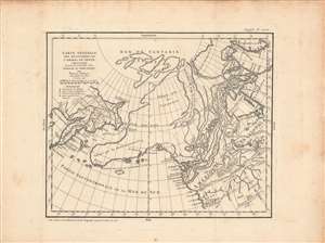
Carte Generale Des Decouvertes de L'Amiral de Fonte representant la grand porbabilite d'un Passage Au Nord Ouest par Thomas Jefferys Geographe du Roi a Londres 1768.
sold
- Digital Map Information
- Suitable for large format printing
- DPI: 600
- File Size: 41.16 MB
- File Type: ZIP / TIFF
- ICC color profile embedded
- Delivered instantly via download link
A fascinating 1772 map of the northwestern parts of North America by Robert de Vaugondy. It depicts the northeastern parts of Asia, speculations on northwestern America and Admiral De Fonte's mythical conception of a Northwest Passage. Robert de Vaugondy prepared this map prior to James Cook's voyages, when Europe was rampant with speculation both regarding the existence of a Northwest Passage and the northwestern parts of America in general. The discoveries of Admiral de Fonte and Juan de Fuca, though now known to be mythical, inspired the European imagination. (more details)
The Early History of the Mapping of the Northeast Passage, on a Single Sheet
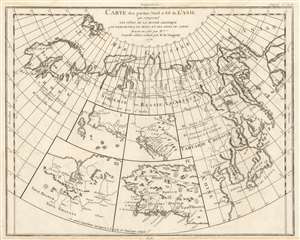
Carte des Parties Nord et Est de l'Asie qui Comprend les Cotes de la Russie Asiatique le Kamschatka, le Iesso, et les Isles du Japon.
sold
- Digital Map Information
- Suitable for large format printing
- DPI: 600
- File Size: 9.67 MB
- File Type: ZIP / TIFF
- ICC color profile embedded
- Delivered instantly via download link
A map of the Northeast Passage, the northeast coasts of Asia, and the American Northwest. The Northeast Passage, much like American's Northwest Passage, was a long sought after sea route through the Arctic that would save European merchantman the expense ... (more details)
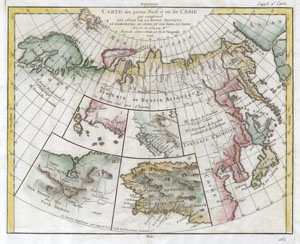
Carte des Parties Nord et Est de l'Asie qui Comprend les Cotes de la Russie Asiatique le Kamschatka, le Iesso, et les Isles du Japon.
sold
- Digital Map Information
- Suitable for large format printing
- DPI: 300
- File Size: 3.16 MB
- File Type: ZIP / TIFF
- ICC color profile embedded
- Delivered instantly via download link
A map of the Northeast Passage, the northeast coasts of Asia, and the American Northwest. The Northeast Passage, much like American's Northwest Passage, was a long sought after sea route through the Arctic that would save European merchantman the ... (more details)
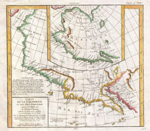
Carte De La Californie et Des Pays Nord-Ouest separes de L'Asie par le Detroit d'Anian, extraite de deux cartes publiees au commencement de 17e Siecle.
sold
- Digital Map Information
- Suitable for large format printing
- DPI: 300
- File Size: 6.62 MB
- File Type: ZIP / TIFF
- ICC color profile embedded
- Delivered instantly via download link
A very interesting 1772 map of the western part of North America by Vaugondy. Includes two contrasting maps, both drawn from larger 17th century maps by Visscher, covering from Cabo san Lucas northward along Baja California to modern day Alaska ... (more details)
The California-as-an-island Myth At A Glance
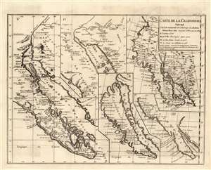
Carte de la Californie suivant I. La carte manuscrite de l'Amerique de Mathieu Neron Pecci olen dresse a Florence en 1604 II. Sanson 1656 III. De L'Isle Amerique Sept. 1700 IV. le Pere Kino Jesuite en 1705 V. La Societe des Jesuites en 1767.
sold
- Digital Map Information
- Suitable for large format printing
- DPI: 600
- File Size: 14.7 MB
- File Type: ZIP / TIFF
- ICC color profile embedded
- Delivered instantly via download link
This is a scarce and important engraving combining five seminal maps of California on one sheet. European understanding of the region’s geography was convoluted and changed many times over the course of more than a century. This map, engraved by the important French cartographer Robert De Vaugondy for the 1772 edition of the Denis Diderot (1713-84) Encyclopedie, traces the gradual clarification of the geography of California through five key stages in the mapping of the region. It opens with the work of Italian cartographer Matheau Neron Pecci (1604) which correctly presumed that the main body of California extended southward into a peninsula. The next map illustrated, by Nicolas Sanson in 1656, was among the most influential of the maps of the 17th century to propose an insular California. Map no. III, by Guillaume Delisle (1700), was one of the first maps produced by a prominent geographer to abandon the insular California. The fourth is the seminal Kino Map. This map, rendered by a Jesuit missionary c.1705, was the work that finally disproved the California Insular theory. Father Franz Kino walked this region between 1698 and 1701. The final map, produced by unnamed Jesuits c. 1767 is a more accurate depiction of the Baja California peninsula. These maps all predate the discoveries of Captain Cook's voyages and hence Diderot's work was as much speculative as historical in many respects - though the Jesuit reports pertaining to California’s non-insularity were authoritative. A fine example of an essential work for all serious California collections.
This map is part of the 10 map series prepared by Vaugondy for the Supplement to Diderot's Encyclopedie, of which this is plate 5. This remarkable map series, exploring the mapping of North America and specifically the Northwest Passage was one of the first studies in comparative cartography. (more details)
This map is part of the 10 map series prepared by Vaugondy for the Supplement to Diderot's Encyclopedie, of which this is plate 5. This remarkable map series, exploring the mapping of North America and specifically the Northwest Passage was one of the first studies in comparative cartography. (more details)
Geographical theories about California.
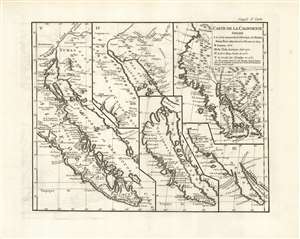
Carte de la Californie suivant I. La carte manuscrite de l'Amerique de Mathieu Neron Pecci olen dresse a Florence en 1604 II. Sanson 1656 III. De L'Isle Amerique Sept. 1700 IV. le Pere Kino Jesuite en 1705 V. La Societe des Jesuites en 1767.
sold
- Digital Map Information
- Suitable for large format printing
- Full resolution TIFF file
- ICC color profile embedded
- Delivered instantly via download link
This is a scarce and important 1772 Robert de Vaugondy composite map of California, combining five seminal maps on a single sheet. European understanding of the region’s geography was convoluted and changed many times over more than a century. This map, engraved by the important French cartographer Robert De Vaugondy for the 1772 edition of the Denis Diderot (1713-84) Encyclopedie, traces the gradual clarification of the geography of California through five key stages. (more details)
The California-as-an-island Myth At A Glance
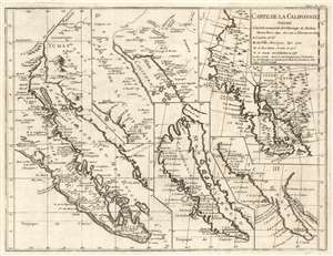
Carte de la Californie suivant I. La carte manuscrite de l'Amerique de Mathieu Neron Pecci olen dresse a Florence en 1604 II. Sanson 1656 III. De L'Isle Amerique Sept. 1700 IV. le Pere Kino Jesuite en 1705 V. La Societe des Jesuites en 1767.
sold
- Digital Map Information
- Suitable for large format printing
- DPI: 600
- File Size: 12.45 MB
- File Type: ZIP / TIFF
- ICC color profile embedded
- Delivered instantly via download link
This is a rare and important engraving combining five seminal maps of California on one sheet. European understanding of the region’s geography was convoluted and changed many times over the course of more than a century. This map, engraved by the important French cartographer Robert De Vaugondy for the 1772 edition of the Denis Diderot (1713-84) Encyclopedie, traces the gradual clarification of the geography of California through five key stages in the mapping of the region. It opens with the work of Italian cartographer Matheau Neron Pecci (1604) which correctly presumed that the main body of California extended southward into a peninsula. The next map illustrated, by Nicolas Sanson in 1656, was among the most influential of the maps of the 17th century to propose an insular California. Map no. III, by Guillaume Delisle (1700), was one of the first maps produced by a prominent geographer to abandon the insular California. The fourth is the seminal Kino Map. This map, rendered by a Jesuit missionary c.1705, was the work that finally disproved the California Insular theory. Father Franz Kino walked this region between 1698 and 1701. The final map, produced by unnamed Jesuits c. 1767 is a more accurate depiction of the Baja California peninsula. These maps all predate the discoveries of Captain Cook's voyages and hence Diderot's work was as much speculative as historical in many respects - though the Jesuit reports pertaining to California’s non-insularity were authoritative. A fine example of an essential work for all serious California collections.
This map is part of the 10 map series prepared by Vaugondy for the Supplement to Diderot's Encyclopedie, of which this is plate 5. This remarkable map series, exploring the mapping of North America and specifically the Northwest Passage was one of the first studies in comparative cartography. (more details)
This map is part of the 10 map series prepared by Vaugondy for the Supplement to Diderot's Encyclopedie, of which this is plate 5. This remarkable map series, exploring the mapping of North America and specifically the Northwest Passage was one of the first studies in comparative cartography. (more details)
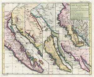
Carte de la Californie suivant. I. La carte manuscrite de l'Amerique de Mathieu Neron Pecci olen dresse a Florence en 1604. II. Sanson 1656. III. De L'Isle Amerique Sept. 1700. IV. le Pere Kino Jesuite en 1705. V. La Societe des Jesuites en 1767.
sold
- Digital Map Information
- Suitable for large format printing
- Full resolution TIFF file
- ICC color profile embedded
- Delivered instantly via download link
This is a rare and important map of California in five different states, ranging from roughly 1656 to 1767. Engraved by the important French cartographer Robert De Vaugondy, for the c.1770 edition of the Denis Diderot (1713-84) Encyclopedie , ... (more details)
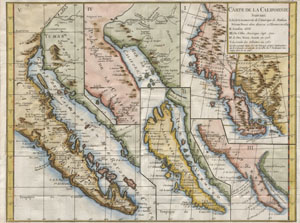
Carte de la Californie suivant / I. La carte manuscrite de l'Amérique de Mathieu Néron Pecci olen dresse à Florence en 1604 / II. Sanson 1656 / III. De L'Isle Amérique Sept. 1700 / IV. le Pere Kino Jesuite en 1705 / V. La Societe des Jésuites en 1767.
sold
- Digital Map Information
- Suitable for large format printing
- DPI: 300
- File Size: 3.12 MB
- File Type: ZIP / TIFF
- ICC color profile embedded
- Delivered instantly via download link
A rare and important map of California in five different states, ranging from roughly 1656 to 1767. Engraved by the important French cartographer Robert De Vaugondy, for the c. 1770 edition of the Denis Diderot (1713-84) Encyclopedie . This ... (more details)
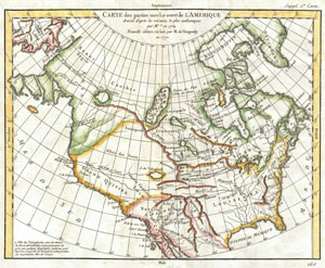
Carte des Parties Nord et Ouest de l'Amerique Dressee d'apres les Relations les Plus Authentiques par M *** en 1764.
sold
- Digital Map Information
- Suitable for large format printing
- DPI: 300
- File Size: 7.24 MB
- File Type: ZIP / TIFF
- ICC color profile embedded
- Delivered instantly via download link
A truly remarkable 1772 map of North America by Robert de Vaugondy. Based upon an earlier map of the region by Thomas Engel, this is a fascinating examination of the general layout and waterways of North America – especially in the west. ... (more details)
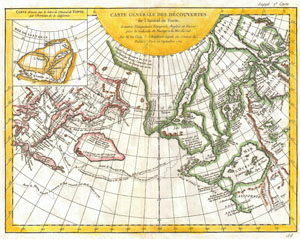
Carte Generale des Decouvertes de l'Amiral de Fonte et Autres Navigateurs Espagnols, Anglois et Russes pour la Recherche du Passage a la Mer du Sud.
sold
- Digital Map Information
- Suitable for large format printing
- DPI: 300
- File Size: 7.94 MB
- File Type: ZIP / TIFF
- ICC color profile embedded
- Delivered instantly via download link
One of the most splendid combinations of hard fact and speculative fantasy to appear in the history of cartography. This map, prepared by Joseph-Nicholas de L'Isle 1762 and republished by Vaugondy in 1772, covers parts of Siberia and ... (more details)
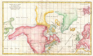
Partie de la Carte du Capitaine Cluny Auteur d'une ouverage anglois intitule American Traveller publie a Londres en 1769.
sold
- Digital Map Information
- Suitable for large format printing
- DPI: 300
- File Size: 12.99 MB
- File Type: ZIP / TIFF
- ICC color profile embedded
- Delivered instantly via download link
A very interesting 1772 map of North America and Greenland, with adjacent parts of Europe and Asia. This map was drawn by Vaugondy to illustrate the mythical voyage of Captain Cluny. Depicts North America from above the Arctic ... (more details)