
Guthrie, William

William Guthrie (1708 - March 9, 1770) was a Scottish historian, journalist, and writer. Born in Brechin, he studied at Aberdeen University with the idea of becoming a parochial schoolmaster. Instead, in 1730, he elected to settle in London and try his hand at literature. He covered parliamentary debates f or the Gentleman's Magazine and soon earned a reputation for being a political writer. He published several scholarly works, including a History of England from the Invasion of Julius Caesar to 1688 in four volumes, and, most notably, his Geographical Historical, and Commercial Grammar.
Britain's remaining North American colonies.
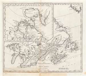
The British Possessions in North America from the best Authorities.
$450.00
Acquire
- Digital Map Information
- Suitable for large format printing
- DPI: 600
- File Size: 37.55 MB
- File Type: ZIP / TIFF
- ICC color profile embedded
- Delivered instantly via download link
This is a first edition example of Samuel Lewis' 1794 map of Canada for Carey's General Atlas, the first atlas published in the young American Republic. It depicts the remaining British colonies in North America (save for Bermuda) in the wake of the American Revolution, before they had cohered into a single entity and identity as Canada. (more details)
First Map of the first state to be published in the United States.
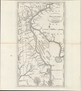
Delaware, from the best authorities.
$500.00
Acquire
- Digital Map Information
- Suitable for large format printing
- DPI: 600
- File Size: 24.55 MB
- File Type: ZIP / TIFF
- ICC color profile embedded
- Delivered instantly via download link
An example of Matthew Carey and William Barker's 1795 map of Delaware, which appeared in Carey's American Edition of Guthrie's Geography Improved, the first atlas published in the United States of America. It provides a fascinating snapshot of America's first state in the years following independence. (more details)
The last days of Ottoman Europe.
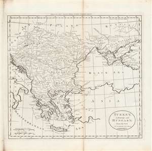
Turkey in Europe and Hungary; from the best authorities.
$400.00
Acquire
- Digital Map Information
- Suitable for large format printing
- DPI: 600
- File Size: 29.37 MB
- File Type: ZIP / TIFF
- ICC color profile embedded
- Delivered instantly via download link
This is Matthew Carey and William Barker's c. 1795 map of Ottoman Europe, Hungary, and nearby territories in southeastern Europe, made for Carey's General Atlas. It depicts the region as it was just prior to a major rearrangement that would see Ottoman rule over the European portion of its empire collapse. (more details)
Earliest Atlas Map of Connecticut Published in the American Republic.
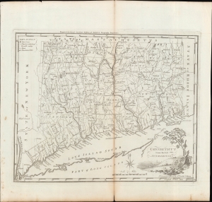
Connecticut from the Best Authorities.
$600.00
Acquire
- Digital Map Information
- Suitable for large format printing
- Full resolution TIFF file
- ICC color profile embedded
- Delivered instantly via download link
A fascinating 1795 map of the state of Connecticut, drawn and engraved by Amos Doolittle for Matthew Carey's Carey's American Edition of Guthrie's Geography Improved, the first atlas published in the United States of America. (more details)
Earliest Atlas Map of Maryland Published in the American Republic.
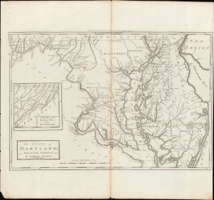
The State of Maryland, from the Best Authorities.
$600.00
Acquire
- Digital Map Information
- Suitable for large format printing
- Full resolution TIFF file
- ICC color profile embedded
- Delivered instantly via download link
An important map of Maryland from the early days of the American Republic, this 1795 work was drawn by Samuel Lewis and engraved by William Barker for inclusion in Matthew Carey's Carey's American Edition of Guthrie's Geography Improved, the first atlas published in the United States. (more details)
Italy during the French Revolutionary Wars.
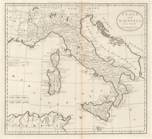
Italy, and Sardinia, from the best Authorities.
$450.00
Acquire
- Digital Map Information
- Suitable for large format printing
- File Size: 8.29 MB
- File Type: ZIP / TIFF
- ICC color profile embedded
- Delivered instantly via download link
This is a 1795 Matthew Carey map of Italy and Sicily. Published during the French Revolution (1789 - 1799), this map captures Italy at a moment of continental upheaval. (more details)
Acquainting North Americans with their southern neighbors.
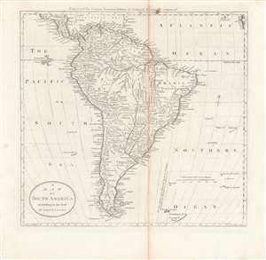
A Map of South America according to the best authorities.
$400.00
Acquire
- Digital Map Information
- Suitable for large format printing
- DPI: 600
- File Size: 29.02 MB
- File Type: ZIP / TIFF
- ICC color profile embedded
- Delivered instantly via download link
Intricately detailed and informative, this is Matthew Carey's c. 1795 map of South America, included in Carey's General Atlas, the first atlas published in the American Republic. It illustrates the continent just prior to the wars of independence that would expel the Spanish from the region, opening the door for greater influence from the United States. (more details)
First map of Africa published in the American Republic.
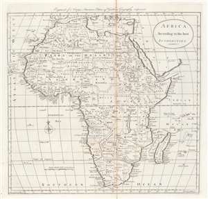
Africa according to the best authorities.
$300.00
Acquire
- Digital Map Information
- Suitable for large format printing
- DPI: 600
- File Size: 9.99 MB
- File Type: ZIP / TIFF
- ICC color profile embedded
- Delivered instantly via download link
This is a 1796 map of Africa from Carey's General Atlas, the first atlas published in the new American Republic. It was made at the height of the Transatlantic Slave Trade and the transformation of the institution of slavery in the early Republic. (more details)
A map of the West Indies from the first atlas published in the United States.
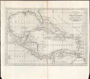
A Chart of the West Indies From the Latest Marine Charts and Surveys.
$250.00
Acquire
- Digital Map Information
- Suitable for large format printing
- Full resolution TIFF file
- ICC color profile embedded
- Delivered instantly via download link
This is a c. 1796 map of the West Indies from Carey's General Atlas, the first atlas published in the new American Republic. (more details)
An early American map of the Russian Empire.
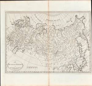
Russian Empire, in Europe and Asia.
$350.00
Acquire
- Digital Map Information
- Suitable for large format printing
- DPI: 600
- File Size: 9.01 MB
- File Type: ZIP / TIFF
- ICC color profile embedded
- Delivered instantly via download link
This is a rare c. 1811 map of the Russian Empire from Carey's General Atlas, the first atlas published in the new American Republic. It shows the Russian Empire after two and a half centuries of territorial expansion beginning with Ivan IV (the 'Terrible') through Catherine the Great. (more details)
A rare early 19th European century map of China.
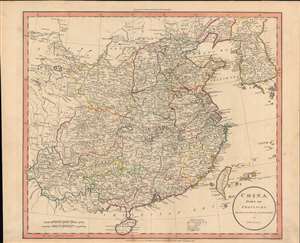
China divided into provinces drawn from the best authorities.
$600.00
Acquire
- Digital Map Information
- Suitable for large format printing
- DPI: 600
- File Size: 43.85 MB
- File Type: ZIP / TIFF
- ICC color profile embedded
- Delivered instantly via download link
John Russell's scarce map of China, produced for the atlas to the 1811 edition of William Guthrie's A System of Modern Geography. Russell highlights the provinces of 'China proper', or roughly the territory of the Ming Dynasty, conquered by the Qing in the mid-17th century. (more details)