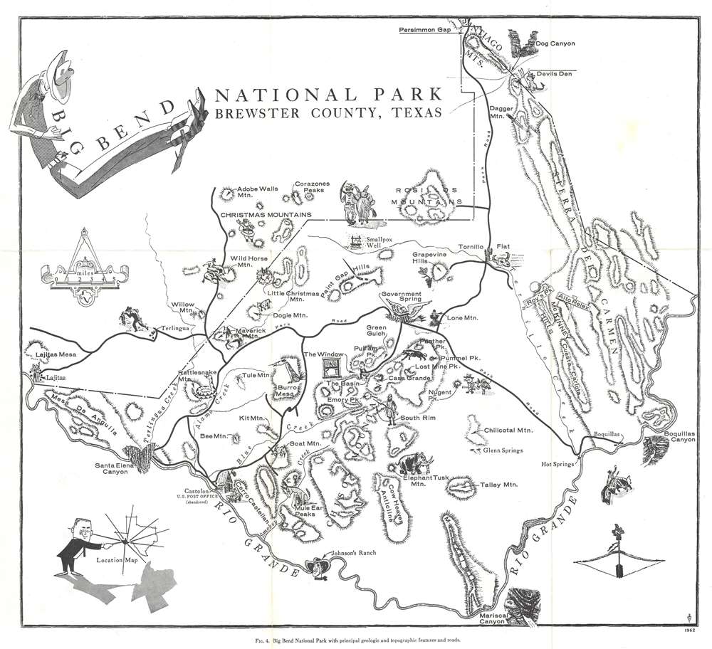
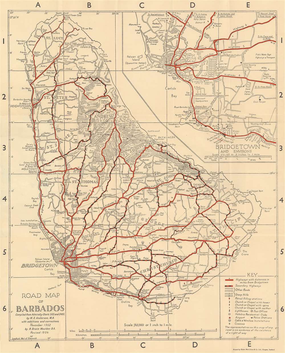
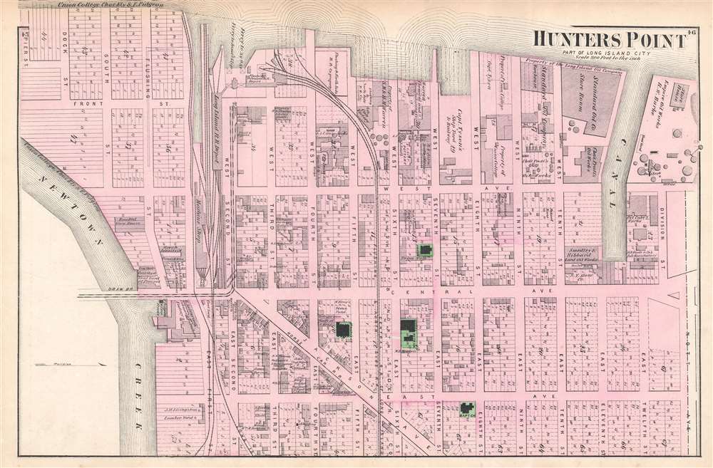
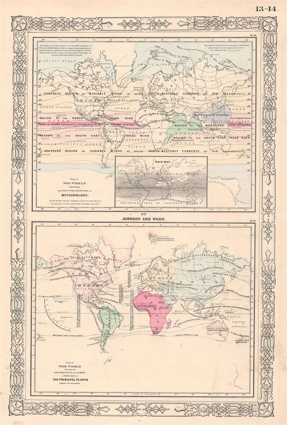
Most recently added antique and rare maps as of 3/28/2024.
1728 Stöcklein Map of the Amazon based on its Earliest Firsthand Mapping
Edition of the Earliest Map of the Amazon Produced by One Who Explored It.
$500.00

1943 Chapin Pictorial Map of the Pacific Fortified Positions During World War II
Makes an effort at preparing the American people for a long, bloody war in the Pacific against Japan.
$400.00

1963 Wright and Fischer Pictorial Map of Oklahoma Civil War Sites
Highlights the events of the American Civil War in Oklahoma, then known as the Indian Territory.
$300.00

1850 Basset Chart of the Flags of Nations
A vexillogical chromolithograph delight!
$950.00

1945 Japanese Cyanotype WWII Map of the Philippines
Unique cyanotype / blueprint map of the Philippines.
$950.00

1895 Map of the Eastern Congo Basin showing the tracks of 10 explorers
Earliest map to compile the exploration of the Congo River Valley during the Scramble for Africa
$850.00

1801 Tardieu Map of the Northeastern United States w/Military Tracts
Illustrates land reserved for U.S. Soldiers after the American Revolutionary War.
$600.00

1649 Blaeu Map of the isles De Re and Oleron, France
Sumptuously Engraved Map of the Home Port and its Surrounds
$600.00

1939 Romer Pictorial Resource Map of South America
Highlights escalating tensions between Germany and the United States and Great Britain over access to South American natural resources.
$450.00

1800 Pennant Map of Southeast Asia, China, Korea and Japan
Attractively engraved map of Southeast Asia, China, Korea and Japan featuring the 'Gulf of Corea'
$1,100.00

1886 Burleigh Bird's Eye View Map of East Pepperell, Massachusetts
Includes an illustration of the Pepperell Covered Bridge.
$1,200.00

1865 Johnson Map of Iowa and Nebraska
Civil War-Era Map of Iowa as the Railroads Stab Westwards
$100.00

1892 Wilbur / Langley Map of San Francisco, California  w/advertising
Beautiful chromolithograph advertising map of San Francisco.
$1,100.00

1831 Barney Map of the Route Profiles for the Boston and Providence Railroad
Profile illustrations of potential routes for one of the earliest American railroads.
$1,000.00

1867 Weyss Map of Appomattox Court House, Virginia
The first published map of the area around Appomattox Court House - where the U.S. Civil War ended.
$450.00

1849 Mitchell Map of France
Map of France with inset of Corsica and the Paris region.
$150.00

1949 Denis Mason Jones Pictorial Map of Leeds, England
Rare pictorial map of Leeds by architect Denis M. Jones.
$750.00

1960 Saigon Moi City Map or Plan of Saigon, South Vietnam
A city map of Saigon published by one of the city's daily newspapers.
$450.00

1960 Soltesz Pictorial Map of American Folklore and Legends
A special edition of Soltesz's folklore and legends pictorial map most likely meant for use in classrooms.
$300.00

1900 Tarchi and Pineider Pictorial City Map or Plan of Florence, Italy
A charming pictorial map of Florence featuring profile illustrations of the city's iconic buildings.
$600.00