
Atwood, John M. (sold)

John M. Atwood (1817 - October 12, 1884) was an American engraver based in Philadelphia and New York City during the middle part of the 19th century. Atwood was born in Georgetown, near Washington D.C. Little is known of Atwood's life but most of his work was completed in conjunction with the publishing firms of Horace Thayer and J. H. Colton. A review of Atwood's work suggests that he was a highly accomplished, stylistically distinct, and detail oriented engraver. Colton seems to have turned to Atwood to engrave some of his most important as well as decorative maps. His most influential map is most likely the 1856 De Cordova pocket map of Texas, however, he also engraved the Colton's well known and highly decorative Thirty Three Miles Around New York and Colton's important 1849 Map of the United States.
Illustrates the Republic of Texas the year before it joined the United States and the Oregon border dispute between the United States and Canada.
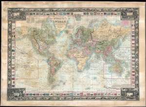
Map of the World, on Mercators Projection.
sold
- Digital Map Information
- Suitable for large format printing
- DPI: 600
- File Size: 91.02 MB
- File Type: ZIP / TIFF
- ICC color profile embedded
- Delivered instantly via download link
This is a rare 1845 Edward Hooker Ensign map of the world on Mercator's projection depicting both the Republic of Texas and the Oregon border dispute between Canada and the United States. A visually striking and incredibly detailed piece, countries throughout the world are labeled, along with innumerable cities and towns. Myriad coastal locations are identified as well. The courses of the world's most important explorers, including Christopher Columbus, Captain James Cook, Vancouver, and La Perouse are illustrated and labeled, many of the courses also provide several dates along the route. An inset of sorts details the Southern Pacific Ocean, labeling numerous islands and tracing the voyages of Cook and Vancouver in detail. The Mountains of the Moon, an apocryphal chain of mountains in Africa, are illustrated almost completely across the center of the continent, with the vast majority of the African interior marked simply as 'unexplored'. The whole is surrounded by two different borders. (more details)
Scarce map of New York City.
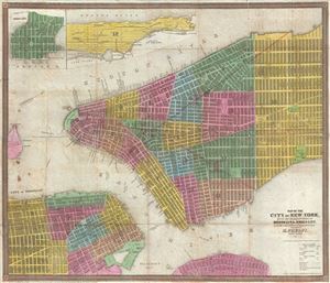
Map of the City of New York, with the adjacent Cities of Brooklyn & Jersey City, and the Village of Williamsburg.
sold
- Digital Map Information
- Suitable for large format printing
- DPI: 300
- File Size: 13.32 MB
- File Type: ZIP / TIFF
- ICC color profile embedded
- Delivered instantly via download link
This scarce 1845 map of New York City and adjacent parts of Brooklyn was published by Humphrey Phelps. Oriented to the west, this map covers the lower parts of Manhattan from the Battery to 32nd Street. It additionally covers adjacent parts of Brooklyn from the ... (more details)
San Francisco named Yerba Buena! Mexican-American War! Texas at its fullest expression!
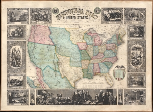
Pictorial Map of the United States.
sold
- Digital Map Information
- Suitable for large format printing
- Full resolution TIFF file
- ICC color profile embedded
- Delivered instantly via download link
A scarce American wall map of the United States and Mexico issued by Ensign and Thayer in 1848 - at the end of the Mexican American War (1846 - 1848). This is one of the few maps to identify San Francisco as Yerba Buena, exhibit Texas's fullest territorial claims, and show Upper California (California, New Mexico, Arizona, Utah, Nevada, Colorado, etc..) prior to its breakup into territories. As the title suggests, the map covers the United States in full and is one of the earliest examples of this map to extend from coast to coast - reflecting the new borders established claimed by the United States in 1846, and formalized by the 1848 Treaty of Guadeloupe-Hidalgo, which ended the Mexican-American War. At this time, no railroads extended west of the Mississippi. Predating the 1849 Gold Rush, Sacramento, founded in 1850, is not present, but the map notes John Sutter's colony of New Helvetica and nearby Sutter's Fort. Great Salt Lake is embryonically mapped, illustrative of the limited knowledge then amiable regarding the geographical disposition of the Great Basin. Nebraska extends northwards to the Canadian border and Washington/Oregon have their eastern terminus at the Rocky Mountains. (more details)
On the cusp of the Westward Expansion.
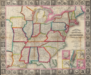
Phelps’s National Map of the United States, A Travellers Guide. Embracing the Principal Rail Roads, Canals, Steam Boat and Stage Routes throughout the Union.
sold
- Digital Map Information
- Suitable for large format printing
- DPI: 600
- File Size: 45.75 MB
- File Type: ZIP / TIFF
- ICC color profile embedded
- Delivered instantly via download link
This is the 1848 issue of the first state of Phelps's map of the United States. The map was issued during the Mexican-American War (1846 - 1848), and as such captures an ephemeral moment in American history: after Texas joined the Union, but before the Treaty of Guadeloupe-Hidalgo and the annexation of Upper California. (more details)
San Francisco as Yerba Buena! Mexican-American War! Texas at its fullest expression!
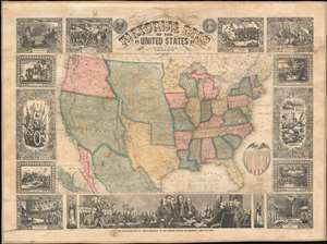
Pictorial Map of the United States.
sold
- Digital Map Information
- Suitable for large format printing
- DPI: 600
- File Size: 145.35 MB
- File Type: ZIP / TIFF
- ICC color profile embedded
- Delivered instantly via download link
A scarce American wall map of the United States and Mexico issued by Ensign and Thayer in 1848 - at the end of the Mexican American War (1846 - 1848). This is one of the few maps to identify San Francisco as Yerba Buena, exhibit Texas's fullest territorial claims, and show Upper California (California, New Mexico, Arizona, Utah, Nevada, Colorado, etc..) prior to its breakup into territories. As the title suggests, the map covers the United States in full and is one of the earliest examples of this map to extend from coast to coast - reflecting the new borders established claimed by the United States in 1846, and formalized by the 1848 Treaty of Guadeloupe-Hidalgo, which ended the Mexican-American War. At this time, no railroads extended west of the Mississippi. Predating the 1849 Gold Rush, Sacramento, founded in 1850, is not present, but the map notes John Sutter's colony of New Helvetica and nearby Sutter's Fort. Great Salt Lake is embryonically mapped, illustrative of the limited knowledge then amiable regarding the geographical disposition of the Great Basin. Nebraska extends northwards to the Canadian border and Washington/Oregon have their eastern terminus at the Rocky Mountains. (more details)
'First Colton map showing the gold fields.' - Streeter
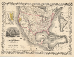
Map of the United States The British Provinces Mexico and c. Showing the Routes of the U.S. Mail Steam Packets to California and a Plan of the Gold Region.
sold
- Digital Map Information
- Suitable for large format printing
- DPI: 600
- File Size: 72.59 MB
- File Type: ZIP / TIFF
- ICC color profile embedded
- Delivered instantly via download link
This is J. H. Colton and J. M. Atwood's 1849 map of the United States, issued to illustrate routes to the newly discovered gold fields in California. Issued immediately in the wake of the gold discovery at Sutter's Mill, this is the first Colton map to illustrate the California Gold Fields. It also Texas in its largest configuration, immediately after the Treaty of Guadalupe Hidalgo. (more details)
Earliest known iternation of Colton's iconic Comparative Mountains and Rivers Chart.
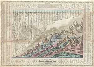
A Combined View of the Principal Mountains and Rivers in the World with Tables showing their relative Heights and Lengths.
sold
- Digital Map Information
- Suitable for large format printing
- Full resolution TIFF file
- ICC color profile embedded
- Delivered instantly via download link
A scarce 1849 pocket format edition of Colton's Mountains and Rivers chart. This is the earliest known iteration of Colton's iconic Mountains and Rivers chart which would later be popularized in his 1855 Atlas of the World and in Johnson's 1860 New Family Atlas ... (more details)
San Francisco named Yerba Buena! Mexican-American War! Texas at its fullest expression!
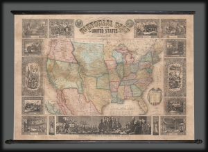
Pictorial Map of the United States.
sold
- Digital Map Information
- Suitable for large format printing
- DPI: 600
- File Size: 1830.69 MB
- File Type: ZIP / TIFF
- ICC color profile embedded
- Delivered instantly via download link
A scarce American wall map of the United States and Mexico issued by Ensign and Thayer in 1849 - at the height of the California Gold Rush and the end of the Mexican-American War (1846 - 1848). This is one of the few maps to identify San Francisco as Yerba Buena, exhibit Texas's fullest territorial claims, and show Upper California (California, New Mexico, Arizona, Utah, Nevada, Colorado, etc.) prior to its breakup into territories. It is also the only map from this series to highlight the California Gold Region. (more details)
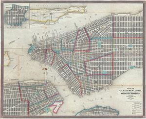
Map of the City of New York, with the Adjacent Cities of Brooklyn and Jersey City, and the Village of Williamsburg.
sold
- Digital Map Information
- Suitable for large format printing
- Full resolution TIFF file
- ICC color profile embedded
- Delivered instantly via download link
This is a scarce and beautiful 1850 pocket map of New York City published by Ensign, Thayer and Co. It covers Manhattan from 32nd Street south to the Battery and Brooklyn from Navy Yard to Sackett Street as well as part of Williamsburg. A large part of ... (more details)
Earliest known iternation of Colton's iconic Comparative Mountains and Rivers Chart.
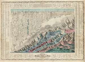
A Combined View of the Principal Mountains and Rivers in the World with Tables showing their relative Heights and Lengths.
sold
- Digital Map Information
- Suitable for large format printing
- DPI: 600
- File Size: 46.9 MB
- File Type: ZIP / TIFF
- ICC color profile embedded
- Delivered instantly via download link
The first 1852 separate-issue edition of Colton's Mountains and Rivers chart. This is the earliest known iteration of Colton's iconic comparative infographic chart illustrating relative sizes of great mountains and rivers. The chart was subsequently reduced in 1855 and reissued in multiple editions for Colton's popular n his 1855 Atlas of the World and later in in Johnson's 1860 New Family Atlas. The map is surrounded by decorative embellishments and several layers of border. To the right and left of the map there is a table identifying the individual mountains via a numerical cross reference system.
This is the finest American Mountains and Rivers chart of the mid-19th century. It depicts the relative distances of the world's great rivers and the relative heights of the world's great mountains. Included are a multitude of details regarding the heights of important cities, glaciers, volcanoes, and tree lines. Also shows Niagara Falls, the Great Pyramid, St. Peter's Basilica in Rome and St. Paul's in London. The chart notes curiosities that would have been relevant at the time, such as 'The Greatest Altitude of the Growth of Peruvian Bark', 'The Glacier of Maladetts', the 'Table Land of Pamar', and the 'Greatest Altitude attained by Humboldt 19400 ft'. Replete with additional geographical errors and misconceptions common to the period. (more details)
This is the finest American Mountains and Rivers chart of the mid-19th century. It depicts the relative distances of the world's great rivers and the relative heights of the world's great mountains. Included are a multitude of details regarding the heights of important cities, glaciers, volcanoes, and tree lines. Also shows Niagara Falls, the Great Pyramid, St. Peter's Basilica in Rome and St. Paul's in London. The chart notes curiosities that would have been relevant at the time, such as 'The Greatest Altitude of the Growth of Peruvian Bark', 'The Glacier of Maladetts', the 'Table Land of Pamar', and the 'Greatest Altitude attained by Humboldt 19400 ft'. Replete with additional geographical errors and misconceptions common to the period. (more details)
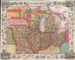
Map of the Western States.
sold
- Digital Map Information
- Suitable for large format printing
- DPI: 300
- File Size: 26.23 MB
- File Type: ZIP / TIFF
- ICC color profile embedded
- Delivered instantly via download link
An attractive example of Thayer's 1853 map of the Western States. Centered on Lake Michigan, Thayer's map covers the states of Ohio, Michigan, Indiana, Illinois, Wisconsin, Iowa, and Missouri, with portions of adjacent Minnesota, Kentucky, Virginia, ... (more details)
Illustrates the original site of Columbia College, now Columbia University.
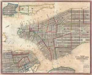
Map of the City of New York, with the Adjacent Cities of Brooklyn and Jersey City, and the Village of Williamsburg.
sold
- Digital Map Information
- Suitable for large format printing
- DPI: 300
- File Size: 13.12 MB
- File Type: ZIP / TIFF
- ICC color profile embedded
- Delivered instantly via download link
This is a scarce and beautiful 1850 pocket map of New York City published by Ensign, Thayer and Co. It depicts Manhattan from 32nd Street south to the Battery and Brooklyn from the Navy Yard to Sackett Street as well as part of Williamsburg. A ... (more details)
Remarkable and highly decorative early American wall sized map of the world.
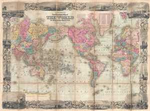
Colton's New Illustrated Map of the World on Mercator's Projection.
sold
- Digital Map Information
- Suitable for large format printing
- DPI: 300
- File Size: 37.61 MB
- File Type: ZIP / TIFF
- ICC color profile embedded
- Delivered instantly via download link
A rare and highly attractive dissected case-map edition of Colton's New Illustrated Map of the World . Centered on America, this grand map presents the entire world on a Mercator Projection. Countries, continents, and sometimes individual ... (more details)
Highly decorative pictorial map of the United States.
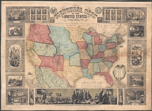
Pictorial Map of the United States.
sold
- Digital Map Information
- Suitable for large format printing
- DPI: 300
- File Size: 48.25 MB
- File Type: ZIP / TIFF
- ICC color profile embedded
- Delivered instantly via download link
An appealing and highly decorative 1853 wall map of the United States. Issued by Horace Thayer, this map was drawn and engraved by J.M. Atwood and covers the entire United States from Atlantic to Pacific and from Canada to the Gulf of ... (more details)
Pre-Civil War Westward Expansion.
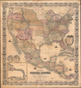
Map of the United States, with its Territories; also Mexico and the West Indies.
sold
- Digital Map Information
- Suitable for large format printing
- File Size: 87.11 MB
- File Type: ZIP / TIFF
- ICC color profile embedded
- Delivered instantly via download link
A scarce American wall map of the United States and Mexico issued by Ensign, Bridgeman and Fanning in 1856. As the title suggests, the map covers all of the United States as well as Mexico, Cuba, and Central America as far as Panama. Inset maps in the lower left illustrate the world and the Lesser Antilles. The focus of the map is westward expansion in the United States. Updates accordingly focused on administrative changes west of the Mississippi. Here, Texas conforms to the Compromise of 1850 borders, and the Gadsden Purchase has added new territory to New Mexico. The borders of Kansas and Nebraska follow the Kansas-Nebraska Act of May 30, 1854, in which Nebraska stretches to the Canadian border. The gold region in the Sacramento Valley is highlighted in California. The map notes emigrant and exploration routes to the west, including Fremont's Route, the Oregon Trail, and the Santa Fe Caravan route. American Indian lands are rigorously identified throughout as if to remind emigrants that the land is not completely free and uninhabited. (more details)
Highly decorative pictorial map of the United States.
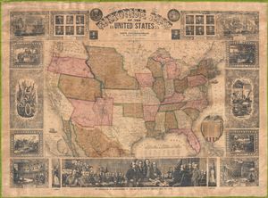
Pictorial Map of the United States.
sold
- Digital Map Information
- Suitable for large format printing
- File Size: 21.19 MB
- File Type: ZIP / TIFF
- ICC color profile embedded
- Delivered instantly via download link
An appealing and decorative 1855 wall map of the United States. Issued by Ensign, Bridgman & Fanning, this map was drawn and engraved by J.M. Atwood and covers the entire United States from Atlantic to Pacific and from Canada to ... (more details)
Highly decorative pictorial map of the United States.
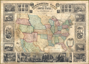
Pictorial Map of the United States.
sold
- Digital Map Information
- Suitable for large format printing
- Full resolution TIFF file
- ICC color profile embedded
- Delivered instantly via download link
An appealing and decorative 1855 wall map of the United States. Issued by ensign, Bridgman & Fanning, this map was drawn and engraved by J.M. Atwood and covers the entire United States from Atlantic to Pacific and from Canada to ... (more details)
Fascinating ephemeral Transmississippi West!
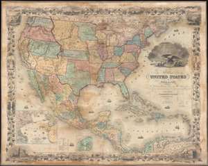
Map of the United States of America, the British Provinces, Mexico, the West Indies, and Central America: with part of New Granada and Venezuela.
sold
- Digital Map Information
- Suitable for large format printing
- File Size: 50.65 MB
- File Type: ZIP / TIFF
- ICC color profile embedded
- Delivered instantly via download link
An exceptionally beautiful map of considerable historic importance, this is J. H. Colton's 1855 map of the United States. The map's coverage extends from Canada to Colombia, inclusive of all of the United States, Mexico, Central America, and the West Indies. It is surrounded by an elaborate grape vine themed decorative border engraved by Bernard. The map itself was engraved by Atwood, and is full of fascinating detail relating to the westward migration and early territorial development of the Transmississippi. (more details)
Modestly sized wall map illustrating the westward expansion.
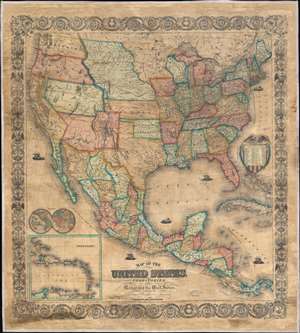
Map of the United States, with its Territories; also Mexico and the West Indies.
sold
- Digital Map Information
- Suitable for large format printing
- File Size: 120.99 MB
- File Type: ZIP / TIFF
- ICC color profile embedded
- Delivered instantly via download link
A scarce American wall map of the United States and Mexico issued by Ensign, Bridgeman and Fanning in 1856. As the title suggests, the map covers all of the United States as well Mexico, Cuba, and Central America as far as Panama. Inset maps in the lower left illustrate the world and the Lesser Antilles. The focus of the map is westward expansion in the United States. Updates accordingly focused in administrative changes west of the Mississippi. Here, Texas configures to the Compromise of 1850 borders and the Gadsden Purchase has added new territory to New Mexico. The borders of Kansas and Nebraska adhere to the Kansas-Nebraska Act of May 30, 1854 in which Nebraska stretches to the Canadian border. The gold region in the Sacramento Valley is highlighted in California. The map noes emigrant and exploration routes to the west, including Fremont's Route, The Oregon Trail, and the Santa Fe Caravan route. American Indian lands are rigorously identified throughout, as if to remind emigrants that the land is not completely free and uninhabited. (more details)
The Civil War - big and bold.
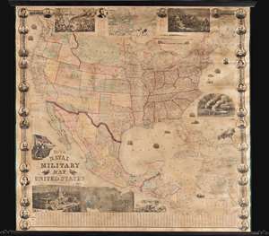
This is a rare 1863 wall map of the United States at the height of the American Civil War (1861 - 1865). The map was issued by John Calvin Smith and Robert Persall Smith during the Civil War to capitalize on general interest in the war among the northern elite. At roughly 70 inches square, this enormous and lavishly produced map covers all of the United States and Mexico. The early state and territory configuration includes the ephemeral Confederate State of Arizona. It is surrounded by images of Union officers and politicians - including Lincoln, Fremont, Wilkes, and Scott. Curiously, these do not include General Grant, as the map's publication in early January of 1863 predates his assumption of overall command on January 29, 1863. The map features multiple vignette scenes including the victory of the Monitor over the Merrimac, the allegorical 'Rescue of the Union', an illustration of 'Camp Life', the Capitol building in Washington, and an overview of the 'Birth of the Union' at Bunker Hill. Of note, the Pacific Telegraph Route is noted running parallel to the Pony Express Route, which is also illustrated. (more details)
One of Colton's most beautiful maps.
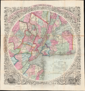
Map of The Country Thirty Three Miles Around The City of New York.
sold
- Digital Map Information
- Suitable for large format printing
- Full resolution TIFF file
- ICC color profile embedded
- Delivered instantly via download link
This is the 1864 edition of one of the most beautiful pocket maps of New York made in the 19th century: Colton's Thirty Three Miles Around the City of New York. (more details)