
The first map to accurately depict Abyssinia and the source of the Blue Nile.
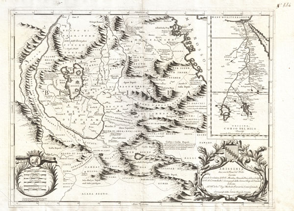
Abissinia, doue sono le Fonti del Nilo descritta secondo le relationi de P.P. Mendez, Almeida, Pais, Lobo, e Lodulfo del P. M. Coronelli M.C. Cosmografo della Seren. Rep. di Ventia…
sold
- Digital Map Information
- Suitable for large format printing
- DPI: 300
- File Size: 13.87 MB
- File Type: ZIP / TIFF
- ICC color profile embedded
- Delivered instantly via download link
This is Coronelli's important 1690 map of Ethiopia (Abyssinia) showing the source of the Blue Nile. This map, focusing on Lake Tana (Tzana Dembea) covers the Ethiopian highlands from Derbeta on the Red Sea south as far as the tribal kingdoms of Sugame, ... (more details)
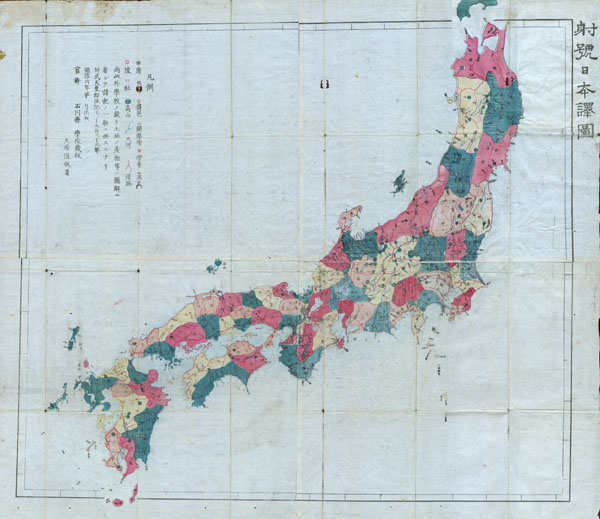
Meiji 4 Map of Japan.
sold
- Digital Map Information
- Suitable for large format printing
- File Size: 14.15 MB
- File Type: ZIP / TIFF
- ICC color profile embedded
- Delivered instantly via download link
This very rare item is a hand colored Meiji Period woodcut map of Japan. Impressive size and detail. Produced in the late 19th century Japanese woodcut style, this map is a rare combination of practical and decorative. All text in Japanese. A fine ... (more details)

Plan de Paris a l'Echelle de 2 Millim, pour 25 Metres, Indiquant les Nouveaux percements et les changements de noms de Voies publiques avec plans supplementaires pour Les Bois de Boulogne et de Vincennes.
sold
- Digital Map Information
- Suitable for large format printing
- File Size: 54.83 MB
- File Type: ZIP / TIFF
- ICC color profile embedded
- Delivered instantly via download link
A stunningly executed 1878 large format folding pocket map of Paris, France by E. Andriveau-Goujon. Focuses on the old walled center of Paris from Neuilly in the northwest to Pantin in the northeast, Issy in the southwest, and Ivry in the ... (more details)
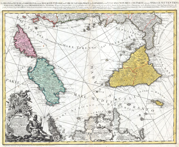
Li Regni di Sicilia e Sardegna colle Adiacenti Isole di Corsica, Elba, Malta e Liparee, o di Vulcano, non men che parte delle spiagge settentrionali dell'Africa e delle Meridionali d'Italia, Rappresentate Idro- Geograficamente e all'esattezza la più possibile, stante la legittima loro Situazione nel Mediterraneo sotto la Supposizione dei grandi stabiliti dagl'Eccmiss.mi della Reial Accademia delle Scienze, proporzionata al Graduato Globo Terraqueo: ridotta alla desiderata Perfezione dai Viaggi e dalla composizione fattane dal Sig. e G.A.B. Rizzi Zannoni N. Padovano Professore di Geografia nella spettabile Società Cosmografica di Norimbergo, A spese degl'Eredi d'Homann MDCCLXII.
sold
- Digital Map Information
- Suitable for large format printing
- DPI: 300
- File Size: 8.75 MB
- File Type: ZIP / TIFF
- ICC color profile embedded
- Delivered instantly via download link
This is one of the Homann Heirs finest and most appealing maps of southern Italy, Sicily and Sardinia. Covers the region from Corsica and the boot of Italy south to Tunisia and North Africa. Includes the island of Malta in the lower right ... (more details)
First map to depict in detail the entirety of Manhattan Island during the Revolutionary War.
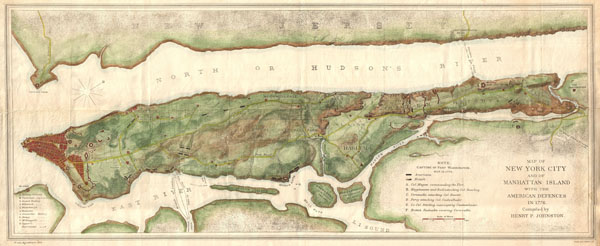
Map of New York City and of Manhattan Island with the American Defences in 1776.
sold
- Digital Map Information
- Suitable for large format printing
- File Size: 17.4 MB
- File Type: ZIP / TIFF
- ICC color profile embedded
- Delivered instantly via download link
An unusual map of Manhattan Island will adjacent parts of Long Island and New Jersey drawn in 1878 for issue in Henry P. Johnson's history of the Battle of Long Island. In compiling his history Johnson was frustrated by the lack of a ... (more details)
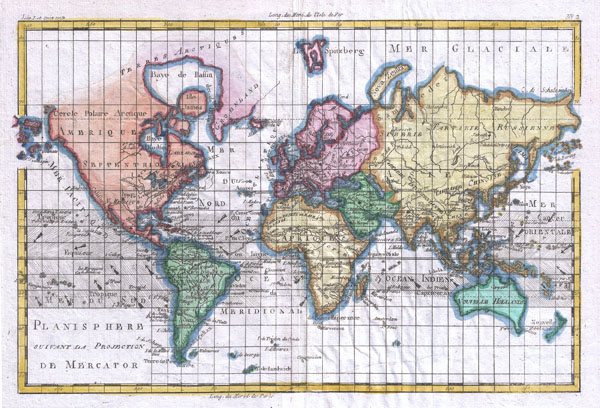
Planisphere Suivant La Projection De Mercator
sold
- Digital Map Information
- Suitable for large format printing
- DPI: 300
- File Size: 4.26 MB
- File Type: ZIP / TIFF
- ICC color profile embedded
- Delivered instantly via download link
A fine example of Rigobert Bonne and G. Raynal's 1780 map of the world on a Mercator Projection. Offers a fairly advanced perspective of the world showing the most recent discoveries and explorations. Nonetheless, there are a few ... (more details)
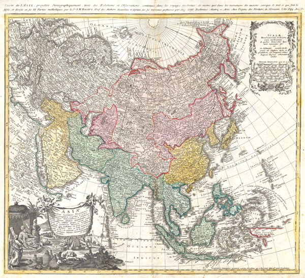
ASIA Secundum legitimas Projectionis Stereographicae regulas et juxta recentissimas observationes aeque et relationes explosis aliorum fabulosis designationibus et narrationibus adhibitis quoque veterum monumentis et recentiorum itinerariis descripta et in partes suas methodicas IX divisa a I. MATTH. HASIO M.P.P.O. nunc ex beate dejuncti subsidiis et M.S.Ctis designata a M. August Gott. Iohb. Boehmio. Impensis Homannianorum Heredum A 1744.
sold
- Digital Map Information
- Suitable for large format printing
- DPI: 300
- File Size: 11.17 MB
- File Type: ZIP / TIFF
- ICC color profile embedded
- Delivered instantly via download link
A fabulously detailed 1744 Homann Heirs map of the Asian continent, including the East Indies. Extends from Europe and Africa eastward through Arabia and India to include the East Indies, Siberia, the Philippines, and a partial New ... (more details)

L'Ancien Monde Et Le Nouveau En Deux Hemispheres
sold
- Digital Map Information
- Suitable for large format printing
- DPI: 300
- File Size: 6.38 MB
- File Type: ZIP / TIFF
- ICC color profile embedded
- Delivered instantly via download link
A fine example of Rigobert Bonne and G. Raynal's 1780 map of the world on a hemispherical projection. Offers a number of interesting details corresponding to the knowledge of the world at the time. Western North America exhibits a ... (more details)
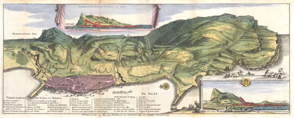
Gibraltar met alle zyne fortificatien en Verbeeteringen tot desselus Verzeekering.
sold
- Digital Map Information
- Suitable for large format printing
- Full resolution TIFF file
- ICC color profile embedded
- Delivered instantly via download link
A very scarce, c. 1720, view format map of Gibraltar most likely prepared and issued by the De La Feuille family. Depicts the peninsula and town of Gibraltar from an east facing view perspective. The town of Gibraltar is well ... (more details)
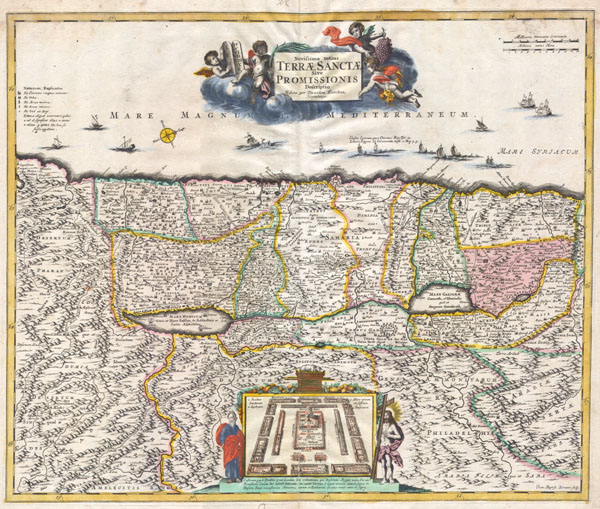
Novissima totius Terrae Sanctae Sive Promissionis Descriptio.
sold
- Digital Map Information
- Suitable for large format printing
- DPI: 300
- File Size: 8.73 MB
- File Type: ZIP / TIFF
- ICC color profile embedded
- Delivered instantly via download link
An altogether stunning map of the Israel, Palestine, or the Holy Land. Issued in 1720 by David Funck of Nuremburg and geographically based upon Visscher's Map of 1659 and De Wit's Map of 1670. The shoreline runs from Sidon to ... (more details)

Carte De La Partie Nord Des Etats Unis
sold
- Digital Map Information
- Suitable for large format printing
- DPI: 300
- File Size: 4.65 MB
- File Type: ZIP / TIFF
- ICC color profile embedded
- Delivered instantly via download link
A fine example of Rigobert Bonne and G. Raynal's 1780 map of the northeastern United States, roughly corresponding to the modern day states of Maine, New Hampshire, Massachusetts, Connecticut, New York, New Jersey, Maryland and ... (more details)

Americae Mappa Generalis.
sold
- Digital Map Information
- Suitable for large format printing
- Full resolution TIFF file
- ICC color profile embedded
- Delivered instantly via download link
A stunning 1746 Homann Heirs hand colored map of both North and South America. This is the second issue of this important map following the earlier edition by J. B. Homann. Map reflects a considerable advancement in American ... (more details)

Carte De La Partie Sud Des Etats Unis
sold
- Digital Map Information
- Suitable for large format printing
- DPI: 300
- File Size: 3.92 MB
- File Type: ZIP / TIFF
- ICC color profile embedded
- Delivered instantly via download link
A fine example of Rigobert Bonne and G. Raynal's 1780 map of the southeastern United States, including Virginia, North Carolina, South Carolina, and Georgia. Offers an interesting post colonial perspective of the region ... (more details)
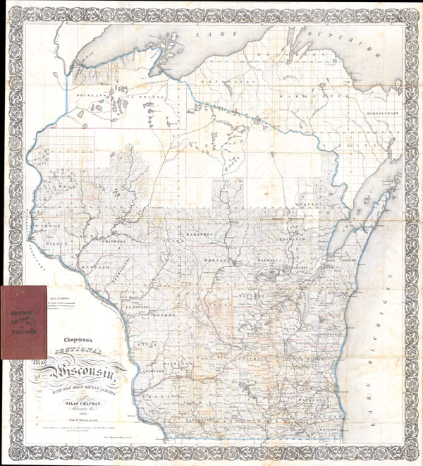
Chapman’s Sectional Map of Wisconsin.
sold
- Digital Map Information
- Suitable for large format printing
- File Size: 6.53 MB
- File Type: ZIP / TIFF
- ICC color profile embedded
- Delivered instantly via download link
This is an extremely rare and unusual 1856 pocket map of Wisconsin by Silas Chapman. Chapman appears to have published two maps pocket maps of Wisconsin in 1856, this map, delineating the entire state, and a another ... (more details)

Les Isles Philippines
sold
- Digital Map Information
- Suitable for large format printing
- DPI: 300
- File Size: 4.74 MB
- File Type: ZIP / TIFF
- ICC color profile embedded
- Delivered instantly via download link
A fine example of Rigobert Bonne and G. Raynal's 1780 map of the Southeast Asia and the Philippines. Map corresponds to modern day countries of the Philippines, Vietnam (Tonquin and Chochin), Cambodia (Camboge), ... (more details)

Peninsula of San Francisco
sold
- Digital Map Information
- Suitable for large format printing
- File Size: 7.64 MB
- File Type: ZIP / TIFF
- ICC color profile embedded
- Delivered instantly via download link
A rare coastal chart of San Francisco Peninsula by the U. S. Coast Survey, 1869. Depicts the immediate city of San Francisco and surrounding areas as far south as San Pedro and Millbrae Station. Includes the ... (more details)

Les Isles Antilles Et Le Golfe Du Mexique
sold
- Digital Map Information
- Suitable for large format printing
- DPI: 300
- File Size: 5.14 MB
- File Type: ZIP / TIFF
- ICC color profile embedded
- Delivered instantly via download link
A fine example of Rigobert Bonne and G. Raynal's 1780 highly desirable map of the West Indies, Gulf of Mexico, Antilles, and Caribbean. Covers from Florida to the Spanish Main and from Mexico to Barbados. ... (more details)

Colton’s Railroad & Township Map of Arkansas.
sold
- Digital Map Information
- Suitable for large format printing
- File Size: 13.38 MB
- File Type: ZIP / TIFF
- ICC color profile embedded
- Delivered instantly via download link
This large and visually stunning 1858 pocket map by J. H. Colton depicts the state of Arkansas. The state of Arkansas is revealed in considerable detail with special attention to roads, railroads, rivers, ... (more details)
Desirable early map showing Texas.

Le Nouveau Mexique avec la partie Septentrionale de L'anciene ou de La Nouvelle Espagne.
sold
- Digital Map Information
- Suitable for large format printing
- Full resolution TIFF file
- ICC color profile embedded
- Delivered instantly via download link
This is a beautiful c. 1780 Bonne map of northern Mexico and Texas. Covers from the Pacific Ocean through Mexico, Texas and Louisiana to western Florida, extends north as far as the Mission of St. Jeronimo ... (more details)

Accurate Carte der Uplandischen Scheren mit der Situation und Gegend umb die Konigle Schwedisch Haupt und Residentz Stadt Stockholm.
sold
- Digital Map Information
- Suitable for large format printing
- Full resolution TIFF file
- ICC color profile embedded
- Delivered instantly via download link
This is a 1730 Homann map of Stockholm Sweden. The lower portion of the map includes two views of ... (more details)