
Ephemeral mapping of the Colorado - Wyoming region.
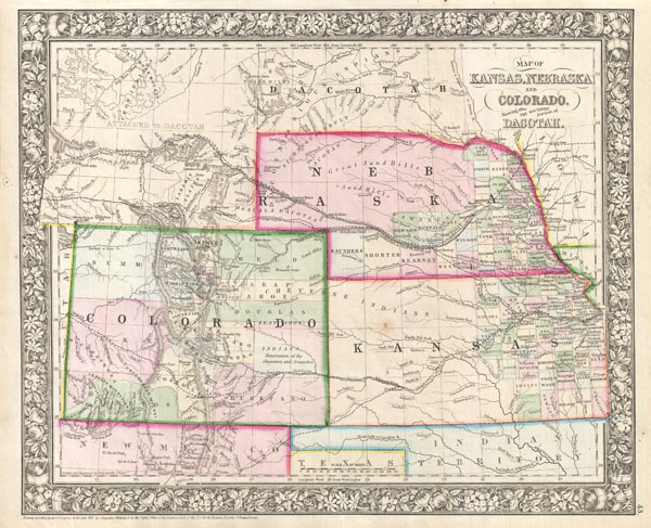
Map of Kansas, Nebraska and Colorado, Showing also the Southern portion of Dacotah.
sold
- Digital Map Information
- Suitable for large format printing
- File Size: 6.12 MB
- File Type: ZIP / TIFF
- ICC color profile embedded
- Delivered instantly via download link
A beautiful example of S. A. Mitchell Junior's 1866 map of Kansas, Nebraska, Colorado and Dakota. Wyoming, though territorially included, was not incorporated as an official territory until 1868 - here it is noted as 'Attached to Dacotah.' Color coded according ... (more details)
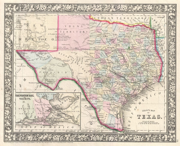
County Map of Texas.
sold
- Digital Map Information
- Suitable for large format printing
- File Size: 5.88 MB
- File Type: ZIP / TIFF
- ICC color profile embedded
- Delivered instantly via download link
A beautiful example of S. A. Mitchell Junior's 1864 map of Texas and part of New Mexico. Highly detailed with notations on railroads, topographical features, springs and cities. Color coded at the county level, with Bexar, Young, Presidio, and El Paso ... (more details)
Stunning 1930s Panoramic View of Korea.
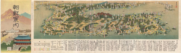
Railroad Map of Korea.
sold
- Digital Map Information
- Suitable for large format printing
- File Size: 7.18 MB
- File Type: ZIP / TIFF
- ICC color profile embedded
- Delivered instantly via download link
An extremely attractive 1936 or Showa 11 panoramic view map of Korea. This uncommon type of map evolved out of traditional Japanese view-style cartography and began to appear in Japan, Taiwan, and Korea in the early 20th century. Generally speaking ... (more details)
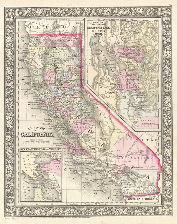
County Map of California.
sold
- Digital Map Information
- Suitable for large format printing
- File Size: 6.74 MB
- File Type: ZIP / TIFF
- ICC color profile embedded
- Delivered instantly via download link
A rare 1866 Map of California by the American map publisher S. A. Mitchell Jr. Covers the region in considerable detail showing extant and proposed rail lines, cities and counties as well as an assortment of additional topographical information. ... (more details)

Plan of Boston.
sold
- Digital Map Information
- Suitable for large format printing
- File Size: 5.84 MB
- File Type: ZIP / TIFF
- ICC color profile embedded
- Delivered instantly via download link
A beautiful example of S. A. Mitchell Junior's 1866 map of Boston, Massachusetts. Depicts Boston along with parts of East Cambridge, Charlestown, East Boston, and South Boston. Offers wonderful detail at the street level including references to ... (more details)
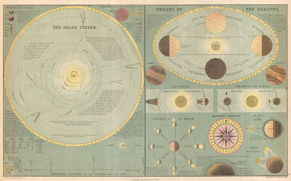
The Solar System. / Theory of the Seasons.
sold
- Digital Map Information
- Suitable for large format printing
- File Size: 4.85 MB
- File Type: ZIP / TIFF
- ICC color profile embedded
- Delivered instantly via download link
This is Adam and Charles Black's 1873 chart of the Solar System and the Theory of the Seasons. The Black brothers introduced this map in the 1850s and it went through a series of revisions and editions well into the 1880s. This example, from ... (more details)
Attractive Art Deco Map of Paris and its monuments.

Paris Monumental.
sold
- Digital Map Information
- Suitable for large format printing
- File Size: 16.5 MB
- File Type: ZIP / TIFF
- ICC color profile embedded
- Delivered instantly via download link
This is an extremely attractive 1926 tourist pocket map of Paris, France. Covers the old walled city of Paris and the immediate vicinity. Important buildings are shown in profile, including the Eiffel Tower, the Arc de Triomphe, Sacre-Coeur, ... (more details)
One of the first and most interesting 19th century comparative elevation charts.

A Comparative View of the Heights of the Principal Mountains and other Elevations in the World.
sold
- Digital Map Information
- Suitable for large format printing
- DPI: 300
- File Size: 21.54 MB
- File Type: ZIP / TIFF
- ICC color profile embedded
- Delivered instantly via download link
This is one of the earliest and most interesting takes on the comparative heights of principal mountains theme. Comparative mountains charts first appeared in the late 18th and early 19th century. Initially these charts focused on Europe or ... (more details)
Stunning Art Deco Map of Paris.

Nouveau Paris Monumental Inineraire Pratique de L'Etranger Dans Paris.
sold
- Digital Map Information
- Suitable for large format printing
- File Size: 25.58 MB
- File Type: ZIP / TIFF
- ICC color profile embedded
- Delivered instantly via download link
This is an extremely attractive c. 1928 tourist pocket map of Paris, France. Covers the old walled city of Paris and the immediate vicinity. Important buildings are shown in profile, including the Eiffel Tower, the Arc de Triomphe, ... (more details)

Paris, ses Environs et ses Fortifications.
sold
- Digital Map Information
- Suitable for large format printing
- File Size: 24.46 MB
- File Type: ZIP / TIFF
- ICC color profile embedded
- Delivered instantly via download link
An unusual 1870 map of Paris, France, and its vicinity by Dr. Ermete Pierotti. Centered on Paris, this map covers the region from Longuesse to Solers and from Cernay to Marchemoret. Identifies countless towns, cities, forests and ... (more details)
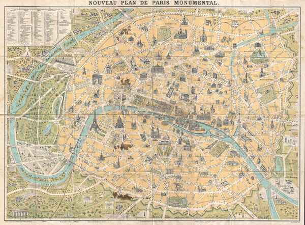
Nouveau Plan de Paris Monumental.
sold
- Digital Map Information
- Suitable for large format printing
- File Size: 23.18 MB
- File Type: ZIP / TIFF
- ICC color profile embedded
- Delivered instantly via download link
An attractive map of Paris, France issued in c. 1890 by L. Guilmin. Covers the old walled city of Paris and the immediate vicinity, especially to the west. Important buildings are shown in profile. All major streets are ... (more details)

Plan de Paris Illustre 1864.
sold
- Digital Map Information
- Suitable for large format printing
- File Size: 18.36 MB
- File Type: ZIP / TIFF
- ICC color profile embedded
- Delivered instantly via download link
An extremely attractive map of Paris, France issued in 1864 by the Garnier Freres. Covers the old walled city of Paris and the immediate vicinity. Important buildings are shown in profile. All major streets are ... (more details)
Stunning Art Deco Map of Paris.

Paris Monumental et Metropolitain.
sold
- Digital Map Information
- Suitable for large format printing
- DPI: 300
- File Size: 24.55 MB
- File Type: ZIP / TIFF
- ICC color profile embedded
- Delivered instantly via download link
This is an extremely attractive c. 1932 tourist pocket map of Paris, France. Covers the old walled city of Paris and the immediate vicinity. Important buildings are shown in profile, including the Eiffel Tower. ... (more details)
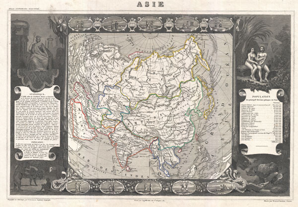
Asie.
sold
- Digital Map Information
- Suitable for large format printing
- DPI: 300
- File Size: 9.78 MB
- File Type: ZIP / TIFF
- ICC color profile embedded
- Delivered instantly via download link
A visually stunning decorative map of Asia dating to 1852, by French map publisher Victor Levasseur. Covers the entire continent of Asia as well as parts adjacent parts Europe and Africa. Shows the Chinese ... (more details)
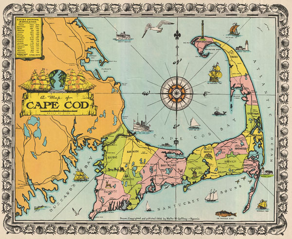
A Map of Cape Cod.
sold
- Digital Map Information
- Suitable for large format printing
- File Size: 11.44 MB
- File Type: ZIP / TIFF
- ICC color profile embedded
- Delivered instantly via download link
This unusual map of Cape Cod was drawn in 1932 by the Cape Cod architect Walter M. Gaffney. This particular map was drawn by Hyannis architect Walter M. Gaffney during the Great Depression. According to his ... (more details)
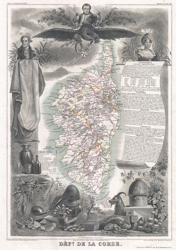
Dept. de la Corse.
sold
- Digital Map Information
- Suitable for large format printing
- DPI: 300
- File Size: 10.04 MB
- File Type: ZIP / TIFF
- ICC color profile embedded
- Delivered instantly via download link
A visually stunning decorative map of Corsica (La Corse) dating to 1852, by French map publisher Victor Levasseur. Levasseur published several different editions of his Corsica map - this being first. The ... (more details)
Map of Ludlow and Custer's reconnaissance of South Dakota's Black Hills in search of Gold.
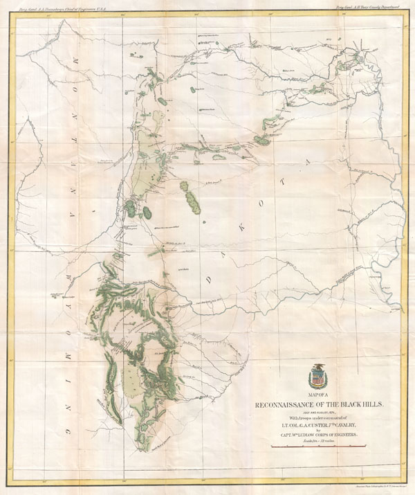
Map of a Reconnaissance of the Black Hills, July and August, 1874, With troops under command of Lt. Col. G. A. Custer, 7th Cavalry, by Capt. Wm Ludlow Corps of Engineers.
sold
- Digital Map Information
- Suitable for large format printing
- File Size: 10.41 MB
- File Type: ZIP / TIFF
- ICC color profile embedded
- Delivered instantly via download link
George Armstrong Custer and William Ludlow's seminal 1874 map of the Black Hills, Dakota Territory, covering from the Missouri to the Powder River and from the 47th to the 43rd parallel. In 1874 one thousand ... (more details)
Levasseur's stunning decorative map of North America showing the ephemeral Republic of Texas.
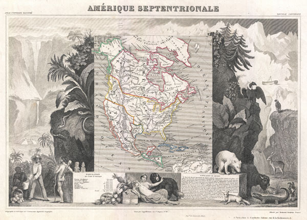
Amerique Septentrionale.
sold
- Digital Map Information
- Suitable for large format printing
- DPI: 300
- File Size: 9.78 MB
- File Type: ZIP / TIFF
- ICC color profile embedded
- Delivered instantly via download link
A visually stunning decorative map of North America dating to 1852, by French map publisher Victor Levasseur. Levasseur published several different editions of his North America map - this being the most ... (more details)
Possibly the most decorative atlas map of the world to appear in the 19th century.

Planisphere.
sold
- Digital Map Information
- Suitable for large format printing
- Full resolution TIFF file
- ICC color profile embedded
- Delivered instantly via download link
A visually stunning decorative map of the world dating to 1852, by French map publisher Victor Levasseur. Levasseur depicts the world on a Mercator Projection, showing the six known continents as well as ... (more details)
A c. 1720 map guide to English piracy and privateering in the West Indies.
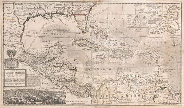
A Map of the West-Indies or the Islands of America in the North Sea; with ye adjacent Countries; explaining what belongs to Spain, England, France, Holland &c. also ye Trade Winds, and ye several Tracts made by ye Galeons and Flota from place to place. According to ye newest and most exact observations, by Herman Moll, Geographer.
sold
- Digital Map Information
- Suitable for large format printing
- DPI: 300
- File Size: 39.29 MB
- File Type: ZIP / TIFF
- ICC color profile embedded
- Delivered instantly via download link
One of the most remarkable and intriguing maps of the West Indies to appear in the 18th century. This is Herman Moll's superb circa 1720 mapping of the West Indies, Caribbean, Gulf of Mexico, Mexico, and ... (more details)