
Extremely rare case map of the area 24 miles around London, England.

Mogg's Twenty Four Miles Round London.
sold
- Digital Map Information
- Suitable for large format printing
- DPI: 300
- File Size: 22.86 MB
- File Type: ZIP / TIFF
- ICC color profile embedded
- Delivered instantly via download link
Edward Mogg's extraordinary 1820 case map of the region 24 miles around London, England. Covers from Ryegate in the south to Hertfort in the north, and from Windsor in the west to Gravesend in the east. Mogg first issued this revolutionary circular format map ... (more details)
Important and monumental 20 panel map of Paris, France.
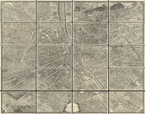
Plan de Paris.
sold
- Digital Map Information
- Suitable for large format printing
- File Size: 17.85 MB
- File Type: ZIP / TIFF
- ICC color profile embedded
- Delivered instantly via download link
This is the c. 1900 Taride edition of Louis Bretez and Michel-Etienne Turgot's monumental 1739 map of Paris. Turgot's map of Paris is possibly the most ambitious urban mapping ever undertaken. Shows the whole of 18th century Paris and offers a wonderful ... (more details)
A curious configuration of Texas presaging the 1850 Compromise following the proposals of Senator Henry Clay.
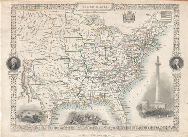
United States.
sold
- Digital Map Information
- Suitable for large format printing
- DPI: 300
- File Size: 5.45 MB
- File Type: ZIP / TIFF
- ICC color profile embedded
- Delivered instantly via download link
An exceptional 1851 John Tallis map of the United States illustrating an ephemeral period shortly following the addition of Texas, the annexation of California, and the treaties ending the Mexican American War. Covers the United States from Santa Fe ... (more details)
Rare view of the of Seat of the Civil War around Washington D.C. and the Chesapeake Bay.

Seat of War. Bird's Eye View of Virginia, Maryland, Delaware and the District of Columbia.
sold
- Digital Map Information
- Suitable for large format printing
- File Size: 29.24 MB
- File Type: ZIP / TIFF
- ICC color profile embedded
- Delivered instantly via download link
A striking 1861 three-color Schedler/Schaus chromolithograph view/map of the Chesapeake Bay region, including Maryland, Virginia, Delaware, and Washington D.C., shortly after the outbreak of the American Civil War (1861 - 1865). Centered on the Chesapeake Bay, the view covers roughly from Gettysburg to Albemarle Sound and from the Ohio River to the Atlantic seaboard. Steam/Sail ships cluster around the mouth of the Chesapeake and Delaware Bays, presumably an attempt to illustrate the ad hoc Union naval blockade of Confederacy. (more details)
One of the first U.S. Coast Survey Charts to depict Miami.
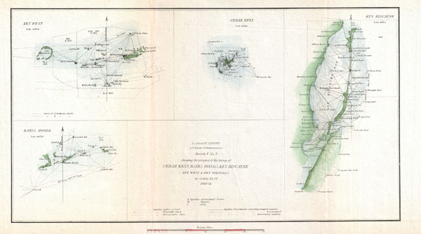
Sketch F No. 2 Showing the Progress of the Survey of Cedar Keys, Bahia Honda, Key Biscayne Key West & Dry Tortugas In Section No. VI 1849-52.
sold
- Digital Map Information
- Suitable for large format printing
- DPI: 300
- File Size: 3.39 MB
- File Type: ZIP / TIFF
- ICC color profile embedded
- Delivered instantly via download link
This is an 1852 triangulation chart of Biscayne Bay, Key West, Bahia Honda, the Cedar keys and the Dry Tortugas produced by the U.S. Coast Survey. Essentially four maps compiled onto a single sheet. Upper left map focuses on Key West, Florida, and ... (more details)
The largest and most dramatic pocket map of Long Island to appear in the 19th century.

Colton's New Map of Long Island.
sold
- Digital Map Information
- Suitable for large format printing
- File Size: 60.46 MB
- File Type: ZIP / TIFF
- ICC color profile embedded
- Delivered instantly via download link
This is Colton's 1880 'New Map of Long Island,' possibly the largest and most dramatic map of Long Island to appear in the 19th century. Covers the region from Newark, Staten Island, and New York City eastward as far as Montauk and Fisher Island. ... (more details)
An early example of one of the most unusal and attractive maps of New York City every printed.

Map of The Country Thirty Three Miles Around The City of New York.
sold
- Digital Map Information
- Suitable for large format printing
- DPI: 300
- File Size: 22.93 MB
- File Type: ZIP / TIFF
- ICC color profile embedded
- Delivered instantly via download link
This is the extremely rare 1848 edition of one of the most beautiful pocket maps of New York made in the 19th century: Colton's Thirty Three Miles Around the City of New York . Covers New York City and vicinity as far south as Ocean County, New ... (more details)
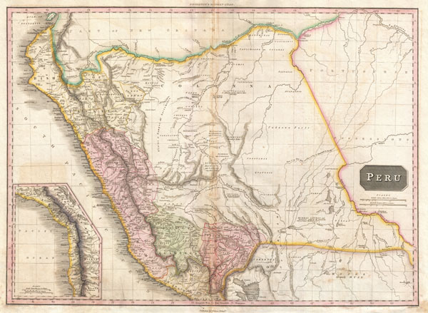
Peru.
sold
- Digital Map Information
- Suitable for large format printing
- DPI: 300
- File Size: 19.67 MB
- File Type: ZIP / TIFF
- ICC color profile embedded
- Delivered instantly via download link
This is John Pinkerton's stunning 1818 map of Peru. Covers the western parts of South America from the Gulf of Guayaquil, in modern Ecuador to Lake Titicaca, modern Peru-Bolivia, and inland well into the Amazon and what is today Brazil. This ... (more details)

Turkey in Asia.
sold
- Digital Map Information
- Suitable for large format printing
- DPI: 300
- File Size: 20.62 MB
- File Type: ZIP / TIFF
- ICC color profile embedded
- Delivered instantly via download link
This is John Pinkerton's stunning 1818 map of Turkey in Asia. Covers the holdings of the early 19th century Ottoman Empire in Asia, inclusive of modern day Turkey, Iraq, Cyprus, Syria, Jordan, Israel, Palestine, Lebanon, Georgia, Armenia, and ... (more details)
Possibly the finest atlas map of Chile to appear in the 19th century.

Chili.
sold
- Digital Map Information
- Suitable for large format printing
- Full resolution TIFF file
- ICC color profile embedded
- Delivered instantly via download link
This is John Pinkerton's stunning 1818 map of Chile. Covers the southwestern coast of South America from the Atacama Desert to the Isle of Chiloe. This beautifully rendered map is truly a masterpiece of engraving, with mountain ranges, ... (more details)
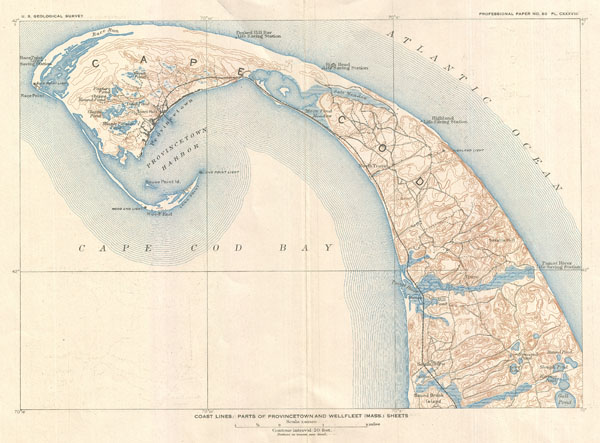
Coast Lines: Parts of Provincetown and Wellfleet (Mass.) Sheets.
sold
- Digital Map Information
- Suitable for large format printing
- File Size: 4.9 MB
- File Type: ZIP / TIFF
- ICC color profile embedded
- Delivered instantly via download link
An unusual 1908 variant on the U.S. Geological Survey's map Cape Cod, Massachusetts. Covers from Gull Pond and Bound Brook Island north along the cape as far as Provincetown Harbor and Race Point. Offers typical superb detail throughout ... (more details)
Extremely scarce U.S. Coast Survey Mapping of West Point Academy

West Point New York.
sold
- Digital Map Information
- Suitable for large format printing
- File Size: 4.48 MB
- File Type: ZIP / TIFF
- ICC color profile embedded
- Delivered instantly via download link
A beautiful example of the U.S. Coast Survey's scarce 1883 map of the West Point Military Academy, New York. Covers the grounds of West Point Military Academy in extraordinary detail noting all important buildings, fortifications, rail ... (more details)

Canada West or Upper Canada.
sold
- Digital Map Information
- Suitable for large format printing
- File Size: 9.76 MB
- File Type: ZIP / TIFF
- ICC color profile embedded
- Delivered instantly via download link
An excellent first edition example of Colton's rare 1855 map of Ontario. Covers what at the time was called Upper or West Canada from Michigan to Montreal. Includes Lake Erie, Lake Ontario, and part of Lake Huron. Two insets in the ... (more details)
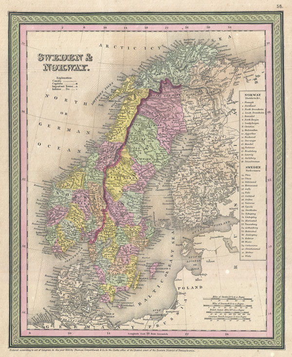
Sweden and Norway.
sold
- Digital Map Information
- Suitable for large format printing
- Full resolution TIFF file
- ICC color profile embedded
- Delivered instantly via download link
A beautiful example of S. A. Mitchell senior's 1850 map of Scandinavia, including Sweden, Norway, Denmark and Finland. Map shows Scandinavia in full with color coding according to region. A table to the right of the map details ... (more details)
An important early mapping of the shoals off Nantucket.

(A No. 2) Preliminary Sketch Showing the positions of Davis's South Shoal and Other Dangers recently Discovered by the Coast Survey and the sounding on the Old South Shoal, Bass Rip, Old Man, Pochuck Rip, &c..
sold
- Digital Map Information
- Suitable for large format printing
- Full resolution TIFF file
- ICC color profile embedded
- Delivered instantly via download link
This beautiful and important sea chart or map depicts the waters immediately surrounding the island of Nantucket, Massachusetts, including Davis' Shoal, Old South Shoal, and others. Uncommon, highly significant, and often ... (more details)
Marks the end of Spanish dominance in the 18th century Pacific.

Carte de la Mer du Sud ou Mer Pacifique entre l'Equateur et le 39 1/2 . De Latitude Septentrionale.
sold
- Digital Map Information
- Suitable for large format printing
- DPI: 300
- File Size: 14.38 MB
- File Type: ZIP / TIFF
- ICC color profile embedded
- Delivered instantly via download link
This is a rare 1750 nautical chart of the Pacific Ocean by the French map publisher N. Bellin. Harkens to the great age of Pacific piracy and privateering. Based on a similar chart in English prepared three years earlier ... (more details)
One of the most beautiful maps of Asia to appear in the 19th century.

Asia.
sold
- Digital Map Information
- Suitable for large format printing
- DPI: 300
- File Size: 24.16 MB
- File Type: ZIP / TIFF
- ICC color profile embedded
- Delivered instantly via download link
This is John Pinkerton's stunning 1818 map of Asia. Covers from the Mediterranean to the Aleutian Islands and from the Arctic to the Equator. This beautifully rendered map is truly a masterpiece of engraving, with ... (more details)
Spectacular trasitional map of Africa revealing an early state of 19th century European incursion into the continent.
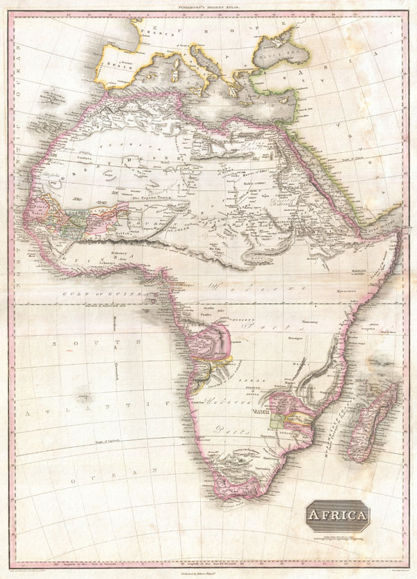
Africa.
sold
- Digital Map Information
- Suitable for large format printing
- Full resolution TIFF file
- ICC color profile embedded
- Delivered instantly via download link
This is John Pinkerton's stunning 1818 map of Africa. Nineteenth century mapmakers were particularly challenged by the difficult task of deciphering Africa. Despite a fairly constant flow of information about the ... (more details)
An extremely unsual variant upon Pinkerton's seminal map of North America.
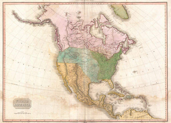
North America.
sold
- Digital Map Information
- Suitable for large format printing
- DPI: 300
- File Size: 17.9 MB
- File Type: ZIP / TIFF
- ICC color profile embedded
- Delivered instantly via download link
This is an extremely unusual mapping of North America prepared for the 1818 American edition of Pinkerton's Atlas. Although the basic engraving remains identical to Pinkerton's Atlas of 1813, published in London, ... (more details)
One of the most beautiful maps of Australasia to appear in the 19th century.
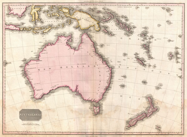
Australasia.
sold
- Digital Map Information
- Suitable for large format printing
- DPI: 300
- File Size: 18.11 MB
- File Type: ZIP / TIFF
- ICC color profile embedded
- Delivered instantly via download link
Truly a masterwork of copperplate engraving, this is Pinkerton's extraordinary 1818 map of Australia, New Zealand and parts of the East Indies and Polynesia. Covers from Borneo south past Australia as far as ... (more details)