
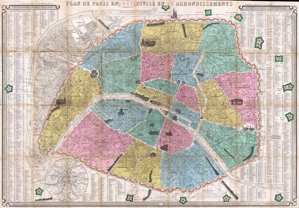
Plan de Paris en 1863 Divise en 20 Arrondissements.
sold
- Digital Map Information
- Suitable for large format printing
- File Size: 33.15 MB
- File Type: ZIP / TIFF
- ICC color profile embedded
- Delivered instantly via download link
This is an extremely attractive 1863 tourist pocket map of Paris, France. Covers the old walled city of Paris and the immediate vicinity. Divided up into 20 arrondissments. Important buildings are shown in profile. Trains entering and leaving the city are also ... (more details)
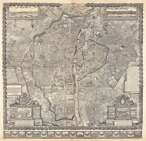
Lutetia Paris.
sold
- Digital Map Information
- Suitable for large format printing
- File Size: 21.85 MB
- File Type: ZIP / TIFF
- ICC color profile embedded
- Delivered instantly via download link
This is a reduction of a plan of Paris originally issued in 1652 by Jacques Gomboust. Gomboust held the position of Ingenieur du Roi and, in that capacity completed a number of important survey's of Paris which eventually evolved into this spectacular map. ... (more details)
Majestic and revolutionary multi panel wall map of Paris.

Lutetia Paris.
sold
- Digital Map Information
- Suitable for large format printing
- File Size: 30.77 MB
- File Type: ZIP / TIFF
- ICC color profile embedded
- Delivered instantly via download link
This majestic nine panel plan of Paris is the c. 1900 Taride reissue of an important map originally issued in 1652 by Jacques Gomboust. Gomboust held the position of Ingenieur du Roi and, in that capacity completed a number of important survey's of Paris ... (more details)
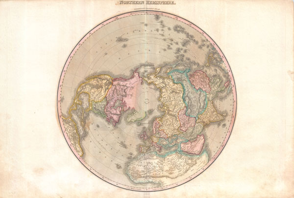
Northern Hemisphere.
sold
- Digital Map Information
- Suitable for large format printing
- DPI: 300
- File Size: 21.33 MB
- File Type: ZIP / TIFF
- ICC color profile embedded
- Delivered instantly via download link
A rare and important 1818 map of the Northern Hemisphere by John Pinkerton. On a Polar projection, this map depicts North America, Asia, the East Indies, and North Africa. In North America, thanks primarily to the work of Cook in the Pacific Northwest, ... (more details)
Uncommon transitional map of the Antarctic with no Southern Continent.
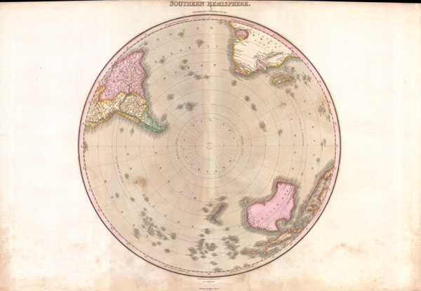
Southern Hemisphere.
sold
- Digital Map Information
- Suitable for large format printing
- DPI: 300
- File Size: 18.95 MB
- File Type: ZIP / TIFF
- ICC color profile embedded
- Delivered instantly via download link
A rare and important 1818 map of the Southern Hemisphere by John Pinkerton. On a Polar projection, this map depicts Australia, Polynesia, and the parts of South America and Africa. This map was issued after the search for Terra Australis , or the ... (more details)
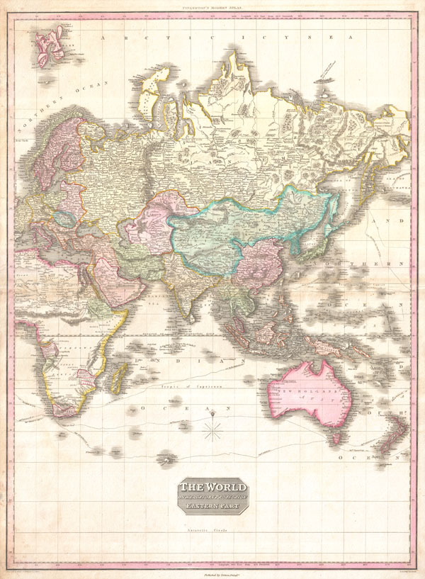
The World on Mercator's Projection Eastern Part.
sold
- Digital Map Information
- Suitable for large format printing
- DPI: 300
- File Size: 22.5 MB
- File Type: ZIP / TIFF
- ICC color profile embedded
- Delivered instantly via download link
A rare and important 1818 map of the Eastern Hemisphere by John Pinkerton. Depicts Asia, Europe, Africa and Australia. The routes of various important explores are noted, including Cook, Vancouver, Perouse, and the return route taken by Cook's ... (more details)

The World on Mercator's Projection Western Part.
sold
- Digital Map Information
- Suitable for large format printing
- DPI: 300
- File Size: 15.87 MB
- File Type: ZIP / TIFF
- ICC color profile embedded
- Delivered instantly via download link
A rare and important 1818 map of the Western Hemisphere by John Pinkerton. Depicts North America, Central America and South America as well as parts of Polynesia, Siberia, Greenland, Iceland, Europe and Africa. The routes of various important ... (more details)
A historic manuscript survey of Tribeca from the 1700s.
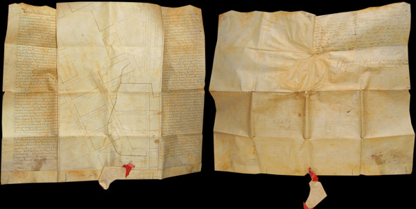
A Map shewing the arrangemnt agreed to between the Corporation of Trinity Church, and the Proprietors of the Estate late Ireland's, with regard to Streets, &c. &c.
sold
- Digital Map Information
- Suitable for large format printing
- Full resolution TIFF file
- ICC color profile embedded
- Delivered instantly via download link
This is a rare historic 1796 indenture and associated manuscript survey map documenting the transfer of certain lands in the Tribeca district of Manhattan from the Trinity Church Corporation to the City of New York. The indenture agreement ... (more details)
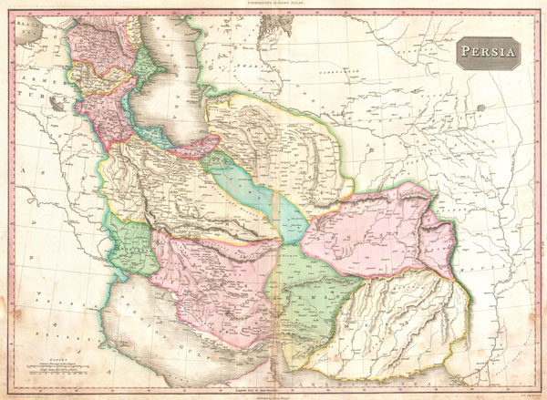
Persia.
sold
- Digital Map Information
- Suitable for large format printing
- DPI: 300
- File Size: 18.74 MB
- File Type: ZIP / TIFF
- ICC color profile embedded
- Delivered instantly via download link
A rare and important 1818 map of Persia by John Pinkerton. Depicts from the Black Sea eastward as far as the Indus Valley, extends north to the Aral Sea and South to the Persian Gulf and the Arabian Sea. Includes the modern day countries ... (more details)
Exceptional post-Revolutionary map of the America Southest.

United States of America Southern Part.
sold
- Digital Map Information
- Suitable for large format printing
- DPI: 300
- File Size: 20.46 MB
- File Type: ZIP / TIFF
- ICC color profile embedded
- Delivered instantly via download link
A rare and important 1818 map of the southeastern part of the United States. Depicts from the Mississippi River eastward to the Pacific, extends north as far as Delaware and south as far as Florida and the Mississippi Delta. This map was ... (more details)

West Indies.
sold
- Digital Map Information
- Suitable for large format printing
- DPI: 300
- File Size: 17.6 MB
- File Type: ZIP / TIFF
- ICC color profile embedded
- Delivered instantly via download link
Extraordinary large format map of the West Indies published in 1818 by cartographer John Pinkerton. Centered on the island of Hispaniola or Santo Domingo, this map covers from the Bay of Honduras to the Windward Isles, and from Florida ... (more details)
An important 19th century map of Arabia.

Arabia.
sold
- Digital Map Information
- Suitable for large format printing
- DPI: 300
- File Size: 18.41 MB
- File Type: ZIP / TIFF
- ICC color profile embedded
- Delivered instantly via download link
Extraordinary large format map of Arabia published in 1818 by cartographer John Pinkerton. Centered on the desert province of Neged, this map details the entire Arabian peninsula as well as the Red Sea, the Persian Gulf, and adjacent ... (more details)

A New Map of Turkey in Europe Divided into all its Provinces' with the Adjacent Countries in Europe and Asia: Drawn Chiefly from the Maps Published by the Imperial Academy of St. Petersburg.
sold
- Digital Map Information
- Suitable for large format printing
- DPI: 300
- File Size: 22.18 MB
- File Type: ZIP / TIFF
- ICC color profile embedded
- Delivered instantly via download link
An extraordinary large format 1794 map of Greece, Turkey in Europe, the Balkans and adjacent regions by Laurie and Whittle. Map covers from the Gulf of Taranto, Italy, eastward as far as the Crimea, extend northwards to Transylvania ... (more details)

Illustrated and Indexed Map of Central Park.
sold
- Digital Map Information
- Suitable for large format printing
- File Size: 12.31 MB
- File Type: ZIP / TIFF
- ICC color profile embedded
- Delivered instantly via download link
A very attractive 1893 map of New York City's Central Park prepared and printed for inclusion in the Illustrated and Historical Souvenir of Central Park . This is an extremely rare variant on the map of Central Park that originally ... (more details)
A seminal map in the search for a Northeast Passage to Asia.
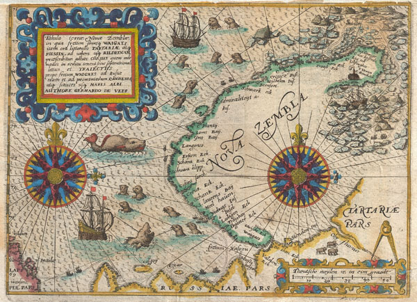
Tabula terrae Nouae Zemblae in qua fretum sinusq Waigats item ord littorialis Tartariae atq Russiae, ad urgem usq Kildeinam ….Authore Gerhardo De Veer.
sold
- Digital Map Information
- Suitable for large format printing
- DPI: 300
- File Size: 3.54 MB
- File Type: ZIP / TIFF
- ICC color profile embedded
- Delivered instantly via download link
A highly important map regarding the early search for a Northeast Passage. This remarkable map was drawn in 1601 by Theodore de Bry to describe the ill fated third voyage of the Dutch explorer William Barentsz in search of the ... (more details)
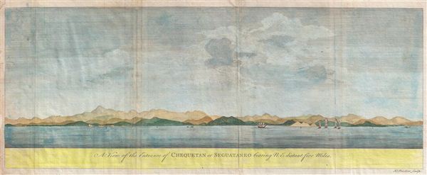
A View of the Entrance of Chequetan or Seguataneo bearing N.E. distant five Miles.
sold
- Digital Map Information
- Suitable for large format printing
- DPI: 300
- File Size: 6.93 MB
- File Type: ZIP / TIFF
- ICC color profile embedded
- Delivered instantly via download link
An extremely attractive 1748 coastal view of the Mexican harbor of Zihuatanejo by George Anson. Today Zihuatanejo is a stunningly beautiful resort area in Guerrero, Mexico, about 250 km north of Acapulco. This area was ... (more details)

Preliminary Chart of New York Bay and Harbor.
sold
- Digital Map Information
- Suitable for large format printing
- File Size: 16.05 MB
- File Type: ZIP / TIFF
- ICC color profile embedded
- Delivered instantly via download link
A rare 1857 coastal chart of New York City, it's harbor, and environs. One of the first 19th century carts to depicts New York City as we know it today, including Manhattan, Queens, Brooklyn, the Bronx and Staten ... (more details)

Preliminary Chart of Monterey Bay California.
sold
- Digital Map Information
- Suitable for large format printing
- File Size: 9.83 MB
- File Type: ZIP / TIFF
- ICC color profile embedded
- Delivered instantly via download link
This is an uncommon 1857 U.S. Coast Survey Chart or Map of Monterey Bay, California Covers from the town and mission of Santa Cruz, south to Monterey City and Point Pinos. Countless depth soundings throughout. ... (more details)

Mobile Bay, Alabama
sold
- Digital Map Information
- Suitable for large format printing
- File Size: 32.44 MB
- File Type: ZIP / TIFF
- ICC color profile embedded
- Delivered instantly via download link
This is an uncommon 1856 U.S. Coast Survey Chart or Map of Mobile Bay, Alabama. Covers from Grand Bay and the mouths of the Alabama and Apalachee Rivers south to Mobile Point, Dauphine Island, and the Sand Island ... (more details)

Asia and its Islands According to d'Anville; Divided into Empires, Kingdoms, States, Regions, &ca. with the European possessions and settlements in the East Indies and an exact delineation of all the discoveries made in the eastern parts by the English under Captn. Cook.
sold
- Digital Map Information
- Suitable for large format printing
- DPI: 300
- File Size: 67.68 MB
- File Type: ZIP / TIFF
- ICC color profile embedded
- Delivered instantly via download link
An absolutely stunning and monumental two panel 1794 wall map of Asia by J. B. B. D'Anville. Covers the entire continent of Asia, including Arabia, the Indian subcontinent, and the East Indies. Names countless ... (more details)