

Johnson's Massachusetts, Connecticut, and Rhode Island.
sold
- Digital Map Information
- Suitable for large format printing
- File Size: 22.84 MB
- File Type: ZIP / TIFF
- ICC color profile embedded
- Delivered instantly via download link
This is Johnson and Browning's 1861 map of Massachusetts, Connecticut and Rhode Island. Covers the states divided into counties with special attention to transportation, especially roads, railroads, and canals. Includes parts of Long Island (East Hampton and ... (more details)

Johnson's Ohio and Indiana, by Johnson and Ward.
sold
- Digital Map Information
- Suitable for large format printing
- File Size: 24.14 MB
- File Type: ZIP / TIFF
- ICC color profile embedded
- Delivered instantly via download link
This is Johnson and Ward's 1862 map of Ohio and Indiana. Covers the states divided into counties with special attention to transportation, especially roads, railroads, and canals. There is an engraved view of the Ohio State Capitol Building at Columbus in ... (more details)

Taiwan
sold
- Digital Map Information
- Suitable for large format printing
- File Size: 20.9 MB
- File Type: ZIP / TIFF
- ICC color profile embedded
- Delivered instantly via download link
This is a rare World War II era Japanese Aviation map of the island of Formosa or Taiwan. Features the island with superb detail, especially with regard to navigational instructions and topography. Include the nearest Chinese coast as well as nearby ... (more details)
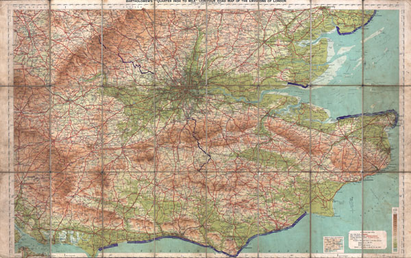
Bartholomew's 'Quarter Inch to Mile' Coutour Road Map of the Environs of London.
$200.00
Acquire
- Digital Map Information
- Suitable for large format printing
- File Size: 36.11 MB
- File Type: ZIP / TIFF
- ICC color profile embedded
- Delivered instantly via download link
This is a rare c. 1928 map of London, England, and its environs. Covers from Portsmouth eastward as far as Ramsgate and northward as far as Oxford and Colchester. Includes London with basic streets and roadways noted Includes routes for road, ... (more details)

Map of Public Surveys in California to accompany Report of the Surveyor General, 1854.
sold
- Digital Map Information
- Suitable for large format printing
- Full resolution TIFF file
- ICC color profile embedded
- Delivered instantly via download link
This magnificent 1854 map is one of the rarest and most sought after early Land Survey maps of California. Covers the entire state with very good detail in the San Francisco Bay area, along the Central Valley, and in the Sierra Madres. ... (more details)

Map of The World Illustrating the Principal Features of Meteorology. / Map of the World Showing the Distributions and Limits of Cultivation of The Principal Plants Useful to Mankind.
sold
- Digital Map Information
- Suitable for large format printing
- File Size: 6.41 MB
- File Type: ZIP / TIFF
- ICC color profile embedded
- Delivered instantly via download link
This is one of the thematic world map sets from the rare 1861 edition of Johnson and BrowningÂ's Illustrated Atlas of the World . Features two maps drawn within a single border. The upper map depicts the worldÂ's meteorological ... (more details)
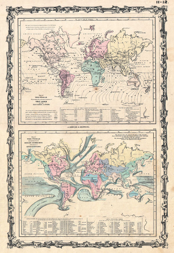
Map of The World Illustrating the principal features of the Land and the Co-Tidal Lines. / Map of the World Showing the principal Ocean Currents & Boundaries of River Systems.
sold
- Digital Map Information
- Suitable for large format printing
- File Size: 6.71 MB
- File Type: ZIP / TIFF
- ICC color profile embedded
- Delivered instantly via download link
This is one of the thematic world map sets from the rare 1861 edition of Johnson and Browning's Illustrated Atlas of the World . Features two maps drawn within a single border. The upper map depicts the world's co-tidal lines ... (more details)

Johnson's Physical Map, Showing the Principal Mountains, Plateaus, & Plains of The World. / Johnson's World. Showing the Lines of Equal Magnetic Declination. / Johnson's World. Showing the Course of the Tidal-Wave in the Three Great Oceans and the Distribution of Volcanoes. / Johnson's World. Showing teh Distribution of the Principal Races of Man.
sold
- Digital Map Information
- Suitable for large format printing
- File Size: 16.67 MB
- File Type: ZIP / TIFF
- ICC color profile embedded
- Delivered instantly via download link
This is one of the thematic world maps from the rare 1870 edition of A. J. Johnson's Atlas of the World . Features four maps drawn c. 1858 by Professor A Guyot. The largest depicts the physical word and attempts to show ... (more details)

Map of the United States Showing the Progress of the Topographic Survey during the Fiscal Year 1887-8.
sold
- Digital Map Information
- Suitable for large format printing
- File Size: 19.01 MB
- File Type: ZIP / TIFF
- ICC color profile embedded
- Delivered instantly via download link
This uncommon map of the United States was issued in 1888 by the U.S. Geological Survey. Depicts the Entire United States with various shaded zones indicating the progress of the Topographic Survey. Various zones show ... (more details)

Lynn Harbor Massachusetts
sold
- Digital Map Information
- Suitable for large format printing
- File Size: 9.15 MB
- File Type: ZIP / TIFF
- ICC color profile embedded
- Delivered instantly via download link
A rare 1859 U.S. Coast Survey chart of the Lynn Harbor, Massachusetts. Covers the North Shore region in the vicinity of Lynn from Chelsea Creek to Kings Beach, including Nahant. Map is hand colored and offers ... (more details)

Canada East or Lower Canada and New Brunswick.
sold
- Digital Map Information
- Suitable for large format printing
- File Size: 10.28 MB
- File Type: ZIP / TIFF
- ICC color profile embedded
- Delivered instantly via download link
This is the very rare 1854 issue of J. H. Colton map of Canada East or Lower Canada. Covers what is today Montreal, Quebec, and New Brunswick. Follows the St. Lawrence River Valley from Montreal eastward to ... (more details)

Northern Hemisphere.
sold
- Digital Map Information
- Suitable for large format printing
- DPI: 300
- File Size: 19.33 MB
- File Type: ZIP / TIFF
- ICC color profile embedded
- Delivered instantly via download link
This fascinating hand colored 1814 map by Edinburgh cartographer John Thomson depicts the Northern Hemisphere from the Arctic to the Equator. Includes all of North America, Europe, and Asia as well as the ... (more details)
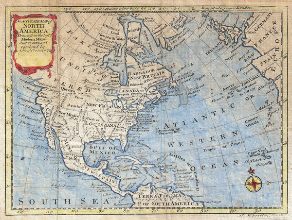
An Accurate Map of North America, Drawn from the Best Modern Maps and Charts and Regulated By Astronl. Observatns.
sold
- Digital Map Information
- Suitable for large format printing
- Full resolution TIFF file
- ICC color profile embedded
- Delivered instantly via download link
This is a curious little map of North America. Covers the whole North America as well as parts of Europe and South America. This is a pirated 1797 reissue of Bowen 1747 map of the same name. Wheatley ... (more details)
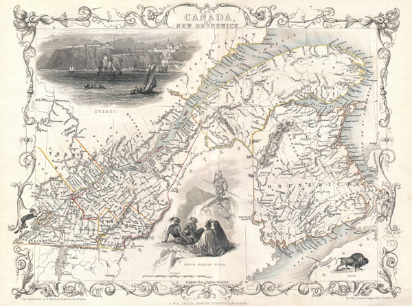
East Canada, and New Brunswick.
sold
- Digital Map Information
- Suitable for large format printing
- Full resolution TIFF file
- ICC color profile embedded
- Delivered instantly via download link
This is John Tallis' extremely attractive c. 1850 map of East Canada or what is now Quebec and New Brunswick. Includes Montreal, Quebec City, and the St. Lawrence River valley. Features five stunning ... (more details)
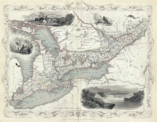
West Canada.
sold
- Digital Map Information
- Suitable for large format printing
- DPI: 300
- File Size: 6.07 MB
- File Type: ZIP / TIFF
- ICC color profile embedded
- Delivered instantly via download link
This is John Tallis' extremely attractive c. 1850 map of West Canada or what is now Ontario. Includes Lake Erie, Lake Ontario, and part of Lake Huron with Georgian Bay. Features five stunning ... (more details)

Coast Lines: Part of Nantucket (Mass.) Sheet
sold
- Digital Map Information
- Suitable for large format printing
- File Size: 3.77 MB
- File Type: ZIP / TIFF
- ICC color profile embedded
- Delivered instantly via download link
This is an unusual chart of Nantucket, Massachusetts, published c. 1919 by the U.S. Geological Survey. Depicts the western part of the island in incredible detail with even individual ... (more details)
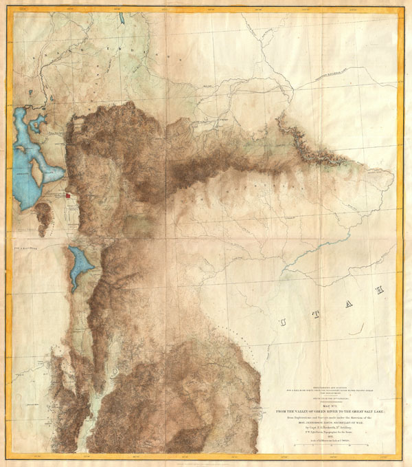
Explorations and Surveys for a Rail Road Route from the Mississippi River to the Pacific Ocean. War Department. Route near the 41st Parallel. Map No. 1 From the Valley of the Green River to the Great Salt Lake; from Explorations and Surveys made under the direction of the Hon. Jefferson Davis, Secretary of War.
sold
- Digital Map Information
- Suitable for large format printing
- File Size: 7.66 MB
- File Type: ZIP / TIFF
- ICC color profile embedded
- Delivered instantly via download link
This is a rare and important 1855 map of parts of Utah and Wyoming prepared for the Pacific Railroad Survey . Covers from the Great Salt Lake eastward to the Green River Valley and ... (more details)

Johnson's Roman Empire, Imperium Romanorum Latissime Patens.
sold
- Digital Map Information
- Suitable for large format printing
- File Size: 16.72 MB
- File Type: ZIP / TIFF
- ICC color profile embedded
- Delivered instantly via download link
This is A. J. Johnson's c. 1864 map of the Roman Empire. Depicts the whole of Europe as well as parts of North Africa, Asia and Persia. Inset maps in the upper right quadrant ... (more details)
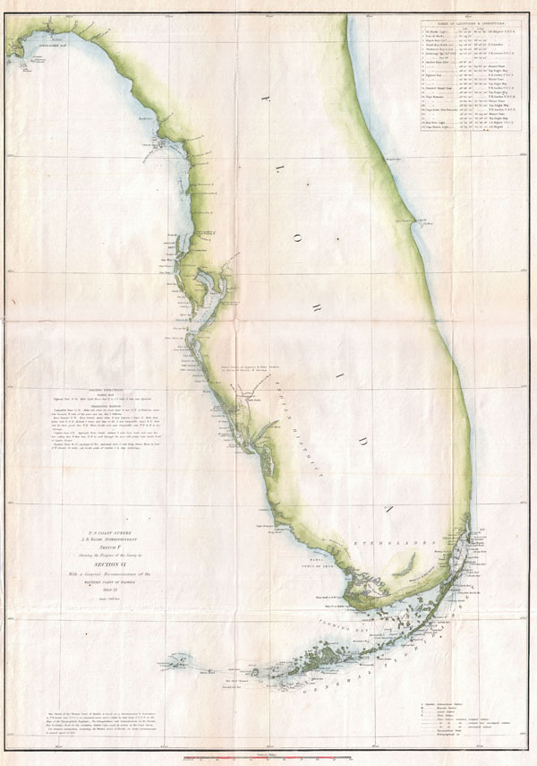
U.S. Coast Survey. A. D. Bache Superintendent. Sketch F Showing the Progress of the Survey in Section VI. With a General Reconnaissance of the Western Coast of Florida 1848-52.
sold
- Digital Map Information
- Suitable for large format printing
- DPI: 300
- File Size: 10.09 MB
- File Type: ZIP / TIFF
- ICC color profile embedded
- Delivered instantly via download link
A rare costal chart of Florida by the U. S. Coast Survey, 1852. Depicts the whole of the Florida peninsula, but specifically details the western coastline, showing all bays and ... (more details)
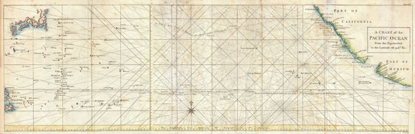
A Chart of the Pacific Ocean from the Equinoctial to the Latitude fo 39 1/2 d. No.
sold
- Digital Map Information
- Suitable for large format printing
- DPI: 300
- File Size: 14.6 MB
- File Type: ZIP / TIFF
- ICC color profile embedded
- Delivered instantly via download link
This is a rare 1748 nautical chart of the Pacific Ocean by the English map publisher R. W. Seale. Chart depicts the trade routes used by Spanish Galleons from Acapulco, Mexico ... (more details)