

Scandinavia complectens Sueciae Daniae & Norvegiae Regna ex Tabulis Joh. Bapt Homanni Norimbergae.
sold
- Digital Map Information
- Suitable for large format printing
- DPI: 300
- File Size: 22.84 MB
- File Type: ZIP / TIFF
- ICC color profile embedded
- Delivered instantly via download link
A beautifully detailed c. 1730 J. B. Homann map of Scandinavia. Depicts both Denmark, Norway, Sweden, Finland and the Baltic states of Livonia, Latvia and Curlandia. The map notes fortified cities, villages, roads, bridges, forests, castles and topography. The ... (more details)
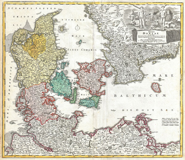
Regni Daniae in quo sunt Ducatus Holsatia et Slesvicum Insulae Danicae Provinciae Iutia Scania Blekingia Nova Tabula
sold
- Digital Map Information
- Suitable for large format printing
- DPI: 300
- File Size: 23.17 MB
- File Type: ZIP / TIFF
- ICC color profile embedded
- Delivered instantly via download link
A beautifully detailed c. 1730 J. B. Homann map of Denmark. Depicts both insular and peninsular Denmark along with parts of Germany and Sweden. The map notes fortified cities, villages, roads, bridges, forests, castles and topography. The elaborate title ... (more details)
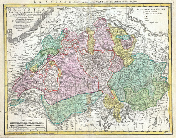
Helvetia Tredecim Statibus Liberis quos Cantones vocant, composita. Unacum feoderatis & subjectis Provinciis, ex porbatissimis Subsidiis geographice delineata per Dm. Tobiam Mayerum, Professorem Matth. Goettingensem.
sold
- Digital Map Information
- Suitable for large format printing
- DPI: 300
- File Size: 22.76 MB
- File Type: ZIP / TIFF
- ICC color profile embedded
- Delivered instantly via download link
A beautifully detailed 1751 Homann Heirs map of Switzerland. Depicts Switzerland along with parts of Italy, France, Germany and Austria. The map notes fortified cities, villages, roads, bridges, forests, castles and topography. Title cartouche in the ... (more details)
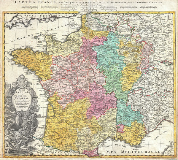
Regni Galliae seu Franciae et Navarrae Tabula Geographica in usum Elementorum Geographiae Schaziano rum accomodata Per Homannianos Heredes 1741. / Carte de France dressee par Guillaume de L'Isle et accommodee par les Heritiers d'Homann a l'instruction de la Jeunesse Norimb. 1741.
sold
- Digital Map Information
- Suitable for large format printing
- DPI: 300
- File Size: 23.85 MB
- File Type: ZIP / TIFF
- ICC color profile embedded
- Delivered instantly via download link
A beautifully detailed 1741 Homann Heirs map of France based upon earlier work of Guillaume de L'Isle. Depicts the Kingdoms of France and Navarre along with parts of Italy, Switzerland, Spain and Germany. The map notes fortified cities, villages, ... (more details)

Regnorum Hispaniae et Portugalliae Tabula generalis de l'Isliana aucta et ad Usum Scholarum novissime accomodata á Ioh. Bapt. Homanno S.C.M. Geogr. Norimbergae. / El Reyno de Espanna dividido en dos grandes Estados de Argon Y de Castilla, subdividido en muchas Provincias, donde le halla tambien El Reyno de Portugal.
sold
- Digital Map Information
- Suitable for large format printing
- DPI: 300
- File Size: 21.82 MB
- File Type: ZIP / TIFF
- ICC color profile embedded
- Delivered instantly via download link
A beautifully detailed c. 1730 J. B. Homann map of Spain and Portugal. Depicts the Iberian peninsula in considerable detail including the Balearic Islands of Majorca, Minorca and Ibiza. Also covers parts of France and northern Africa. The map ... (more details)

Map of the Basin of the St. Lawrence Showing also the Natural and Artifical Routes Between the Atlantic Ocean and the Interior of North America.
sold
- Digital Map Information
- Suitable for large format printing
- DPI: 300
- File Size: 94.78 MB
- File Type: ZIP / TIFF
- ICC color profile embedded
- Delivered instantly via download link
A rare, beautiful and gigantic map of the St. Lawrence Basin issued in 1852 for Israel de Wolf Andrew's report for the Treasury Department. Depicts the Basin of the St. Lawrence River from the Maritime Provinces of New Brunswick and Nova ... (more details)

Imperii Romano-Germanici in suos Status et Circulos Divisi Tabula Generalis in Ustus Iuventutis Erudiendae…
sold
- Digital Map Information
- Suitable for large format printing
- DPI: 300
- File Size: 21.74 MB
- File Type: ZIP / TIFF
- ICC color profile embedded
- Delivered instantly via download link
A beautifully detailed c. 1740 J. B. Homann map of those parts of Europe dominated by the Holy Roman Empire or the German Empire. Depicts most of central Europe from the Netherlands eastward as far as Poland and Hungary and as far south ... (more details)
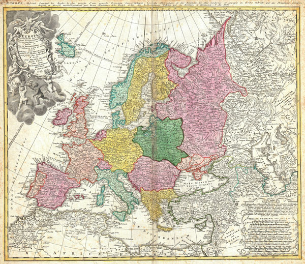
Europa Secundum legitimas Projectionis Stereographicae regulas et juxta recentissimas observationes aeque ac relationes… / L'Europe, dessinee suivant les Regles le plus precises d'une nouvelle Projection Stereographique, tiree des Observations et des Relations les plus modernes et appuyee en divers endroits des Monumens antiques, dressee et divisee methodiquement par Iean Mattias Has Profess. Ordin des Mathematiques: Publiee par les Heritiers d'Homann L'An 1743
sold
- Digital Map Information
- Suitable for large format printing
- DPI: 300
- File Size: 20.94 MB
- File Type: ZIP / TIFF
- ICC color profile embedded
- Delivered instantly via download link
A beautifully detailed 1743 Johann Matthais Haas map of Europe. Depicts all of Europe including Iceland and parts of North Africa and Asia. Color coded according to sovereign nation. Elaborate title cartouche in the upper left quadrant ... (more details)
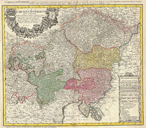
S. R. I. Circulus Austriacus ... le Cercle d'Autriche consistant dans l'Archiduché d'Autriche, le Duché de Stirie, de Carinthie, de Carniole, dans le Comté de Tyrol, et les Pays Autrichiens Anterieurs, dans la Souabe, avec ses confins dessiné avec justesse ...
sold
- Digital Map Information
- Suitable for large format printing
- DPI: 300
- File Size: 22.33 MB
- File Type: ZIP / TIFF
- ICC color profile embedded
- Delivered instantly via download link
A beautifully detailed 1747 Homann Heirs map of Austria and Bohemia ( Czech Republic). Includes parts of Italy, Switzerland, Germany, Croatia, and Hungary. The map is filled with information including fortified cities, villages, roads, ... (more details)

Tabula Marchionatus Brandenburgici et Ducatus Pomeraniae quae sunt Pars Septentrionalis Circuli Saxoniae Superioris…
sold
- Digital Map Information
- Suitable for large format printing
- Full resolution TIFF file
- ICC color profile embedded
- Delivered instantly via download link
A fine example of J. B. Homann's c. 1720 map Brandenburg and Pomerania, Germany. Shows Frankfurt, Brandenburg and Berlin. Also includes parts of Denmark and much of Poland. The map is filled with information including fortified ... (more details)
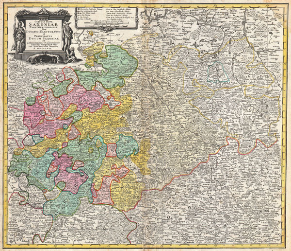
Circuli Supe. Saxoniae Pars Meridionalis sive Ducatus Electoratus et Principatus Ducum Saxoniae…
sold
- Digital Map Information
- Suitable for large format printing
- Full resolution TIFF file
- ICC color profile embedded
- Delivered instantly via download link
A fine example of the Homann Heirs map of Saxony, Germany. Covers from Berlin in the north, to Prague in the southeast and Efurt in the west. The map is filled with information including fortified cities, villages, roads, ... (more details)
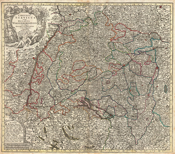
Circulus Suevicus in quo Ducatus Wirtenbergensis cum reliquis Statibus et Provinciis curate defiguatus propomtur Studio et eaelo Matthaei Seutteri.
sold
- Digital Map Information
- Suitable for large format printing
- DPI: 300
- File Size: 24.85 MB
- File Type: ZIP / TIFF
- ICC color profile embedded
- Delivered instantly via download link
This is a rare c. 1740 map of Swabia and Wittenberg, Germany. Covers from Strasburg eastward as far as Landsperg, north as far as Nuremberg and south to Lucern. Includes Nuremberg, Heidelberg, Strasburg, Manheim, Lucerne ... (more details)

Bavariae Circulus et Electorat Insuadquasque Ditiones tam cum Adiacentibus Quam Insertis Regionibus accuratissime divisus part Jo: Baptistam Homannum Norimbergae. / La cercle de Baviere, qui comprend la regence d'Amberg …
sold
- Digital Map Information
- Suitable for large format printing
- Full resolution TIFF file
- ICC color profile embedded
- Delivered instantly via download link
This is a rare and attractive map of Bavaria, Germany. Covers from Rabiz as far south as Innsbruck, including Munich, Salzburg, Passau, Bamberg, Nuremberg and Augsburg. Detail includes cities, forts, some topographical ... (more details)

Sketch A No. 5 Showing proposed Site for a Light House on Sow and Pigs Reef.
sold
- Digital Map Information
- Suitable for large format printing
- DPI: 300
- File Size: 5.83 MB
- File Type: ZIP / TIFF
- ICC color profile embedded
- Delivered instantly via download link
This is an unusual 1853 U.S. Coast Survey chart of the Sow and Pigs Reef, located just off Cuttyhunk, near Martha's Vineyard, Massachusetts. Chart depicts the site of a proposed lighthouse on Saddle Rock. An inset in ... (more details)
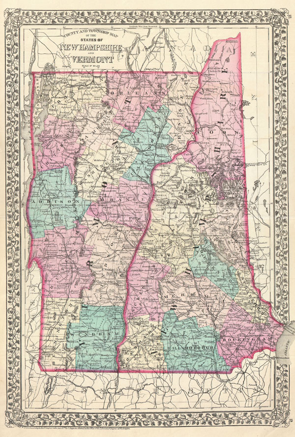
County and Township Map of the States of New Hampshire and Vermont.
sold
- Digital Map Information
- Suitable for large format printing
- File Size: 16.14 MB
- File Type: ZIP / TIFF
- ICC color profile embedded
- Delivered instantly via download link
A beautiful example of S. A. Mitchell Jr.'s 1877 map of Vermont and New Hampshire. Denotes both political and geographical details. Divided according to counties and highlighted with Mitchell's typical pastels. One ... (more details)

Plan of Boston.
sold
- Digital Map Information
- Suitable for large format printing
- File Size: 14.69 MB
- File Type: ZIP / TIFF
- ICC color profile embedded
- Delivered instantly via download link
A beautiful example of S. A. Mitchell Jr.'s 1879 map of Boston, Massachusetts. Covers Boston as far east as Brookline and as far south as Dorchester. Detailed to the level of individual buildings and streets. An ... (more details)

Colton's New Jersey.
sold
- Digital Map Information
- Suitable for large format printing
- File Size: 19.47 MB
- File Type: ZIP / TIFF
- ICC color profile embedded
- Delivered instantly via download link
This is a large double page folio variant form of Colton's Map of New Jersey. Issued in Colton's 1868, this map represents a significant update upon the earlier Colton map of New Jersey which had not been ... (more details)

Hawaii Territory Survey, Niihau Hawaiian Islands, 1904.
sold
- Digital Map Information
- Suitable for large format printing
- File Size: 3.36 MB
- File Type: ZIP / TIFF
- ICC color profile embedded
- Delivered instantly via download link
This rare and extraordinary 1904 map of the island of Niihau was prepared for the 1906 Report of the Governor of the Territory of Hawaii to the Secretary of the Interior . The Report was an attempt to ... (more details)

County Map of Arizona and New Mexico.
sold
- Digital Map Information
- Suitable for large format printing
- File Size: 4.17 MB
- File Type: ZIP / TIFF
- ICC color profile embedded
- Delivered instantly via download link
A beautiful example of S. A. Mitchell Jr.'s 1877 map of Arizona and New Mexico. Superb detail regarding American Indian Tribes, mining areas, and emigrant trails. Denotes both political and ... (more details)

Sketch F Showing the Progress of the Survey in Section VI. With a General Reconnaissance of the Coast of Florida 1848-57.
sold
- Digital Map Information
- Suitable for large format printing
- File Size: 7.47 MB
- File Type: ZIP / TIFF
- ICC color profile embedded
- Delivered instantly via download link
This is a rare 1857 U.S. Coast Survey chart of the Florida coast. Omits the southern top of Florida. An inset in the lower left quadrant details Tortugas Island. There is an interesting ... (more details)