
Ghost towns, lost mines, and romance.

The Historic West. Lost Mines and Ghost Towns, Frontier Military Forts.
sold
This is a 1968 Andy Dagosta pictorial map of the American West highlighting ghost towns, lost mines, and other frontier sites. Covering from Central Colorado to the Pacific, skull icons mark ghost towns, bugles identify sites of military posts (some dated), crossed shovels and pickaxes indicate old mines, and bells mark missions. The storied emigrant trails of the Old West, including the Oregon Trail, California Trail, and Santa Fe Trail are noted. Vignettes throughout depict Native Americans, a covered wagon, a prospector with his mule, and a ghost town, among other scenes. A pictorial border surrounds the entire map and reinforces the adventure and romance American frontier. (more details)
Bookstores in the Mission District!

A Book Lover's Guide to the Mission.
sold
This is a 1991 Wayne Holder and Elizabeth Newman map of the Mission District, San Francisco, California. A description of the map published in the May 1991 edition of the North Mission News describes the map best:
A Book Lover's Guide to the Mission is a handy, pocket-sized guide to the many bookstores and cafes in this culturally rich and ethnically diverse neighborhood. It also lists galleries, theatres, and other places where booklovers hang out.(more details)
The front has drawings of thirty-four shop fronts, and listings of almost fifty establishments. On the back, you will find descriptions of each place, along with hours of business, addresses and telephone numbers.
In a departure from the usual competitive nature of business, many of the small shops in the area, as well as the Mission Branch of the San Francisco Public Library, contributed to help make the map a reality. Wayne Holder, owner of Manzanita Used Books and Records, created the map with local graphic artist Elizabeth Newman.
Newcomers and visitors can use the map to become acquainted with the neighborhood, and even long-term residents may find a few surprises. The neighborhood is constantly changing, so we plan to update the listings periodically. On this page you’ll find we have added six new cafes that have opened since the first edition of the map was issued in late February. The map is available at most Mission district bookstores and cafes. Pick up a map soon and take a walking tour of the neighborhood!
Track James Bond.

The Ian Fleming Thriller Map.
sold
This is a 1987 John Zeleznik and Susan Lewis pictorial map of the world drawn to highlight Ian Fleming's James Bond novels. A generic portrait of James Bond (that admittedly bears a striking resemblance to Sean Connery) dominates the sheet. A portrait of a classic 'Bond Girl' wearing sparkling diamonds and holding an open bottle of champagne appears as well. An Aston Martin appears in the lower left, while a Japanese inspired temple occupies the upper right. The entire map is superimposed on a gigantic Union Jack meant to illustrate the global reach of British intelligence. Crosshairs mark 117 locations corresponding to an index that further breaks sites down by novel and chronology, covering roughly from Casino Royale (1953) through Octopussy (1965). In addition to locations, the map notes cars, drinks, villains, women, and guns from each. Completing the Bond aesthetic, the index is superimposed over illustrations of lounging naked women. (more details)
Air route from San Francisco to Auckland.
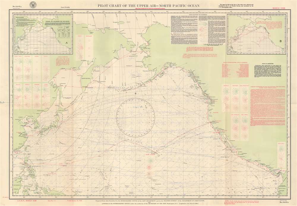
Pilot Chart of the Upper Air - North Pacific Ocean.
$300.00
Acquire
- Digital Map Information
- Suitable for large format printing
- Full resolution TIFF file
- ICC color profile embedded
- Delivered instantly via download link
This is a March 1938 U.S. Navy Hydrographic Office aeronautic map of the North Pacific detailing prevailing winds. Wind roses indicate what the wind at the surface averaged over 100 hours. Boxes on the left and right sides provide average wind readings at 2,500 feet, 5,000 feet, and 10,000 feet above major cities of the Pacific Rim, including Shanghai, Hong Kong, Manila, Seattle, Los Angeles, and San Diego. Red lines trace air routes, including the famed China Clipper route from San Francisco to Hong Kong via Honolulu, Midway, Wake, Guam, and Manila. An inset in the upper left presents isobars and isotherms for March 1938 and an inset in the upper right details gales for the month of March. Explanatory information occupies most of the upper right. (more details)
World sailing routes after World War II.
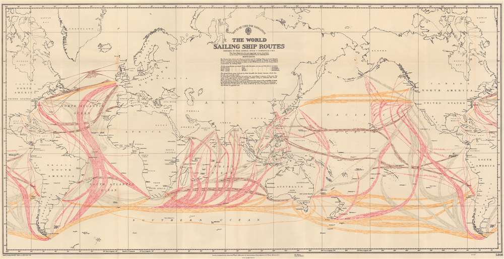
The World Sailing Ship Routes.
sold
- Digital Map Information
- Suitable for large format printing
- File Size: 49.65 MB
- File Type: ZIP / TIFF
- ICC color profile embedded
- Delivered instantly via download link
This is a 1950 Boyle T. Somerville map of world sailing routes. Somerville uses color to identify the direction of the illustrated routes with north-going routes tinted pink, south-going routes tinted gray, east-going routes tinted yellow, and west-going routes tinted brown. Arrows within the routes reinforce the direction of the route and the months when each route is used appear in darker shades of each tint. No political boundaries are illustrated, and only a few nations are identified. Important port cities are labeled worldwide, including New York, London, Montevideo, Buenos Aires, Rio de Janeiro, Cape Town, Mumbai (Bombay), Shanghai, and Hong Kong. (more details)
Bird's-eye view of the grandiose Panama-Pacific International Exposition.

Panama Pacific International Exposition: San Francisco, CA USA On the Shores of the Golden Gate.
sold
- Digital Map Information
- Suitable for large format printing
- File Size: 9.11 MB
- File Type: ZIP / TIFF
- ICC color profile embedded
- Delivered instantly via download link
This is an extremely rare 1914 Cardinell-Vincent view of the grounds of the Panama-Pacific International Exposition (PPIE) in San Francisco. Made before the exposition itself, it shows the pavilions and other structures of the exposition with San Francisco Bay in the background. (more details)
Silver boomtown by the first African American Lithographer.
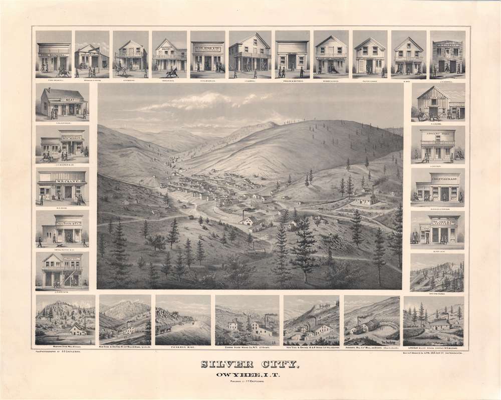
Silver City, Owyhee, I.T.
sold
- Digital Map Information
- Suitable for large format printing
- File Size: 52.62 MB
- File Type: ZIP / TIFF
- ICC color profile embedded
- Delivered instantly via download link
A remarkable 1866 bird's-eye view of Silver City, Idaho Territory, issued by Grafton Tyler Brown, America's first African American lithographer, and presenting the mining boomtown at its height of prosperity. Silver City experienced one of America's richest mineral strikes, producing gold and silver for more than 40 years. This view is one of only two known examples, significant not only for its historic illustration of a pop-up boomtown in full bloom, but also for being one of the few surviving views engraved and printed by Grafton T. Brown. Unlike many views, it has the unique distinction of being drawn from daguerreotype photographs taken by Philip Frederick Castleman, who visited with a supply caravan in 1866. (more details)
First map of a Philippine Province - printed in Manila!
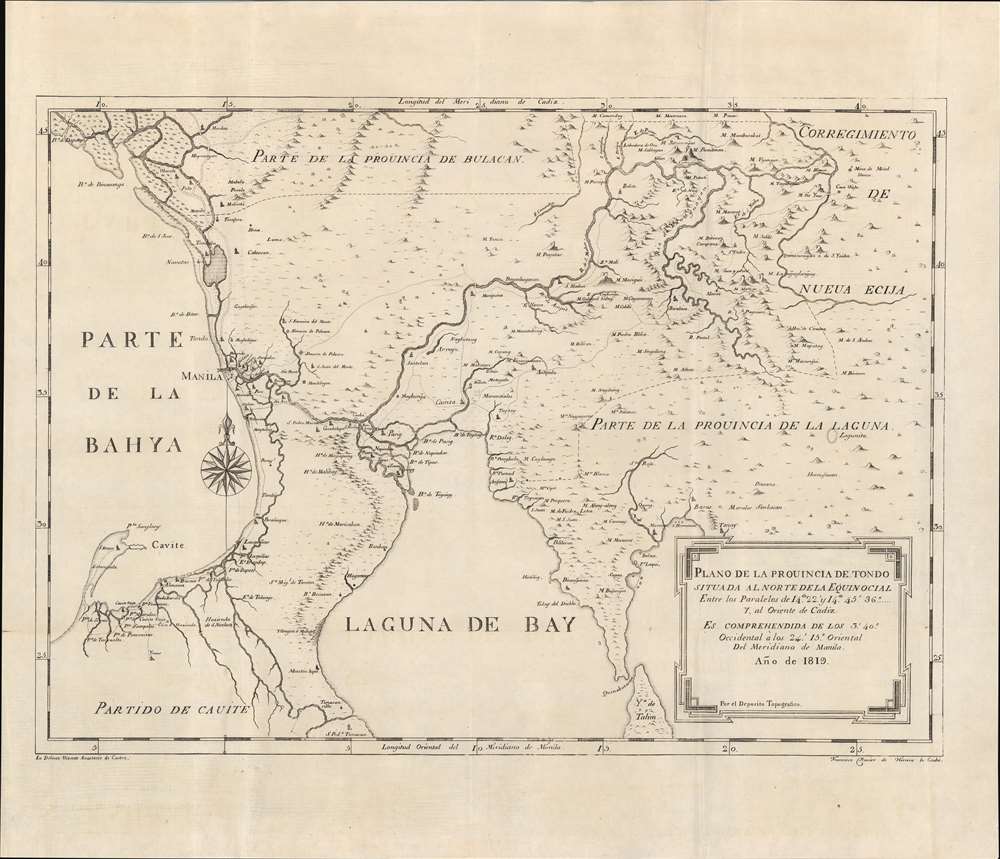
Plano de la Prouincia de Tondo situada al Norte de la Equinocial.
sold
- Digital Map Information
- Suitable for large format printing
- DPI: 600
- File Size: 14.89 MB
- File Type: ZIP / TIFF
- ICC color profile embedded
- Delivered instantly via download link
An outstanding example of the 1819 Deposito Topografico / Ildefonso de Aragón map of the province of Tondo, Philippines, accompanied by the 56-page text ' Provicia de Tondo. This is the first specific map of a Philippine province, compiled as part of Ildefonso, and the Deposito's flagship effort to bring structured modern survey techniques to the archipelago. (more details)
Unique insight into the early development of the Back Bay.
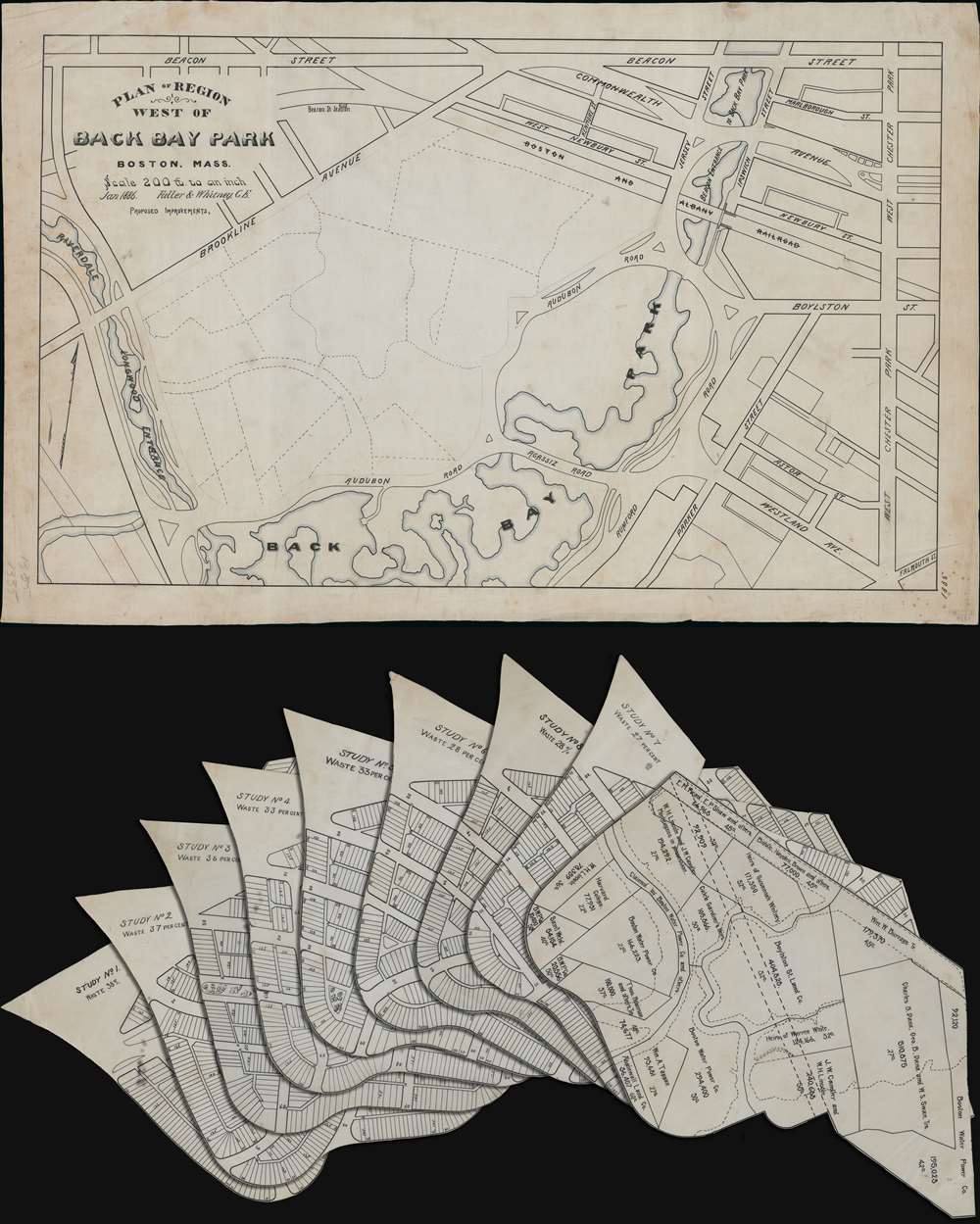
Plan of Region West of Back Bay Park Boston, Mass.
sold
- Digital Map Information
- Suitable for large format printing
- Full resolution TIFF file
- ICC color profile embedded
- Delivered instantly via download link
This is a unique 1886 Fuller and Whitney urban planning manuscript map of Boston's Back Bay immediately to the west of the Fens Park. The map consists of a manuscript masterplan, with 8 prospective overlays, each proposing a different plan for the new residential development. The plans offer slightly different street layouts, each with a different level of 'waste' by which the designer meant parks, boulevards, gardens, and other public recreation areas. The final development most resembles plans 7 or 8, representing the least 'urban waste'. In addition, there is a 9th overlay illustrating land rights and property ownership. (more details)
Best 18th century chart of St. Kitts and Nevis.
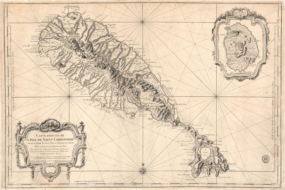
Carte Réduite de L'Isle de Saint Christophe Dressée au Depost des Cartes Plans et Journaux de la Marine, Pour le Service des Vaisseaux du Roy, Par ordre de M. le Marquis de Massiac, Lieutenant General des Armées Navales, Secretaire d'etat aiant le Départment de la Marine, Par le S. Bellin, Ingenieur de la Marine et du Depost des Plans, Censeur Royal de Academe de Marine et de la Societe de Londres. M.DCC.LVIII.
sold
- Digital Map Information
- Suitable for large format printing
- Full resolution TIFF file
- ICC color profile embedded
- Delivered instantly via download link
This is a large, scarce, 1758 Bellin map of the Caribbean islands of St. Christopher / St. Kitts and Nevis. The map is superbly engraved, with dramatic pictorial mountains, finely rendered forests, and two elegantly rendered cartouche frames. The grand scale of the map allows richer detail than any map of these islands we have seen until the Jefferys map based on Anthony Ravell's (1675 - July 3, 1727) c. 1717 survey. Although Ravell's work predates this map, Bellin would not have had access to it, and placenames and navigational details diverge sharply. Like most maps of these islands, including Bellin's own smaller-format map, this was based largely on the surveys of Andrew Norwood (16?? - 1685). The maps of Moll, Bowen, and Mount and Page all relied on Norwood's survey for source material. But this map shows more concrete, contemporaneous data than the Norwood, including individual structures in many cases. Since this was intended for use by the French Navy, it is very likely that more recent intelligence was consulted, none of which has otherwise survived. (more details)
A uniquely Japanese combination of 'Kawaii' and military expansionism.

世界パノラマ大地圖 / World Panorama Map.
sold
- Digital Map Information
- Suitable for large format printing
- File Size: 58.72 MB
- File Type: ZIP / TIFF
- ICC color profile embedded
- Delivered instantly via download link
A remarkable 1933 Japanese issue pictorial map of the world drawn by Keizo Shimada (島田啓三). Centered on the Japanese Empire, which is highlighted in red and includes both Taiwan and Korea, this map extends to cover the entire world except for the Atlantic, which is only minimally addressed. (more details)
Original Art Deco Key West Promotional art.

Key West Florida The Gateway to Havana. The island city via the over-sea highway.
sold
- Digital Map Information
- Suitable for large format printing
- File Size: 2.34 MB
- File Type: ZIP / TIFF
- ICC color profile embedded
- Delivered instantly via download link
This is the c. 1938 original hand-painted art board for an art deco period advertisement promoting the Over-Sea Highway - today U.S. Route 1 from Key Largo to Key West. The image depicts c. 1930s cars crossing the Long Bridge between Marathon and Big Pine Key. Long Bridge is now part of the Florida Keys Overseas Heritage Trail and all automobile traffic has been rerouted to a modern parallel bridge. Nonetheless, the Long Bridge's classic arcs remain and the bridge itself is popular with hikers and anglers. In the foreground, vacationers fish under palm trees while a ferry - to Havana? - passes. (more details)
German Prisoner of War camps housing French POWs.
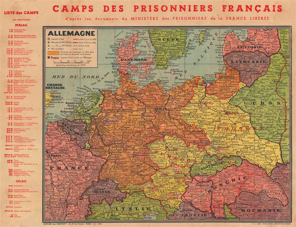
Camps des Prisonniers Français d'après des documents du Ministère des Prisonniers de la France Libérée.
sold
- Digital Map Information
- Suitable for large format printing
- File Size: 30.64 MB
- File Type: ZIP / TIFF
- ICC color profile embedded
- Delivered instantly via download link
This is a 1944 Jean Baneton map of Europe identifying German camps housing French POWs. Camps throughout Germany, Austria, and Poland are noted, with an index outside the left border separating Stalag (camps for enlisted men) and Oflag (camps for officers). Each camp is identified by its alphanumeric name and its location. The ones that are struck through are camps that were dissolved by the time this map was printed. Conveying impressive historical perspective, red lines mark European borders in 1923, while black dashed lines mark those in 1944. (more details)
California produced half the world's supply of mercury from the 1850s - 1890s.
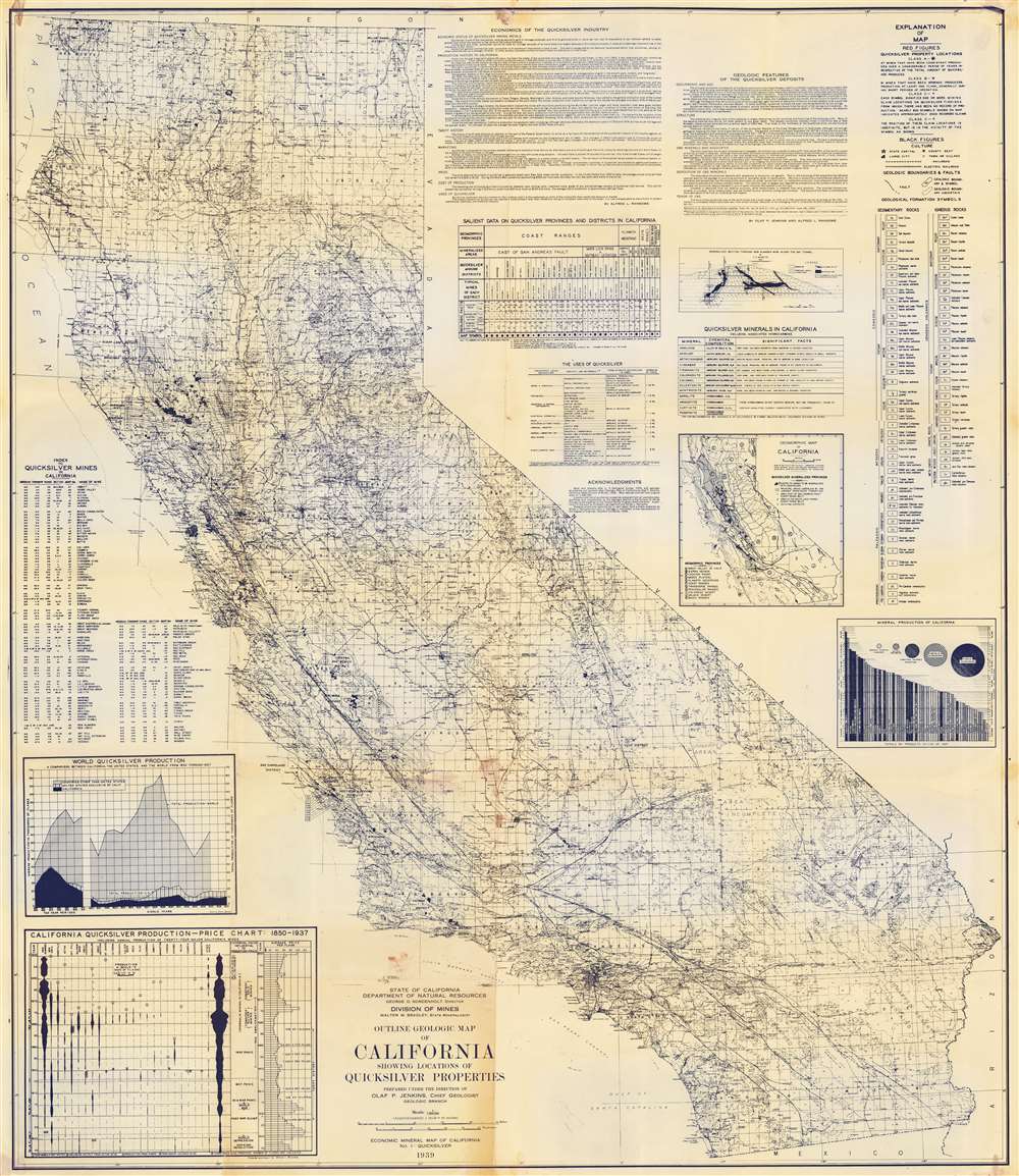
Outline Geologic Map of California Showing Locations of Quicksilver Properties.
sold
- Digital Map Information
- Suitable for large format printing
- File Size: 79.41 MB
- File Type: ZIP / TIFF
- ICC color profile embedded
- Delivered instantly via download link
This is a 1939 CA Dept. of Natural Resources Division of Mines diazotype map of California mercury / quicksilver mines. 117 mines throughout California are numerically identified, most in the Coastal Ranges between Oregon and Santa Barbara. An alphabetical index of quicksilver mines appears along the left, noting the township and range for each. (more details)
Small but significant.
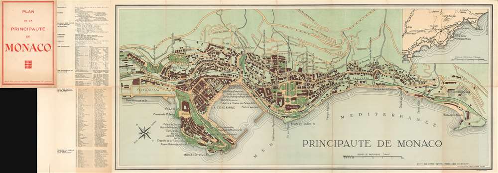
Principauté de Monaco.
sold
- Digital Map Information
- Suitable for large format printing
- File Size: 34.29 MB
- File Type: ZIP / TIFF
- ICC color profile embedded
- Delivered instantly via download link
This is a c. 1943 J. Fissore and V. Danoy map of the Principality of Monaco, the second-smallest country in the world and also one of the richest. The map depicts the principality from the cemetery to Monte Carlo Beach and from the Route de la Moyenne Corniche to the Mediterranean. Charmingly executed, over one hundred locations throughout are identified. Among the identified locations are the palace, the cathedral, the museum of anthropology, the hospital, and several cinemas. Monuments, museums, theaters, post and telegraph offices, consulates, and banks are also identified in the index. (more details)
Promotion for Peoria.
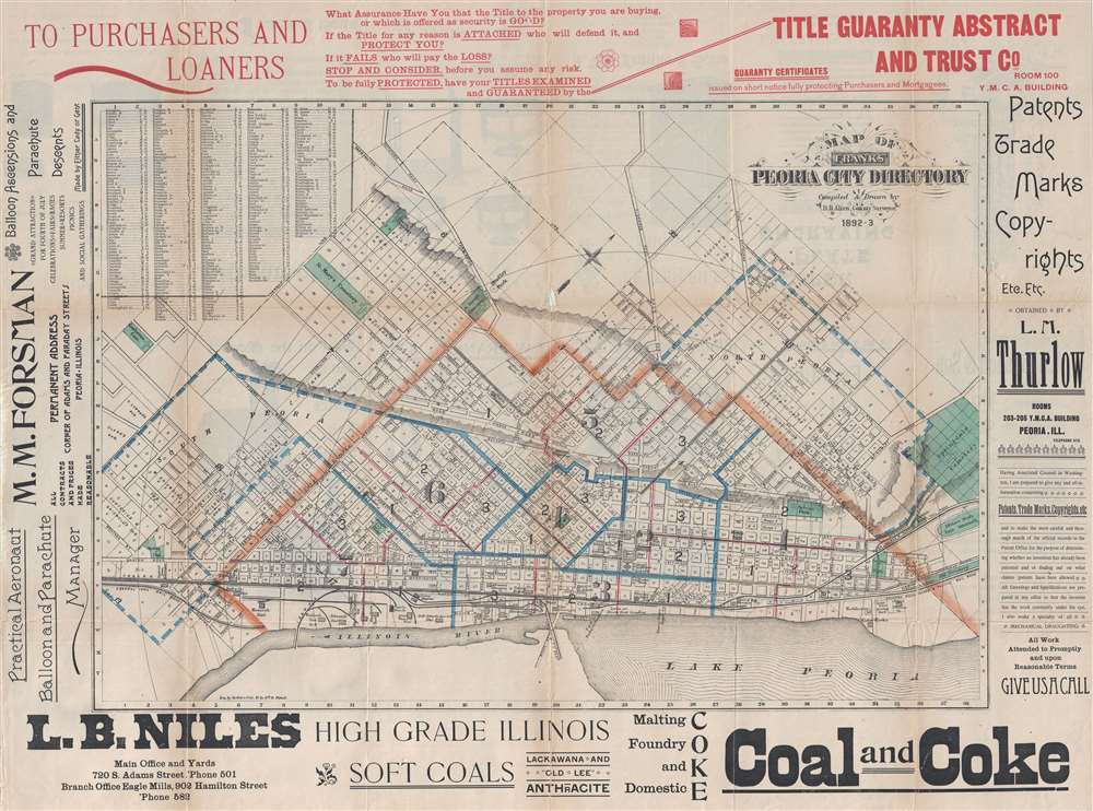
Map of Franks' Peoria City Directory.
sold
- Digital Map Information
- Suitable for large format printing
- File Size: 13.04 MB
- File Type: ZIP / TIFF
- ICC color profile embedded
- Delivered instantly via download link
This is an 1893 D. B. Allen city map or plan of Peoria, Illinois. Oriented toward the northwest, the map depicts the city from just north of the township line to Lake Peoria and the Illinois River and from South Peoria to Springdale Cemetery and the Illinois State Fair Grounds. Meticulously detailed, each block, both inside and outside the city limits (which are indicated by an orange line), are individually numbered. Every street is labeled, along with companies, government buildings, and parks. Several properties outside the city limits are identified using the owner's last name. Railroad lines, such as the Indiana, Bloomington, and Western Railroad, the Central Iowa Railroad, and the Rock Island and Peoria Railroad, are illustrated along Lake Peoria and the Illinois River. A street index is situated in the upper left corner of the map. (more details)
Curious relic of the Cold War.
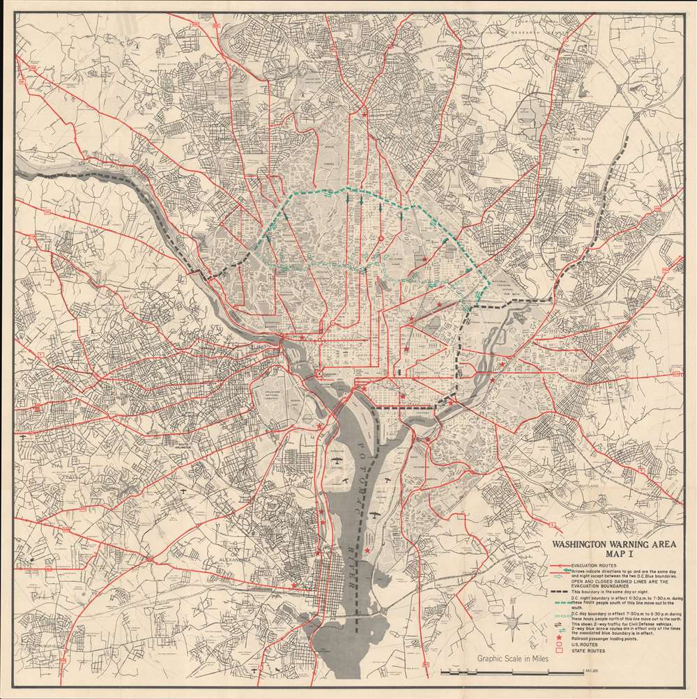
Washington Warning Area Map I. / Washington Warning Area Map II.
sold
A curious relic of the Cold War, this is a 1959 Office of Civil and Defense Mobilization map of Washington D.C illustrating evacuation routes in case of nuclear attack. The map was issued to disseminate Washington D.C. evacuation plans in the case of a nuclear strike. With Cold War tensions an all-time high, this was a very real concern. There were no less than 9 nuclear close calls between 1956 and 1969. These plans were likely devised following the 1956 Suez Crises, when a series of misinterpretations, false intelligence, and high political tension nearly led to a nuclear exchange. (more details)
Land reclamation projects by Fort Lawton and the West Point Light House?
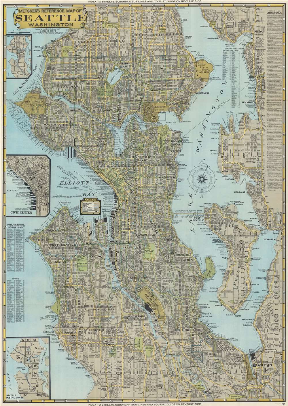
Metsker's Reference Map of Seattle Washington.
sold
- Digital Map Information
- Suitable for large format printing
- Full resolution TIFF file
- ICC color profile embedded
- Delivered instantly via download link
This is a 1949 Charles Metsker city plan or map of Seattle, Washington. Coverage extends from Haller Lake south to Foster and from the West Point Lighthouse and Shilshole Bay to the eastern shore of Lake Washington. Districts are identified throughout, and an alphabetic index is included in Lake Washington. Piers in Elliott Bay are identified by the operating company and numerous boathouses are marked. Parks and golf courses are illustrated as green spaces. The Lake Washington Floating Bridge (today known as the Lacey V. Murrow Memorial Bridge and Homer M. Hadley Memorial Bridge) is depicted, and pontoons, anchor cables, and ship channels along the bridge are marked. The University of Washington, the U.S. Naval Air Base, and Fort Lawton are illustrated. (more details)
One of the first large-scale maps o the United States made by Americans for Americans.
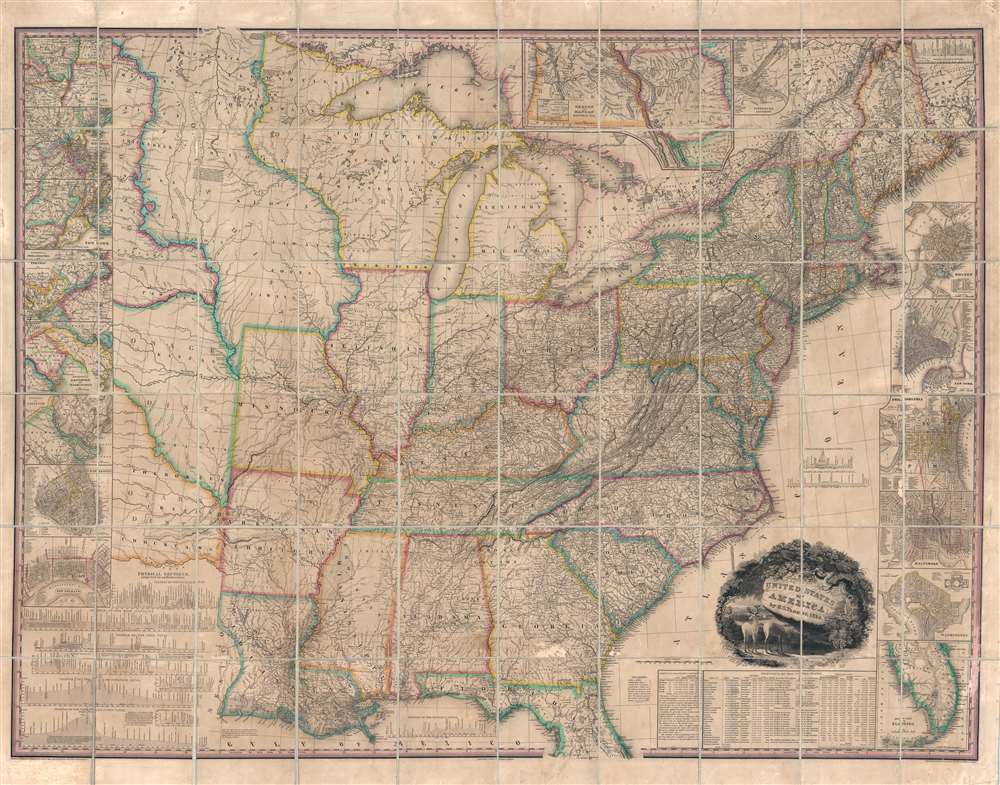
United States of America.
sold
- Digital Map Information
- Suitable for large format printing
- DPI: 600
- File Size: 144.44 MB
- File Type: ZIP / TIFF
- ICC color profile embedded
- Delivered instantly via download link
This, the first edition of Henry Schenck Tanner's 1829 wall map of the United States, is one of the most important American maps of the 19th century. With this important map Tanner initiated a new age of quintessentially American cartography. Unlike his predecessors, John Melish and Matthew Carey, Tanner was born and raised in the United States, and his maps are uniquely American productions, embracing American values and interests. Note the cartouche, with two deer grazing in a dense forest, while in the background three miniscule trains steam westward - a fitting metaphor for the United States, at the time undergoing brisk industrialization fueled by unlimited natural resources. Within the historical context, this map follows the territorial acquisitions of the 1819 Adams-Onís Treaty (Florida, Oregon?), but predates the major expansions in the southwest following the Mexican-American War (1846 - 1848) and the Treaty of Guadalupe-Hidalgo (1848). (more details)
London gets an upgrade.
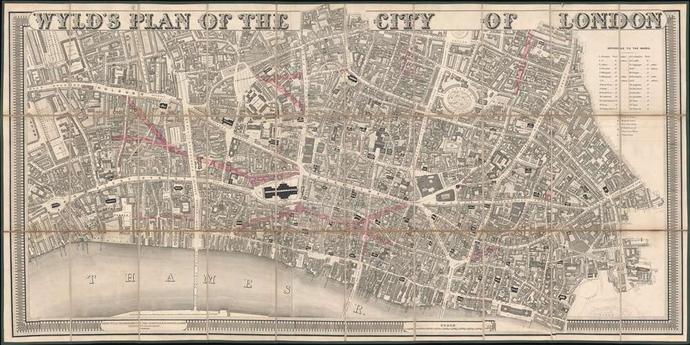
Wyld's Plan of the City of London.
sold
- Digital Map Information
- Suitable for large format printing
- Full resolution TIFF file
- ICC color profile embedded
- Delivered instantly via download link
An exceptionally striking large scale 1842 map of the 'City of London' issued by James Wyld to illustrate new and proposed streets. Wyld presents a highly detailed focus, with coverage extending from roughly St. Clement Danes Church to Minories, and from Charter House Square to the Thames. Notably, it names and numbers individual property lots. The map is surmounted with bold titling in large decoratively engraved letters. (more details)